Photos
|
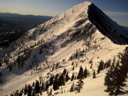
Bridger Range, 2012-01-06 These slides werer triggered by explosives during control work on Thusday. A weak snowpack structure in the Bridger Range is continuing to produce obvious signs of instability. Photo: Alex Marienthal |
|
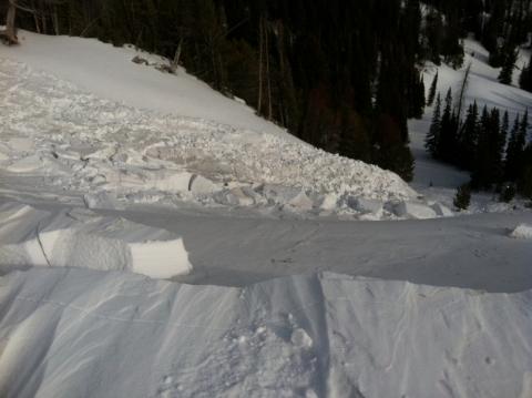
Southern Madison, 2012-01-06 This recent avalanche occurred in the Taylor Fork drainage of the southern Madison Range. Snowmobilers dug a snowpit in this area on a SE facing slope at 9456ft and got low stabitlity test scores and all their ECT's propagated. ECTP3, CT6, and PST end 38/100. Photo: J. Miller |
|
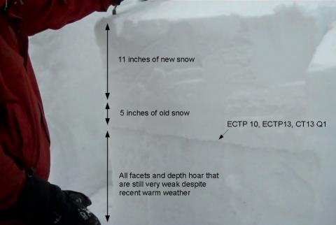
Bridger Range, 2012-01-05 The snowpack in the Bridger Range has a slab of new snow resting on very weak facets. Despite recent warm weather, conditions remain unstable. It can take a very long time for facets and depth hoar to finally heal. Unfortunately it might take most of the season. Photo: GNFAC |
|
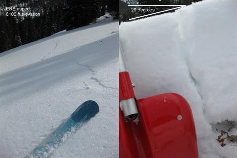
Lionhead Range, 2012-01-05 This slope collapsed and cracked when skiers approached it. If the slope had been steeper than 30 degrees it would have avalanched. These are clear signs of unstable conditions. Photo: K. Birkeland |
|
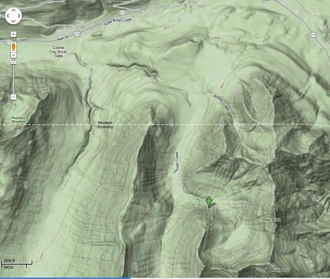
Cooke City, 2012-01-04 |
|
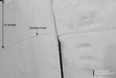
Northern Gallatin, 2012-01-03 Surface hoar is buried under a 14 inch thick slab of snow on Mt Ellis. We could not find it in the burned area where wind destroyed it, but we found it just a few hundred feet lower. It is easier to find if you brush your hand along the pit wall. |
|
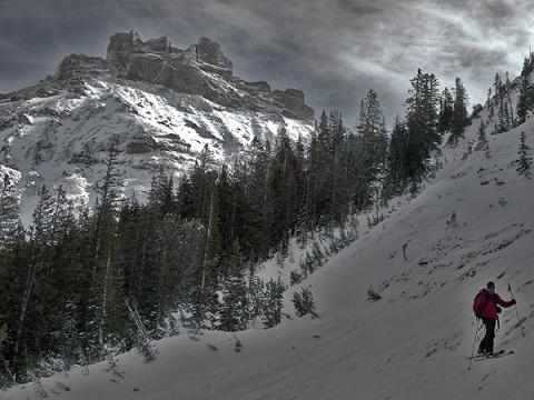
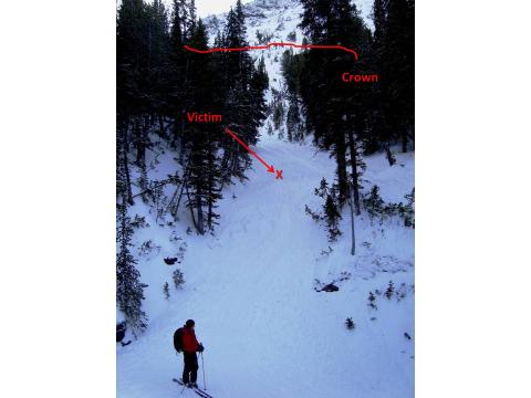
Cooke City, 2012-01-03 Index Peak is in the background of the slope that avalanched. Karl is about 75 feet below the crown. Photo: B. Fredlund |
|
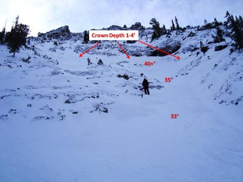
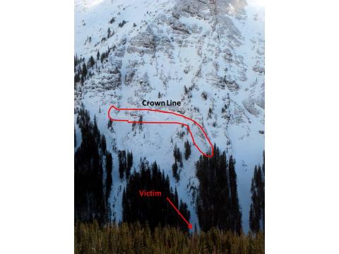
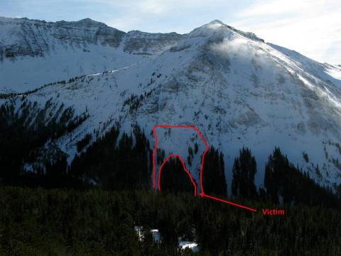
Cooke City, 2012-01-03 The slope angles in the gully were in the 20s, but got steep quickly near the crown. The depth varied as the slide ran over rocks that were thinly covered and into deeper pockets of snow. Photo: GNFAC |
|
Cooke City, 2012-01-03 Karl is standing on the 10-12' of debris that filled the creek. Measured with an altimeter, the slide was 250 feet vertical distance from debris to the crown. Photo: GNFAC |
|
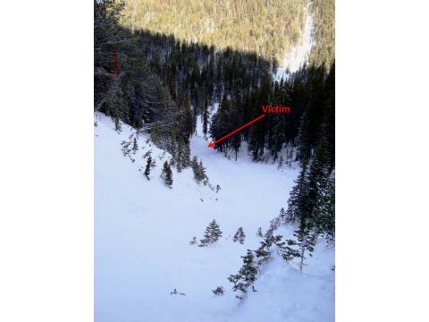
Cooke City, 2012-01-03 A view looking down the slope from the crownline. Photo: GNFAC |
|
Cooke City, 2012-01-03 Photo: C. Corey |
|
Cooke City, 2012-01-03 Photo: C. Corey |
|
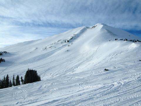
Cooke City, 2012-01-03 This avalanche on Fisher Peak outside Cooke City occurred early yesterday morning (1-02-12). This exact slope avalanched Nov 26th. A thick layer of facets at the ground are getting reloaded and avalanching a second time. Photo: E. Stifler |
|
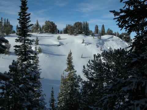
Cooke City, 2012-01-03 Backcountry skiers saw this and other recent avalanches as they toured in Goose Creek outside Cooke City yesterday (1-02-12). The snowpack continues to be unstable on the backside of the weekends avalanche warning. Photo: E. Stifler |

|
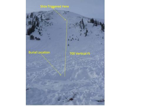
Cooke City, 2012-01-02 New snow and strong winds made for unstable conditions in the mountains around Cooke City. This side was triggered by a snowmobiler which resulted in a fatality. Photo: Jon Marshall |
|
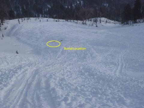
Cooke City, 2012-01-01 The victim of this side was found with the tip of his boot sticking out of the snow. He was buried approximately 10-12 minutes but was unable to be revived. Photo GNFAC |
|
Cooke City, 2012-01-01 This slide occurred on Mt Henderson outside of Cooke City. The slope was NE facing and heavily wind loaded. Photo GNFAC |
|
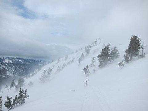
Northern Gallatin, 2012-01-01 Yesterday morning (12/31/11) strong winds were blowing at the ridgetops in the northern Gallatin. With a foot of new snow to move, the winds up Hyalite easily blew it around at the higher elevations. Steady 30 mph with gusts to 60 mph wee measured. Photo: B. VandenBos |
|
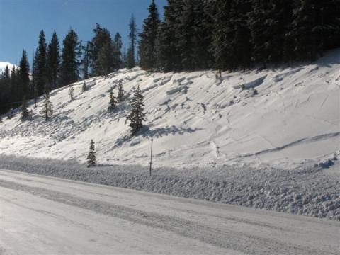
Southern Madison, 2012-01-01 Many small avalanches along highway 191 are incative of the unstable conditions in the higher terrain. These slides are Mother Nature's avalanche warning. Photo: J. Pape |
|
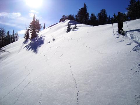
Southern Madison, 2011-12-31 The snowpack collapsed and cracked with almost every step we took. Signs of instability were everywhere. Photo: GNFAC |
