Photos

|
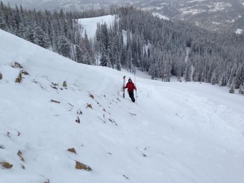
Cooke City, 2013-12-05 These avalanches released early in the week after the larege snowstorm: north to northeast facing slopes that likely ran on faceted snow 1-2 feet off the ground. Photo: B Fredlund |
|
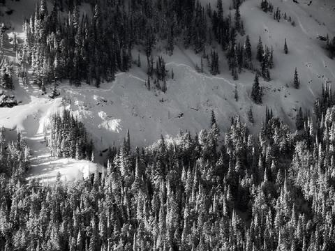
Northern Madison, 2013-12-04 This slide was triggered by the Big Sky Ski Patrol on the north side of Lone Mountain (formerly Moonlight Basin). It broke about 3 feet deep on facets near the ground. This slide was triggered with explosives, and it is notable because it occurred on a slope that has no history of producing avalanches. Photo: Big Sky Ski Patrol |
|
Cooke City, 2013-12-04 This natural avalanche was one of at least 20 observed on Tuesday, Dec 3 near Cooke City following a storm that deposited 3 inches of snow water equivalent which was over 2 feet of heavy snow. Photo: B. Fredlund |

|
Cooke City, 2013-12-04 This natural avalanche was one of at least 20 observered Tuesday, Dec 3 near Cooke City following a storm that deposited 3 inches of snow water equivalent which was over 2 feet of heavy snow. Photo: B. Fredlund |
|
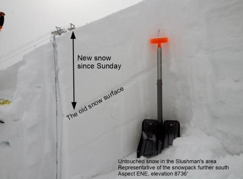
Bridger Range, 2013-12-03 About 14" of new snow has fallen in the Bridger Range. The Slushmans area is still backcountry and this snowpack gives us a good sense of conditions further south in places like Saddle Peak. The weakest layer is the old snow surface. Any amount of wind effect will make the new snow easier to fracture. Photo: GNFAC |

|
Cooke City, 2013-11-27 Surface hoar has formed on many slopes near Cooke City. Surface hoar is just frost deposited on the snow surface. Small facets have formed just under the surface hoar. Either one may be the next weak layer when more snow falls. Photo: GNFAC |

|
, 2013-11-27 |

|
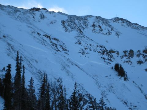
Northern Madison, 2013-11-27 1.5 to 2 feet of snow is on the ground at Lionhead. This pic is above Denny Creek at 8,000 feet. The snowpack is faceted, but not as bad as I thought. I could not get layers to propagate fractures in my stability tests. The top three inches is the weakest snow in the pack, so we'll be watching closely when it gets buried with the next storm. Photo: GNFAC |
|
Northern Madison, 2013-11-27 This pic was taken by Big Sky Snow Safety on Nov 25th after avalanche control on north facing terrain in Headwaters. The snowpack is similar to the backcountry, so we pay close attention during their control. In essence, they have weak snow. Facets are breaking 30cm off the ground on an old ice crust. Slides are 3-4 feet deep and fractures are propagating. Photo: BSSP
|
|
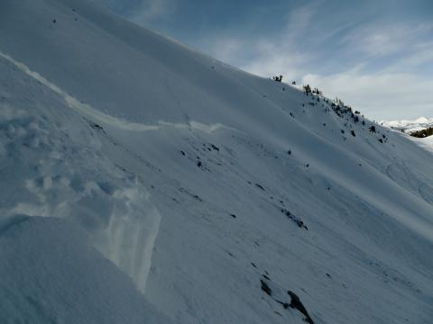
Cooke City, 2013-11-27 Crown face. Photo: GNFAC |
|
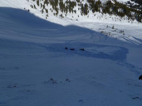
Cooke City, 2013-11-27 Avalanche debris. Part of the slab remained intact. Photo: GNFAC |
|
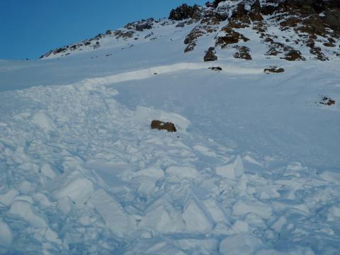
Cooke City, 2013-11-27 Avalanche on Crown Butte. Notice how it did not propagate very far into the deeper snowpack. Photo: GNFAC |
|
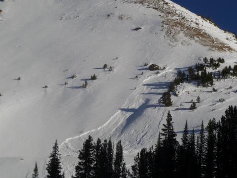
Cooke City, 2013-11-27 Snowmobile triggered slide. Just east of Daisy Pass under Chimney Rocks. Photo: GNFAC |

|
Cooke City, 2013-11-27 Avalanche debris on Crown Butte. Notice how part of the slab remained intact. Photo: GNFAC |
|
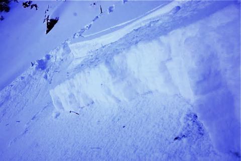
Northern Madison, 2013-11-24 This slide was skier triggered on Saturday, November 23. It occurred on a N facing slope and broke on a layer of facets about 8 inches above the ground. Ski tracks can be seen just above the crown. |
|
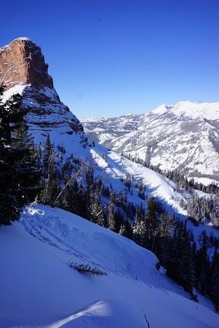
Northern Madison, 2013-11-24 This slide was skier triggered on Saturday, November 23. It occurred on a N facing slope and broke on a layer of facets about 8 inches above the ground. |

|
Cooke City, 2013-11-23 This recent avalanche occurred on a NE aspect of Crown Butte. Photo: B. Fredlund |
|
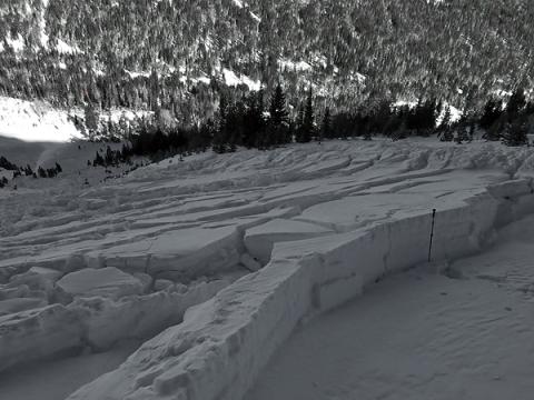
Cooke City, 2013-11-23 This slide an one other occurred on a NE aspect of Mt Henderson above the Fisher Creek near Cooke City. Notice the ski pole to gauge depth of the avalanche. These slides broke over 3 feet deep on weak facets near the ground. One slide was 300 feet wide and the other was about 100 feet wide. At least one was human triggered. Photo: B. Fredlund |
|
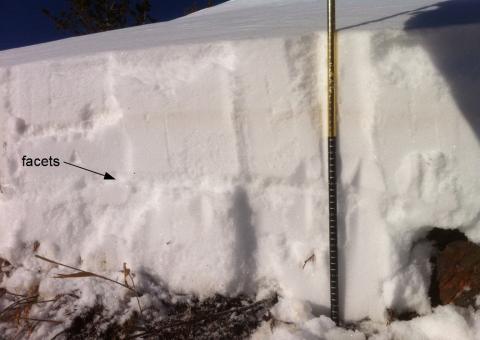
Northern Madison, 2013-11-23 The snowpack in Beehive Basin north of Big Sky is generally 2-3 feet deep. An obvious layer of facets can be found in most places in the lower half of the snowpack. The latest snowfall, 3 days ago, does not seem to have stressed this layer enough to create unstable conditions. Finding this layer and doing a stability test or two only takes a few minutes. Photo: C. Diaz |
|
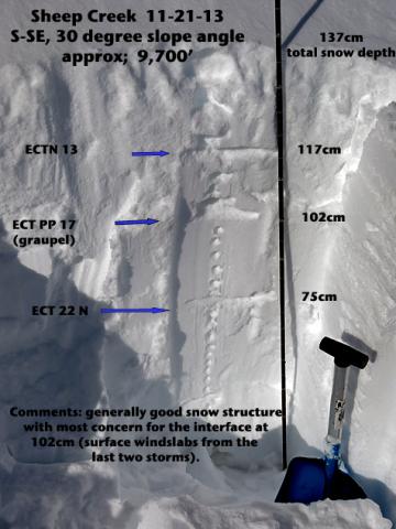
Cooke City, 2013-11-23 The snowpack is 4.5 feet deep in this photo and mostly stable. The weakest layer in the photo is labeled at 102 cm (3.3 ft), but should gain strength quickly. Photo: B. Fredlund |
