|
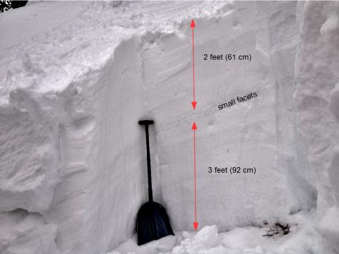
Northern Madison, 2014-02-27 The avalanche in Chippewa cliffs in the backcountry on Lone Mountain broke near the middle of the snowpack on a layer of small facets that formed in late January. This avalanche happened on 2/26. Photo: GNFAC
|
|
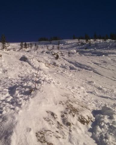
Cooke City, 2014-02-27 The avalanche was triggered by the second skier in a group of two. The first skier safely descended 400' and pulled off into thick trees. The second skier hit a thin and weak spot on the slope and triggered a deep slab avalanche. It broke 10-12 feet deep, ran full width and 1300 feet downslope. No one was caught.
|

|
Cooke City, 2014-02-27 Looking downslope after the hard slab avalanche released. Classification: HS-AS-O-R3.5-D3
|
|
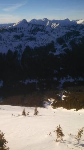
Cooke City, 2014-02-27 This is a pictures taken minutes before it was triggered. The second skier down the slope triggered it below them from a thin spot (1 foot deep).
|
|
Northern Madison, 2014-02-26 From the Big Sky Ski Patrol:
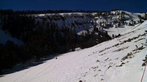
There was a snowboard triggered avalanche in the Chippewa Ridge area which is adjacent to Wyoming Bowl. The area is easterly facing, open timber with a lot of cliffs and rock outcroppings. 9400 ft. elevation +/-. The slide broke about 50 linear feet below the ridge top and was 250-300 ft. wide, which we had never seen in that area before. The crown was up to 3’ deep. The ridge is only about 200 vertical feet tall and the slide ran to the bottom. R3D2.
|
|
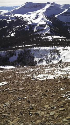
Northern Madison, 2014-02-26 Looking south from Big Sky at the snowboarder triggered slide in the sidecountry. Steep and rocky terrain. This is bulls-eye data that other slopes could avalanche too. Photo: Big Sky Ski Patrol
|
|
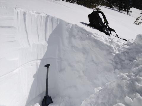
Lionhead Range, 2014-02-25 The snowpack in many places like on this west facing slope on Lionhead has 2 weak layers. One is near the ground that formed in early December. The other is in the middle of the snowpack that formed in late January. While both have gained a lot of strength both have produced recent avalanches. Photo: GNFAC
|

|
Lionhead Range, 2014-02-25 This photo was taken from on top of one large debris pile from an avalanche that occurred late last week (about Feb 20). Both avalanches broke about 4-5 feet deep on facets that formed in early December. We have not seen avalanches on this layer lately, but these are a major clue that others could occur. Photo: GNFAC
|

|
Lionhead Range, 2014-02-25 This cornice triggered avalanche produced a big debris pile (6-10 feet deep) because it broke near the ground. It likely happened on Monday, Feb 25. Photo: GNFAC
|
|
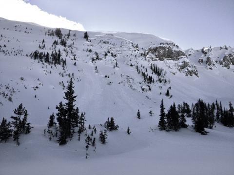
Lionhead Range, 2014-02-25 This slide occurred Monday (Feb 24). It broke at the ground and was triggered by a falling cornice. The debris pile was 6-10 feet deep. We belived this slope avalanched previously this season. Another recent slide can be seen to the right. Photo: GNFAC
|

|
Lionhead Range, 2014-02-25 The weak layer of facets that formed in January is buried under 80 cm of snow and was not breaking in any of my stability tests. It is gaining strength annd stability with each passing day. It's still worth keeping an eye on, but the trend is very positive. Photo: GNFAC
|

|
Bridger Range, 2014-02-21 About a foot of new snow was completed scoured from west facing slopes and deposited on the other side of the ridge forming drifts and wind slabs. Photo: GNFAC
|

|
Cooke City, 2014-02-20 This slide was photographed on Thursday, February 13, 2014 during an Avalanche Warning for the mountains around Cooke City. It occurred on ESE facing slopes on Barronette Mountain which is just inside Yellowstone N.P. just before the Northeast Entrance Gate. There are many well known ice climbs on this mountain. Photo: N. Corwin
|

|
Cooke City, 2014-02-20 This recent natural avalanche occurred on an E aspect on Mt. Republic just south of Cooke City. It broke several hundred feet wider than what is seen in the photo. Photo: B. Fredlund
|
|
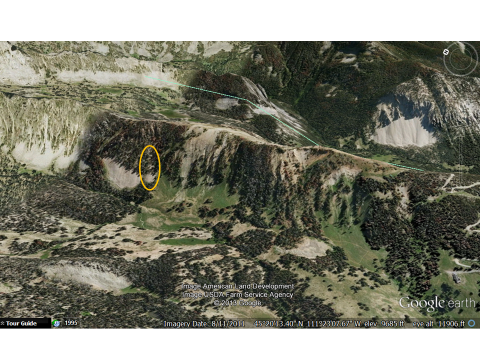
Northern Madison, 2014-02-18 The oval shows the location of the avalanche.
|

|
Cooke City, 2014-02-18 Wind loaded slopes releaed naturally in upper Pebble Creek. These conditions are similar to mountains outside Cooke City. Photo: B. Fredlund
|
|
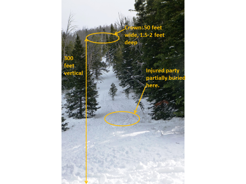
Northern Madison, 2014-02-17 This photo is looking up the slope from the toe of the debris. The debris was 6-8 feet deep and 40 feet wide. The slide ran 300 feet vertical and was 50 feet wide at the crownline. Average slope angle at the starting zone was 40 gress and 36 degrees steepness at the trigger point. The avalanche released on a layer of small-grained facets 1.5 to 2 feet from the surface. Photo: GNFAC
|
|
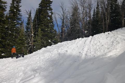
Northern Madison, 2014-02-17 The toe of the debris is approximately 6-8 feet deep. Photo: GNFAC
|
|
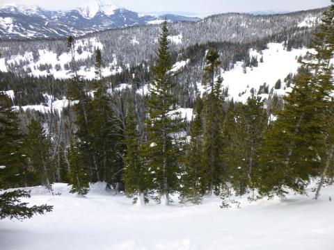
Northern Madison, 2014-02-17 Three skiers triggered this from lower on the slope, 100 vertical feet below the crown. This picture was taken at the crown and looks downslope. Luckily they were below these trees when it avalanched since getting carried into them could be fatal. Photo: GNFAC
|
|
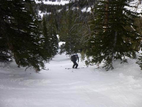
Northern Madison, 2014-02-17 Three skiers triggered the slope from near the person in the photo. They were skinning uphill at the time. Photo: GNFAC
|