|
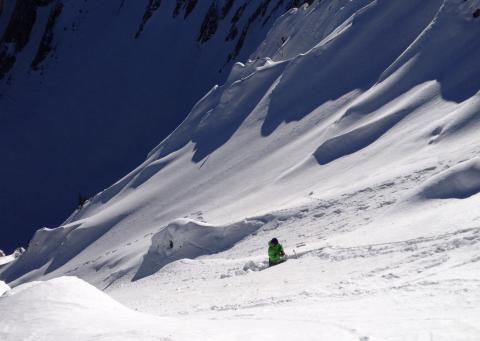
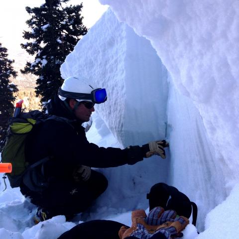
Bridger Range, 2014-01-24 Weak facets about a foot above the ground are the weakest and easiest to find in steep, rocky, avalanche starting zones. It is tricky because they do not appear to be a problem in the snowpack in meadows and other safe areas to dig snowpits. This means we can easily get false indications of stability. We used a rope to safely dig in this location. Photo: GNFAC
|
|
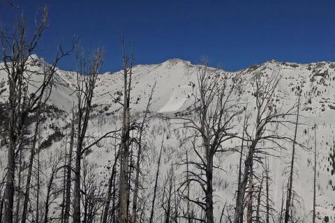
Cooke City, 2014-01-22 From an email: "We observed this snowmobile triggered avalanche minutes after it occurred on Southern Aspect of Miller's Ridge in Sheep Cree Basin (Cooke)." Four sledders were highmarking and triggered this avalanche on Saturday, January, 18. Photo: B. Norrgard
|
|
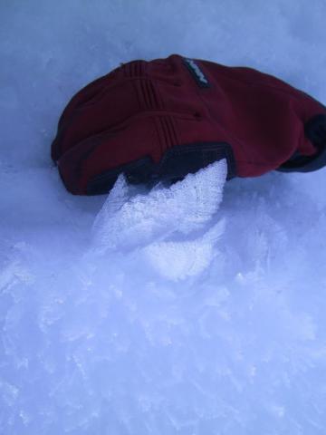
Southern Madison, 2014-01-22 This surface hoar crystal is huge! It was found in Teepee Basin. We are findine surface hoar deposits and other facets forming at the snow surface. These may be our next avalanche problem when they get buried. Photo: J. Mom
|
|
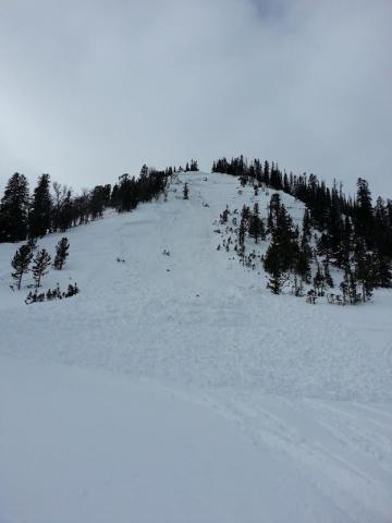
Lionhead Range, 2014-01-20 From an email: "North east facing slope. Wind Loaded. Snow pit dug showed signs of propagating fractures. The rider was told not to ride the slope but opted to give it a shot. Slope broke about 20 feet above the rider halfway up the slope, then fractured at the top after the slide started. Crown was between 3 and 8 feet deep, 150 feet wide at the top but fractured in the trees as well. The slide broke on the facets near the ground." Photo:
|

|
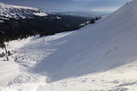
Cooke City, 2014-01-19 This avalanche was triggered by a snowmobiler on Friday afternoon (1/17). It is located on a northeast facing slope at 9,700 feet at the northern end of Henderson Ridge near Chimney Rock. The slide was approx 500 feet wide, 300 feet vertical and broke 4-12 feet deep. The slope angles at the crown measured 36-50 degrees steep and the runout angle was 22 degrees, which means it was a large avalanche for this slope (HS-AS-O-R4-D3). The rider was buried, but dug up, given CPR, revived and he rode away. He and his machine were located on the right edge of the debris. He was lucky and had good partners. Photo: GNFAC
|
|
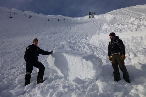
Cooke City, 2014-01-19 The slope was 36-50 degrees at the crown and put hard slab debris up to 15 feet deep in the runout. The rider and his snowmobile were dug up on the left flank of the slide near the parked snowmobiles in the picture. He was dug up, revived and rode back to town! Photo: GNFAC
|
|
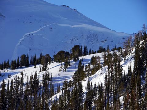
Cooke City, 2014-01-19 The avalanche was 4-12 feet deep. It was a very steep and heavily wind-loaded NE facing slope. The debris consisted of hard slab snow. Photo: GNFAC
|
|
Cooke City, 2014-01-18 This slide occurred on Mt Henderson outside of Cooke City. The slide was triggered by a snowmobiler who ended up fully buried. The rider was buried for nearly ten minutes and was dug out by his partners. Photo B. Fredlund
|

|
Northern Madison, 2014-01-18 This snowpit was dug on Yellow Mountain north of Big Sky. The snowpack structure in this area is poor, with facets near the gound being the layer of concern. It's becoming harder to impact this layer, but it's still capable of propagating a fracture and producing avalanches. Photo GNFAC
|

|
Cooke City, 2014-01-18 This slide was triggered by a snowmobiler who was caught and fully buried. He was recued by his partners and fortunately survived. The avalanche occurred on an ENE facing slope that was heavily wind loaded. It likely failed on layer of facets near the ground. Photo Bill
|

|
Cooke City, 2014-01-17 This slide was observed in upper Goose Creek outside of Cooke City. The slope is east facing and heavily wind loaded. Steep, rocky, wind loaded terrain will continue to be likely areas to produce avalanches. Photo B. Fredlund
|

|
Southern Madison, 2014-01-17 This natural slide occurred in Tepee Basin in the souther Madison Range. Wind loaded slopes, specifically those in steep-rocky terrain are likley areas to produce avalnaches. Photo E. Heaps
|

|
Northern Madison, 2014-01-17 This slide occurred on Wednesday (1-15-14) just above Cabin Creek and under Skyline Ridge in the Southern Madison Range. Photo: W. Bennett
|
|
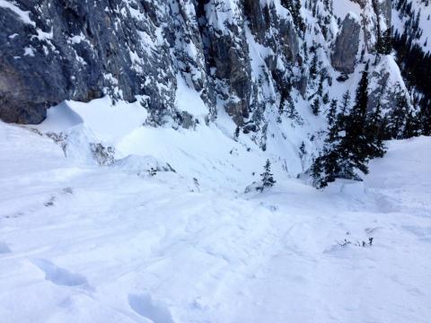
Bridger Range, 2014-01-16 This slide was triggered by a cornice that wasn't much heavier than a skier. It broke on a layer of facets 38 cm above the ground (about a foot). This slope was not recently wind loaded and almost faces due north. The slab ranged from 2-4 feet deep but averaged about 3 feet deep. Photo: GNFAC
|
|
Bridger Range, 2014-01-16 Any skier or rider caught in this slide in the Dogleg Chute north of Bridger Bowl would have taken a nasty ride. The slide ran nearly 1,000 vertical feet and deposited debris 4-5 feet deep. Photo GNFAC
|

|
Bridger Range, 2014-01-16 This slide occurred in the Dogleg Chute north of Bridger Bowl. The weak layer (facets near the ground) was impacted in an area where the slab was thinner then propagated into deeper parts of the snowpack. The slide was triggered by a cornice drop, but could easily have been triggered by a skier or boarder. Photo GNFAC
|

|
Bridger Range, 2014-01-16 This slide occurred in the Dogleg Chute north of Bridger Bowl. The slide was triggered by a conrnice drop and produced a crown 2-4 feet deep. There is no doubt a skier or rider could have ealily triggered this slide. Photo GNFAC
|

|
Northern Madison, 2014-01-16 This slide occurred at Big Sky Resort on the Wave wall on Wednesday (1/15/14). It was triggered intentionally with a 6 lb explosive placed low in the path on a piece of bamboo. Two pits were dug in the starting zone the day before. Both showed horrible structure in the snowpack. One gave unstable results in stability tests, the other gave stable results in stability tests. Based on the poor structure and layering the BSSP decided to shoot it and got the results they hoped for. Photo: BSSP
|

|
Lionhead Range, 2014-01-16 This natural avalanche was spotted Tuesday (1/16/14) by Ace Powder Guides just below Lionhead. It broke 1-3 feet deep on a SE aspect near Mile Hill. Not long after seeing this slide, they triggered a bigger one just by riding under a steeper slope. They were ready for it and were not caught. Photo: E. Heaps
|
|
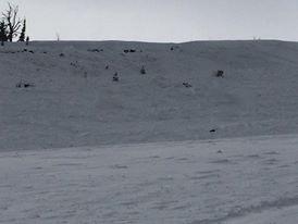
Northern Gallatin, 2014-01-14 On Saturday, January 11, a skier triggered this slope in Lick Creek up Hyalite. This is not a common occurrence and illustrates the poor snow stability at lower elevations. Photo: K. Okonski
|