
|
Southern Madison, 2013-12-28 This slide occurred in Tepee Basin north of West Yellowstone. If you look closely, you can see two snowmobiles caught in the debris. These riders are lucky the slide did not go bigger. Photo E Heaps
|

|
Southern Madison, 2013-12-28 This slide appears to have been snowmobile triggered. It occurred in lower Teepee Basin. Photo: GNFAC
|
|
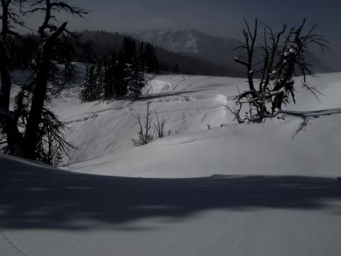
Southern Madison, 2013-12-28 This slide occurred on a wind loaded slope at the head of Cabin Creek in the Southern Madison Range. Photo: GNFAC
|

|
Northern Gallatin, 2013-12-28 This slide was triggered by a cornice drop. Photo Ben Vandenbos
|
|
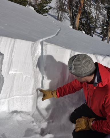
Northern Madison, 2013-12-27 This slope collapsed and cracked when a small chunk of cornice was dropped on it. The problem is very weak facets about a foot above the ground. The only reason this did not produce an avalanche is the slope is 24 degrees in steepness. A few degrees more and it would have avalanched. Photo: J. Yarington
|
|
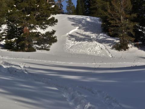
Northern Madison, 2013-12-27 This small slide occurred very close to the trailhead for Beehive Basin just north of Big Sky. Even though small, it is a bad sign when small slopes avalanche that normally don't. Photo: GNFAC
|

|
Northern Madison, 2013-12-27 This slide occurred just left of a common skin track in Beehive Basin just north of Big Sky. The skin track ascends the area along the right side of the photo. Photo: GNFAC
|

|
Northern Madison, 2013-12-27 This slide probably occurred on 12-26 and may have been triggered by pinwheels of snow rolling down from the rocks above. A common skin track goes up the subridge in the foreground. Photo: GNFAC
|
|
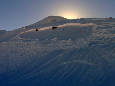
Cooke City, 2013-12-27 This human triggered slide occurred just north of Lulu Pass outside of Cooke City. A heavy wind load sitting on a layer of facets with a trigger was the recipe that caused this slide. Photo GNFAC
|

|
Northern Madison, 2013-12-27 These two slides occurred near Big Sky around 12/24. Photo: C. Corey
|

|
Northern Gallatin, 2013-12-27 Three avalanches can be seen in this photo. They are several of many in Hyalite Canyon. Photo: B. VandeBos
|
|
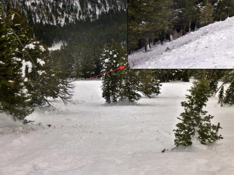
Northern Gallatin, 2013-12-26 Looking down the avalanche path shows a wall of trees that could easily kill a person or cause major trauma. This is a bad place to get caught, but also a bad place to wait for your partners to ski down from above. Unfortunately Mt Ellis doesn't have very many or very good safe zones from which you can watch your partner ski. Photo: GNFAC
|
|
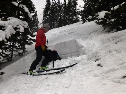
Northern Gallatin, 2013-12-26 This photo shows where the skier's tracks entered the avalanche and approximately where he triggered it. The weak layer of facets that fractured can be seen scooped out of the snow. The crown profile can be seen here: http://www.mtavalanche.com/images/13/ellis-crown-profile?size=_original
Photo: GNFAC
|
|
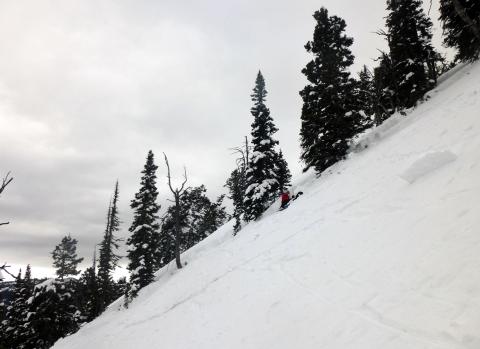
Northern Gallatin, 2013-12-26 This avalanche on Mt Ellis was triggered just below the person in this photo. Total snowpack depth was about 80cm or 2.5 ft. See http://www.mtavalanche.com/images/13/ellis-crown-profile?size=_original for a crown profile. Photo: GNFAC
|

|
Northern Gallatin, 2013-12-26 Overview of a skier triggered slide that occurred on Christmas day 2013. The skier followed the red line. It was triggered at the little red dot. He was able to maintain his speed and escape to the left. The avalanche debris ran about 700 feet vertical through the trees below. Conservatively the debris involved 4,000,000 pounds of snow. Photo: GNFAC
|
|
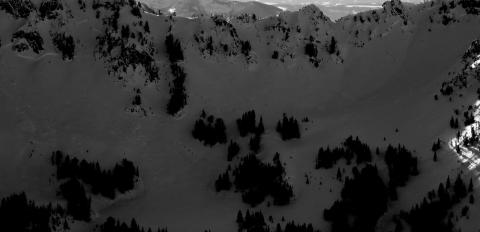
Northern Gallatin, 2013-12-26 This naturally triggered avalanche was seen just east of Alex Lowe Peak in the northern Gallatin Range. It occured on a NE facing slope. Most notable is that it broke about 1000 ft wide. Photo: B. VandenBos.
|
|
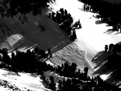
Northern Gallatin, 2013-12-26 This slide occurred on a NW facing slope just south of Mt Blackmore in the northern Gallatin Range. Although hard to see in the photo, the photographer reported seeing fresh mountain goat tracks entering the slope that avalanched and unfortunately none leaving. Photo: B. VandenBos
|
|
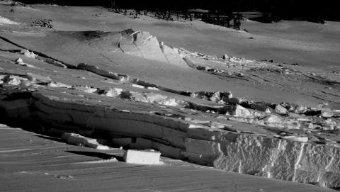
Northern Gallatin, 2013-12-26 This slide was triggered by dropping a very large cornice onto the slope below. It occurred on a ridge leading to the summit of Mt Blackmore in the northern Gallatin Range. The maximum slope angle on this slope was 30 degrees. Photo. B. VandenBos
|
|
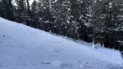
Northern Gallatin, 2013-12-26 Snow plastered on the tree trunks shows the depth of avalanche debris as it was flowing through the trees.
|
|
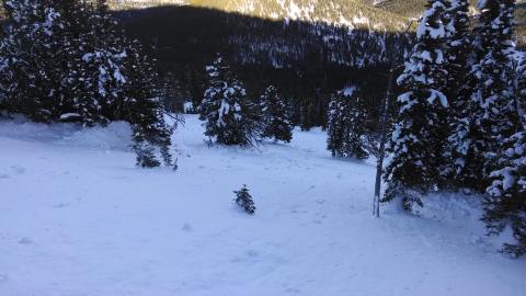
Northern Gallatin, 2013-12-26 This skier triggered avalanche occurred on Mt Ellis in the northern Gallatin Range on Christmas day. The debris ran far downhill and over ran a popular (but not totally safe) route used many to climb to the top of the burned area.
|