Photos
|
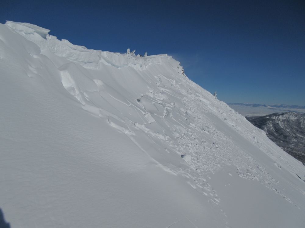
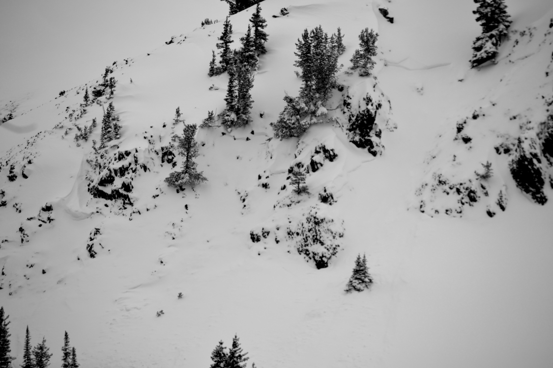
Bridger Range, 2017-11-07 Debris on Apron at Bridger Bowl. Likely from a wind slab in Hidden Gully that ran last night. Wind slabs were very easy to trigger today, and could be harmful or deadly if caught in. Photo: GNFAC |
|
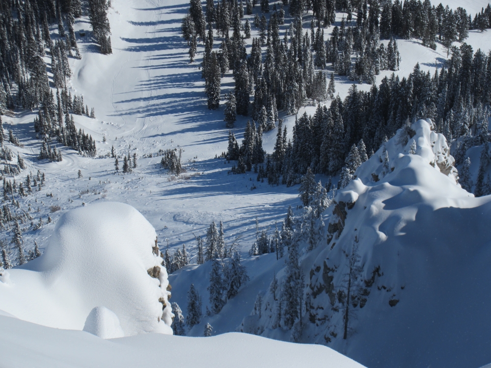
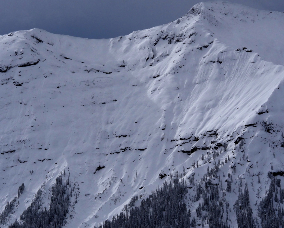
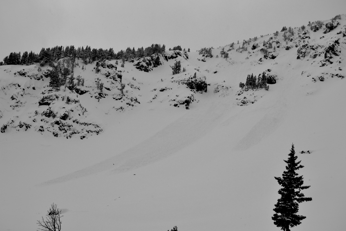
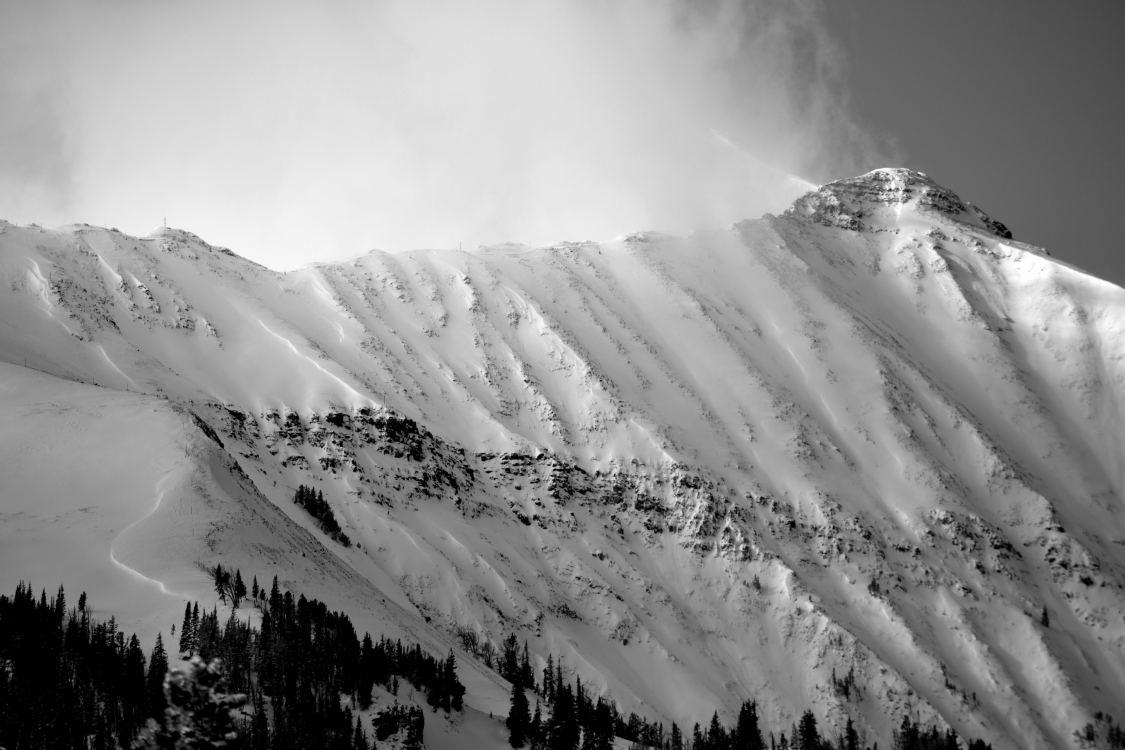
Bridger Range, 2017-11-07 Wind slabs that formed from recent snow and wind were easy to trigger today, and many ran naturally overnight. Wind slabs will continue to grow with more wind, and should be avoided. Photo: GNFAC |
|
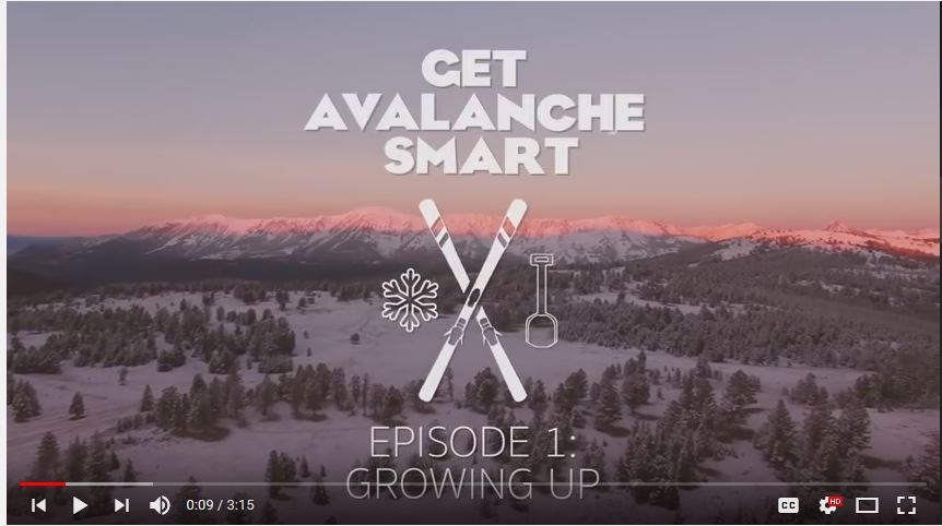
, 2017-11-07 A screenshot of Get Avalanche Smart - Growing Up, the first of 4 short films promoting avalanche education that were produced by the Friends of the Avalanche Center. https://youtu.be/MtFmJYhWG58 |
|
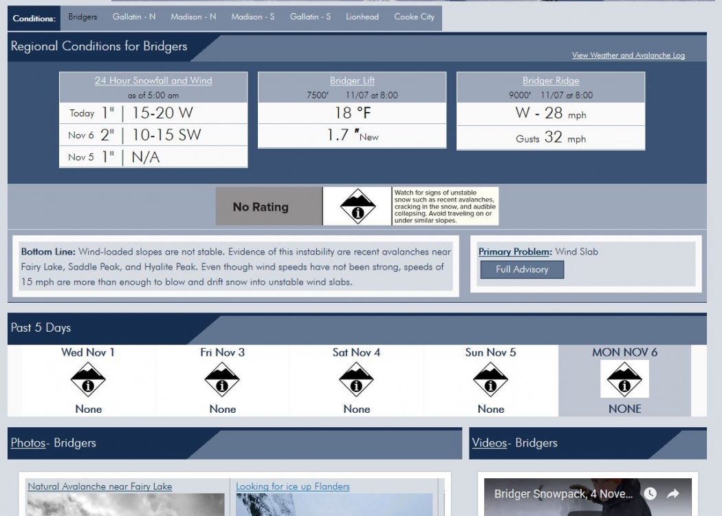
, 2017-11-07 |
|
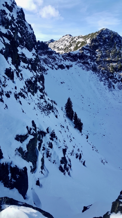
Cooke City, 2017-11-07 This slab avalanche was observed in Republic Creek on Monday, November 6. It's on a NE aspect, around 9,800' and estimated to be about 5' deep and 50' wide. Photo: B. Fredlund |
|
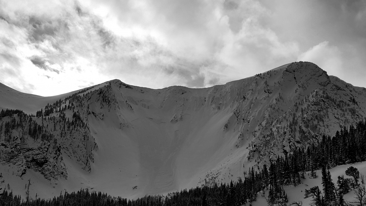
Bridger Range, 2017-11-05 This slide on Saddle Peak occurred during or shortly after the storm on Nov. 3rd-4th. The slope appears to be wind loaded and the slide was likely triggered by a cornice fall. Photo: GNFAC |
|
Bridger Range, 2017-11-05 Two skiers took this picture skinning up the Fairy Lake Road in the Bridger Range. Wind had been moving lots of snow around; pretty active loading on ridge tops as well as lower elevation spots. The lower hills surrounding the approach to Ainger Basin from the road were heavily loaded as well. Photo: G. Antonioli
|
|
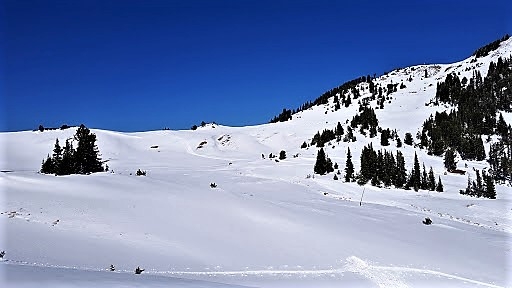
Northern Gallatin, 2017-11-05 Climbers wallowed across soft, powdery snow up Flanders Creek in Hyalite looking for ice to climb. The snow was not layered and it easily sluffed off.Photo: M. Hopkins |
|
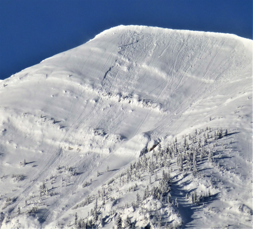
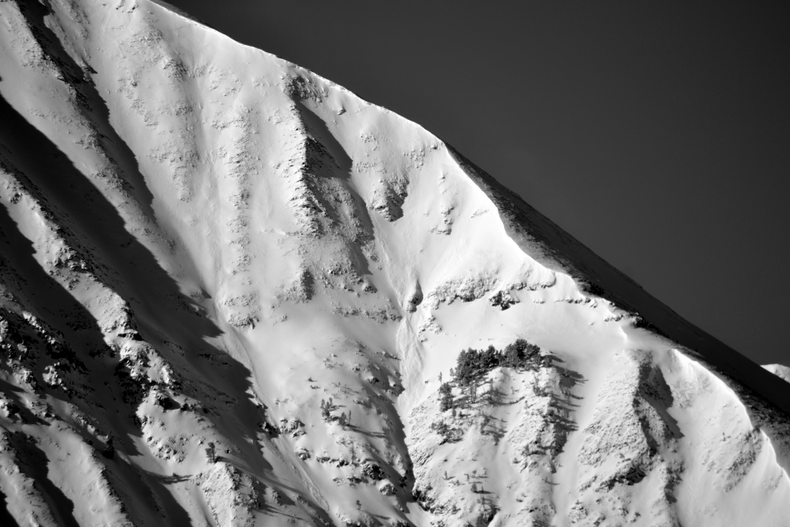
Northern Gallatin, 2017-11-04 This crown lines were observed on Mt Blackmore in the northern Gallatin Range. These slides occurred on NE facing slopes around 10,000 ft. and were the result of new snow and wind loading. Photo B. Vandenbos |
|
Northern Gallatin, 2017-11-04 Skiers on Mt Blackmore in the northern Gallatin Range observed these natural avalanches on a NE facing slope. The slides were a result of new snow and wind loading. Photo B. Vandenbos |
|
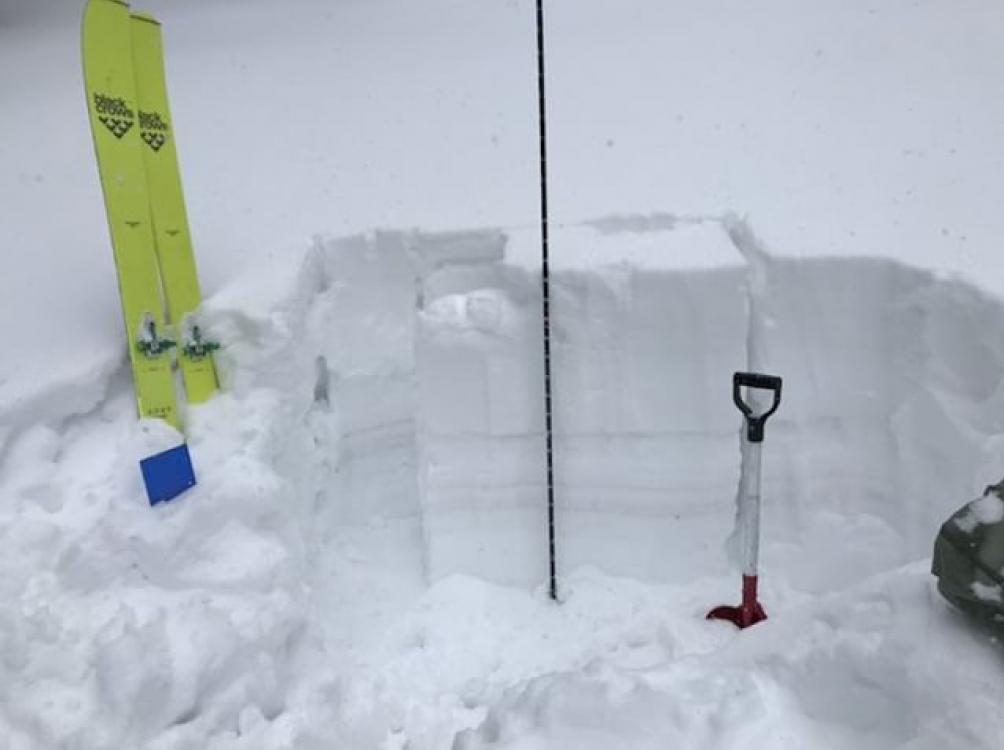
Bridger Range, 2017-11-03 This snowpit was dug near the top of the Apron at Bridger Bowl. The stability test score of ECT 9 means it propogated all the way across and slid quickly on the 9th tap. The weak layer was 30 cm from the surface in a 90cm snowpack. The interface between the old/new snow may remain unstable through the weekend, especially with wind-loading. Photo: Roy Taylor
|
|
Cooke City, 2017-11-01 .Photo: B. Fredlund |
|
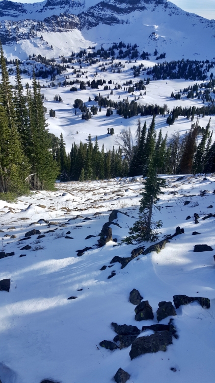
Northern Gallatin, 2017-10-23 A thin and weak snowpack exists in the northern Gallatin Range. This weak foundation will likely produce avalanches when heavier snow returns to the area. Photo: G. Antonioli |
|
Northern Gallatin, 2017-10-23 Variable snow conditions exist in the northern Gallatin Range near Bozeman. On high north facing slopes, dense wind slabs, a variety of crusts, and weak unconsolidated snow make up the snowpack. The existing snow will likely become weaker as time goes by. This will create a weak foundation for future snowstorms. Photo: G. Antonioli |
|
, 2017-10-23 Friday, 27 October, 6:30 p.m. at the Emerson Cultural Center. Tickets and Info Grizzly Outfitters of Big Sky is title sponsor of this year's 19th Annual Powder Blast. Mystery Ranch, World Boards, Community Food Co-op, and Spark R&D are key sponsors along with Alpine Orthopedics, Stronghold Fabrication, Highline Partners, and Marcie Hahn-Knoff Real Estate. Javaman, Edward Jones andBuck Products are other long-time PB supporters. Join us for the best fundraiser of the year! All proceeds benefit the Friends of the Avalanche Center which supports avalanche awareness, education and information throughout southwest Montana. Your $30 donation gets you an unforgettable evening at the Emerson Cultural Center. Beer from Katabatic Brewing Company; Wine from Montana Ale Works; Dinner by Bountiful Table; Music by DJ Missy O'Malley And the best silent auction of outdoor gear in the valley! |
|
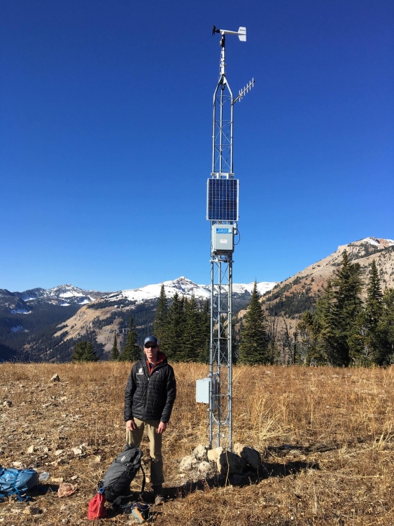
Lionhead Range, 2017-10-20 Lionhead weather station is up. The early season snow has stuck around most higher elevation, shady slopes, while sunnier slopes have little to no snow. The remaining snow will be the foundation for this winter's snowpack and a layer to keep an eye on. Photo: GNFAC |
|
Lionhead Range, 2017-10-20 Blue skies, snow capped peaks, and above average temps made for a perfect day to put up the Lionhead weather station. View the data here: https://www.mtavalanche.com/weather/stations/lionhead-weather-station |
|
Cooke City, 2017-10-17 In the montains around Cooke City, 1-2 feet of dense snow exists above 9,000 ft. This will likley make up the foundation of the winter snowpack. Fortunately, this base layer has gained strength with recent warm weather and should be a strong foundation for future snows. Photo K. Broderick |
|
Northern Madison, 2017-10-12 Small wind slabs near the ridgeline and debris piles. Strong wind transported recent snow into drifts in gullies and near ridgelines. Photo: B. VandenBos |
|
Northern Madison, 2017-10-12 Snow transported by wind on the headwaters of Lone Mountain cross-loads the gullies with drifts. These drifts can be unstable and slide in steep terrain. Photo: B. VandenBos |