Photos
|
Bridger Range, 2019-03-03 From BBSP on 3/2/19: "Large natural avalanche pulled out last night/early morning on the backside of north peak of saddle peak in Bostwick canyon, the slide path is known as the 'Y' to local skiers and hasn't run this year, or been skied. Crowns looked to be 3-6ft, it ran further than anything i've seen there in the past decade, knocking over small trees and some old standing dead in the run out. R3 D3.5." Photo: BBSP Link to Avalanche Details |
|
Cooke City, 2019-03-03 A skier saw this recent natural slab avalanche on a east aspect around 9,700' near Cooke City. He also saw another large slab avalanche on the ENE side of Miller ridge just below 10,000'. Photo: B. Fredlund Link to Avalanche Details |
|
Northern Madison, 2019-03-03 Deepest part of crown from slide triggered 3/2 by the YC Ski Patrol conducted avalanche mitigation work above one of their roads. A 2lb explosives charge was detonated from an aerial tram and triggered a R4/D3 avalanche that ran to the ground on depth hoar. The crown was 4', The max path width was around 250', and it ran 350 vertical feet to the bottom of the runout zone. The elevation was 8400' on a ENE aspect and max slope angle of 36 degrees. Photos courtesy YC Ski Patrol. Link to Avalanche Details |
|
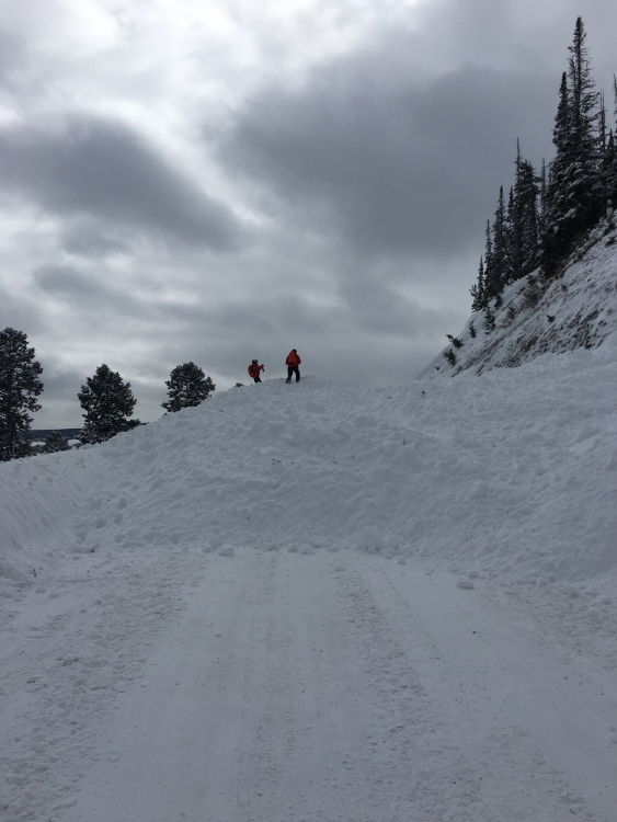
Northern Madison, 2019-03-03 Today the YC Ski Patrol conducted avalanche mitigation work above one of our roads. The area is outside of our ski area boundary and receives no skier traffic. A 2lb explosives charge was detonated from an aerial tram and triggered a R4/D3 avalanche that ran to the ground on depth hoar. The crown was 4', The max path width was around 250', and it ran 350 vertical feet to the bottom of the runout zone. The elevation was 8400' on a ENE aspect and max slope angle of 36 degrees. Two sections of road, which were controlled for traffic, were buried with an estimated 15-20 feet deep deposition pile. We’ve seen this path go big in the Spring, but we can’t recall it ever going quite this big. Photos courtesy YC Ski Patrol. Link to Avalanche Details |
|
Northern Madison, 2019-03-03 |
|
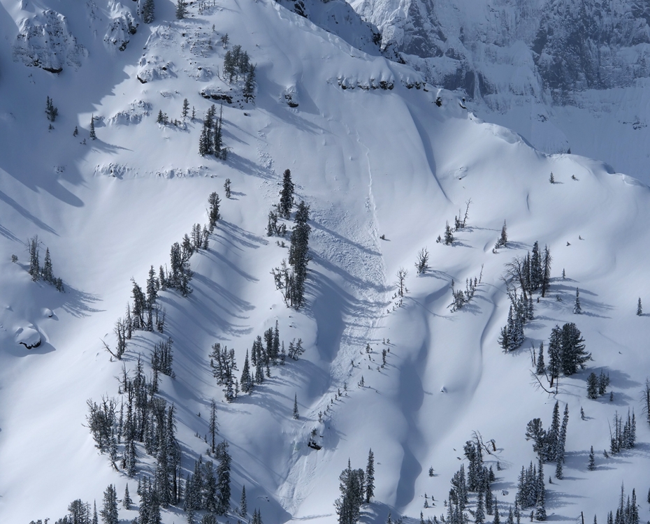
Cooke City, 2019-03-01 From the email: "Had a good look around from the Lamar Valley up to Cooke first thing this am, and the epicenter of the avalanche activity appeared to be around Mt. Horinday and Barronette Peak. Lots of slab avalanches on the east face of Barronette. Most looked to be about 1-2' deep. Much quieter the further up valley toward Cooke City you went." Photo: B. Fredlund Link to Avalanche Details |
|
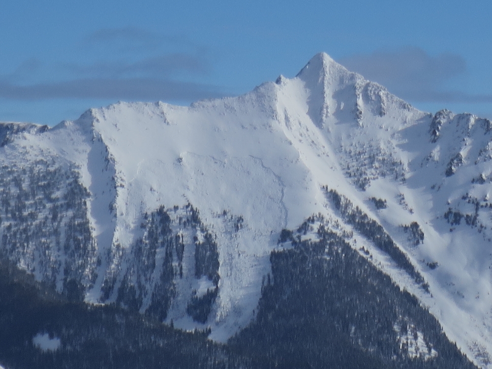
Northern Madison, 2019-03-01 Days of heavy snow and strong winds created unstable conditions in the mountains near Big Sky. This massive natural avalanche was observed on Wilson Peak north of Big Sky Ski Resort. As snow and wind subside, conditions will gradually become more stable. Photo: C. Babineau-Z Link to Avalanche Details |
|
Out of Advisory Area, 2019-02-28 We received this report of an unusually large natural avalanche in the East Mill Creek drainage: " First time in 17 years we have had an avalanche come into our road. Natural, maybe from a point release that fractured new snow about 20 inches at the crown, propagated 50 yards, ran about 300 feet without stepping down, leaving about 5 foot deep debris. A new 2 inches is covering the debris that likely went during this afternoons warming." Photo and comments: L. Watson Link to Avalanche Details |

|
Bridger Range, 2019-02-28 A skier reported seeing multiple recent avalanches near the Throne. They dug a pit and got propagating results failing at a density change within the new snow. From the email: "Around a foot of wetter, denser new snow (F+) slid on a dryer new snow interface (F-)". Photo: C. Kussmaul Link to Avalanche Details |
|
Cooke City, 2019-02-28 This natural avalanche was observed between Cooke City and Silver Gate. Heavy snow and strong winds are creating unstable conditions in the mountains around Cooke City. Photo: B. Fredlund |
|
Southern Madison, 2019-02-28 |
|
Southern Madison, 2019-02-28 |
|
Northern Madison, 2019-02-28 Skiers intentionally triggered this wind-loaded slope in the northern Madison Range. It broke 50' wide and 100' vertical. Photo: Anon Link to Avalanche Details |
|
Northern Madison, 2019-02-28 Skiers intentionally triggered this wind-loaded slope in the northern Madison Range. It broke 50' wide and 100' vertical. Photo: Anon Link to Avalanche Details |
|
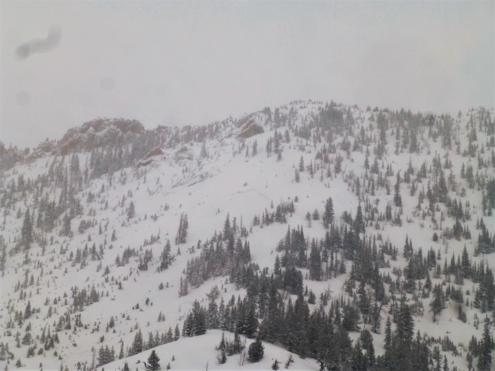
Bridger Range, 2019-02-27 |
|
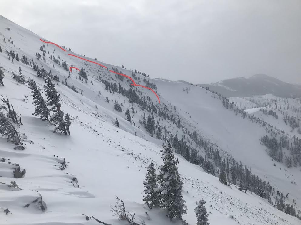
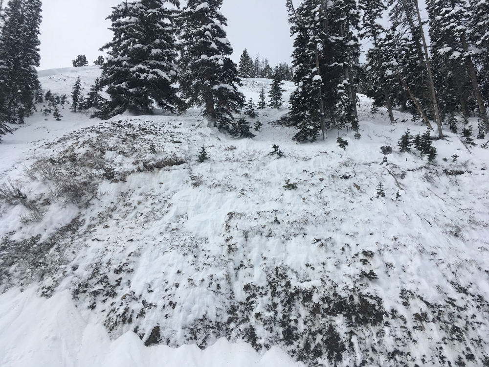
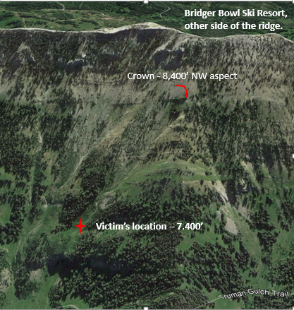
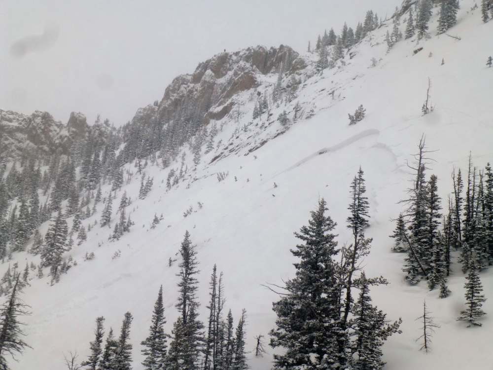
Bridger Range, 2019-02-26 The avalanche can be seen in the center of the photo. Snow on the lookers right flank also avalanched from wind-loading. There is still a lot of snow that did not avalanche, which is still dangerous and could slide. Photo: GNFAC Link to Avalanche Details |
|
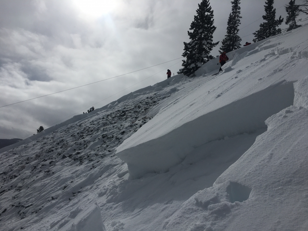
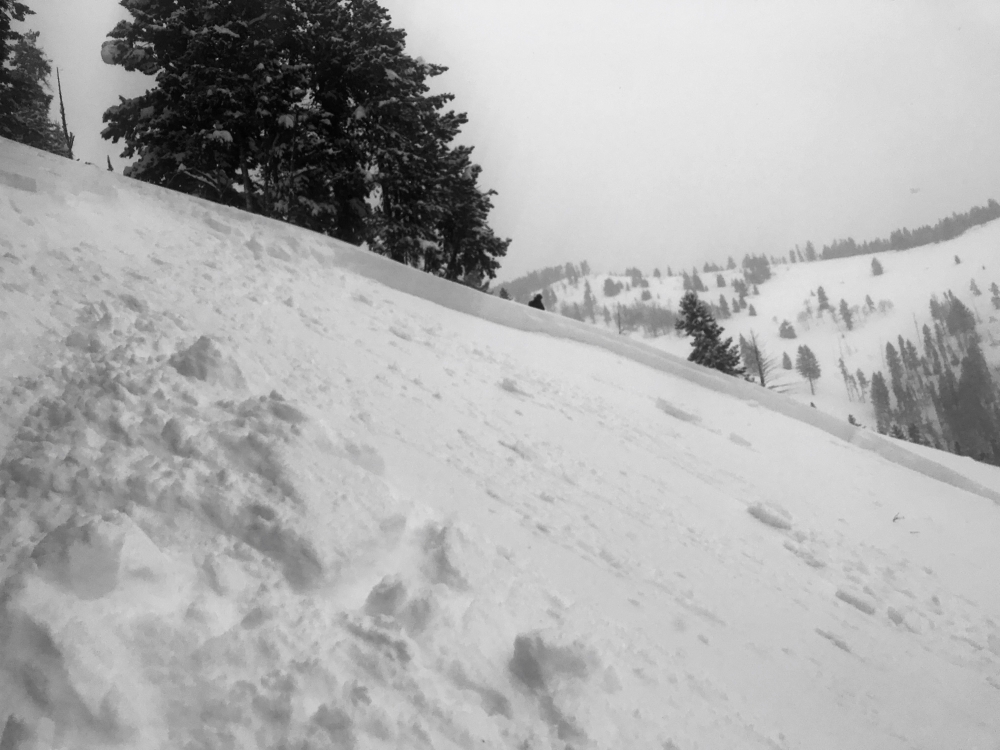
Bridger Range, 2019-02-26 The crown looks to be 4 feet deep and 100 feet wide. It is bigger than it appears in the picture. There is still a lot of snow above the crown which could avalanche. Photo: GNFAC Link to Avalanche Details |
|
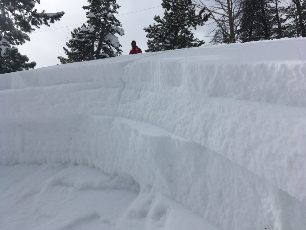
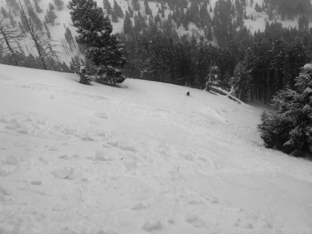
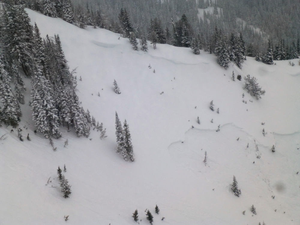
Bridger Range, 2019-02-26 The lower of the two crowns may have been triggered by the two rescuers as they entered the slope. Photo: GNFAC Link to Avalanche Details |