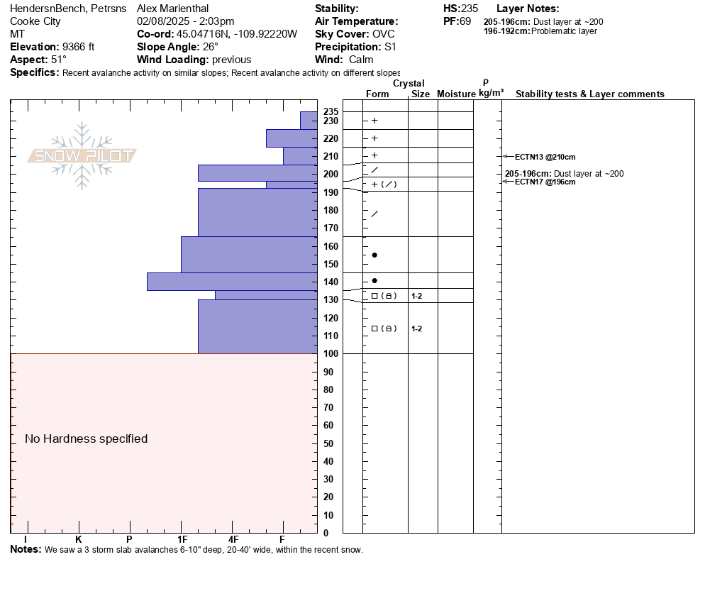
Snow Observations List
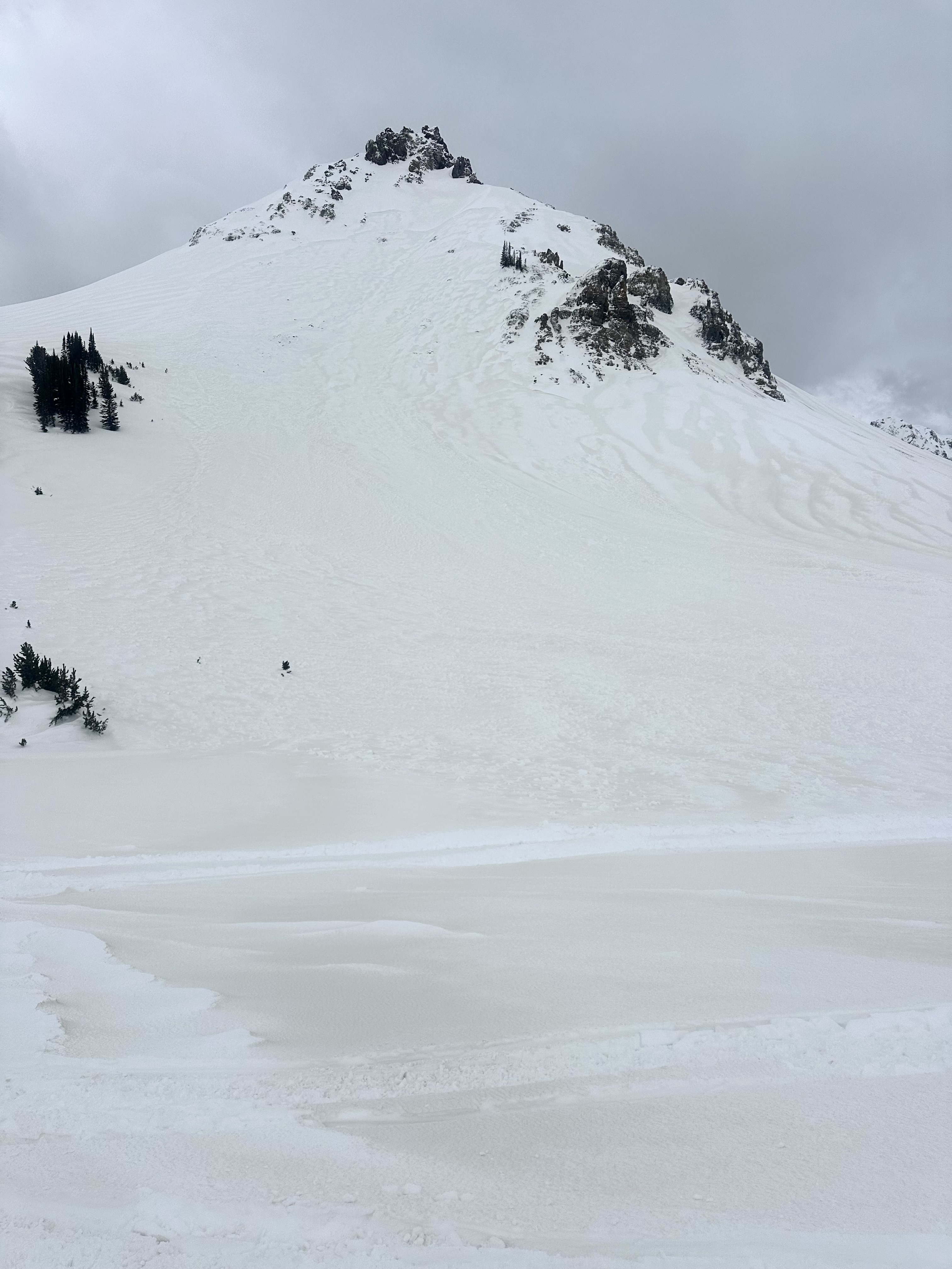
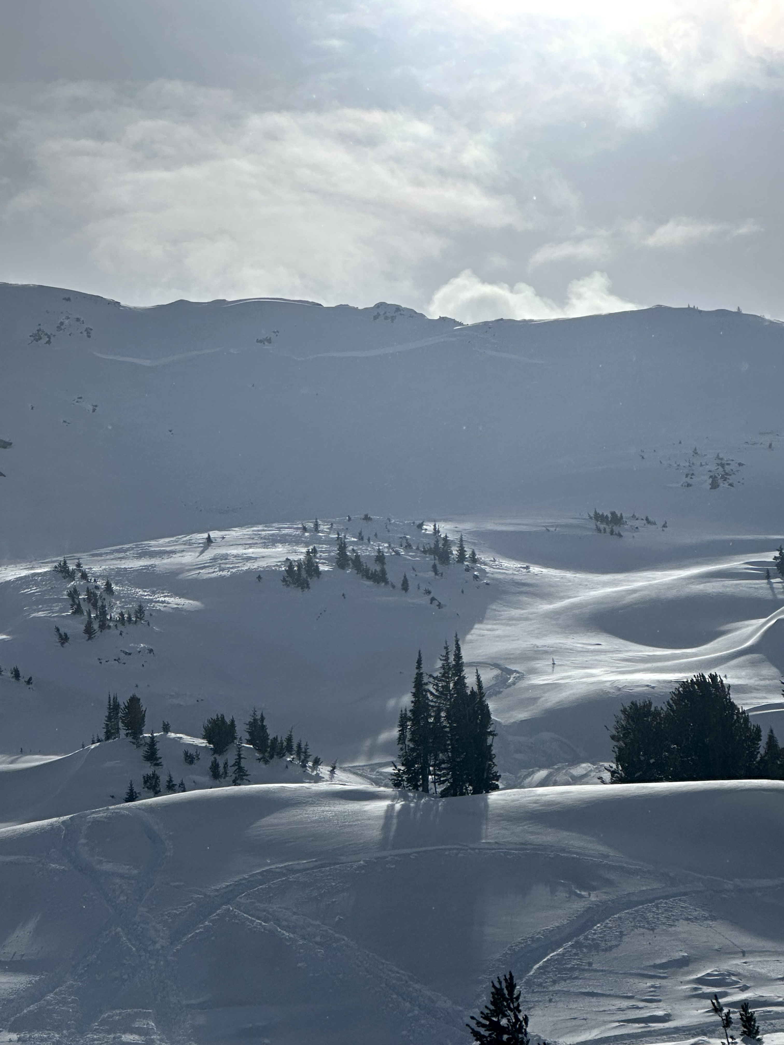
This afternoon we rode up to Henderson Bench, then up Lulu road to the Cabins below Scotch Bonnet. It was snowing lightly most of the day with light to moderate wind. Wind was steady moderate near Lulu Pass. Visibility was limited, but we got a brief look at some of Henderson Bench and Scotch Bonnet.
We saw 3 avalanche that broke 6-10" deep within the recent snow, R1-D1s, 20-40' wide.
For the next 1-2 days I expect any fresh drifts will be easy to trigger. There are some density changes within the recent snow that could cause storm slab avalanches to break easier on non-wind loaded slopes.
We dug on a northeast facing slope at 9,360' elevation. Below the dust layer that was deposited at the end of last week's storm there is a lower density layer of precipitation particles that was preserved. This produced an ECTN in our test, but seems like it could contribute to avalanches for the next few days at least. (profile attached).
Snow that fell since last weekend was settled to about 2.5-3 feet. We did find some small facets buried below the last week's snow, but they were not showing obvious signs of being a widespread problem. I am still cautious that larger, wider avalanches could break on this facet layer until the snowpack has 1-3 more days to adjust to the weight of recent snow, especially on wind-loaded slopes.
Practice cautious route finding and careful snowpack assessment as avalanches are likely within the recent snow, and possibly could break 2-4 feet deep below all the snow that fell over the last week.
Full Snow Observation ReportOverall, the snowpack seems to lack widespead pwl problem (below the recent snow), but visibility and digging was limited today. I remain hesitant until we can gather more evidence and give the snowpack more time. Potential for wind slab and storm slabs seems enough to warrant CONSIDERABLE danger. Danger could come down quickly as loading tapers off, but this could change if we see something different tomorrow like concerning pit results or larger avalanches.

Saw this small soft slab above Round Lake today. SE facing, 9500 ft. Likely skier triggered, there were lots of ski tracks on that hill.
Poor visibility today but no other avalanches observed.
Full Snow Observation Report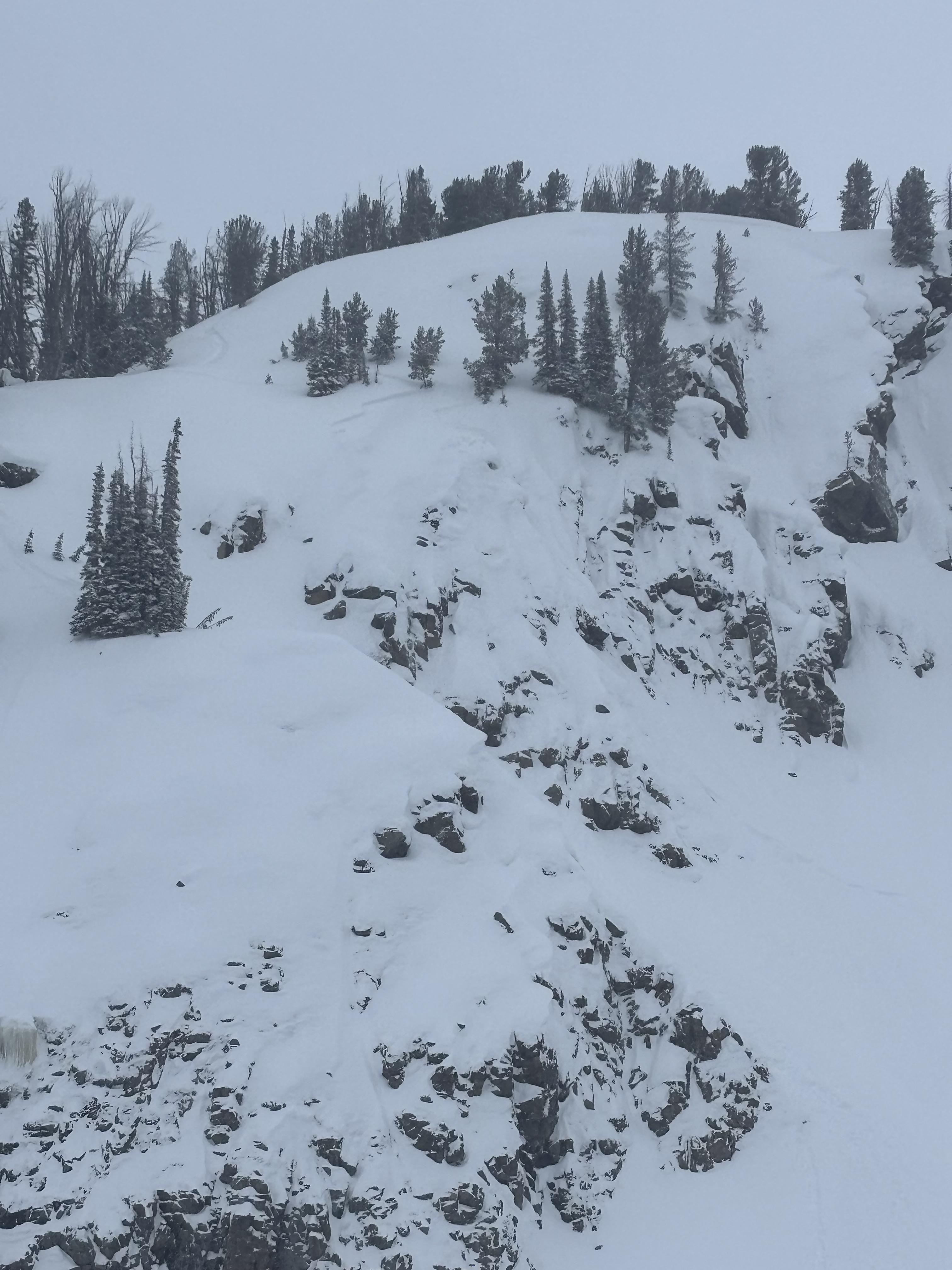
Skied south of Cooke today. Winds were strong with frequent gusts to extreme out of the S. 3cm of new between 1530 and 1700. No cr, co and the wind slab produced moderate, non-planar results in hand pits. Limited vis and no avalanches observed.
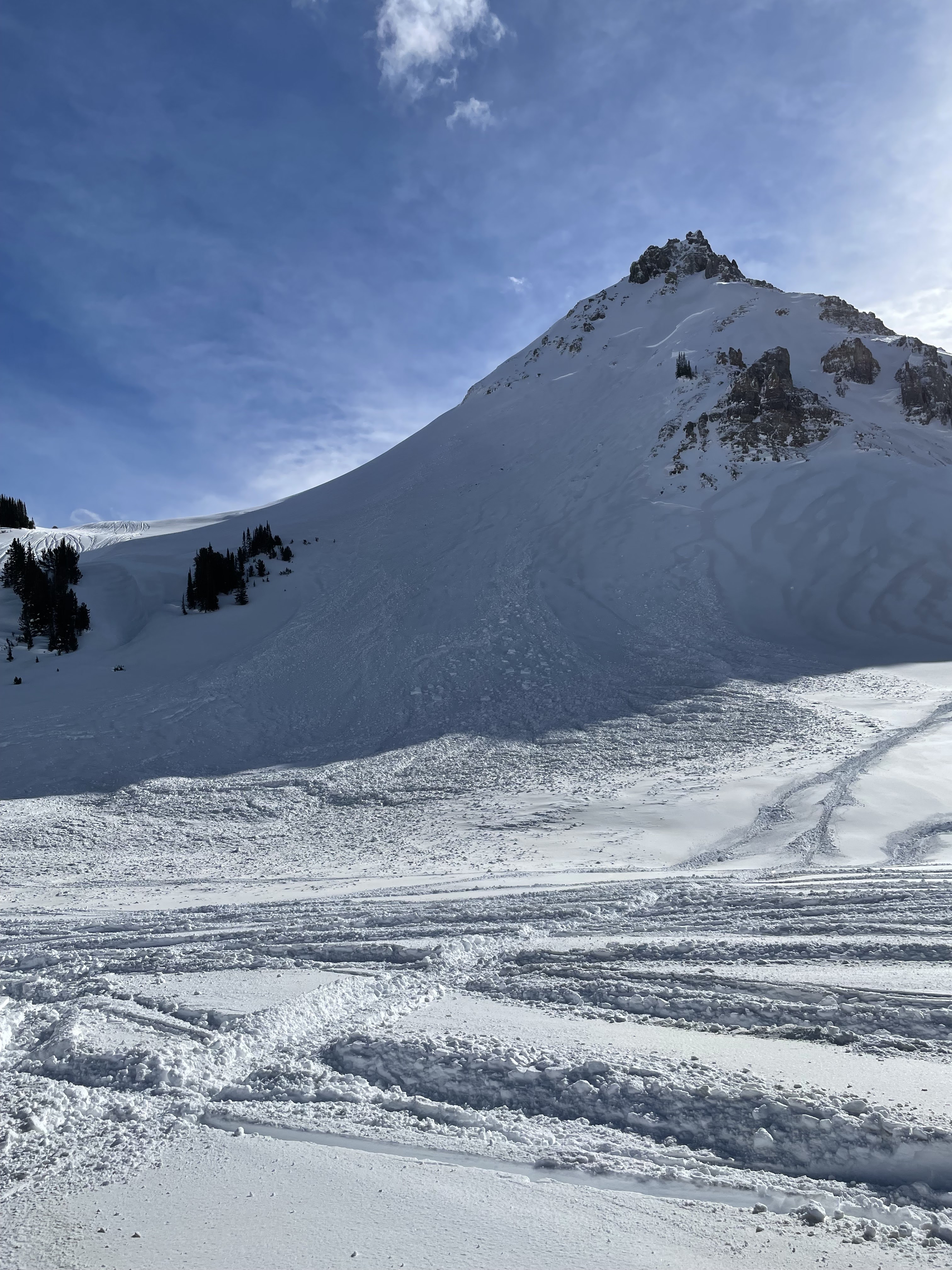
Full Snow Observation ReportSaw a number of slides today, as to be expected. All the large ones I noticed were north facing. Also, the dirty snow was so odd to see mid winter. It was brown all over the sled zone.
N face of crown butte, looks like it slid before the dirt event (we think the end of the storm yesterday/ or last night must have been dirty snow?). It was extremely deep and terrible vis yesterday, but blower snow. Not the case today with how warm it got.
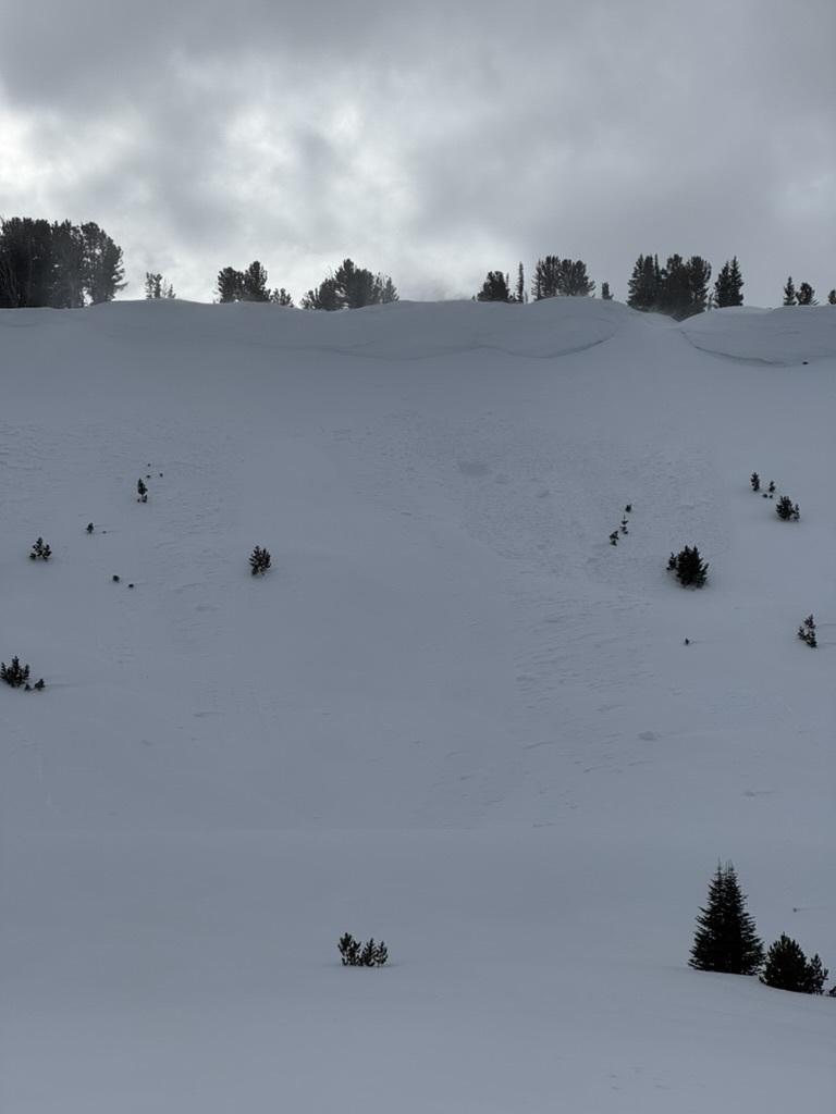
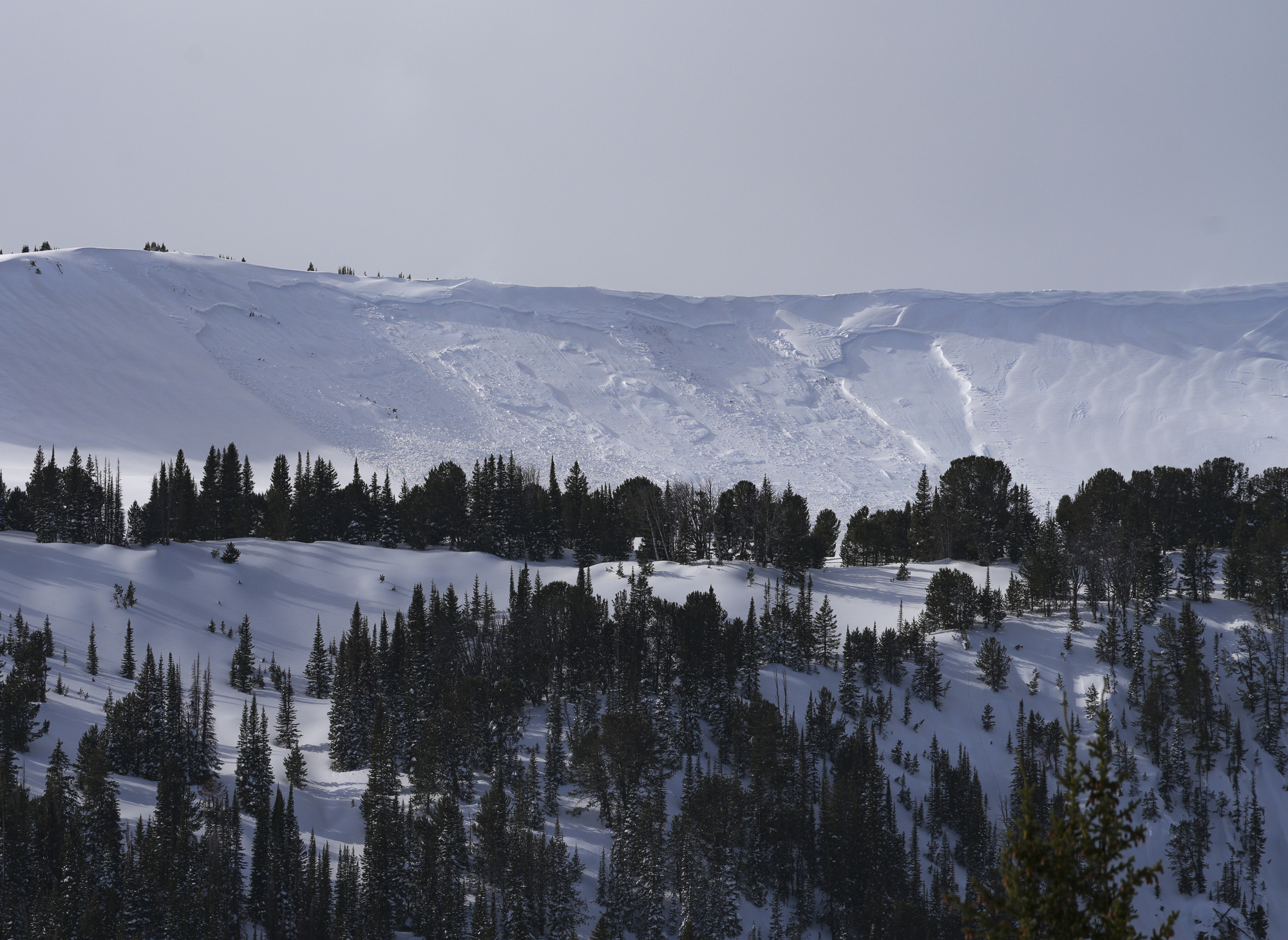
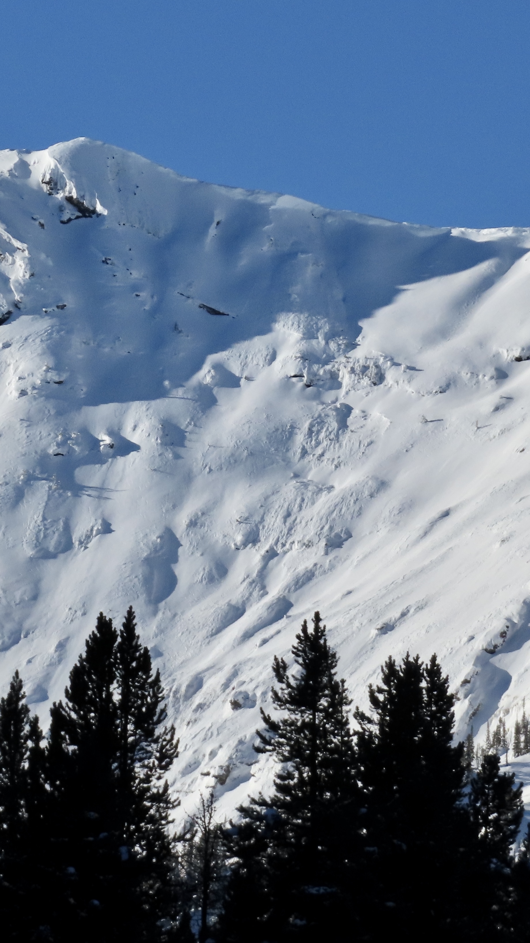
This is the N side of scotch bonnet, looks like a big break, didn’t get any closer than this however.
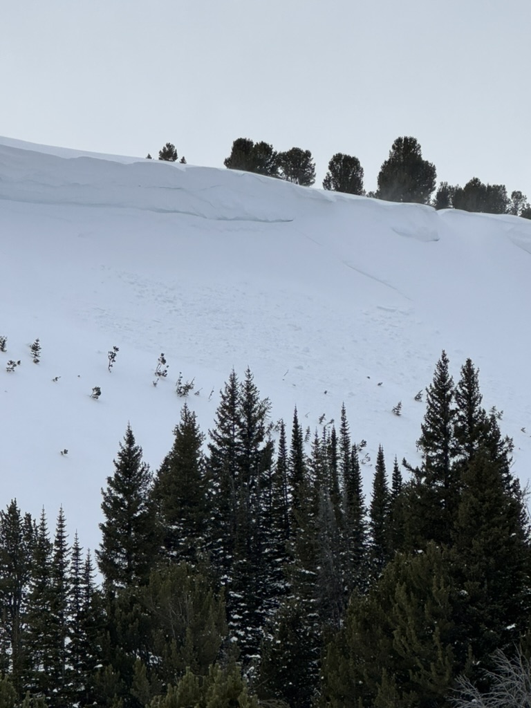
Also saw some decent sized slides on the N side of Henderson, but was too far away to get photos.
Just a little wind load cornice break, but it broke while I was coming down that track to the right.
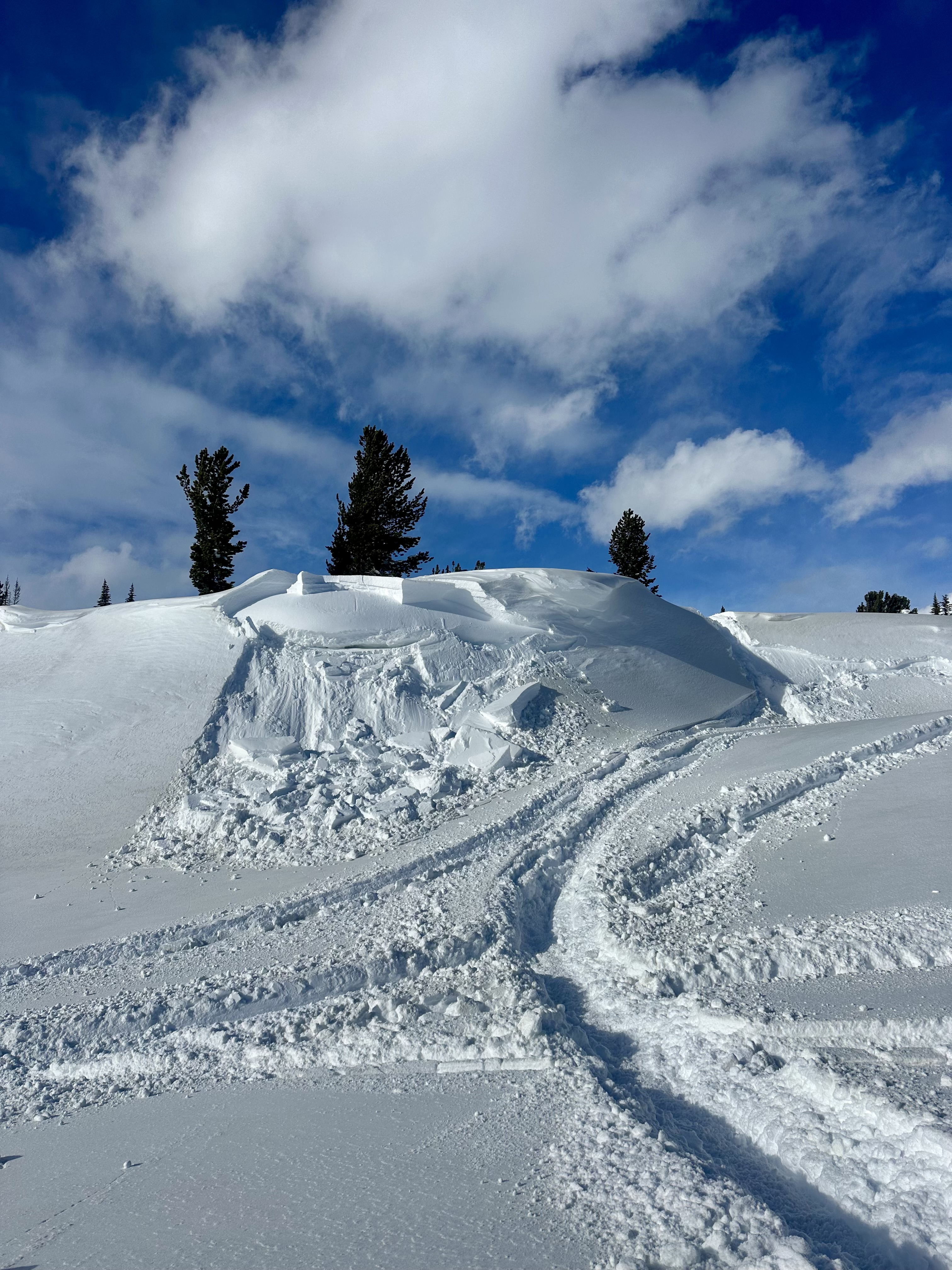
While sledding today we observed 3 different avalanches. The first was on E Henderson above the bench in nearly the same spot as the 12/30 avalanche. It ran sometime between 11:30 and 12:30 today.
The second was on the north aspect of Scotch Bonnet. The third was on the north aspect of Crown Butte. We don't think these broke on any deep PWLs, since none of the crowns were impressively deep. The latter two likely ran at the end of the storm yesterday. The crowns were starting to drift in, but there was little to no new snow on the debris.
Notably, there is a widespread dust layer on the snow surface, and possibly another layer further down within the recent storm snow.
Blowing snow was moderate to intense at ridgetops and west aspects are scoured. Winds were light to moderate out of the S and W. Skies were SCT to BKN.
Full Snow Observation Report
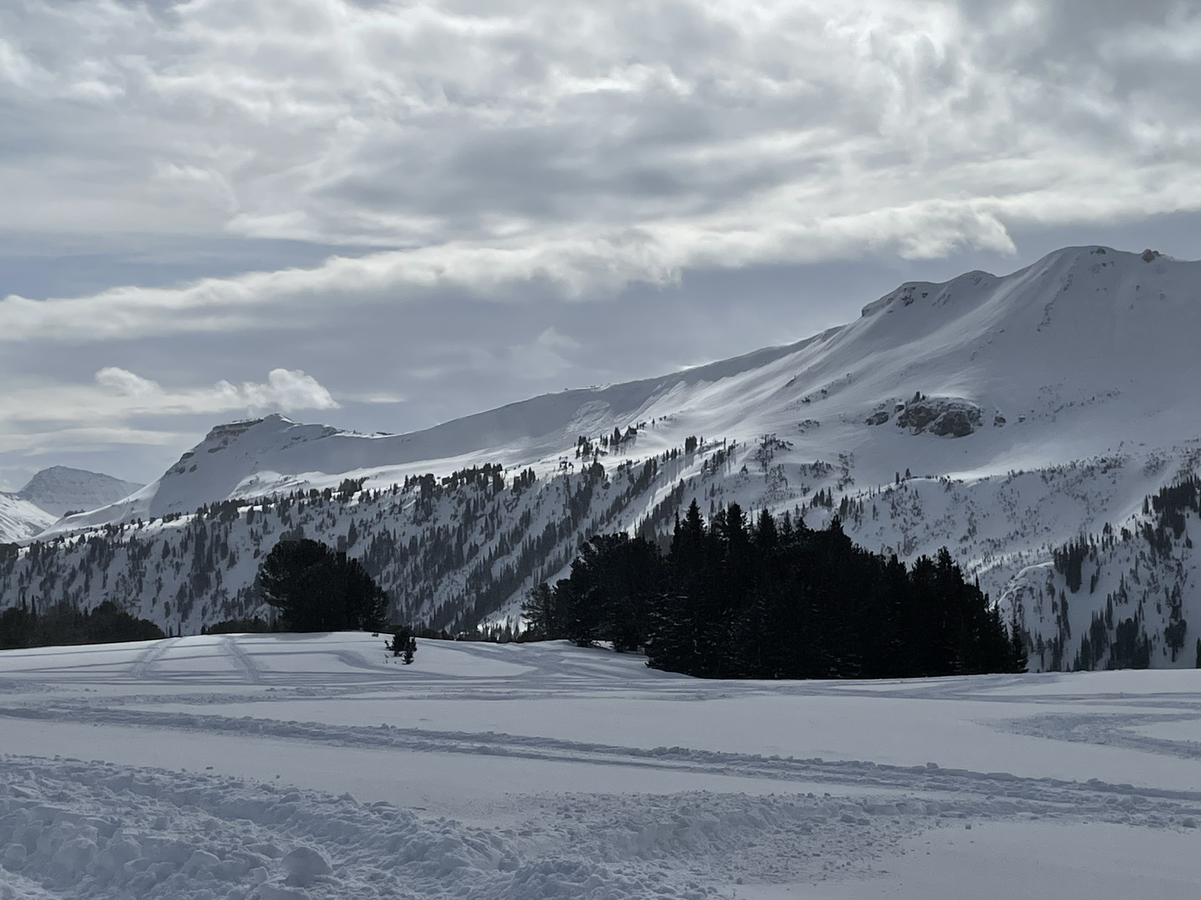
Today, we had the pleasure of riding with USFS Snow Rangers from Bozeman, Livingston, Gardiner and Cooke City. We rode into First and Second Yellow Mule and Buck Creek drainages.
Temperatures were warm, topping nearly 40 degrees at the parking lot around 4pm. Strong winds blew all day from the SW, sustaining 30mph at ridgelines. Snow was actively transported all day by winds, and plumes were visible on far away ridgelines and summits. There was around 1.5-2' of new snow from the weekend. Widespread dirt and/or dust was also noted on snow surfaces.
Our primary concern today was slopes where strong winds had formed thicker slabs from recent snowfall. On the headwall of the Second Yellow Mule, we saw two recent wind slab avalanches. These were small (R1 D1), immediately below the ridge, and likely broke late last night or this morning.
Our snowpits today were relatively anticlimactic. We were curious as to how recently buried weak layers were reacting to the new snow. In three separate locations, we performed multiple tests and saw high scoring propagation in only 2 of 9 total tests. This propagation was difficult to replicate. We had ECTN's within the new snow and on the new/old interface. We found broken surface hoar feathers and facets under the new snow, but even those weak grains were not visible in every pit. That being said, we did not travel into Bear Basin, where, prior to the recent snow, Alex found large, buried surface hoar (https://www.mtavalanche.com/node/33832). We did not observe any cracking or collapsing.
Full Snow Observation Report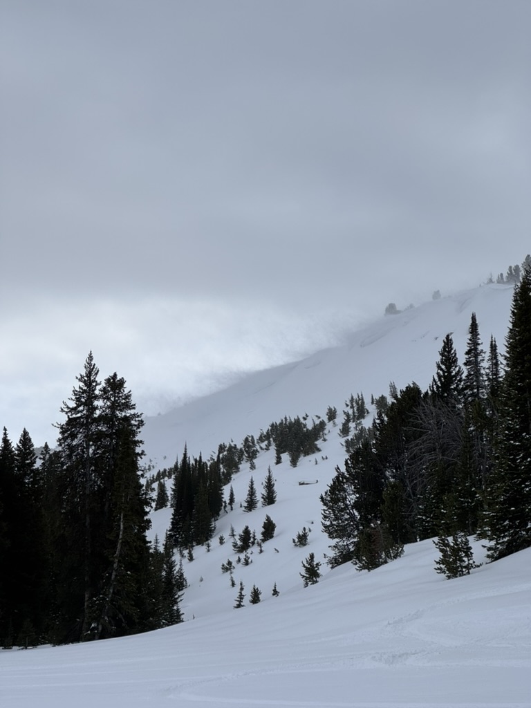

Afternoon ski/ snowmobile tour north of Cooke City today. Some recent avalanche activity noted on east Mt. Henderson, and NE Miller Ridge. Photos attached.
Very warm temps today (33F for a high at Fisher Creek, but 47F at 2pm the NE Entrance!)
There is now a widespread dust/ pollen layer on the snow surface from recent strong SWerly winds also.
The new snow was a bit upside-down and sticky today with the warm temps, but still skied well on the right aspects and timing.
I measured the new snow depth up near the base of Lulu Pass and was finding 65cms settled new. Much less in the lower elevations around Cooke City though.
Also, yesterday we were ski touring up Republic Creek on westerly aspects of Woody Ridge. I was able to ski cut a small test slope and get a wind slab to crack and move a short distance (6" deep), but aside from that, no other natural avalanche activity noted on west Woody (good visibility in afternoon on exit).
Also, on our exit yesterday we observed 3 D1 storm slab/ wind slab natural avalanches on east Mt. Republic. All mid slope, where it is common for cross-loading. These appeared to be failing at the new/ old interface.
No collapsing noted the last 3 days of ski touring.
Full Snow Observation Report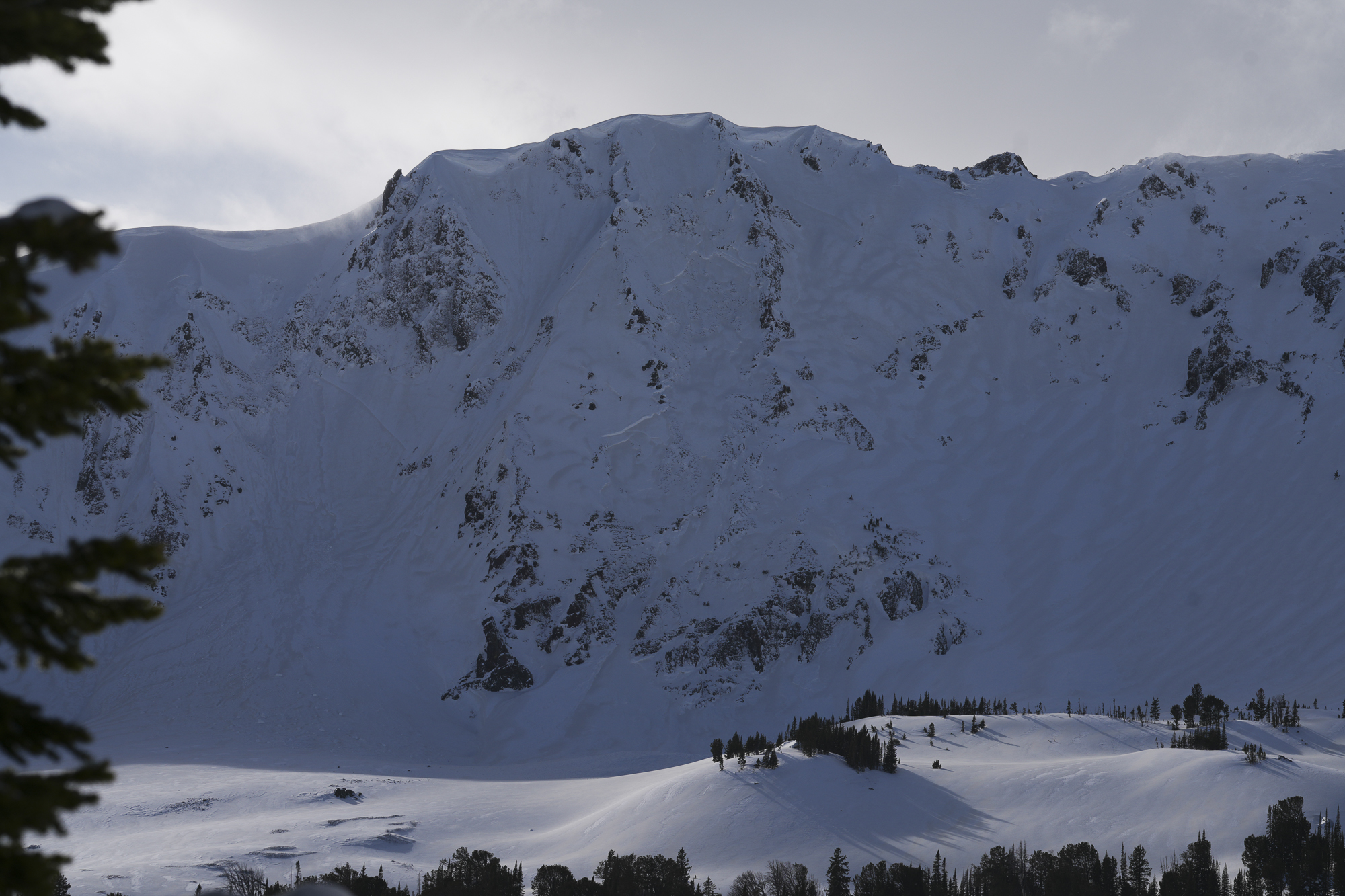
During a full day of ski touring near Round Lake, we saw about 4" of new snow. Hard to tell though because the wind was really blowing snow around. I saw two small shallow wind slab avalanches but vis was poor.
Full Snow Observation ReportSkied south of Cooke over the weekend. Winds were L-M gusting to X out of the W, SW. 19" HN at 8500' from Friday night to Sunday afternoon. Small, localized cracking of wind slabs, but they weren't as reactive as I would have expected. No avalanches seen, although visibility was limited. There are some density changes within the storm snow, including a layer of graupel. Storm snow was not reactive in hand pits. On solar aspects, there is a MF crust under the recent storm snow and facets under the crust. The crust varies in thickness depending on aspect and elevation, 1-3cm.
Full Snow Observation ReportSkied north of Cooke City. Lots of cracking and small slabs on pillows. Observed one small wind slab on NW facing slope 9200 ft.
Full Snow Observation Report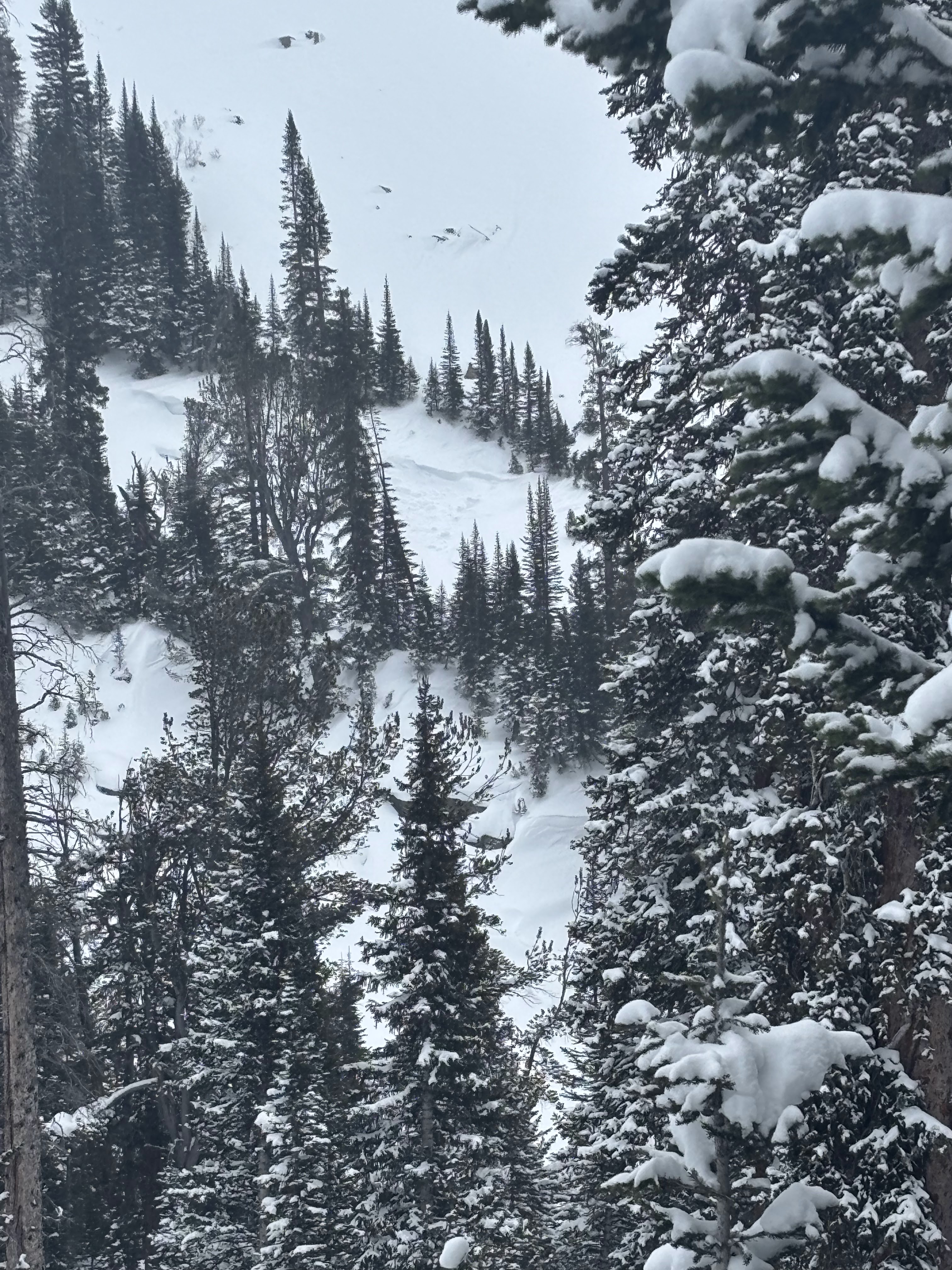
Observed a large wet loose (D1) in Zimmer Creek today off SE facing cliffs. Likely happened 1/29. There were also other smaller wet loose avalanches nearby on south facing cliffs
Full Snow Observation Report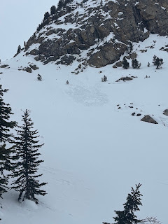
Today, we toured south of Cooke City, up Republic Creek and Republic Mountain. We spotted widespread, weakening snow surfaces: surface hoar feathers at lower elevations, faceted snow on cold, shady slopes up high, and faceted snow beneath crusts on solar aspects. Our pit on an E aspect at 9460' did not produce unstable test results, but showed the top 1.5' of snow to have faceted and weakened during this bout of high pressure. These layers are not concerning now, but will certainly be top of mind when the next storm system arrives over the weekend.
We spotted several loose wet avalanches that occurred yesterday in steep, rocky terrain up Sheep Creek. We also noted an old, deep persistent slab avalanche on a NW' aspect near the south end of the Republic Creek drainage. This likely broke around a week ago.
Skies were clear, winds were calm, and temperatures were warm in the sun and chilly everywhere else.
Full Snow Observation Report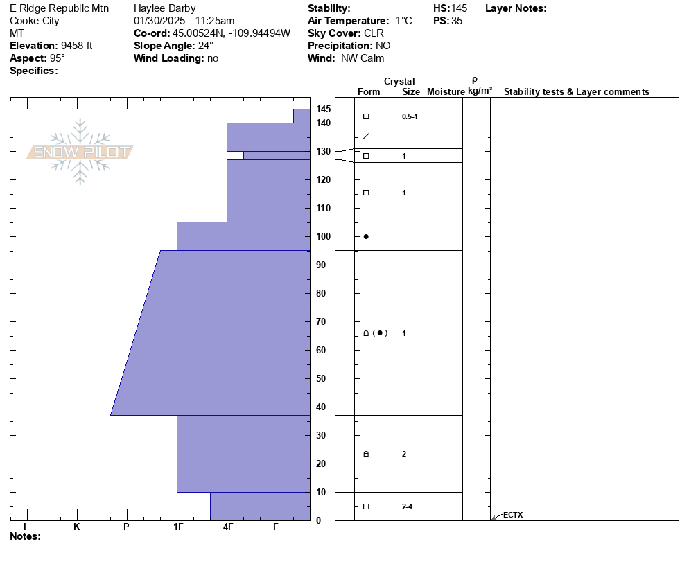

We skied up west Woody Ridge and skied down into Hayden Creek about 500 feet, then back up and over, and out Republic Creek.
Skies were clear with calm winds and a light breeze at the ridgetop. Temperatures were still mostly cold, single digits down low and teens up high in the morning. The sun felt hot mid-day, snow bombs were falling off trees and there were some small rollerballs around steep rocks on southerly facing slopes.
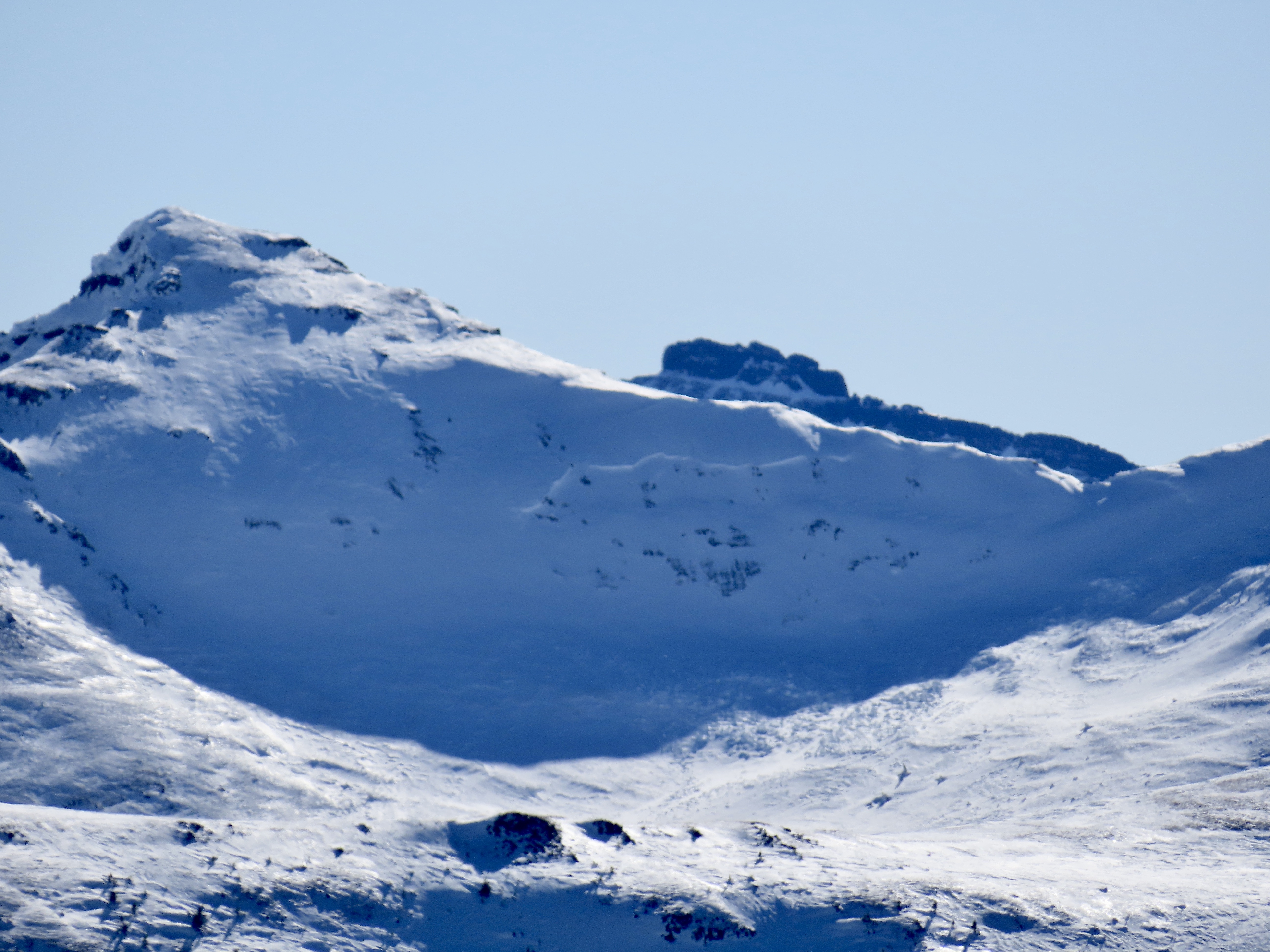
We saw one old, but very large persistent slab avalanche further up Republic Creek (pictured). It was on similar aspect and elevation as a somewhat more recent persistent slab in nearby Hayden Creek, North-northeast, 10,000'. It appeared to be 6'+ deep and 500'+ wide. The bed surface and crown had been partially drifted in, so it seemed it was probably at least a week old...?
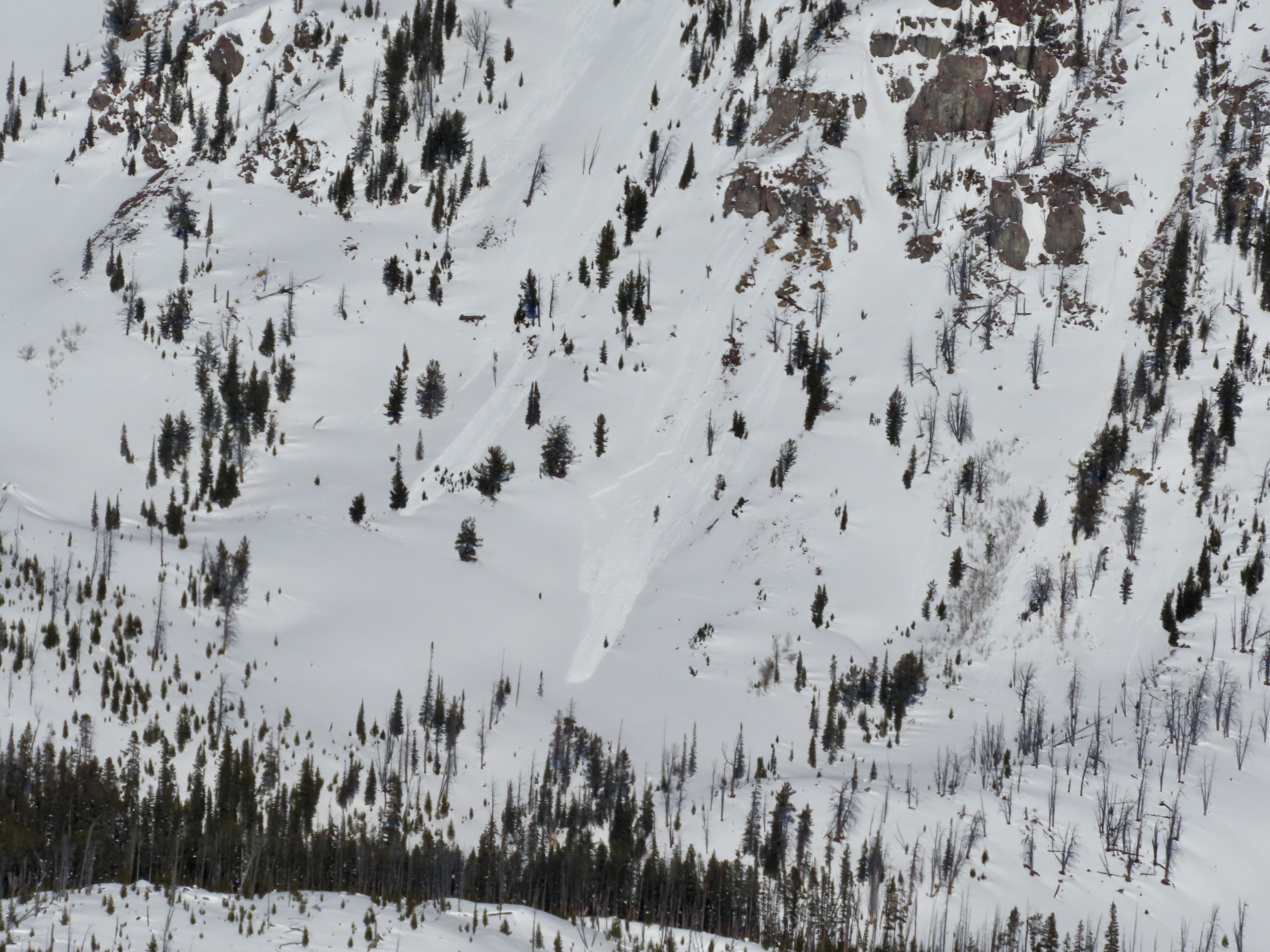
There was also a recent cornice fall on a very big steep slope up Republic Creek (picture) which did not trigger anything large or deeper, but entrained some snow and ran over a thousand feet vertical.
We dug a pit at 9,900' on a west aspect. Snow depth was 150cm (5 feet). We had an ECTN11 below 3 inches of snow on top of small sugary facets near the surface. There were soft (4f+) sugary facets at the bottom of the snowpack, but they did not break in an ECT or with extra force. Snow depth above 9,000' was ~4 feet average based on a few places we probed as we toured up.
There were signs of a lot of previous wind up high. It has been a few days without wind, but there are probably some isolated instabilities of small stiff wind slabs sitting on facets which could be triggered.
Full Snow Observation Report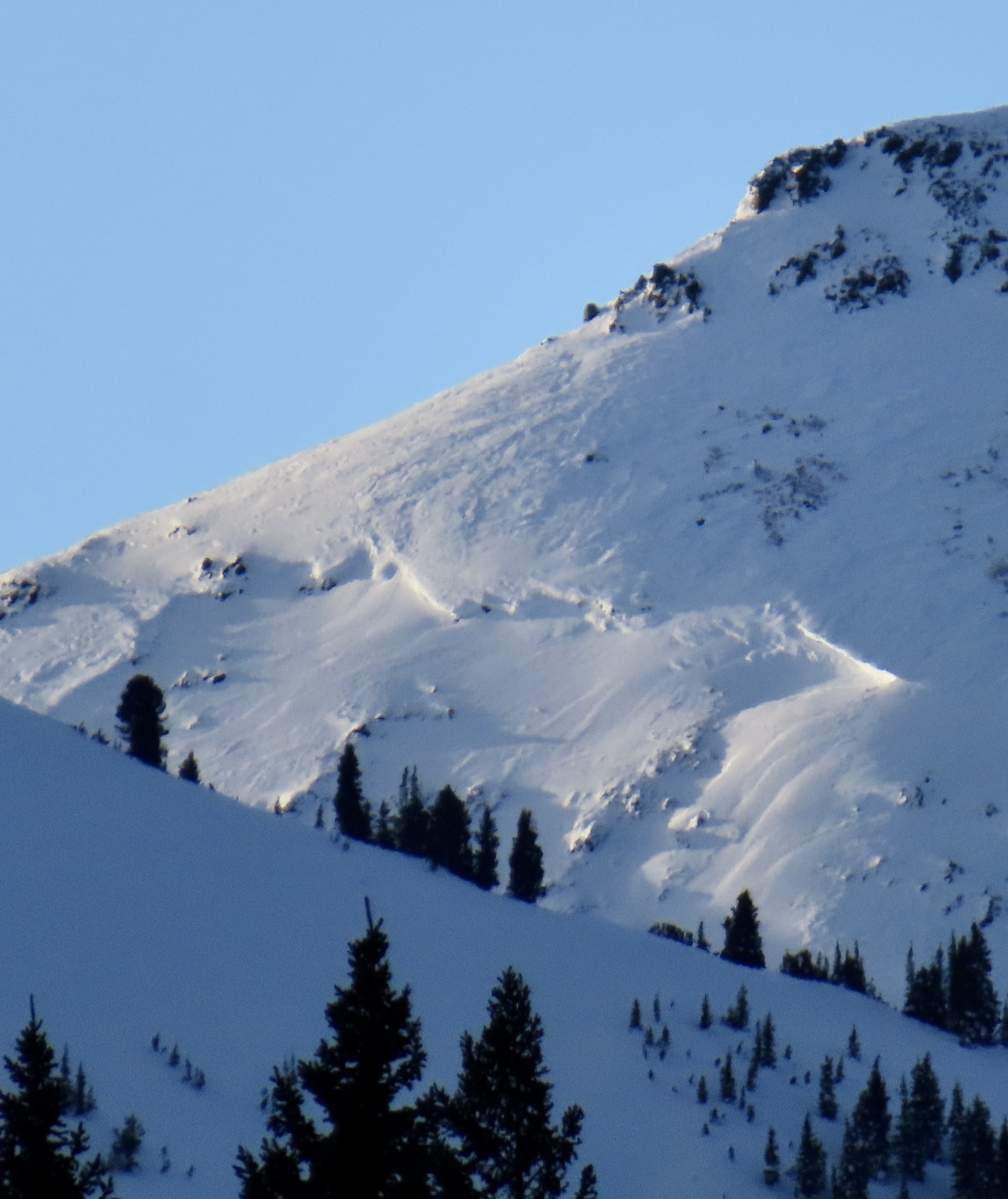

We saw most terrain in the motorized area north of Cooke City. We went passed Round Lake to Goose Lake wilderness boundary, around the north of Sheep Mtn. and Scotch Bonnet to Lulu Pass, out to Mt. Abundance, back south over Daisy Pass, and around town hill/Miller Rd., then up and down Sheep Creek to the top.
Skies were clear and wind was calm to non-existent with cold temperatures (singles to teens F).
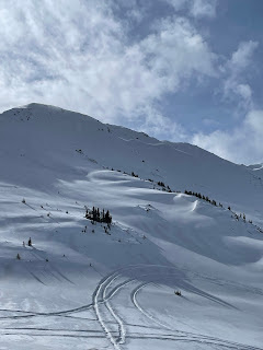
We saw a handful (4-6?) of old wind slab avalanches of various ages. The most recent and largest appearing, but still not very fresh, was on the north side of Scotch Bonnet (attached photo). Most were D1-D1.5, the slide pictured was D2.
We dug on the southeast shoulder of Mt. Abundance (profile attached). Snow depth was 3.5-4 feet and we had ECTNs. There were some soft-ish facets near the bottom of the snowpack. We also dug a pit in Sheep Creek and had an ECTX, snow depth of 4-5 feet. We did a lot of hand pits to look for recently buried facets. Small sugary facets were generally easy to find, buried 3-6" deep below soft snow. If and where snow is drifted into thicker slabs, these facets might make those slabs more reactive.
A lack of recent avalanches combined with minimal recent loading from new snow and wind point to avalanches being unlikely. The recent large persistent slab in Hayden Creek shows that although slides are unlikely they could be big. We would rule-out big slopes that are heavily wind-loaded, and otherwise feel ok in steep terrain while sticking to safe travel protocols (carry a transceiver, probe AND shovel, and only expose one person at a time to avalanche terrain).
Full Snow Observation Report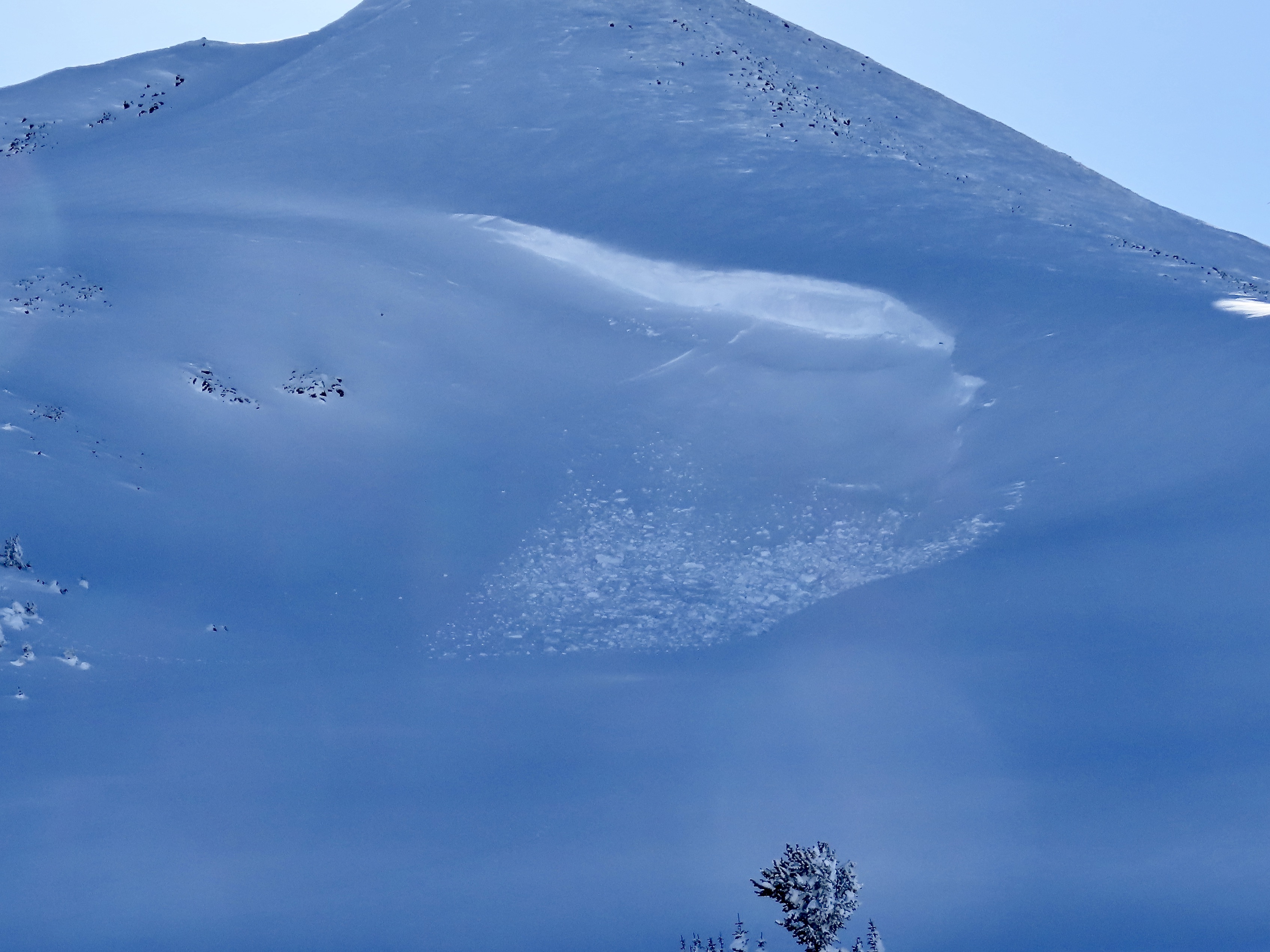


While touring today, we saw a deep slab avalanche at the southern end of the Hayden Creek drainage. NE aspect. It seemed to be recent, likely in the last day or so.
Full Snow Observation Report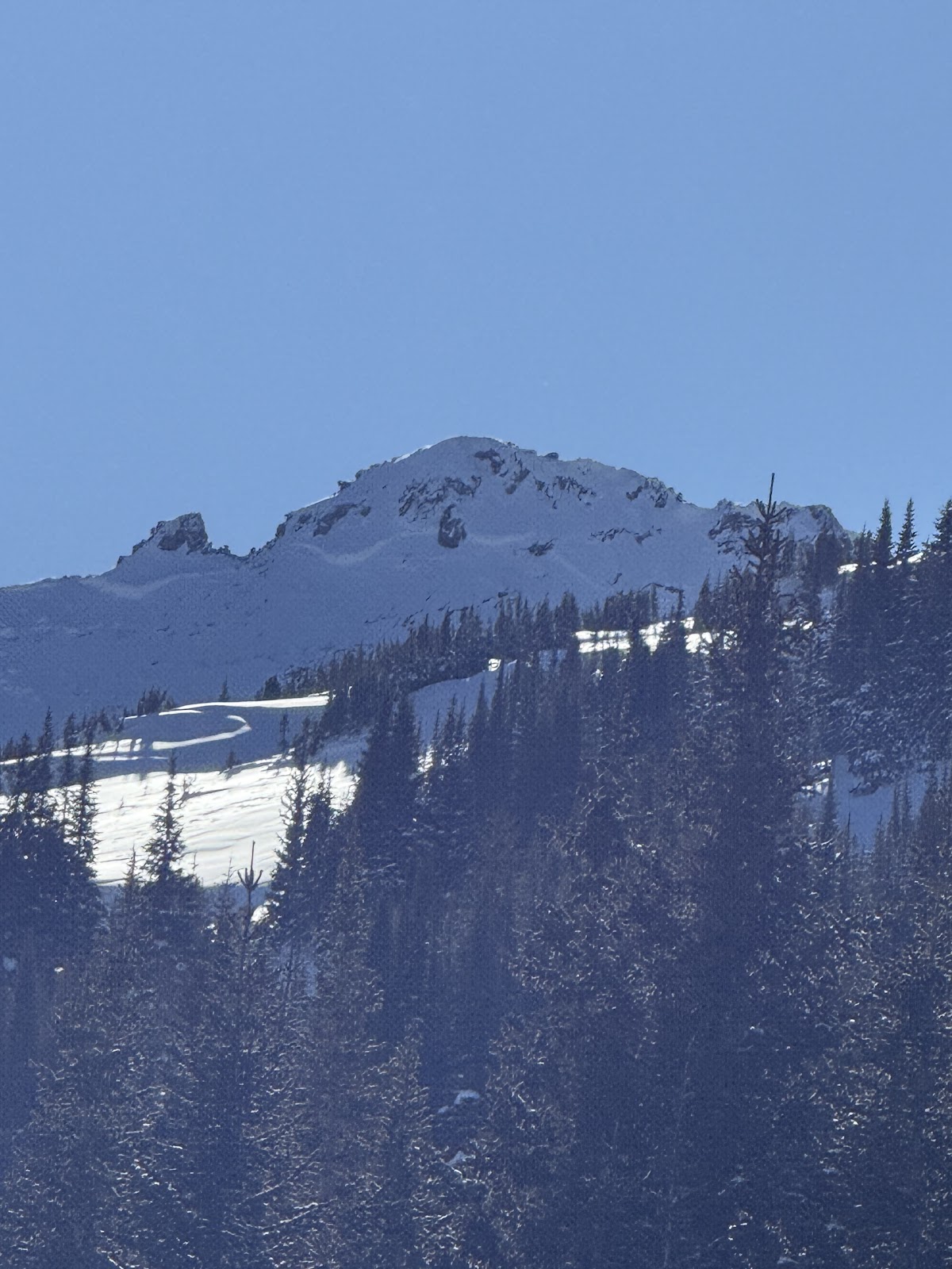
Here are our observations from Cooke City today. Our plan was to tour up the south side of Miller Mountain as far as we felt comfortable. Winds were mostly calm during the day, and temperatures were darn-right cold all day, even on southerly aspects. It was -26F when we pulled into town.
The sheep creek drainage had a lot of evidence of prior wind transport, most non-sheltered aspects had textured snow. We dug a pit at 9600’, HS was 190cm! At 150cm above the ground, we encountered a 1cm thick melt-freeze crust with small facets forming over it’s surface. We also noted 4-finger basal facets all the way at the ground.
Our ECT produced nothing terribly remarkable. ECTN25 and ECTN26 on the melt-freeze crust. It could be a layer to look out for in the near-future. The snow above treeline began to stiffen, so we ripped skins around 10k feet and had a lovely ski down.
Toured into Pebble Cr drainage.
2 to 4" of new, low density snow.
Saw evidence of wind loading and two older, small slides on N facing aspects of some W - E sub ridge lines. Slides both appeared to be from wind loaded snow that broke right below the ridge line on the leeward side. 100 to 150' wide, 18" deep and running for 100 to 200'.
No cracking or collapsing found on any aspect during the tour and we couldn't get anything to move.
Nice snow wherever you could find a wind protected area.
Full Snow Observation ReportIsolated shooting cracks and windslabs above treeline south of Cooke City today. Strong winds from the west. Lots of wind transport going on up high. The vis was good this morning and I could see far for the first time in a while. I saw no new avalanches.
Full Snow Observation ReportWind slab avalanche on E Henderson North of the large slide path close to Fisher Pk. R1 D2,1-2' deep, 200' wide. It broke aprx 200' below the summit mid slope. Phone was too cold to take photos. It looks like it broke on the 19th. Wind slabs 5-10" deep were easy to trigger on test slopes North o Lulu pass. Active loading today on upper elevation SW-SE aspects. Multiple ECTX test results on S aspects at 8600' over the weekend.
Full Snow Observation Report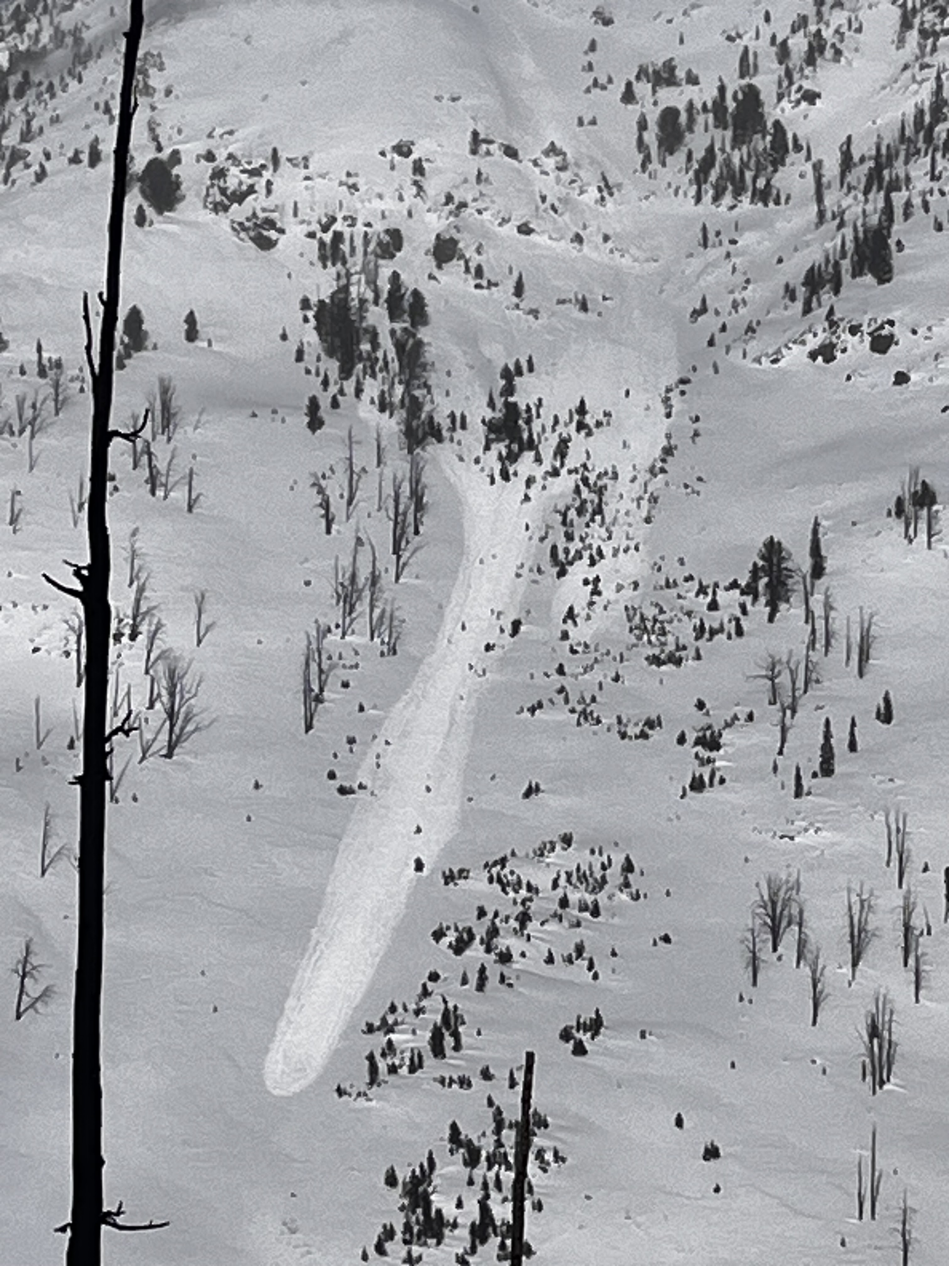
Observed freshly formed surface hoar near the top of Woody Ridge, 9800-10000 ft, W facing. Winds were light out of the N
Full Snow Observation Report