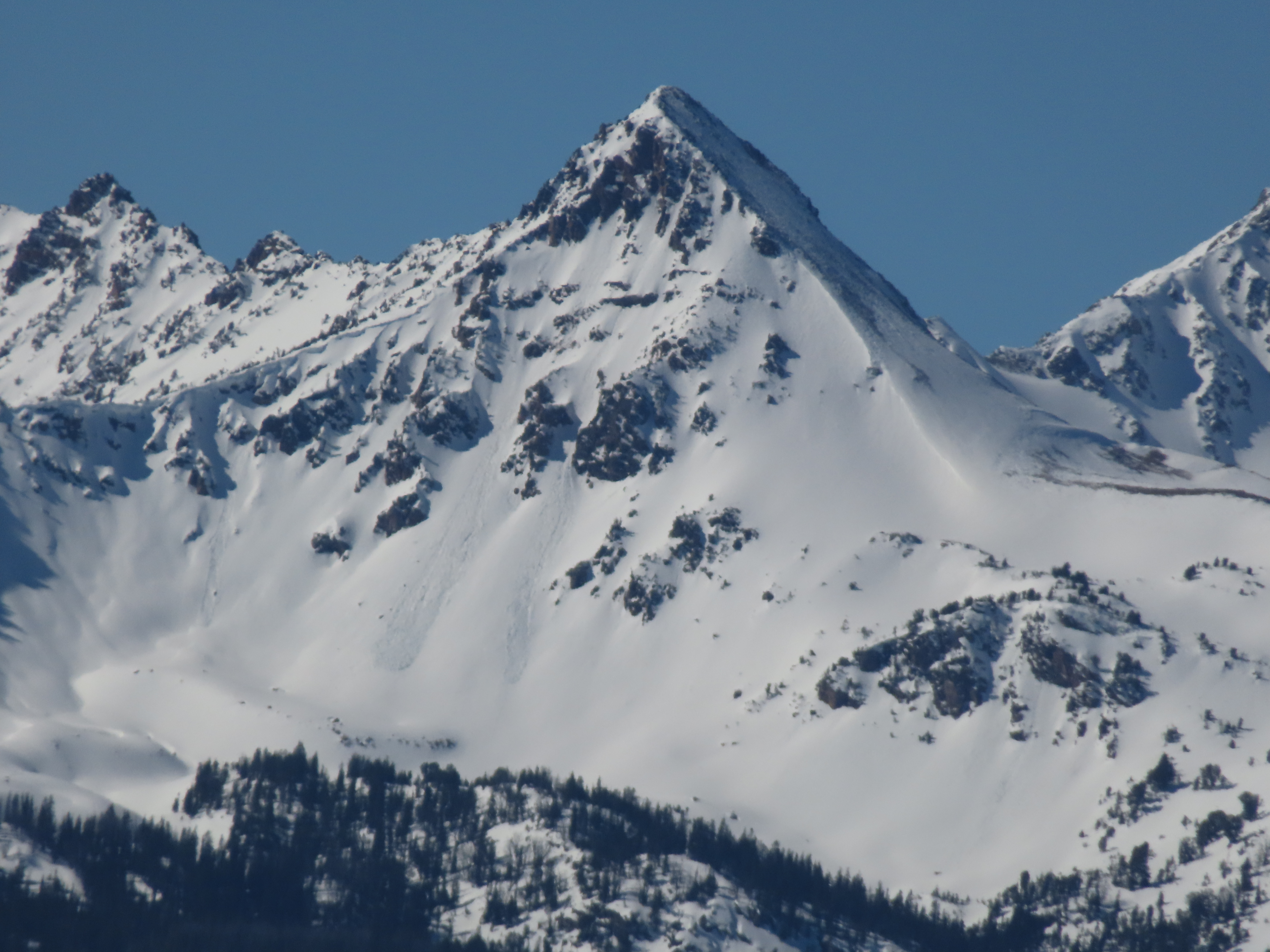
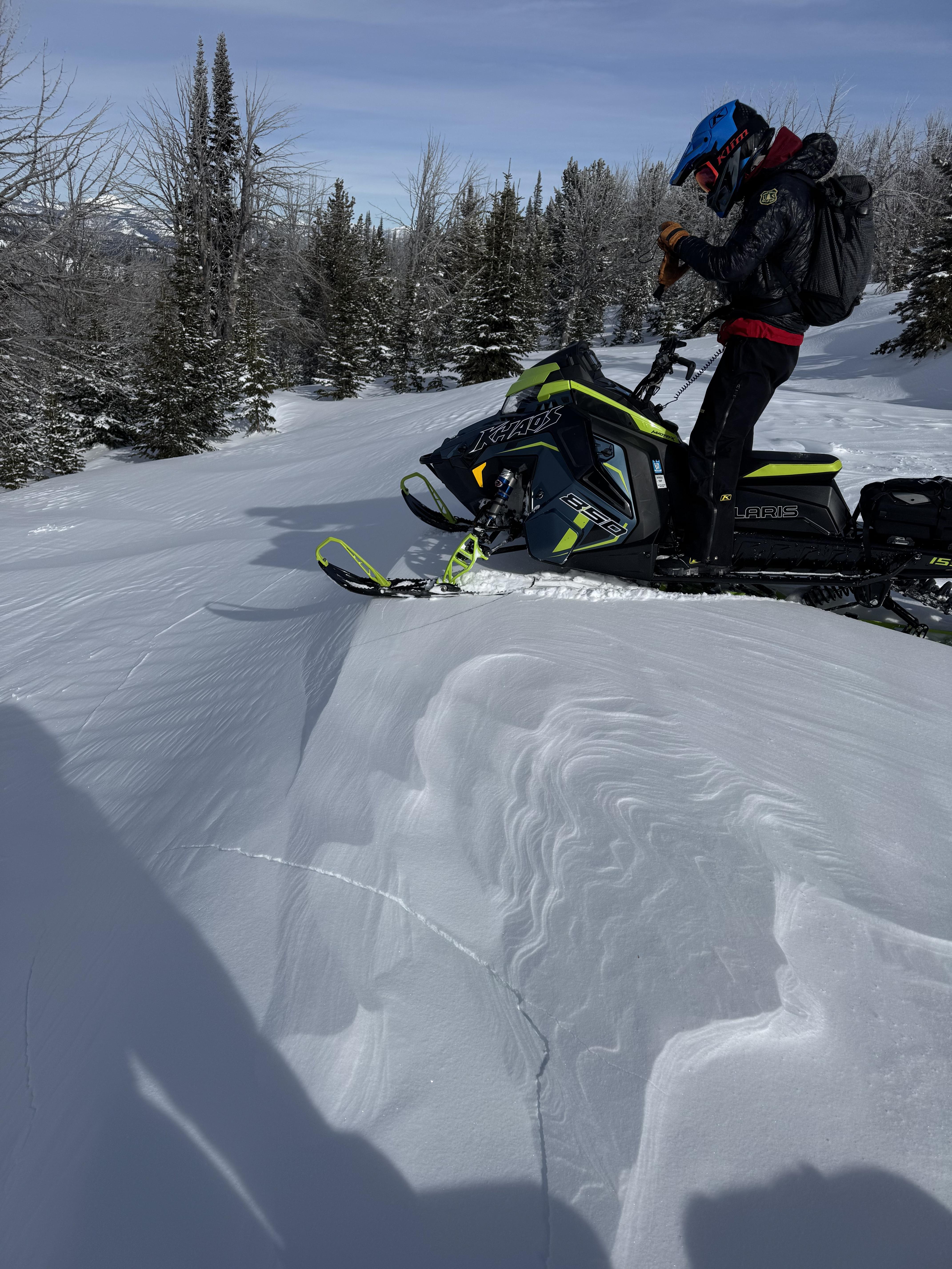
Snow Observations List
This wet loose avalanche is a great example of where they often occur. Rocks absorb extra heat from the sun and can quickly melt and destabilize the snow. Either move under areas like this early in the morning (as we did), or if you have to travel under them later in the day, move quickly.
Full Snow Observation Report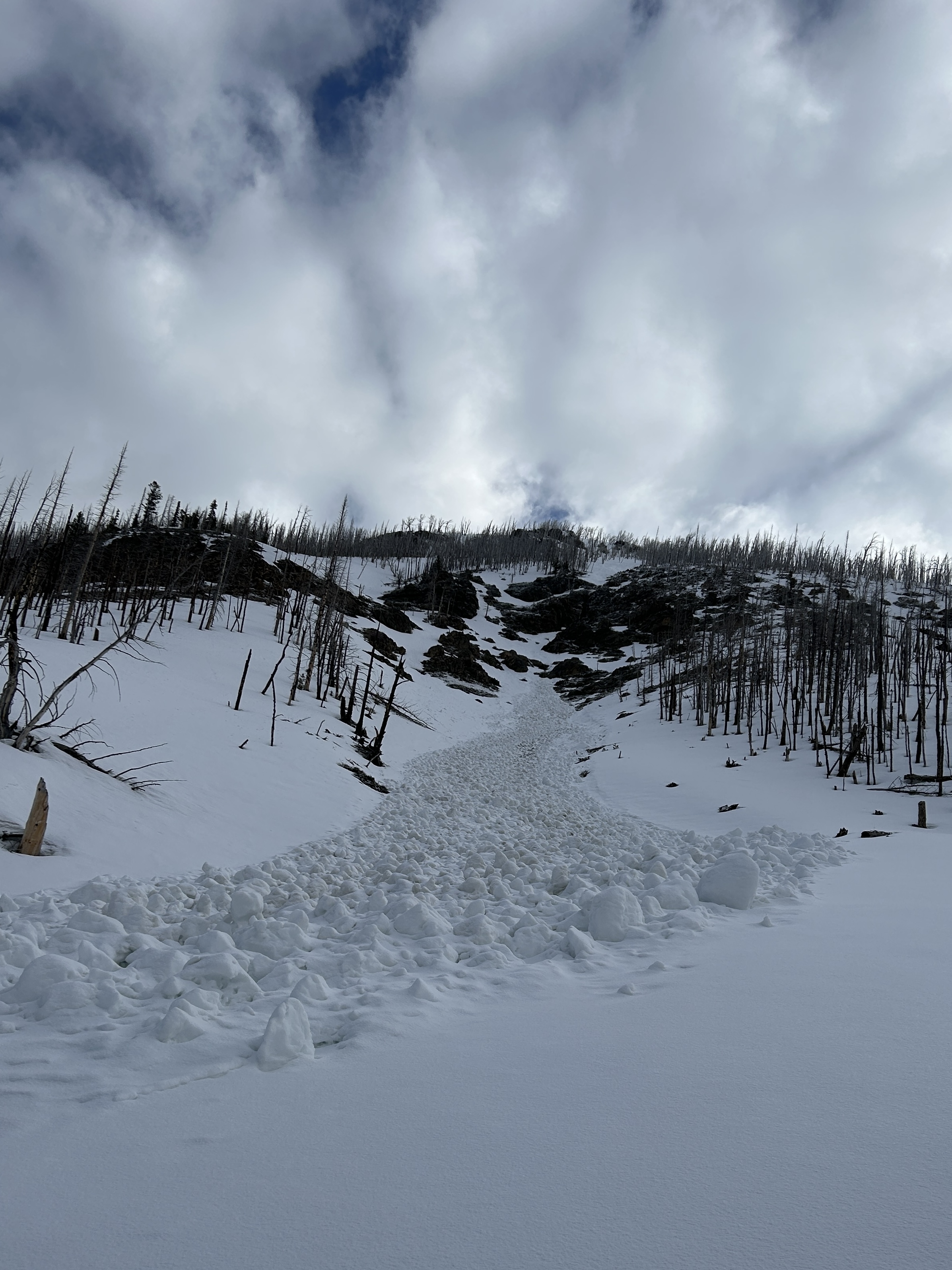
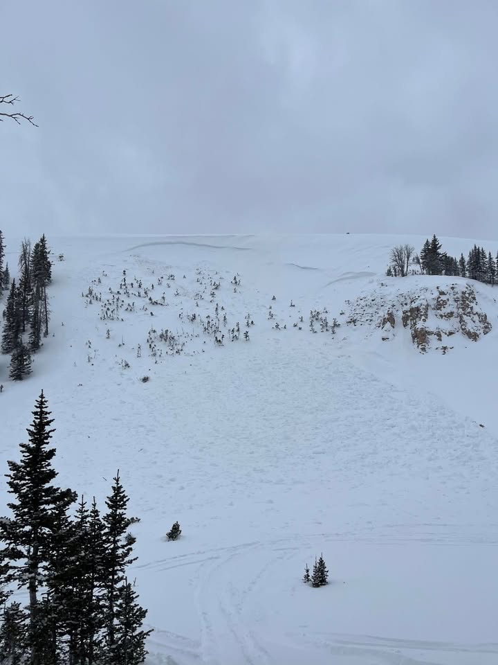
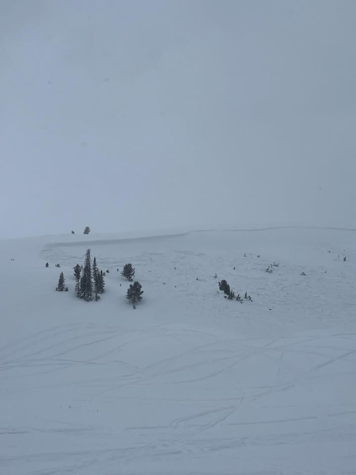
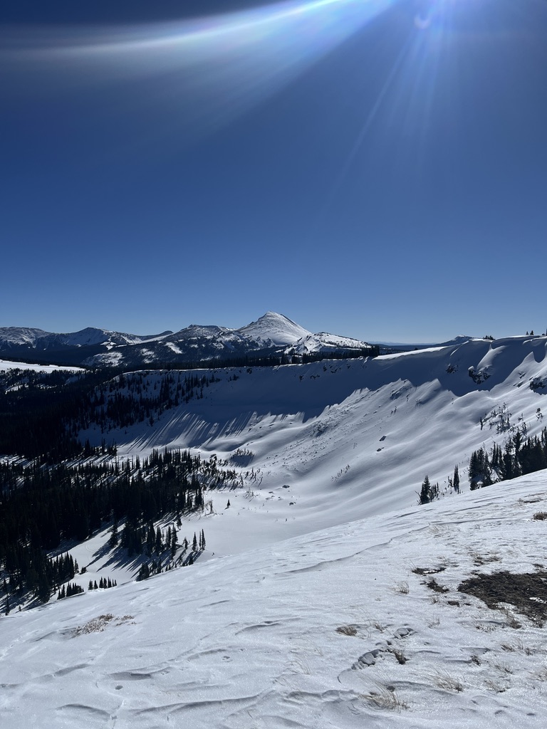
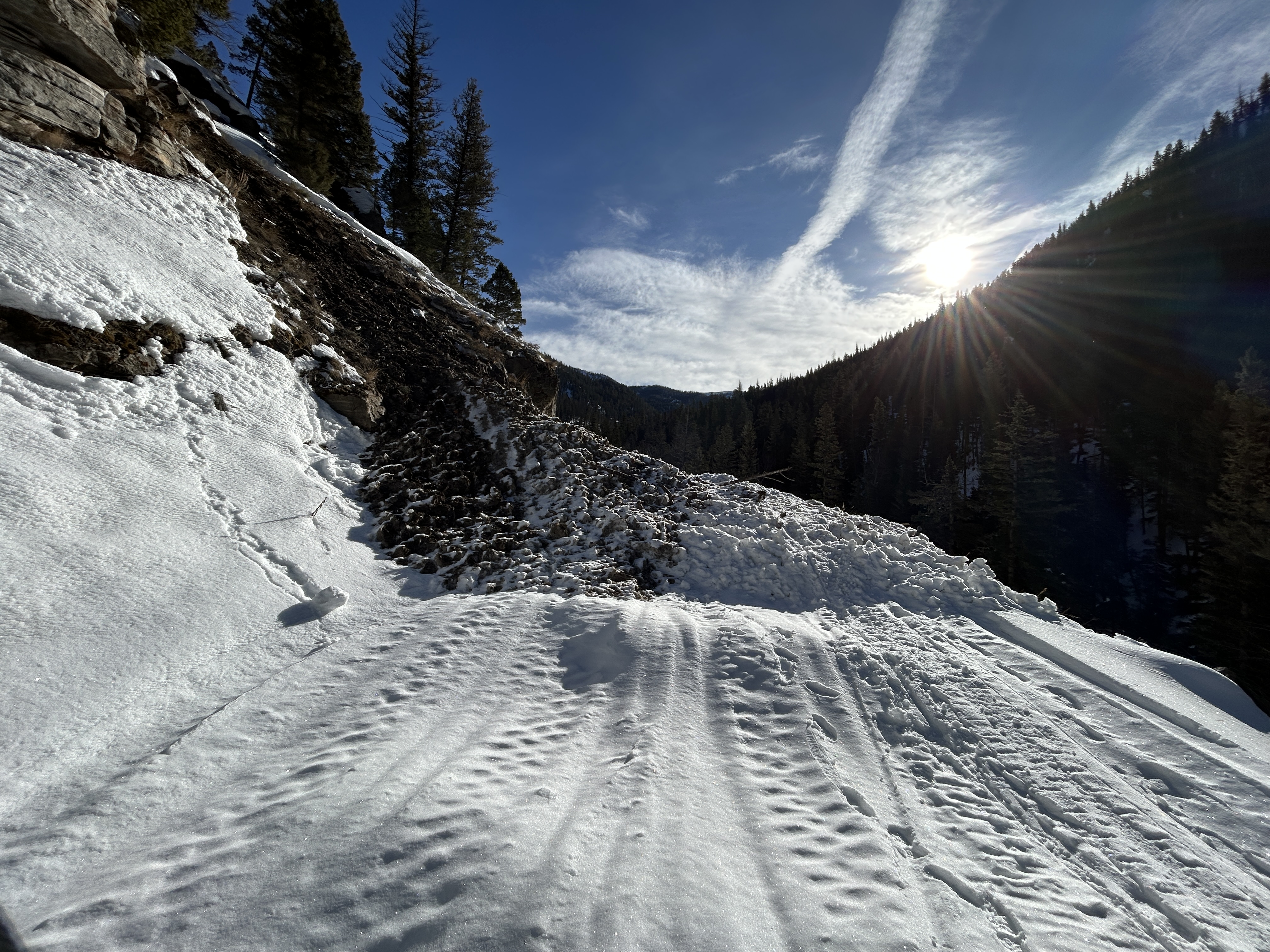
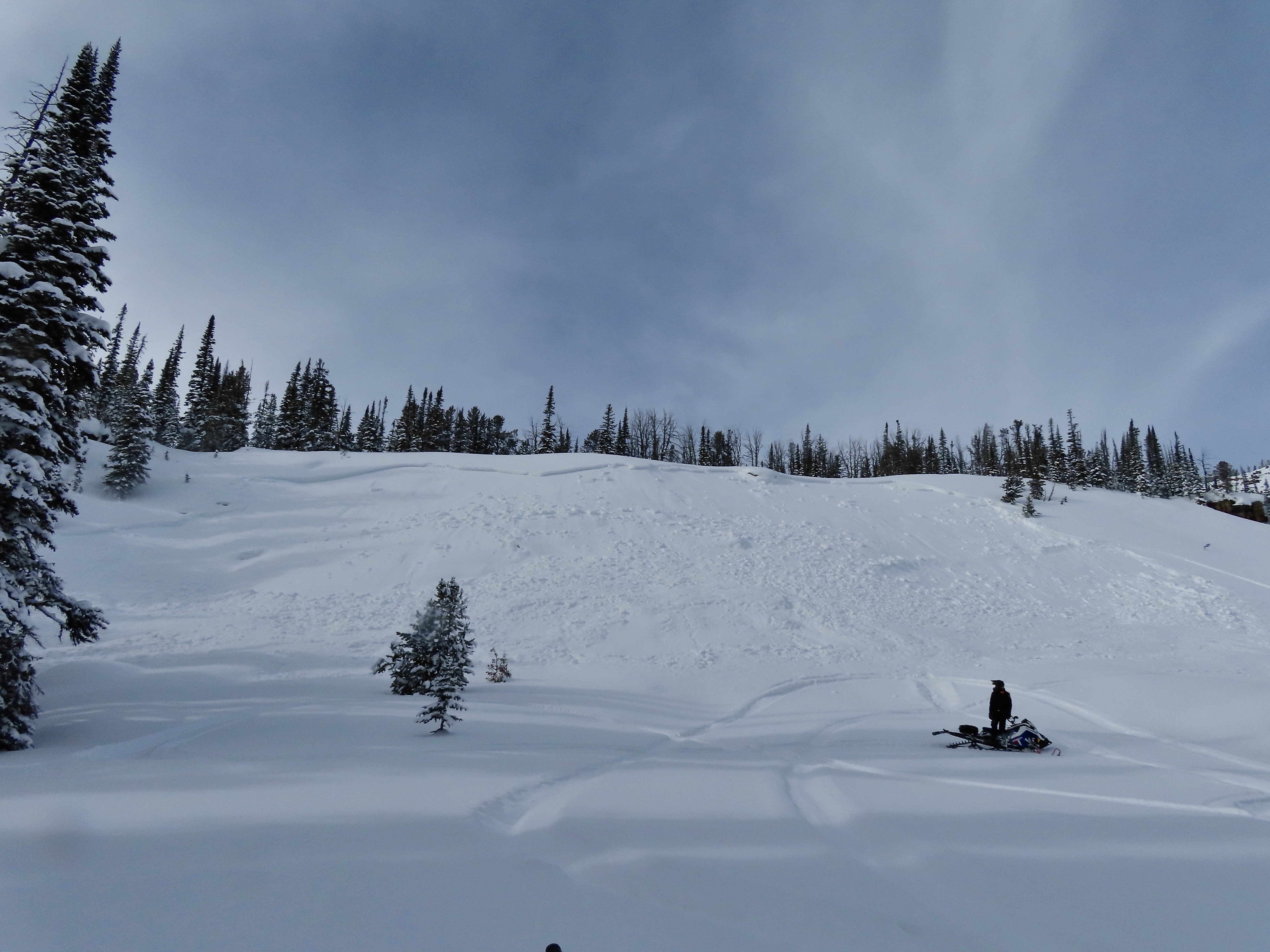
We rode into Tepee Basin along the headwall and up to the wilderness boundary. There had been a number of small releases of roller balls in steep rocky terrain but nothing got legs and ran. It would be hard to classify any of the activity, even as small wet loose avalanches. Crusts stayed robust and supportable throughout the day.
There was 2-3” new snow at the bottom of the basin and 4–5 inches up near the wilderness boundary. Winds were calm, and there was no active wind loading. The new snow throughout the basin got moist during the heat of the day. North-facing slopes at upper elevations stayed cool and mostly dry.
We had a nice late-season ride. Avalanches are unlikely under the current status quo. Today, the primary problem was isolated wind-slab instability in upper-wind-exposed terrain. Overall, there are safe avalanche conditions.
A significant warm-up or a significant pulse of snow would change the equation. At this point, it seems like most of the snow around has been transformed by warm temperatures over the last few weeks. I am more worried about new snow than a warm-up.
Full Snow Observation ReportWe rode into the Taylor Fork, up to the weather station, and out towards the wilderness boundary. Temperatures were around 40 degrees at the car. There was a surficial refreeze last night with a skiff of graupel on top. With mostly sunny skies and calm winds the snow surface dampened quickly.
We dug down on two sunny aspects (E-SE) and noted moist snow throughout the snowpack. In our first snowpit (9220', HS:108) we did not get notable test results (ECTX). We found that although faceted snow remains at the base of the snowpack, water has percolated down and moistened these basal layers.
We also dug on a NW aspect (8800', HS:199) with no notable test results (ECTX). Moist snow exists in the upper 1.5' of the snowpack with dry snow to the ground.
We noted no cracking or collapsing. We saw a good number of wet-loose avalanches on steep sunny slopes, but all were relatively small in width and depth.
Full Snow Observation Report


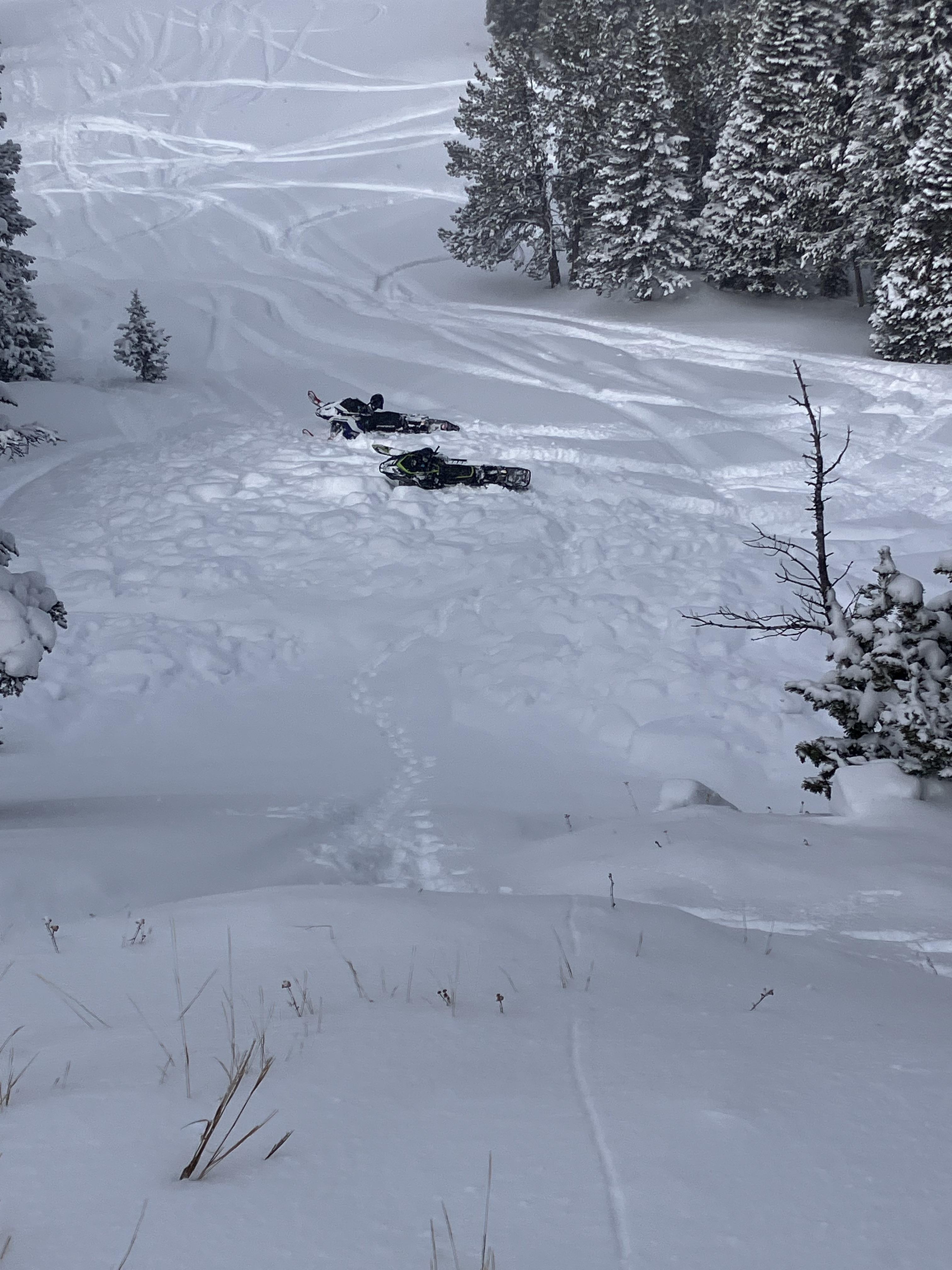
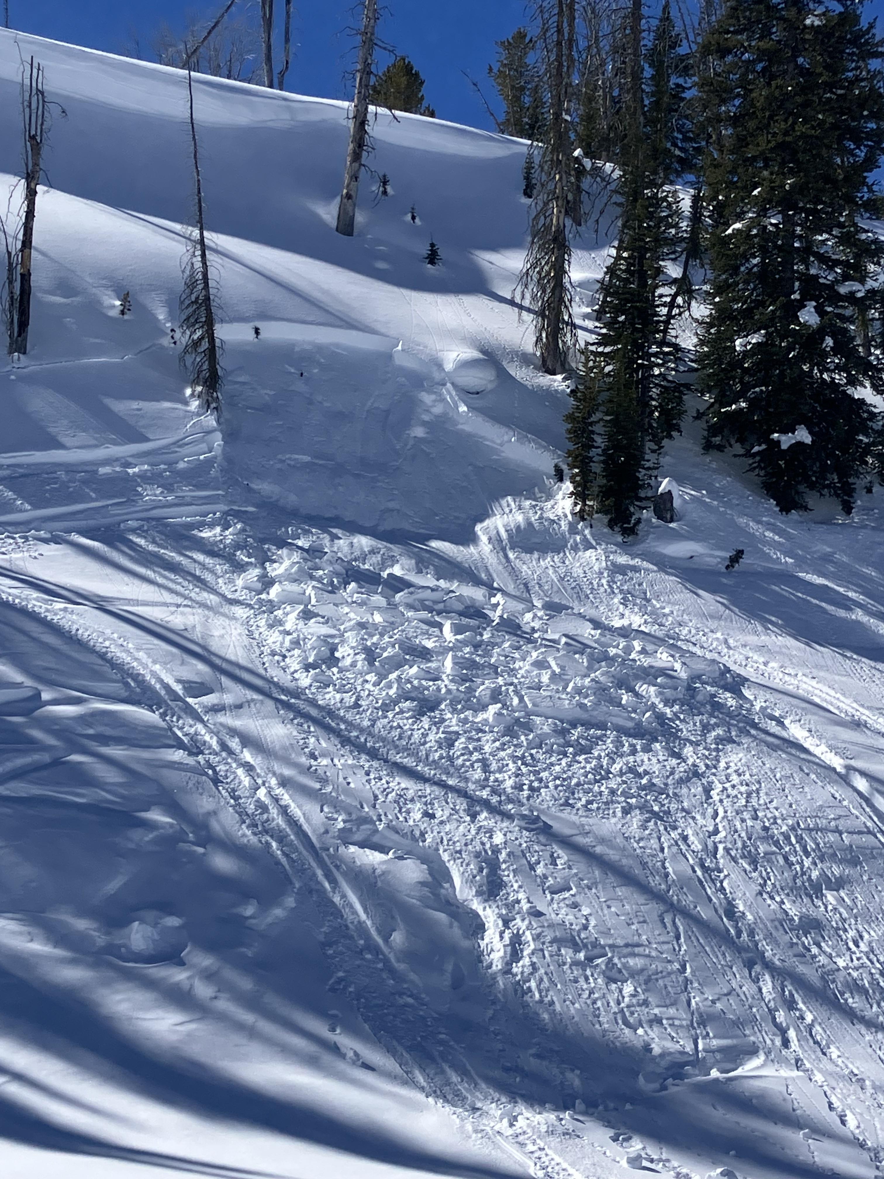
Snowmobile triggered slide in Taylor Fork today from above cutting across. Nobody caught. 2.5 feet deep 150 feet wide
Full Snow Observation Report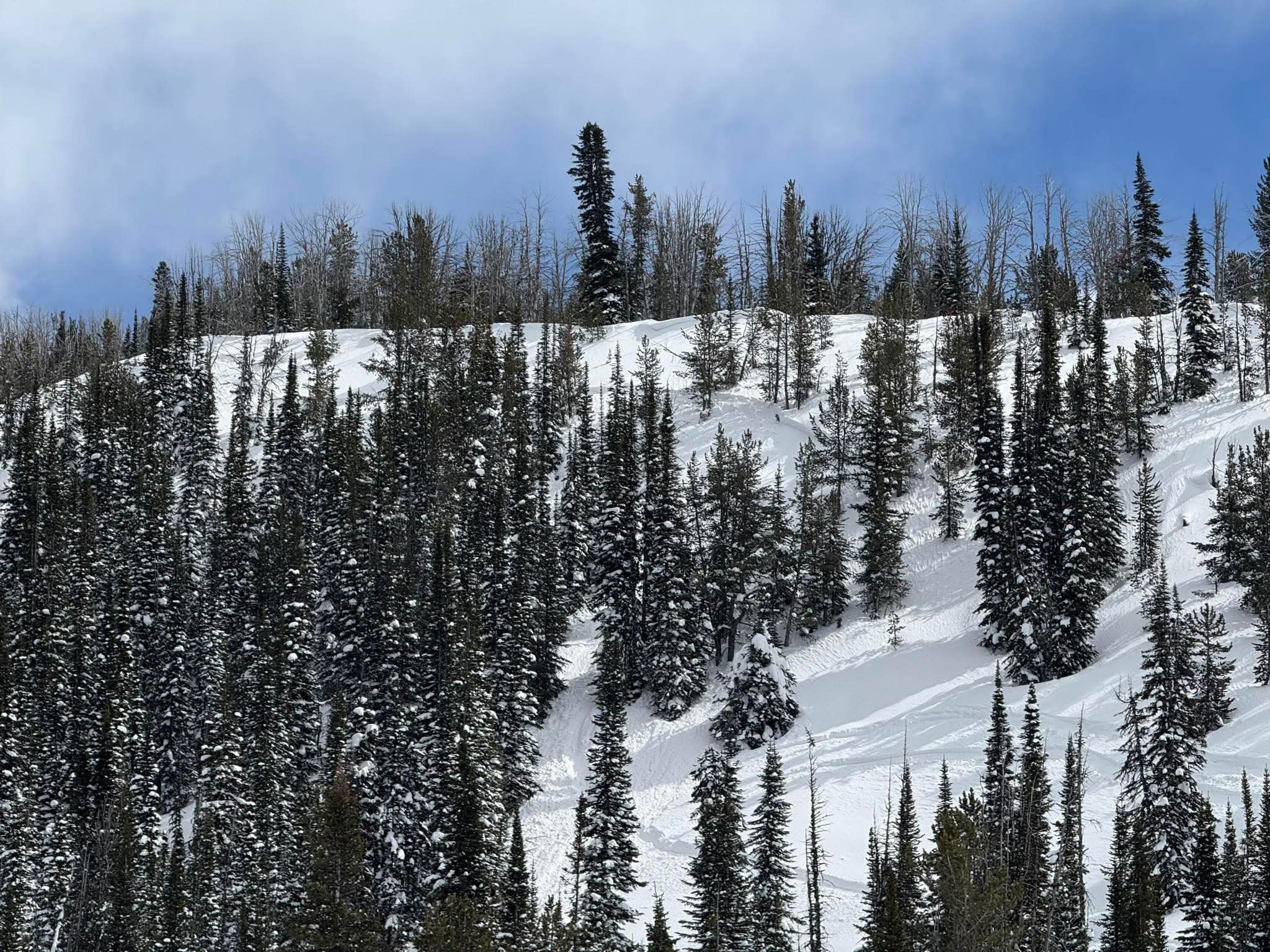

From FB message. Today (3/19) in Taylor Fork
Full Snow Observation Report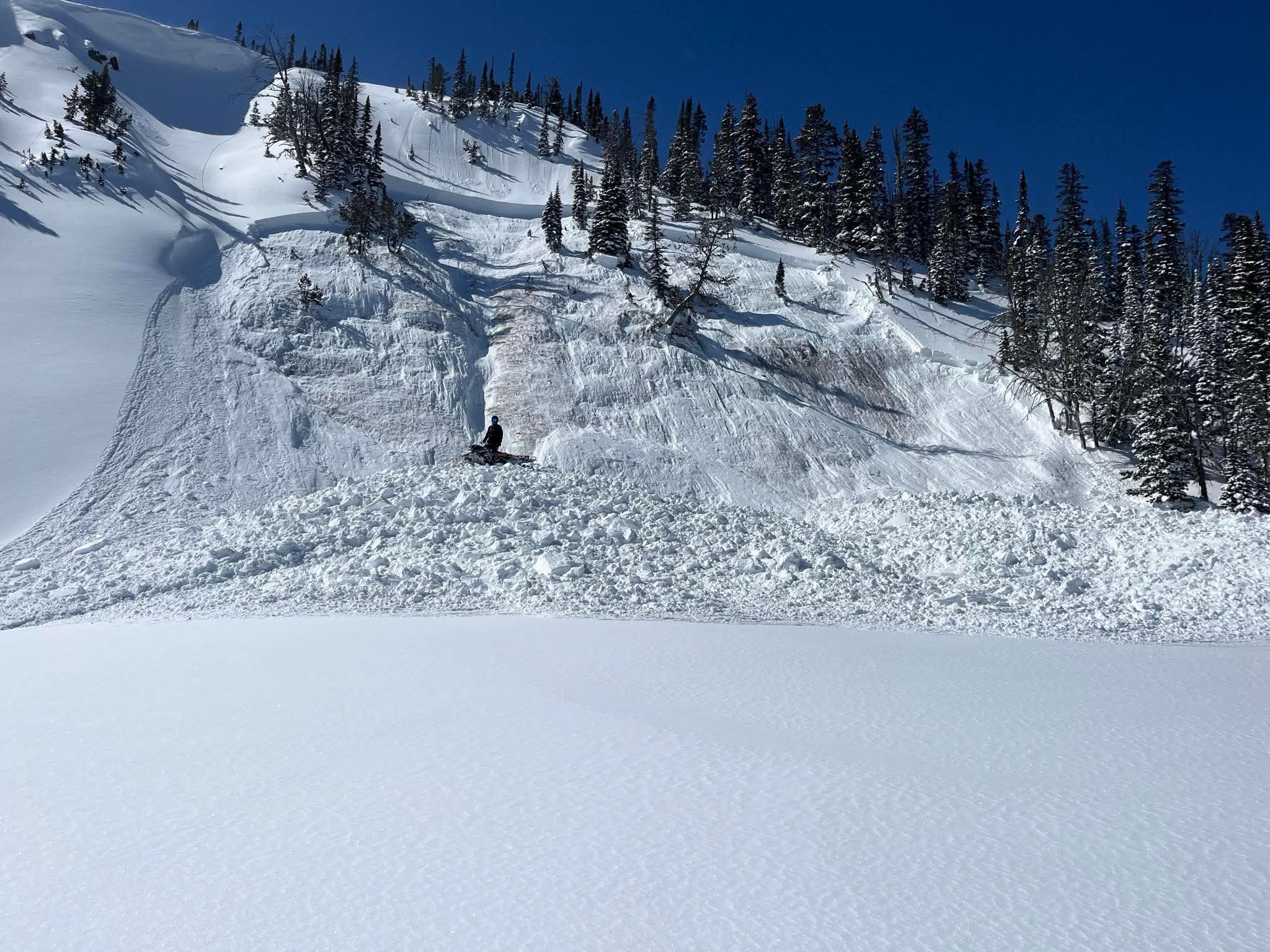
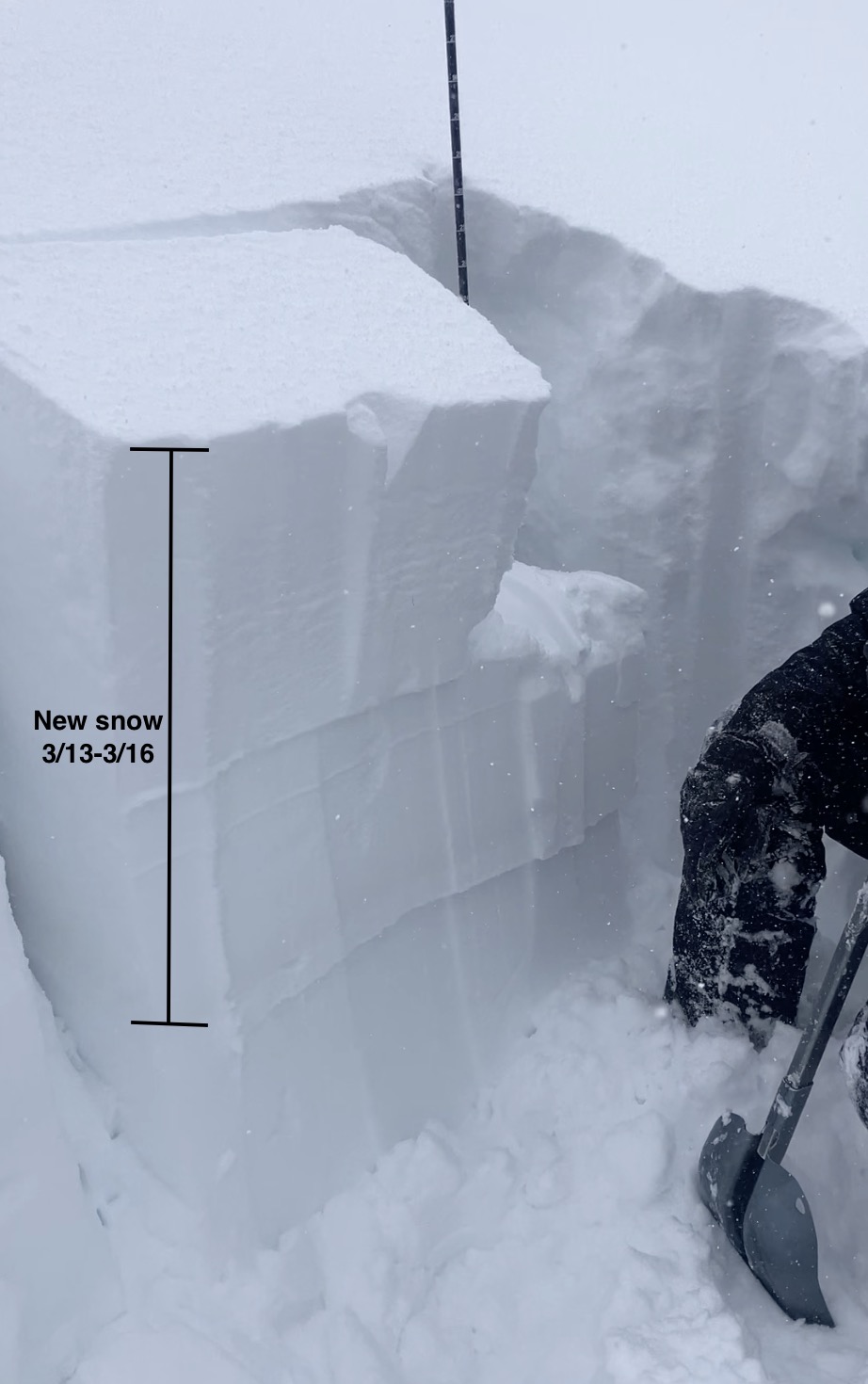
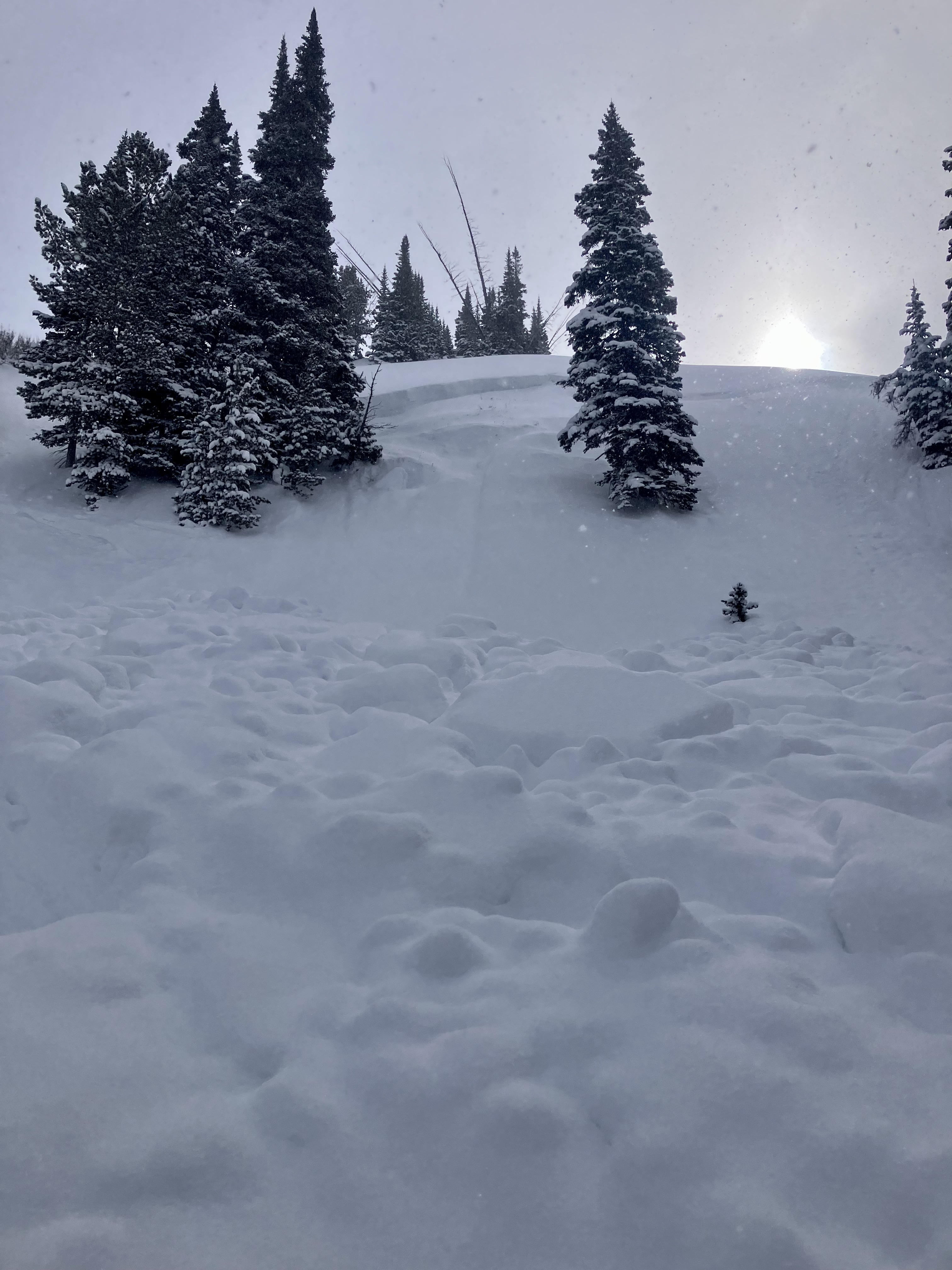
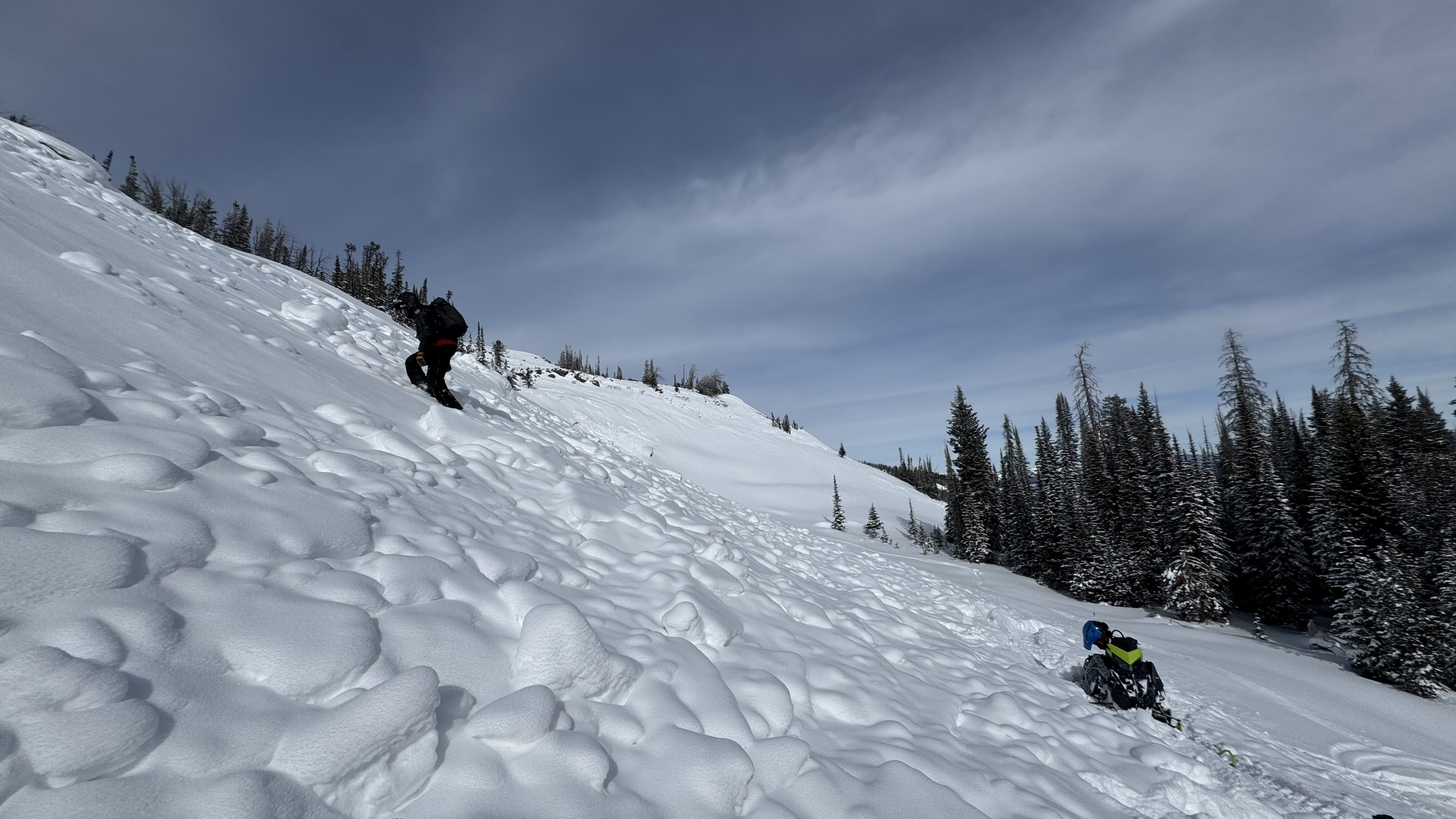
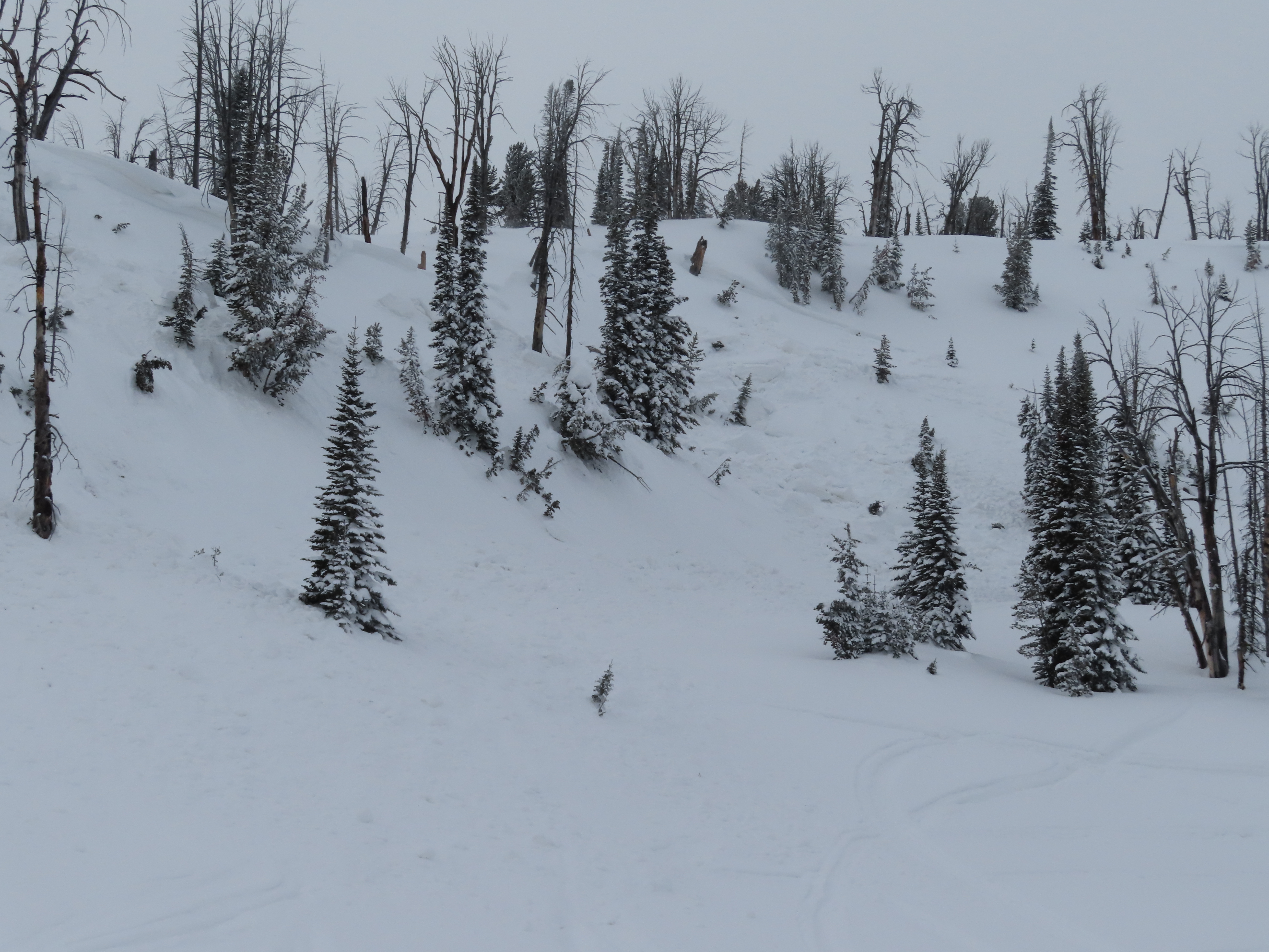
We rode into Tepee Basin and to the north wilderness boundary. It was snowing all day with moderate winds and some strong gusts in more open areas. We could only slightly see the bottom of some avalanche path, but did not see any signs of avalanches (there could have been some higher up in terrain obscured by clouds.)
There was 1.5-2 feet of new snow that fell since Thursday. We dug (3) snowpits on northeast, north and southeast slopes, between 8800'-9200'. The pits on northerly slopes had ECTP 17 and 22 on a thin weak layer below the new snow. We also had ECTP 6 within the storm snow.
There was minimal cracking across the surface in the new snow, but plenty of signs of fresh drifts. It felt likely you would easily trigger storm slab or wind slab avalanches on steep slopes.
Full Snow Observation ReportCONSIDERABLE danger felt correct


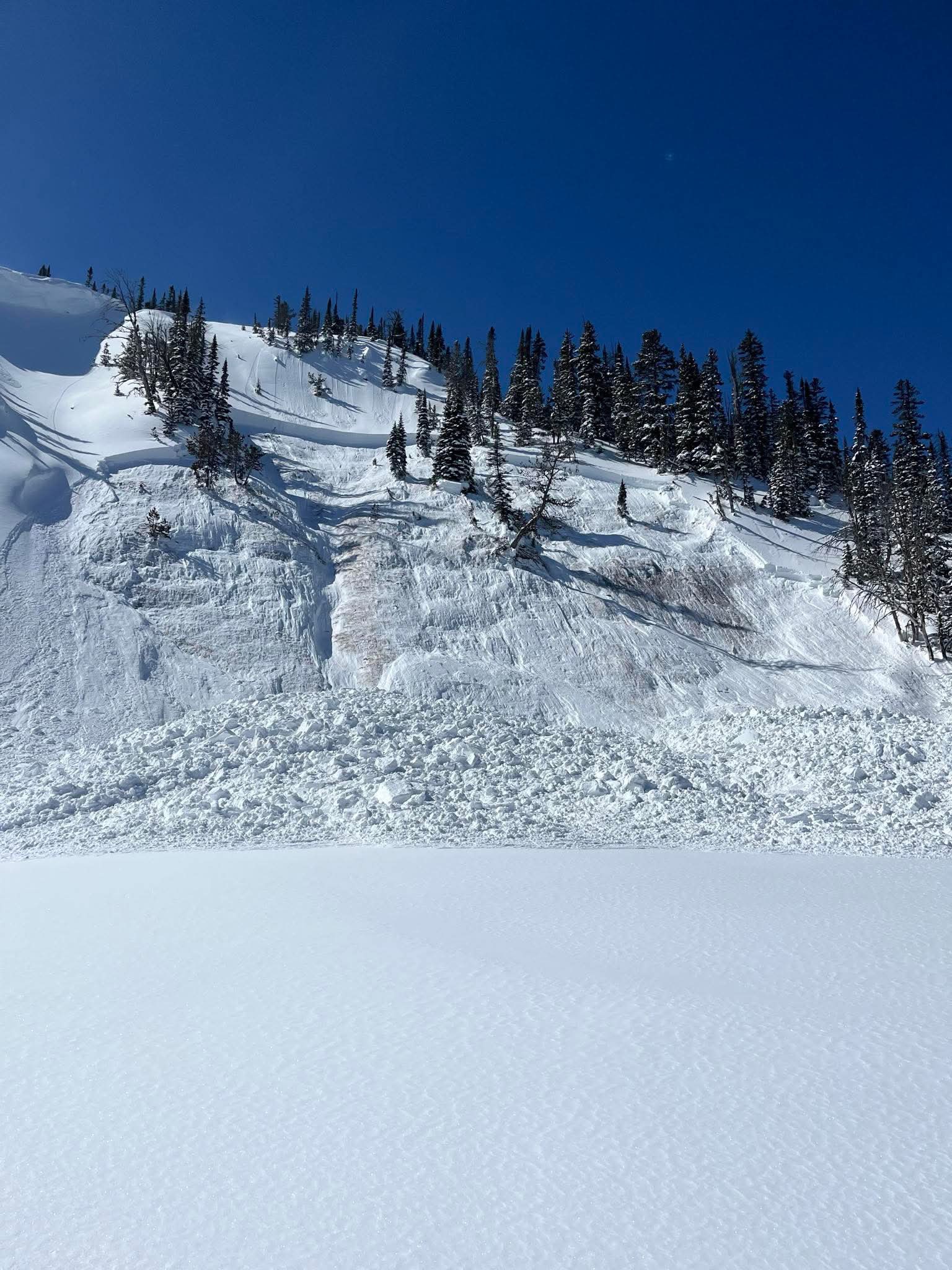
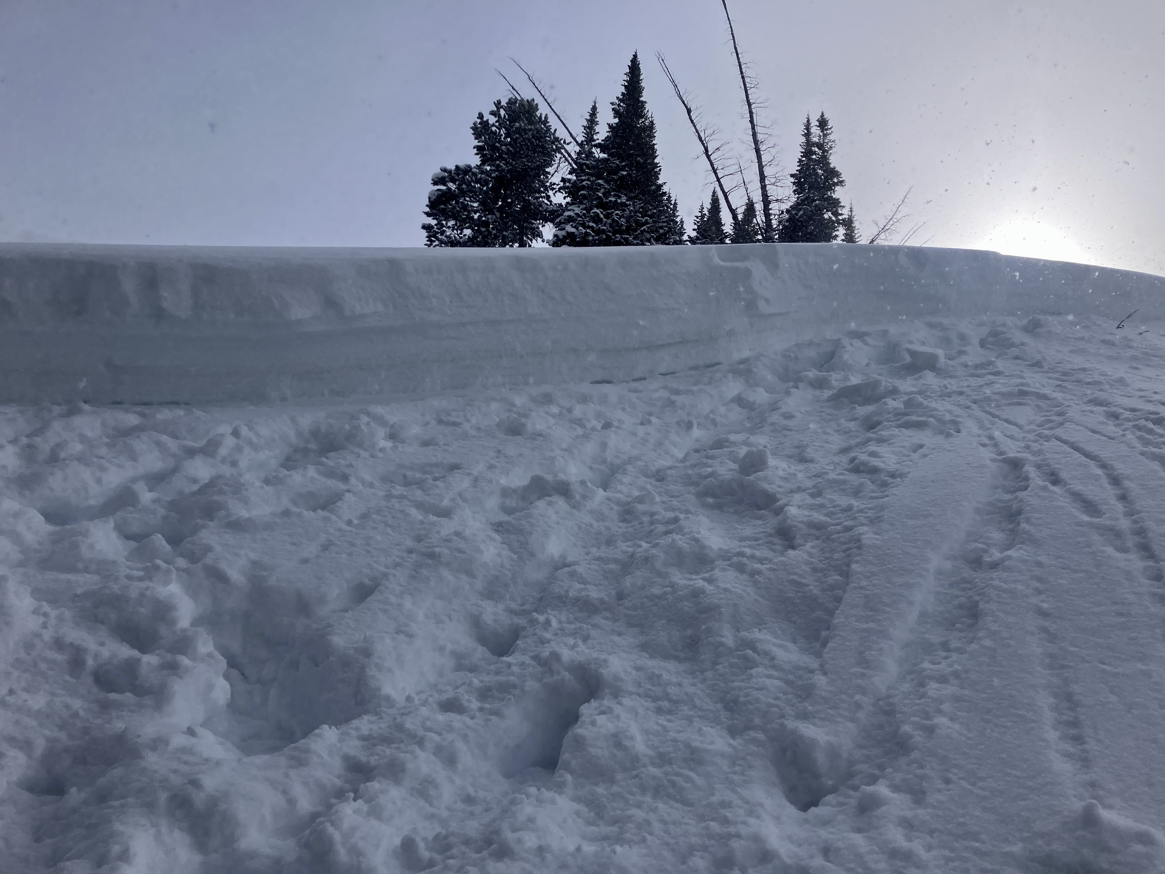
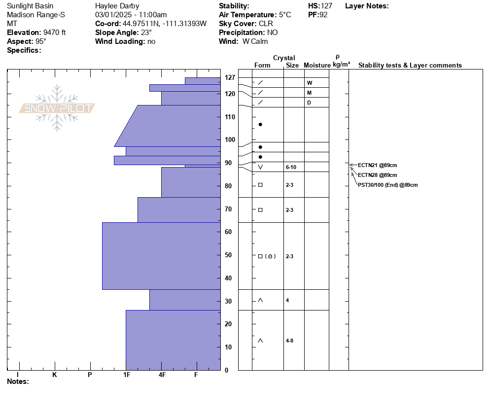
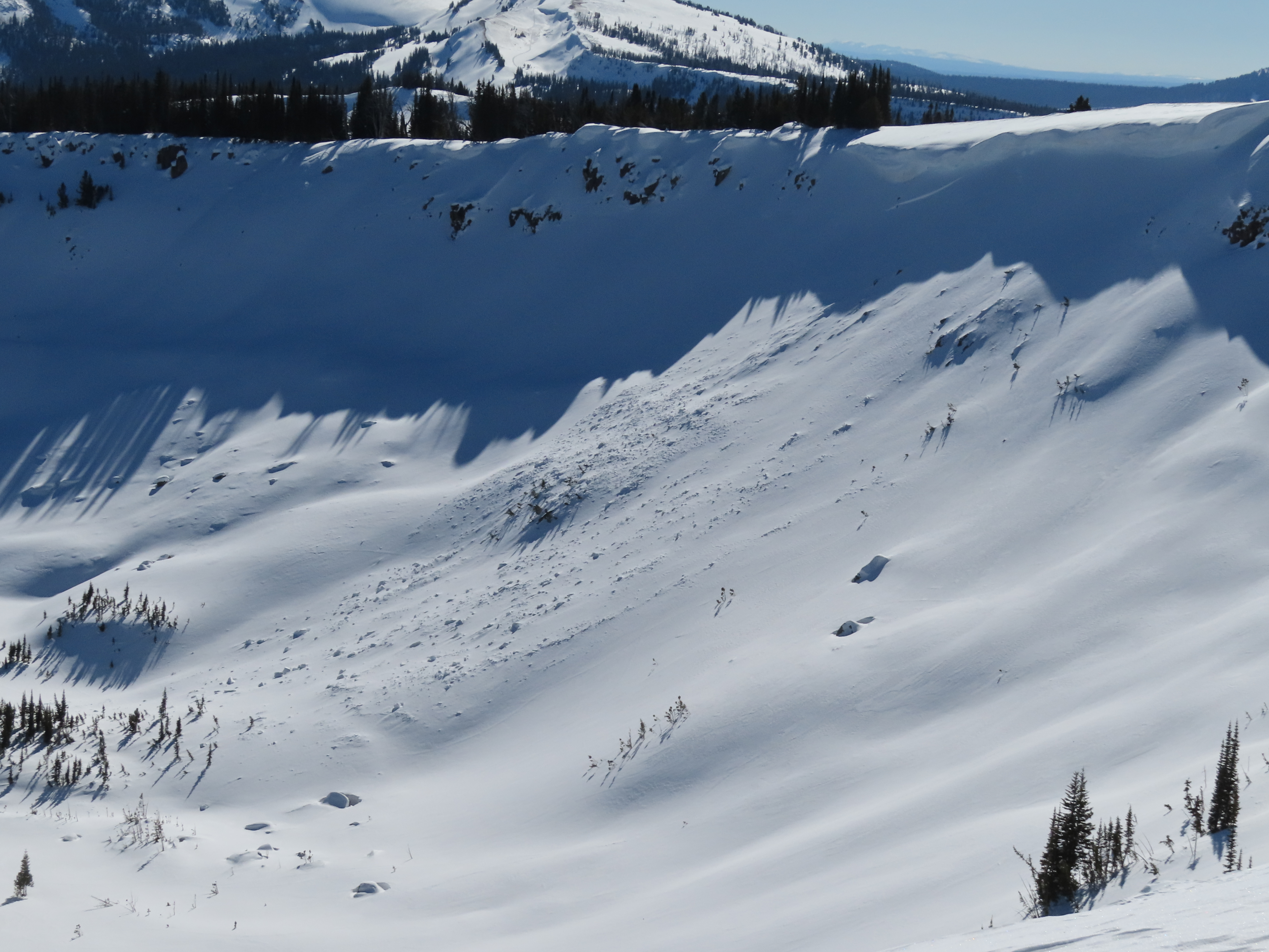
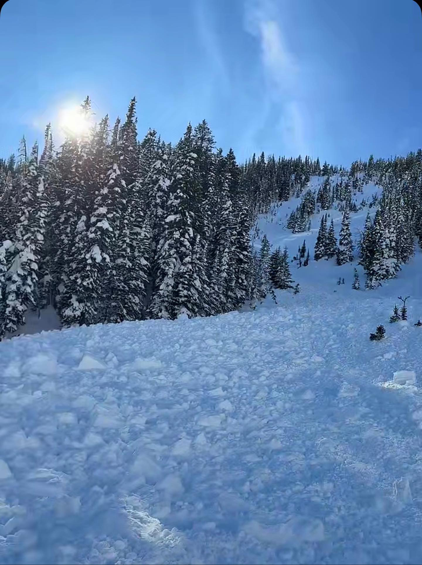
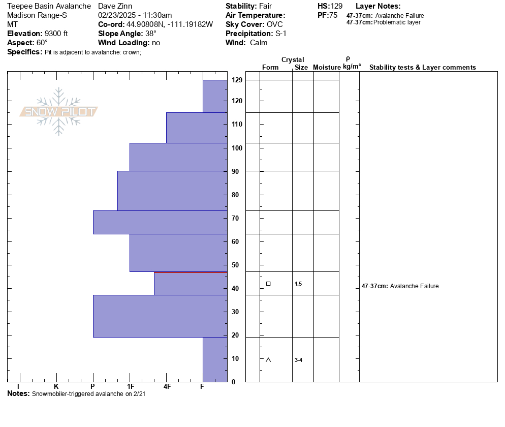
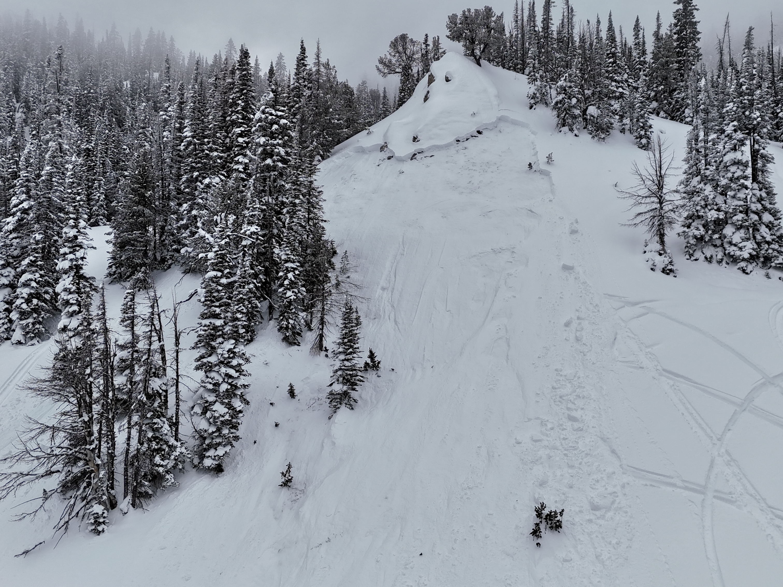
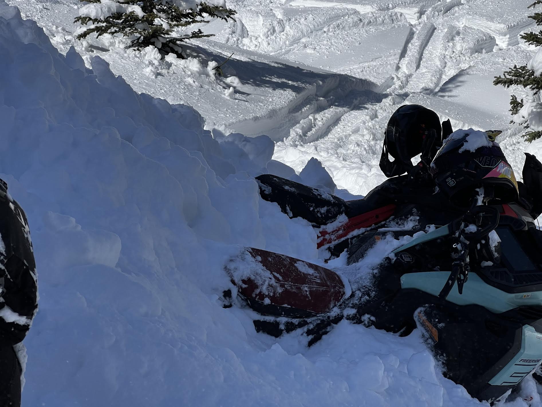
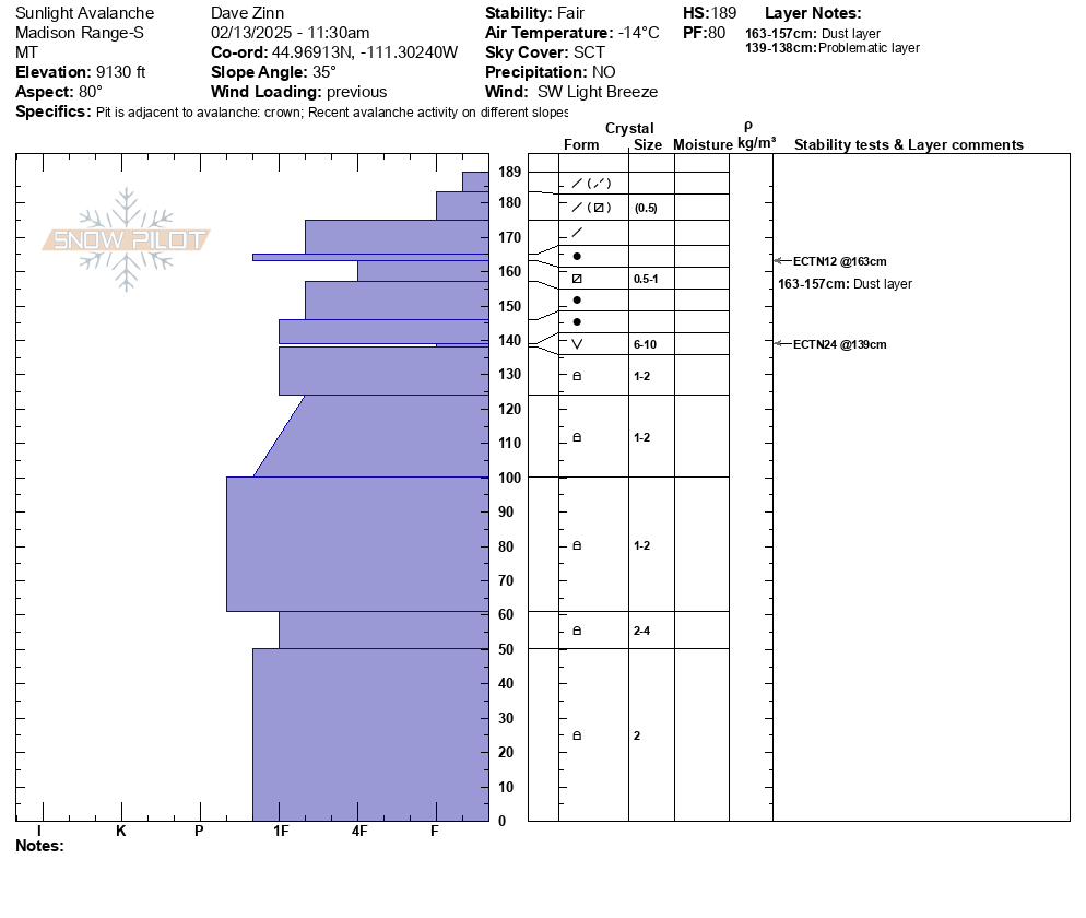
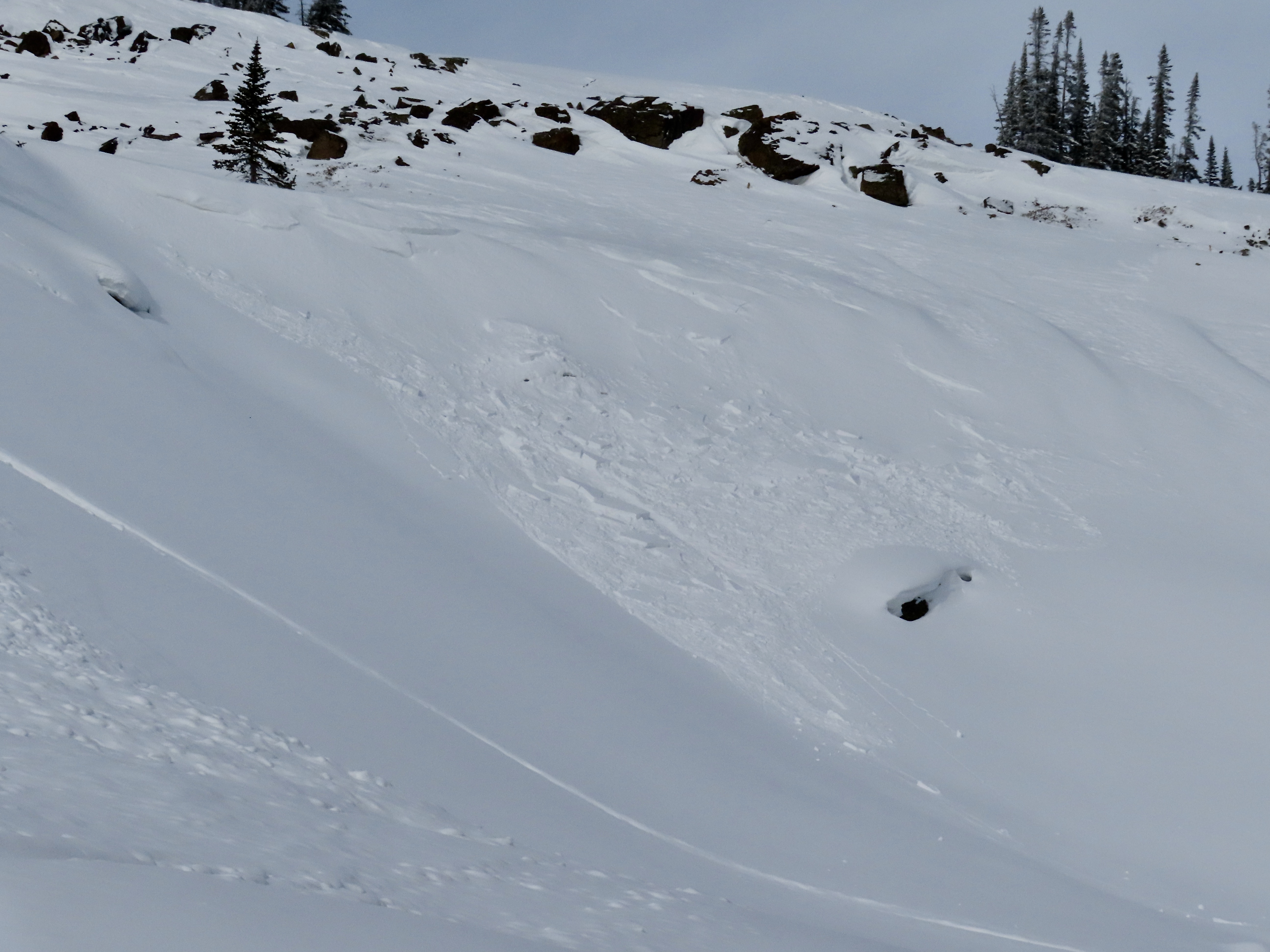
We looked at the avalanche in Sunlight Basin/Taylor Fork that was triggered by a snowmobiler yesterday. It was 50' wide, 100' vertical, 2-3' deep hard slab with 8-9" new snow on top. Broke on weak facets buried in late January. Dirt layer from Feb 4 was visible 6-8" above weak layer. Bed surface was 3" to 1.5' deep of weak, sugary facets. Slope angle was 38-40+ degrees. 8800', WNW aspect.
We also rode to the northwest end of Carrot Basin near the wilderness boundary and dug a pit. Snow depth was 5-6 feet. We found the buried weak layers 3 feet deep. It broke and propagated with many extra hits after an ECTX.
Snow fell lightly most of the day up high while it was sunny in the parking lot. Wind was light with a few moderate gusts. There was minimal signs of recent wind, but forecast is for wind to increase and there is a lot of light snow to drift into slabs.
Full Snow Observation Report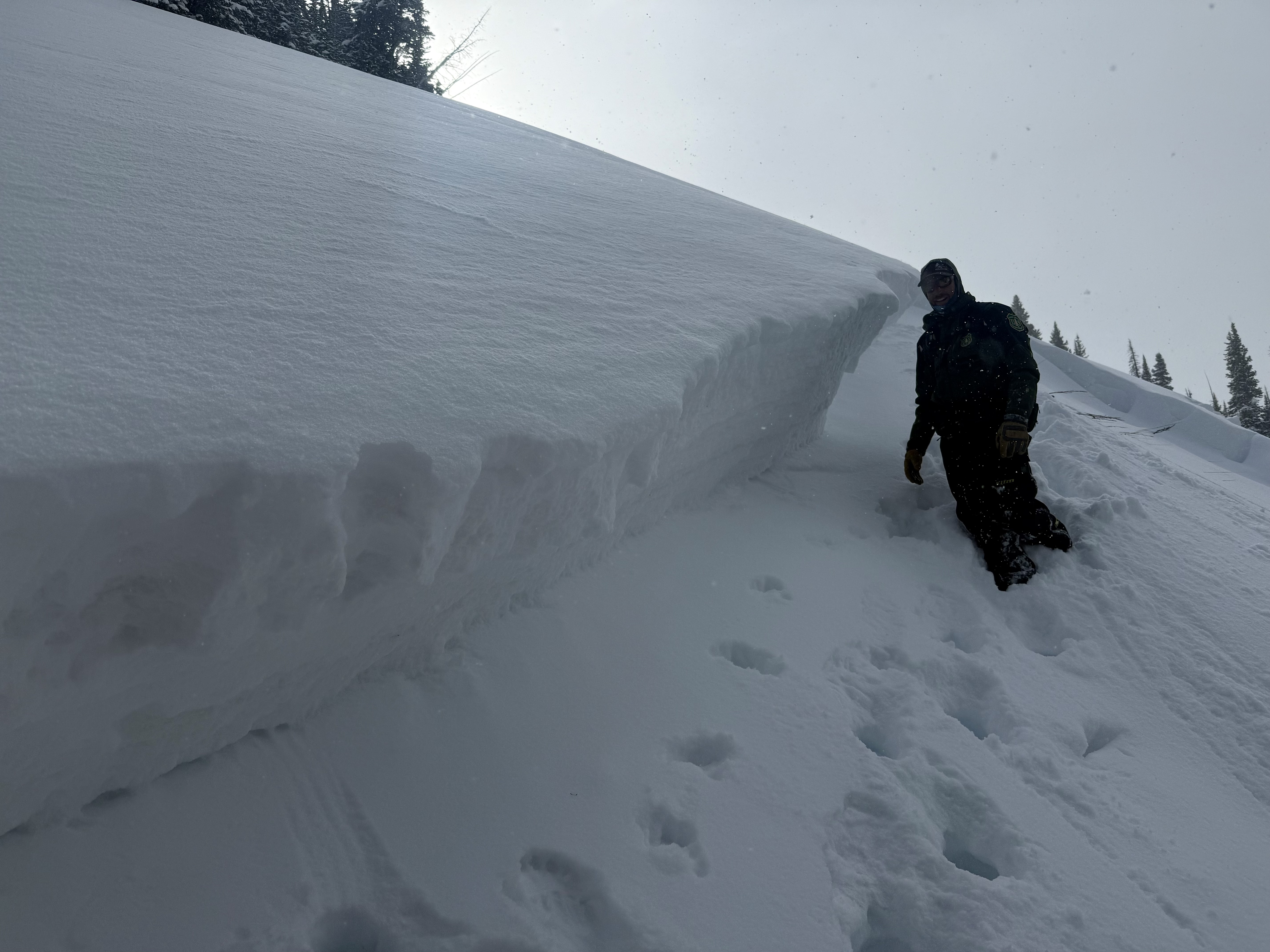


A group of riders saw Mark at the gas station and shared that they had triggered a 4' deep slide in a small pocket in Sunlight Basin of the Taylor Fork area. It was in an area with a relatively shallower snowpack, and broke on weak snow near the bottom of the snowpack. The rider that triggered it was going uphill and got stuck shortly after and noted the snowpack was much deeper there.
Full Snow Observation Report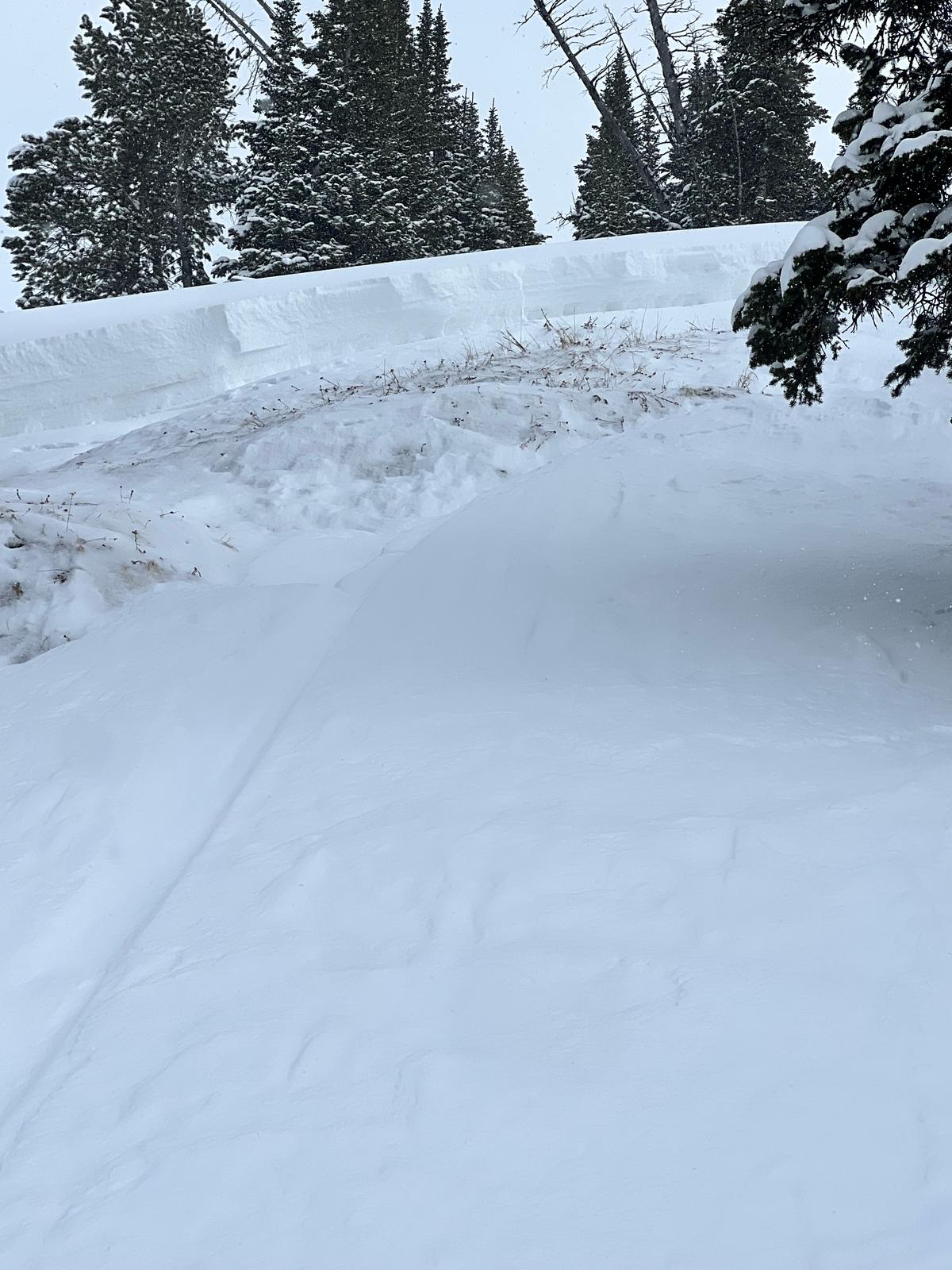
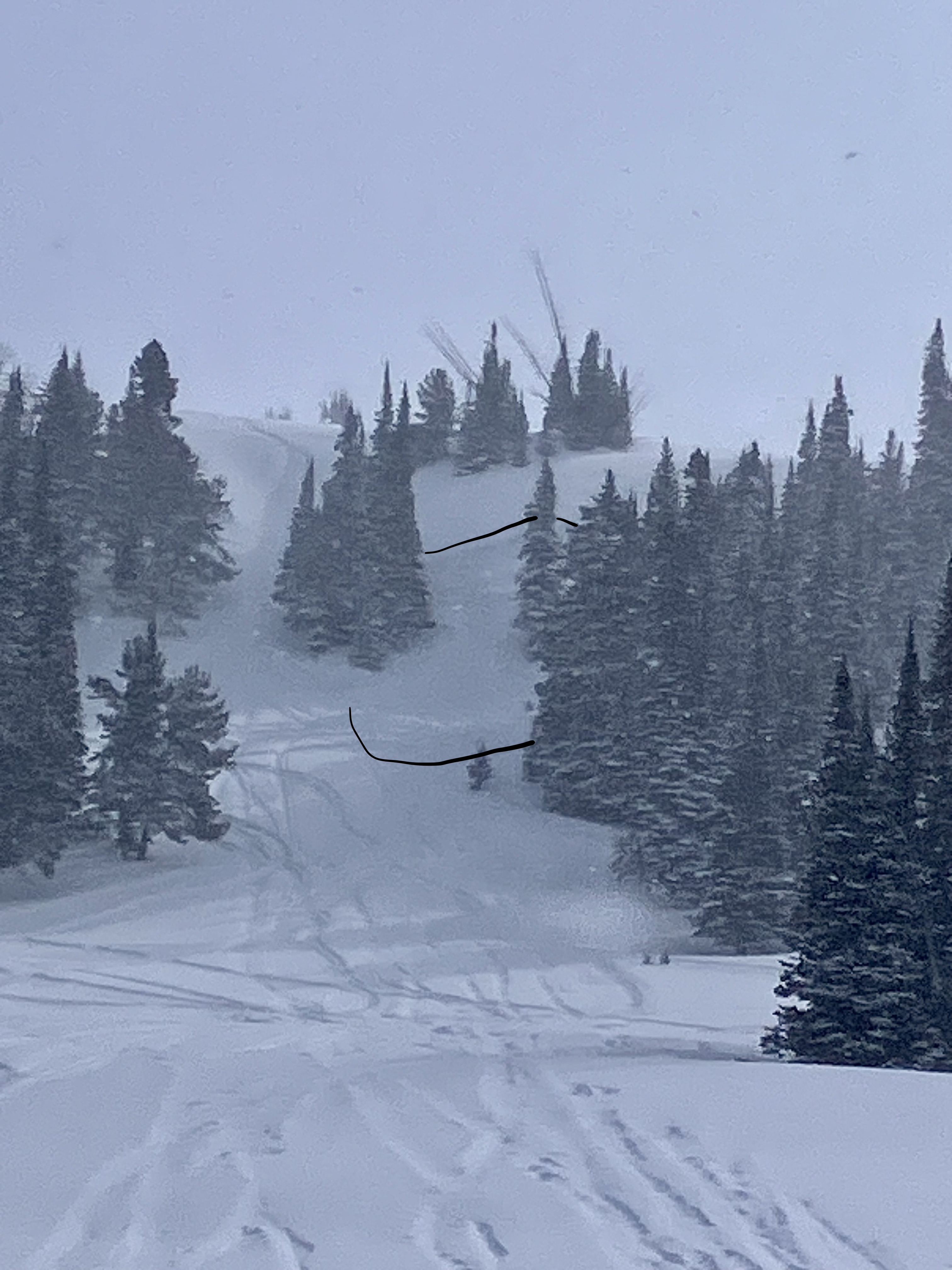
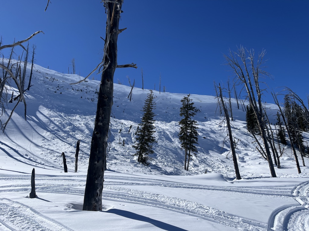
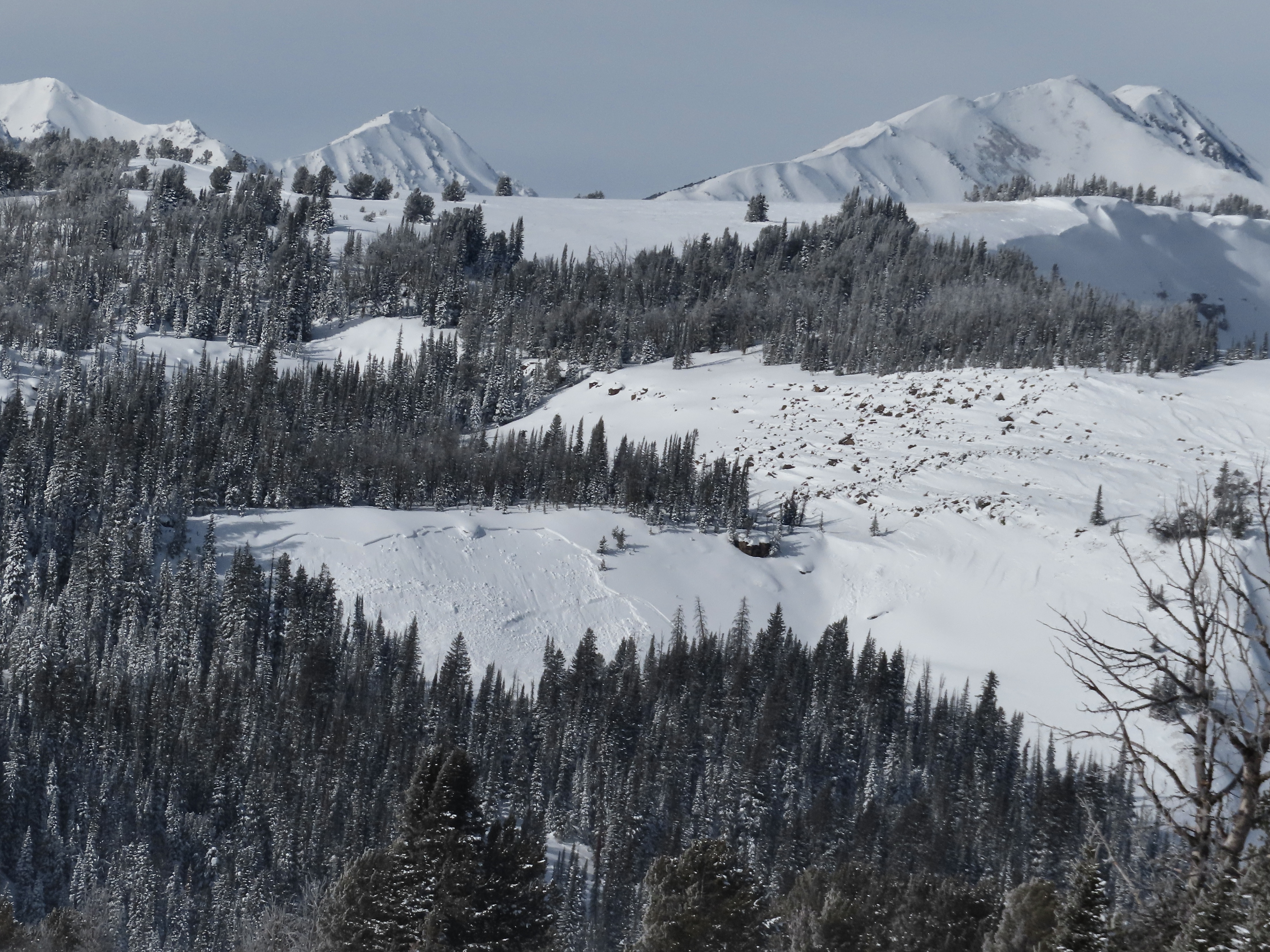
Another day of warm temps and clear skies allowed us to cover a lot of ground in the Southern Madisons. We rode into the Taylor Fork, up to the weather station, to the top of Carrot Basin, through Sage Basin, up and over into Cabin Creek, and all the way up to the head of Red Canyon.
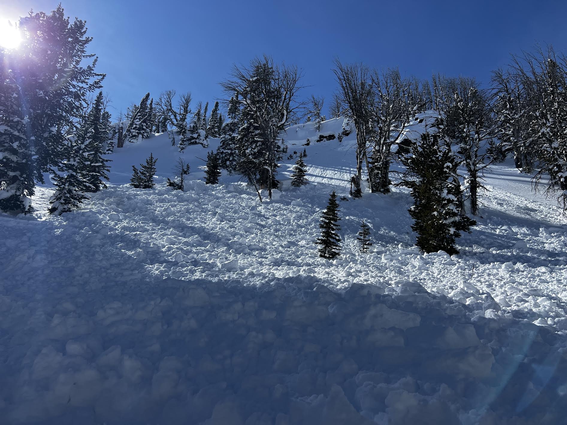
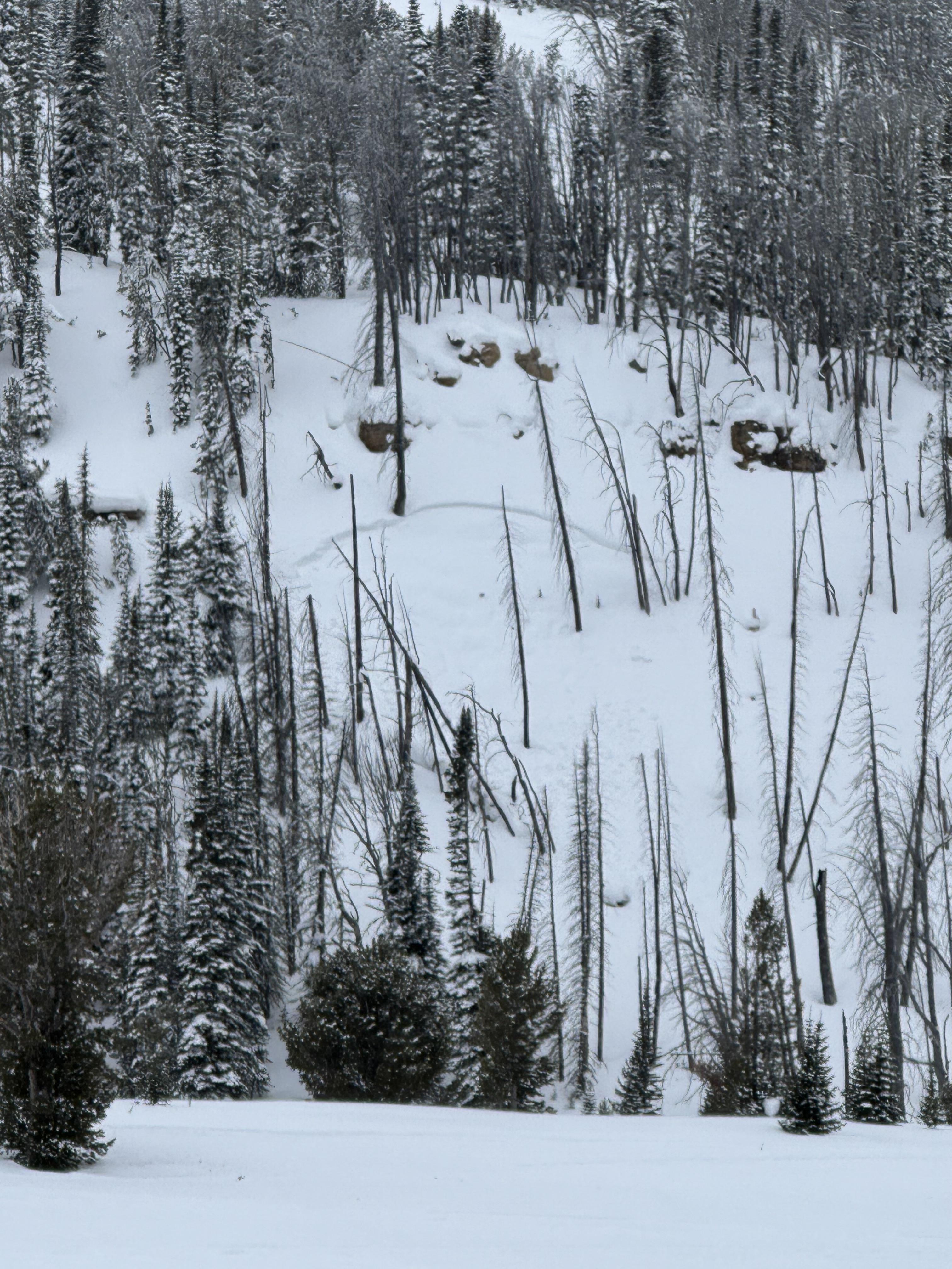
We spotted a few old avalanches. One in Cabin Creek that was triggered two days ago by snowmobilers on a N facing aspect. At the top of Carrot Basin, we saw a small avalanche (R1-D1) on a N aspect that likely broke yesterday on buried weak layers. We also spotted one cornice-fall triggered (R2-D2) avalanche that broke earlier this week in Sage Basin and then an older wind slab in Sunlight Basin.
We dug a snowpit in Sunight Basin right next to where Alex and I dug last week. At that site on 2/21, we triggered whumpfing, shooting cracks and got propagation in our snowpit. Today we did not experience any of those signs of instability. Our snowpit showed poor structure with buried surface hoar and facets but yielded ECTN's on that weak layer.
There were a handful of small wet-loose avalanches on solar aspects that we noted throughout the day. While northerly aspects stayed cold, solar aspects became wet a couple inches down.
Despite no remarkable new avalanche activity and the stubborn reactivity in our snowpit, we remain wary of mid-elevation slopes steeper than 30 degrees. Over the last 12 days, we have received reports nearly every day of avalanches breaking on persistent weak layers buried 2-3' deep. Recent nearby avalanche activity in Teepee Basin and Lionhead is evidence that these weak layers should not be trusted quite yet.
The travel advice remains tricky, but you have a few options:
1. Before committing to steep slopes, dig down 2-3' and assess for layers of buried surface hoar and facets. Make observations as you step off your snowmobile or skis or board - are you staying on the surface or sinking all the way to the ground?
2. If you are choosing to ride steeper slopes, pick ones with less consequential terrain features like trees, cliffs or gullies.
3. The ol' reliable option: stick to riding slopes less than 30 degrees.
Full Snow Observation Report
Avalanche danger still felt MODERATE per the slew of recent PWL avalanches in this area


From IG message: "Getting word that a group triggered a decent slide today out at cabin creek. I’ll attach the coordinates to the general area, to the best of my knowledge.
44.86484, -111.22023
No burials. They were able to outride if. But thought I’d send coordinates in case you guys were gonna be in the area and wanted to check it out."
Full Snow Observation Report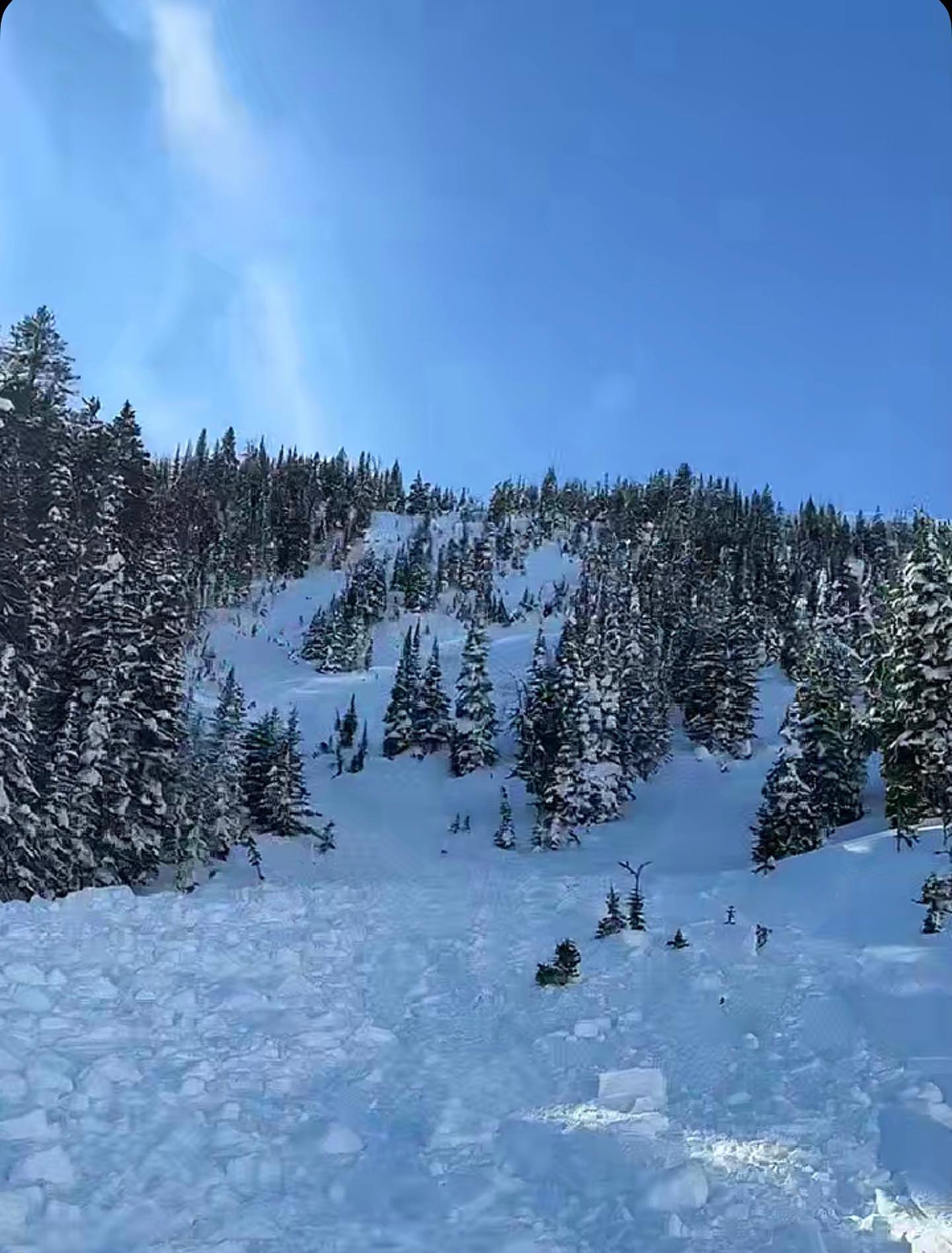
Riding in this morning, we saw this older wet slide on the Portal Creek road down low at about 6400' in elevation on a south facing slope by lots of exposed rocks. For reference, Gallatin River is 5800' in this area.
We didn't see any fresh ones on our way out at about 2:30.
The most likely places for big wet slides are slopes or areas with exposed rocks and cliffs. Generally these wet slides happen a little predictably in the afternoon as the snow gets wet. We know what time of day they'll happen, but it's hard to know exactly when they'll release, so watch out when the snow is obviously wet if traveling under slopes like this.
You don't need to worry about them in the morning, when the snow is frozen. What a nasty avalanche with sticks, rocks, and dirt in it?
Full Snow Observation Report
8761ft
43 NE
13 degree slope
HST 125
ECTP 12 50 down
Soft snow ski pen 30 cm
supportable pow
clear skis tell 11:20
11:20 few
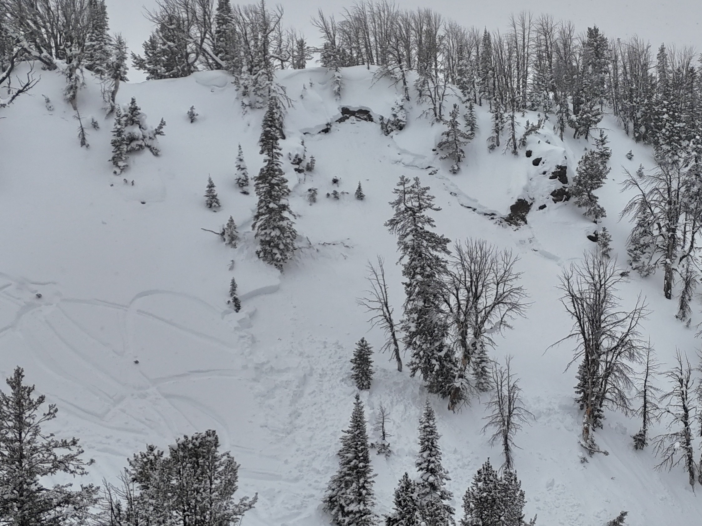
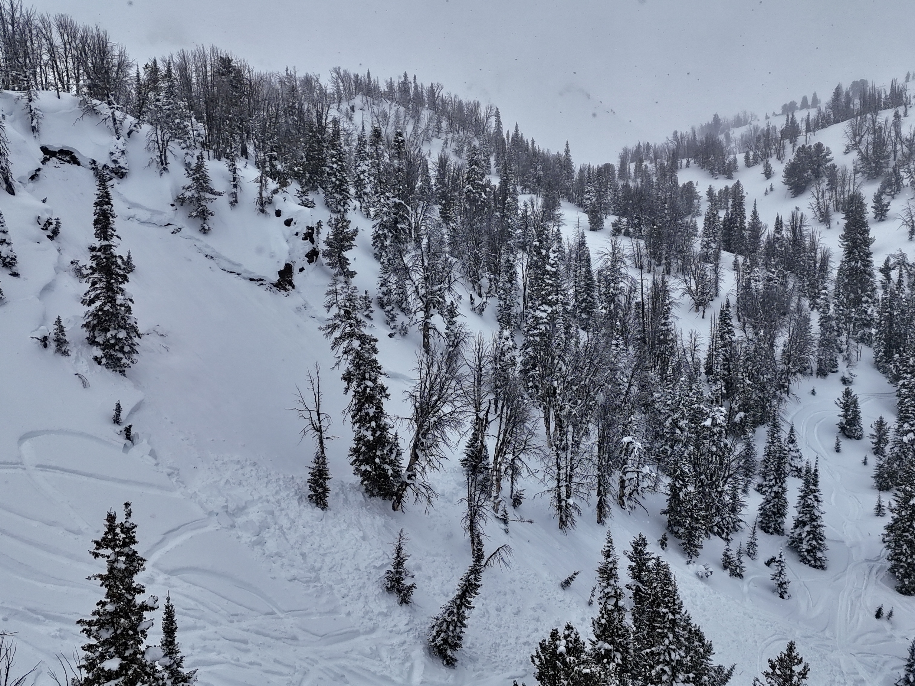
Full Snow Observation ReportWe got to ride into Tepee Basin with a pair of snowmobilers who were involved in an avalanche two days ago (2/23). The pair generously offered to join us and run us through the incident. It was an incredible opportunity to learn from each other. Read details about the slide.
The avalanche failed on the weak layer of facets that formed in late January. We also spotted another avalanche in similar, mid-elevation terrain likely triggered yesterday or earlier this morning. Both of these avalanches fit the pattern we've been seeing in Lionhead and the recent slide outside the forecast area in the Black Canyon area of Island Park. Other than the Black Canyon avalanche which is uncertain because we have not visited the site, the slides are taking place in mid-elevation terrain, smaller slopes with minimal wind-loading, and a thinner snowpack.
The snowpack in both the Tepee slides was thin relative to the average snowpack depth (129 cm).
Take Homes:
- You aren't good to go if you avoid the steep, upper-elevation, wind-loaded bowls. Steep slopes at mid-elevations harbor weak snow and have the potential for an avalanche.
- The persistent slab avalanche problem is alive and well. The epicenter of this problem is in the Lionhead area and the Southern Madison and Southern Gallatin Ranges.
- The issue with this avalanche problem is the distribution. It's nearly impossible to tell which slopes will slide and which ones won't. On many, the weak layer isn't so weak and the likelihood of triggering one is low. On other slopes, the weak layer is very weak and the likelihood of triggering one is up there.
Full Snow Observation Report
MODERATE is good today. We have a storm coming into the area tonight, an inch of water will take the danger to CONSIDERABLE for PWL issues.

From email: "One of my crew was partially buried in an avalanche today(head about 1’ down, leg and arm still above snow) at approximately 13:10 hrs. Slope was greater than 35 degrees, crown approximately 85 yards wide, over 3’ at its thickest point. I believe it was a NE exposure with wind loading at the top. I had a bad feeling about this slope and mentioned it to my crew and avoided riding on it until one rider ran out of gas and I had to help him. Upon completion of task, I rode back to a spot that wasn’t as safe a vantage point as what I had previously stayed at, but the intention was we were all on our way out. So I parked and within 30 seconds, I hear my friend yelling behind me. I turn and immediately think “oh he’s about to hit us”. So, I attempted to start up my sled, to no avail While watching behind me. Suddenly, a massive “snow cloud” appeared about 30 yards above him and it took about 2-4 seconds to register that it was an avalanche and not another rider careening out of control at us. By that time, it was too late to do anything. The avalanche had reached the back of my friend and my sled, pushing us forward about 6 feet at 3-4mph. After it stopped, I assessed 3 of four of our team was accounted for, and one (the one who yelled at us) was not. He was partially buried by the front of the avalanche much like our sleds were. Fortunately, within 5 seconds, I saw an arm and a leg sticking out of the snow and we had his airway and head cleared within about 20 seconds. He was located approximately 10 yards from us. "
Full Snow Observation Report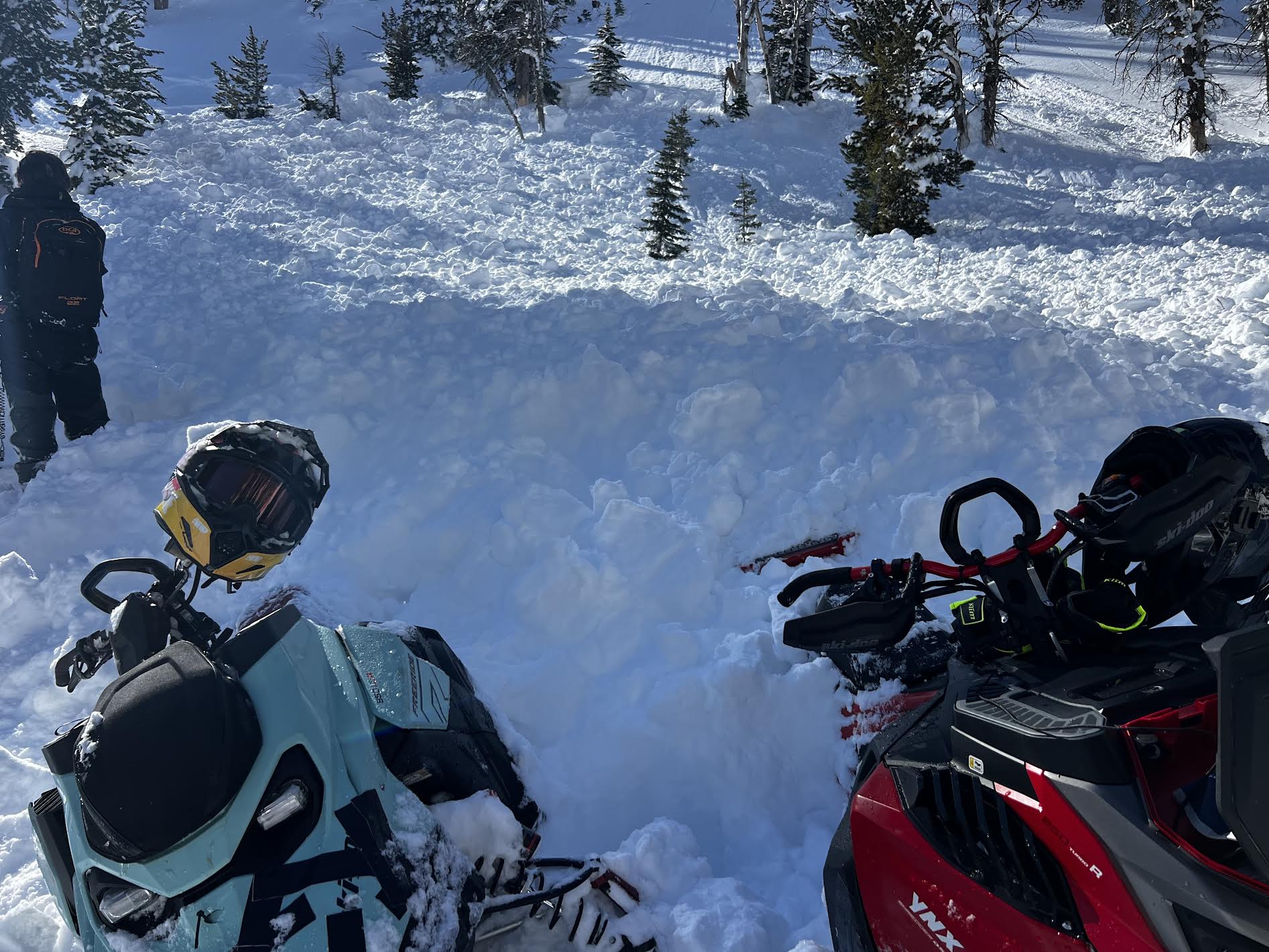
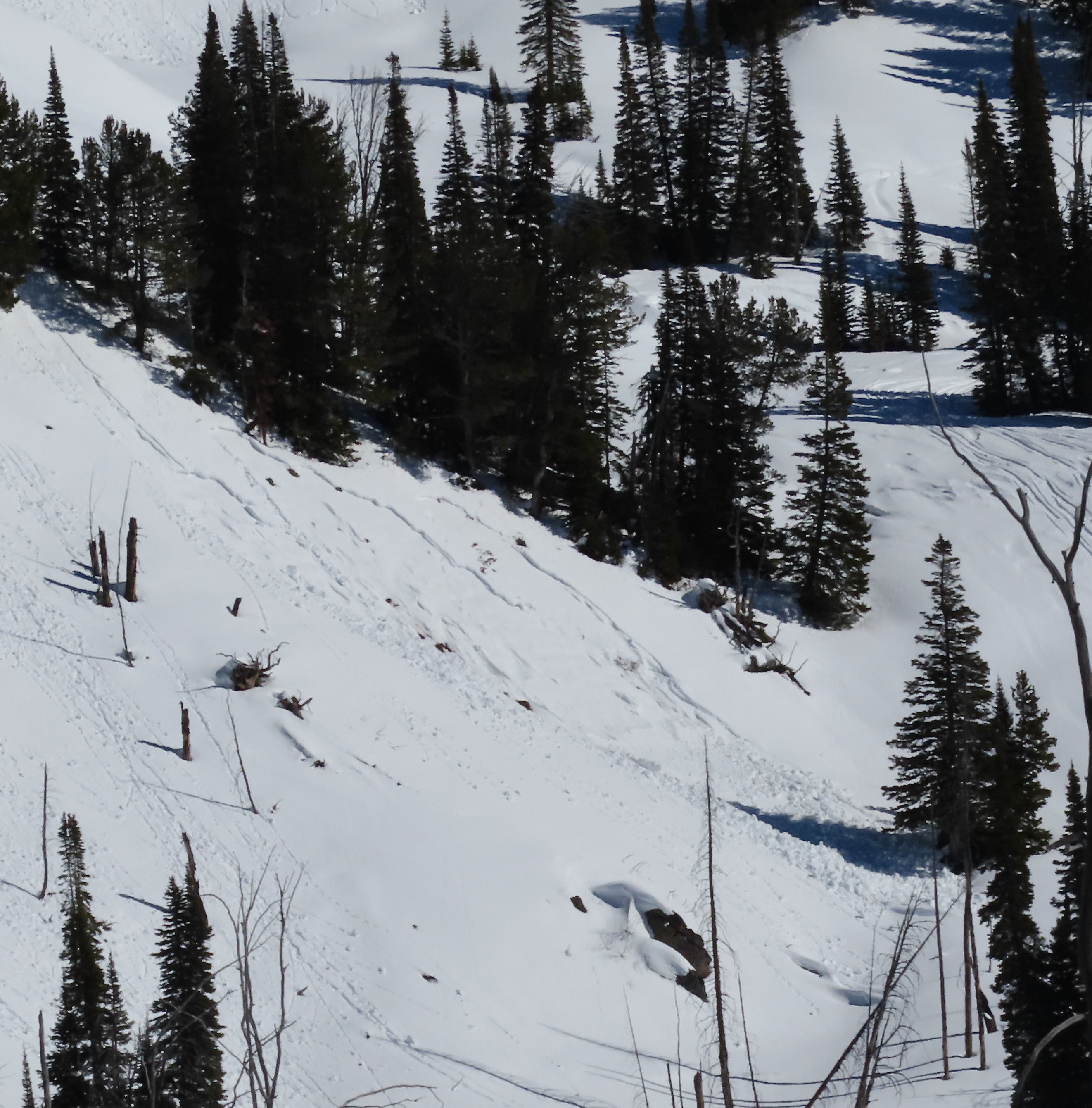
From IG message: "We remotely triggered this hillside in Taylor's fork yesterday [2/21] from the Ridgeline above it. We were looking for a safe spot to drop down when it released below us. Circled around for some pictures. The snow was pretty shallow, only 2-3 feet deep, and slid to the ground. South facing slope"
Full Snow Observation Report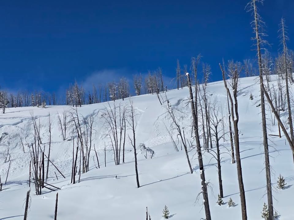
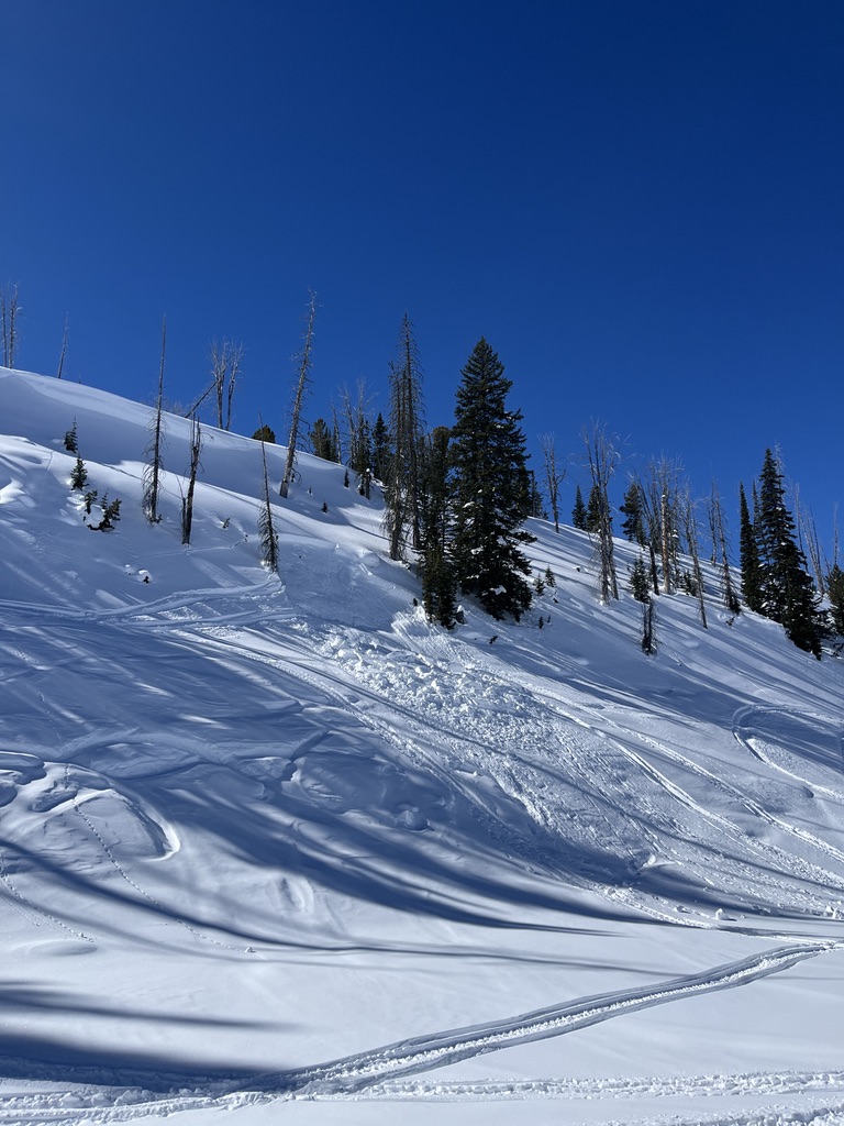
Clear skies, sunshine and great visibility today allowed us to cover a lot of ground in the Southern Madisons. We traveled up the Taylor Fork to the weather station in Sunlight Basin, over to the head of Carrot Basin, through Sage Basin and up and over into Cub and Cabin Creeks.
Winds were light all day and only picked up later in the afternoon, gusting moderately from the south in the parking lot. Solar aspects moistened in the upper 1-2" of the snowpack, but we noted minimal signs of wet snow instability.
We came to the Taylor Fork searching for signs of instability from persistent weak layers and wind slabs, and we found both. We saw up to five recent avalanches from the last few days. 1-2 looked to have failed on PWLs, and the rest were wind slabs. Cornice collapses triggered at least two of these avalanches.
Outside of recent avalanches, a few other red flags jumped out at us. While traversing to our pit site in Sunlight Basin, we triggered a whumpfing collapse and a shooting crack up to 100' long across an adjacent slope. This snowpit on a SE aspect was made up of a dense slab of recent snow, sitting on top of many different layers of junky, faceted grains. Propagation was easy to find (ECTP 11, HS: 112). We also dug snowpits on N and SW facing slopes. While we found weak snow on these slopes, the N (ECTPX) and SW (ECTP25), the snowpack was deeper in both areas and the weak layers were less developed. When compared to what Alex and Mark found three weeks ago in this area, these instabilities are becoming less widespread and more stubborn to trigger, but an avalanche breaking on these weak layers is still possible.
Full Snow Observation Report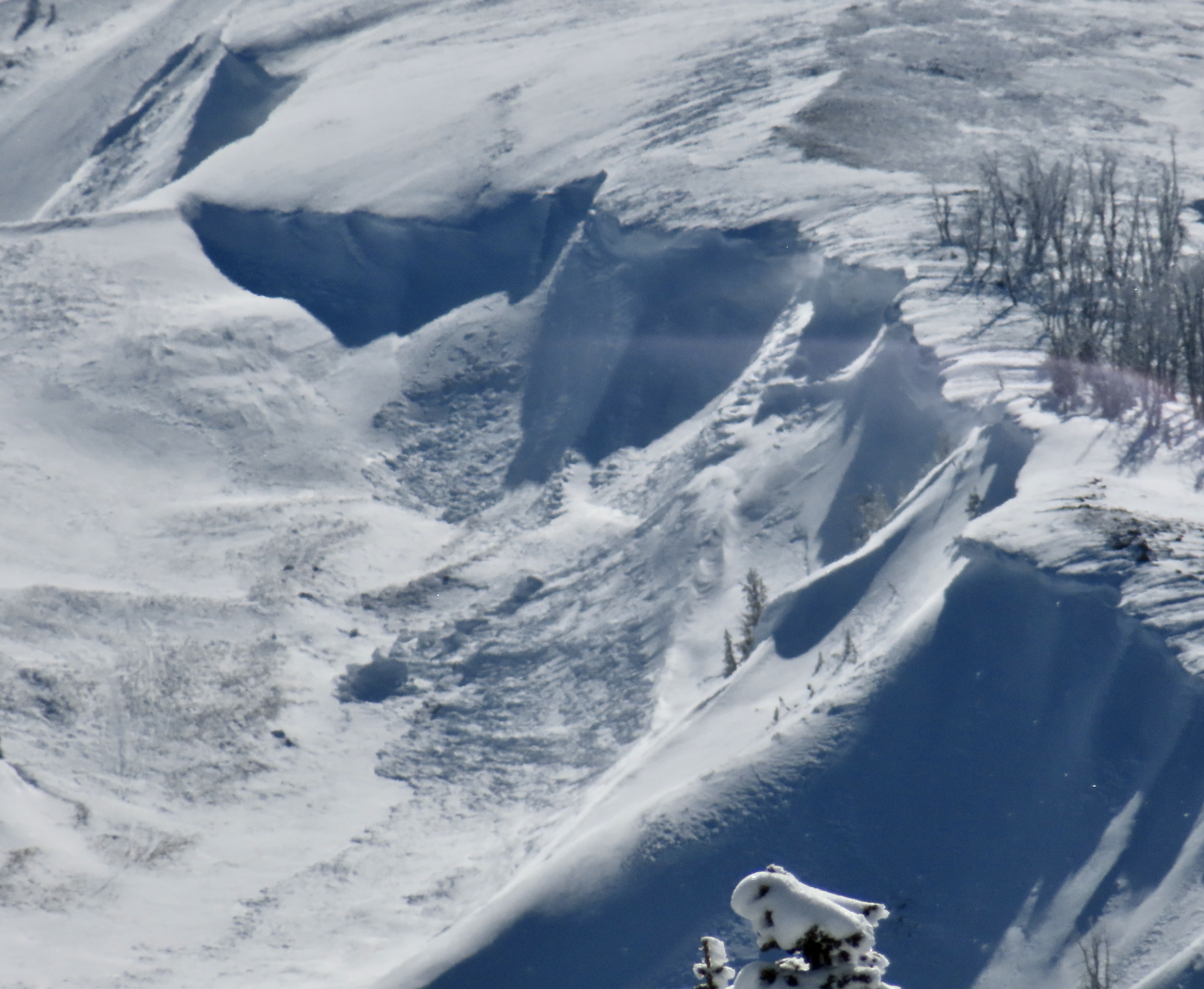


Skied the Bacon Rind Skillet on 2/21 based on the GNFAC's good report from their snow pit on 2/19 and had no signs of instability. Wind on 2/21 was from the SE and was moving some snow around down low (filled in the old skin track) but things were sheltered in the trees. Not much drifting in the meadows towards the top either. There was a thin melt/freeze crust formed on solar aspects lower down (up to ~500 feet above the parking). We were there from about 10:00 - 14:00 and it was cloudy all day, the snow never got very wet or heavy.
Full Snow Observation Report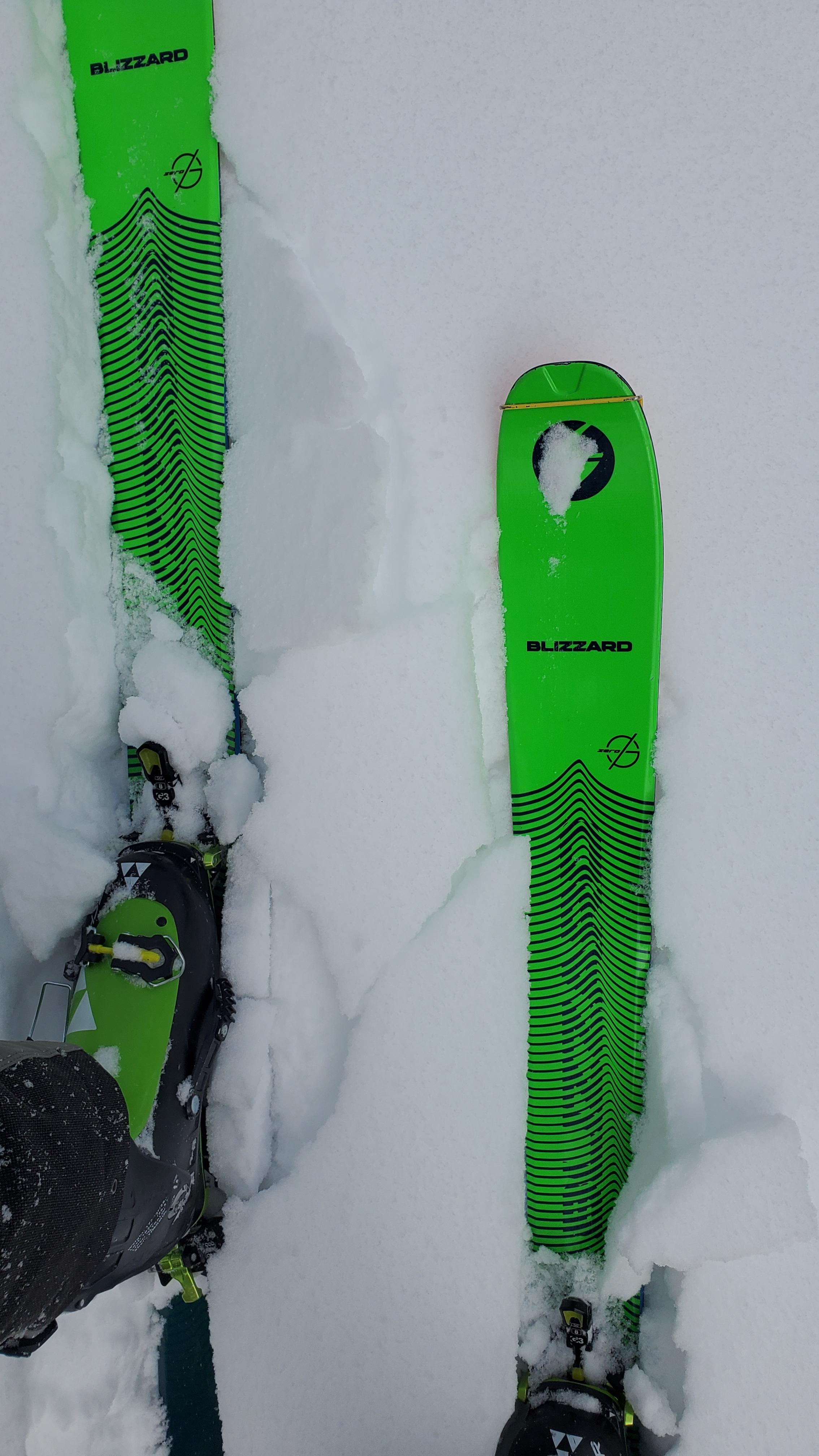
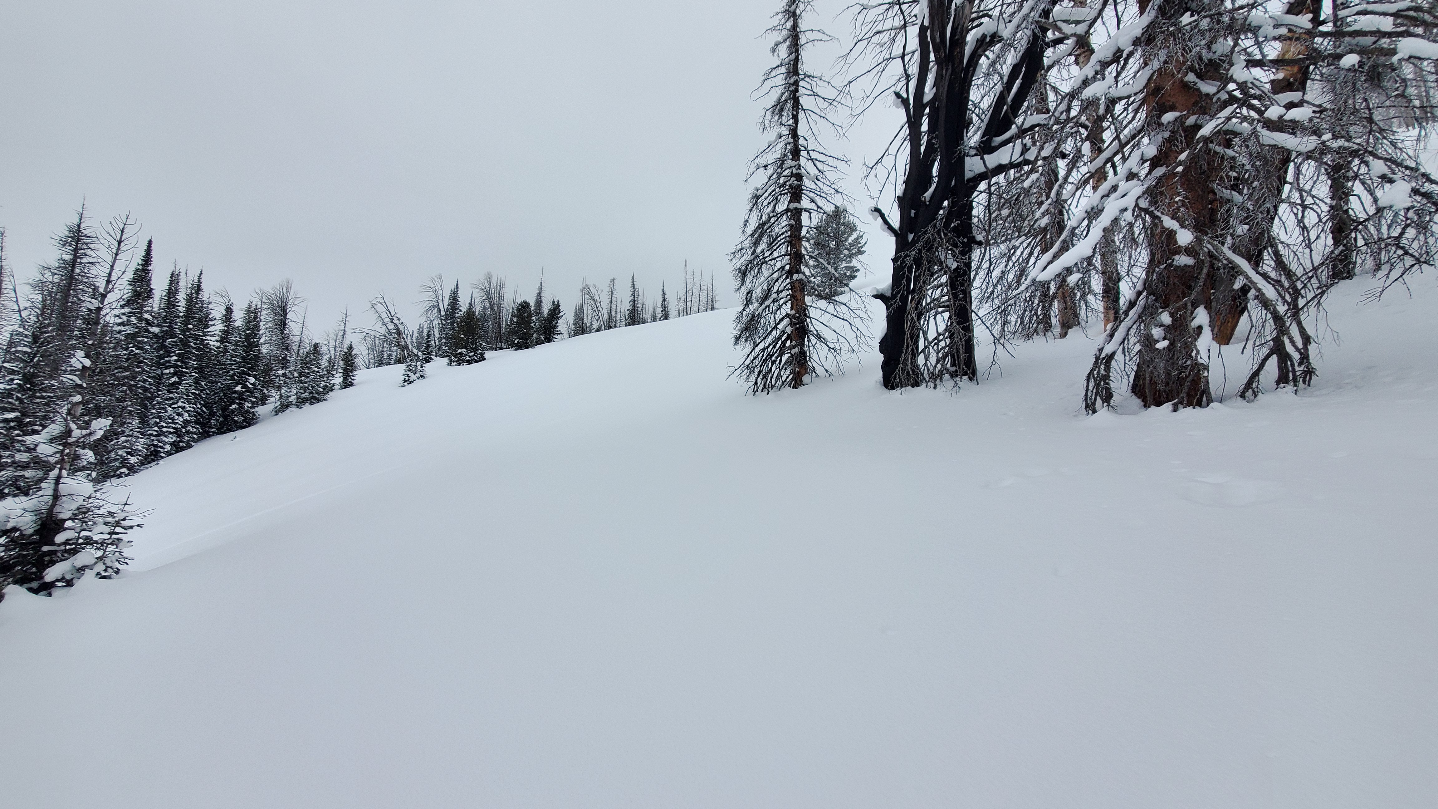
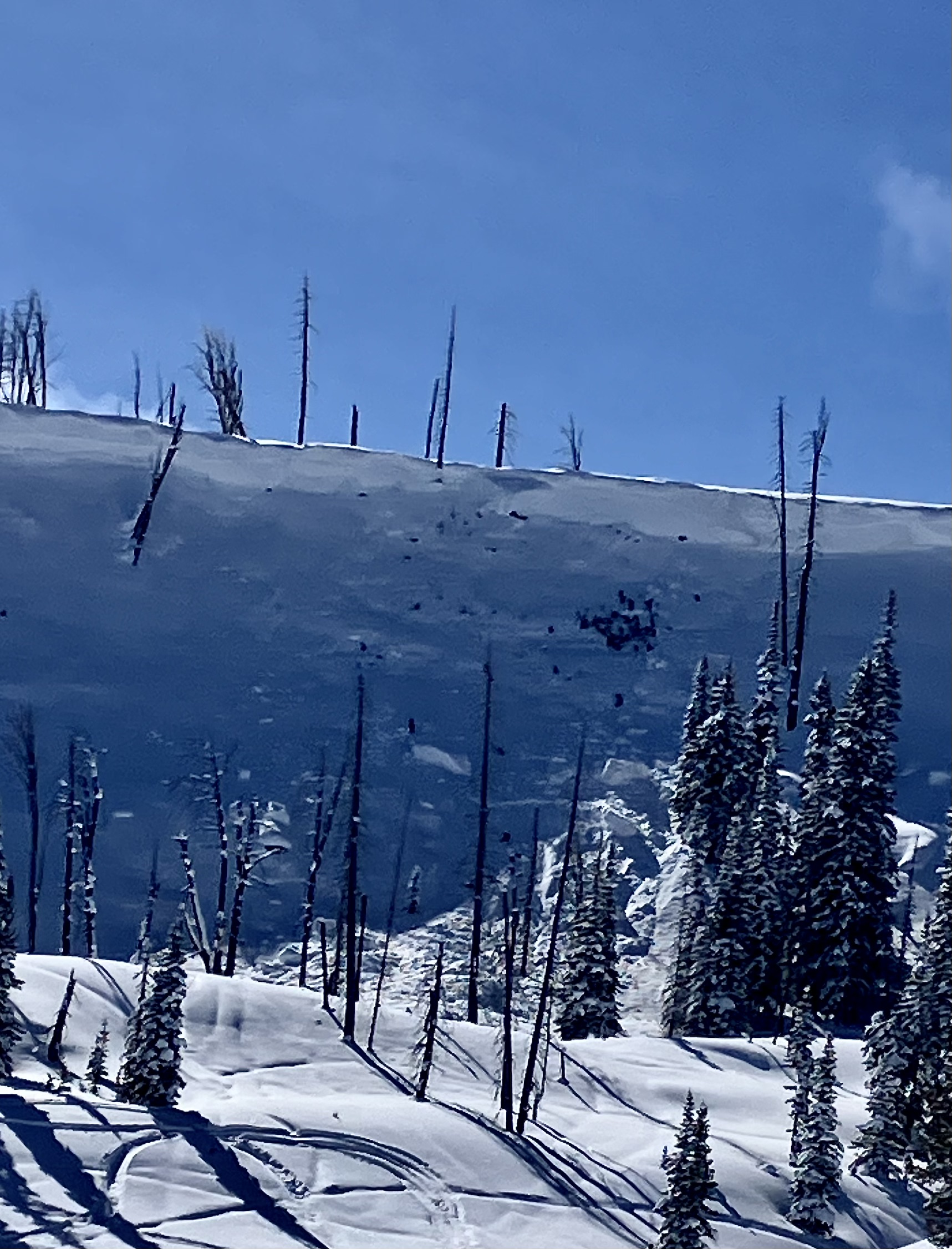
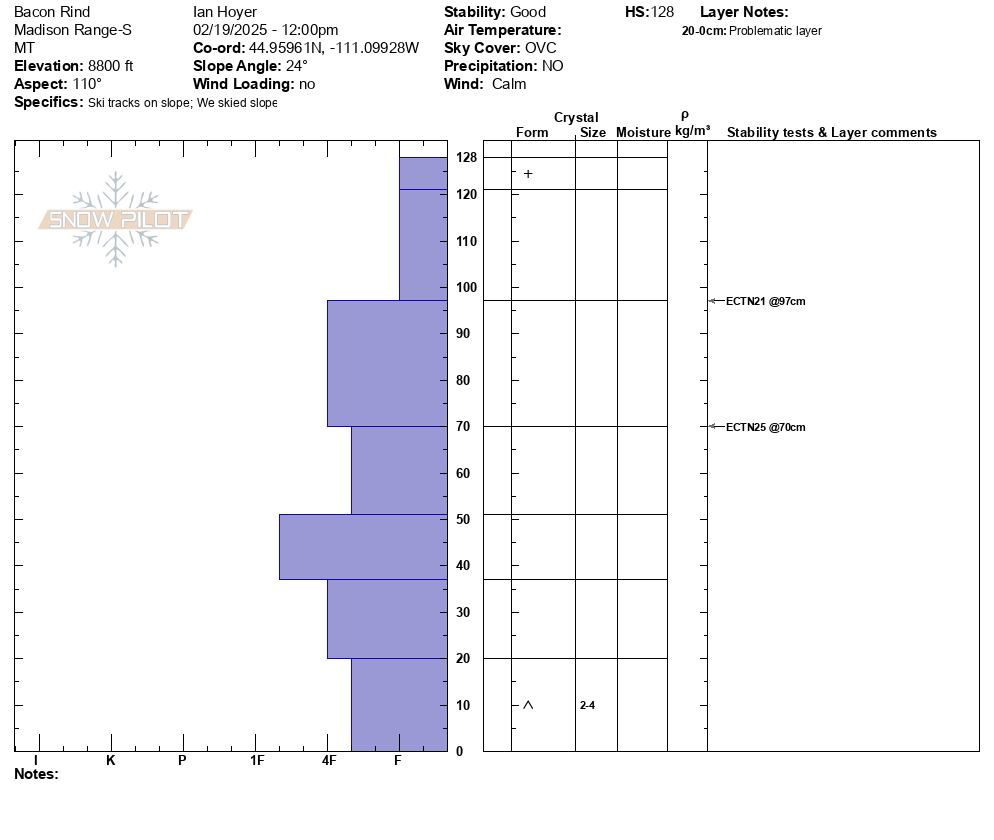
Skied up the southern of the two typical Bacon Rind skintracks (through the more heavily burned area to the upper meadows). Saw no signs of instability (no cracking, collapsing, or recent avalanches).
Dug a pit on an E aspect at 8800 ft in one of the upper meadows. 128 cm snow depth. No propagation in an Extended Column Test. There is weak snow at the ground, but it isn't super well developed or very weak (4 Finger minus hardness).
No wind affect where we traveled today.
Full Snow Observation ReportMODERATE on the non-windloaded slopes we saw today seemed right on.
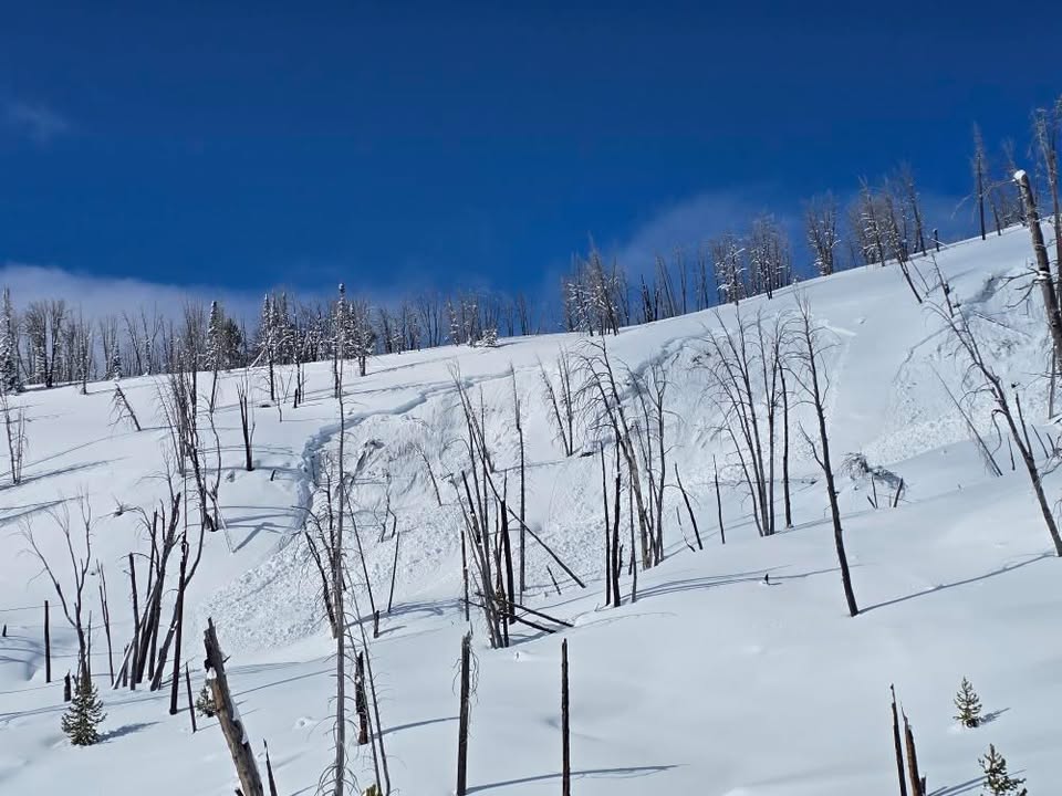
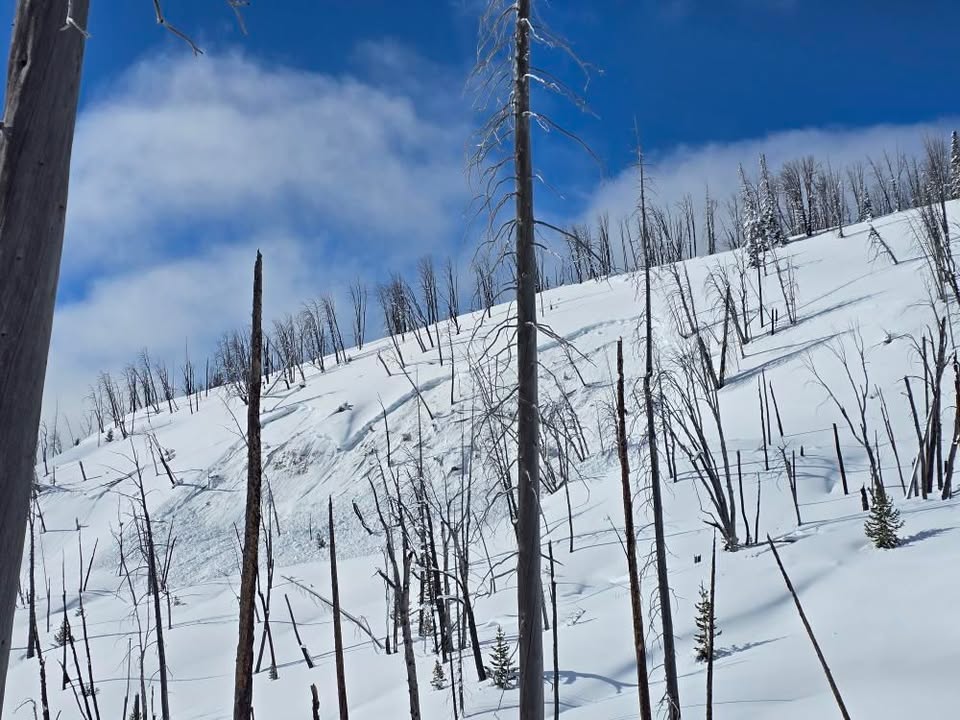
We rode into the Taylor Fork, down into the bottom of Sunlight Basin, across Carrot Basin and to the Wilderness Boundary. We saw four persistent slab avalanches that likely broke last weekend or at the beginning of the week. All appeared to be snowmobiler-triggered R1-2, D1.5-2 avalanches at broke of the January layer of near-surface facets and surface hoar. Additionally, we saw one wind slab avalanche (R1, D1) in Sunlight Basin. This slide was fresh from this morning or yesterday.
We dug a crown profile for the persistent slab avalanche in Sunlight (attached). ECTN24 on the SH layer buried 50 cm (20") deep.
We also dug above Carrot Basin on a northeast-facing slope: ECTP14 & ECTN15 on the NSF layer 50 cm deep.
Near the Wilderness Boundary on a southeast-facing slope: ECTX
Persistent slab avalanches still seem possible, but it they have reached an equilibrium on most slopes that feels like the bottom end of MODERATE danger. Wind slab avalanches are certainly possible with the fresh slide as evidence as well are shooting crack in a drift as we rode in. Outside of large terrain, these will not be that large.
New snow and increasing wind starting tonight will change the equation. The snowpack can take 0.5" of SWE without notching up the danger, but 0.75" with more coming would make human-triggered avalanches likely.
Full Snow Observation Report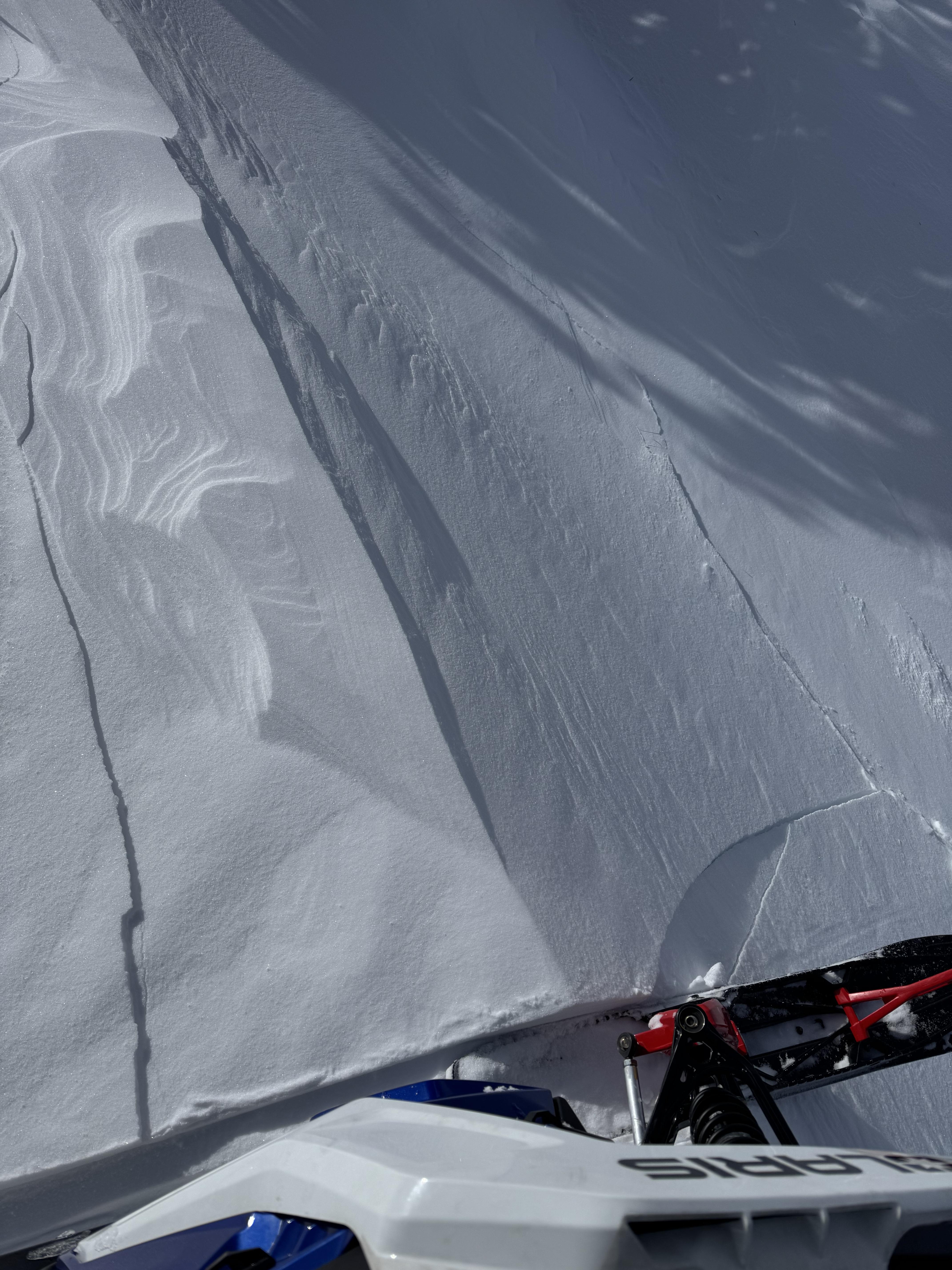

From FB message: "Two snowmobiler triggered avalanches in Southern Madison. Riders did not have beacons or rescue equipment. Riders made it out safe luckily."
Full Snow Observation Report