Snow Observations List
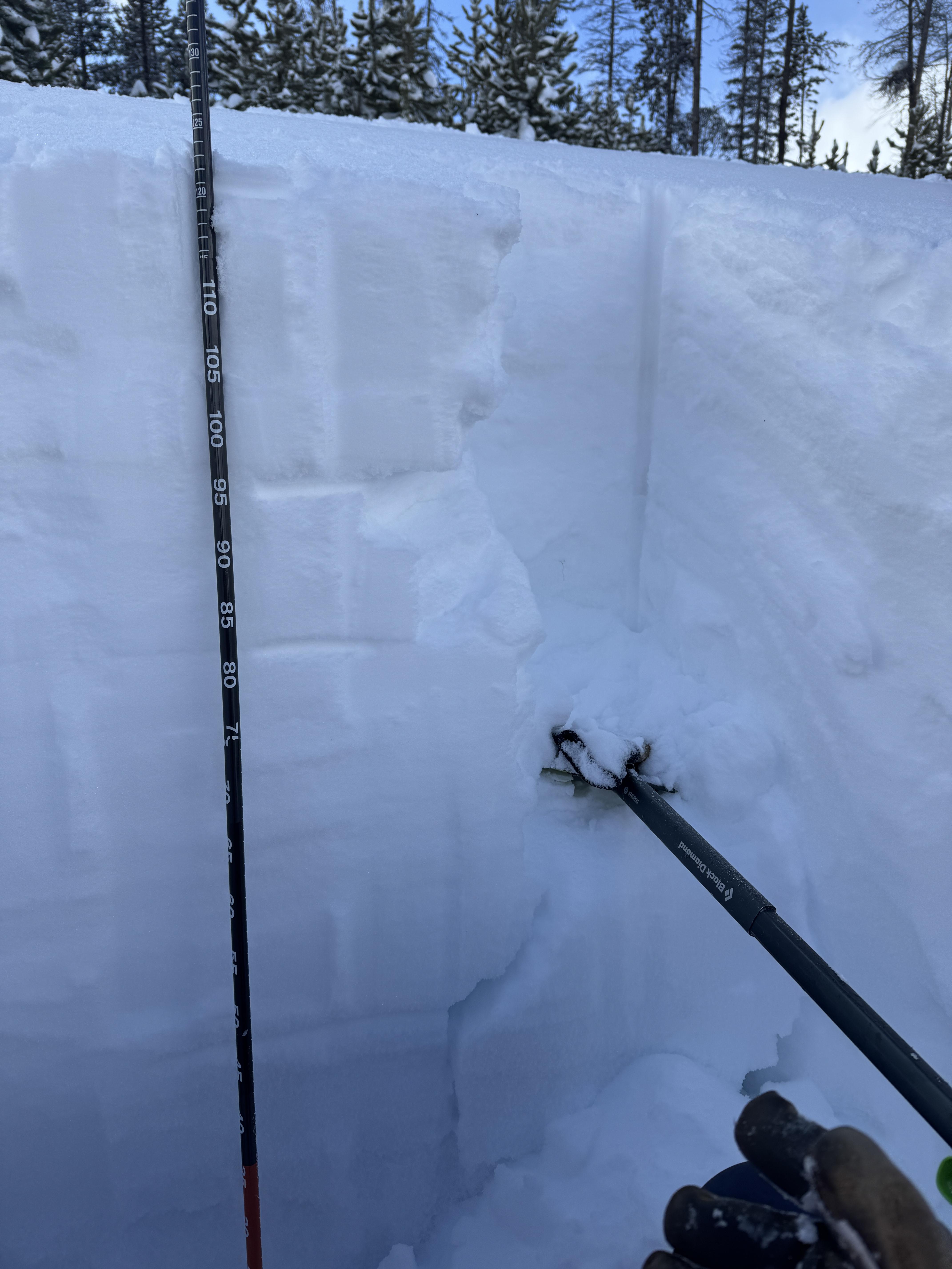
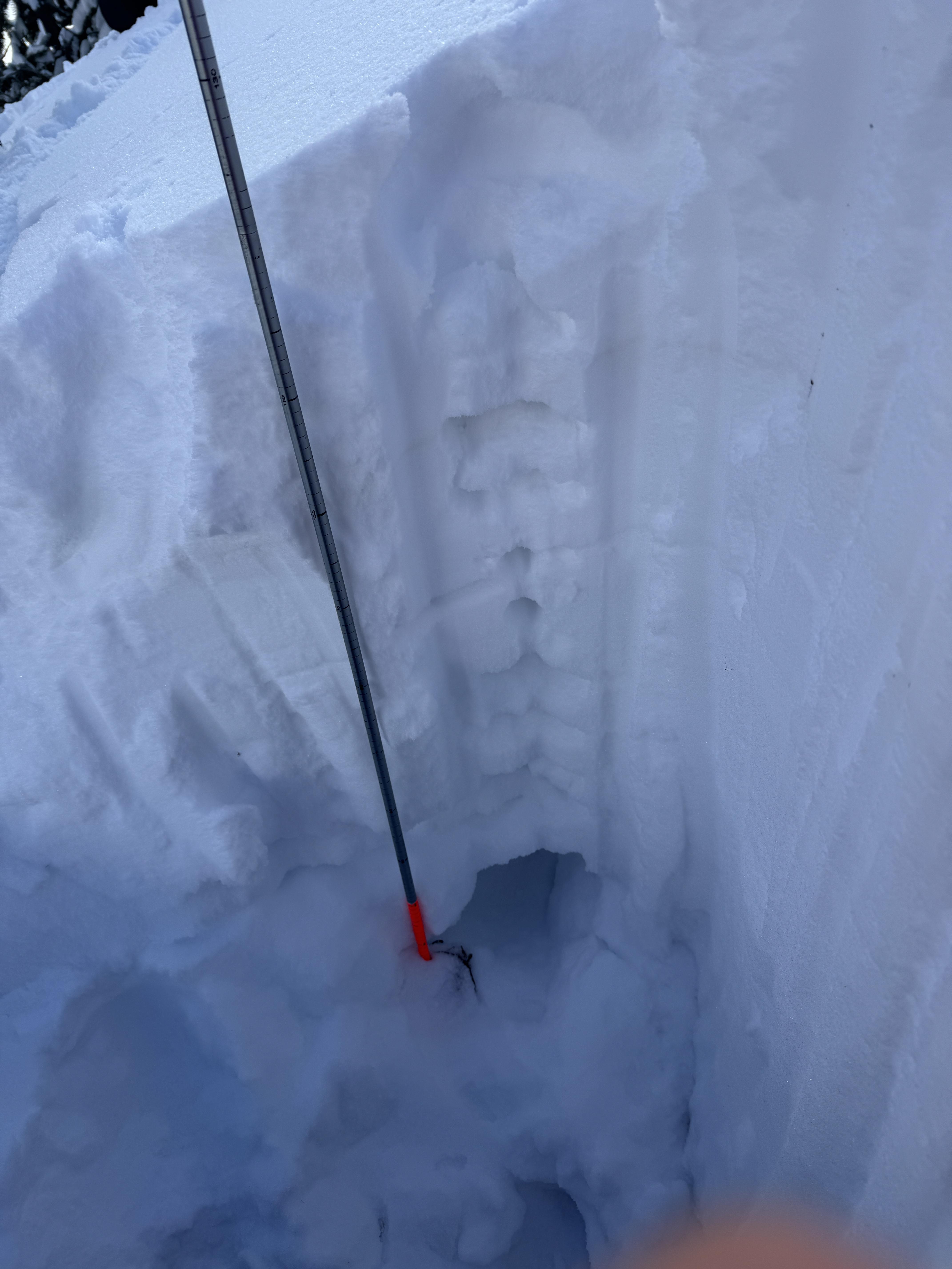
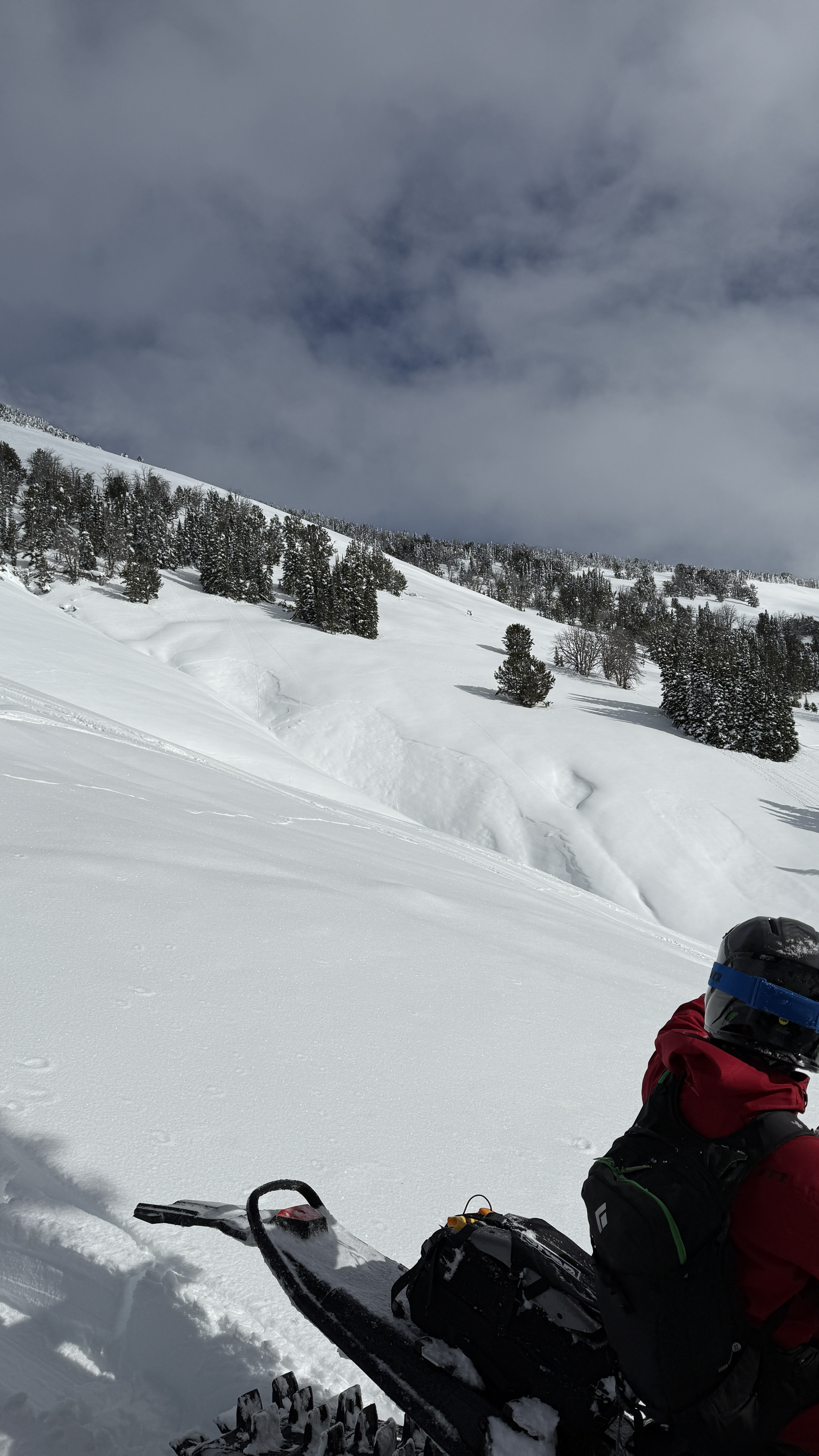
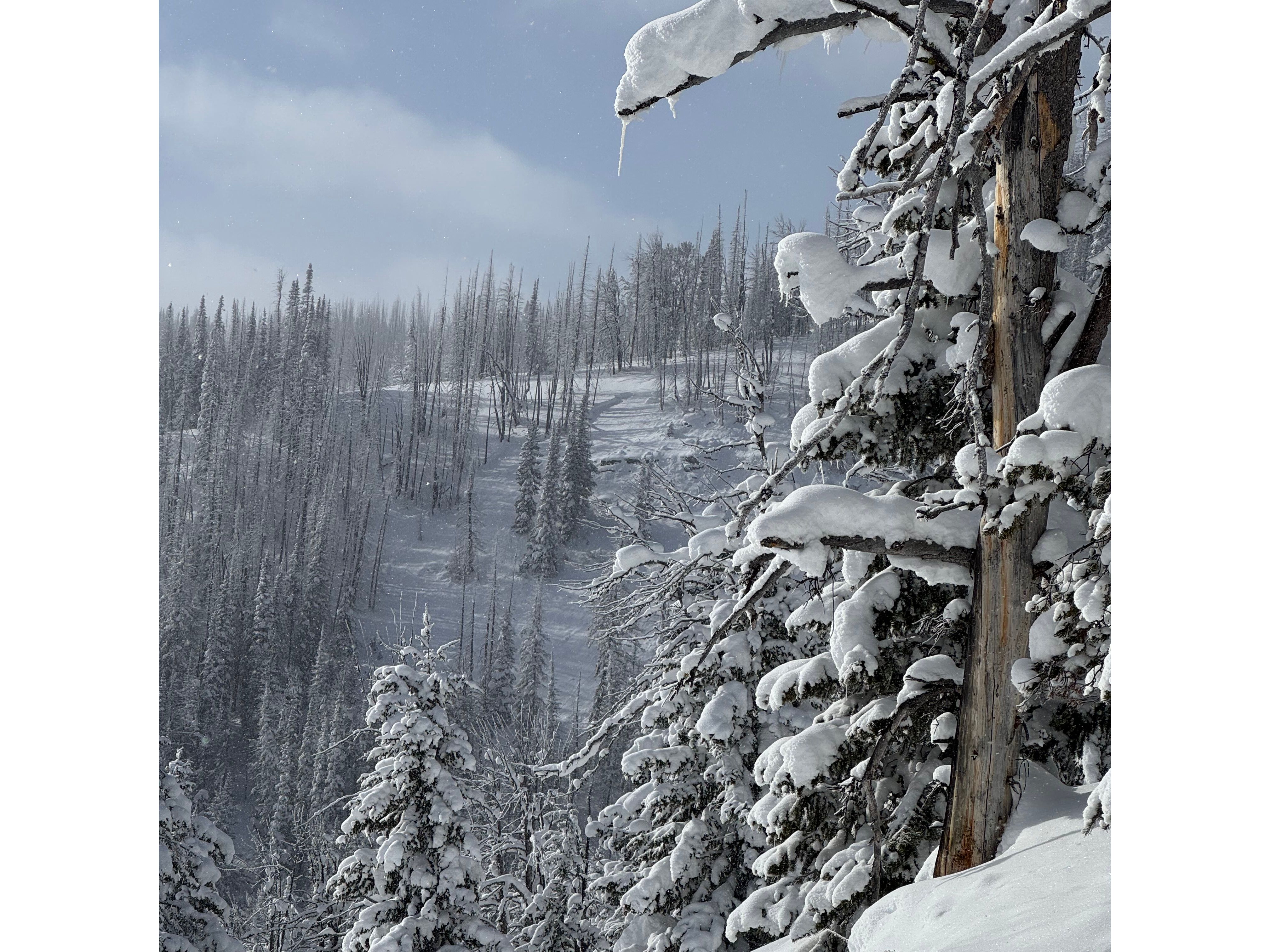
Bacon Rind
Consistent crusts at Around 75cm up and 63cm up
Facets at 35cm up to Ground
44.96280, -111.08678, 10:14
7850ft
68 E
20 degrees
HST 110cm
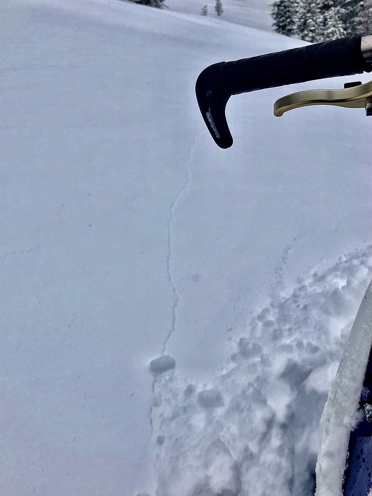
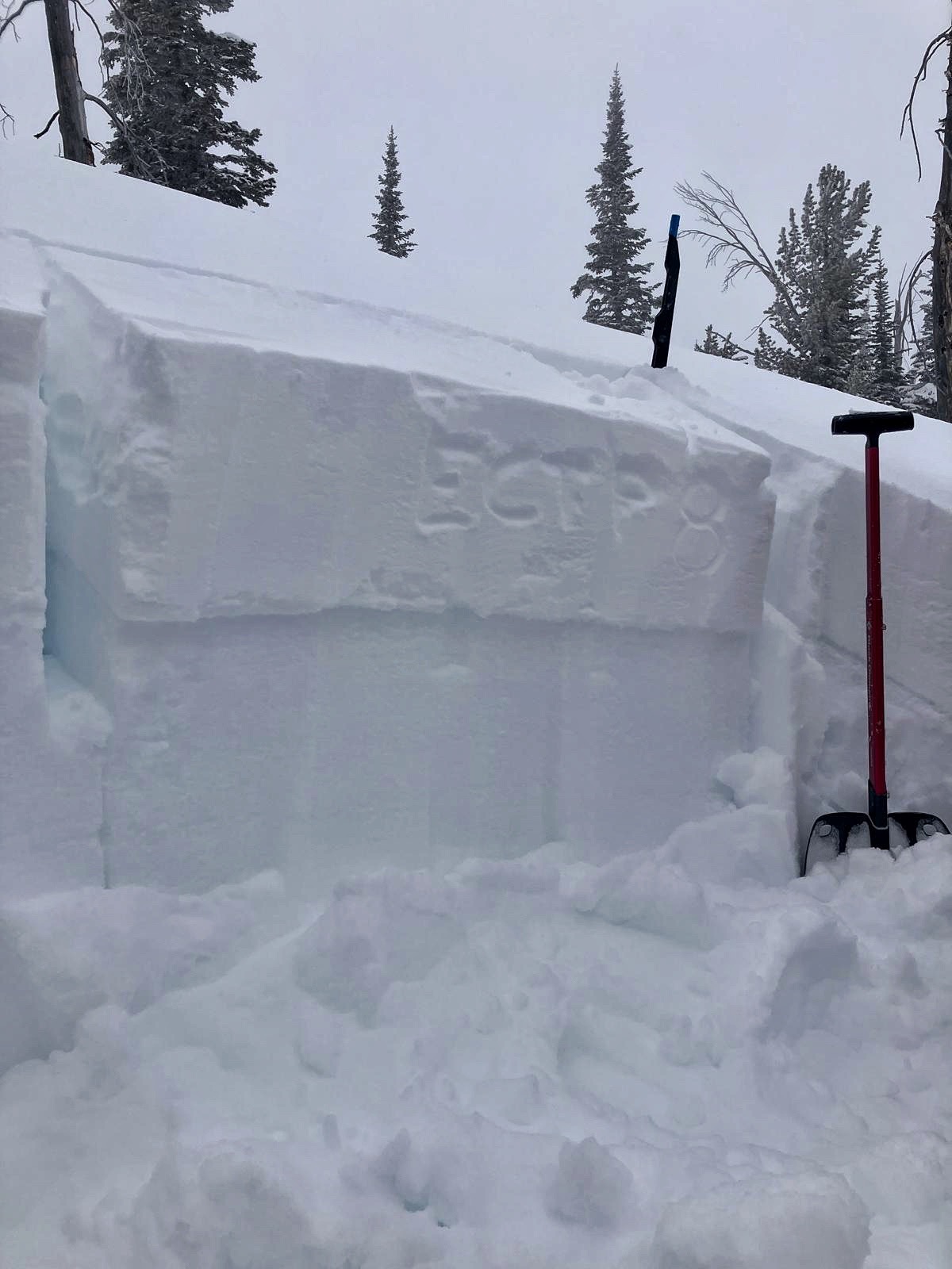
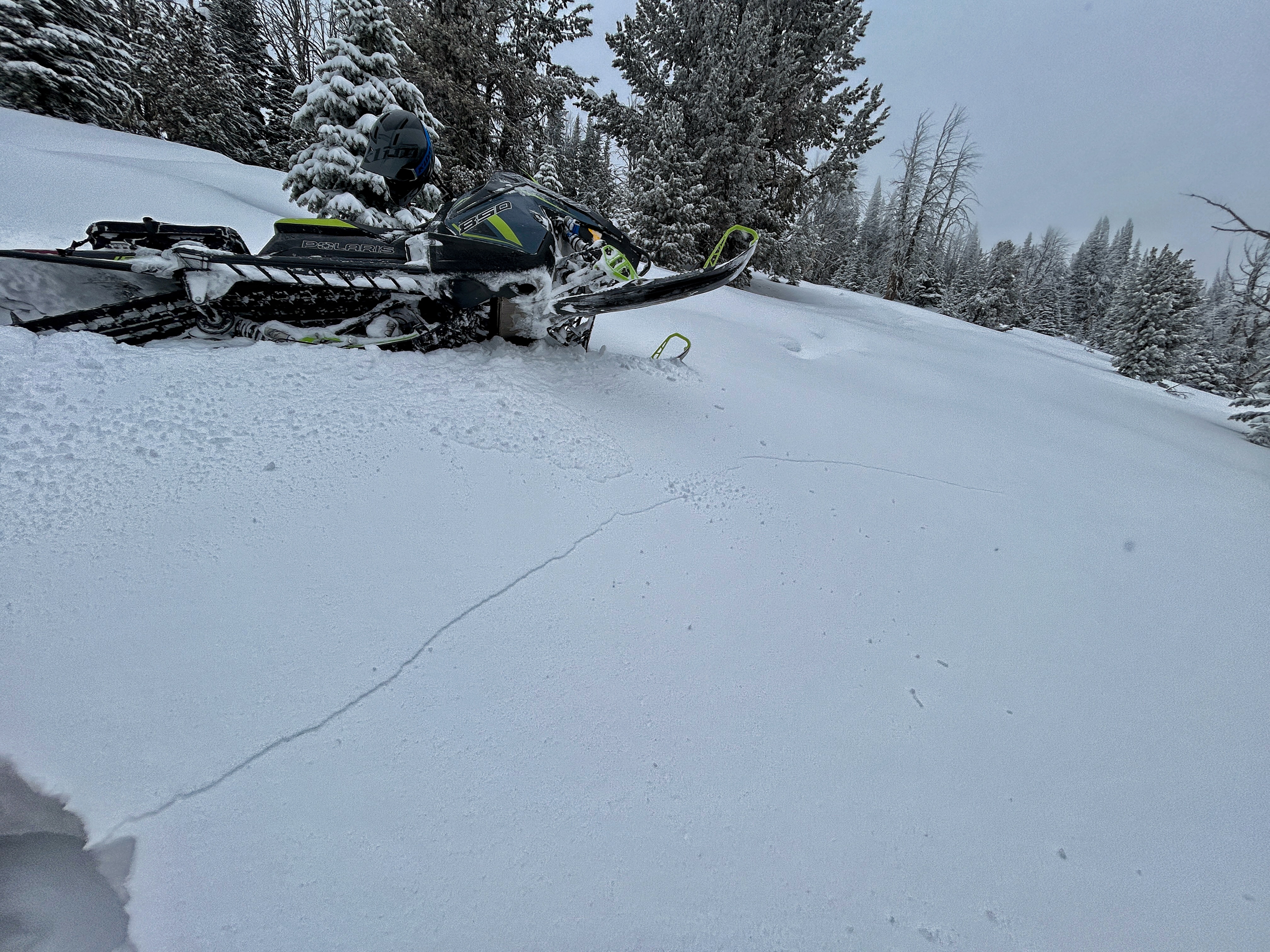
ECTP 25 65 cm up
ECTp 16 35 cm up
44.96019, -111.09583, 11:30
8578ft
59 NE
10 degrees
Hst110cm
ECTN25 75cm up
ECTP16 63cm up
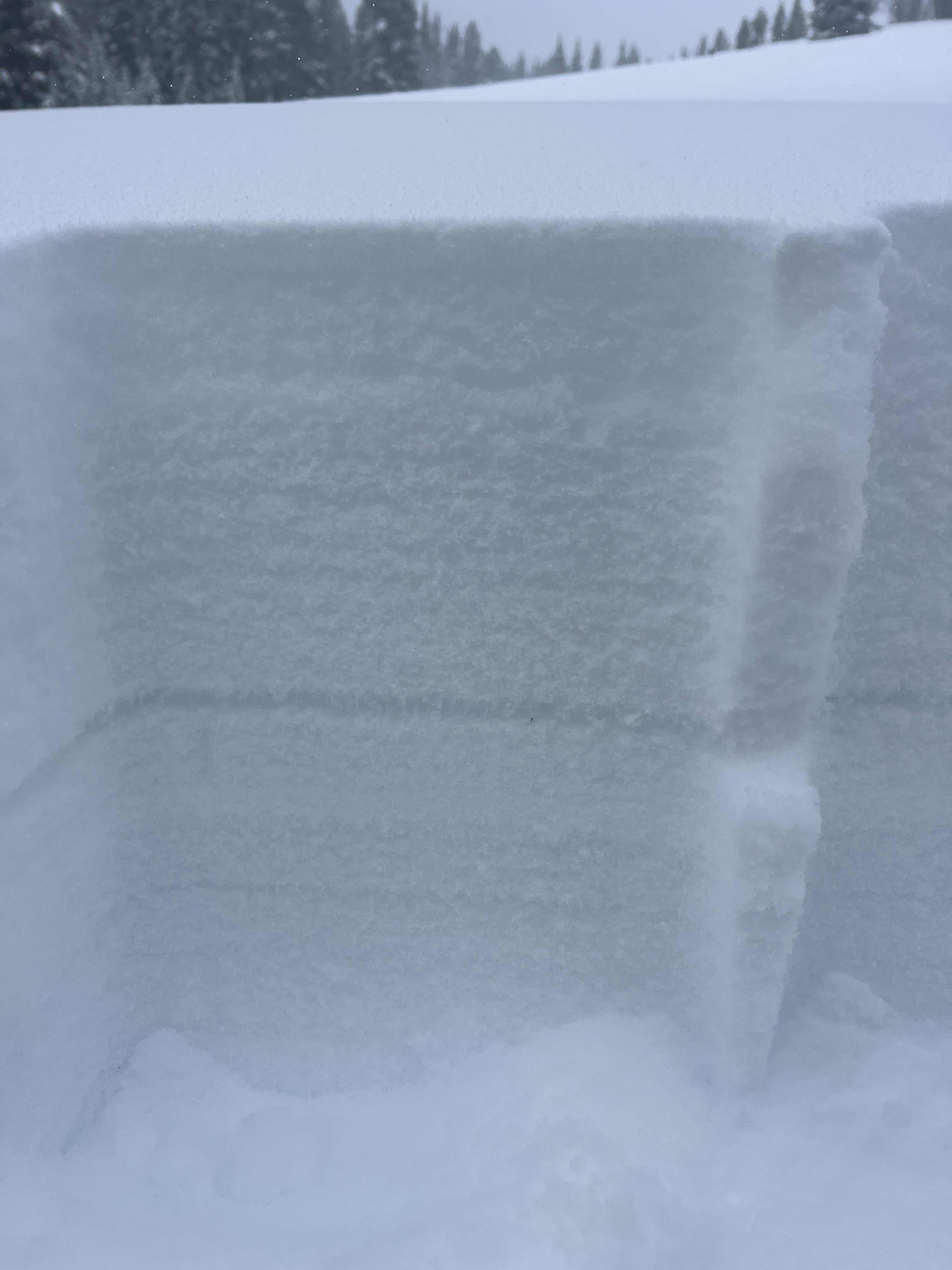
Full Snow Observation Report
On the ascent, particularly above 8000 ft using quick pole insertion tests, my group noticed a first crust at about 12-15 cm, a middle soft weak layer, and then about 45-50 cm down a second crust, then weak soft snow to the ground.
On a SE slope at 8750 ft elevation, my group performed an ECT and PST test. The snow temp was -15 C and the air temp was -14 C.
Snow height was 115 CM.
Test results:
ECT X
PST 55 cm/100 on the weak layer of depth hoar from 25 cm to ground.
The first 8 cm was fresh snow--dendrite or decomposing precipitation particles (F hardness). The next four layers from 107-67 cm were various layers, including a dust layer, mostly rounds, minimal faceting, 4F hardness. From 67 CM and lower, there was an increase in faceted snow, and of course, depth hoar for the last 25 cm.
Overall, a great day of low-angle tree skiing.
Full Snow Observation ReportWe dug at couple and got propagation irregularly. Snow surfaces were soft on NE, Wind affected on S and E.
44.94818, -111.06373
7505 ft
69 E
HST 95 CM
EctN 5 25 CM down
ECTP 19 65 CM down
CT2 q2 down CM 25
CT17 Q2 down CM 65
44.94458, -111.06444
7736 ft
55 NE
Hst 135 CM
ECTN 5 96 CM up
ECTN 17 82 CM up
ECTN 27 45 CM up
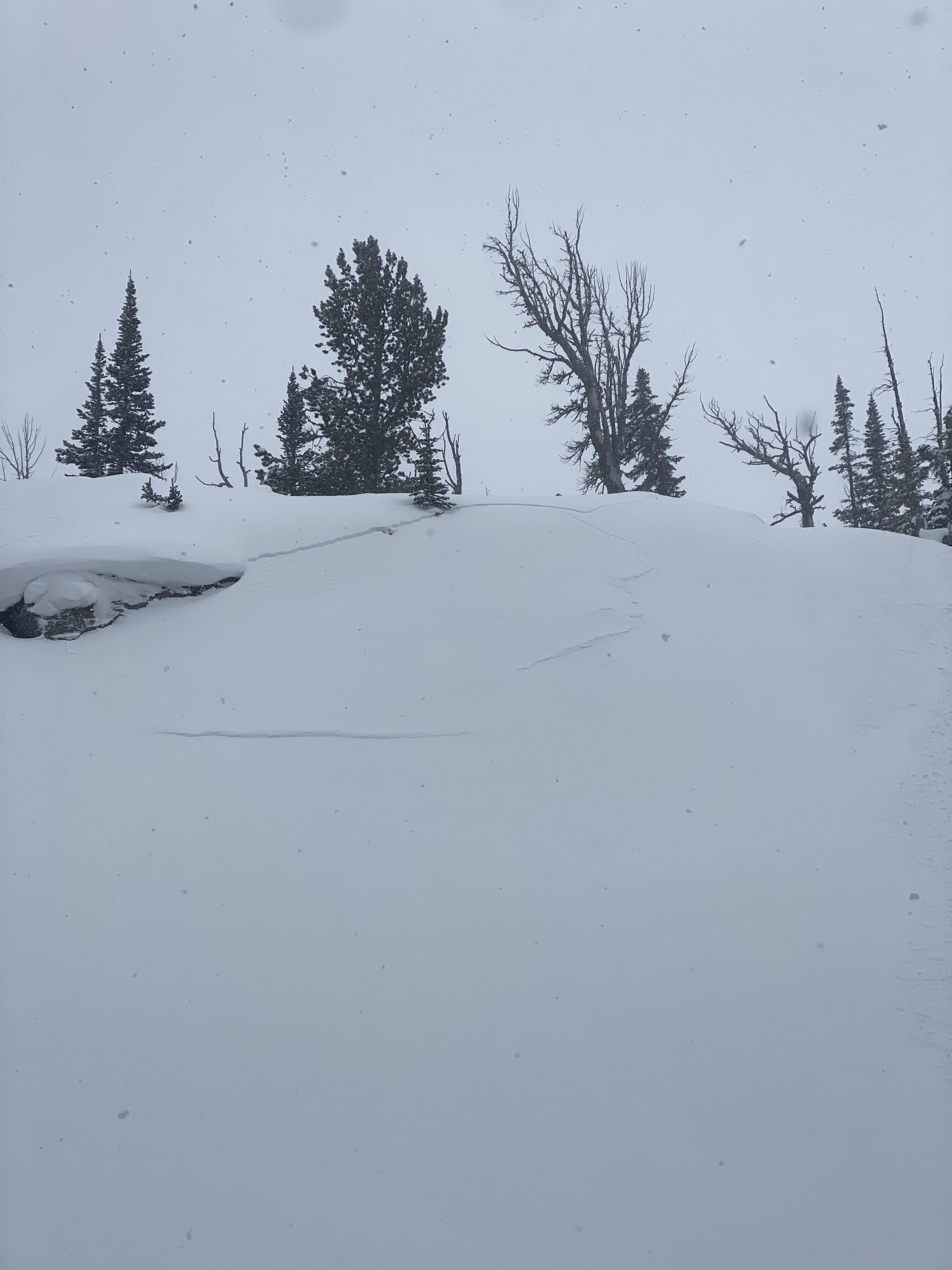
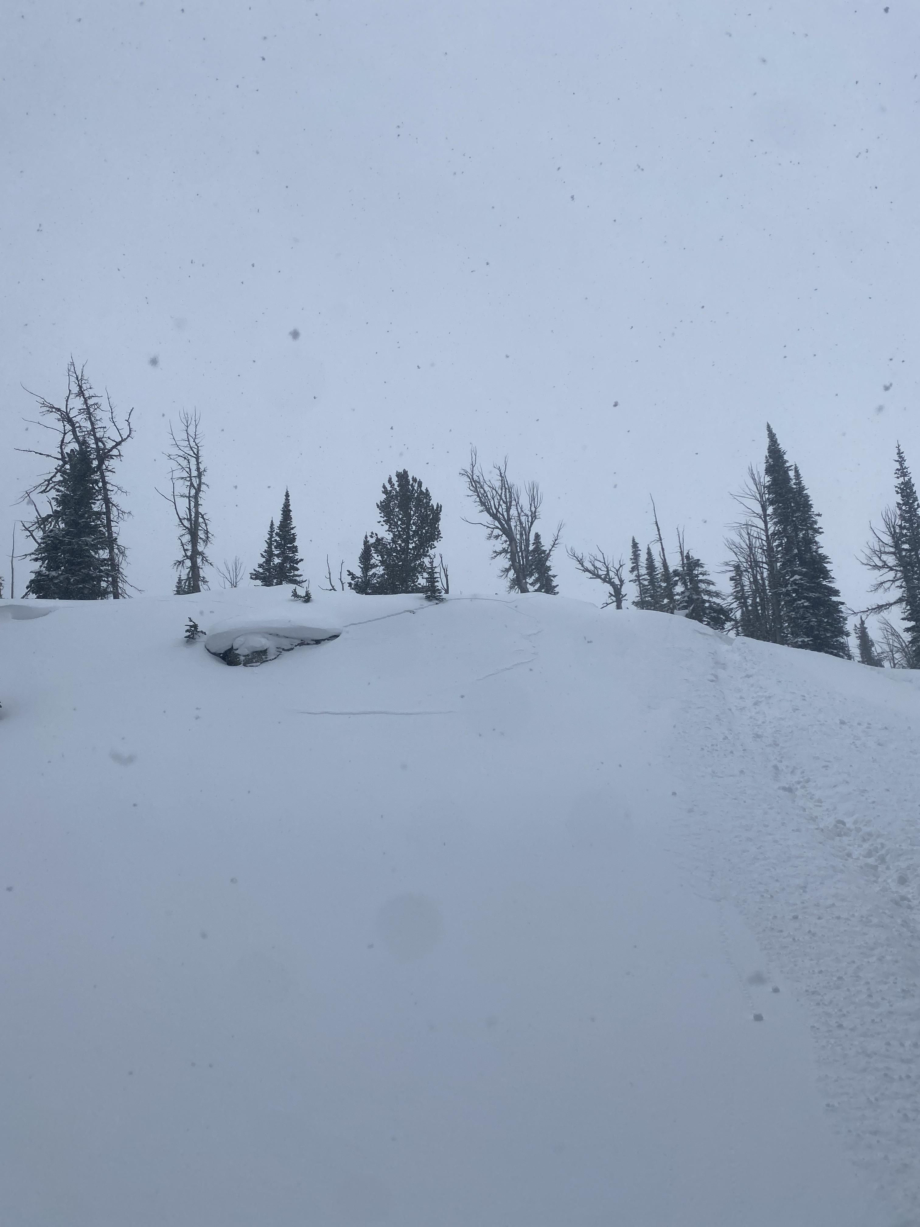
Had several large whumphs in windslabs at the top of bacon rind today. Interestingly they only started once a few inches of new snow had accumulated from the cold front. At the end of the day the windslabs are out there with enough load to make them pretty touchy.
No obvious signs of instability where there was no wind loading.
Full Snow Observation ReportFigured I would send in some observations as we were out yesterday in Whits Lake back in Dutchman's Basin and with extreme wind the snow was getting moved around and the wind was putting snow in unusual locations. This was a wind loaded hill but a very shallow angle hill maybe 20-25 degrees. Snow broke on an old layer before this past weekend's storm, that slab was probably 14-24" think in spots. Snow was generally stable other than wind blown spots.
Full Snow Observation Report
We went to the Taylor Fork area and into Cub/Cabin Creek to see what snow surface was buried by recent snow (about 0.8" swe in this area).
It was easy to find small facets in every pit we dug (some had surface hoar as well). We looked at N, SW, W, and E aspects at elevations around 9000 ft. On a north aspect, they were 1mm facets chained together almost 10mm long.
Consistently these weak layer were 8-10" deep (more in areas with drifting). They produced easy ECTP's and one ECTPV.
What was remarkable is that this layer produced shooting cracks all day long. They were generally subtle but would shoot 10-50 feet.
WHAT TO DO? Now is time to shift our mindset to "stepping back". Lots of great powder is on the way. Unfortunately this snow will likely come with a lot of wind. The more snow/water and wind that come, the bigger of a step back, we'll need to take in our terrain choices. By the end of the week, we will likely be avoiding all avalanche terrain including runout zones in areas that get 3-4" of swe.
Full Snow Observation Report


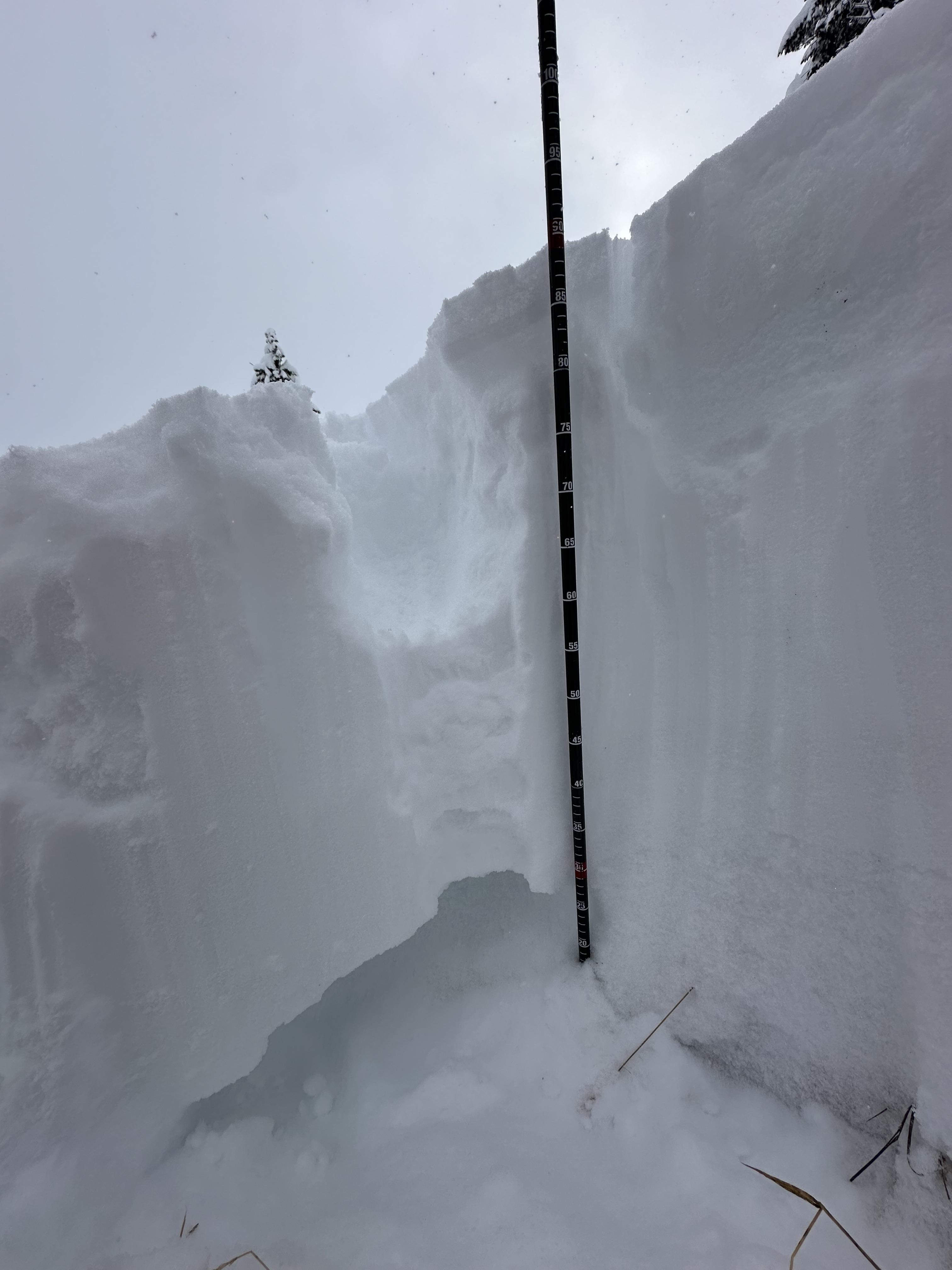
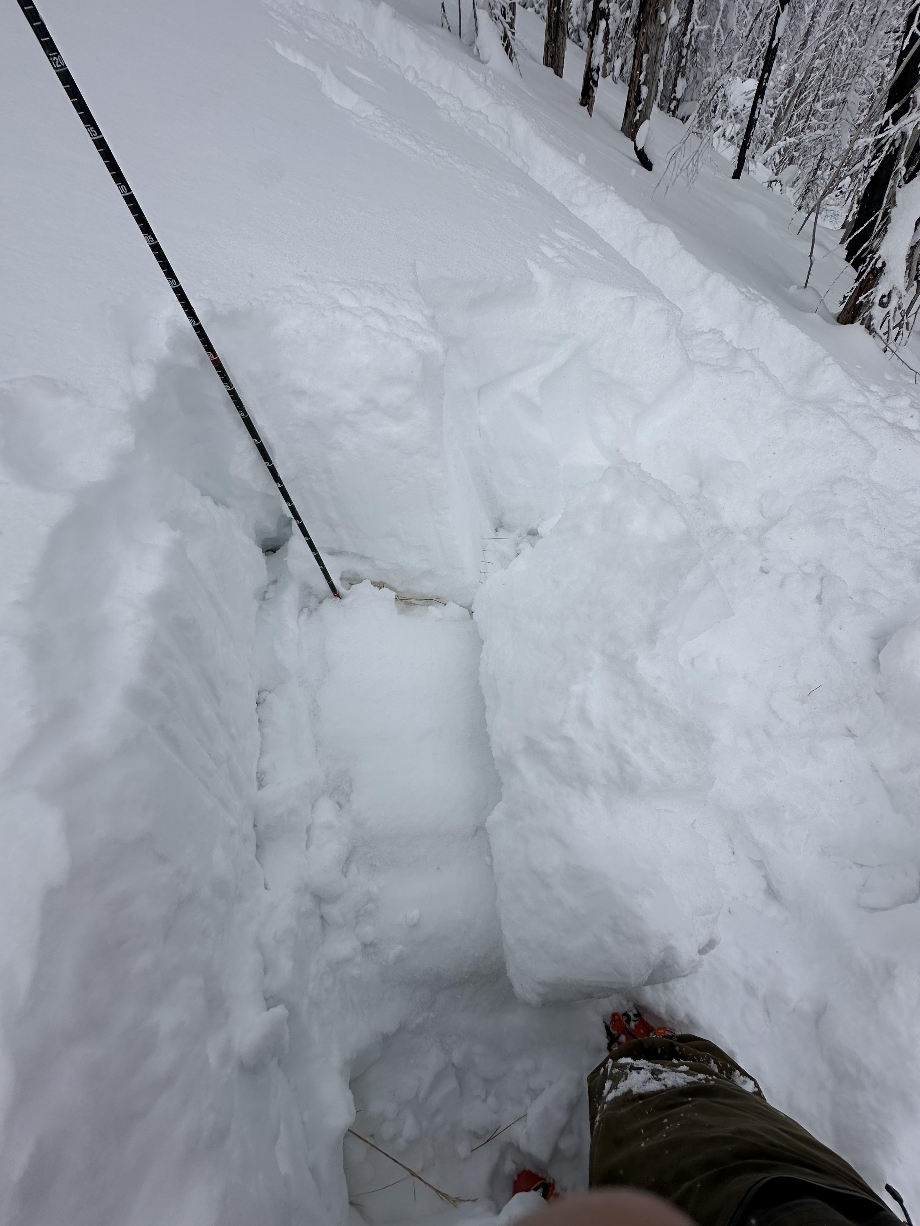
See attached profile and photos.
Buried SH below the 2/1 storm. 1-2cm thick layer buried approximately 20cm deep below F precip particles. Surface snow had some graupel particles in it as well.
Full Snow Observation Report
From email: "Today I drove down Taylor fork road, with the thought of potentially getting up on woodward mtn, until I saw a crown on the NE
Face of its northern summit, basically wall to wall near the top of the slide path. There were a couple other sled tracks that also went to the end of the road, so I figured maybe it was pretty recent, as I didn’t hear about it in the advisory. Concerning because it appears to have propagated maybe 250ft across, while maybe only 1-2 ft deep"
From FB message 1/19: "In between redstreak peak and white peak... The whole slope cracked... the one I stopped on I put my leg in the crack and went to my knee inside the crack"
Screenshots from videos sent in messenger
Full Snow Observation Report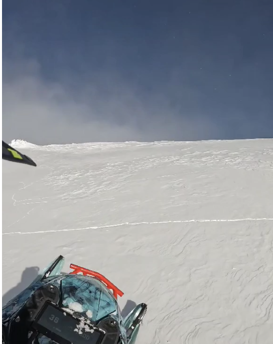
Dug a pit on divide peak on a southwest facing aspect that was about 210cm deep. ECTX, PSTX on sun crust 15cm down from surface that the new snow had fallen on. Entire snowpack 4F-1F from the thin sun crust to the buried facet layer than began around 165cm deep. Saw evidence of some wind slabs beginning to form near the ridge line. It was cold.
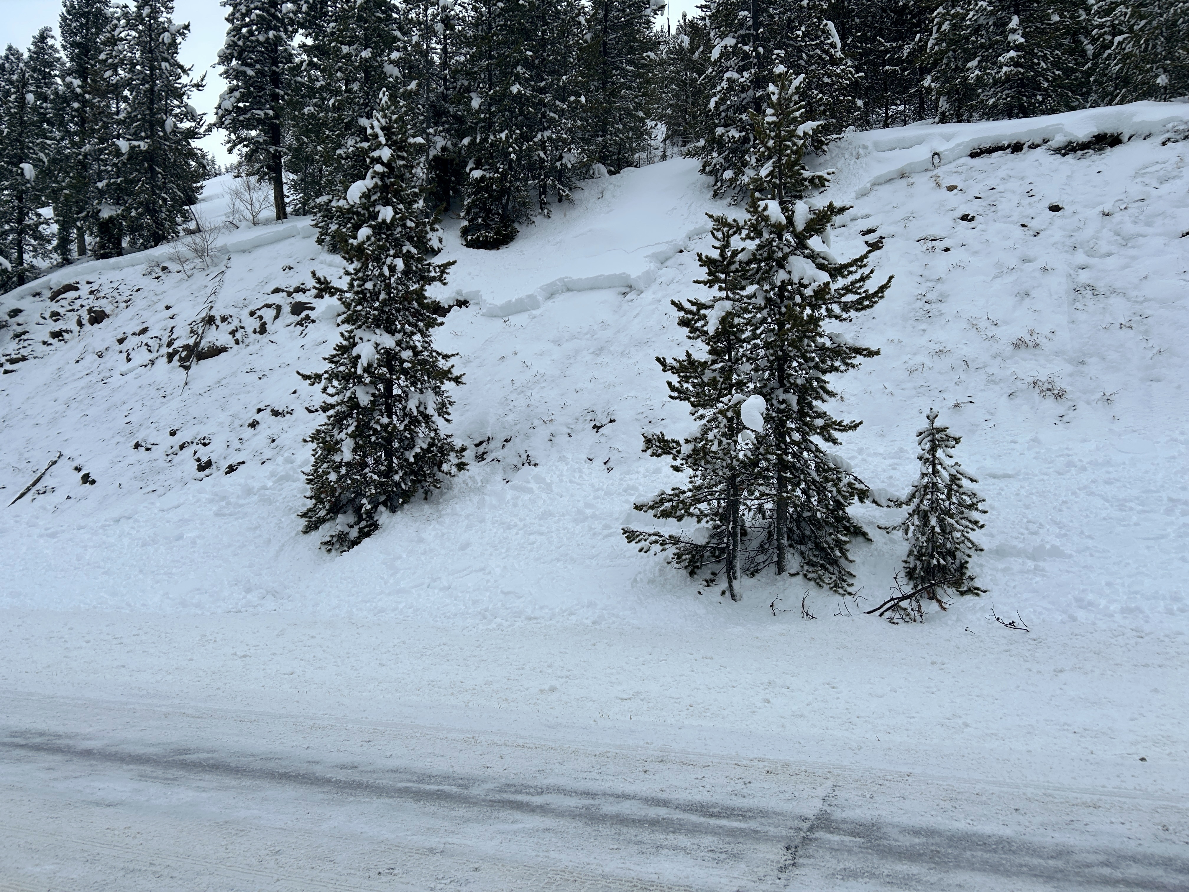
Full Snow Observation ReportWe rode under the full length of Skyline ridge under all the south facing slide paths.
The only avalanches we spotted were from 1-2 weeks ago. No cracking or collapsing observed.
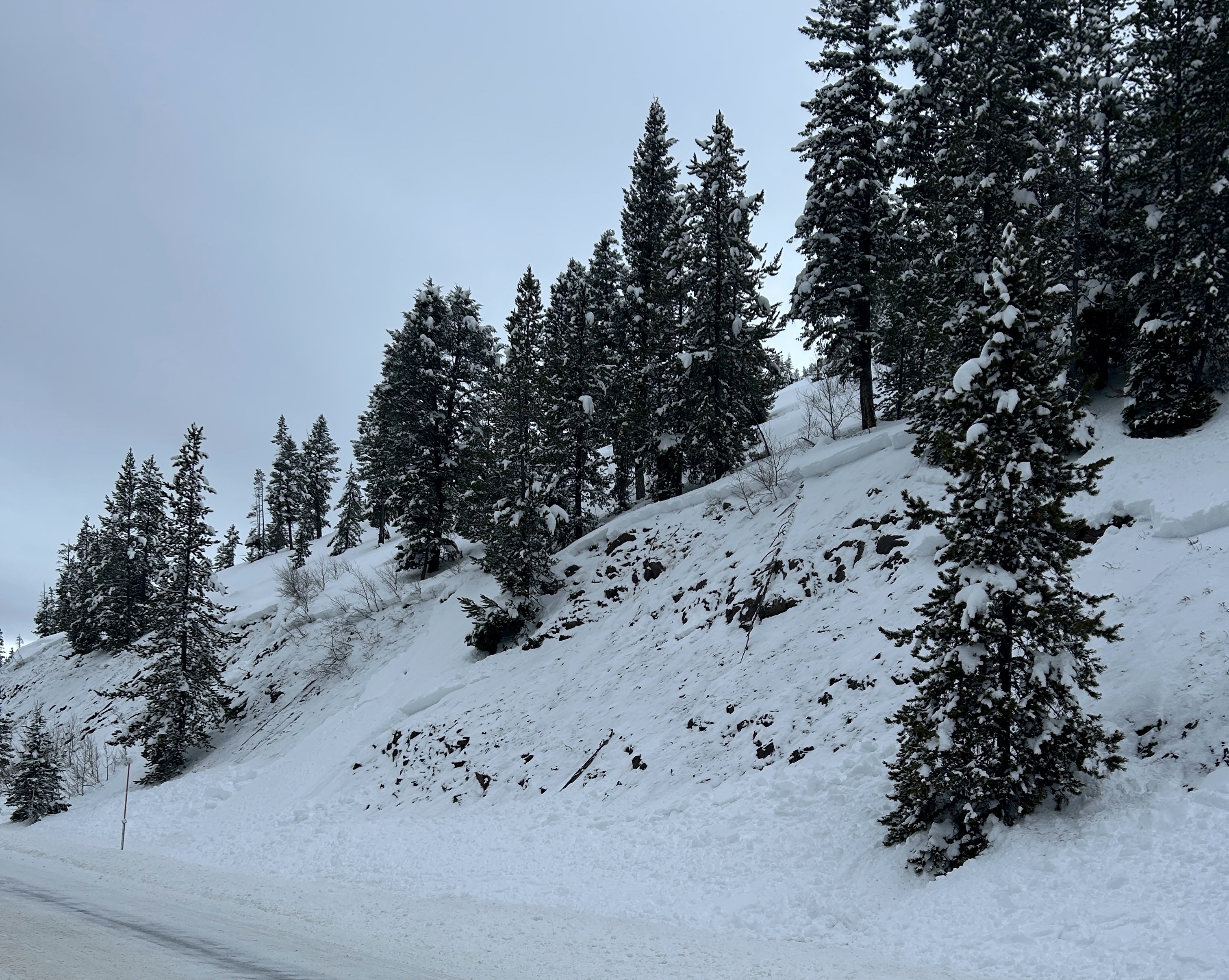
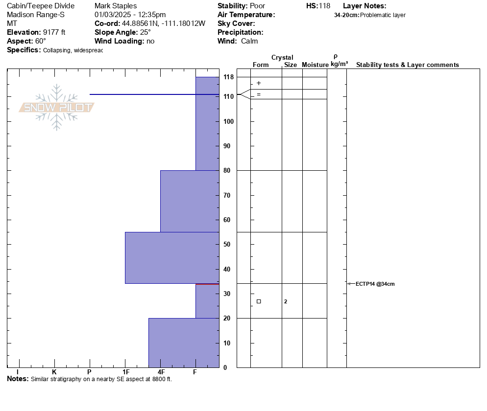
Snowpack
- Depths ranged from about 1m to 1.5 m. The snow really got shallow as we rode west and down the cabin creek drainage. Above 8800ft and closer to the Teepee/Cabin divide, coverage was great.
- The layer of facets from early December is much weaker where the snow is less than 1 m deep and gaining strength where the snow is around 1.5m deep.
- Conditions didn't seem dangerous. Remotely triggering a slide seems very unlikely. The odds of triggering a slide on those facets seems pretty low but still something that could happen.
- What mainly felt dangerous is letting your guard down. With tracks everywhere, sunshine, great traction, and supportable snow, we felt that it would be easy to be complacent. If an avalanche happened, then we'd be unprepared.
- The odds of triggering a persistent slab avalanche will continue to step down unless there is another loading event (ie - more wind and snow).
Moving foward
- The danger and avalanche conditions will be dependent on weather. A small amount of snow and very cold weather is expected in the next 5 or so days
- Wind could still form more wind slabs
- The inch or two or three of snow that could come Fri/Sat will be subjected to bitter cold weather and could create a new faceted layer...time will tell
- Continue to maintain safe travel practices: exposing only one person at a time to avalanche terrain, having everyone else watch from a safe location, ensuring everyone has rescue gear and knows how to use it.
Overall impression - The snowpack in this area probably isn't as stable or strong as it is in the Northern Madison Range closer to Big Sky. The snowpack is probably stronger and more stable than on Lionhead.
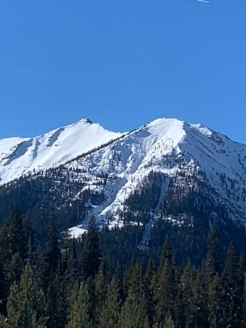
Full Snow Observation Report

This avalanche was spotted from the air on Wednesday, Jan 15 on Red Mountain in the southern Madison Range (just west of Ernest Miller Ridge).
It appears to be on an east facing slope at around 9800 ft.
Full Snow Observation Report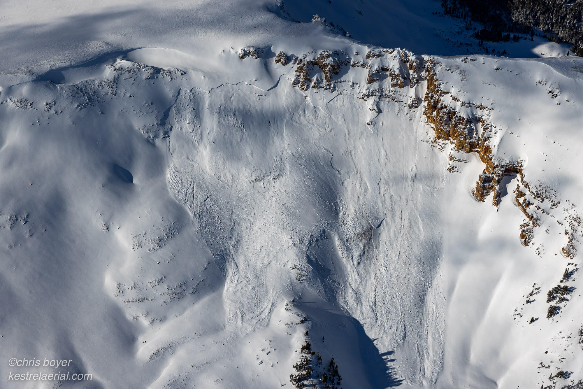
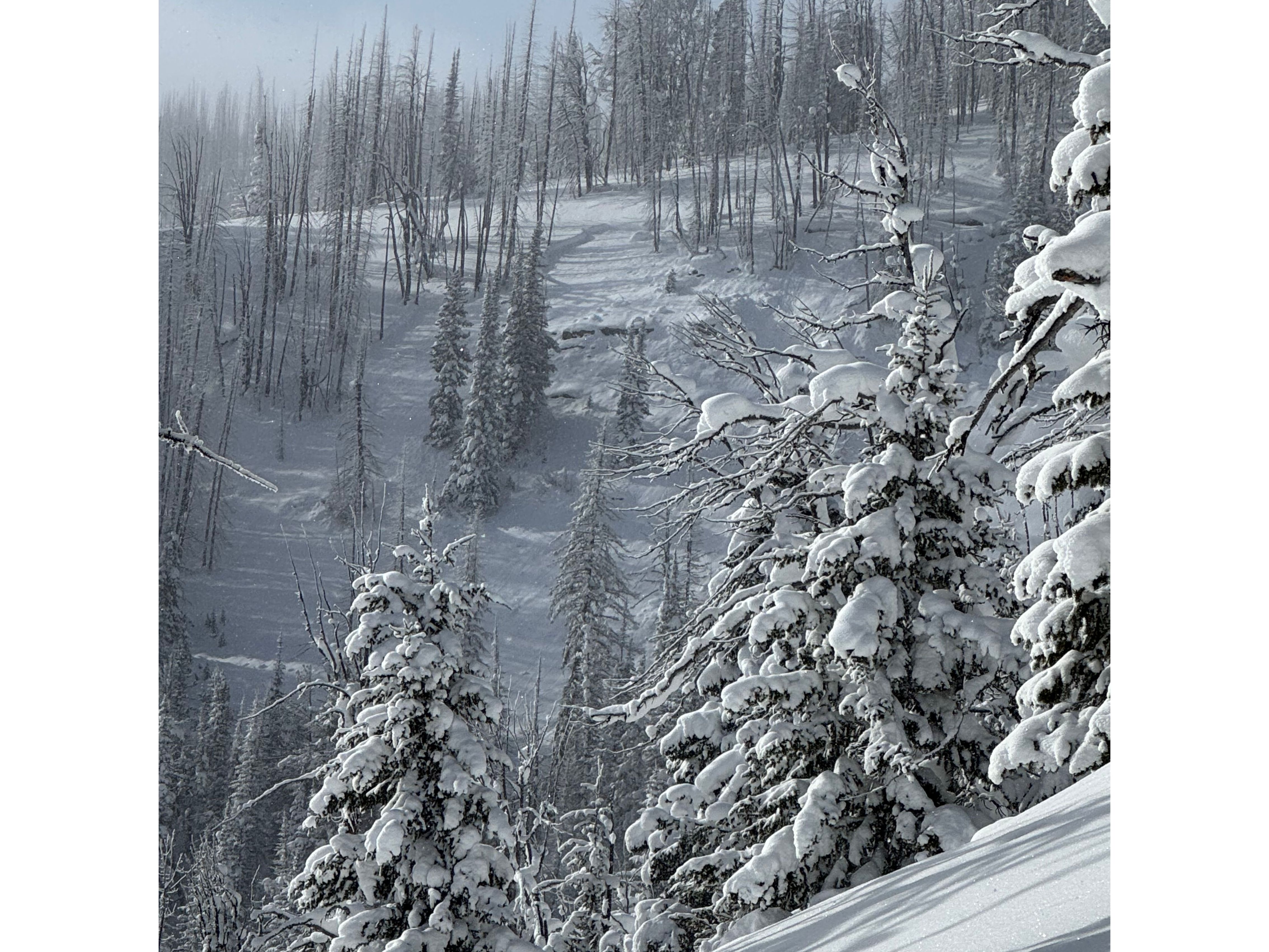
While driving to and from West Yellowstone today, I noticed what is potentially a skier/snowboarder triggered avalanche on the east side of HWY 191 on a West/Southwesterly aspect, directly across the highway from the Bacon Rind Area and Snowslide Creek. There were numerous tracks through steep rocky chutes next to the road, one of which had avalanched perhaps 75' wide, 18-24" deep, and running nearly to the flats at the base of the slope. Judging by the thin layer of fresh snow it potentially happened on Sunday or maybe Monday. There were tracks through the cliffs above the slide and coming out of the slide.
Full Snow Observation Report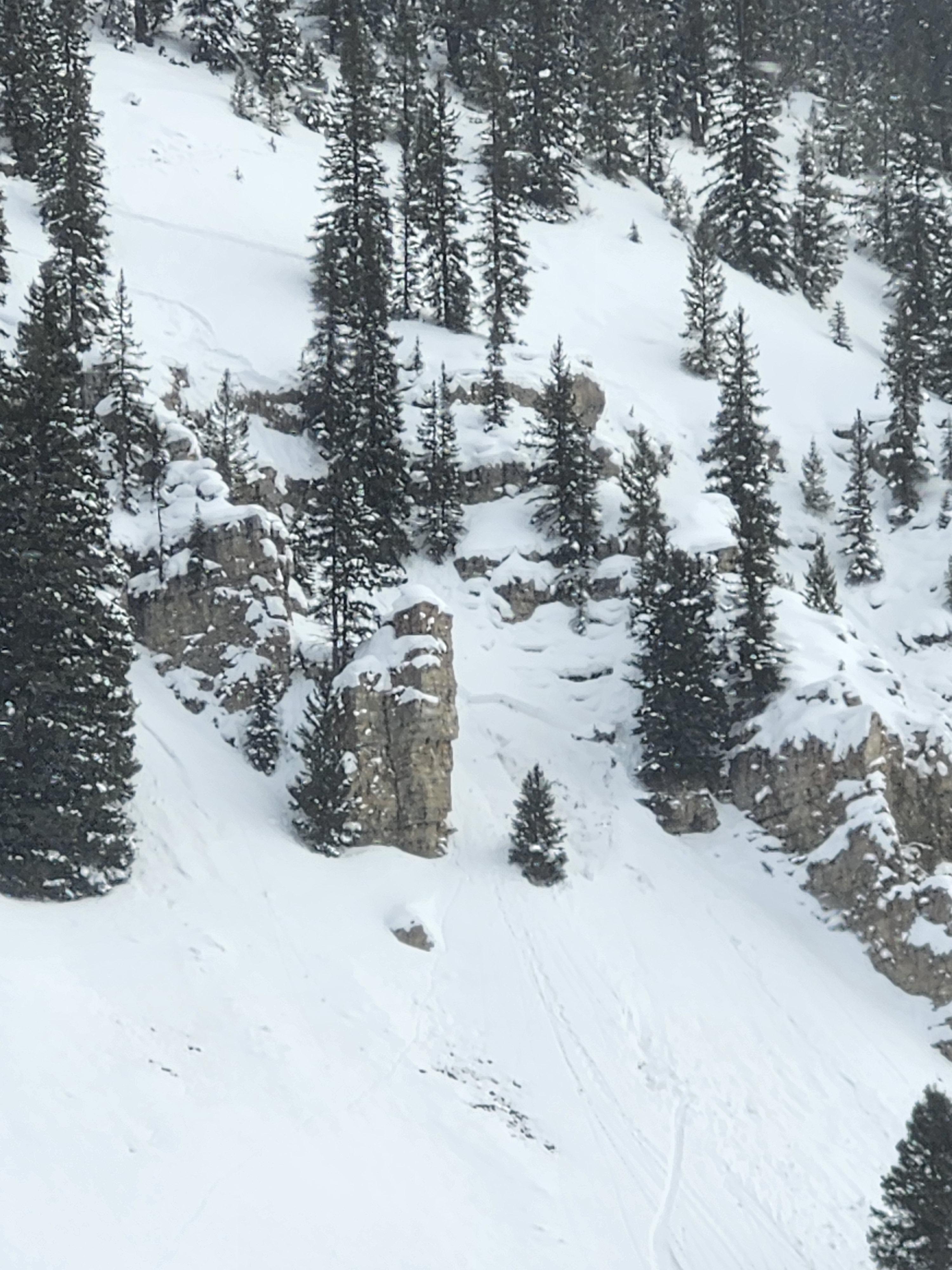

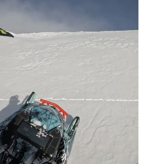
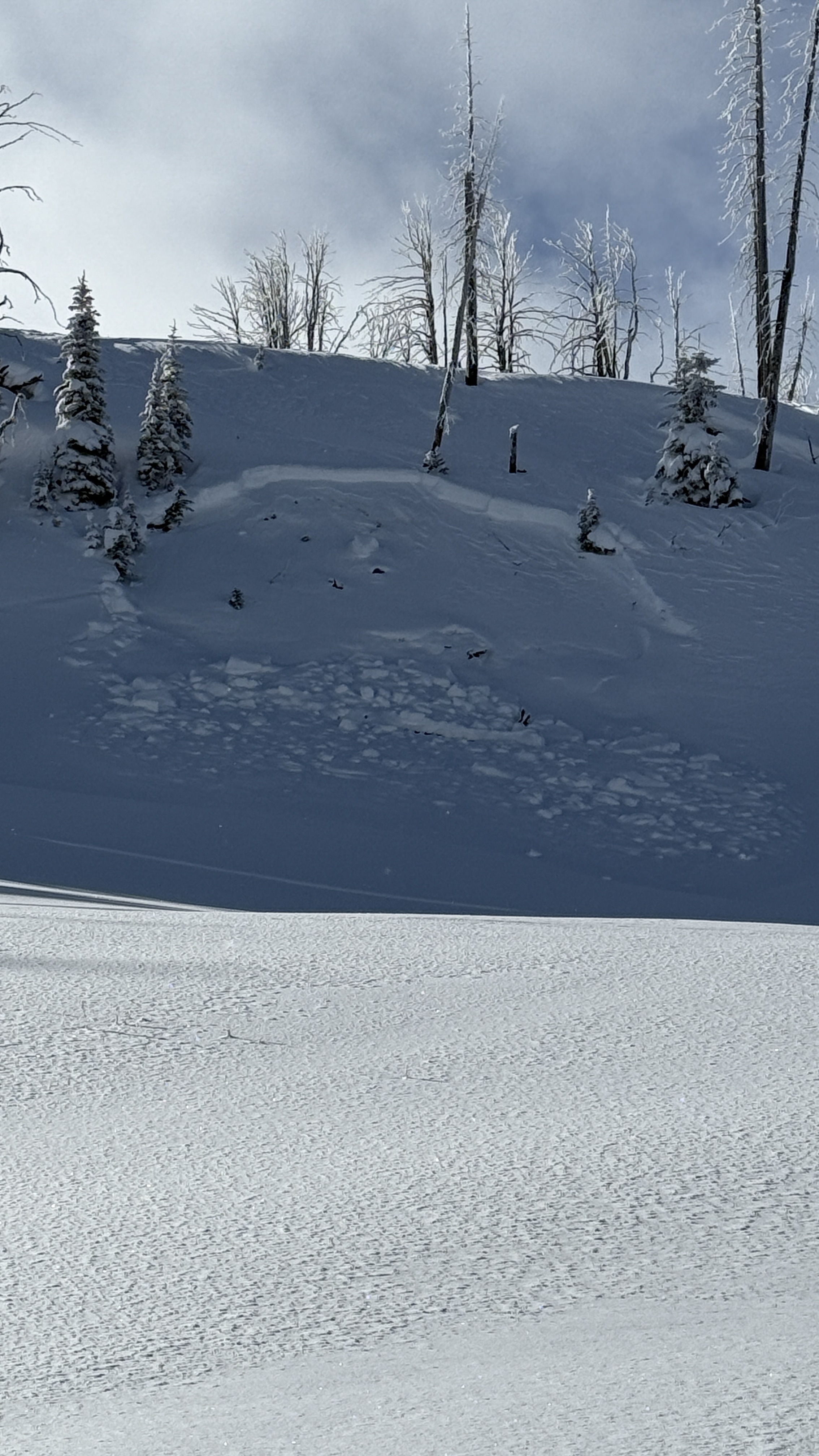
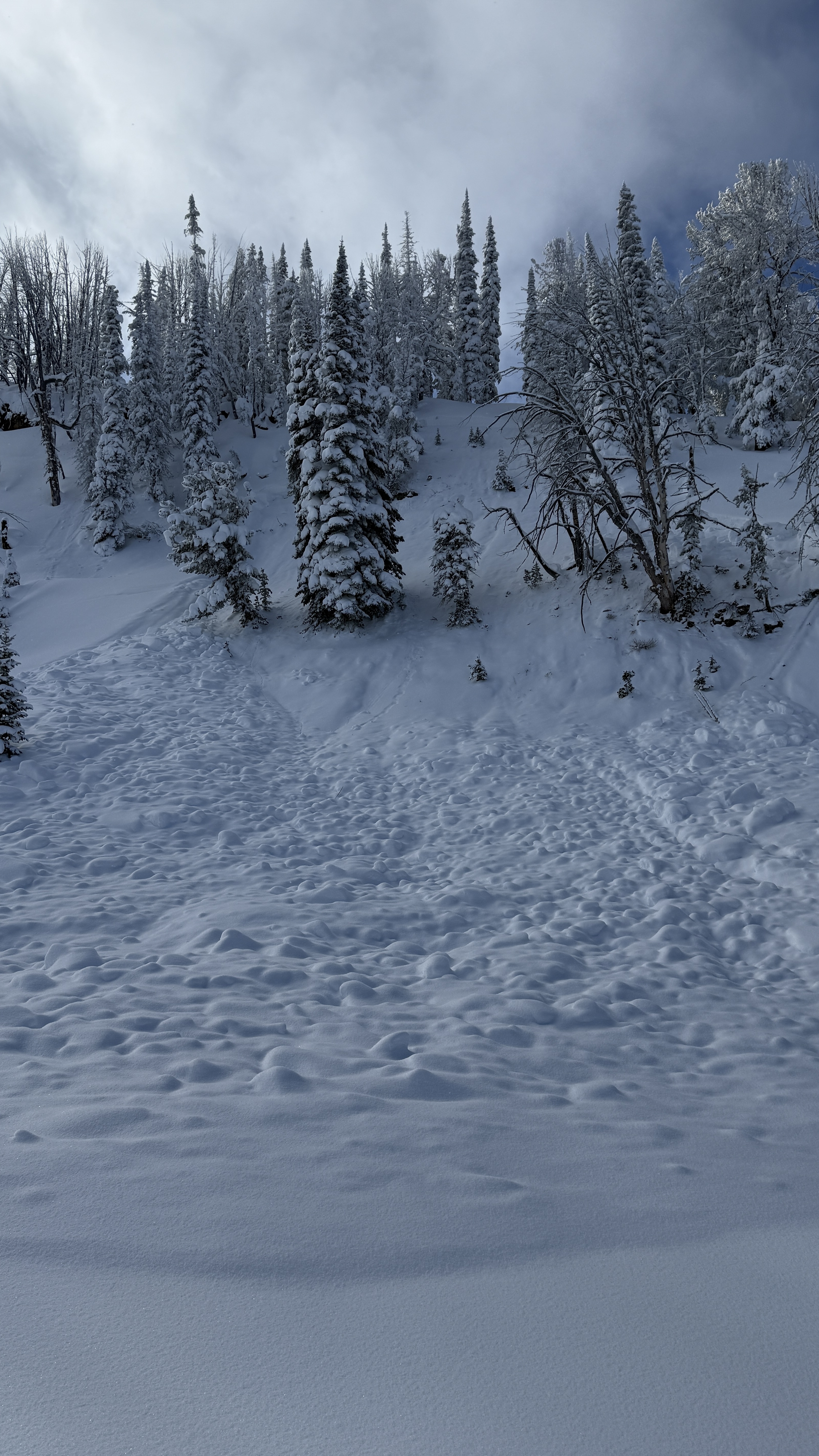
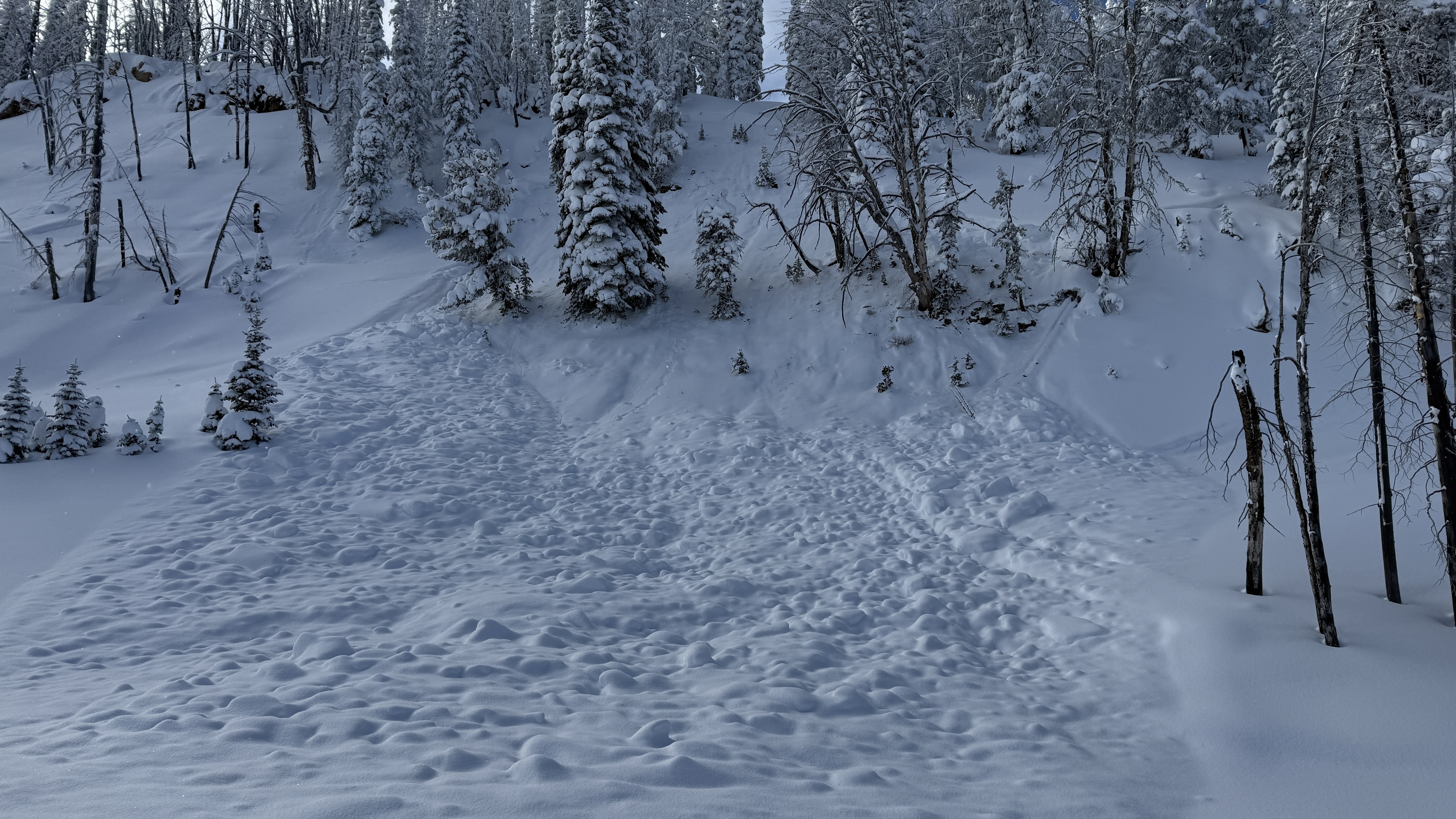
Travel conditions have improved significantly since the last time we were at Bacon Rind, unfortunately, avalanche conditions have not. Similar to what Dave and Alex saw yesterday in Lionhead, the snowpack on Bacon Rind is shallow and has well-developed persistent weak layers near the bottom of the snowpack.
While ascending the burn, we triggered so many thunderous collapses that we quickly lost count. These collapses shook snow off the trees around us and visibly dropped the snow surface beneath our feet. Near the top of the ridge, we saw a large avalanche (SS-N-R3-D2-O) that broke on a north facing aspect, around 2' deep, on weak snow near the ground. It was not clear whether it was one large avalanche or two that released sympathetically with one another. If one slide, this avalanche broke nearly 900' wide and slid around 1000' vertical. It broke during the most recent period of intense loading in this area, likely January 5th or 6th.
When we reached the top of the Skillet and dug a snowpit, we noticed that the upper portion of the path had cracked and shifted in numerous places but had not avalanched. Our snowpit on an east aspect showed a 2' dense slab on top of sugary facets and depth hoar. Our test result was ECTP 13. We also dug a pit on a south facing aspect and noted shallower snow that was slightly stronger than the other aspects we had seen thus far (north and east).
Given all these clear signs of instability, it was an easy decision to stick to terrain less than 30 degrees, including runout zones.
S-1 snowfall most of the day, with calm winds. Skies began overcast and cleared throughout the day.
Full Snow Observation ReportThe avalanche danger felt nothing but CONSIDERABLE today.


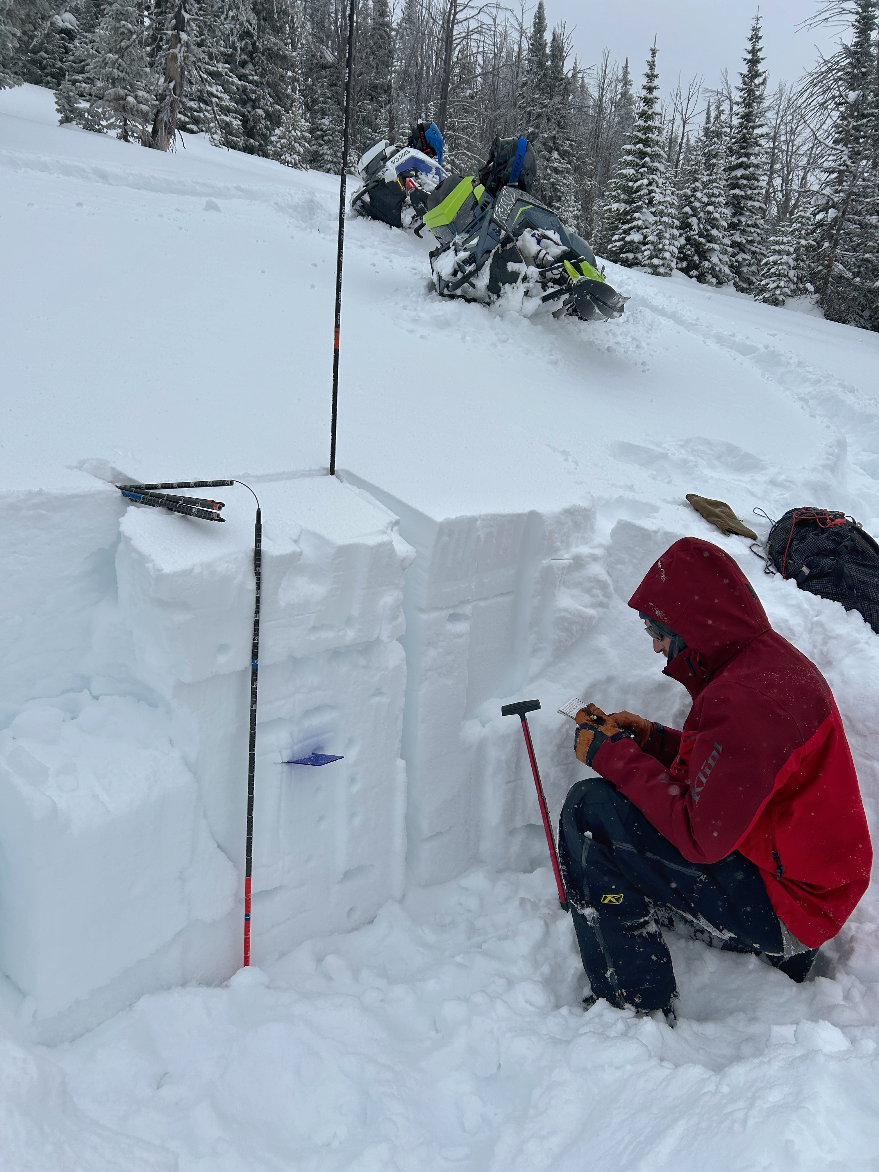
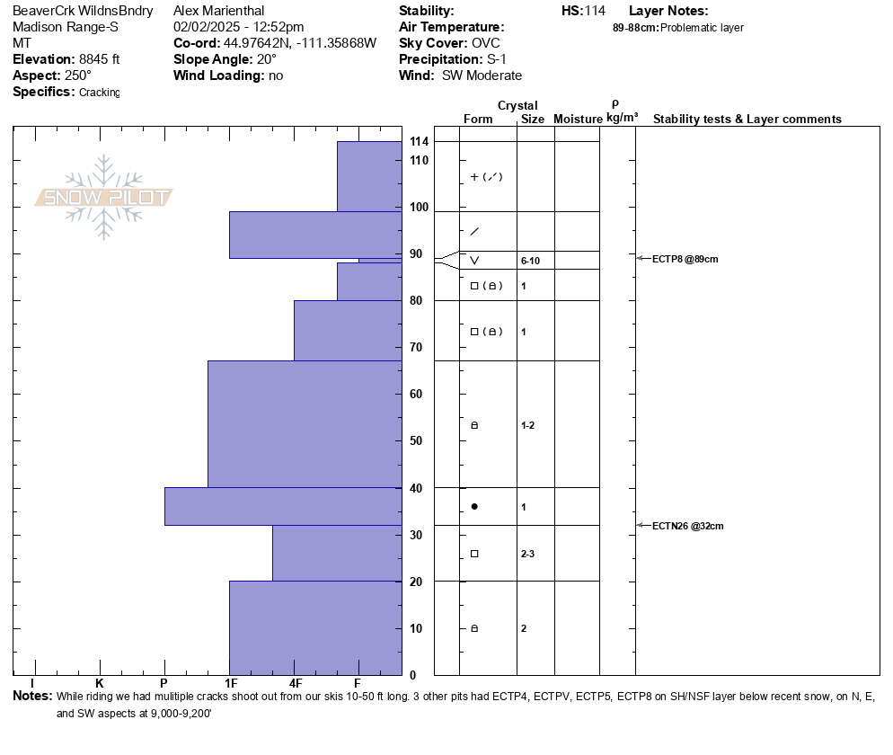
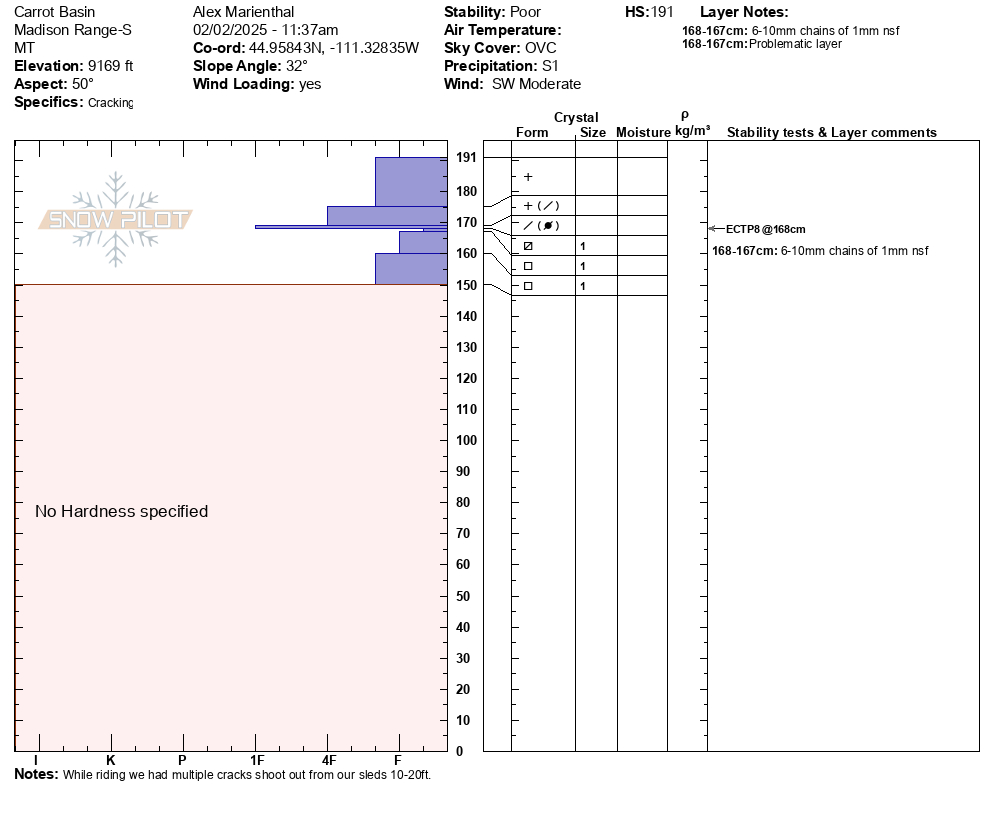
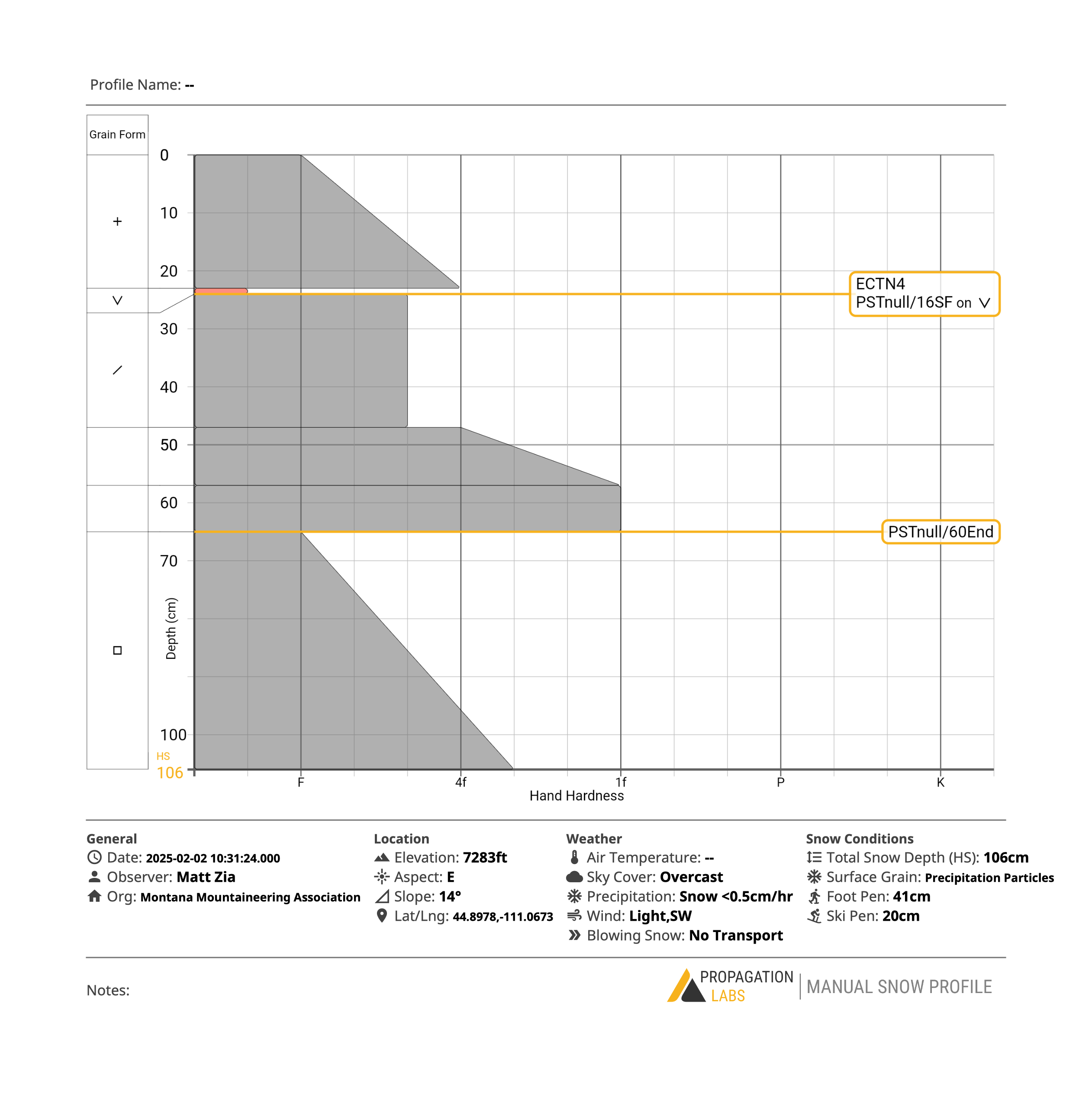
We rode into the Taylor Fork today to check out conditions after the new snow from the last two weeks. We traveled up to the weather station above Sunlight Basin, along Sage Basin to the the Beaver Slide, and through Carrot Basin to the wilderness boundary.
No cracking or collapsing was noted today. We did note two small avalanches along the Carrot Basin headwall from sometime in the last two days that broke on weak snow near the ground. These areas looked to have a shallower snowpack. Besides old crowns previously reported, and these two slides, we did not see any new avalanches in the area.
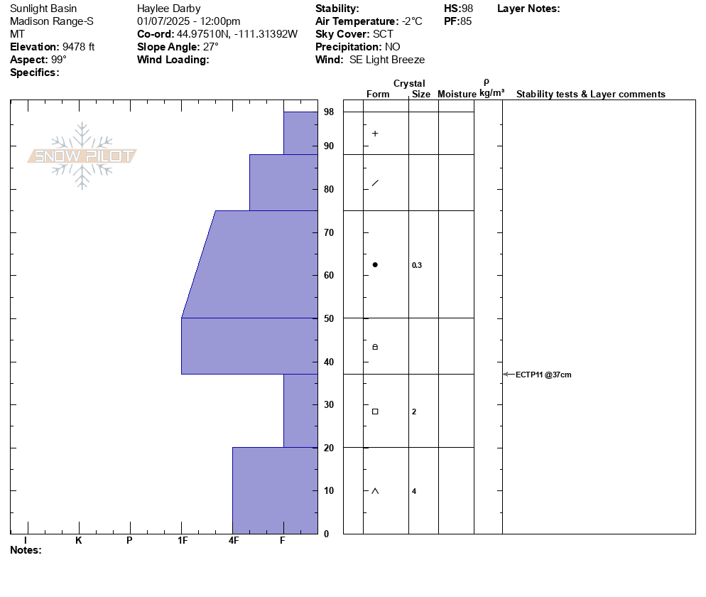
Near Sunlight Basin, we performed a snowpit test on an east aspect at 9480' (HS 98). It propagated (ECTP11) on weak, faceted snow near the ground. Our second pit, at the wilderness boundary, was on a south aspect at 8840' (HS 122). It propagated on weak snow below a melt-freeze crust near the ground (ECTP24).
With blue skies, sunshine, and a lack of cracking and collapsing, it was easy to be lulled into a false sense of confidence about our snowpack. But with a loading event ending only yesterday and our unstable test results, we chose to reign in our enthusiasm, follow a conservative travel plan, and stick to riding lower-angle powder.
Full Snow Observation Report


Group from Wisconsin spotted 3 very fresh avalanches today. 2 for them near Red Canyon and 1 near Whites Peak. No other info. Might get photos tomorrow.
2 other slightly older slides spotted
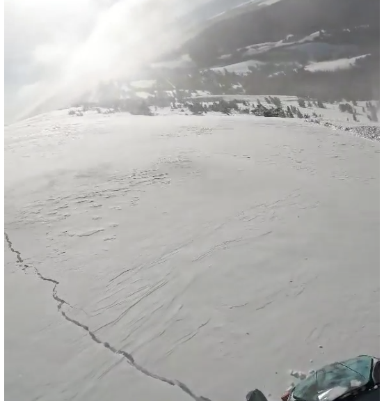
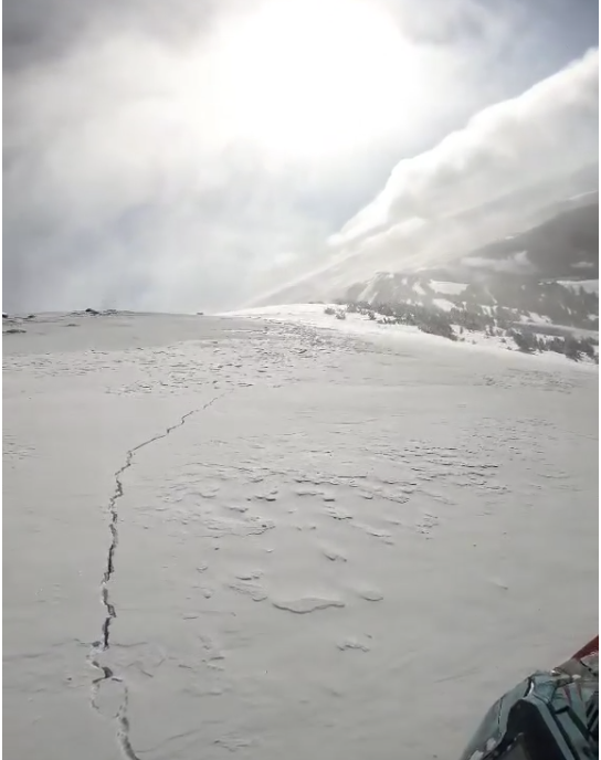
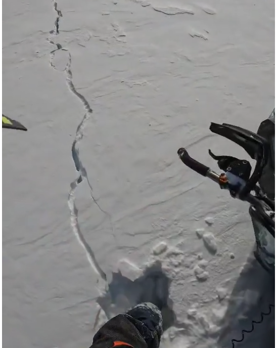
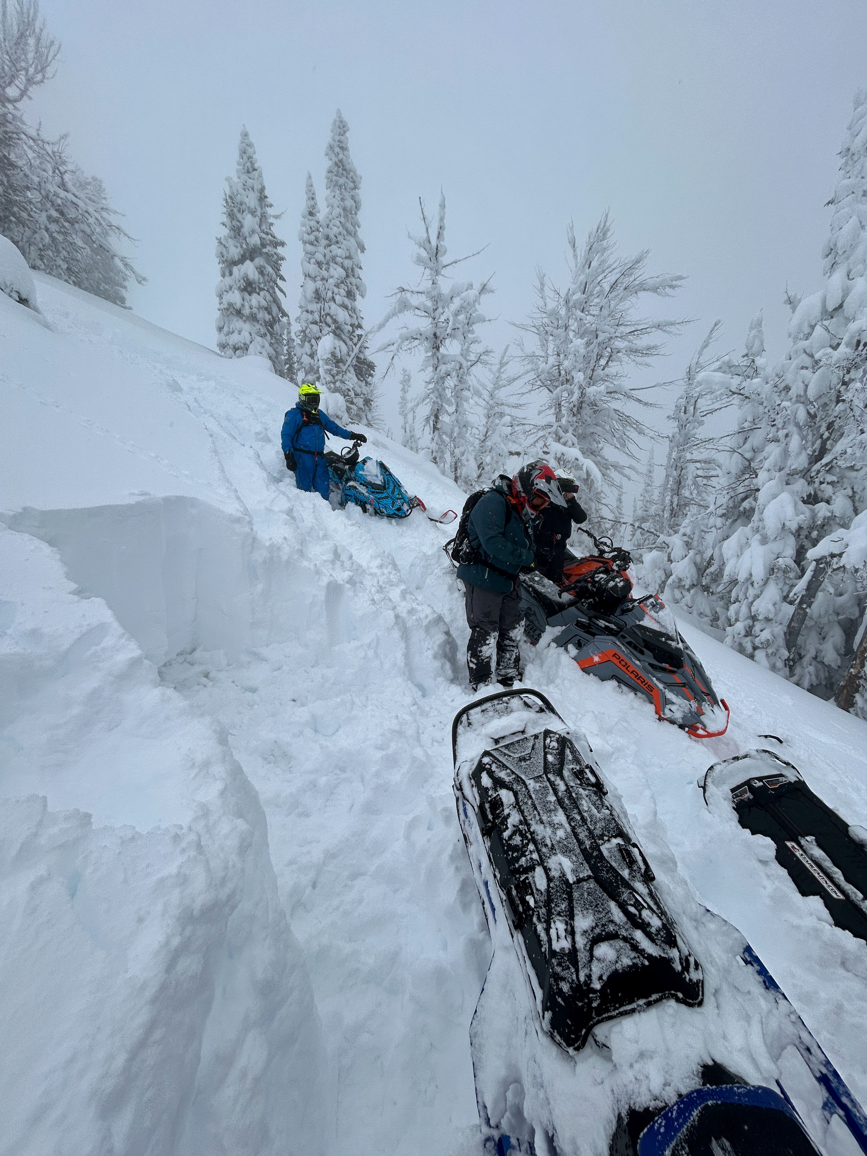
Full Snow Observation ReportToured up northwest of the bacon rind trailhead to the ridge. Did two pits, both with similar failures on the buried weak layer during ECT. Pleasant skiing in low angle terrain. Roller balls made an appearance down low @ 7400”.
Pit 1
44.96190, -111.08941
95cm snow depth ECTN21. Failed on faceted snow that existed 23-35cm above the ground.
Pit 2
44.95982, -111.09903
100cm snow depth
ECTP17. Failed on faceted layer 30cm above the ground.
sugary fist snow 20-30cm above the ground; somewhat consolidated 4F storm slab 30-60cm; powder fist snow 60-95cm


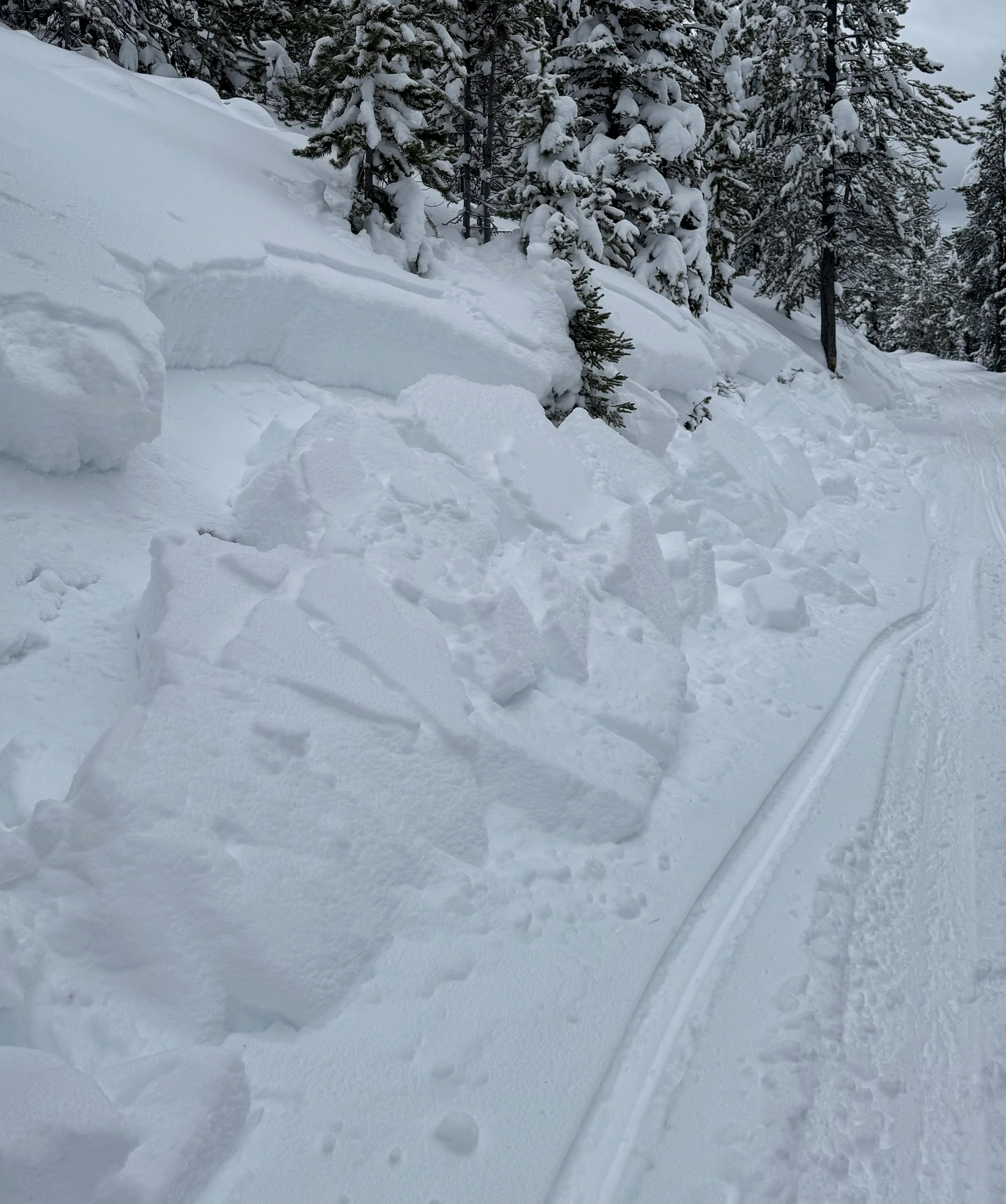
We rode to the divide between Cabin and Teepee Creeks and then the fog/clouds set in and we couldn't go higher or further out.
From the moment we left the trail there was WIDESPREAD collapsing all day long. Snowpits were consistently 3-4 feet deep and the weak layer usually a foot above the ground. At higher elevations, I suspect that the weak layer is closer to 2 feet above the ground. Because of the widespread collapsing and very bad visibility, we were hyper-aware of slope angles so that we didn't inadvertently get on or under avalanche terrain.
Small slopes at low elevations were avalanching including some along Hwy 191 in YNP. It's always a bad sign when road cuts are avalanching.
We stayed away from ALL AVALANCHE TERRAIN.
The good news - the powder is incredible, the coverage is excellent, and this snow is exactly what we need to heal the weak layer. Unfortunately, avalanche conditions have to get worse before they get better.
Full Snow Observation Report
Considerable danger certainly covered it today. With any bump in snowfall or increase in winds, I wouldn't hesitate to go to HIGH danger.

We observed many large whumps and shooting cracks while headed up the meadows of Cinnamon mountain today, several of which were large enough to shake nearby saplings. These collapses were likely triggering on the recently buried layer of basal facets. Conditions included warm temps, light SW winds, overcast to obscured cloud cover, and S-1 to S1 precip including steady graupel. Nothing particularly surprising considering the conditions in nearby areas, and we chose to keep our terrain choices conservative.
Full Snow Observation Report