Snow Observations List
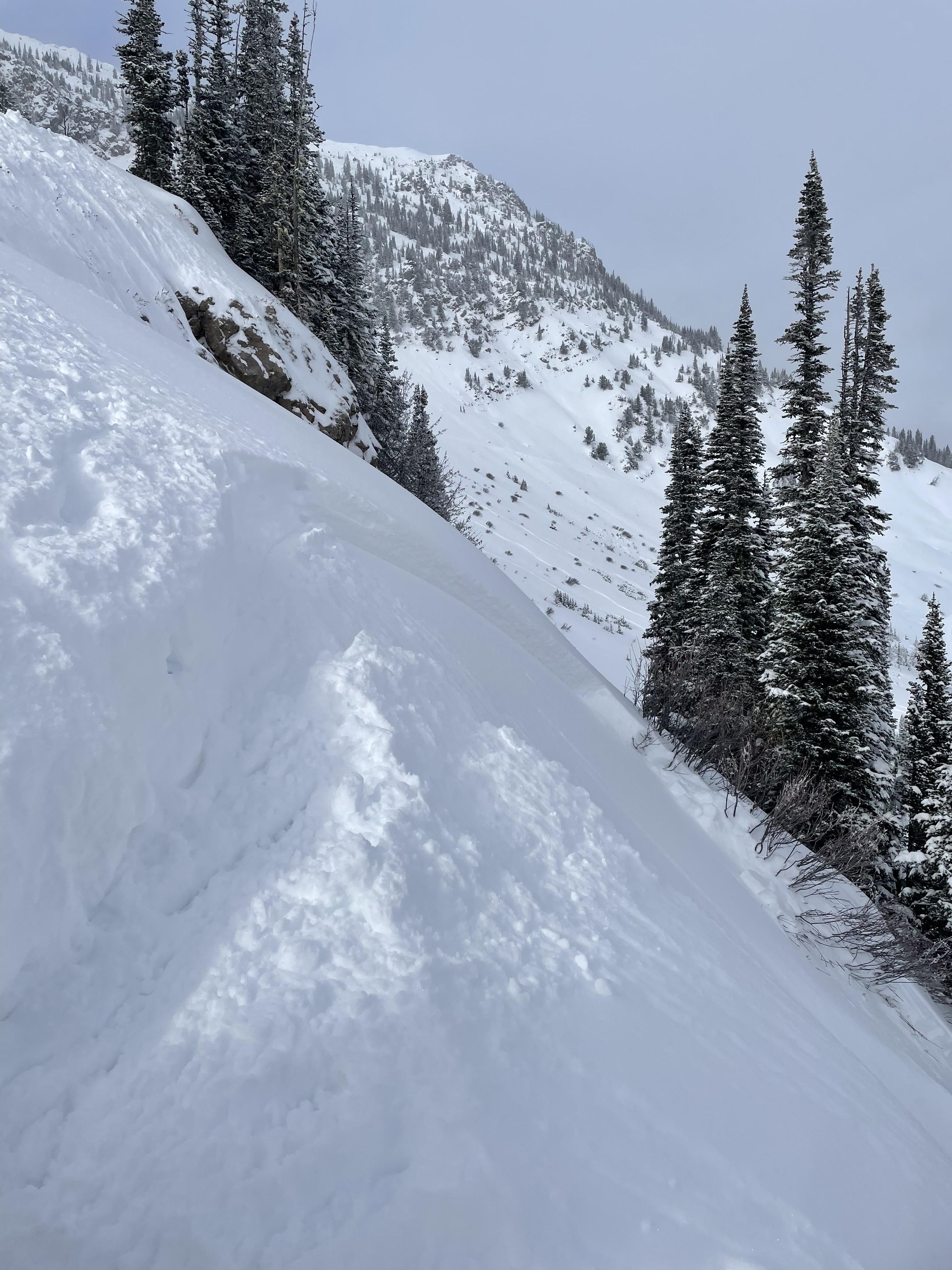
My partner and I snowmobiled into the Taylor fork up to the base of Shedhorn Mountain where we began ascending the E aspect on skis. On the way up, SW winds were gusting in the moderate range and there was active wind loading visible on the ridgeline. We chose to make our way up one of the main avalanche paths and observed a definitive faceted weak layer below more recent new snow. In November, I had observed this weak layer while it was forming, so I was not surprised to find it.
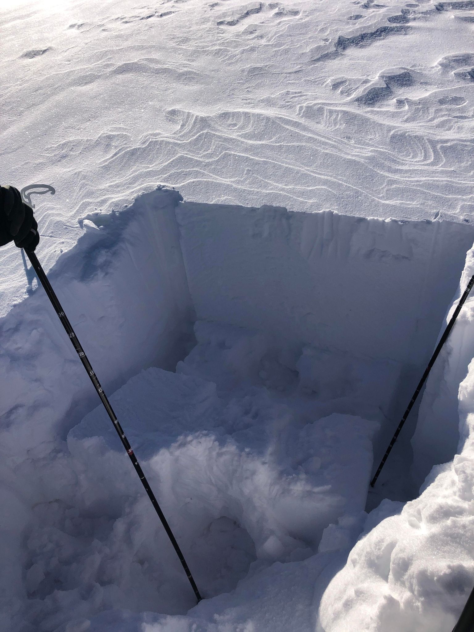
On a due east aspect at 8972', we chose to dig a quick test pit in lower angle terrain before traveling higher on the slope and exposing ourselves to the steeper avalanche terrain above that had evidence of somewhat recent D1-1.5 avalanches. Our pit showed a snow depth of 80cm and a definitive weak layer below recent new snow. Our results were encouraging, ECTN16, and we skinned up to treeline and skied the lower angle slopes below.
Full Snow Observation ReportWe rode from Sage Creek trailhead to the weather station. After we got everything installed, we headed to Sunlight Basin to dig. There was about 12-15 cm of new and wind drifted snow. On the walk to the pit location we noticed the snow was punchy. HS was 94 cm on the E aspect. We got an ECTP 13 on a layer of 2 mm facets 44 cm down from the surface. New and wind drifted snow put a substantial slab on top of this weak layer. After we dug our pit visibility improved, and we saw a R1-D1 across the bowl that looked recent. While sledding around the area we noticed faceted snow in the middle of the snowpack in multiple locations.
Full Snow Observation Report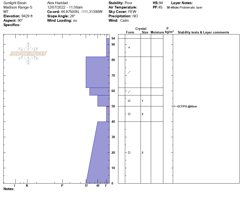

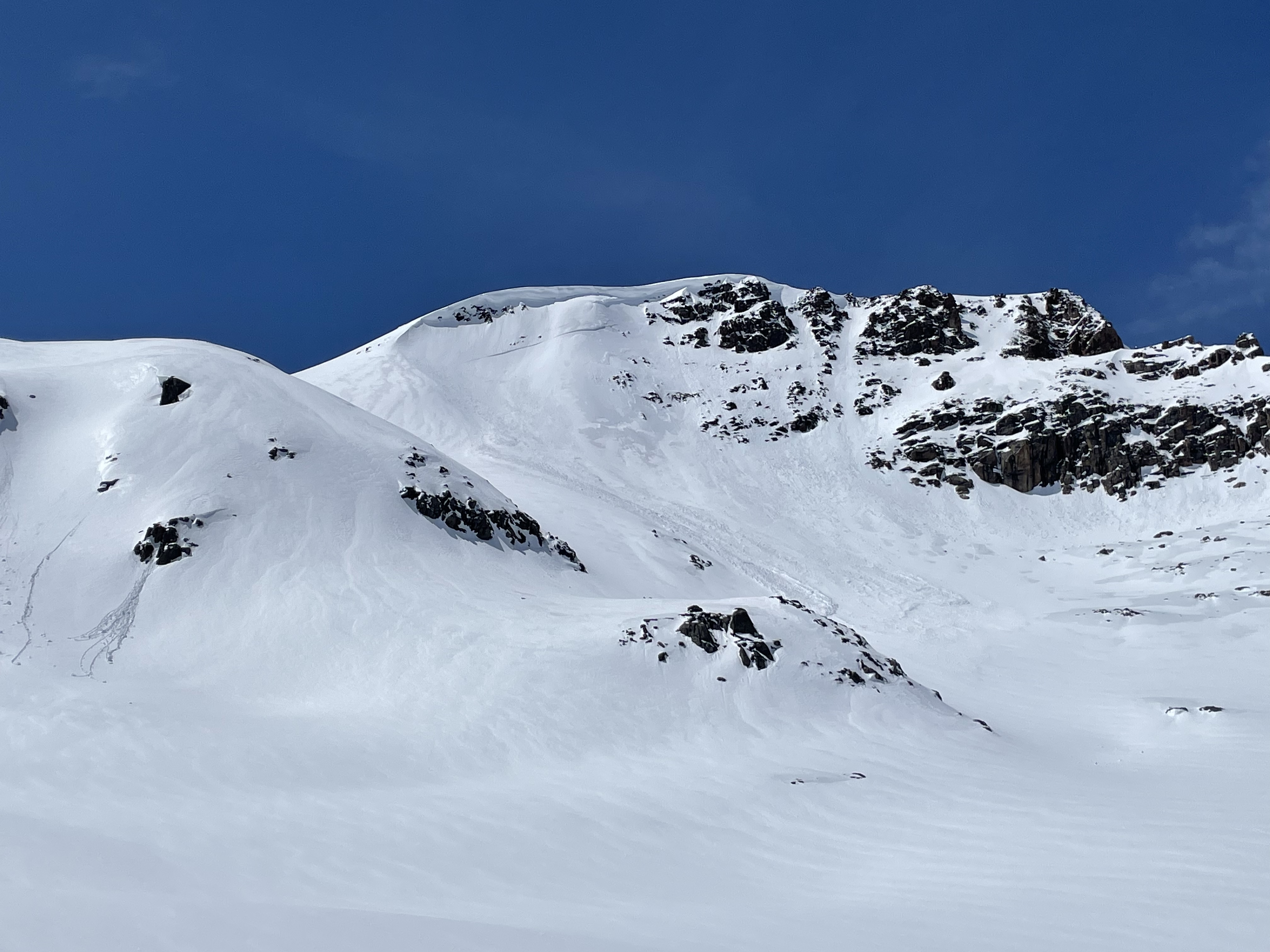
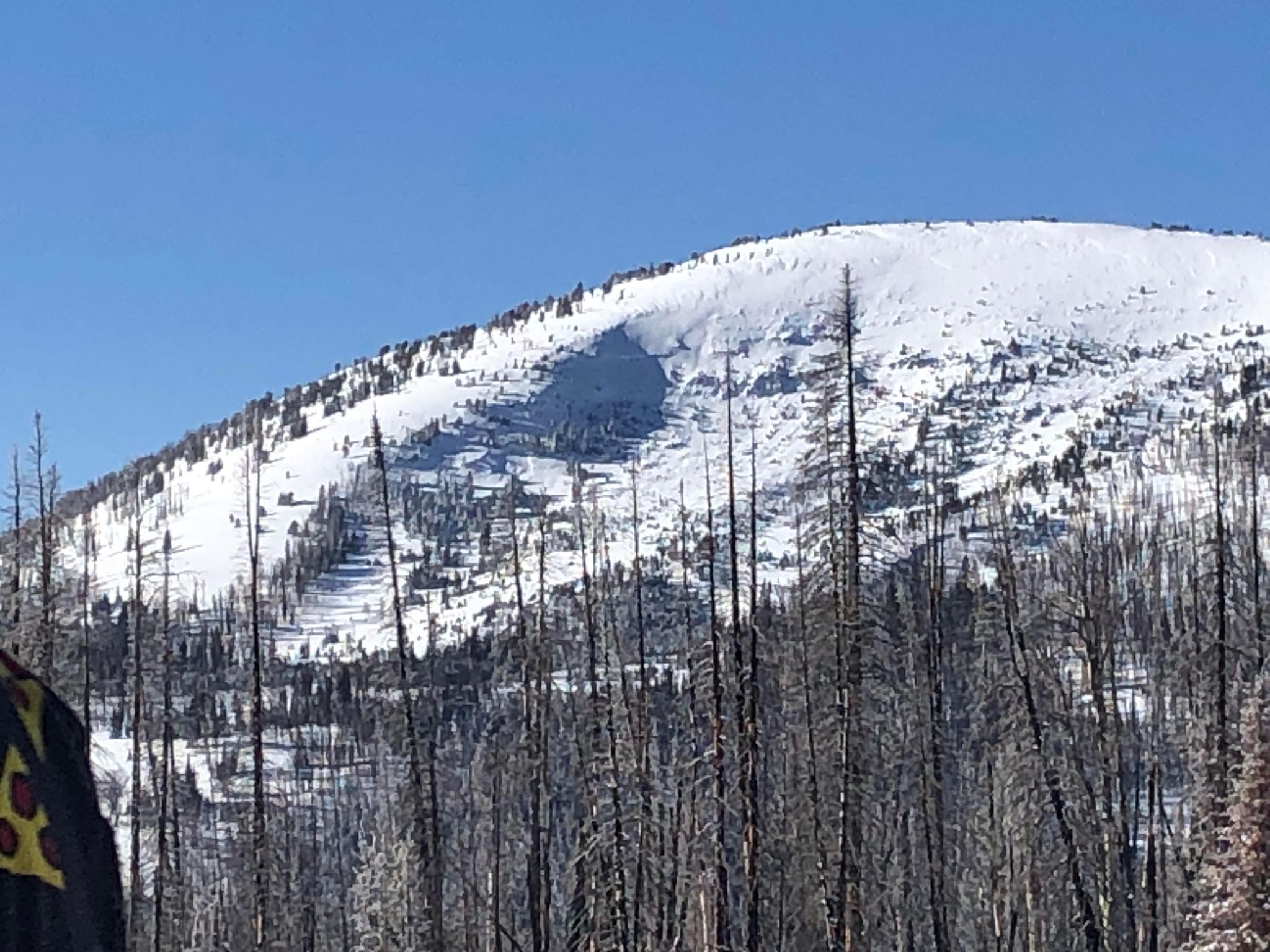
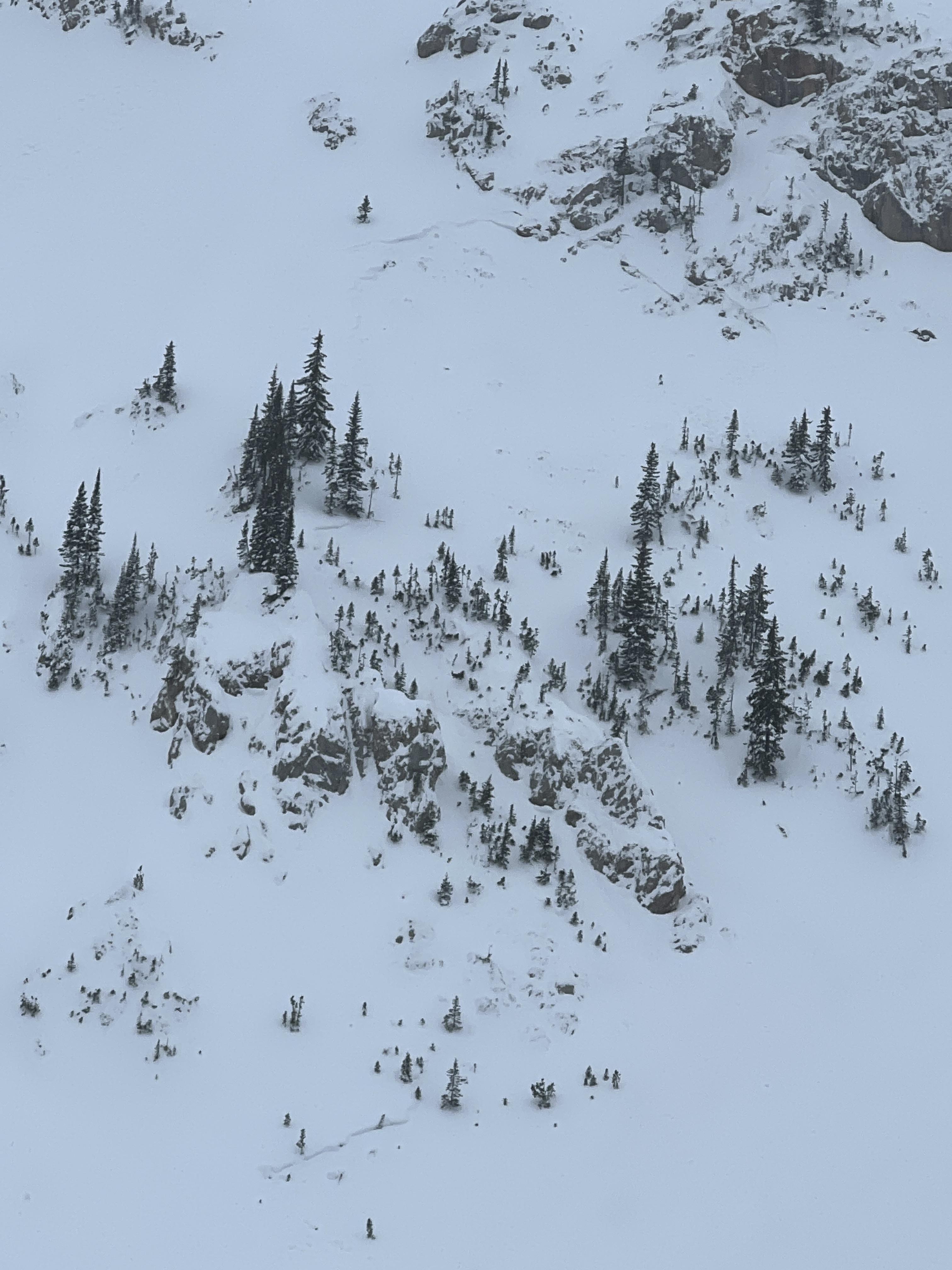
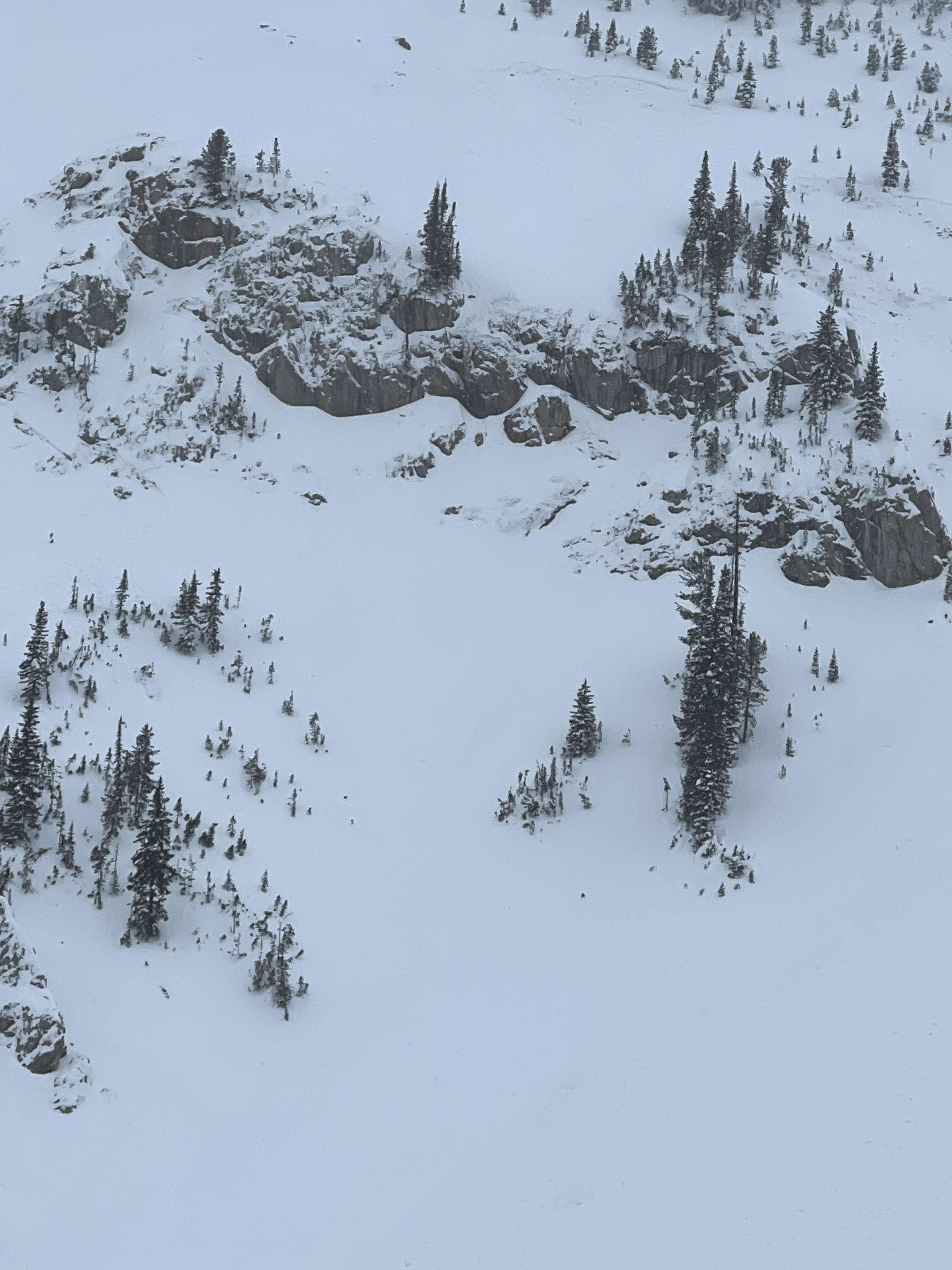
Toured up to Bacon Rind today and skied meadows off of the ridge. Noted many collapses and whumpfs in the snowpack as we ascended east aspects to the ridge. Looking toward Ernie Miller ridge, we noted an old crown in the main bowl just below the summit. It was on an E-NE aspect, 200 or more feet wide and looked to be filled in with new snow but was still visible. Looking east from the top of the ridge, we noted another crown on a west aspect that looked to be about 100' wide and deep.
Dug a pit at 8700' on a W aspect. HS was 70cm. We got an ECTP12 45 cm up from the ground at the interface between wind packed snow and a layer of .5-1mm facets and mixed forms. That layer made up the bottom 45cm of the snowpack in that area.
Dug another pit at 8800' on an E aspect. HS was 115cm. We got an ECTP 14 50cm up from the ground on that same interface as described above. The bottom 50cm of the snowpack looked to be facets and mixed forms. The upper 65cm in that area was a mixture of different layers of wind packed grains that ranged from F to 4F hardness.
Coverage on the descent is adequate, similar if not better than any point midwinter last season. Under skis, the snow in the burn/forest feels unconsolidated and very sugary.
Full Snow Observation Report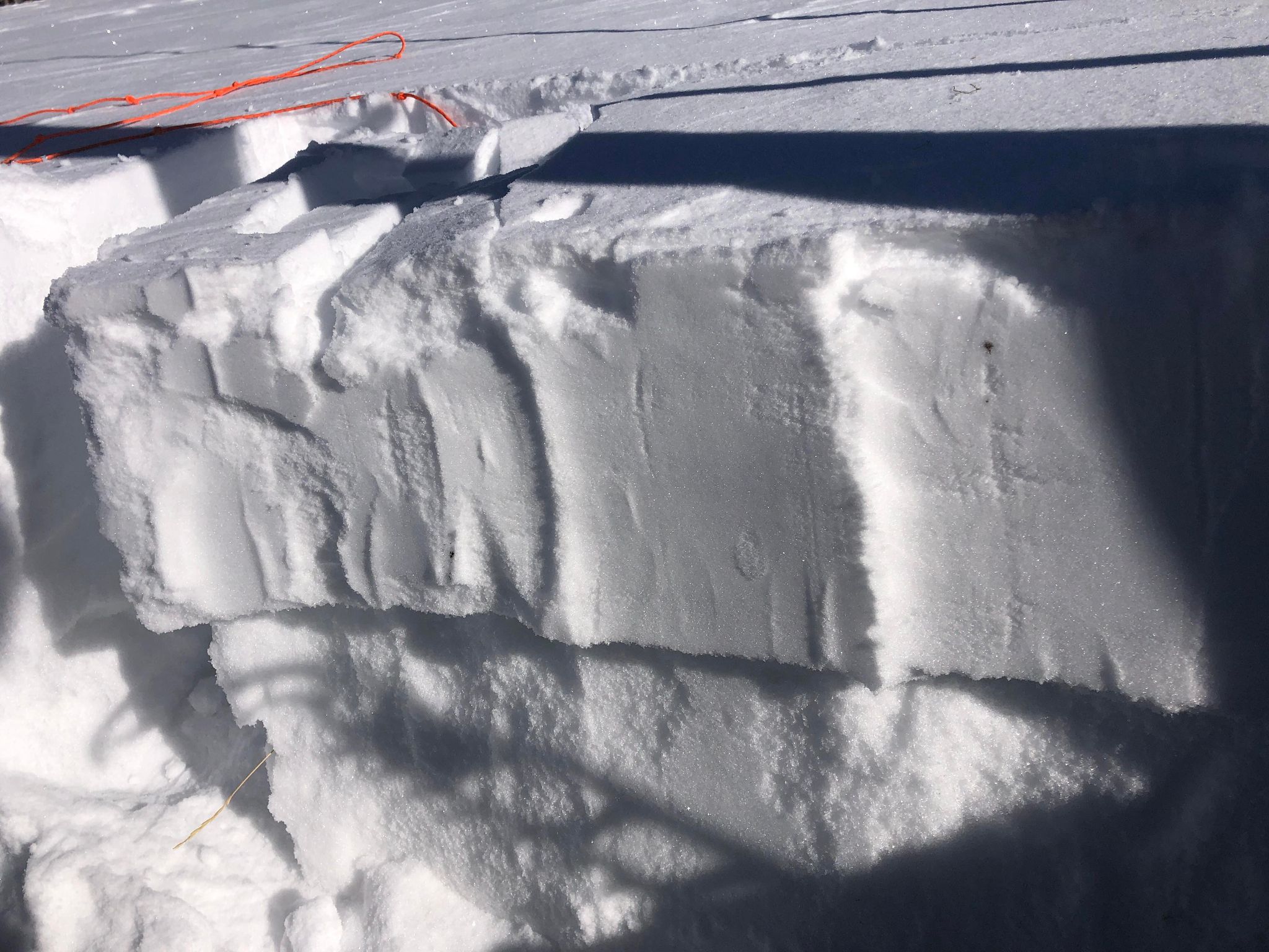
We toured to Ernie Miller today and saw a natural avalanche on a NE slope around 9600 ft. We heard and felt multiple collapses on our way in. We dug a pit on an east facing slope around 9300 ft where we found 105 cm of snow. We got a ECTN 2 result, failing on an interface about 15cm from the surface and ECTP5 failing 40 cm from the surface.
Full Snow Observation Report
We observed no natural avalanches or overt signs of instability, although one group in the parking lot mentioned seeing a small slide south in Sage Basin past the Otter Slide. The foot of new snow was wind affected. Human-triggered avalanches in the new snow and wind slabs were possible. These will stabilize in the next few days unless there is continued loading.
We dug in Carrot Basin and on the slope up to the weather station. We did not find the weak layers of surface hoar or near-surface faceting like at Lionhead Ridge. I am not convinced it doesn’t exist anywhere, but it does not appear to be widespread. Test results were ECTN 11-15 under the foot of new snow.
Full Snow Observation Report

ECT Results - ECTN 11 at 55cm
Location: Bacon Rind, Skillet, about the center of the upper skillet meadow, approx 100' below the ridge line N 44deg58.3210' W 111deg05.8191
Weather: Temp ~25F, cloudy, moderate snowfall, winds mild in trees, moderate winds on ridge line
Heading: E (110deg)
Elevation: 8890
Slope Angle: 34deg
Total Snow Depth: 110cm
We observed about 50-55cm of new and wind deposited snow on the eastern aspects that we assumed had been from snowfall/wind over the last week. This new snow layer was generally F hardness. The new snow was weakly supported by a 3cm thick faceted layer. The ECTN 11 result was due to this faceted layer collapsing. The remaining base snow pack was 50-55cm thick and approximately 2F hardness. We repeated the test 2x in the same pit by digging back and retesting, the faceted layer failed both times without propagation, the ECTN 11 result was clear in the second test, the first test was hard to interpret but allowed us to identify the problem layer. ECTX result on the remaining 55cm thick base snow layer.
Wind loading produced dense snow drifts that were prevalent along the ridge line, but in the protected east aspect meadows below the ridge line there was much less evidence of denser wind loading. We did not observe any whoomping either skinning up or skiing down or any signs of natural avalanches. We skied the east facing short meadow just south of the skillet, then skied the SW facing meadow to the west of the ridge line and lastly skied the skillet to the valley floor. As someone else reported earlier in the season the bottom half elevation of the run to the valley floor has many exposed downed trees and hidden hazards, personally I won't return to ski there until there is more snow depth at lower elevations. The SW facing meadow had a supportable suncrust layer, with a mix of 6"-24" of wind drifted new snow depth, depending on where/how the wind had scoured it.
Full Snow Observation ReportSkied bacon rind skillet & one gulley just south of it today
No avalanche activity, cracking or whumphing
No wind today up to 9000’; no evidence of recent wind-drifted snow
No new snow; Snowed s-1 all morning with no real accumulation (trace)
Average HS 60 cm at Skillet ridge top (approximately 9000’); 70 cm max depth
Faceted surface snow on cold aspects (skied well) and 3 cm thick crust on anything remotely solar
Dug one quick pit on E aspect at 8840’:
HS 60 cm
CT 13 Q3 down 17cm
CT 23 Q3 down 25 cm
ECTN 24 down 30 cm
Full Snow Observation Report
Yesterday toured up Bacon rind on the spur just to the south of the Skillet, dropped west towards Ernie Miller ridge and skied two laps on the N end of the ridge. We travelled back to the car on the same route and skied out the skillet.
60-70cm HS observed on E aspect at the top of Bacon rind Ridge
No Cracking or Collapsing observed all day
Great supportable skiing, didn't fall through to facets anywhere
pole probes felt uniform/generally right side up all day
1F zipper crust on the surface of anything solar
Full Snow Observation ReportLoud pow, obvious near surface faceting on most slopes, thin breakable sun crust on S aspects, wind affected on unprotected NW aspects at ridge line, ECTX x2, lots of deadfall, still too thin in many places for enjoyable skiing
Full Snow Observation Report
Dug two pits at Bacon Rind today. Very similar snow structures in both. Shallow and weak but not unstable.
Skied a number of laps in the southern meadows and out the skillet at the end of the day. No signs of instability were noted. Skiing was pretty good.
A number of Avalanche Crowns on an east aspect at 9500 ft.
Full Snow Observation Report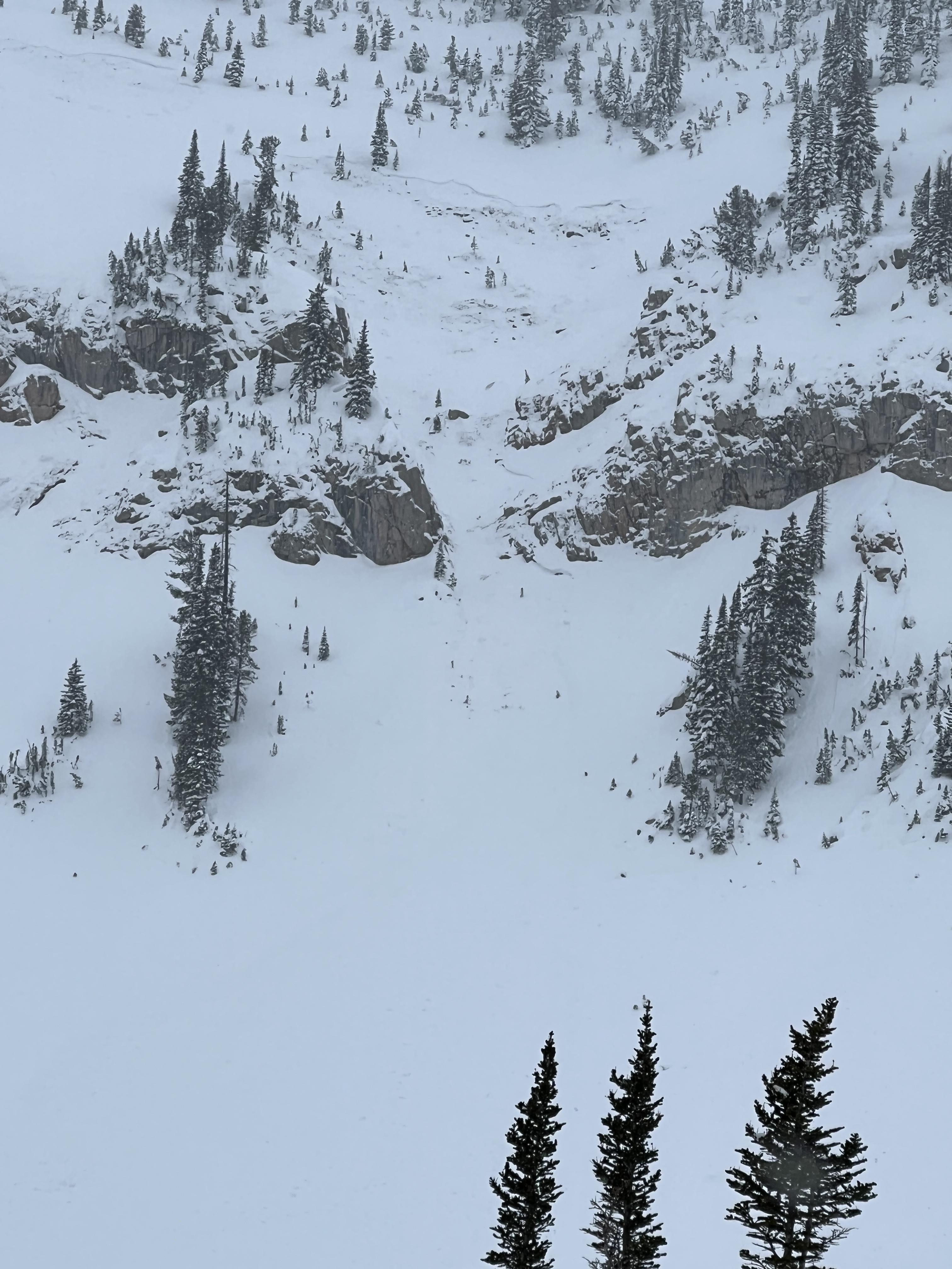
Dug a pit at the bottom of the upper meadows at Bacon Rind. 8700ft, got no result for an individual column or extended column, even a shovel shear produced no result. New snow from last weeks storm cycle bonded very well to the old snow from the first October storm. 60-80cm in upper meadows without much of any wind effect.
Full Snow Observation Report
Strong temperature inversion in the AM, -4F in the meadow and about 20F at the ridgeline. Sunny by late morning with light winds. The southern aspects were getting baked pretty good in the sun. We were getting roller balls and snow globbing on our skis on the SE aspect to the south of the standard skin track.
About 60 cm of snow at the top. Soft (F hardness snow) basically to ground. Almost no wind loading. Definitely can see some of the snow at the very bottom starting to facet a bit. We saw A LOT of surface hoar mid slope and down in the meadow, but very little toward the top. The northerly aspects had no obvious signs of instability yet. I'd expect the surface hoar and/or an extended period of dry weather could set up some interesting weak layers over the coming days/weeks depending on how the weather plays out.
Full Snow Observation ReportSmall slab avalanche triggered by skier in a small chute near The John and Bronco runs in Bridger Bowl. Propagation from skier’s ski, slab slid down through the chute. Crown maybe 10 feet wide. Slab looked about 6 or 7 inches thick. Looked like a layer of new snow from today and yesterday’s storm sliding on top of an old crust layer. Nobody harmed, just spooked. Watch out!
Full Snow Observation Report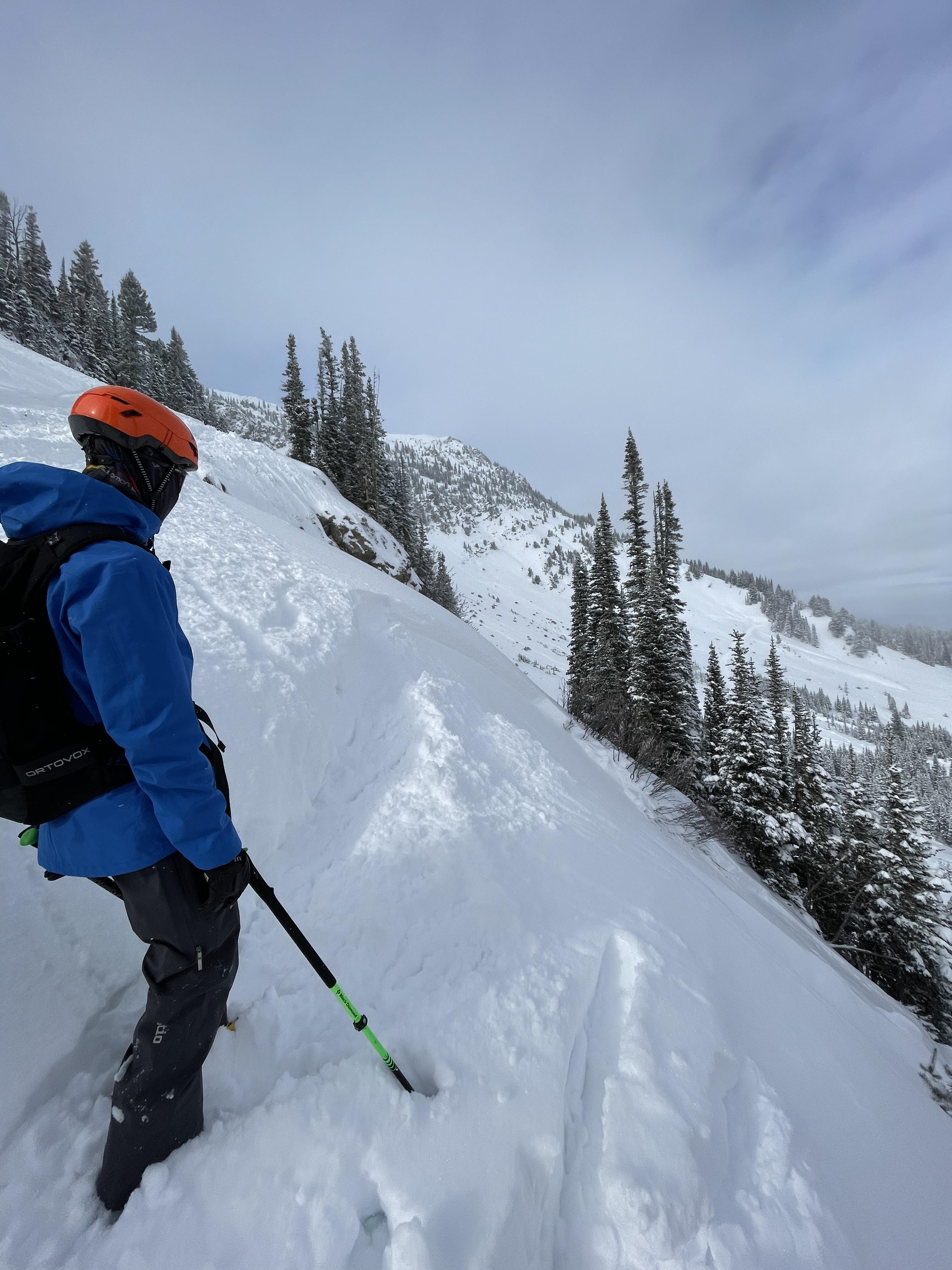
An observer saw evidence of wind loading creating the conditions for avalanches in the Bridger Range on Sunday. Cracking is an indicator of instability. The observer noted that the relatively small drift he saw was "nothing consequential," but this shows that unstable drifts are forming. They will be more consequential where there is more snow and as the wind creates larger drifts.
Full Snow Observation Report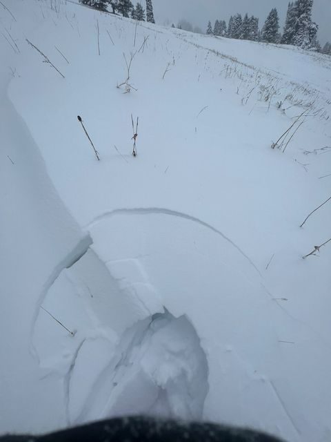
Triggered a small slide underneath the cornice of the southeast chute off of Emigrant peak. The slide was 50 ft wide, 4 inches deep, and ran for about 100 ft. The slide was not large enough to knock you off your feet (D1). The latest storm had deposited about 12 inches of new snow underneath the cornice.
other older slides were visible on a wind loaded NW oriented slopes at the bottom of the basin. Still feels like winter out there with lots of light snow up high!
Full Snow Observation Report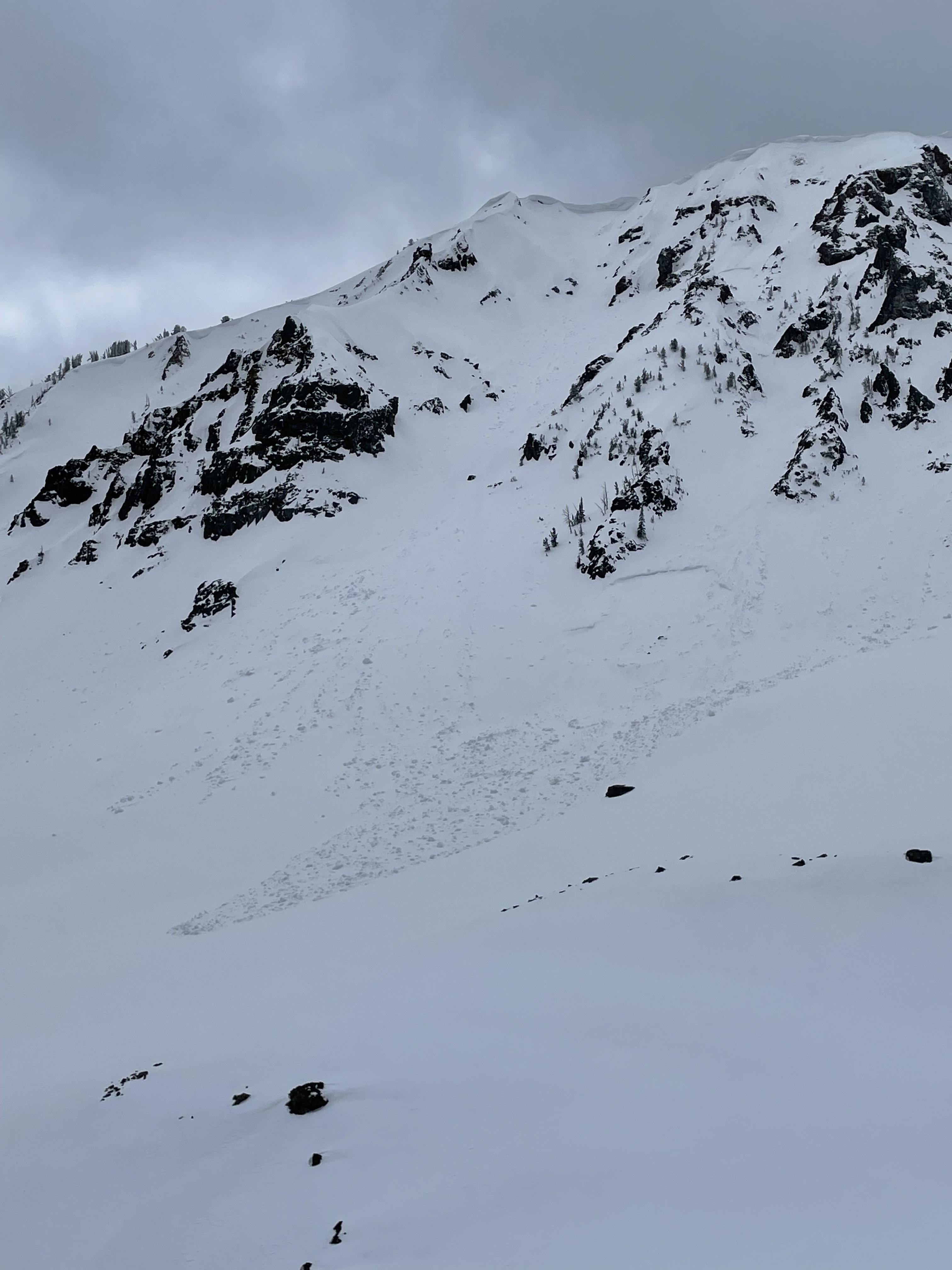
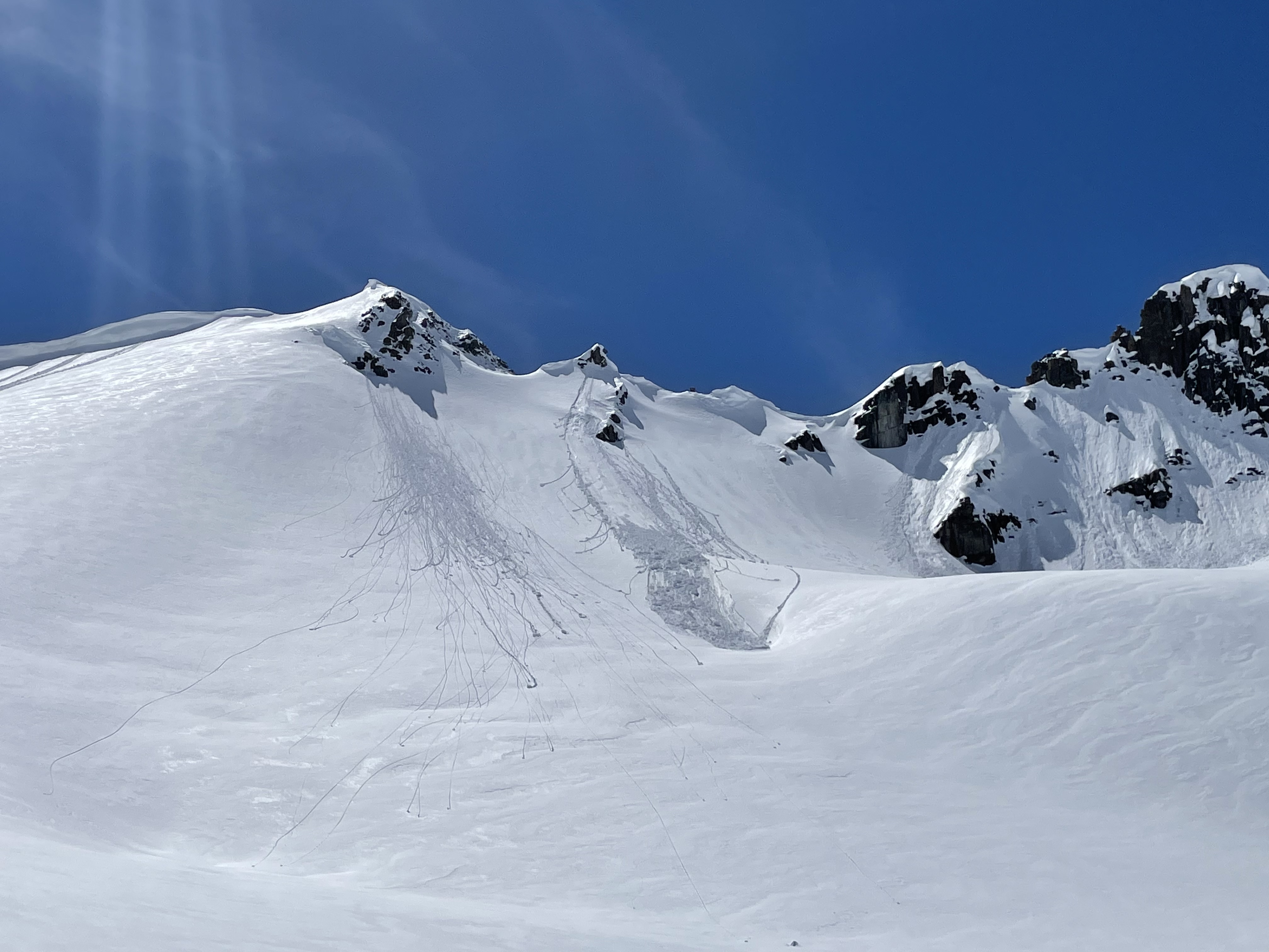
We saw a point release that mobilized a slab of new snow on an East facing slope off of mt fox in cooke city.
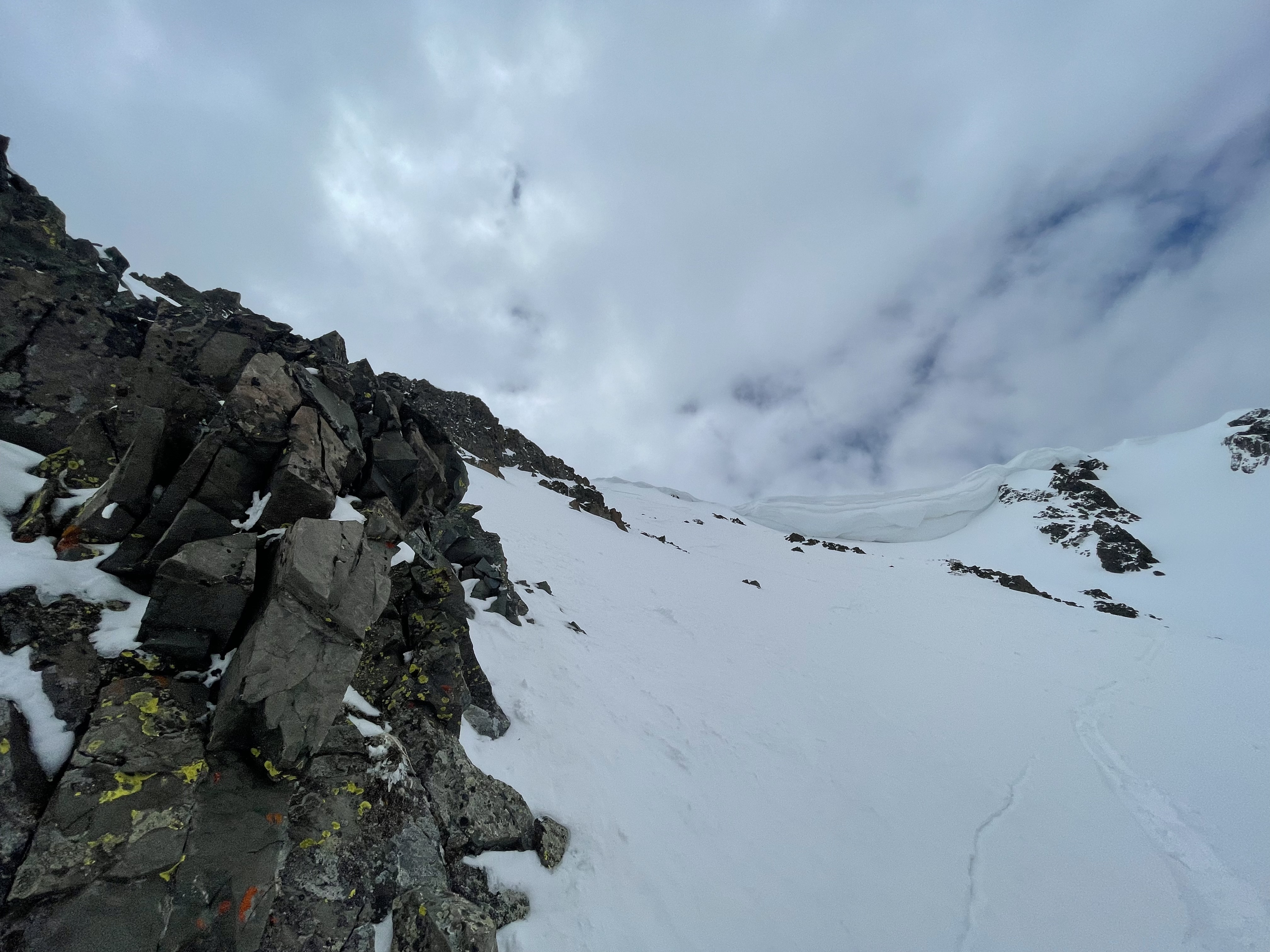
cool example of a roller ball turning into a point release and into a wet slide avalanche. The new snow had heated up considerably during the day on Sunday. There were some older crowns below a cornice to the north of mt fox (second photo) with slide debris that extended down the whole face (600ft). Likely slid during a storm within the last week
Full Snow Observation Report