Snow Observations List
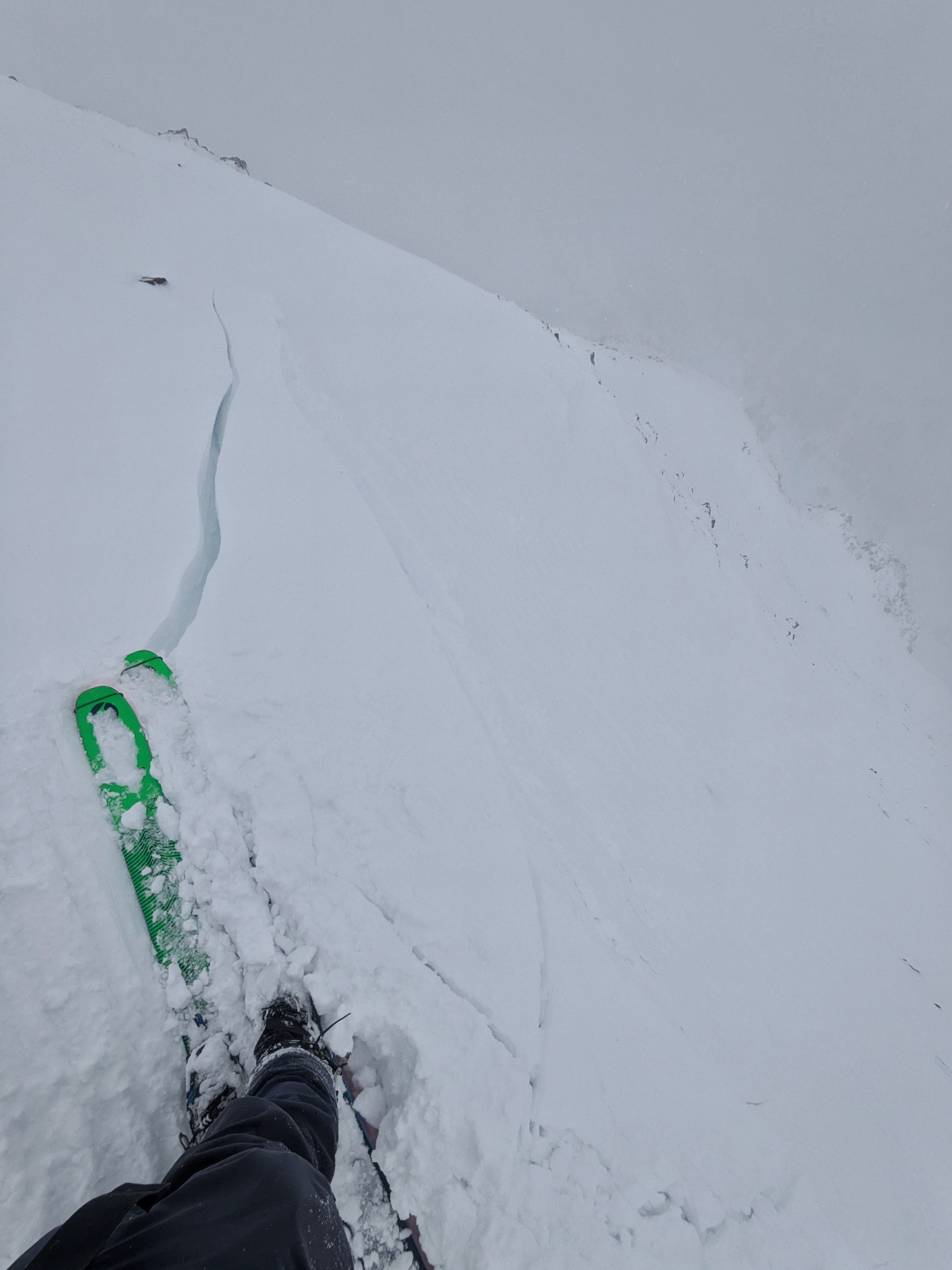
While doing stability tests on the bottom 100 ft of the Bacon Rind Runout, we observed multiple "whumps" and a 10-12 ft crack about 5" deep on ~20° terrain.
Full Snow Observation ReportFrom text message: a snowmobile triggered a small persistent slab avalanche in the Taylor Fork on Tuesday. The rider was not caught.
On a nearby slope, a larger avalanche failed 150 wide on weak layers near the ground.
Full Snow Observation Report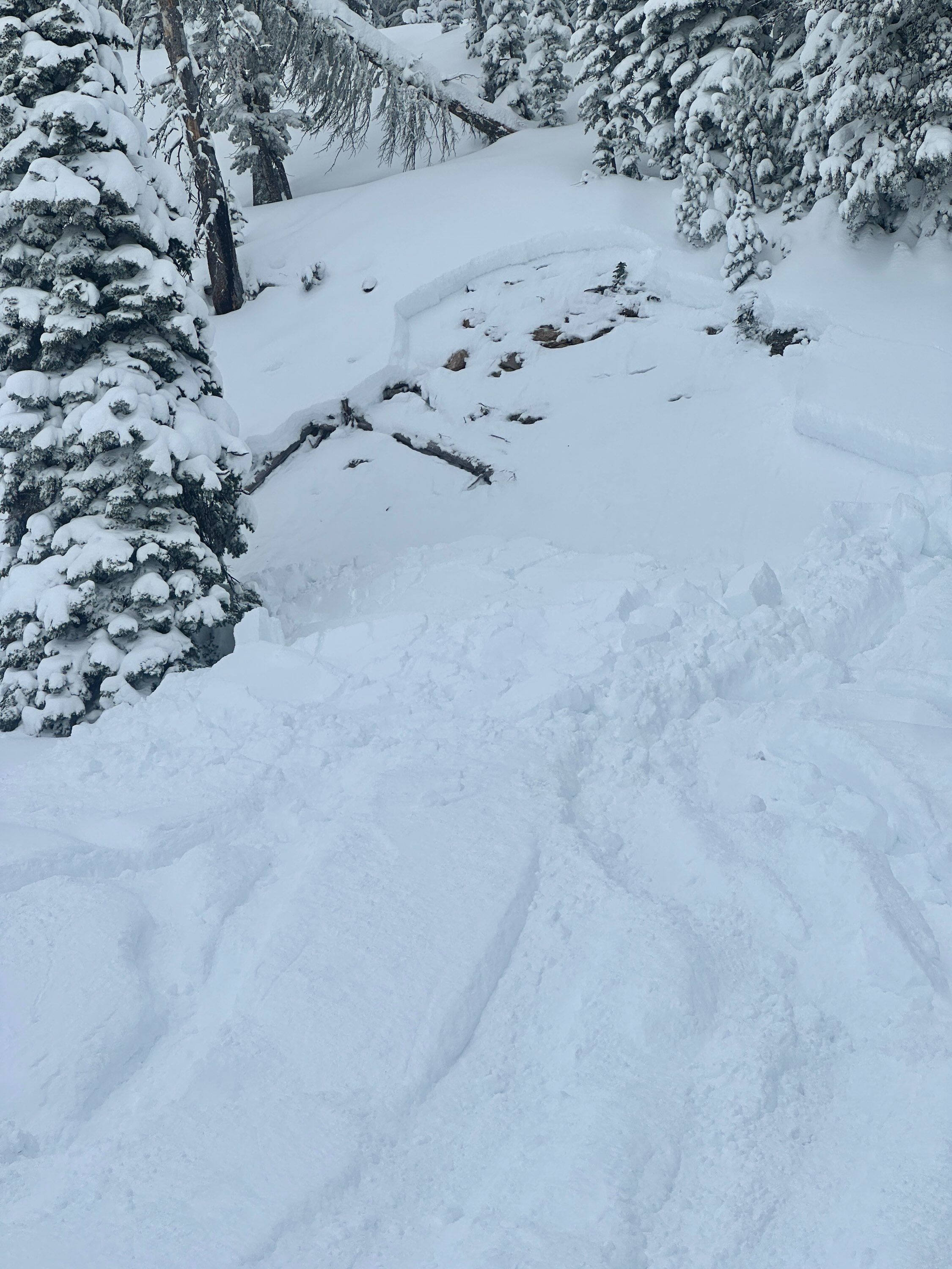
There was a natural avalanche on the landslide face above quake lake. The avalanche failed on a weak layers near the ground and broke several hundred feet wide.
Full Snow Observation Report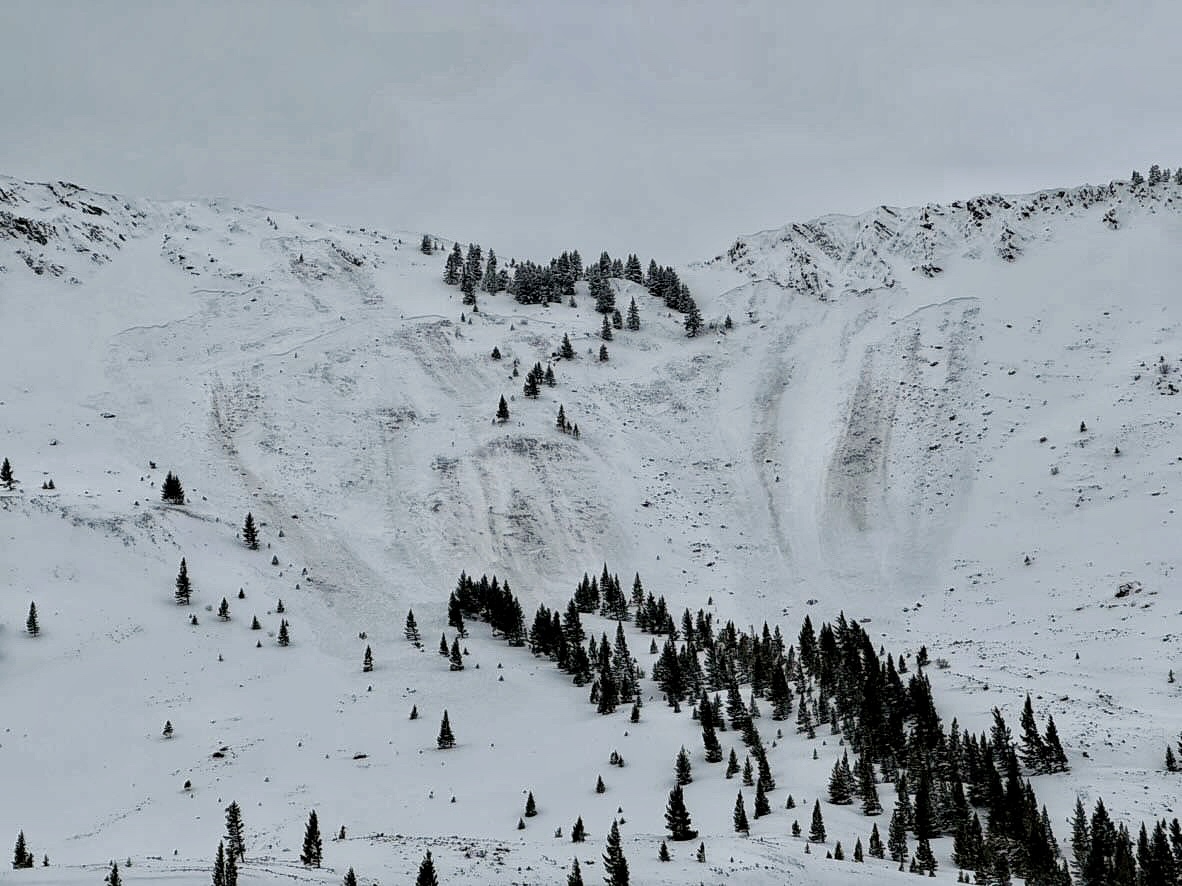
We toured into Carrot Basin and Sage Creek this morning. The storm ended and skies were broken by 1000. The spx is about 1M deep and the surface conditions are soft and excellent in most areas with wind effect along the ridges. At about 130 we moved from carrot to sage creek and notcied three small and one large avalanche along cabin creek divide that were not present earlier in the day. Most looked remote and were isolated pockets (R1/D1). As we rounded the corner into sage there was one fresh larger slide (R2/D2) at about 9,400' on a NE facing slope. It appeared to be natural (remote?), failed at the ground and was about 200' wide and ran for 200' the crown was 2-3' deep.
Full Snow Observation Report
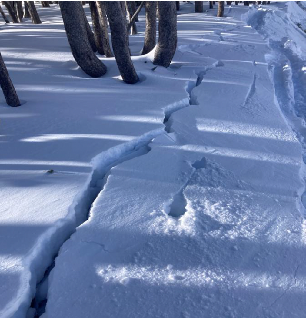
Widespread cracking and collapsing at Tele Meadows today, primarily in wind-affected areas. Shooting cracks up to 100 feet.
S1 all day, only about 5cm new by 3pm. Winds mod in the AM, light in the PM from the south.
Still pretty thin cover, lots of sagebrush sticking through on the usual ski runs.
Full Snow Observation Report
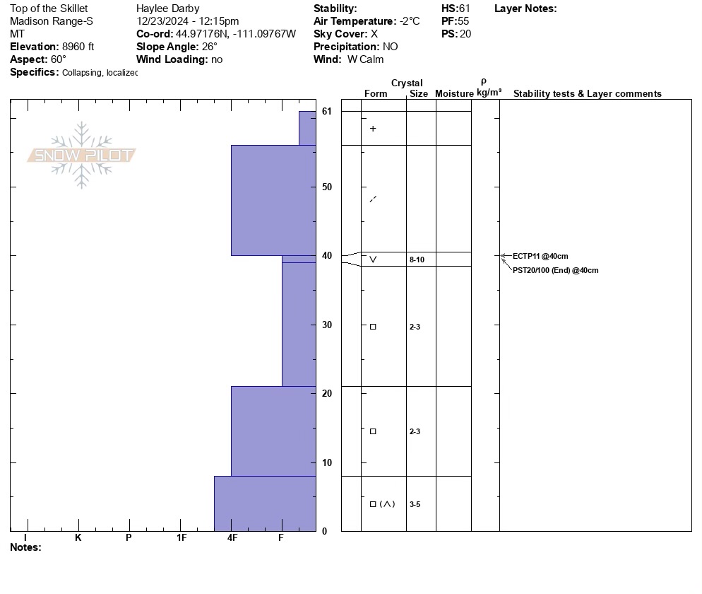
Despite a couple of recent observations stating that Bacon Rind could use more snow, we decided to try it. Perhaps we should have listened. Total snow depths ranged from 15 to 24" (39-61 cm in our snowpits), or in shorthand... not enough snow!
We toured up to the top of the Skillet in the northern of the two primary Bacon Rind areas. The thin snowpack was primarily comprised of weak, sugary facets with a thin soft slab (Fist to 4 Finger hardness) on top. In 2/3 of the upper elevation snowpits, there was a layer of feathery surface hoar buried on top of the facets and below the soft slab. Snowpack tests generally indicated instability (ECTPV, ECTP3, ECTP11, and PST 20/100 end).
While we chose not to roll the dice, the slab was thin (7" thick maximum), and we observed indications (slab qualities) that an avalanche most likely would not break widely across a bowl. HOWEVER, similar to what Alex and I saw at Lionhead the day before, it won't take much new or wind-drifted snow to change the equation, driving the avalanche danger up and making avalanches large enough to bury or injure a skier or rider likely.
For now, it seemed that barely buried logs, stumps, and rocks were the greatest hazard. Once it snows enough to change the skiing quality meaningfully, I will worry about recreating on terrain steeper than 30 degrees due to avalanches. 0.5" of SWE would drastically change the picture.
Full Snow Observation ReportDanger was MODERATE today.


Surprisingly shallow snow pack on the upper parts of Bacon Rind. South of Skillet area in the meadows. 2-3 foot depth max at 8800 on a SE aspect. 10+ inches of newer snow on top of a well developed surface hoar. A semi-supportable crust below that with facets to the bottom. ECTP 11 really surprised us, failing on the surface hoar. Challenging skiing staying on top and did some base damage on rocks even up high. Log jam roller coaster back down to the car. Still a fun outing. Send us snow! And keep up the good work!
Full Snow Observation ReportSkied Bacon Rind meadows today. Didn't look at the Skillet.
S1-S2 all day, L-M winds from the south
HS of 45cm at the road and 65cm at the ridgeline. It is more or less entirely faceted and unsupportable. Ski pen of 40cm and boot pen to the ground.
Skiing was good but hazardous. Lots of audible rock strikes, and getting through the trees back to the road was challenging.
Not recommended yet.
Full Snow Observation Report

Hey Guys,
Brent and I got the public Avalanche Beacon Park installed today. It's located in the Old Airport area just off the Two Top trail, here in West Yellowstone. The 8 beacons are all buried. We could use some more snow to help cover them a little more, hopefully the next few days will provide that and we'll be off and rolling.
Thanks guys,
Jim Norlander
Full Snow Observation ReportWe rode into Yale Creek just south of Sawtell peak in the Centennials. Thin snowpack that is mostly faceted. There was a slight rain/mist the night before and again in the afternoon with warm air moving into the area ahead of the approaching storm. The rain/mist created a zipper crust on top of the snowpack.
The snow under that zipper crust is faceted and weak. It will be the primary weak layer once a slab forms on top.
Full Snow Observation Report
It's pretty rugged getting up to Yale Creek without using the maintenance road. Dropping into Yale is pretty rough but the Ride crew brought a chain saw to remove a log that is always in the way.


Gusty winds transporting snow in Taylor Fork on Saturday. Triggered a 4-5 inch deep wind slab that propagated about 50 ft at the top of a north east facing slope at 9,500 ft.
Full Snow Observation Report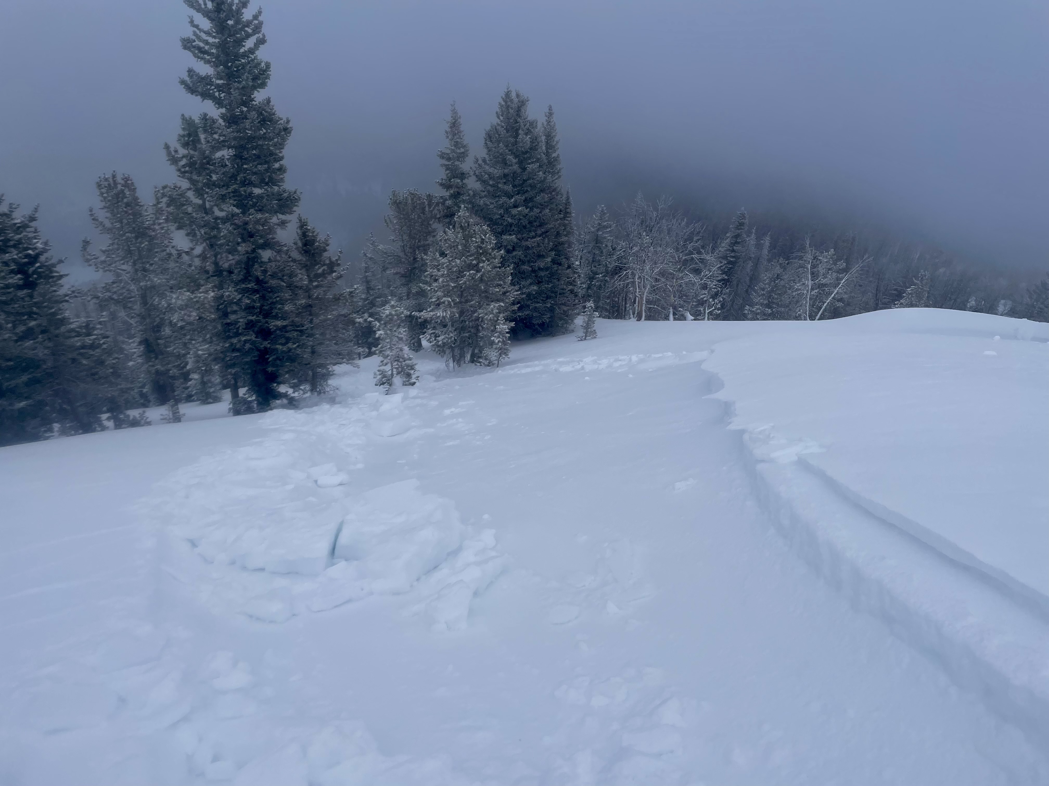
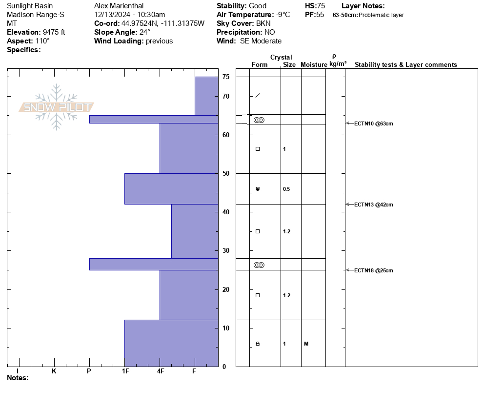
We rode to the Taylor Fork weather station and along the edge of meadows in upper Sage creek. Two snowpits and video attached. Dug one in Sunlight Basin on ESE aspect (near weather station) and one in Sage Creek on NE aspect. ECTNs and ECTX test results.
While riding across Sage Basin we found surface hoar buried 4" deep in most handpits and in our snopwpit, and otherwise 1-2mm facets existed at the same depth.
Snow depth was fairly consistently 2 feet. Trail was thin, but soft and not too bumpy yet.
Wind was light to moderate with some strong gusts near the weather station. Very light snow was falling midday. Mostly cloudy with a few shots of blue sky.
I saw one small old wind slab on a heavily wind loaded short slope at the end of the trail.
Snow stability was good today, but the weak layers near the surface could change that quick depending on how much snow falls this weekend.
Full Snow Observation Report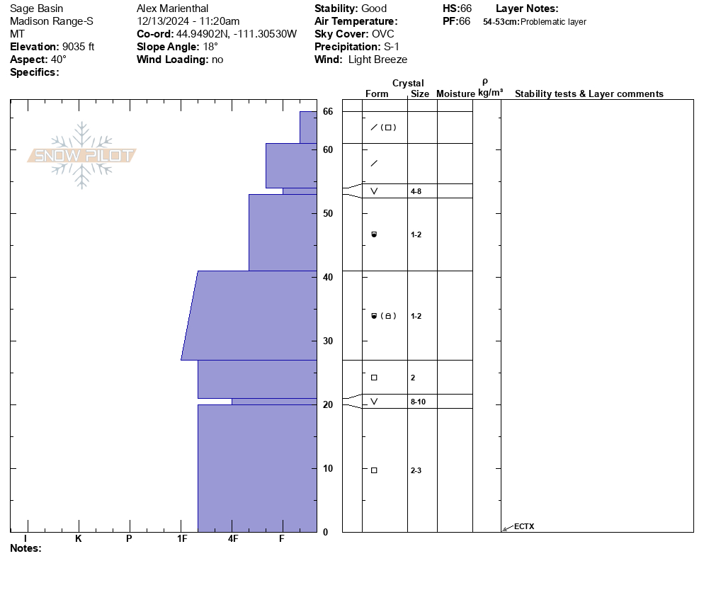

Just an initial look at low elevation snow around some of the ice climbs.
8" of new snow at the Grotto Falls TH.
I couldn't find any surface hoar that was buried by last night's snow, but I'm sure it's out there. Doesn't really matter because there's plenty of weak, faceted snow that was the previous snow surface.
The new snow is all fluff and not a concern at lower elevations in Hyalite. Perhaps it could be enough of a load and enough of a cohesive slab at higher elevations where more snow fell.
For now, things seem mostly stable, but that will change quickly with any amount of wind.
Full Snow Observation Report
LOW danger on non-wind load.

We rode into the Taylor Fork to the weather station and then over to the wilderness boundary. The trail in and out was in decent shape. The riding in the Taylor Fork was very thin with plenty of barely hidden obstacles. We moved slowly through the terrain and managed to avoid the landmines.
It was 12 degrees when we left the car, temps were warmer up as we climbed but, even under sunny skies, the snow surface never got wet. Dry snow conditions were mostly stable, with no wet snow instability. I would worry about hitting a buried log or rock more than triggering an avalanche. However, we did get a couple of propagating tests in a 60 cm deep snowpit at the edge of Sunlight Basin (ECTP18 @ 22 cm) and at the Wilderness Boundary in a 49 cm deep pit (ECTP14 @14 cm).
The snowpack is getting worked by the period of high pressure... surface hoar and near surface facets up top and faceting at the base. We will continue to monitor the state of the snowpack as we move toward the next snowfall assessing the structure that will eventually get loaded.
Full Snow Observation Report


This was a nice walk to stretch the legs in the Taylor Fork. My observations largely aligned with what GNFAC fxers observed in the same drainage on the same day.
Deep temperature inversion was present, it was 3 F when I left the car at 10 in the morning, and I eventually climbed out of the cold pool of air around 8,200'. I stopped and dug a few roadside handpits on the drive in from 191, it was impressive how much additional faceting was occurring below the level of the inversion. Here, the snowpack consisted mostly of 20-30cm of facets (DH near ground), with a decomposing 4F ambient temp crust in the mid-pack. I had no stability concerns down low today, but this very weak lower-elevation snow will create problems with additional loading. With enough load I would expect to see frequent, long-running collapses as well as the potential for remotely triggering slides from long distances in valley bottom locations. Many low elevation slopes facing SSE-S-SW-WSW had lost much of their snow cover, but solar margins and anything tilted a bit away from the sun were holding snow.
Above the level of the inversion and continuing up into the alpine the snowpack looked a bit better, but not great. Faceting was less pronounced and I was unable to get ECTs to propagate in a pit dug in a relatively flat meadow at ~8,600' (which felt like a decent proxy for shaded slopes based on structure). However, shortly after leaving this pit I initiated a large collapse that traveled across an entire large meadow; the collapse was audible for over a second as it propagated. This collapse and the weak layer of concern in my pit is the widespread basal weak layer, buried beginning in mid-November. This was the only direct instability feedback from the snowpack I experienced this day.
In the alpine, snow surfaces were weathered and highly variable, presenting as a mish-mash of facets, crusts, thin wind skins, and stiffer, denser hard slabs from recent snowfall. None of these surfaces looked terrible, but I'd expect a quick load of snow+wind to find plenty of locations with collapsible weak layers capable of producing avalanches. I looked around for a place to dig and look at basal weakness but was unable to find anything of value due to this high degree of variability. There was a thin but widespread rime/humidity crust in the upper few cms of the snowpack that was present as high as I observed (11,000' +). I observed some cracking that had occurred previously in steep, heavily wind-loaded north-facing terrain. It was not perfectly clear if this cracking involved the weak layer near the ground or just the thinner, wind-drifted hard slab near the surface, but it seemed like it was more of a surficial problem.
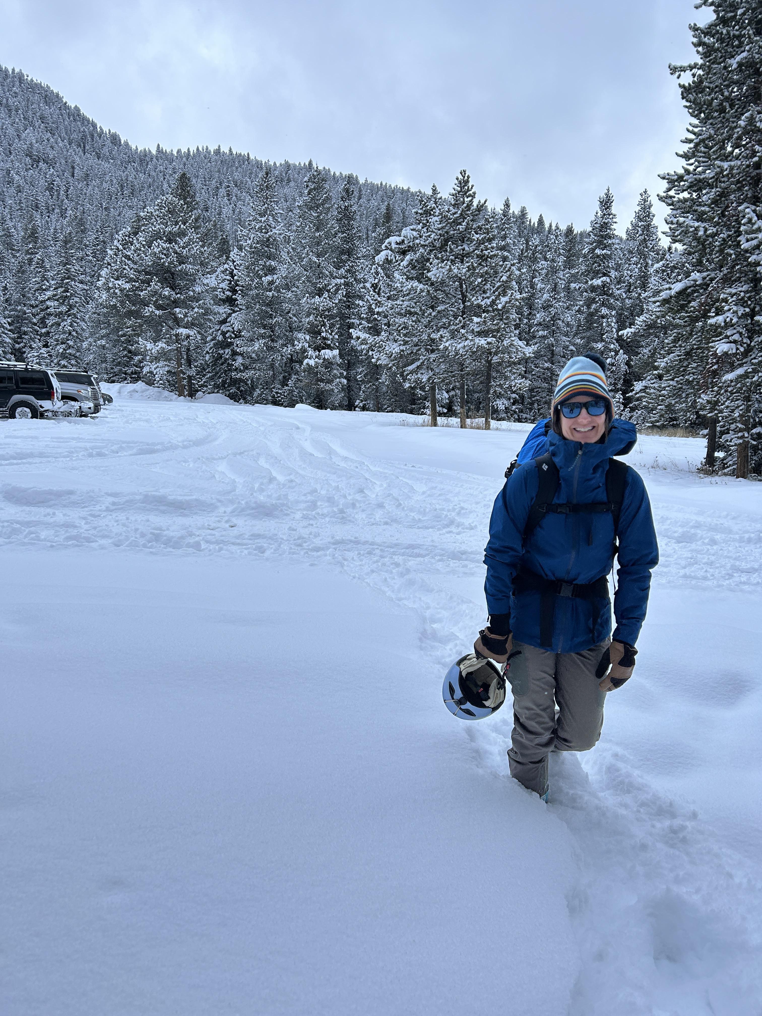
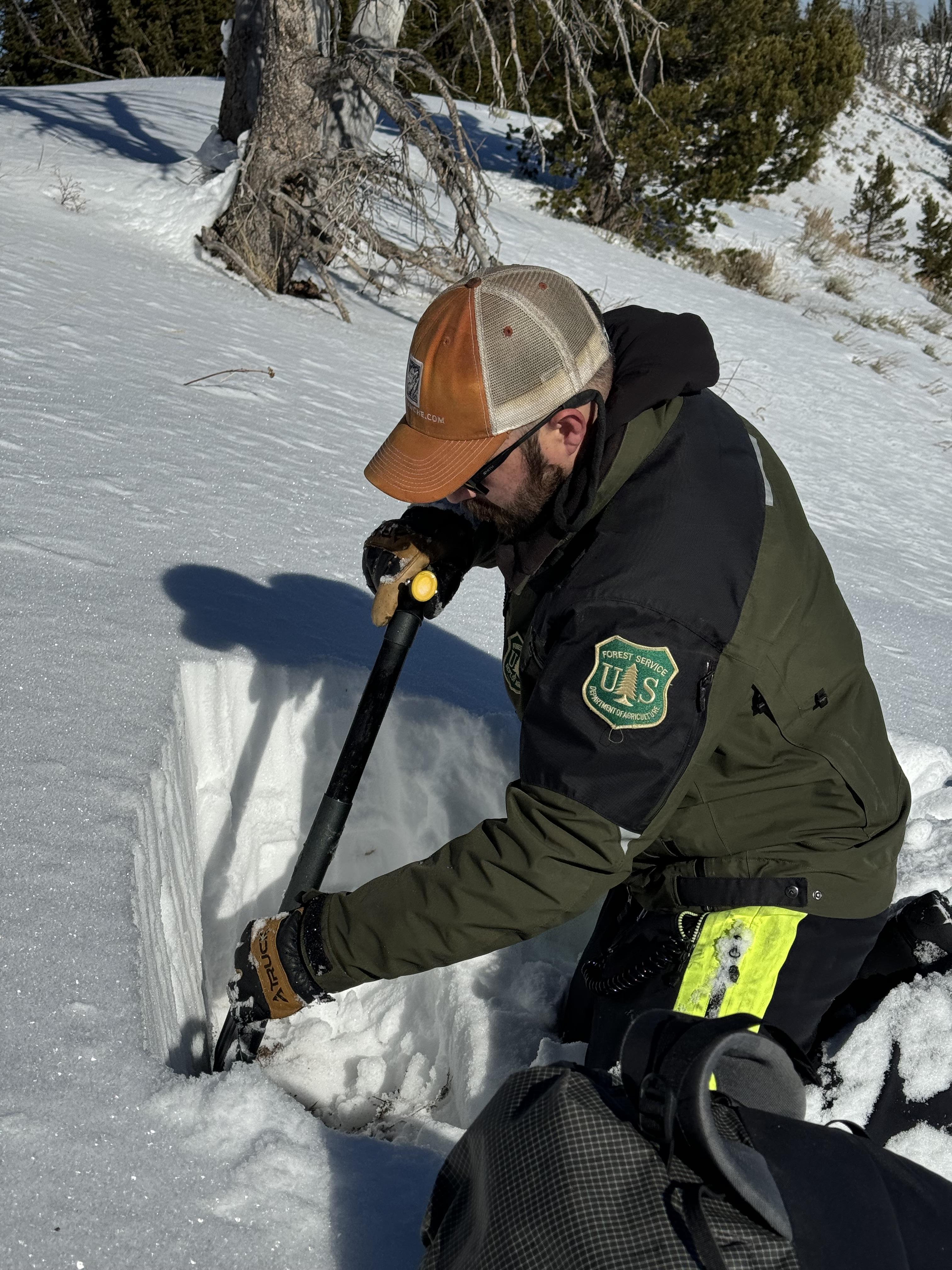
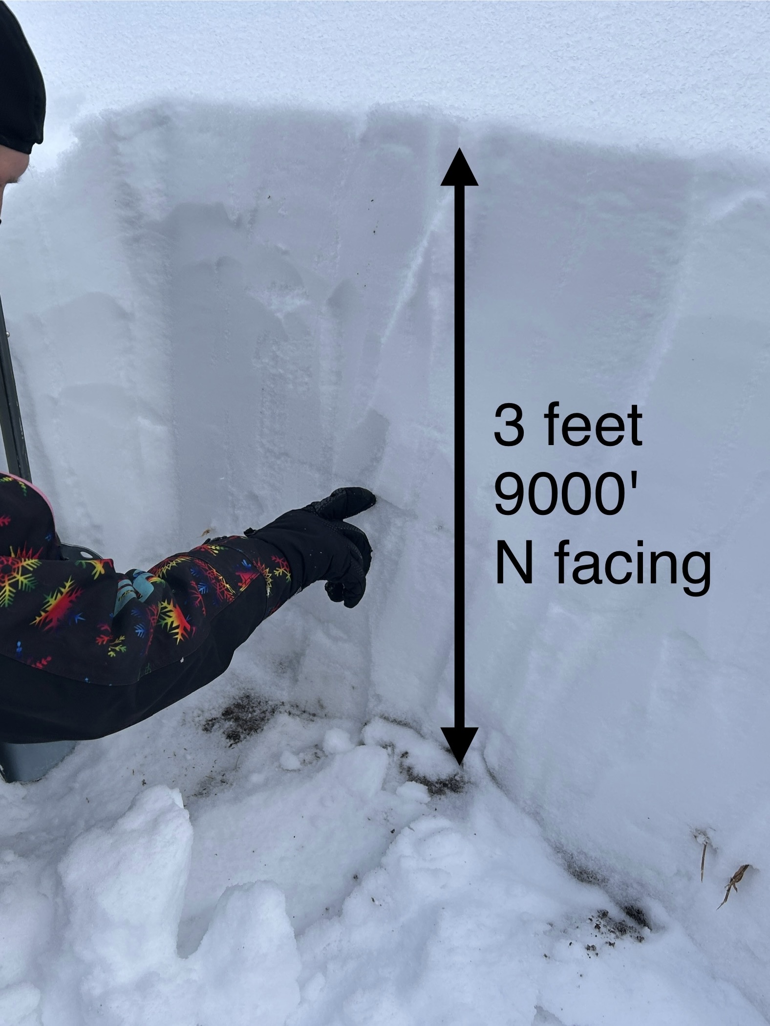
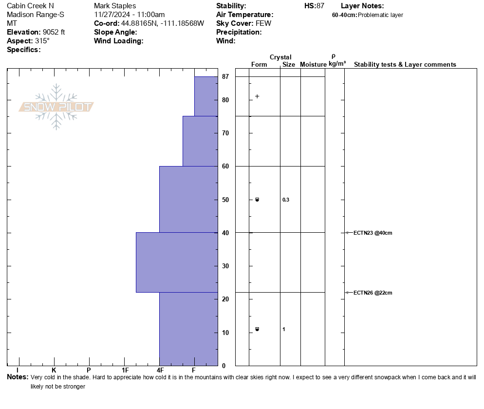
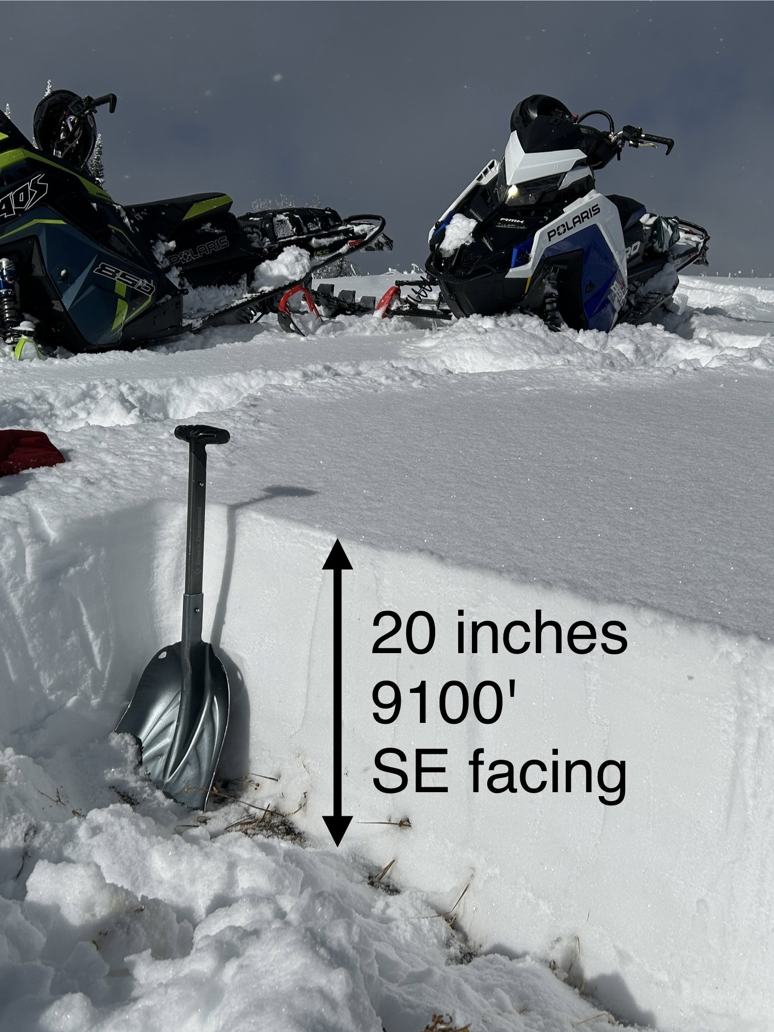
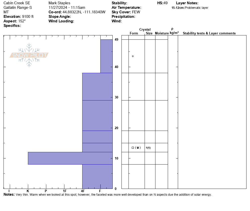
Full Snow Observation ReportWe rode into Cabin Creek very delicately, and it was great to be riding in late November. Hitting rocks is the greatest threat.
Overall conditions are thin but great to see so much snow.
9000 ft, N facing - 87 cm (~35 inches)
9100 ft, SE facing - 49 cm (~20 inches)
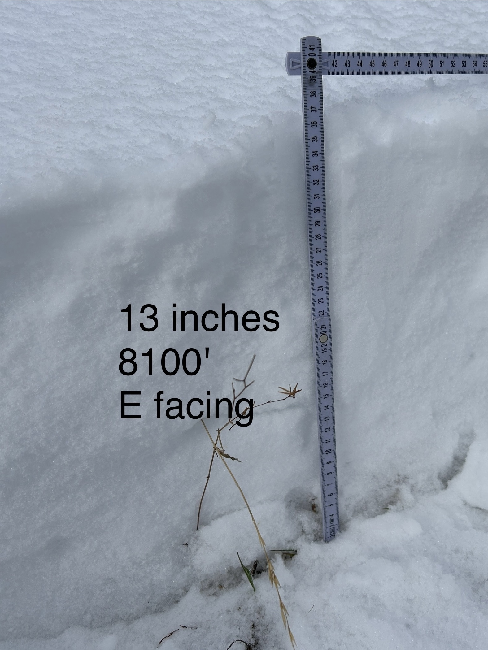
8100 ft, E facing - 35 cm (~13 inches)
Some faceting is occurring in the snowpack (aka - weakening), but the current state of the snowpack isn't the main issue. It's hard to appreciate how cold things are in the mountains and how cold the snow will get under clear skies. Clear nights in December will significantly weaken the snowpack, and it will look A LOT different the next time we come back.
What we need? - Snow. We don't need a lot but a few inches every few days along with cloudy skies will help things a TON.
Where can you trigger an avalanche right now? - I think you need to find a slope with recent wind drifts where you can either get a wind slab or persistent slab avalanche.
Lastly - the radiation recrystallization process is happening as well. On an East-facing slope at 8100 ft at around noon, the surface of the snow was dry but snow just under the surface was damp.
Full Snow Observation Report

From email: "Northerly facing terrain harbors October snow, which has faceted. It is holding up plenty of dense snow and wind slab from the quite snowy and windy November. It was unable to hold the additional weight of a human trigger, and two pockets failed at the ground, which produced avalanches. Crown height maxed at 2’. Notably, where it did not avalanche, the failure propagated hundreds of feet down the ridge. It is a good data point- northerly aspects near tree line have potential instability."
Full Snow Observation Report
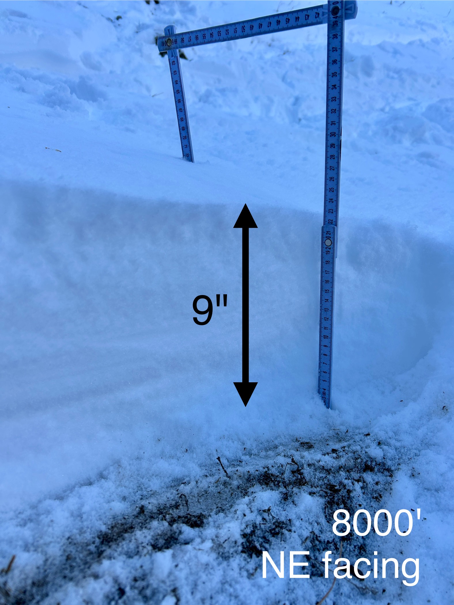
Early season conditions. At 8000' just below the Sacajawea trail bowl, there is about 9" of snow. In the trail bowl, winds moved that snow around and there is nice firm, supportable (ie - not hitting rocks) snow.
Warm weather really settled the snow and it became damp today on many sun exposed slopes. It stayed dry and cold on high north.
Overall, the things seem quite stable, even though there may be a wind slab or two that could still avalanche.
Full Snow Observation Report

Triggered a small wind slab:
-9600'
-N aspect on the NW ridge of Sphinx Mountain
-Strong SW wind
-Noticed other small crowns, likely triggered from another party traversing the north-facing bowl at similar elevations
Full Snow Observation Report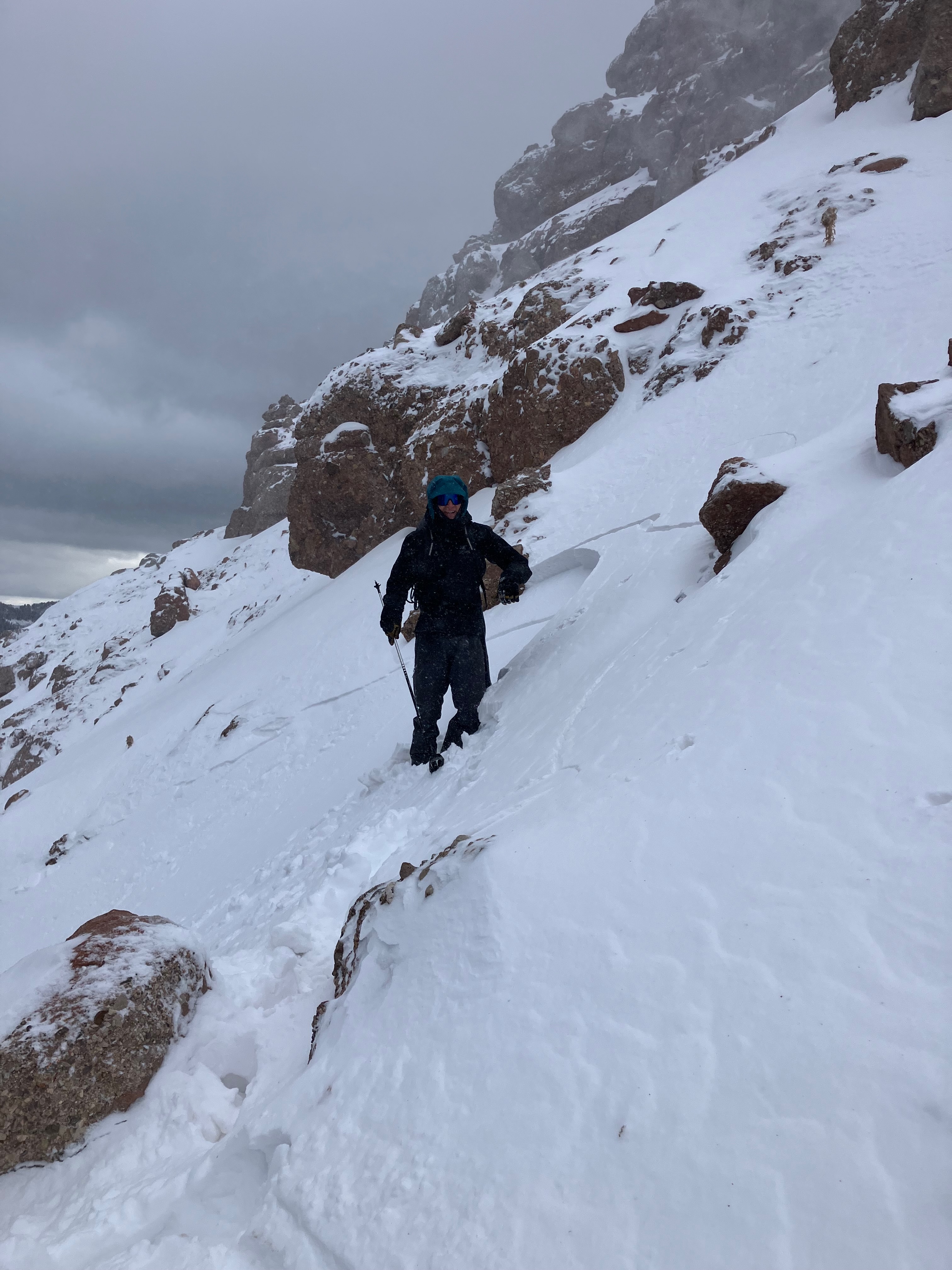

From e-mail: "Photo attached from near top of hyalite peak yesterday eve , 11/2. Cracking in recent hard wind slab, I had to really jump hard to make this. Walked on many other hard slabs that were well bonded. Highly variable snowpack. I think you'd be most likely to get into trouble by popping out a small hard slab pocket like this and getting magic carpeted into some thinly covered terrain."
Full Snow Observation Report