Snow Observations List
I dug a 113cm deep pit at 7,610' on a SE aspect in the Bacon Rind area. I found about 31cm of fist density facets and depth hoar at the bottom. In an extended column test I got a score of ECTN 27 at 80cm up from ground on a 1cm thick layer and ECTN 28 at 68cm up from ground on a 3cm thick layer. I didn't get too in the weeds with grain id but both of these layers were a mix of low density facets and what seemed like a non-continuous melt form crust.
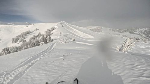
Across the road from Bacon Rind at 7,070' on a west facing slope I saw a small skier triggered slide that ran into the Gallatin River.
Full Snow Observation Report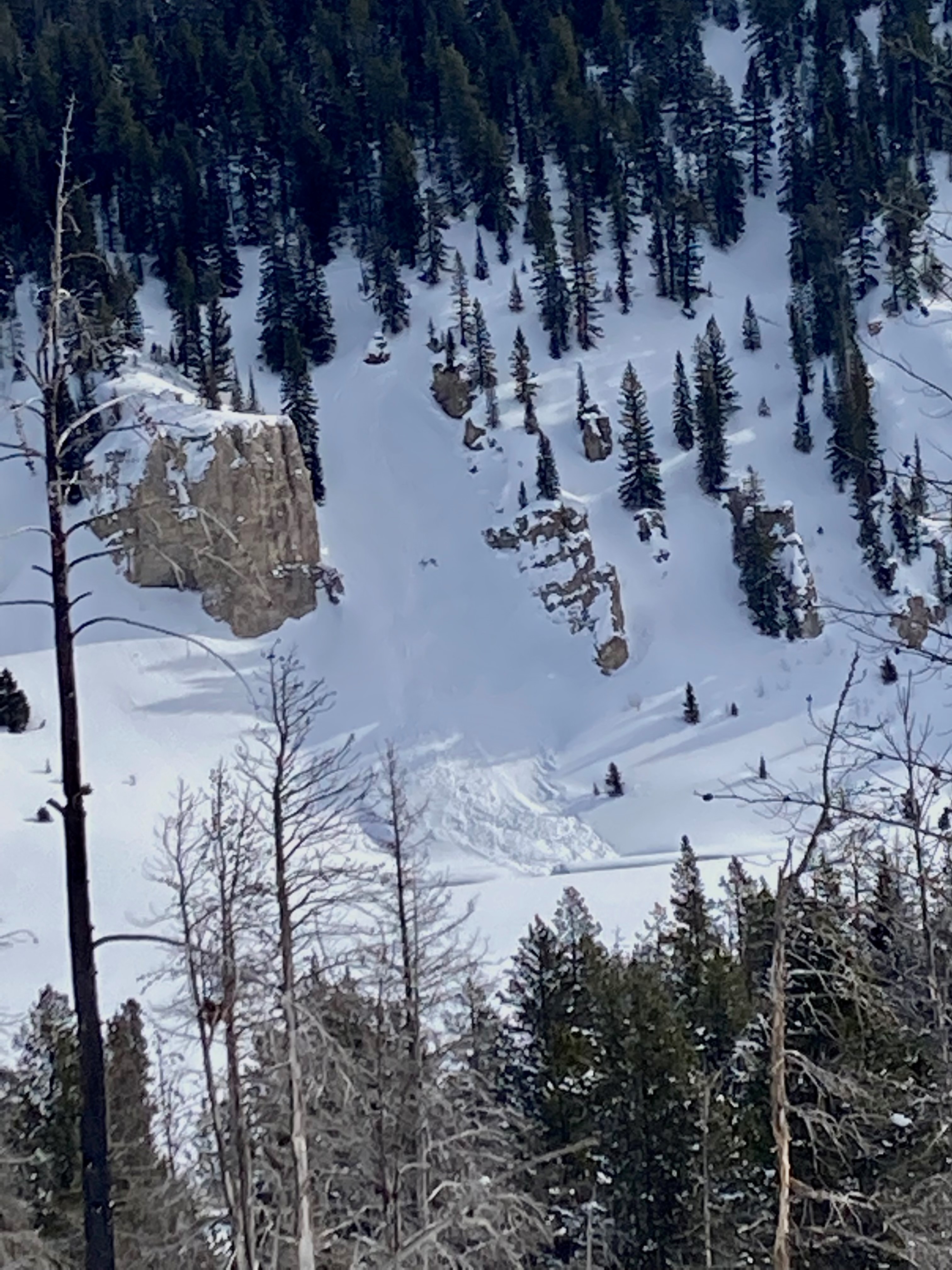
Dr. Karl Birkeland of the National Avalanche Center skied into Bacon Rind with us today. We found the surface hoar layer that is causing avalanches elsewhere, but in Bacon Rind it is not a serious concern. This is the same layer responsible for deep avalanches in Cooke City and one nearby in Taylor Fork. In this area the weak layer is capped with 4" snow water equivalent (SWE) while in Cooke City it is under 11" of SWE, almost triple the weight. We found no other weak layers of concern.
Full Snow Observation Report

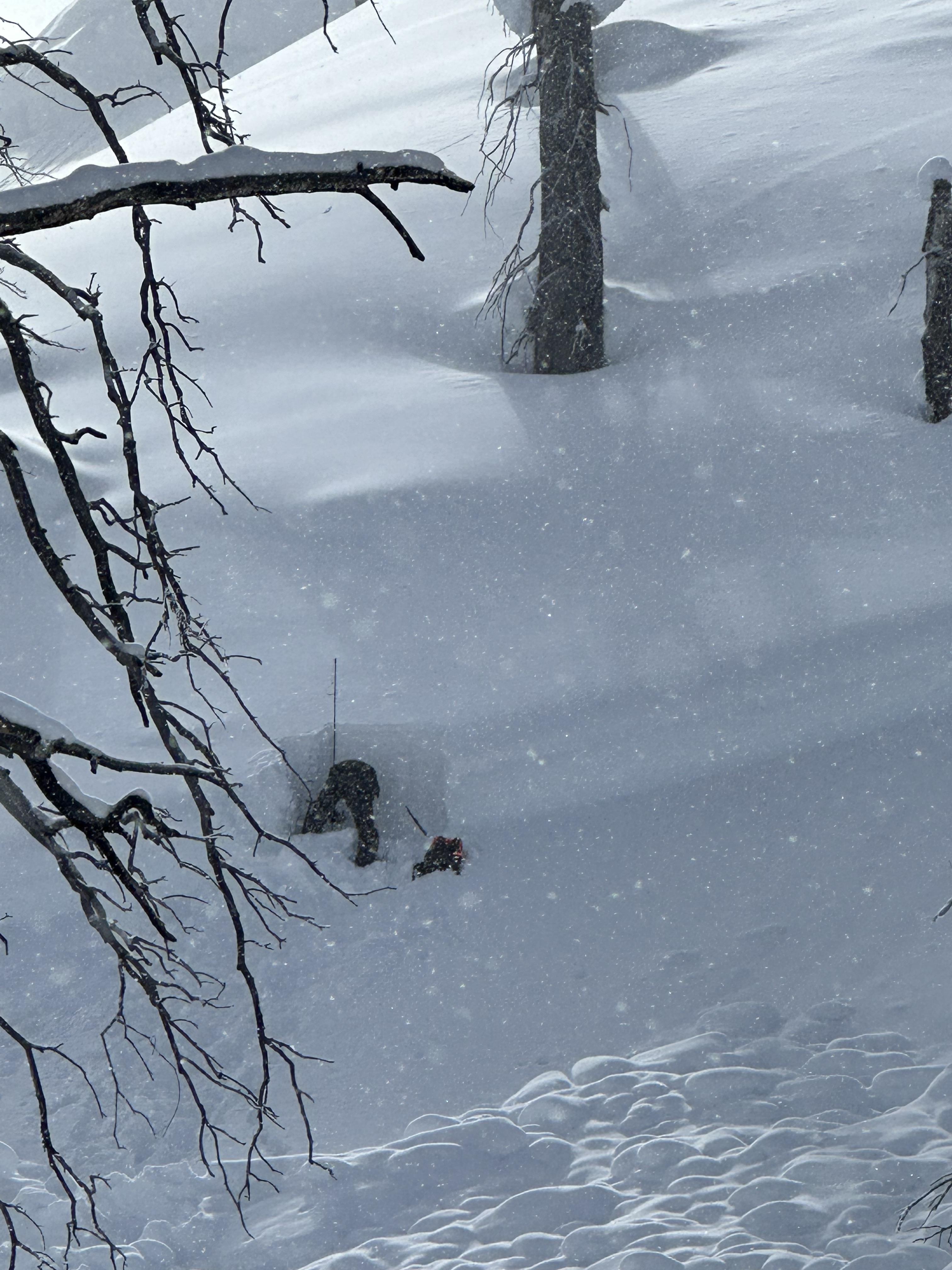
Hey GNFAC,
I dug on a SE facing aspect at the top of the Skillet in Bacon Rind today.
I found a HS of 163cm, and a 40cm slab from the last two weeks of on top of at least four notable weak layers.
I was initially optimistic about the stability, but had an easy shovel shear test, followed by an ECTP17 Q1 at 120cm up from the bottom.
Our group opted not to ski the Skillet, and found some great turns in lower angle trees nearby.
Another observation of note is a widespread layer of surface hoar that was deposited about 4 days ago, and is now covered by about 10-12 cm of snow.
There was about 15” of storm snow. One of the slopes in Sage Basin avalanched with a large cornice trigger. The slide failed 85 cm deep (~3 feet) on a layer of surface hoar. The surface hoar was a surprise as we haven't seen avalanches on this layer for a long time. I got an ECTP27 in the flank, and it failed on the same layer of surface hoar as the avalanche. I would recommend minimizing time on wind-loaded slopes or avoiding them all together. Weak layers buried 3-4 feet deep are back in play, and I wouldn't ride a steep slope without testing them quickly.
Full Snow Observation Report


NW aspect 8900’
HS 175cm
ECTP11 @120cm on 4F facets
This test result changed our intended plans and we decided to stay off steep slopes. We experienced intermittent light snow and light wind all day.
Full Snow Observation Report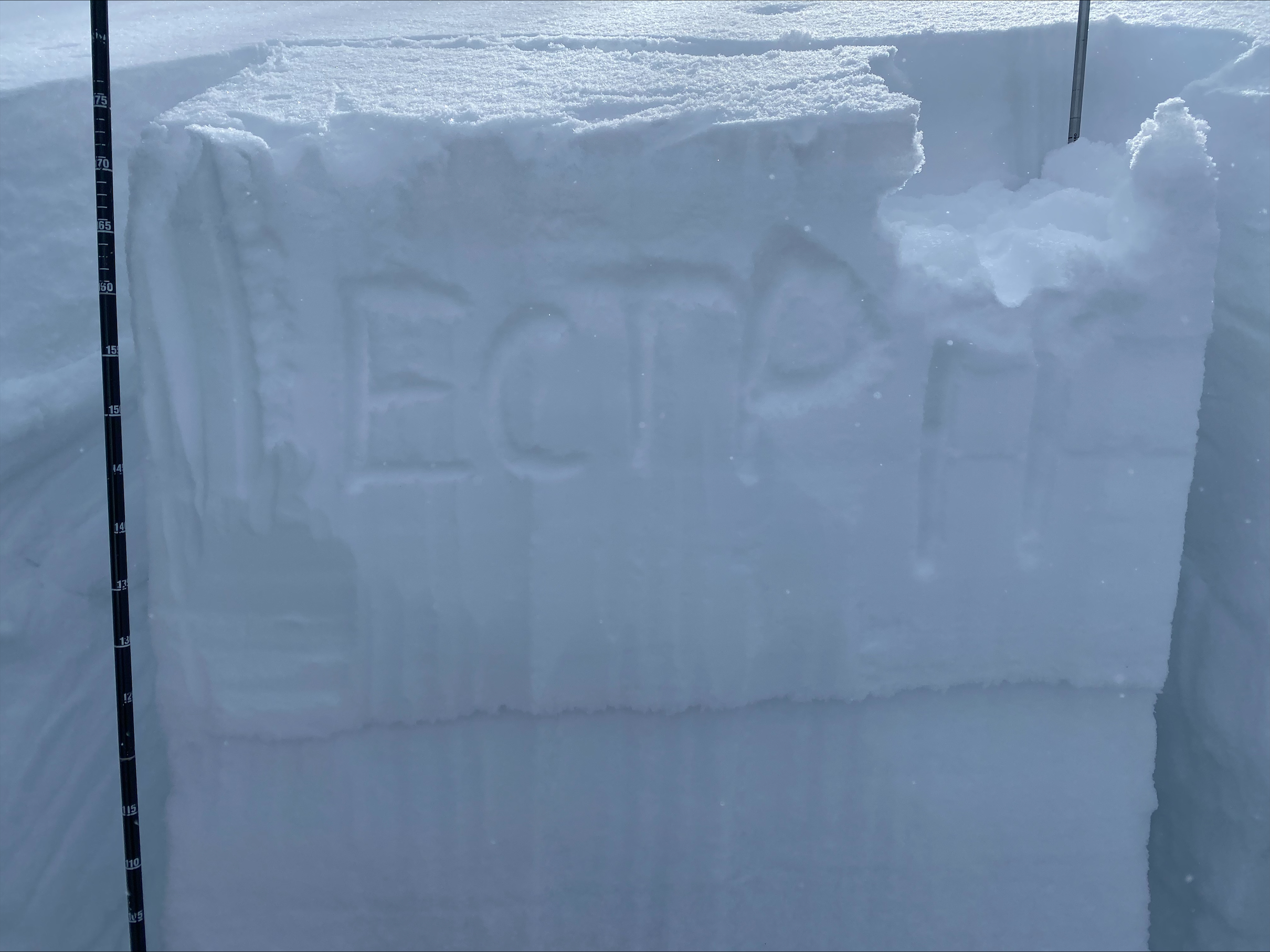
We rode through Sunlight Basin, Sage Basin, and Cabin Creek today looking for avalanche activity from the most recent storm that dropped 15" of snow (1.5" of snow water equivalent) in the Taylor Fork area. We did not see any signs of recent avalanches. Today the wind blew from the NE, and it was drifting the new storm snow throughout Cabin Creek and Sage Basin. Since the wind is transporting the storm snow it is still possible to trigger an avalanche several days after the storm.
Full Snow Observation Report
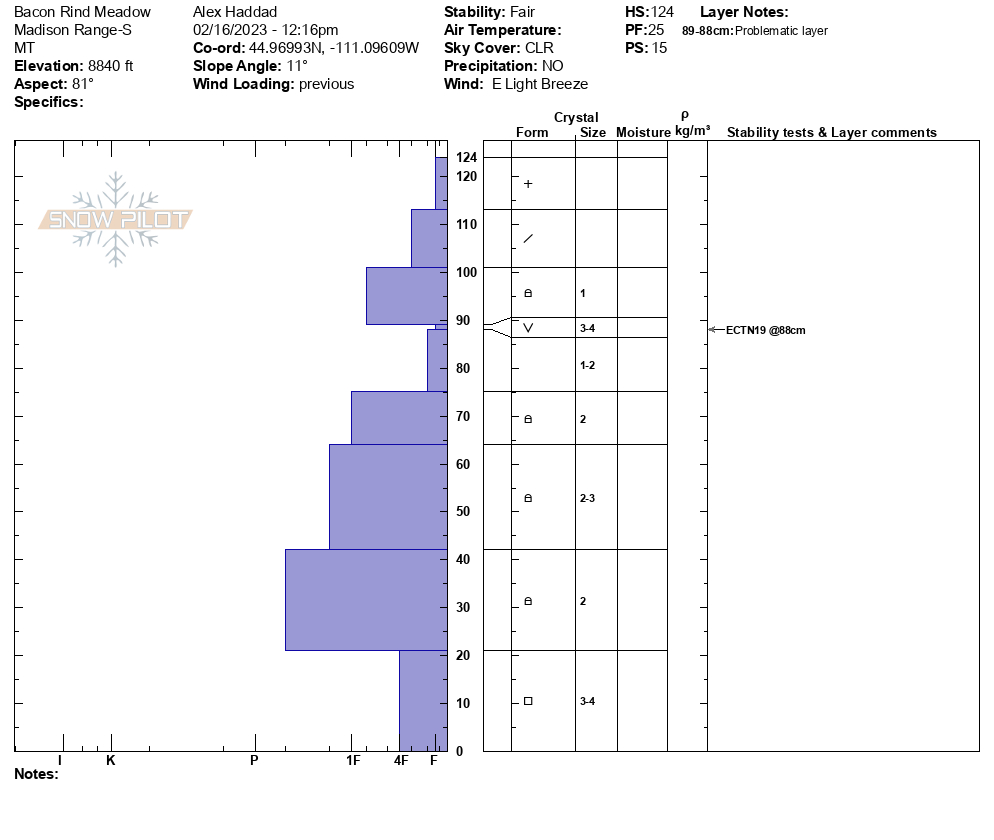
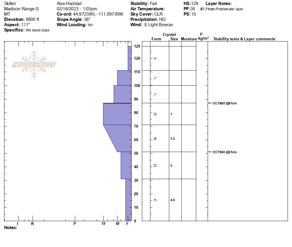
We toured up to the Skillet today. We noticed that winds from the NE had drifted the 4-6" of storm snow throughout Bacon Rind. The wind drifting is a bigger concern in the less sheltered areas of Bacon Rind. We dug two pits on a SE aspect at 7500', and 8,600'. There is a melt freeze crust sitting atop a layer of facets 4-6" below the surface, and this propagated easily in our pits (ECTP 3, ECTP 11). This is not a concern now, but it could be when new snow falls on this weak snow. Next, we dug a pit in the meadow to the south of the Skillet at 8,800'. We found surface hoar 14" below the surface, and it did not propagate in our test. In our pit at the top of the Skillet, we did not see propagation either. The terrain we were in today is trending towards stability.
Full Snow Observation Report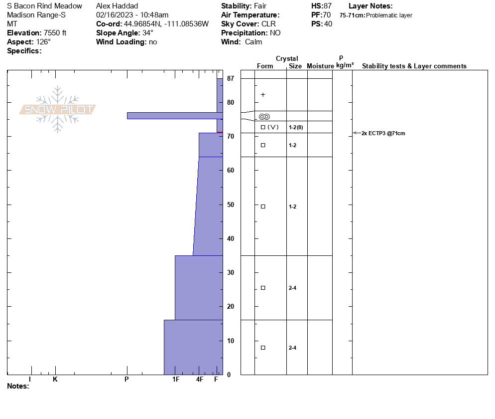

We measured 14" of snow from Tuesday's storm with 1.6" of snow water equivalent. We were encouraged that we did not see any natural (or human-triggered) avalanche activity. However, there is a significant caveat to this. East to Northeast winds stripped the steep slopes of Carrot and Sage Basins that are regularly wind-loaded by the prevailing winds. Thick drifts in abnormal locations were evident. Ridgetop were we rode had pillows of drifted snow and we could see cornices running downhill on the SW side of Sage Peak that indicated the gullies and depressions were cross-loaded. We dug a couple of pits. The first, in Sage Basin was unremarkable. The second, at the edge of Sunlight Basin, yielded an ECTP23 on a layer of facets/ surface hoar buried two feet deep.
We avoided wind-loaded slopes and recommend digging to test weak layers in the upper three feet of the snowpack before riding/ skiing in steep terrain.
Full Snow Observation Report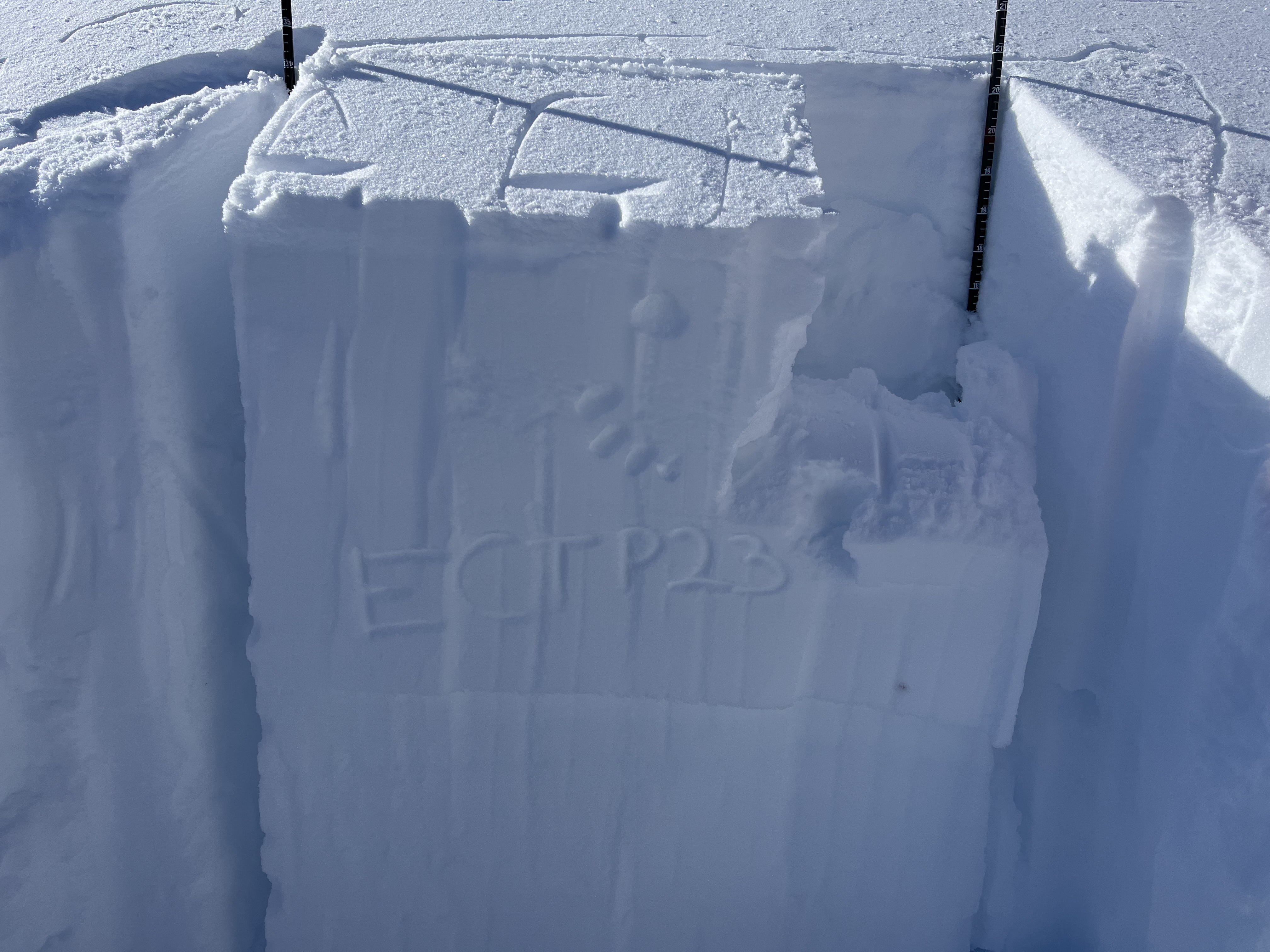

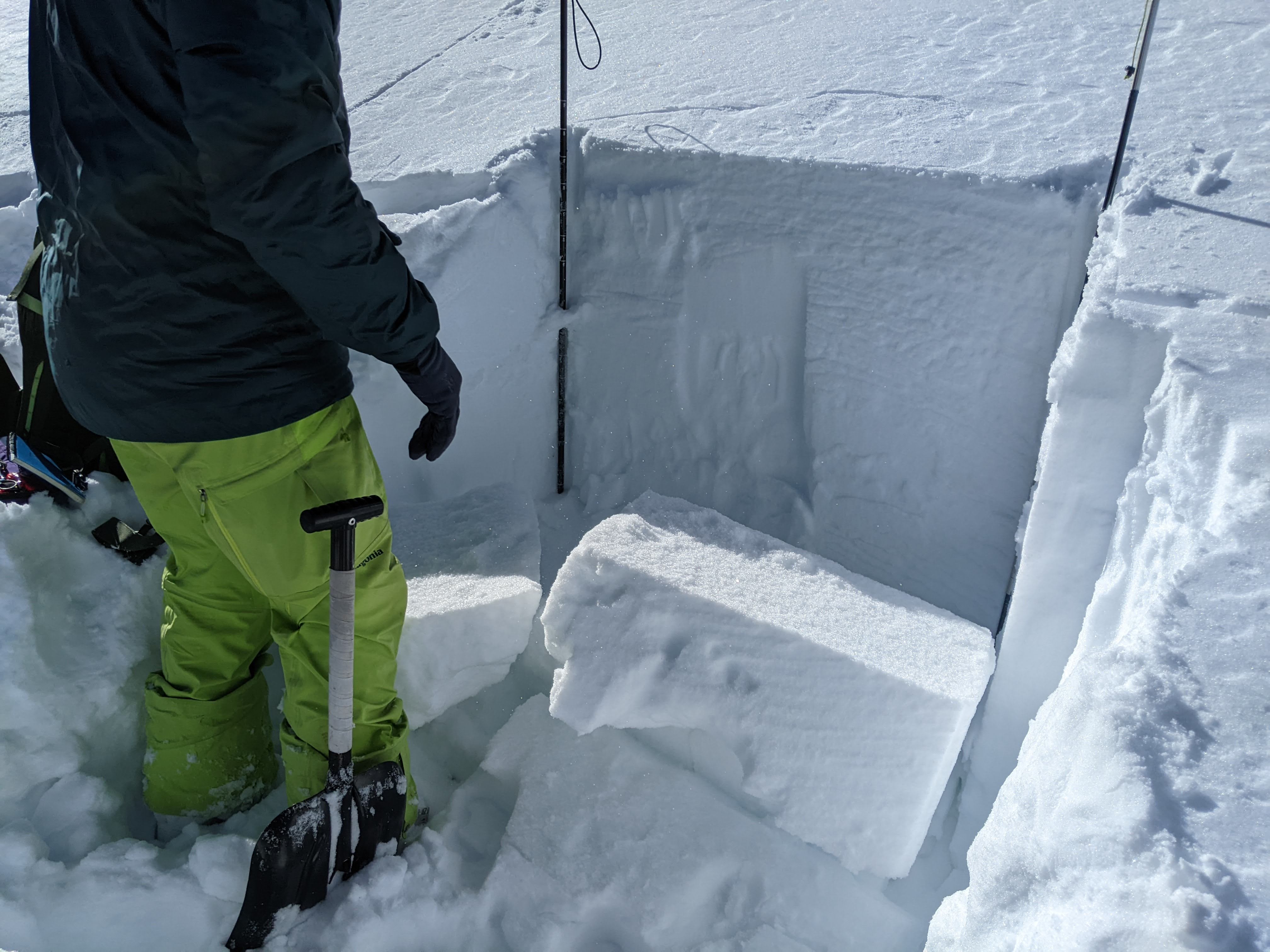
Skied in the bowl to the south of Pika point on a north facing aspect.
ECTN28 on top of very large facets in the bottom ~30cm of snowpack, but no result on a CT conducted directly adjacent to the ECT.
I've included a snowpilot pit profile here. Took my best guess at grain type - it looked like the facets between 80cm and 30cm were beginning to round.
Later in the day noticed some small (D1, R1) wet loose slides on steeper south faces.
Full Snow Observation Report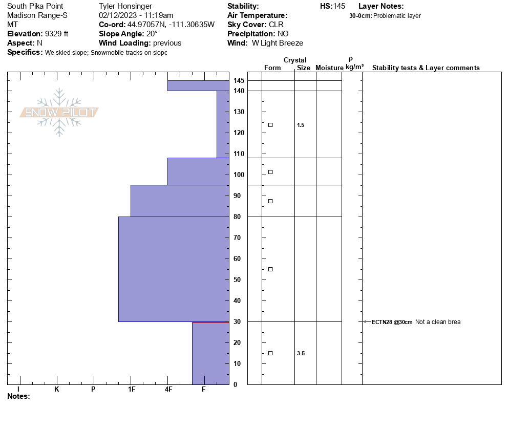
Poor test scores in our pit, but deep snow.
HS 190cm
ECTP 22, 190-155cm, Q1 shear (fist to 4F)
ECTP 27, 155-135cm, Q1 shear (4-1F)
Shear 135-115cm, Q1 (1F)
All on 1-2mm facets. Pretty nasty layer cake, we skied less than 30° after digging. Obvious wind effect on the steep bowl, no recent activity but hard wind slabs above 9500’ pretty much everywhere
Pit location: 9120ft, 44.94353, -111.1315
Full Snow Observation Report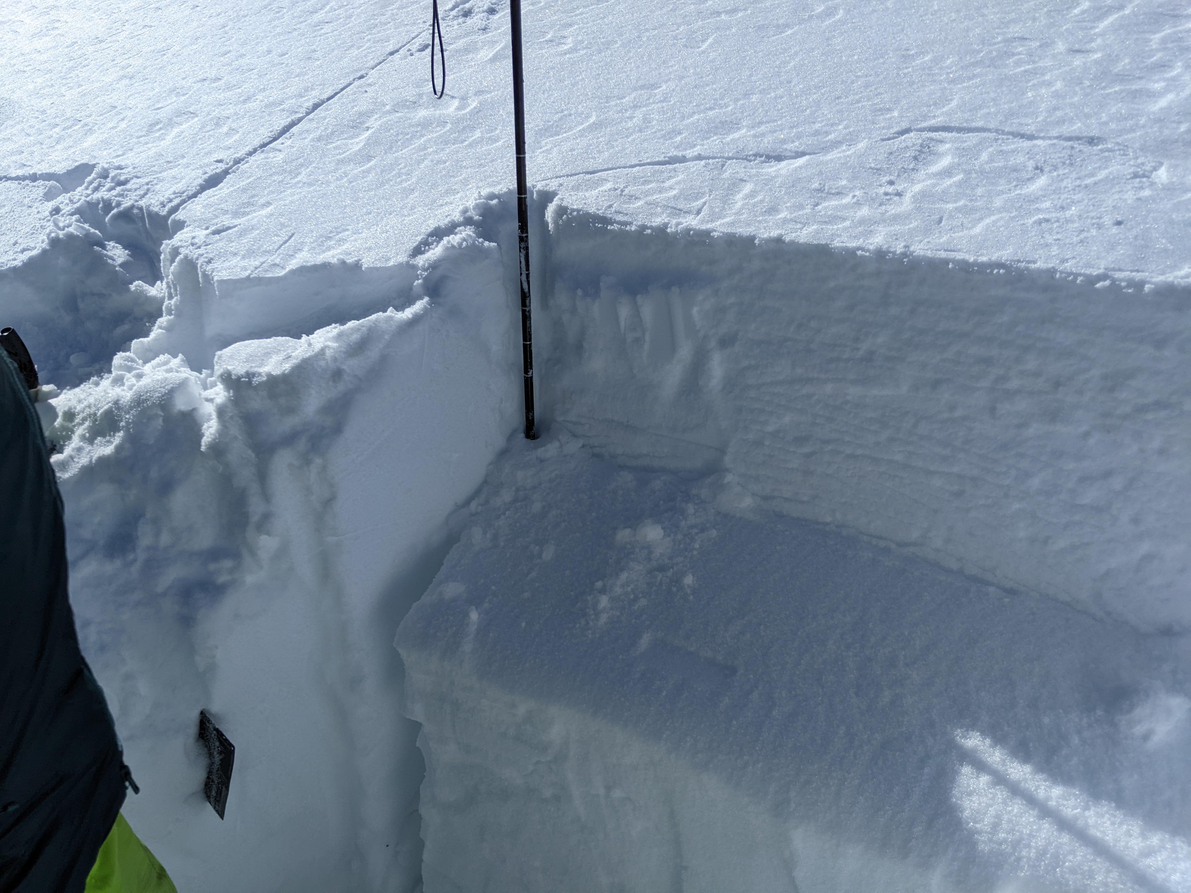
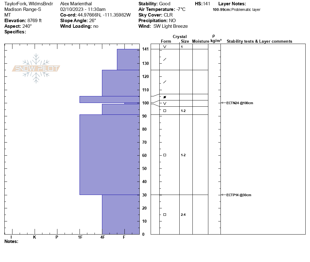
We rode into the head of Cabin Creek from Taylor Fork and turned around behind Sage Peak, then headed to the northwest side of Carrot Basin at the wilderness boundary. We did not see any recent avalanches. We dug two pits. One at the wilderness boundary and one off the north facing ridge in Carrot Basin. At the wilderness boundary HS was 140cm and we had ECTN24 on surface hoar/facets buried 40 cm down. We also had an ECTP14 on facets near the ground, but this one seemed more like an outlier. In our pit at Carrot Basin HS was 155 cm and we had ECTX. Overall, stability seemed to be good. With minimal recent snow, and weak layers becoming stubborn, the likelihood of avalanches is trending towards unlikely.
Full Snow Observation Report

This afternoon my group of 4 was riding up out of Tepee Creek heading towards Cabin Creek and I set off this small slide on a northeast facing slope as I was coming down it. The slide broke about a foot deep on top of the packed layer of snow and was 150-200' wide at the crown. Thankfully it slid slowly, less than 100' and I was able to ride out of it.
Full Snow Observation Report
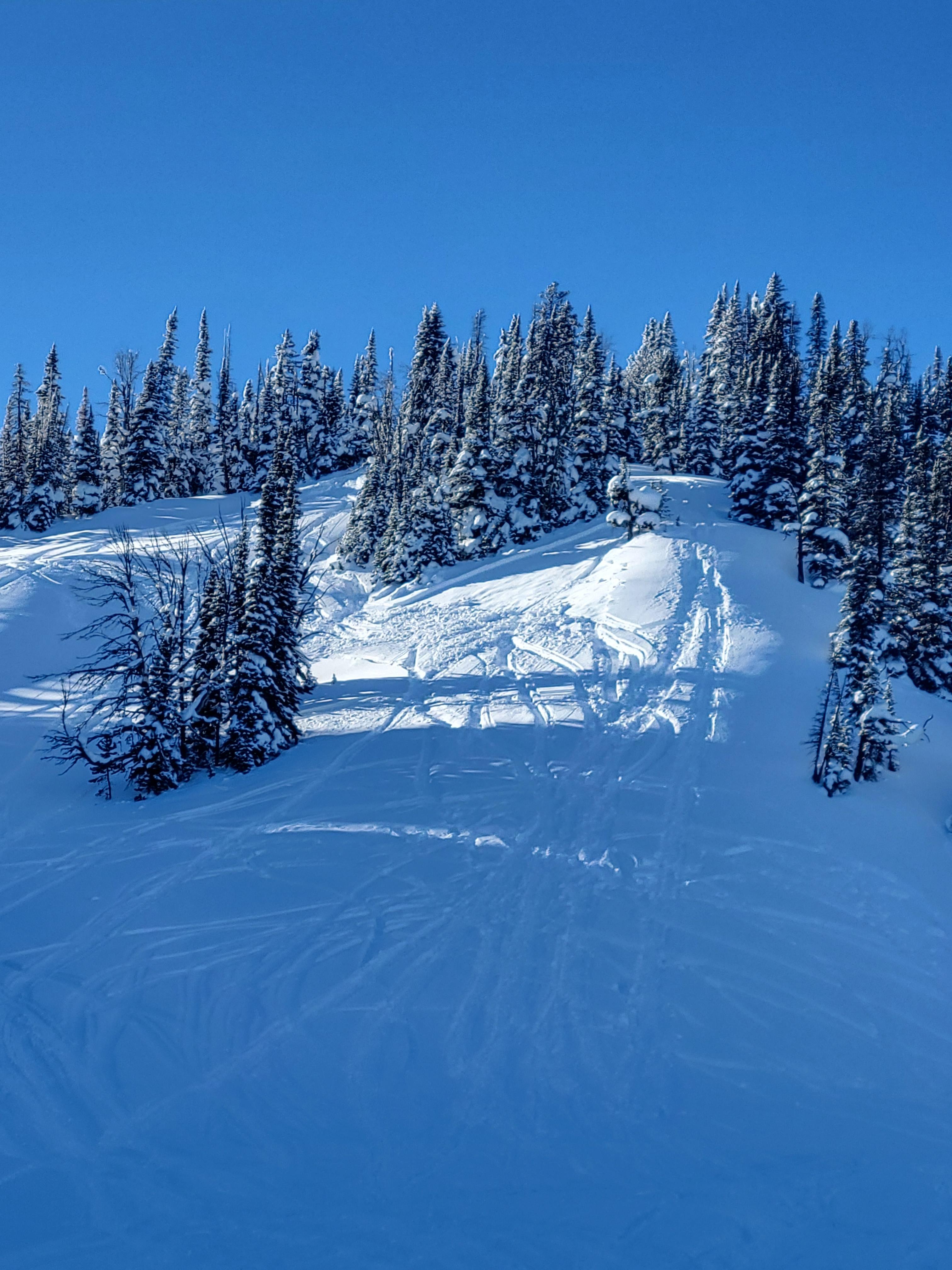
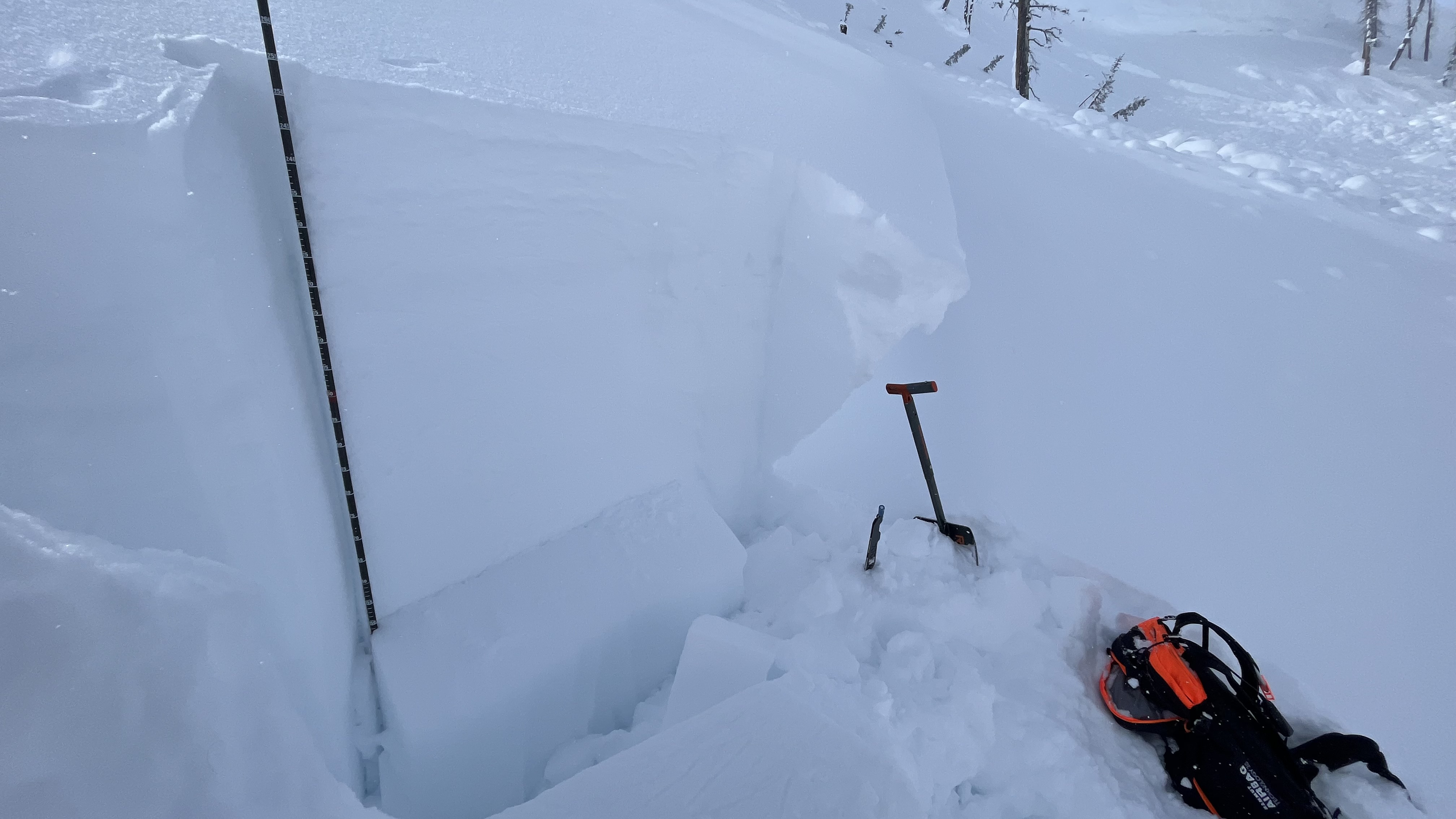
The 3-5” of new snow at Buck Ridge has blown into 1-1.5’ wind slab throughout the area. Cornices were built along the trail, and along ridgelines. The wind continued to transport snow today. We rode towards Beaver Creek to see if there was any avalanche activity–we saw a few small wind slabs. Next, we headed to the head of Bear Creek. The snow had built big pillows of wind drifted snow along the climb to the wilderness boundary. We observed some cracking on this slope when we stepped off our sleds. We stopped and dug a pit on the east facing slope at 9,400’. We found 7.5’ of snow (240 cm), and we had an ECTP 14, 2.5 feet below the surface of the snow on a layer of facets.
Full Snow Observation Report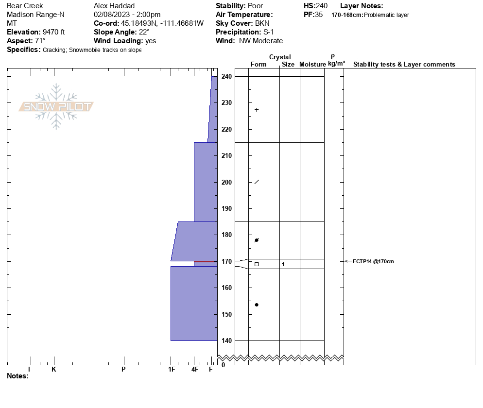

We toured up to the bacon rind ridge, descended a southwest aspect, and then headed over and up to the Ernie Miller Ridge.
In sheltered locations, there was approximately 15 cm of storm snow from Sunday into Monday.
On an east-southeast aspect off of Ernie Miller between approximately 9000-9700', we found widespread 20-25 cm thick 1F wind slab sitting on 1 mm facets. The slab was moderately resistant in hand shears and remained intact once isolated. It was not reactive to our jumping on small test slopes. We observed no cracking during our ascent and saw no signs of reactivity during our descent.
Above approximately 9700', the surface was largely scoured and there was a thin wind skin.
We observed similar facets below the storm snow on our ascent of a southwest aspect between 8000-8700' on the way back up to the bacon rind ridge.
Full Snow Observation ReportFrom FB: We saw a fresh break on the west face of sage peak last night, I would guess around 9500’.
Full Snow Observation ReportDid a couple runs just to the north of bacon rind, had good runs. Dug a pit and did an ECT test at about 8300 ft on a SE aspect, snow pack was about 4 ft deep. I got an ECT-P10 with a Q2 shear quality. My column failed and propagated on a thin barely visible strip of surface hoar in between the new and old snow, there was about 12 inches of new snow. Also noticed ‘many thin (appeared to be 4-5 inches)slab crowns, on steeper terrain right off the rode near the pulloff West facing aspect, also tons of the same shallow looking crown on the spur road up to big sky on the steep south facing stuff above the road.
Skied near Bacon Rind Creek on 2/1/2023. Surprisingly little wind affect, still some snow on trees and a soft snow surface. Excellent low angle powder skiing in wind protected areas. Underlying snow structure very weak though. Weak layer likely from the December cold snap buried ~40-50cm from surface is super concerning, not to mention basal weak layers and new snow interface... New snow from the 1/27-1/28 storm has settled to a soft slab (F-4F) 35cm thick. Still lots of snow available for transport.
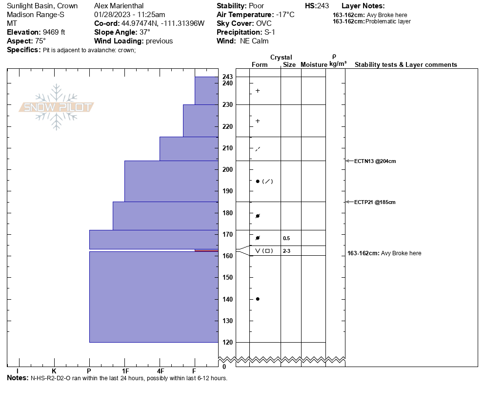
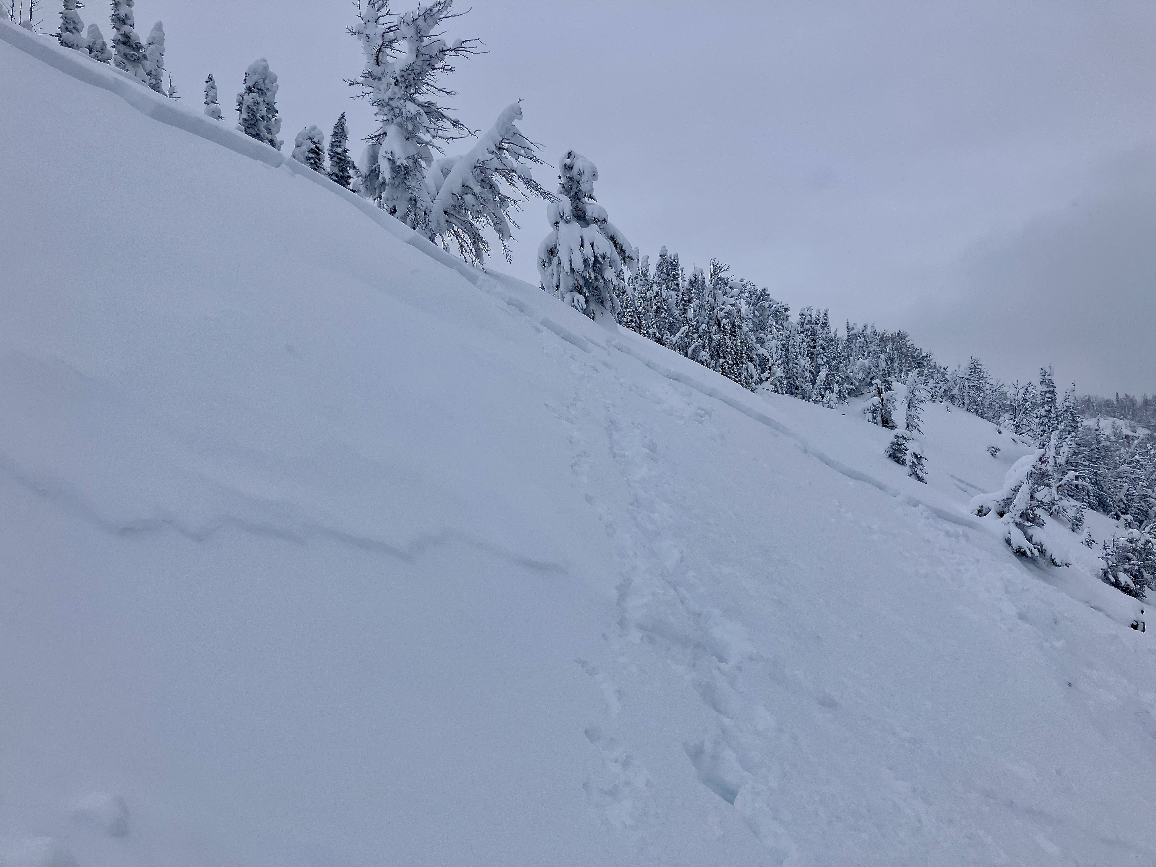
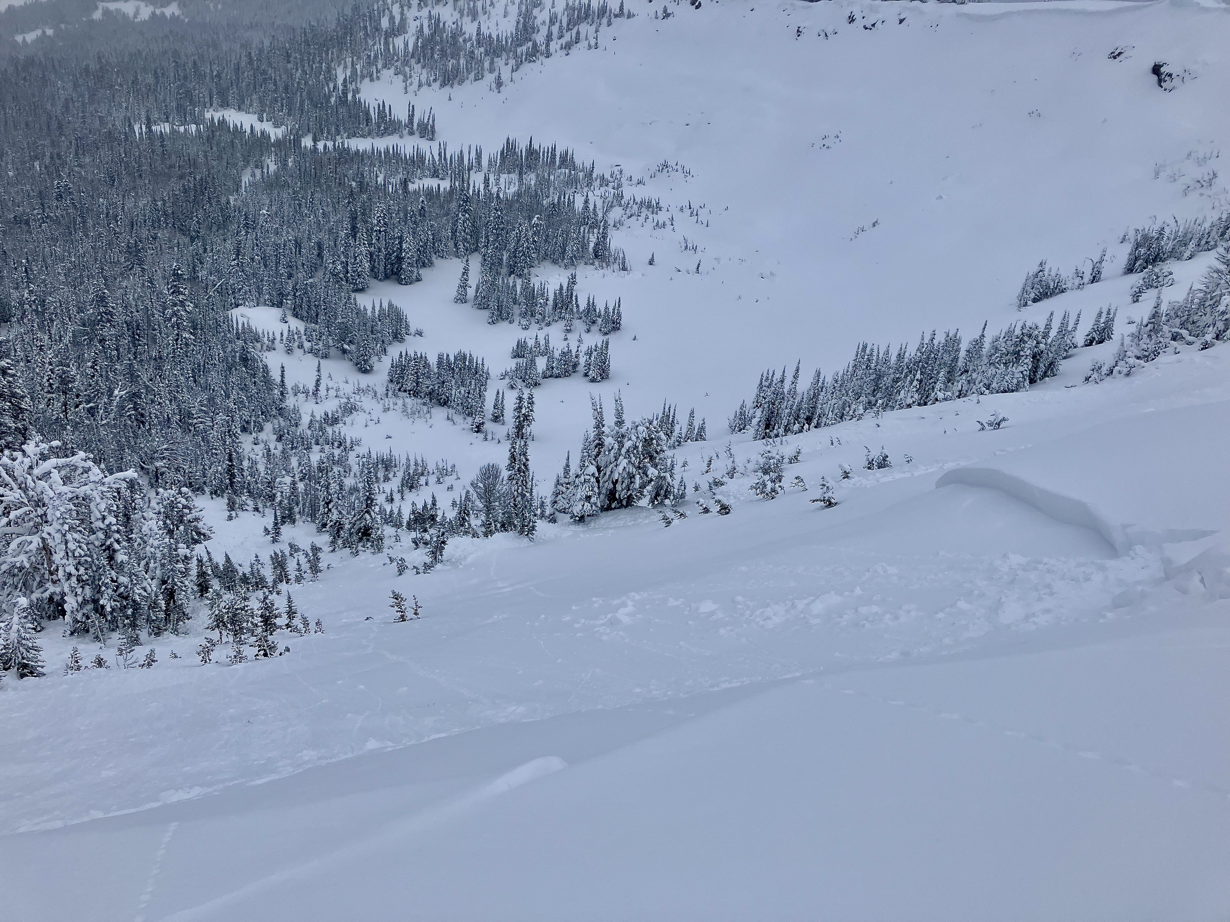
Full Snow Observation ReportWe rode to the Taylor Fork weather station (near Pika Point on the rim of Sunlight Basin) and noticed a few slides along the way. At the weather station we could see that the north end of the basin natural avalanched: the slopes from where the cornices end in Sunlight Basin past Pika Point. It broke up to 2.5 feet deep on an old layer of facets and surface hoar. The slide was R2 D2, 3-400 feet vertical and at least 750 feet wide. It was a large Hard Slab. We spent time at the crown digging, making a movie and getting cold. No surprises, just great to see a real avalanche. We also saw smaller slides looking west from the station, close by. Afterward, we rode to the Sage/Carrot divide in deep snow; hero riding. Skyline Ridge was obscured in clouds.
On the drive back to Bozeman we could see many slides on road cuts and on slopes across the river; low elevation avalanches that we don’t get to see often.
Full Snow Observation Report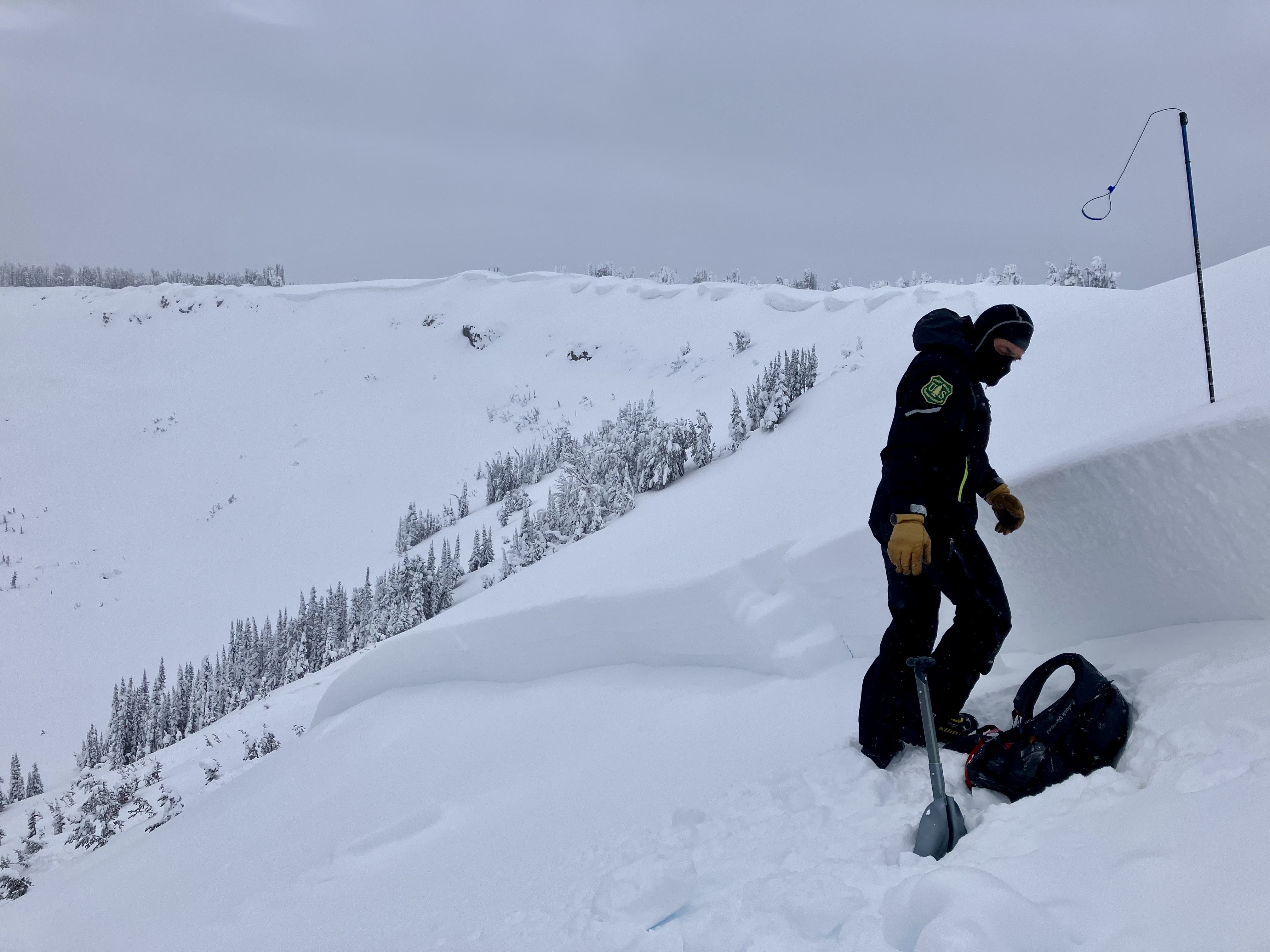

From IG message: "Another one today. Back of buck creek. Triggered 100 yards above where I crossed below it in the safe zone, after I went by. No burials."
Full Snow Observation Report