Snow Observations List
From IG message 4/17/24: "Remote trigger up little bear today. Went to the groundish."
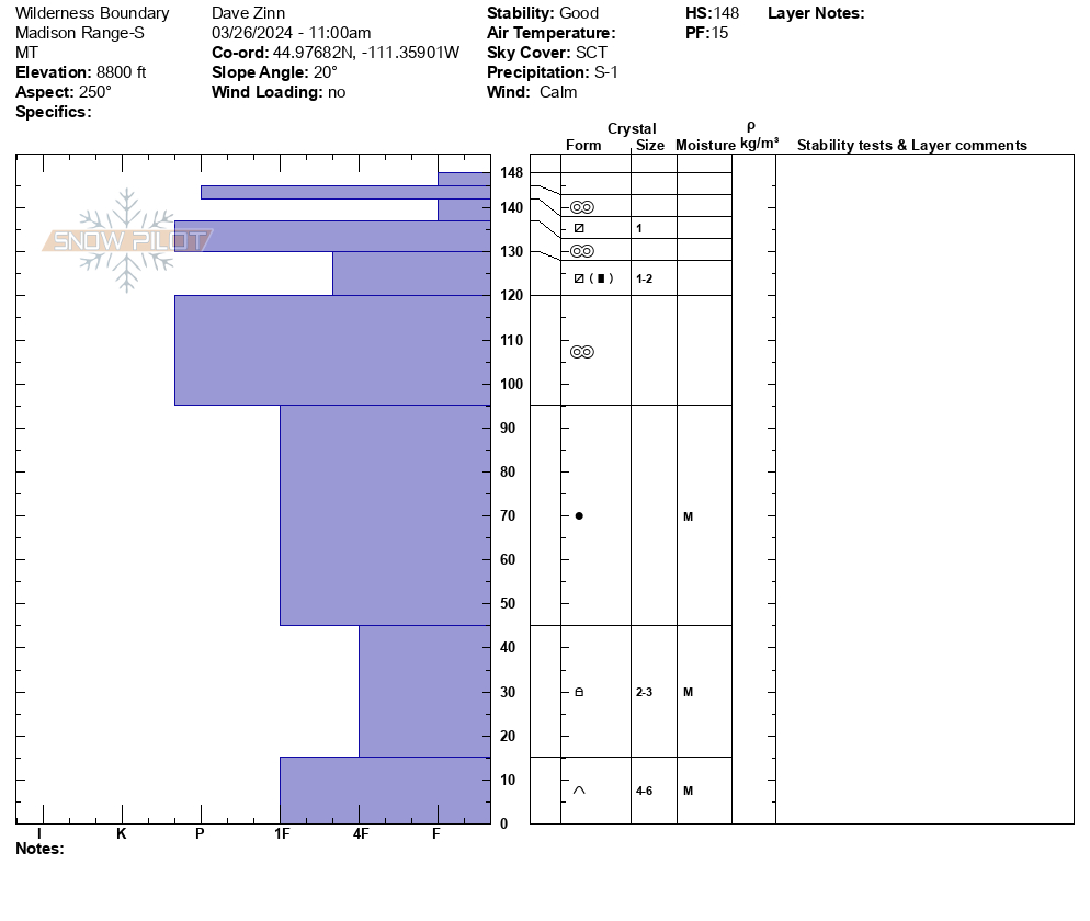
Full Snow Observation Report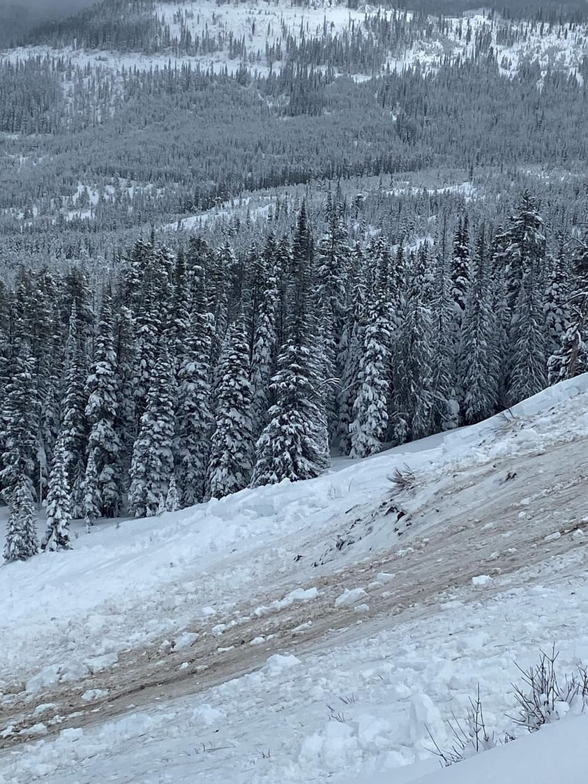
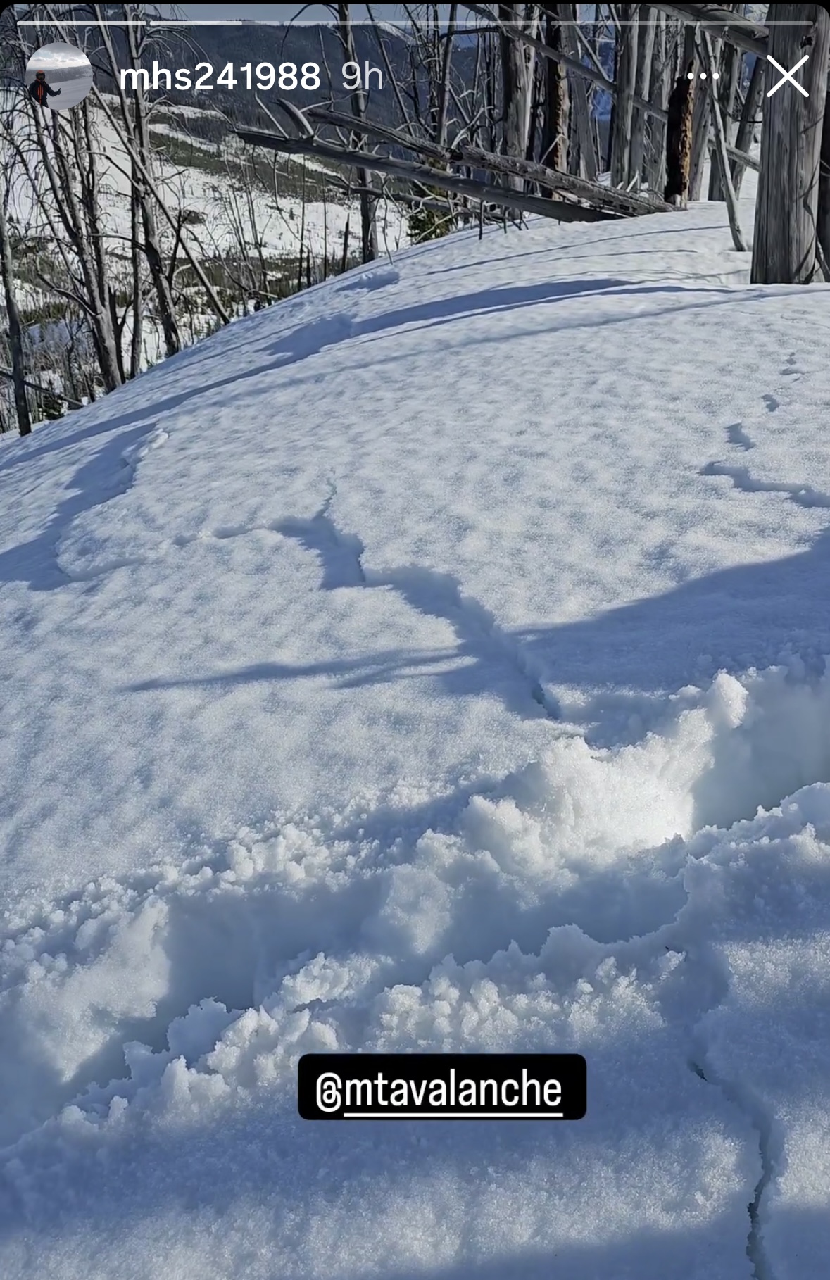
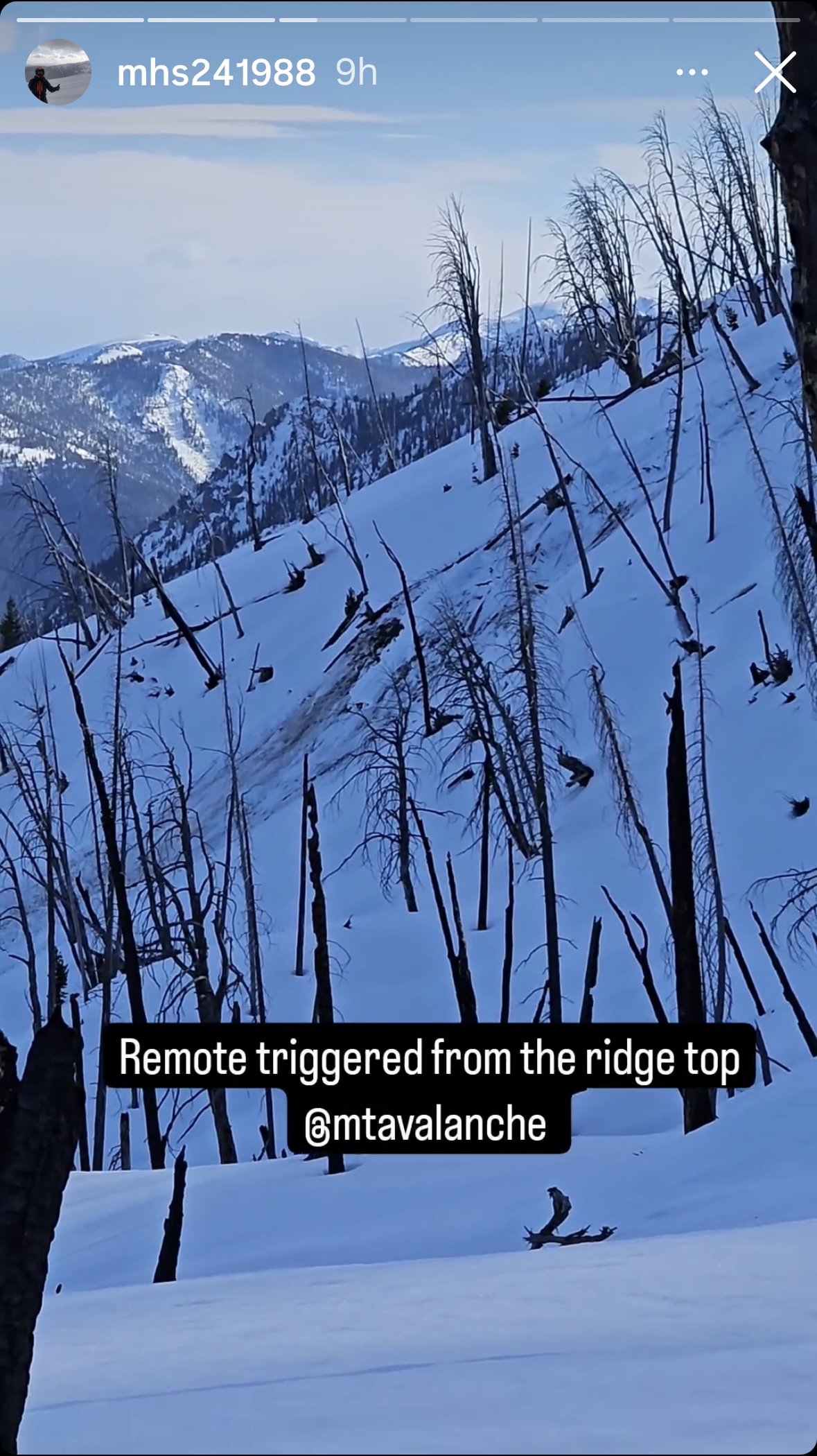
From IG: A group of riders noted very wet snow west of Cabin Creek and Southwest of the Taylor Fork. They were sinking to the ground where it was unconsolidated. The group remotely triggered a wet slab avalanche from the ridge top. There were shooting cracks that connected their location to the avalanche. This is an interesting of persistent weak layer and wet snow avalanche problems.
Full Snow Observation Report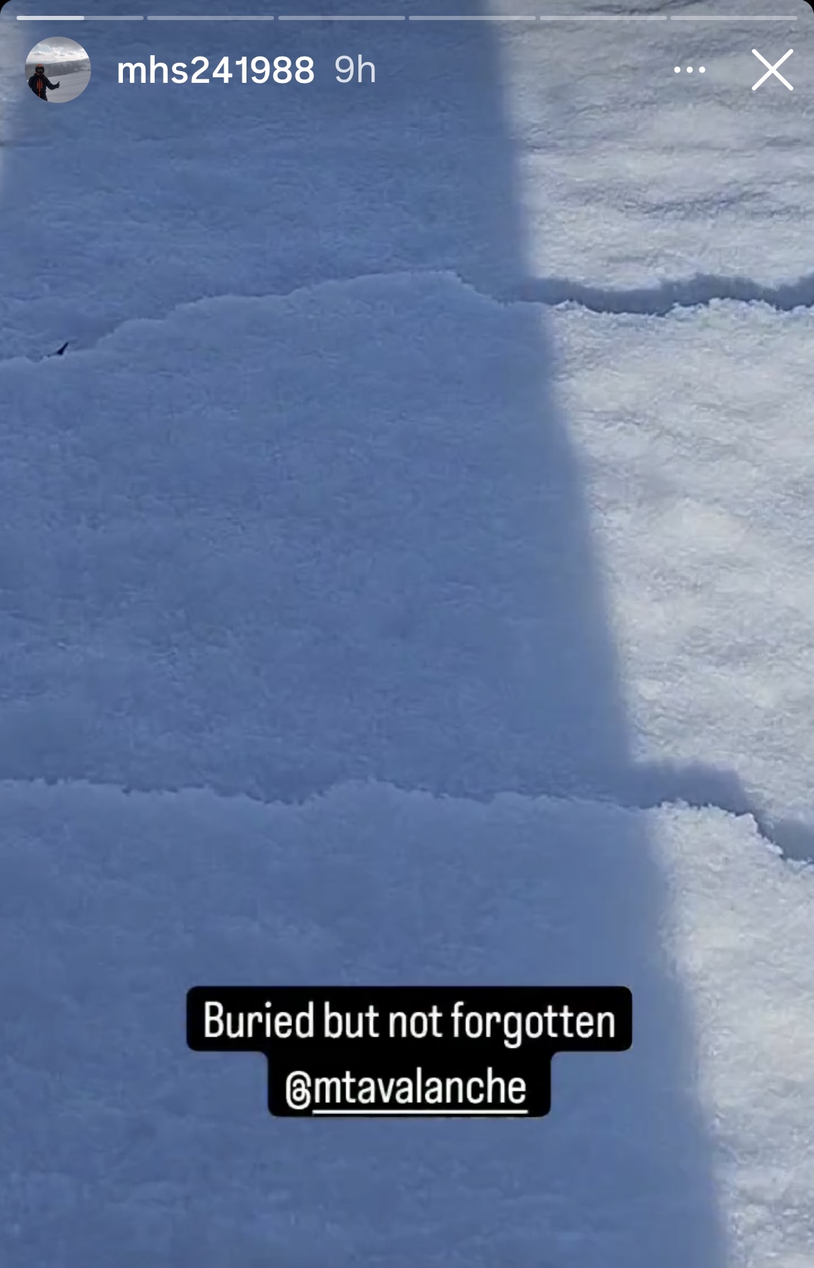
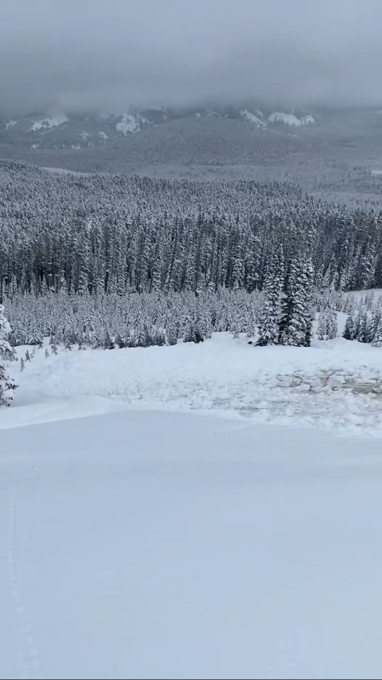
From IG: Wet slide to the ground above Quake Lake.
Full Snow Observation Report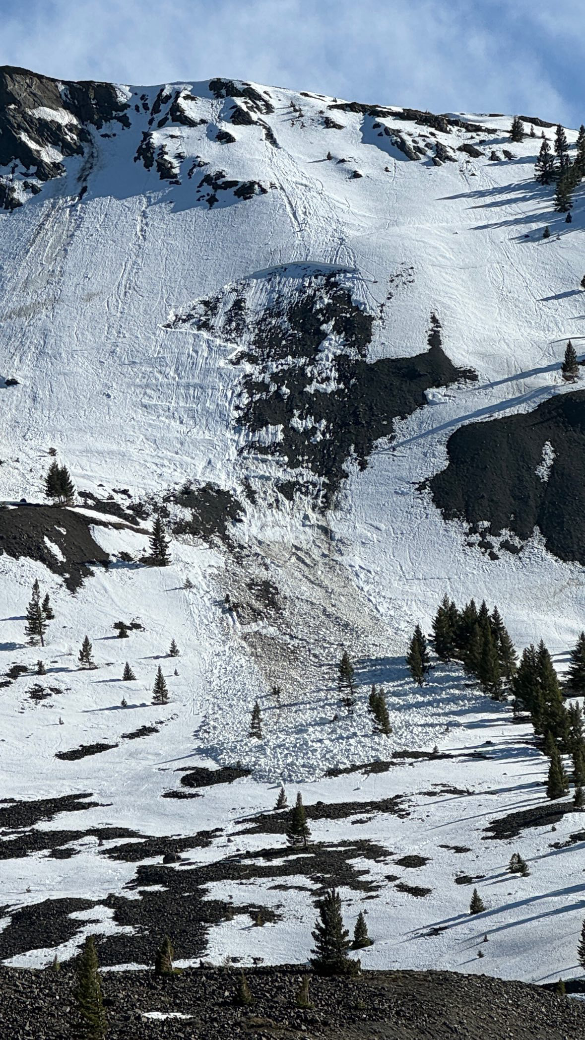
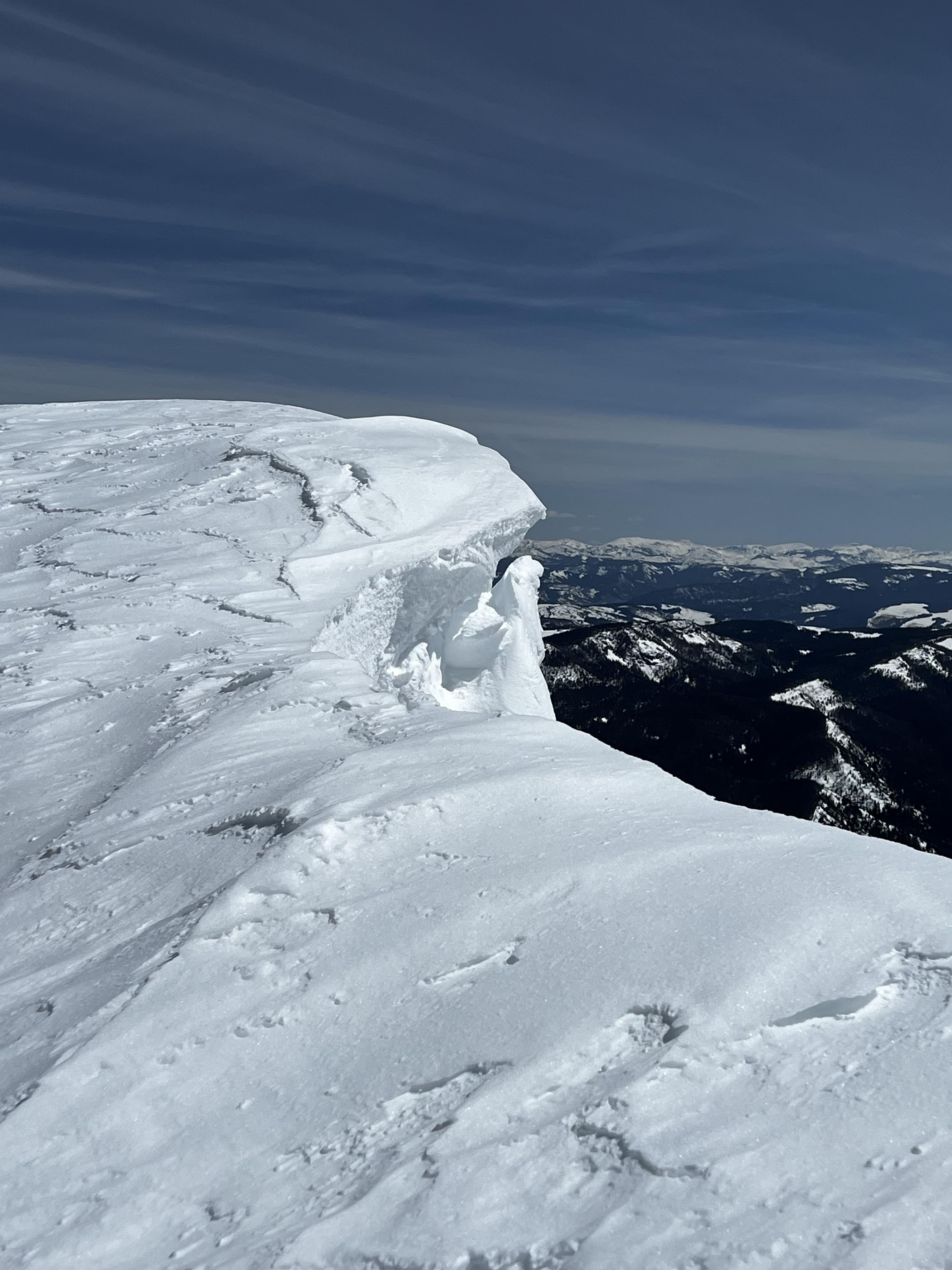
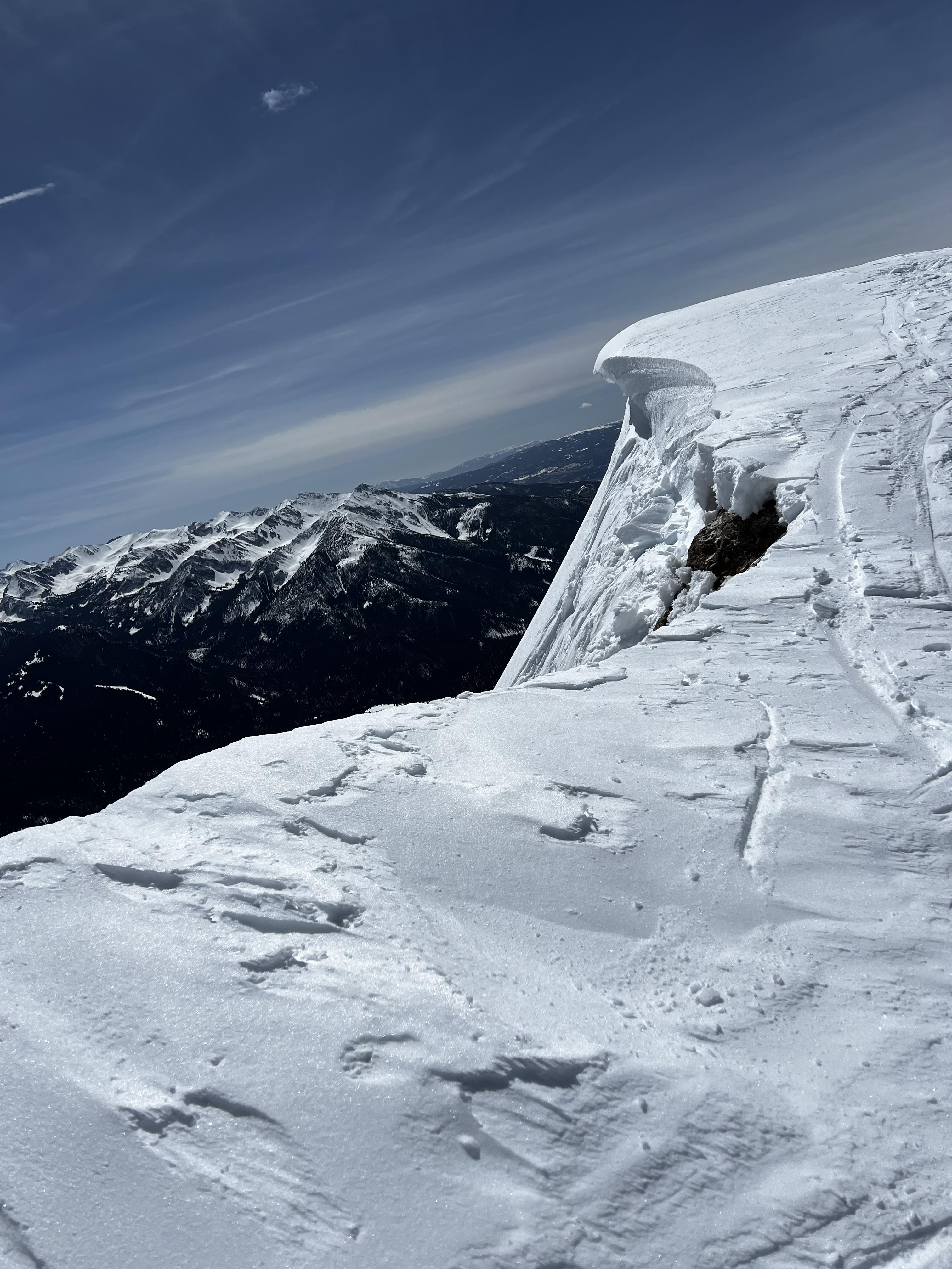
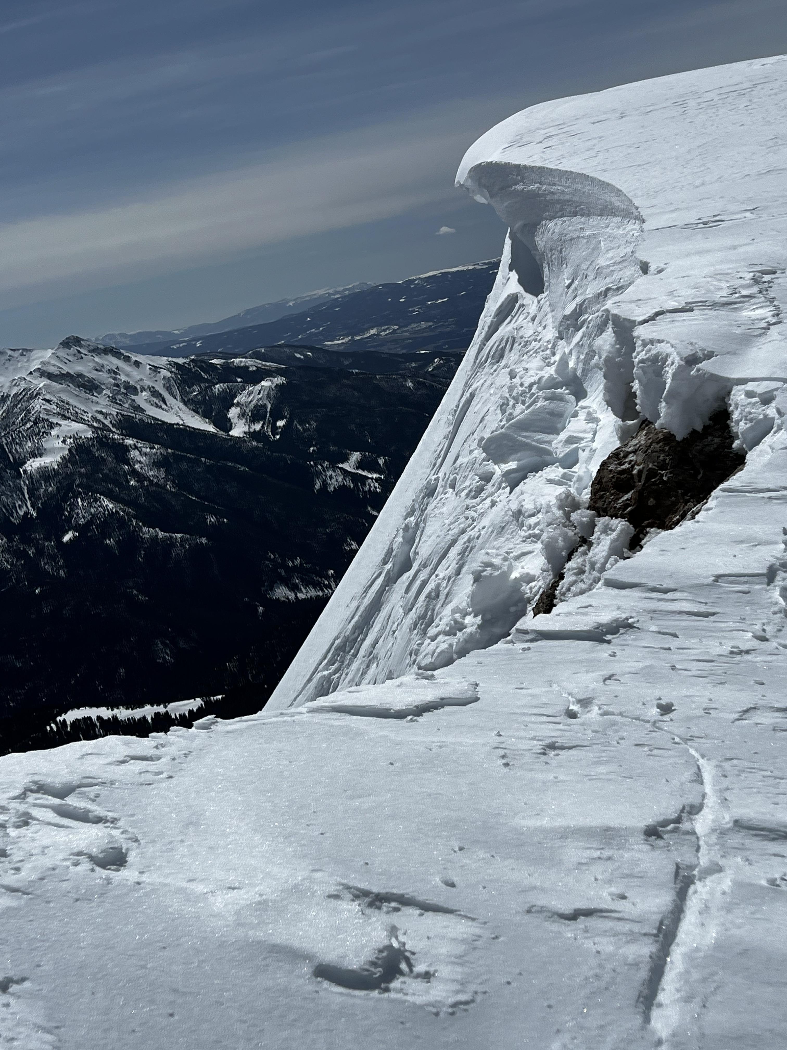
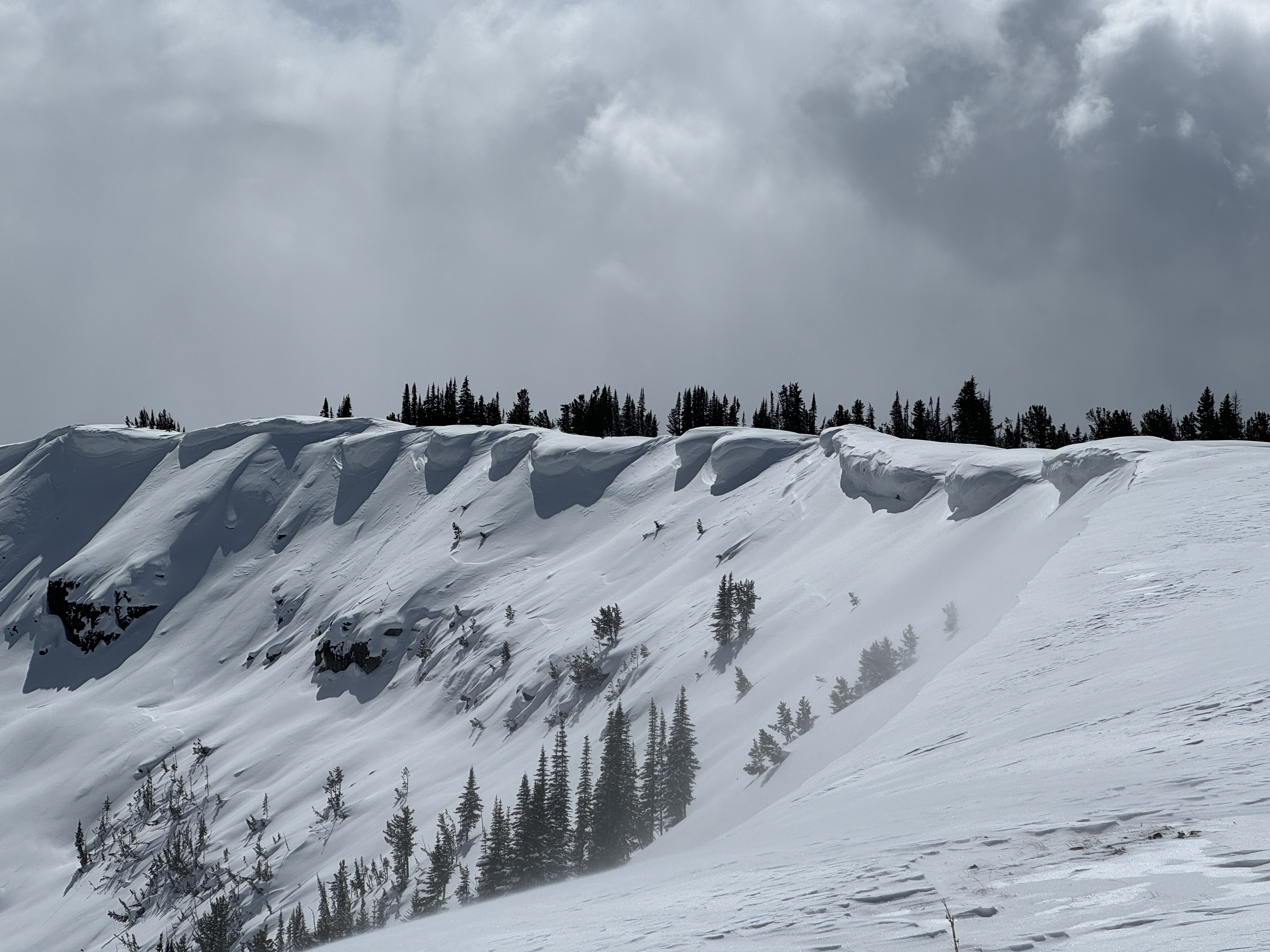
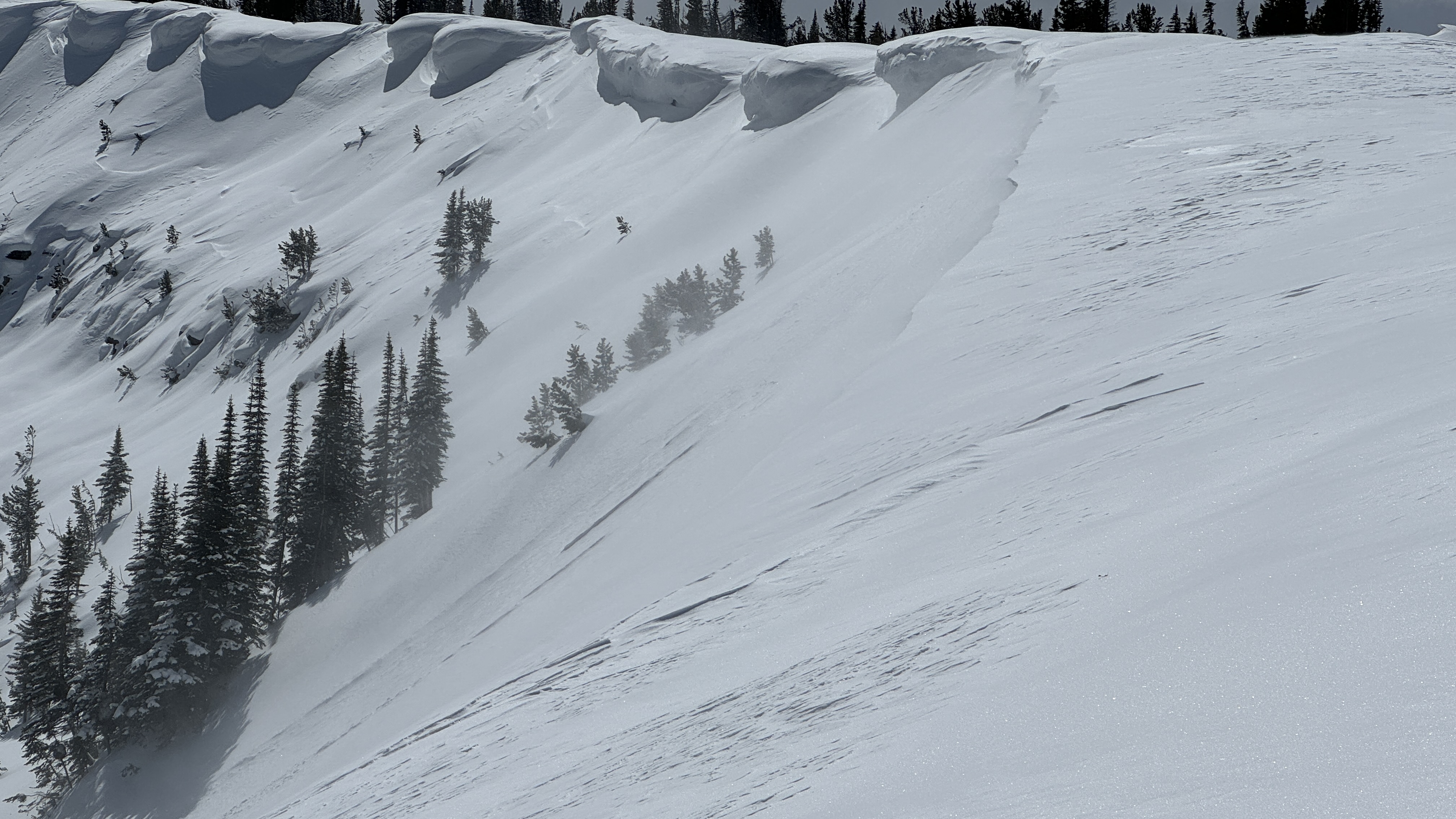
Unintentionally triggered a large cornice collapse on the south face of the Sphinx. I should have expected it, but it was certainly touchier than I was anticipating. Intermittent wind gusts kept upper elevations cooler and we found somewhat cold snow up high. At treeline and below it was hot and crusty! Photos show cornice before and after.
Full Snow Observation Report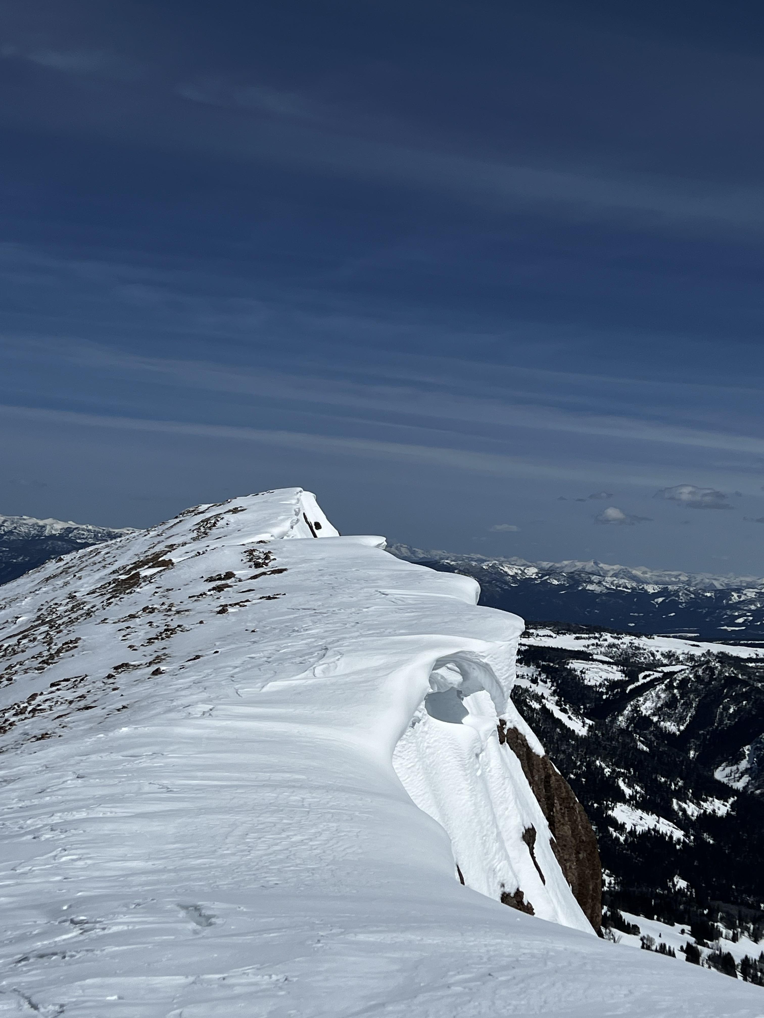
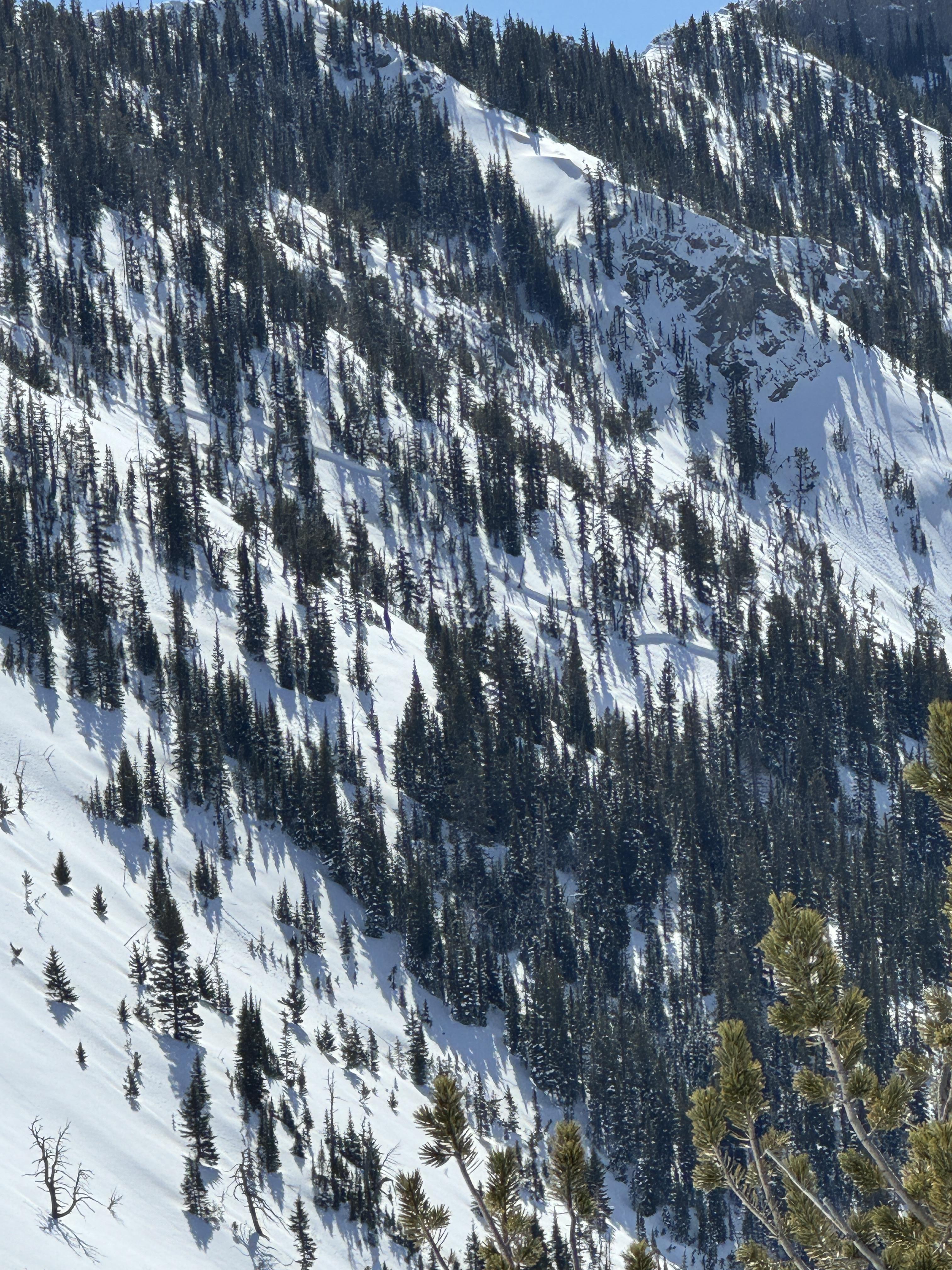
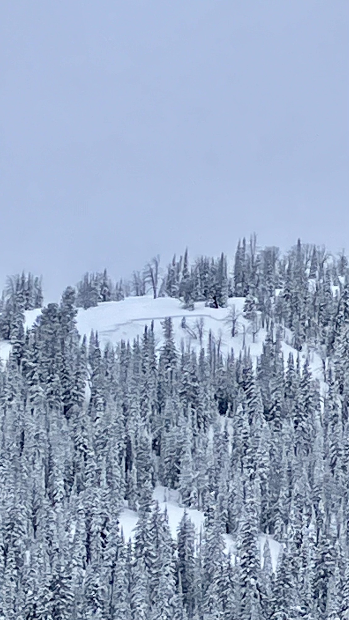
We toured down the west side of the Bridger Range on the edge of Truman Gulch and found predictably weak snow on an upper-elevation NW-facing slope. Conditions were variable and transitioned to a thick crust as we moved on to a lower elevation, west-facing slope. By the time we came down the Ramp, the snow was getting wet, we saw roller balls, and we avoided steep, sun-exposed terrain.
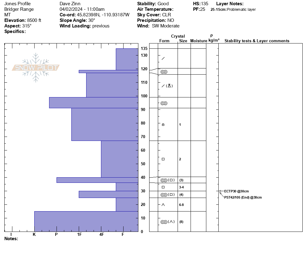
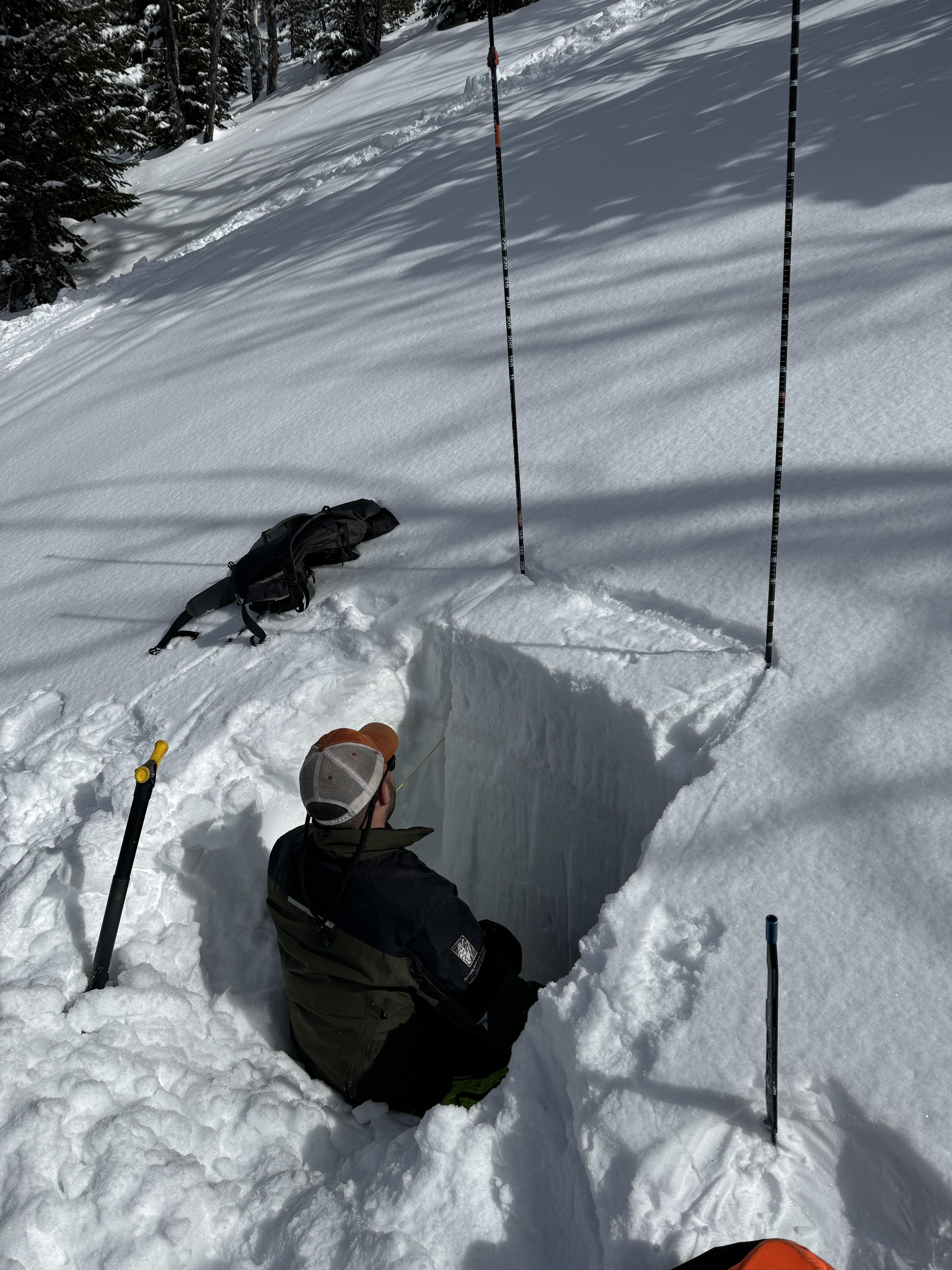
We dug below NW Passage. It was a 135 cm deep snowpack, dry throughout, with Fist plus hard facets and depth hoar making up the foundation (ECTP30, PST 42/100 end at 30 cm from the ground.
Full Snow Observation ReportMODERATE rising to CONSIDERABLE seemed correct.

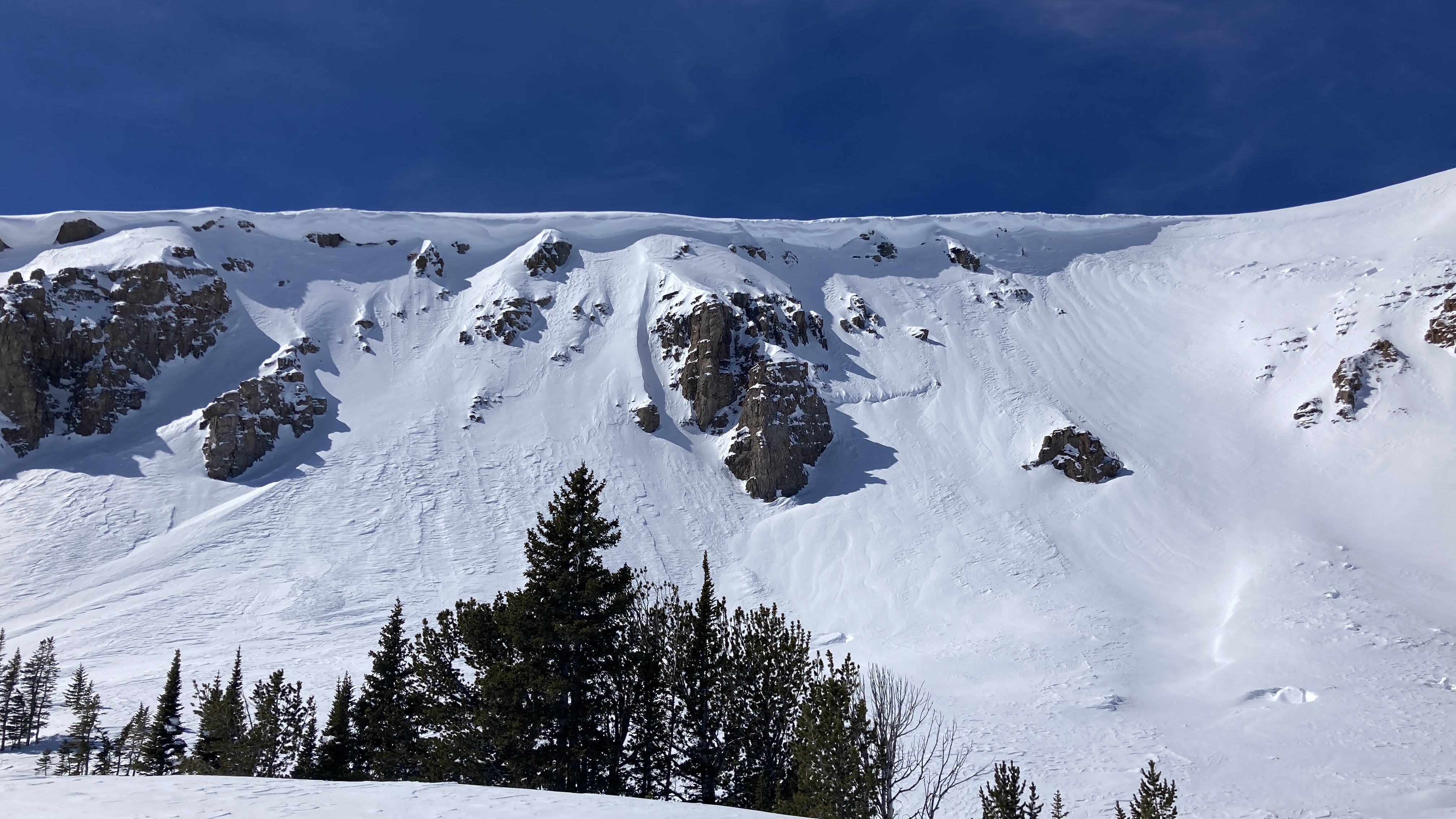
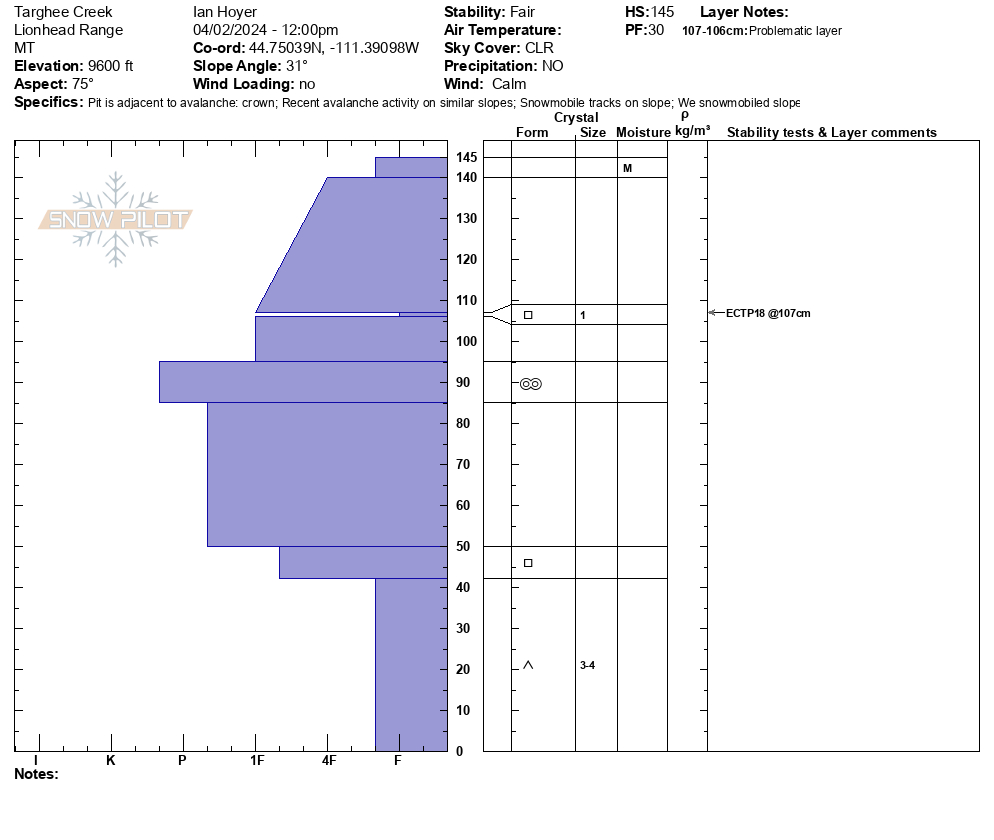
We rode from the Buttermilk trailhead up Denny Creek to Lionhead Ridge, along Lionhead Ridge through Watkins Creek and to the motorized boundary at the head of Targhee Creek.
There was a ~1" crust at the surface when we left the trailhead, with dry snow beneath. We saw our first wet loose avalanche of the day running around 11 am. By 12:30 there were dozens and many rollerballs. None of them ran particularly far or picked up too much volume. The snow surface was moist on sunny slopes by late morning, but not more than a few inches down.
We saw one small slab avalanche that occurred since this weekend's snow. It appears to have been triggered by a snowmobile yesterday (4/1/24). It broke 10" to 2 ft deep, 50 ft wide, and ran ~50 vertical feet. It broke on a thin layer of facets beneath the new snow. Digging in the crown, dry facets at the ground were along still present and weak (fist hardness).
Signs of older avalanches were visible beneath the new snow, including one slide that broke in early March. No cracking or collapsing were observed today.
Full Snow Observation ReportMOD rising to CON seemed totally reasonable.

Saw no signs of instability. Skied east to southeast aspect slopes. The snow did get moist, but not sloppy, in the afternoon. Did not execute any snow pits and accompanying test. The snow pack felt solid. Would have been nice to do a little snow science, but it was a long tour.
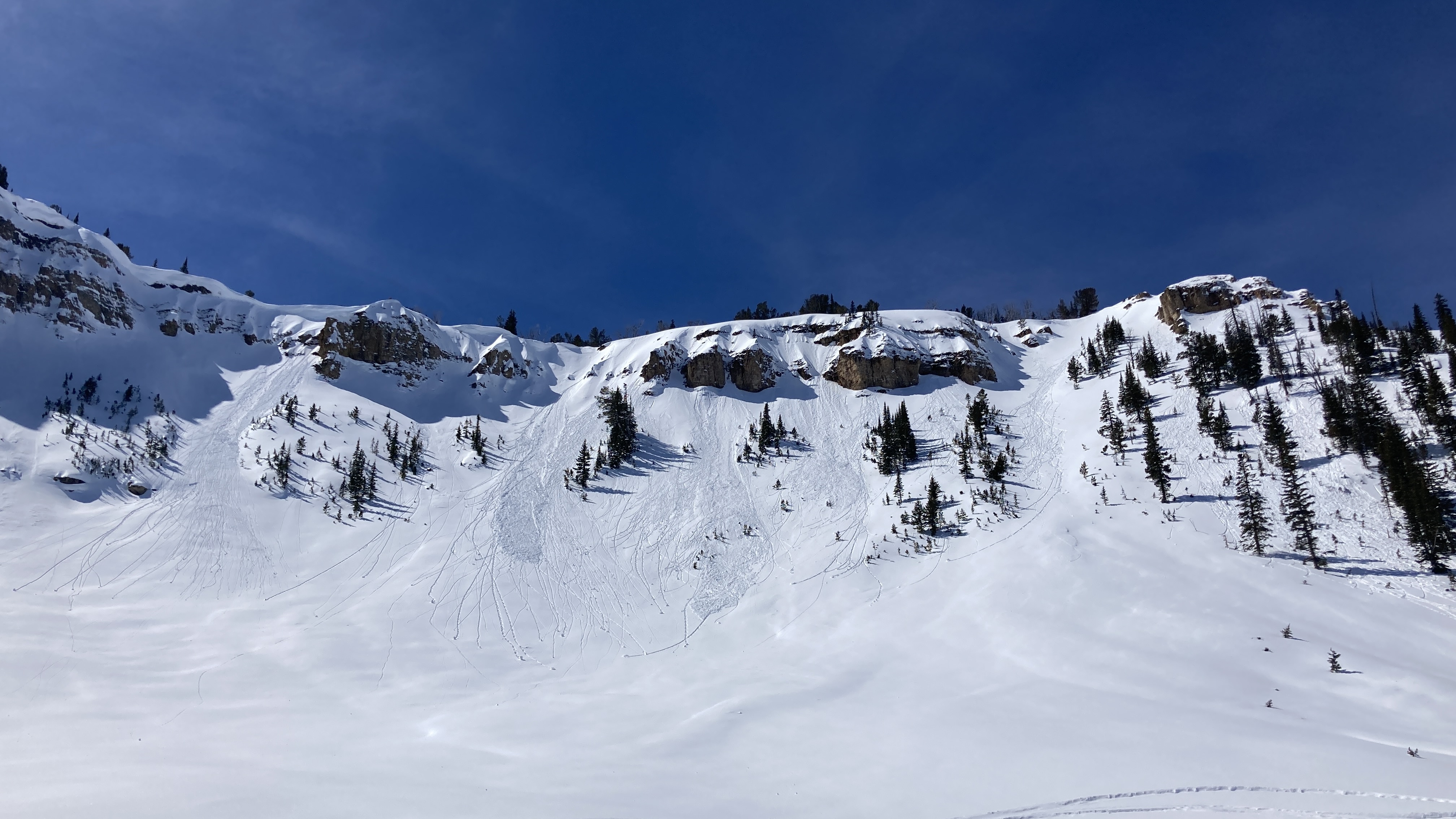
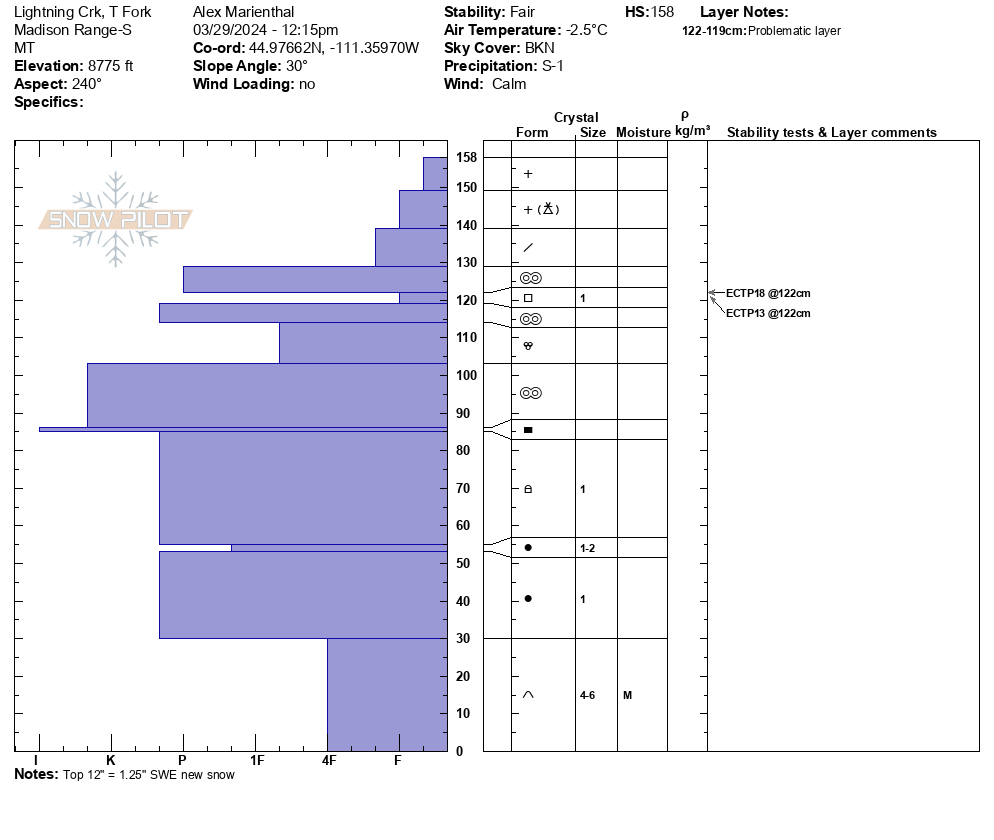
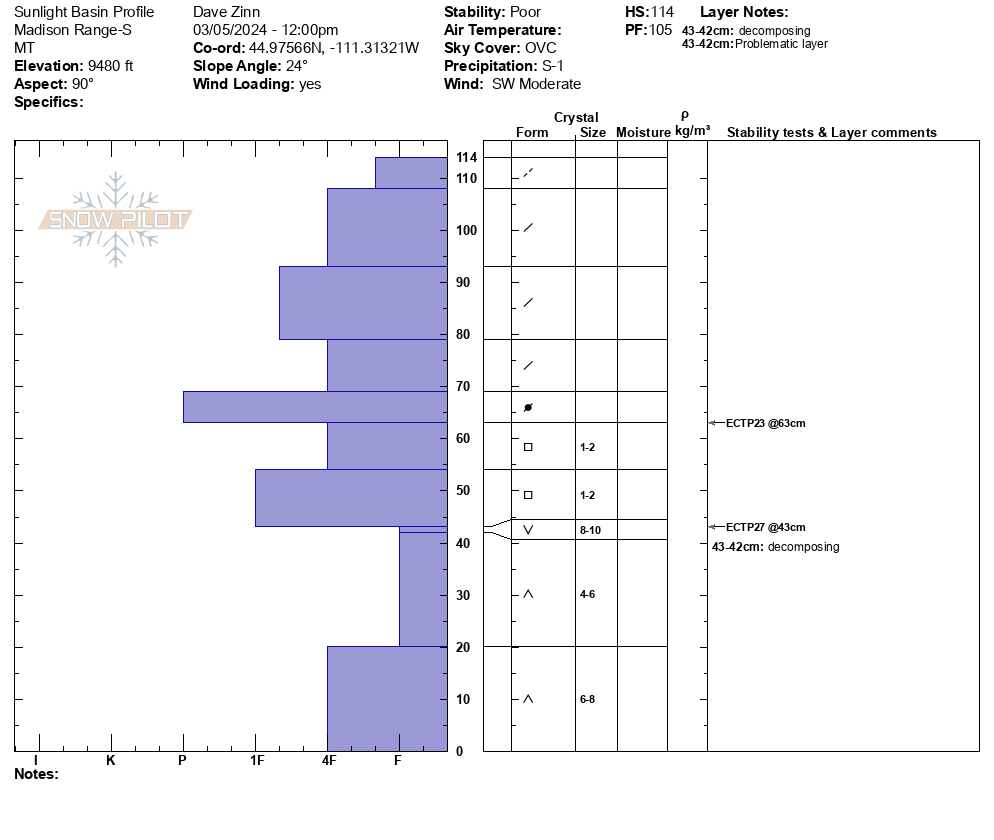
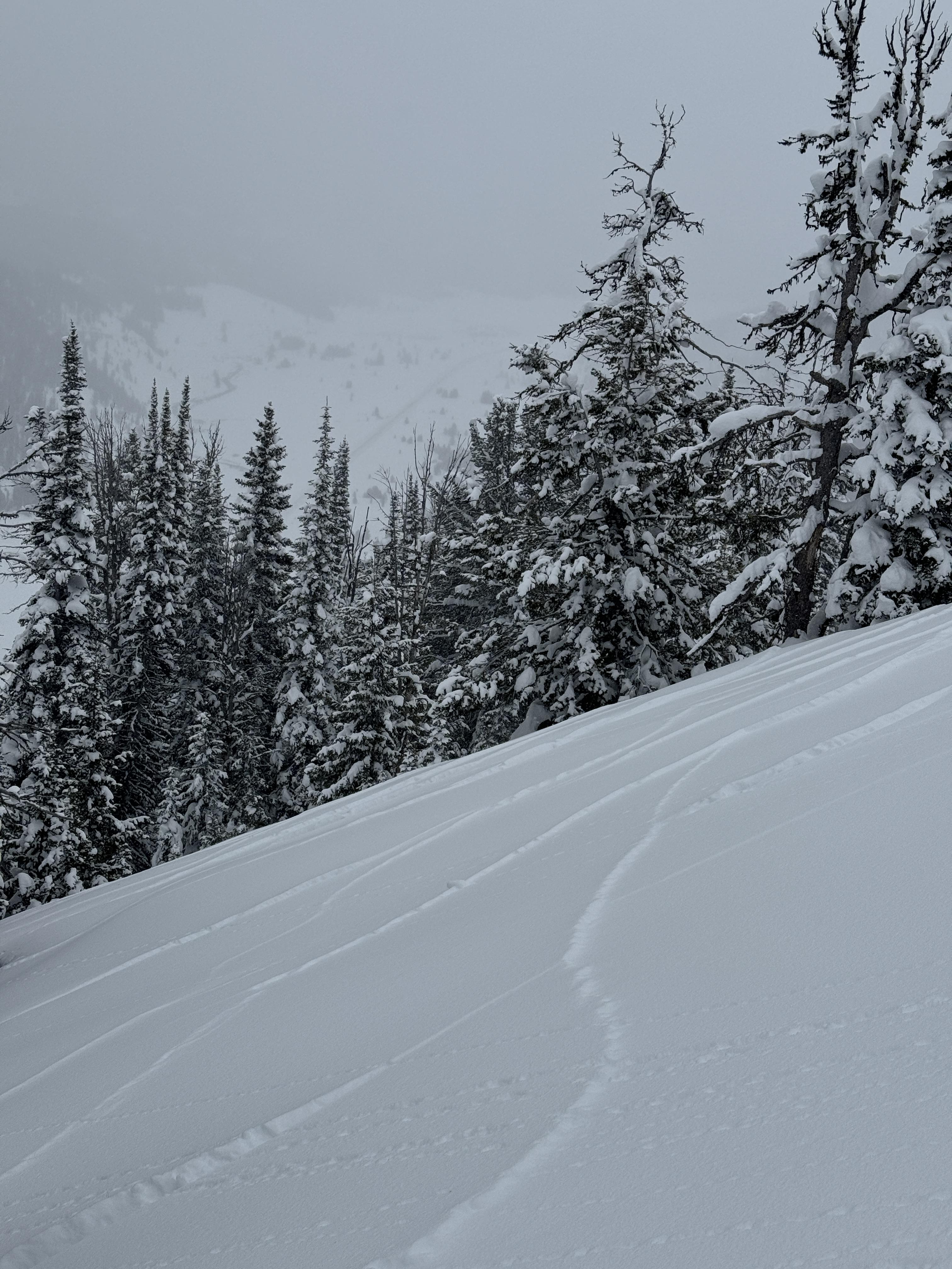
Full Snow Observation ReportWe rode into Taylor Fork, to the ridge at sunlight basin, through Carrot basin to the wilderness boundary, and back along the ridge to Beaver slide. There was 12" of new snow equal to 1.25" SWE.
Wind was calm, and skies were partly sunny with clouds obscuring Sage Peak, Skyline and areas to the south. The recent snow had not been affected by wind anywhere. The ridge near the weather station that is normally scoured still had 8"+ of light new snow on it. Sunny slopes got moist in the afternoon.
The only new avalanche I saw was one slope with small debris from a loose snow slide/ or new snow/wind slab on Kirkwood Ridge.
We dug a pit near the wilderness boundary where Ian and Dave dug earlier in the week. We had ECTP13 and ECTP18 on the recently buried layer of small facets below a 2" crust under the 12" of new snow.
Full Snow Observation ReportI mentioned to Ian on the phone I saw a deeper PWL avalanche near Woodward peak, but after looking at my photos I think it was actually a rock band... Not totally sure one way or the other, but I'm leaning towards not an avalanche.
My movie wont save in the new software I use for the vertical format, so that probably won't get published, but maybe in the morning.

Dug a pit near the top of bacon rind on an east facing slope. ECT-P 14 on the new snow slab breaking 12” deep
Full Snow Observation ReportWe toured over south Bacon Rind and into Ernie Miller Ridge today. The weather was variable, alternating between periods of calm winds and warm sun, and periods of heavy cloud cover, snow, and high winds. At the summit winds were strong out of the SW, but previous wind deposits further down pointed towards recent Northerly winds. These were strong enough to scour snow off the crust, and create drifts up to a foot deep. The sun was also affecting the snow surface, rapidly warming and wetting the snow above the crust. This wet snow was not bonding well to the crust. Some cold snow remained and made for good skiing.
We took the variability of the snowpack and the risks of a consequential slide into account and traveled through moderate terrain, avoiding excessive exposure.
Full Snow Observation ReportWe rode into the weather station, across to the Wilderness Boundary, along the ridgeline to the Beaver Slide, and back. We saw one new wind-slab avalanche in Sunlight Basin. It was small. From a distance, it appeared to be about 6" deep and 30' across (R1-D1). The other notable avalanche activity was a full-depth wet slab avalanche that broke last week during the warm-up on Lightning Ridge.
We dug a 150 cm deep pit at the Wilderness Boundary. The basal facets and depth hoar were moist. The upper-level melt-freeze crusts were so thick and hard that even with a saw assist, we could not isolate the column to the ground. There were two newish near-surface facet layers in the upper 10" of the snowpack. No hazard now, but they will be something to watch when loaded.
Full Snow Observation ReportThe danger was good at MODERATE.
Skied at Cinnamon Mountain today. The recent warm spell was not kind to the snowpack off 191. South facing slopes at all elevations had lost significant amounts of snow, with those below 7500 ft mostly bare and muddy.
Where there was still snow a thick yet loosely frozen crust capped weaker layers lower in the snowpack. Out of the wind this crust had barely refrozen, and I crashed through it many times, sometimes with the slab propagating further and shaking nearby saplings. Near treeline the crust became stout and supportable, and the 2-3 cms of new snow were bonding well (i.e. wet snow on wet crust).
Light winds with moderate gusts out of the WSW were lightly drifting the new snow, and precip was falling intermittently and as rain below ~7 kft. Certainly a funky day out there.
Full Snow Observation ReportWe rode from Taylor Fork through Cabin Creek on March 17. We saw a few recent slab avalanches that happened after the last snowfall, and some recent natural wet loose avalanches, and a cornice fall. Both (all) of these types of slides are possible for someone to trigger the next 2-3 days.
Melt freeze crust on sunny slopes was 1-1.5" thick with dry snow below. Softened on south-southwest slopes by midday to early afternoon. Shady slopes seemed to be staying dry up high. Skies were mostly clear with calm wind.
Full Snow Observation Report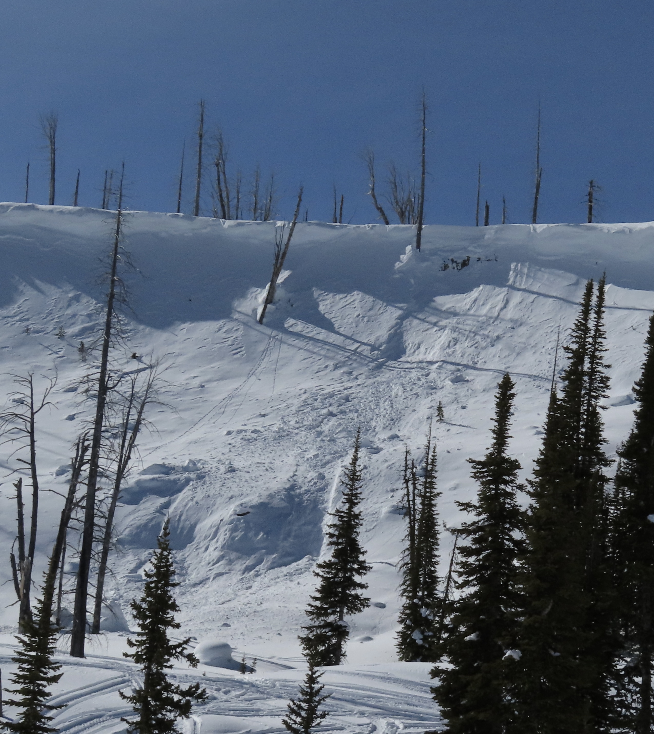

Toured up to the Cinnamon Mountain Lookout today. In a small meadow along the trail I got a small whumph, with a crack propagating out 5-10 feet all around me. HS was around 30-40 cm in this meadow. HS rose rapidly with elevation and I had no other large collapses throughout the day, but noticed some localized cracking in recently formed windslabs, and rapid warming of the snow surface in the sun all day. I dug a pit about 200' down from the summit, directly south facing, and got unremarkable test scores from a scary structure (full profile is in snowpilot). With the several warning signs I had seen, I chose to take my test results with a grain of salt, and ski a conservative line.
Full Snow Observation Report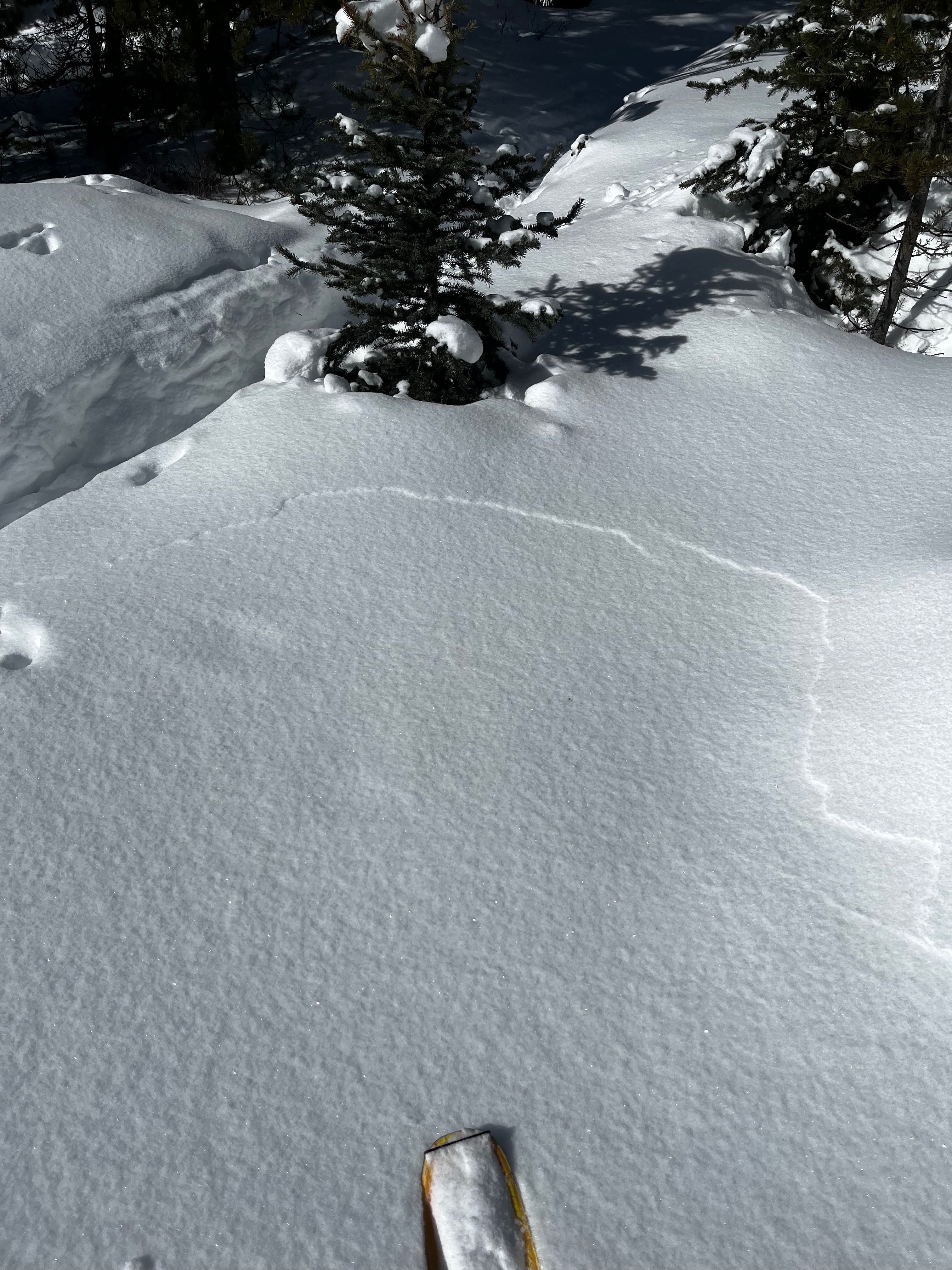
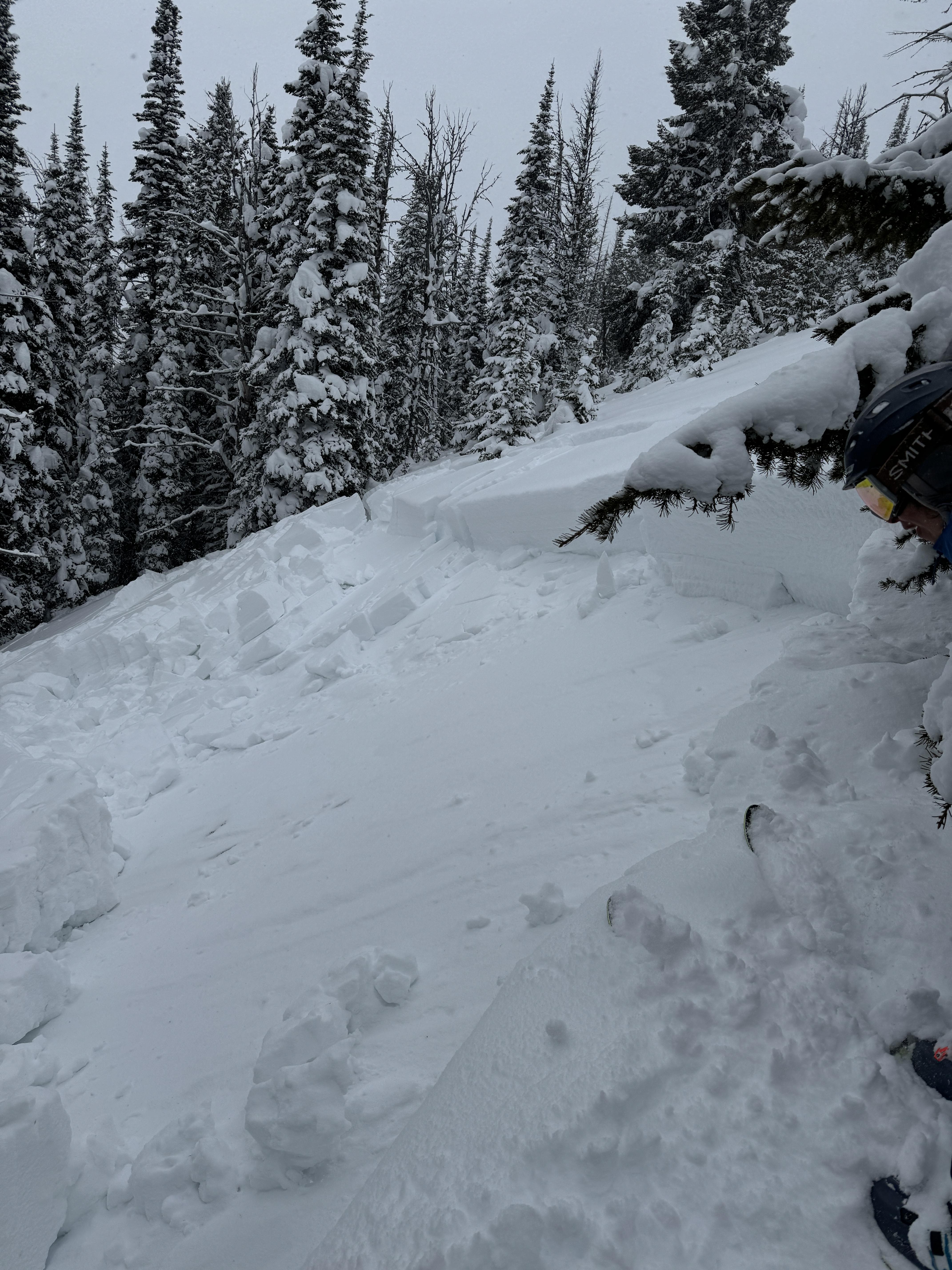
We rode into the Taylor Fork past Consolation Hill and to the weather station at Sunlight Basin. Winds were strong through the morning and we rode in a ground blizzard in all the open meadows along the trail in. There was not much for obvious drifting on the road, but the snow was obviously going somewhere. Snowfall intensity varied from a trace to an inch per hour (S -1 to S2). The highest precipitation intensities occurred around 1-1:30 PM as we began our ride out.
We did limp our way to the Sunlight Basin pit site in poor visibility and dug, but the wind, snow and light were such that we couldn't even visualize the bowl near the weather station. Digging a pit, we found more of the same structure that we have tracked for a few months now. The depth hoar does not seem to have gained any measurable strength, but the layers of surface hoar are somewhat more decomposed. We got an ECTP 23 on a layer of facet in the mid-snowpack and an ECTP27 on the depth hoar.
As we discussed in our video for the day, today and tomorrow the equation is simple... new and wind-drifted snow on a weak snowpack equals dangerous conditions. As we move into a period of high pressure for the rest of the week, the likelihood of triggering an avalanche will decrease as will signs of instability and, most likely, the frequency of avalanches. However, the consequences of getting caught will remain unchanged. As folks are enticed by steeper terrain later in the week, we strongly recommend an incremental approach to expanding terrain selection and avoiding slopes with terrain traps. Additionally, safe travel practices become essential if you are stepping into the ring, especially carrying rescue equipment, knowing how to use it, and traveling one at a time on any slope steeper than 30 degrees.
Full Snow Observation ReportDanger was CONSIDERABLE as far as I could tell, given the zero visibility.

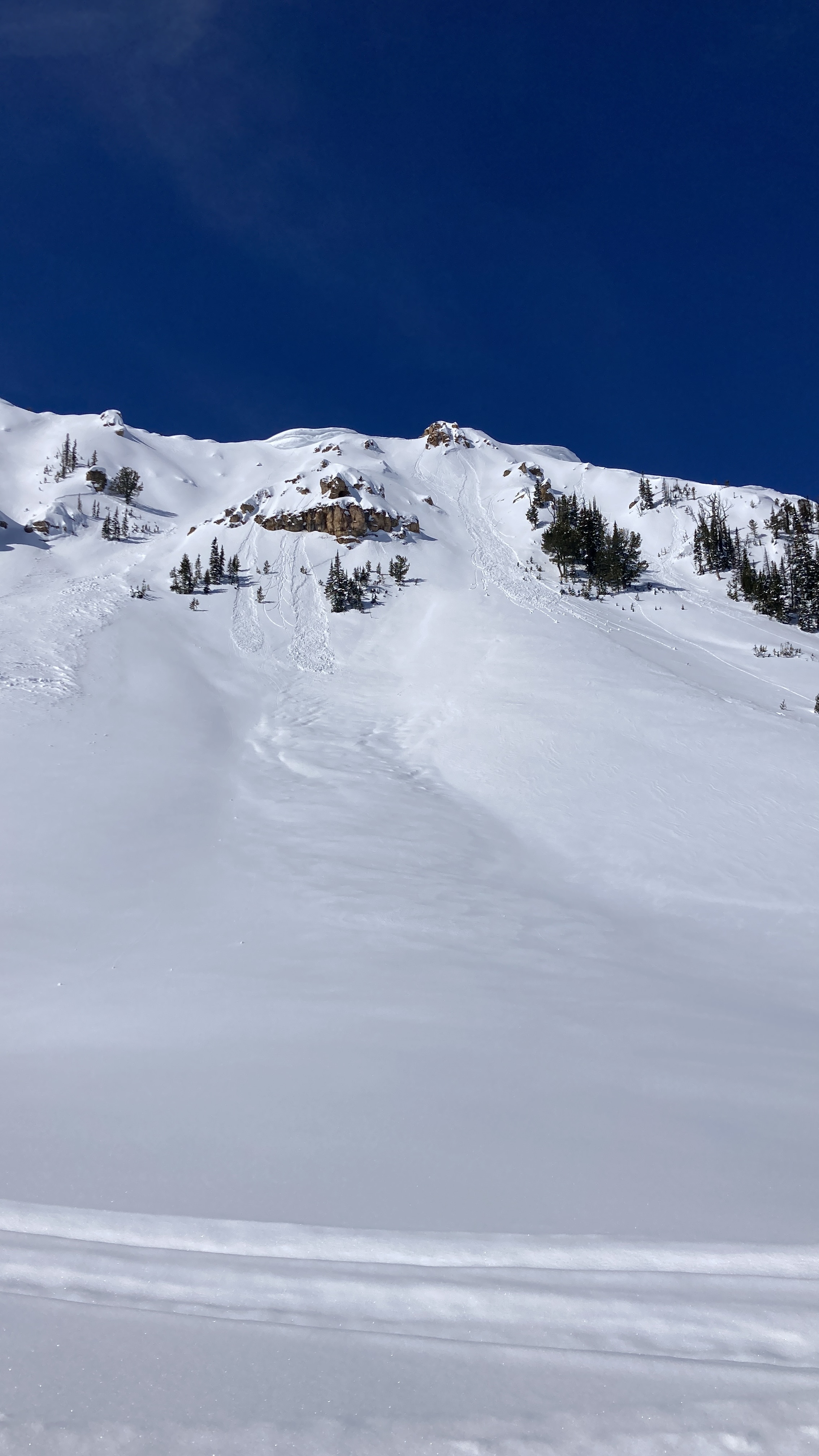
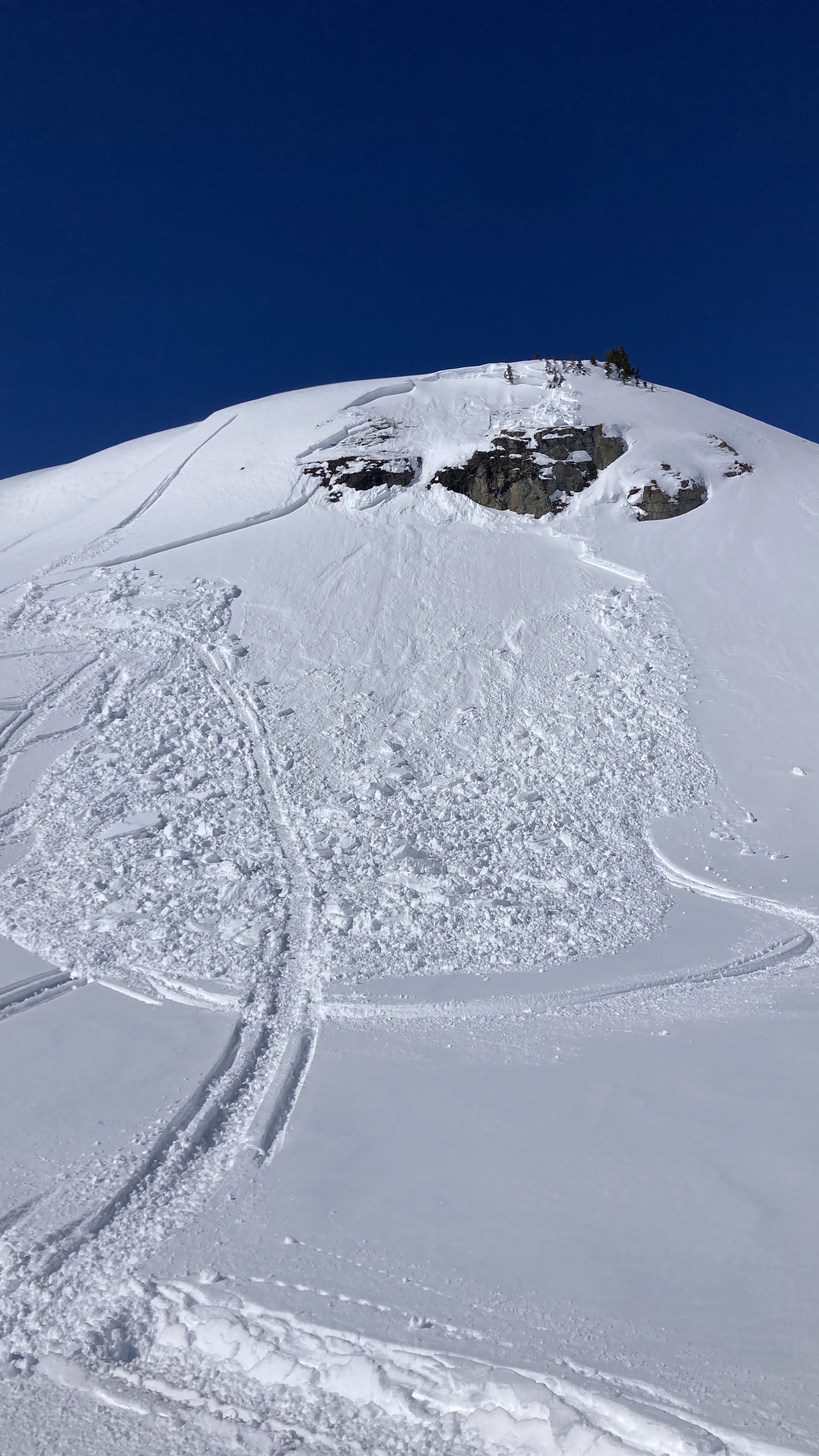
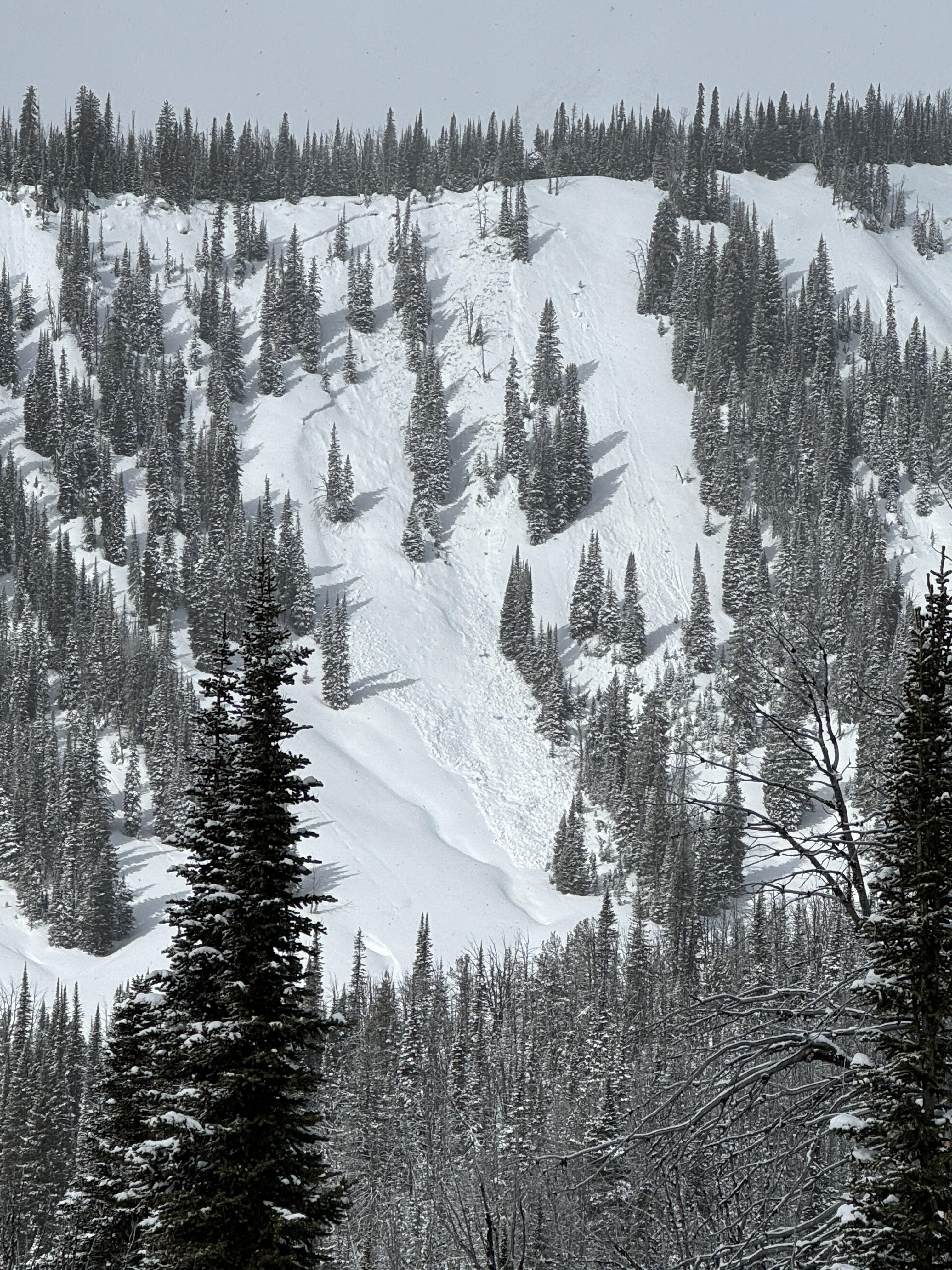
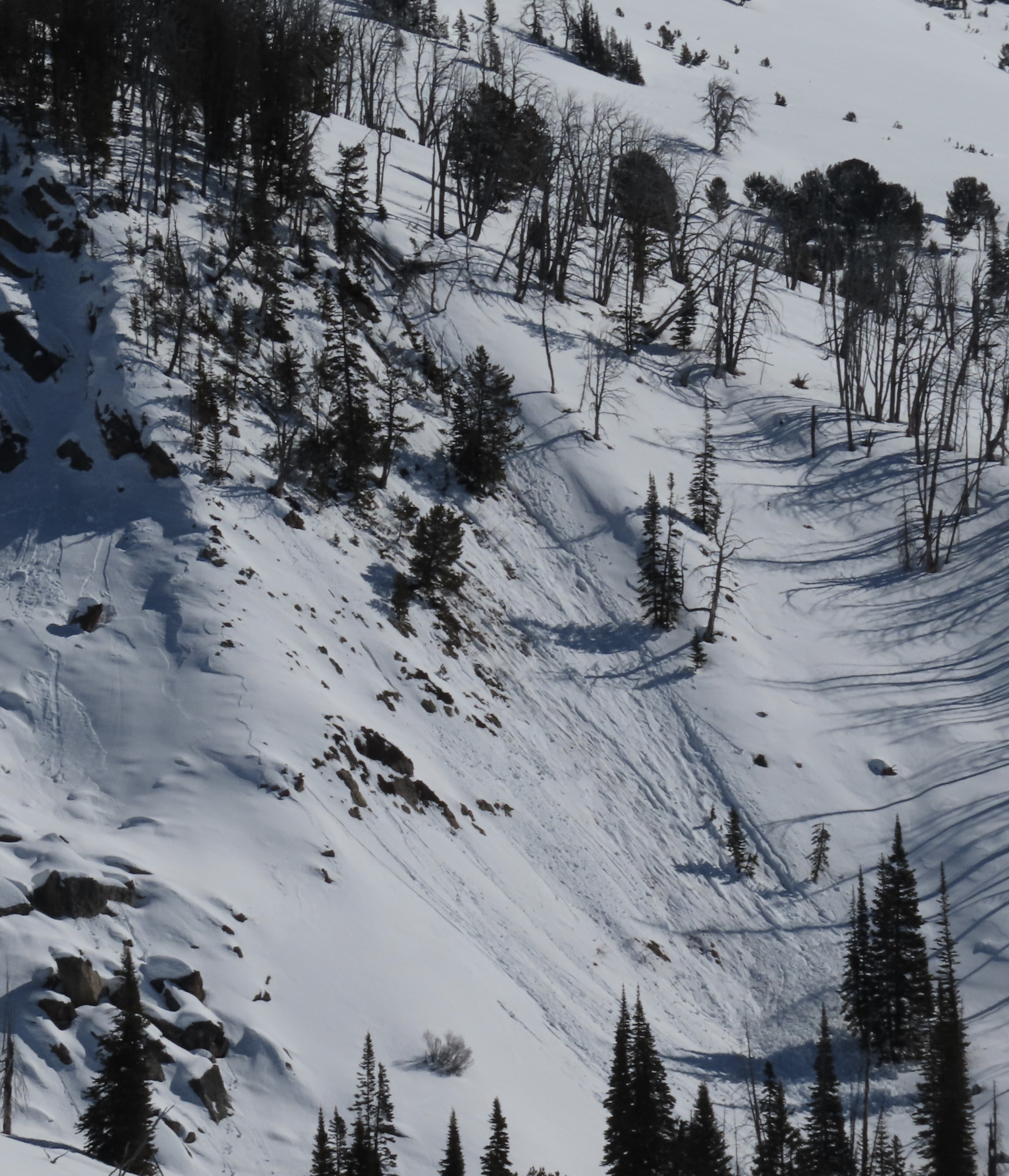
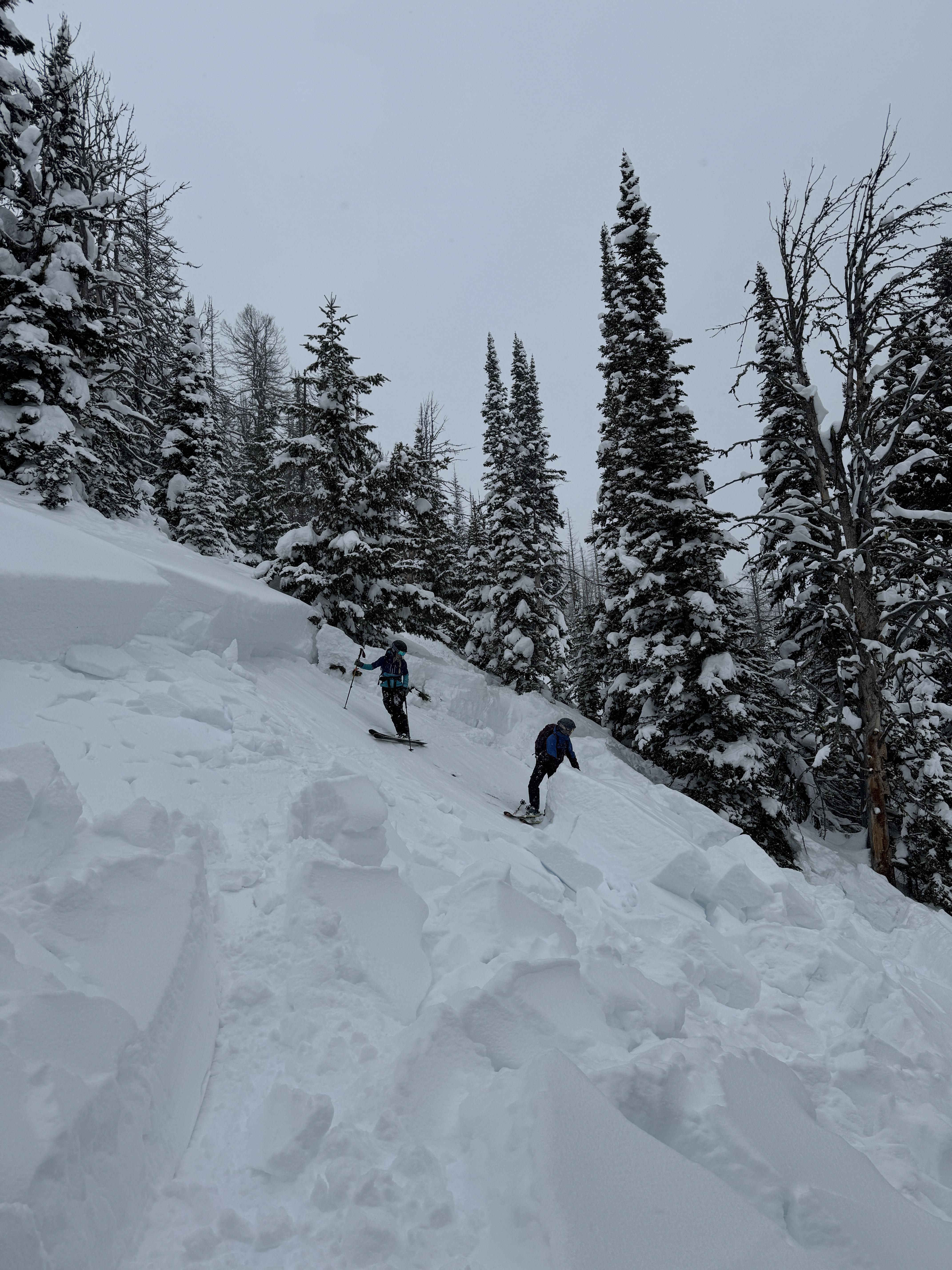
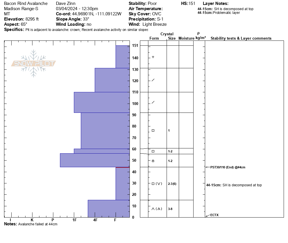
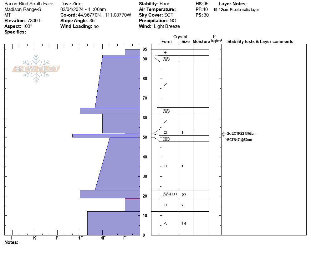
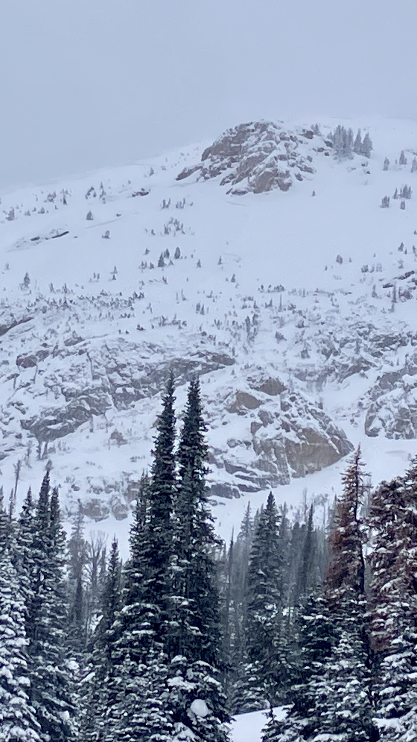
We toured up toward the Skillet along the standard uptrack route at Bacon Rind. We deviated to the south to look for a natural avalanche that broke on March 2nd in the south-facing meadows a third of the way up. We did not find it but dug a pit. 95 cm HS with a newly buried weak layer of facets above a crust at 52 cm (ECTP22x2 plus an ECTN17 on this layer). The depth hoar near the ground was moist.
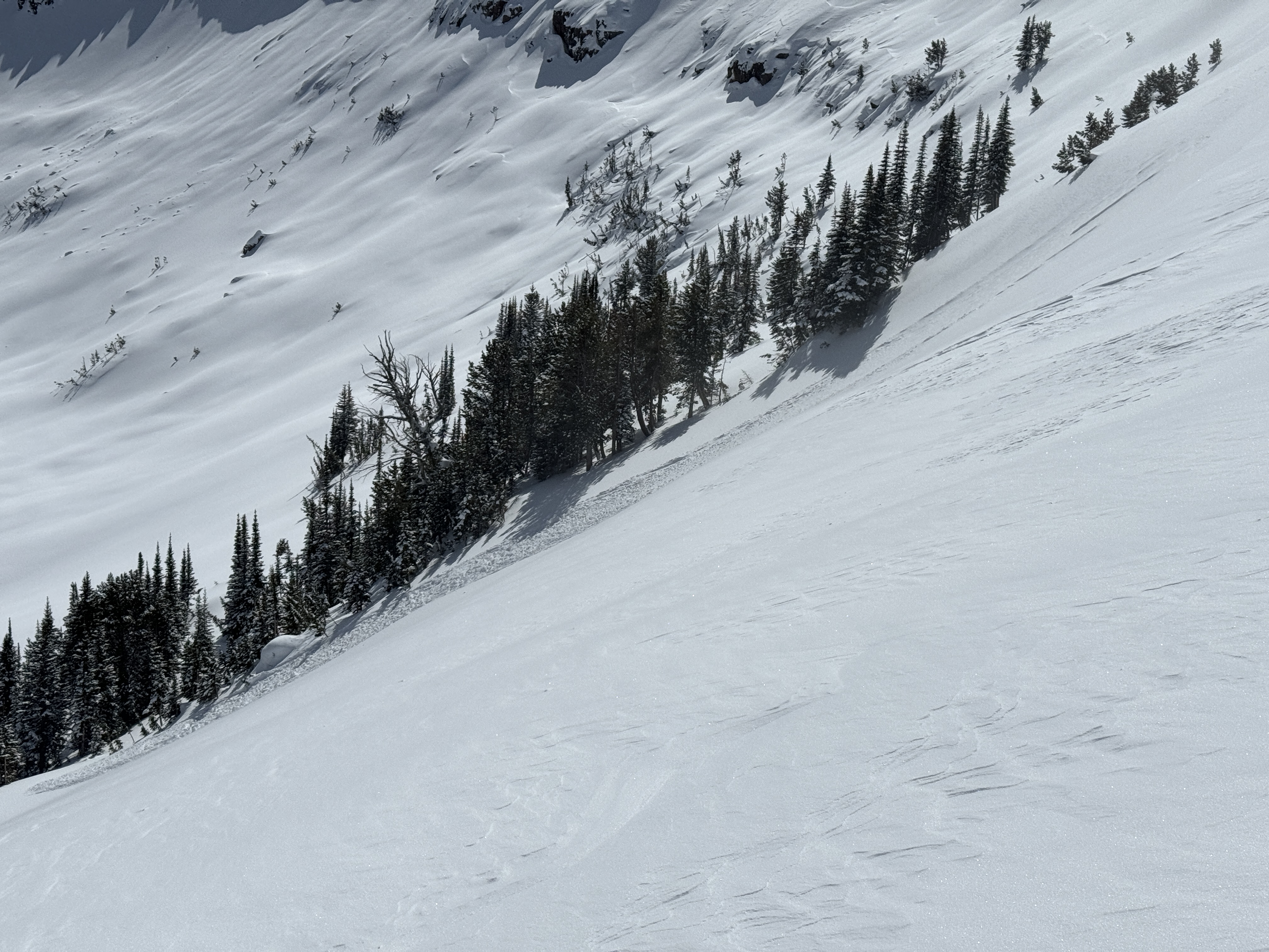
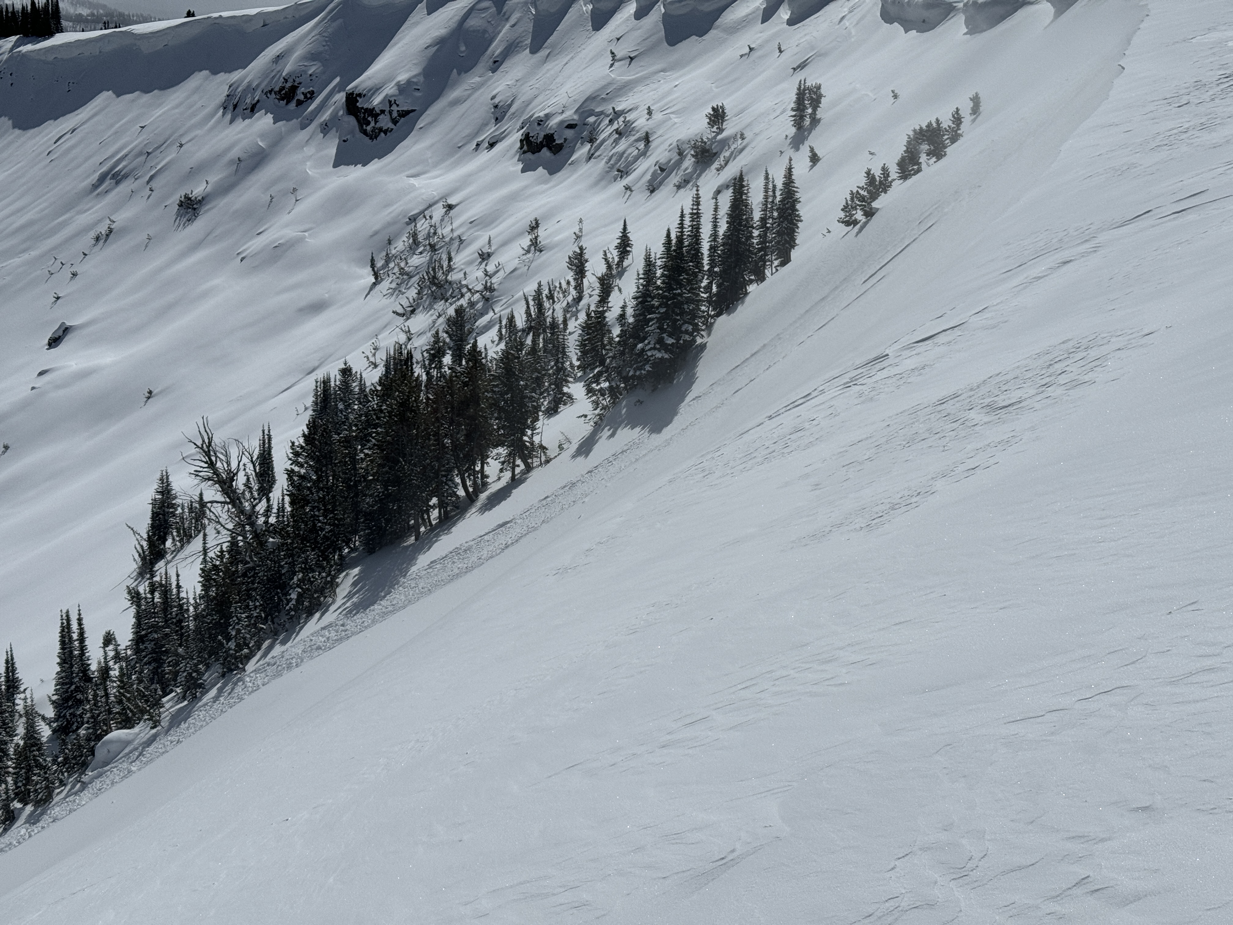
Somewhat dejected after failing to locate the avalanche, we proceeded back to the typical route. We came across a deep avalanche on a small rollover. 100 feet wide, 3-4 feet deep, and 50-75 feet vertical. Slope angles ranged from 29-33 degrees steep. It was an R5, D1.5 avalanche that certainly would have been very dangerous on a larger slope. ECT in the crown was unremarkable (this is not uncommon in the crown of an avalanche), PST 30/110 End.
Continuing up, the next open meadow had collapsed and was splintered with shooting cracks. The failure propagated through the trees with more cracks and buckle marks as the slab tried to release... which it did a bit further downslope. Again, the crown was 3-4 feet deep, and the terrain constrained the length.
No additional signs of instability.
These two avalanches were different than the two we were initially looking for. I suspect skiers triggered them remotely on March 2 given the amount of new snow on the debris, but they may have failed naturally. Regardless, avalanches in these locations are very unusual and are indicative of dangerous conditions. With more snow coming the next two days, travel in or near avalanche terrain requires a great deal of caution. Conservative terrain selection will be essential.
Full Snow Observation Report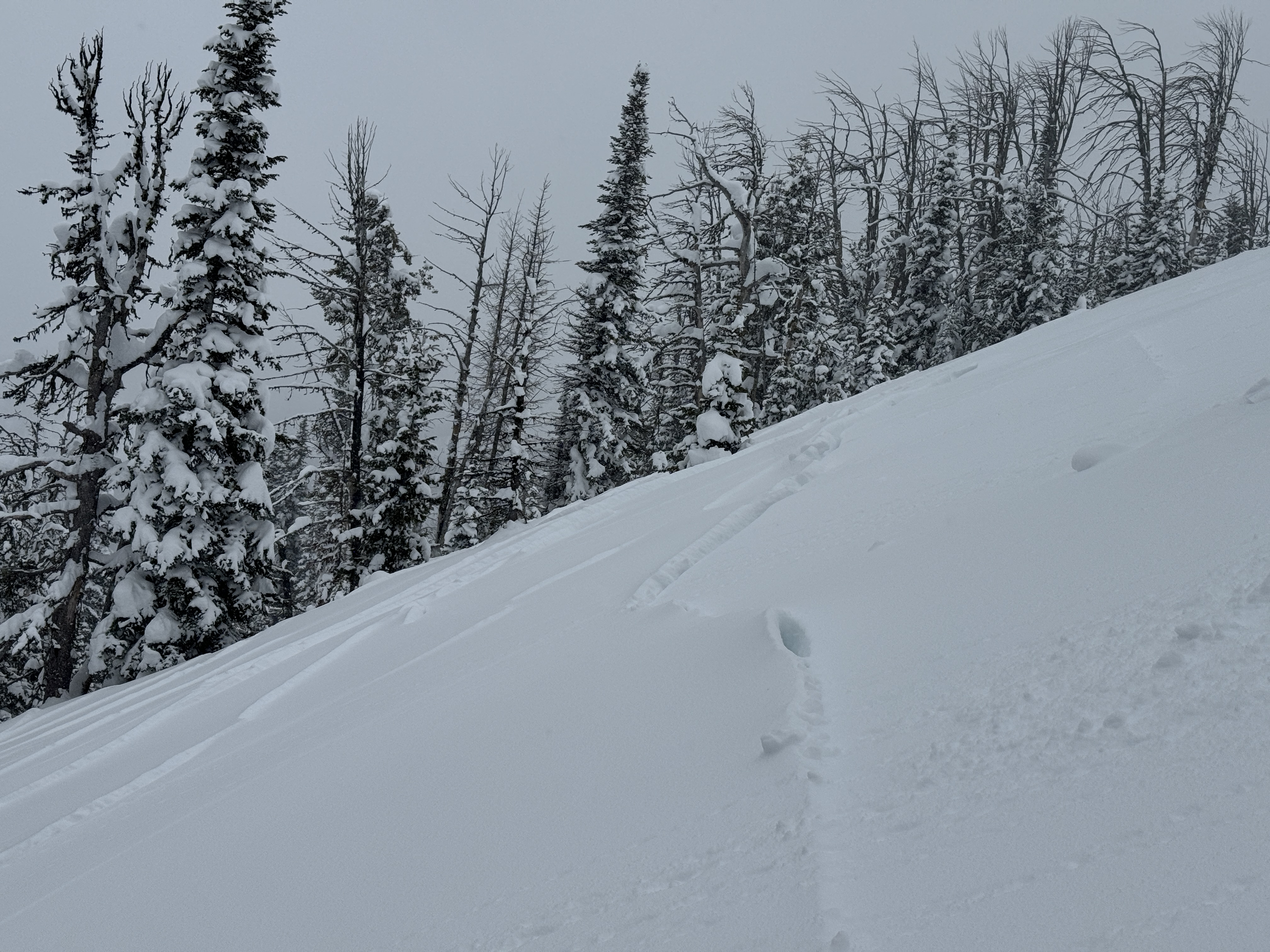

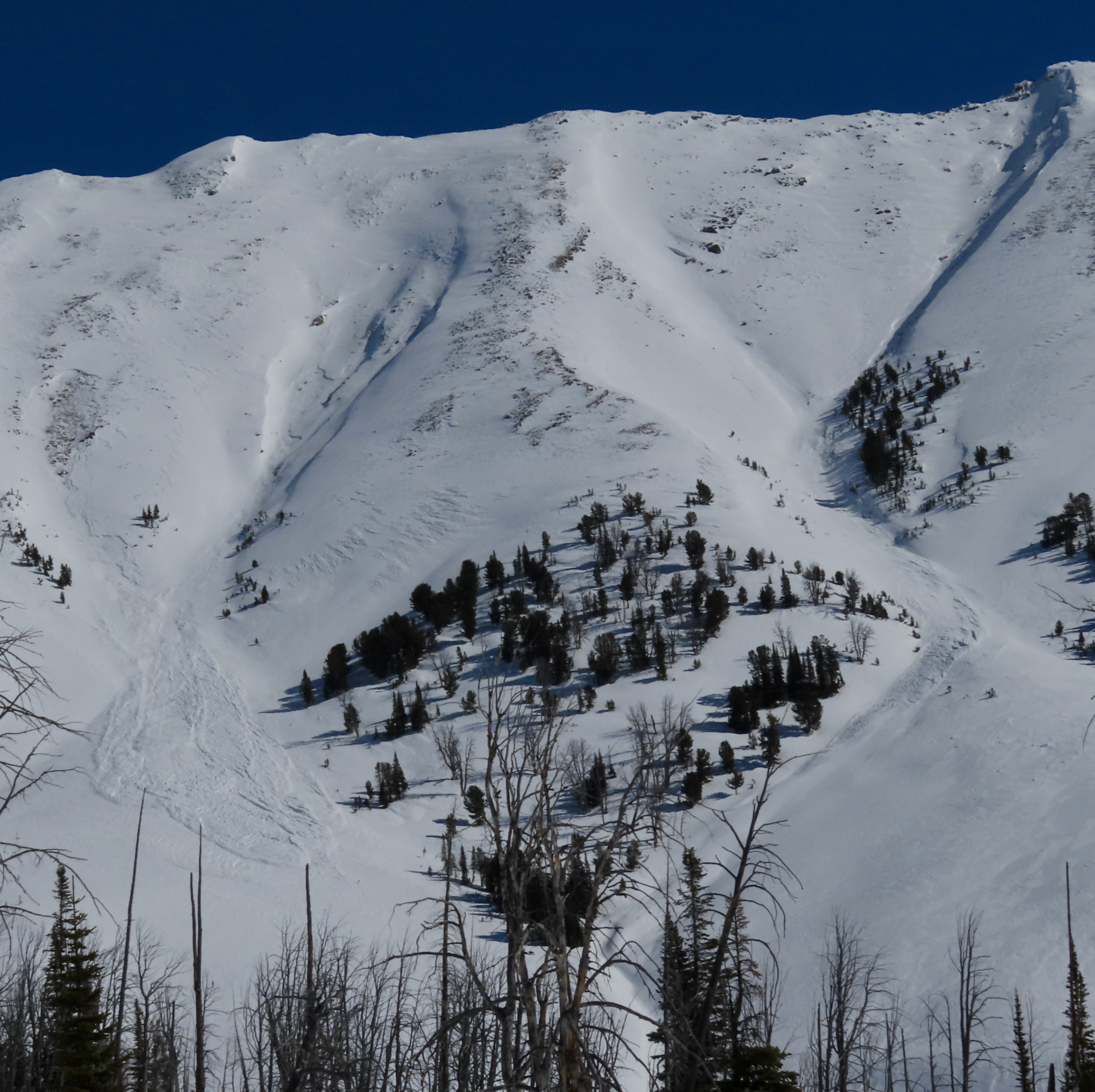
While traveling to Big Sky from Ennis, I noticed a large avalanche on the east face of Fan Mt.
Crown appears to start at approx. the 9500' elevation with a vertical drop of at least 2000'. Crown appears to be 200-300 yards wide
Full Snow Observation ReportWe saw one avalanche on a southeast facing slope. At about 7,400’ on a North facing slope we experienced a valley shaking whumpf while traveling up a heavily used ski track.
Full Snow Observation Report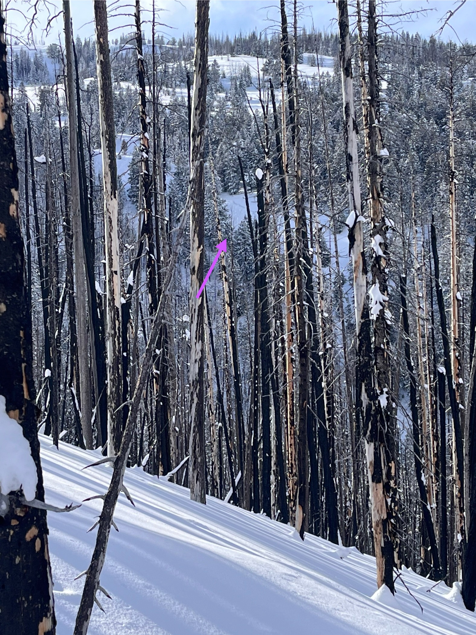
We were skiing out of the Cabin Creek cabin over the weekend, mostly in the low angle terrain around Skyline Ridge. Throughout the storm on Saturday and after the clouds cleared on Sunday we experienced consistent whumpfing while breaking trail. Some were larger and some were smaller, usually triggered by the person breaking trail but some of the larger ones were triggered by the second or third skier in the track.
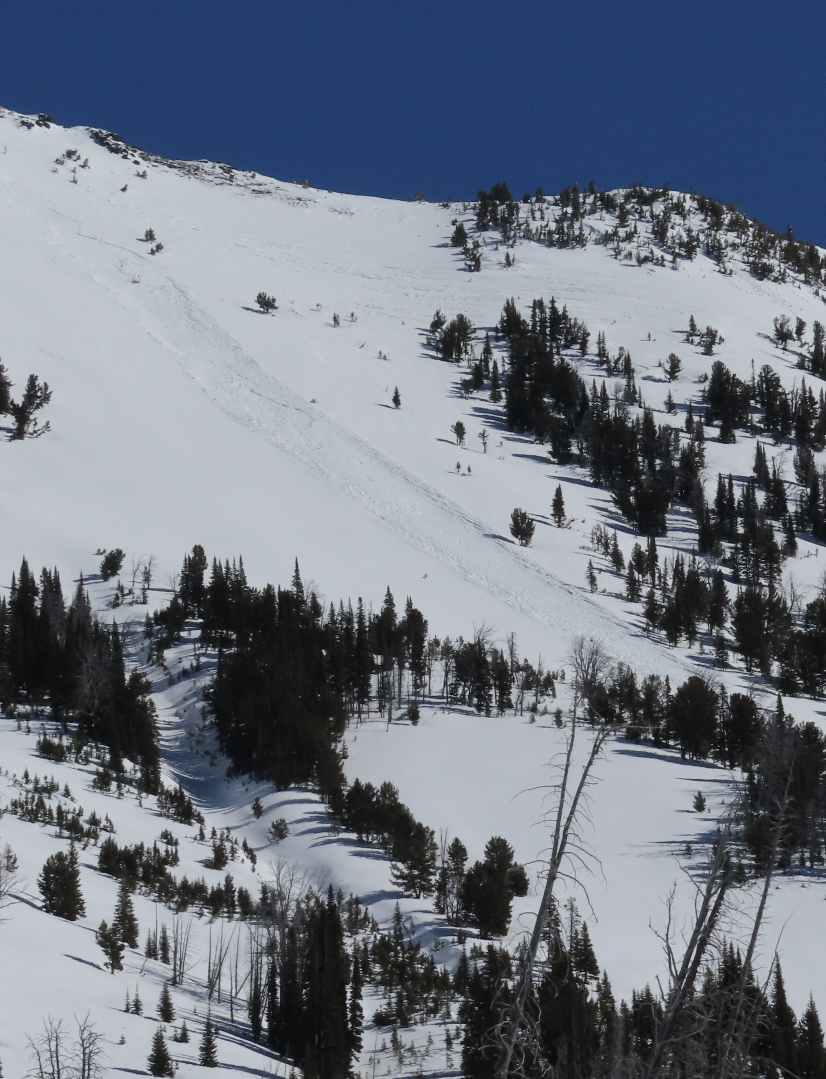
Full Snow Observation ReportWe rode into Tepee Basin and saw two recent avalanches. One looked like it happened this morning on a treed ridgeline, 1-1.5' deep 150-200' wide. The other looked like it maybe happened yesterday, on a heavily wind-loaded slope below some cornices, 2-2.5' deep and 250-300' wide. We had brief good visibility of the major avalanche terrain in the upper basin and didn't see any other slides. We measured 12" of snow = 1.5" of SWE that fell since Thursday. Snow was drifted near ridgelines and in the highest meadows. There was some cracking in the new snow around sled skis, but it was minimal.
Full Snow Observation ReportWe had a few time-consuming stucks along the trail in and out... more on that later.
