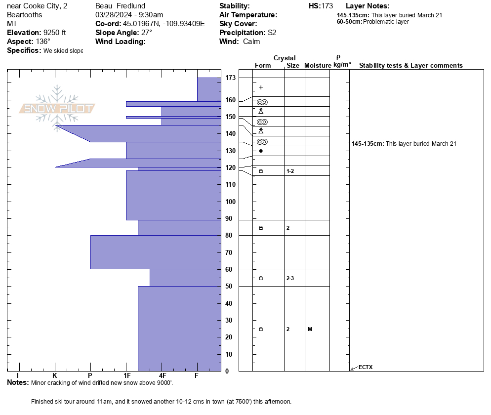
Snow Observations List
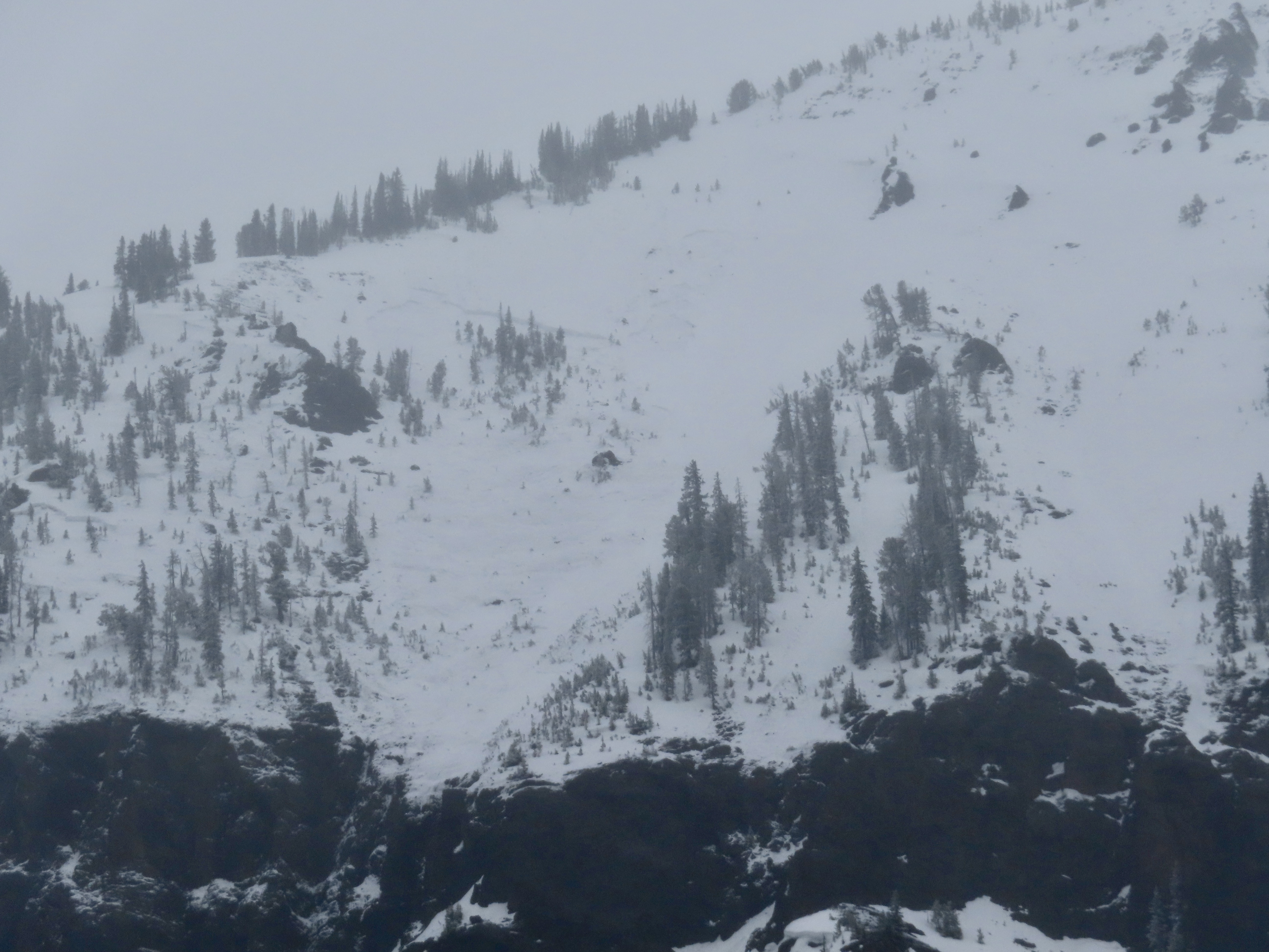
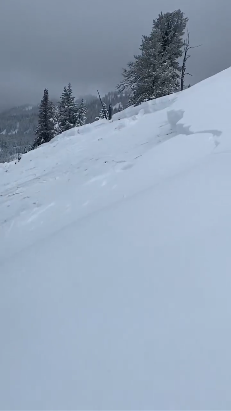
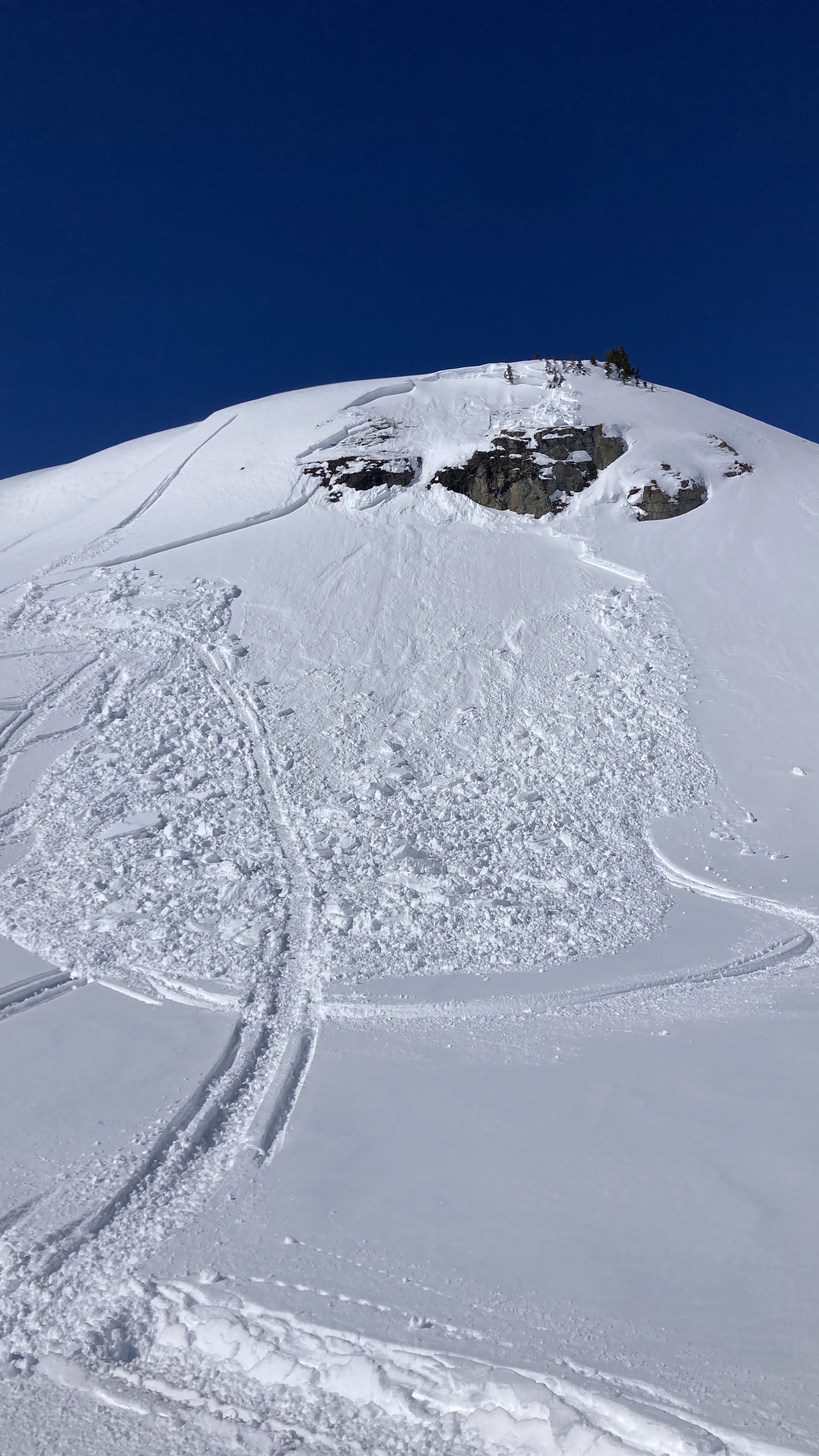
Our party (3) triggered a significant wet loose slide on the fin today. I, the first skier dropped in next to existing tracks from earlier in the morning. I made a couple of small turns in unskied snow to test it and decided that not much was moving. As I continued down the wet surface snow started to slide and accumulate. My partner called me on the radio to tell me a lot of snow was moving behind me and I cut left. I traversed hard to lower angle terrain until I felt I could safely descend the rest of the slope. My partners descended the bed surface until they could traverse out.
We made several key mistakes today. We knew it would be warm and that we should be up and down early. We left later than planned, moved slower than expected and failed to adjust our plan. We mistook lack of wet loose activity on similar aspects and elevations on features we could see as sign of stability. We failed to make a plan B or establish a turnaround time. We interpreted a party ahead of us that skied the slope as a go ahead. Another party approaching behind us added pressure to go. They also skied the slope after us in similar style to my partners.
In our favor, we communicated well, radios were key, stayed calm and we managed ourselves through the situation. I feel humbled and lucky to have gotten away with a free lesson. One that I didn't think I should have needed.
Full Snow Observation Report
Wind load on old crust, probably from Wednesday.
Full Snow Observation Report
From email 5/1/24: "Hi crew. I triggered a soft slab avalanche on the North side of Sheep Mountain today. D1.5 200’ wide ran 200’. Crown was 6-12’’ deep. I was able to ride out of it and anchor in a safe spot.
It broke on our 7th lap and we had seen no signs of instability prior to the avalanche but wind loading was occurring and obvious. The avalanche broke and on a dirty crust that formed during a rain event last week."
Full Snow Observation Report
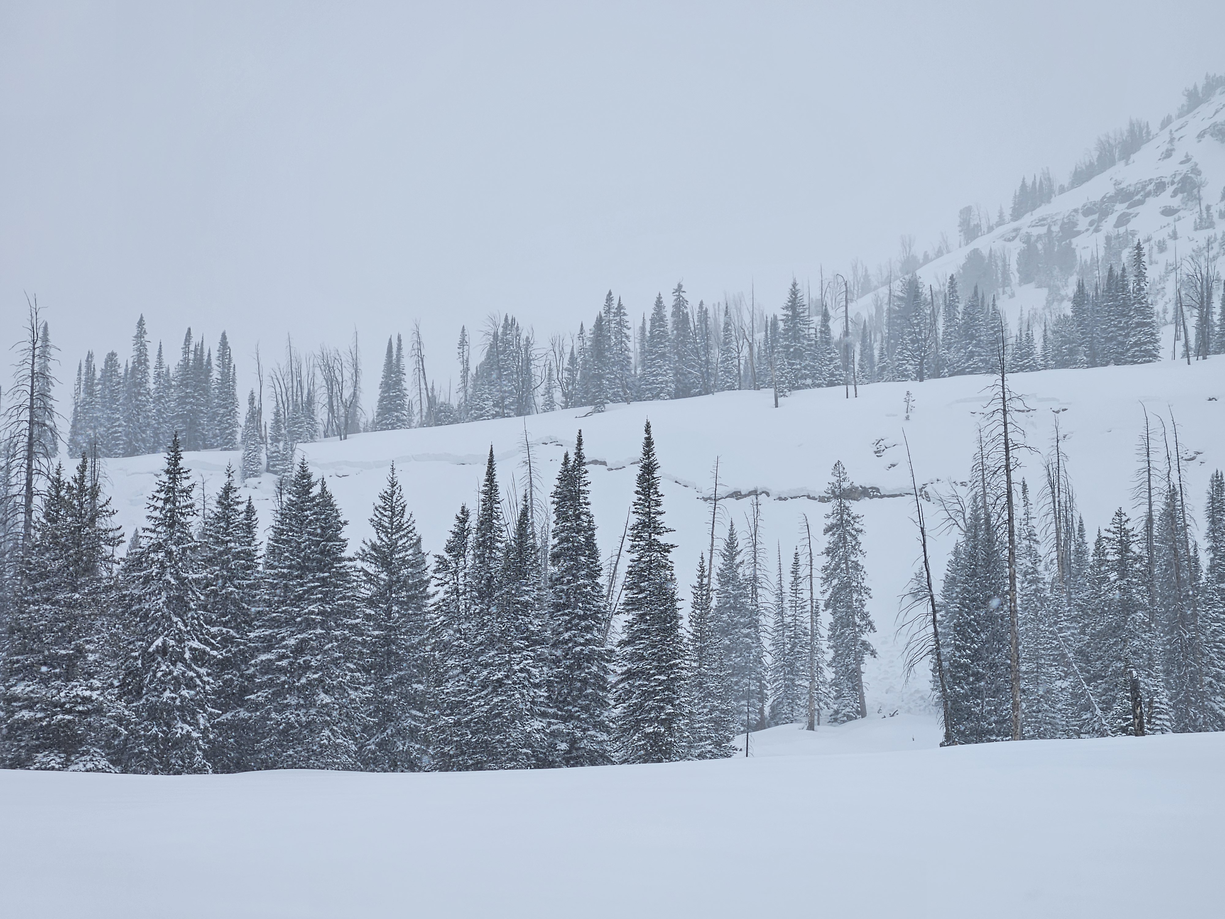
Skied north of Cooke City the last couple days ( Sat. 4/27 and Sun. 4/28), near Lulu Pass and Henderson Mtn.. Yesterday there was 2-3" of moist new snow, and the snowpack below had not refrozen up to 9500-10k', it was very wet and unsupportable below the new snow. Moderate east wind yesterday drifted the new snow into small slabs up high.
Today there was 1-2" new snow on top of a thin, breakable crust around 9,000', with wet unsupportable snow below the crust. The crust softened quickly in any sunshine midday. Pulses of heavy snow mixed with periods of partial sunshine and calm-light wind.
Saw only small slabs crack beneath skis along the ridge yesterday, and minimal wet snow avalanche activity. Despite minimal observed avalanche activity, it seemed like a skier or rider could trigger a larger wet avalanche, especially on slopes that received sunshine.
Photos attached of what appear like wet slabs possibly from Friday when the precip. started after the first night or two of poor freeze (North side of Republic, and Henderson Bench).
Full Snow Observation Report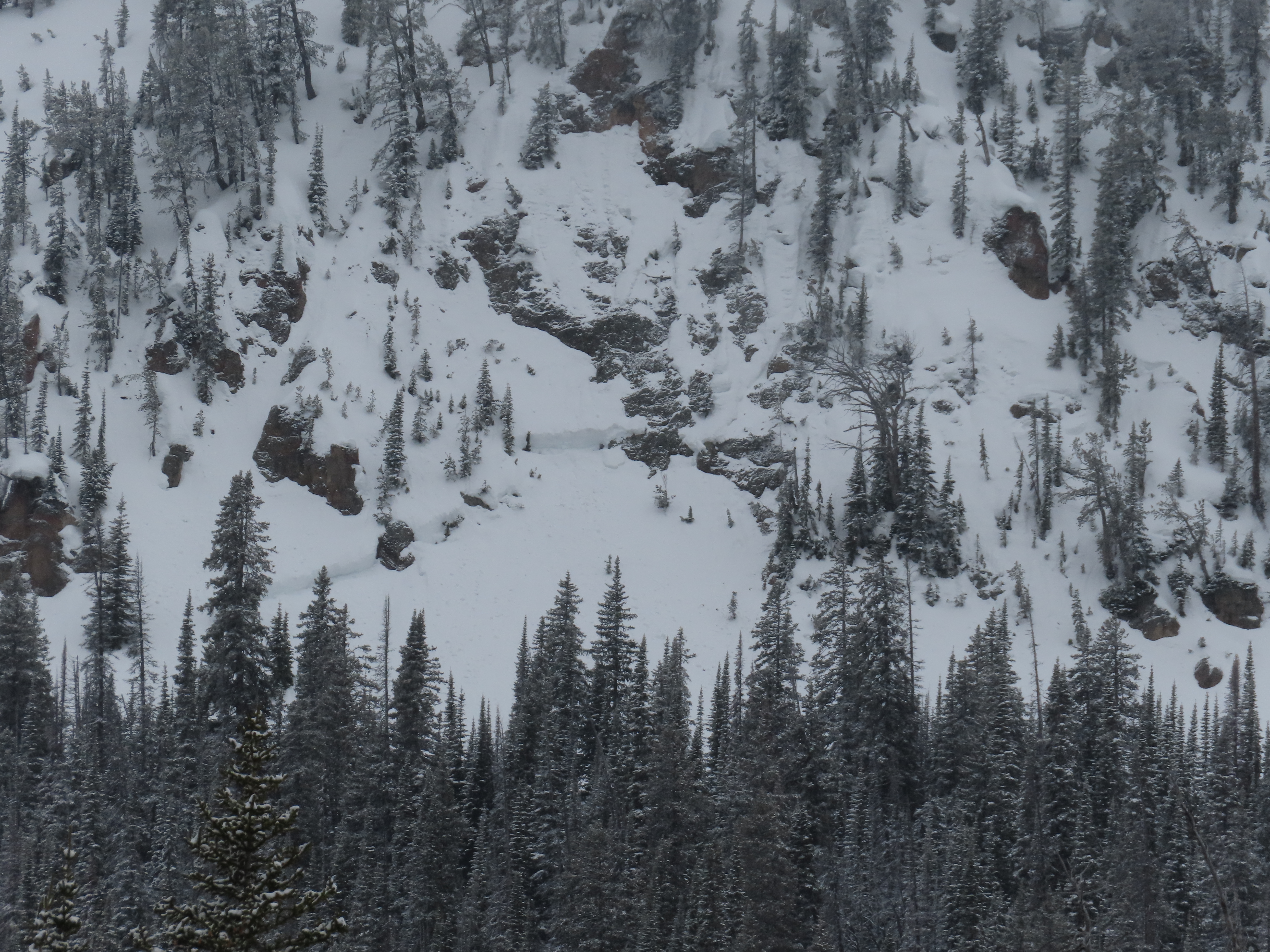
On 4/26/24 large natural wet slabs were seen running on Wall Mountain near Silver Gate. An observer from Beartooth Powder Guides sent us a video of them happening at 3pm while it was 43 degrees F. I also noted a similar large crown on the north side of Republic Mtn. that probably also happened this afternoon.
Full Snow Observation Report
From IG on 04/26/2024
Full Snow Observation Report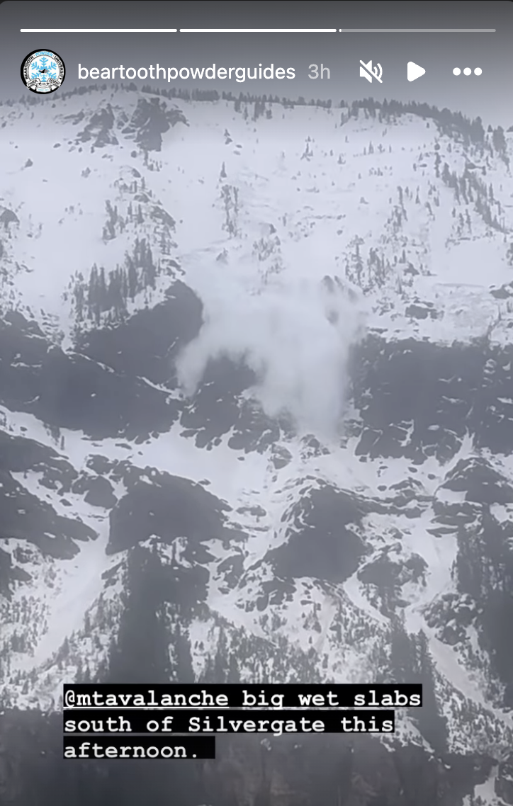
Elevation: 10231
aspect: ESE
time: 10:35, April 22nd
CTX - broke below isolated block, pit depth ~100cm
Avalanches in the goose lake area: small loose snow avalanches on shady aspects. Evidence of rollerballs and small cornice falls on sunny aspects from previous days.
Full Snow Observation ReportDug a pit around 9700' on a WNW shaded aspect below a couloir on Miller Mountain in Cooke City. We found ~95cm snowpack, with 5-10" of lower-density fresh snow. We dug to the ground and found a consistent and firm snowpack all the way down, didn't find any facets at the ground. Isolated cracking, ECTN25 ~20-25cm down, below the thick melt-freeze crust from the warm-up immediately before this week's snow. The fresh snow had sluffed out on most chutes before we got there (likely during the storm) but we saw very little sluff triggered by our skiing
The fresh snow skied great on shaded aspects that hadn't been affected by wind. Non-shaded snow surfaces were definitely getting wet by 1 pm, the sun felt hot, but we didn't observe any wet slides before we left. The snow on the ride out was very wet, with watery-slush puddles on the lower parts of the trail.
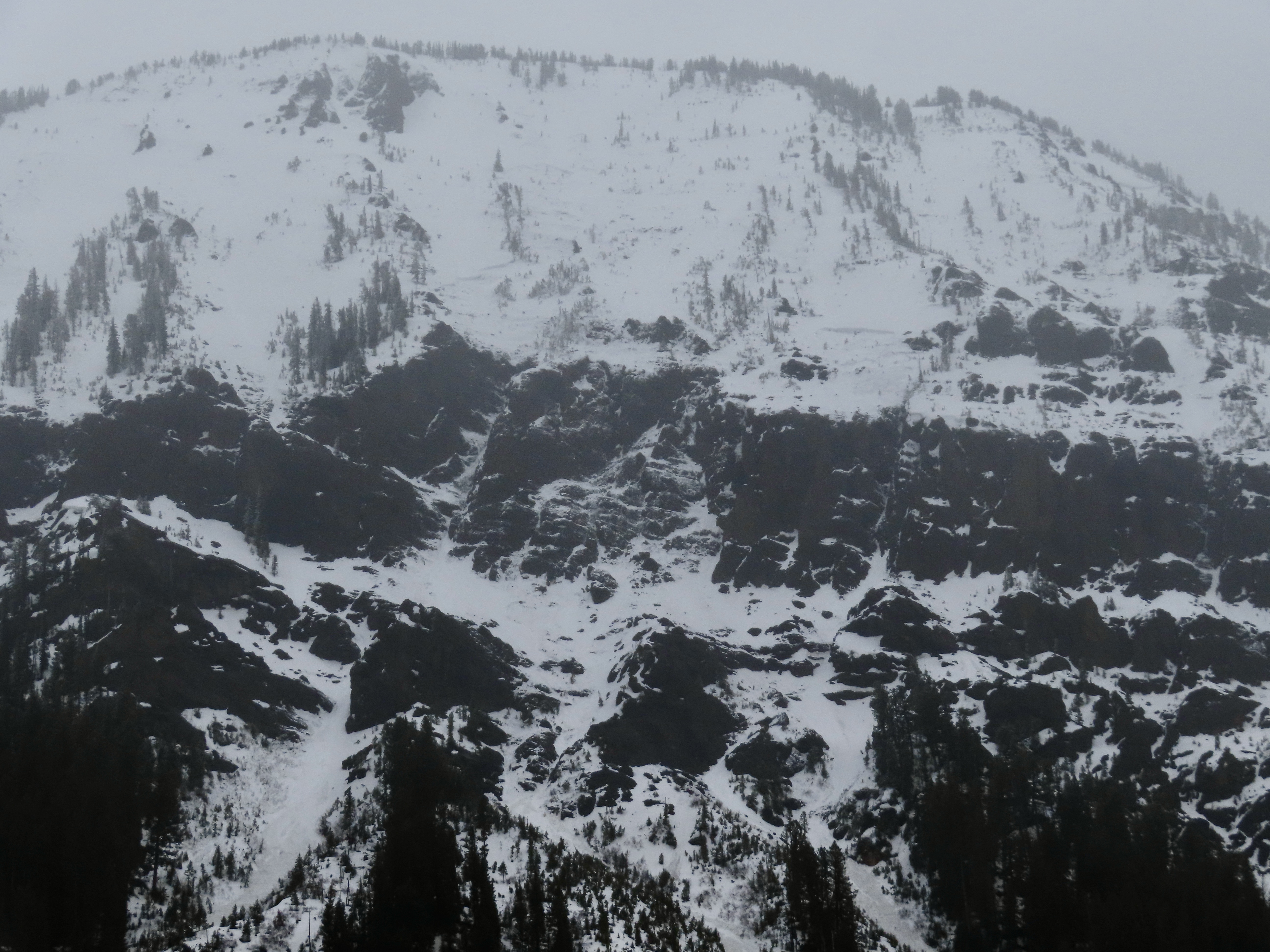
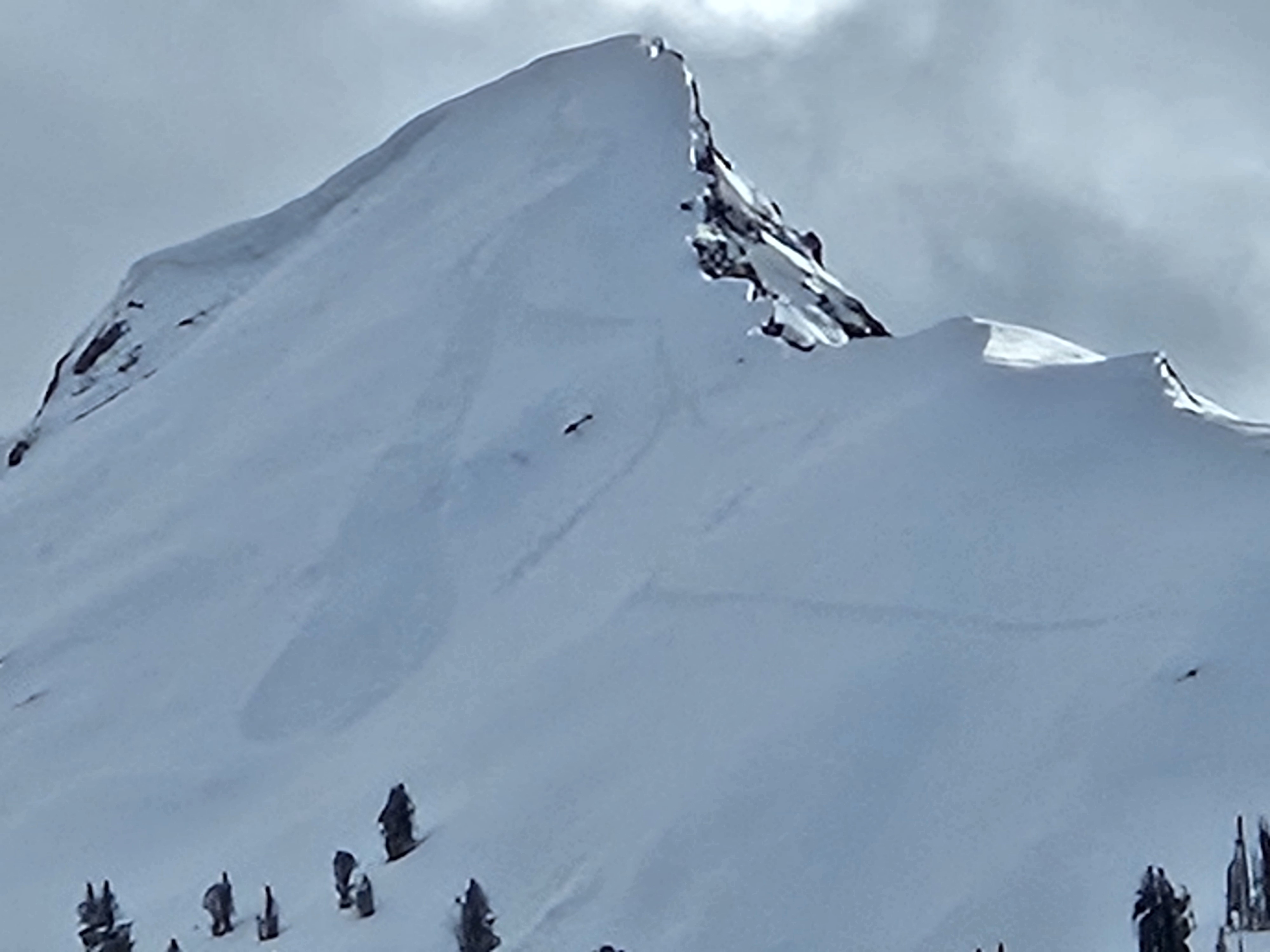
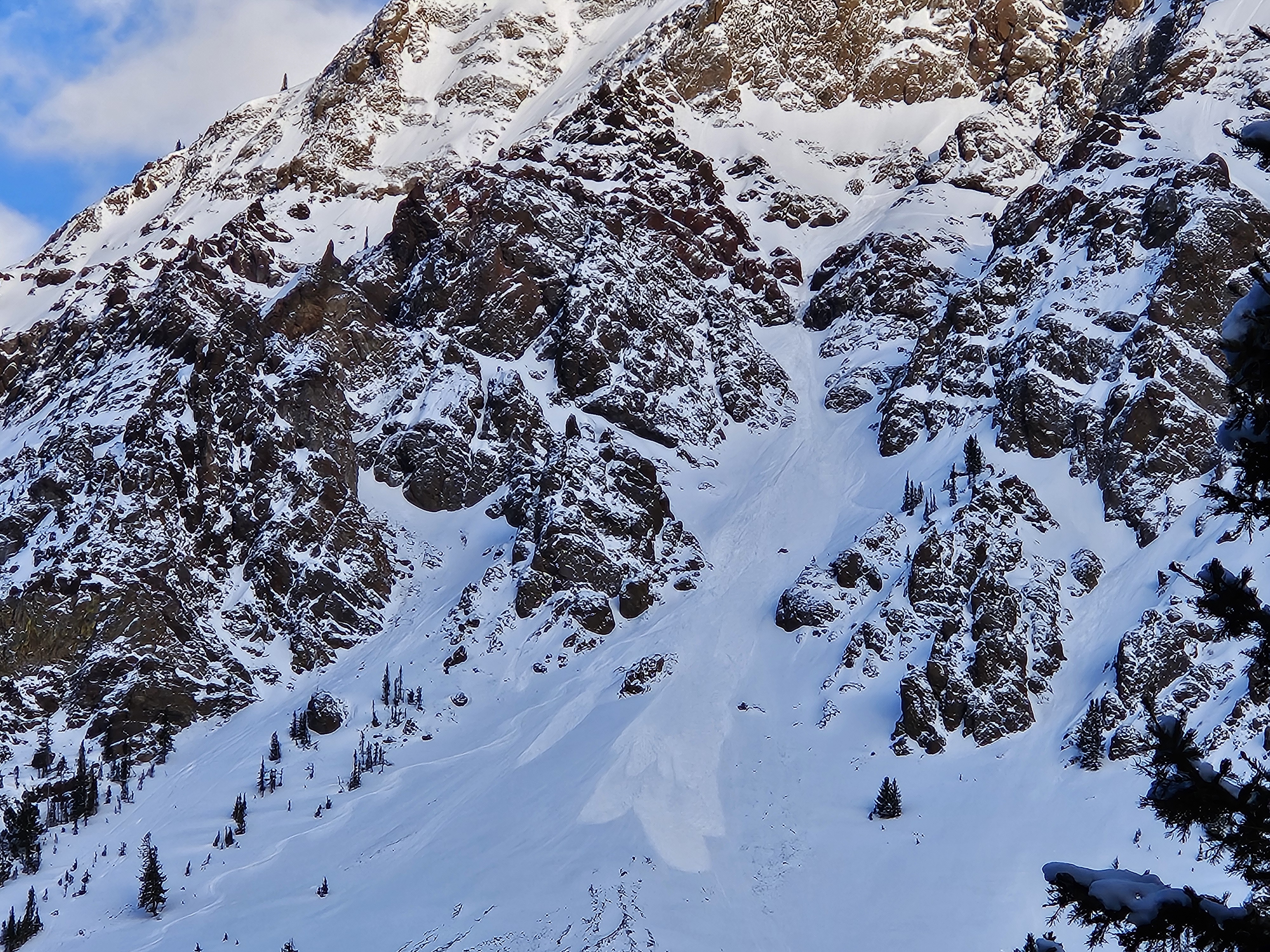
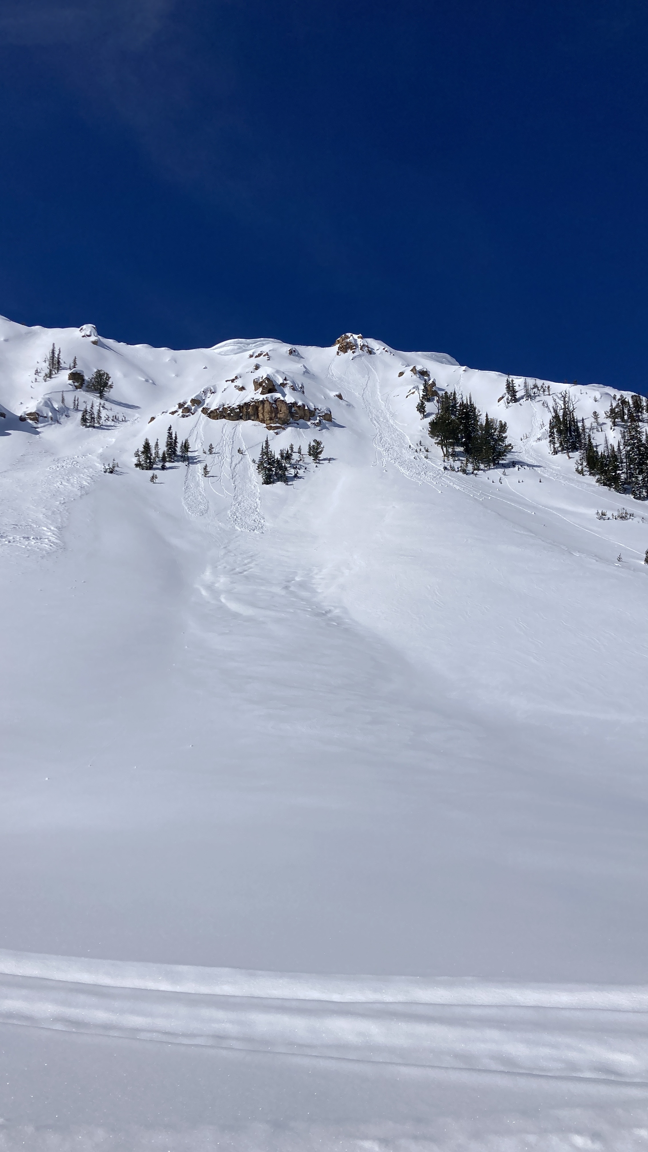
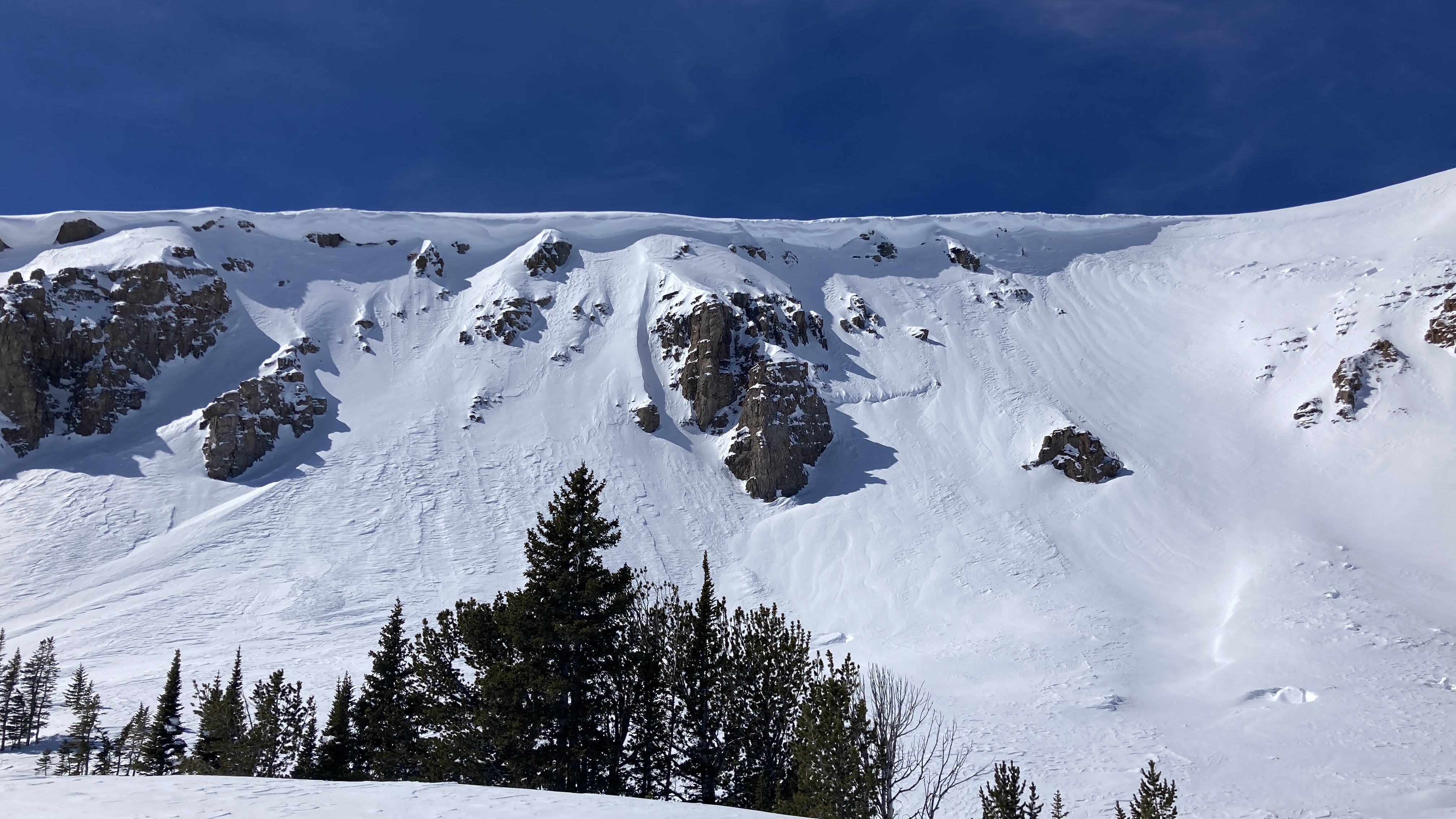
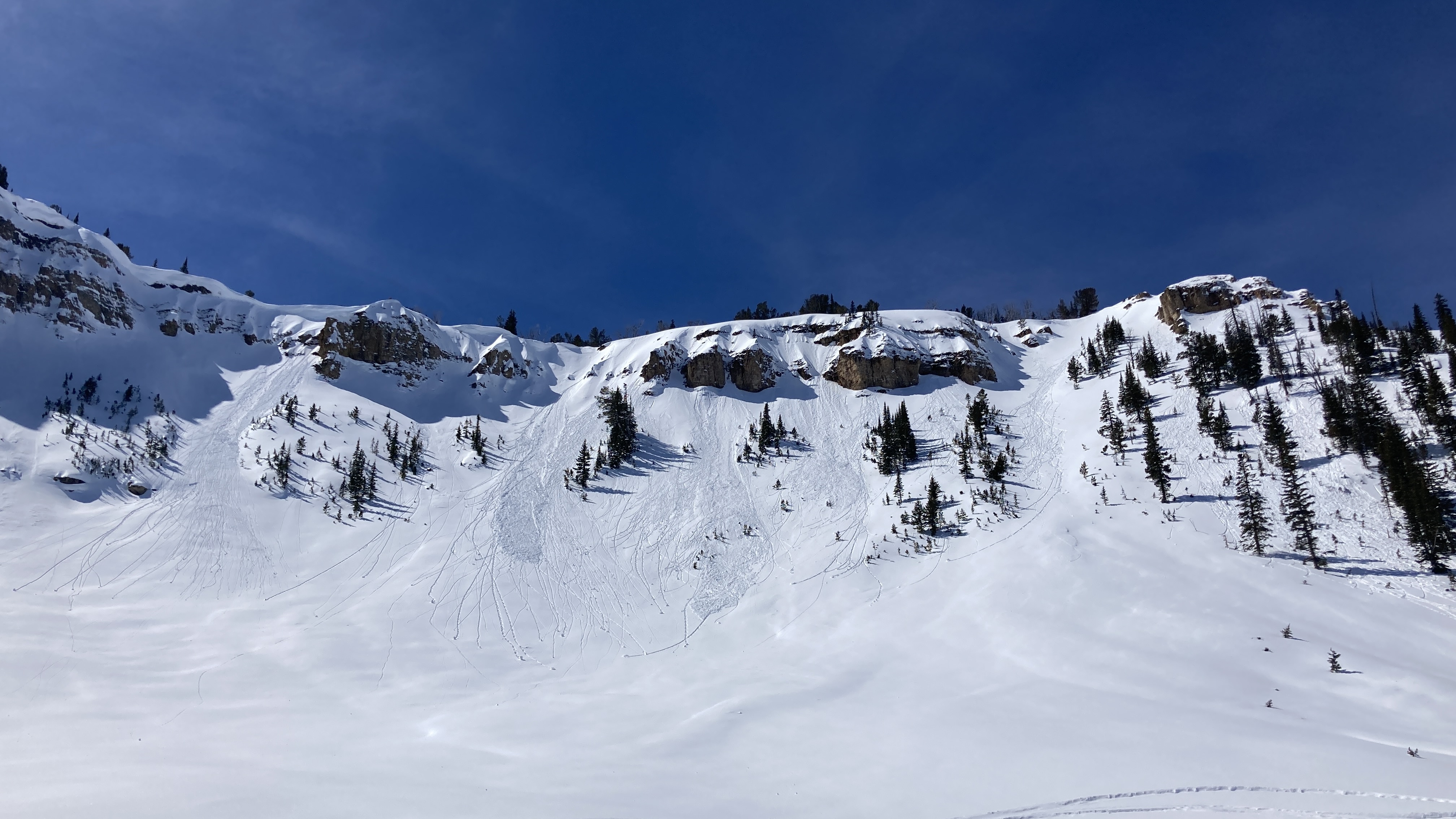
Full Snow Observation ReportCookes' always interesting in the spring, deep slab goes to sleep and the Grizzlies wake up. Curious how she knew to thread the cornice just right(Sheep Mt). Second Pic is a large sluff on the Fin, couldn't quite make out the track route till I drove to Silver Gate. He skied the hanging gully to the east of the third pic and rock climbed across the cliff to this sluff and tracks... Don't ask how I know it was a grizz, no time to get a pic.
Full Snow Observation Report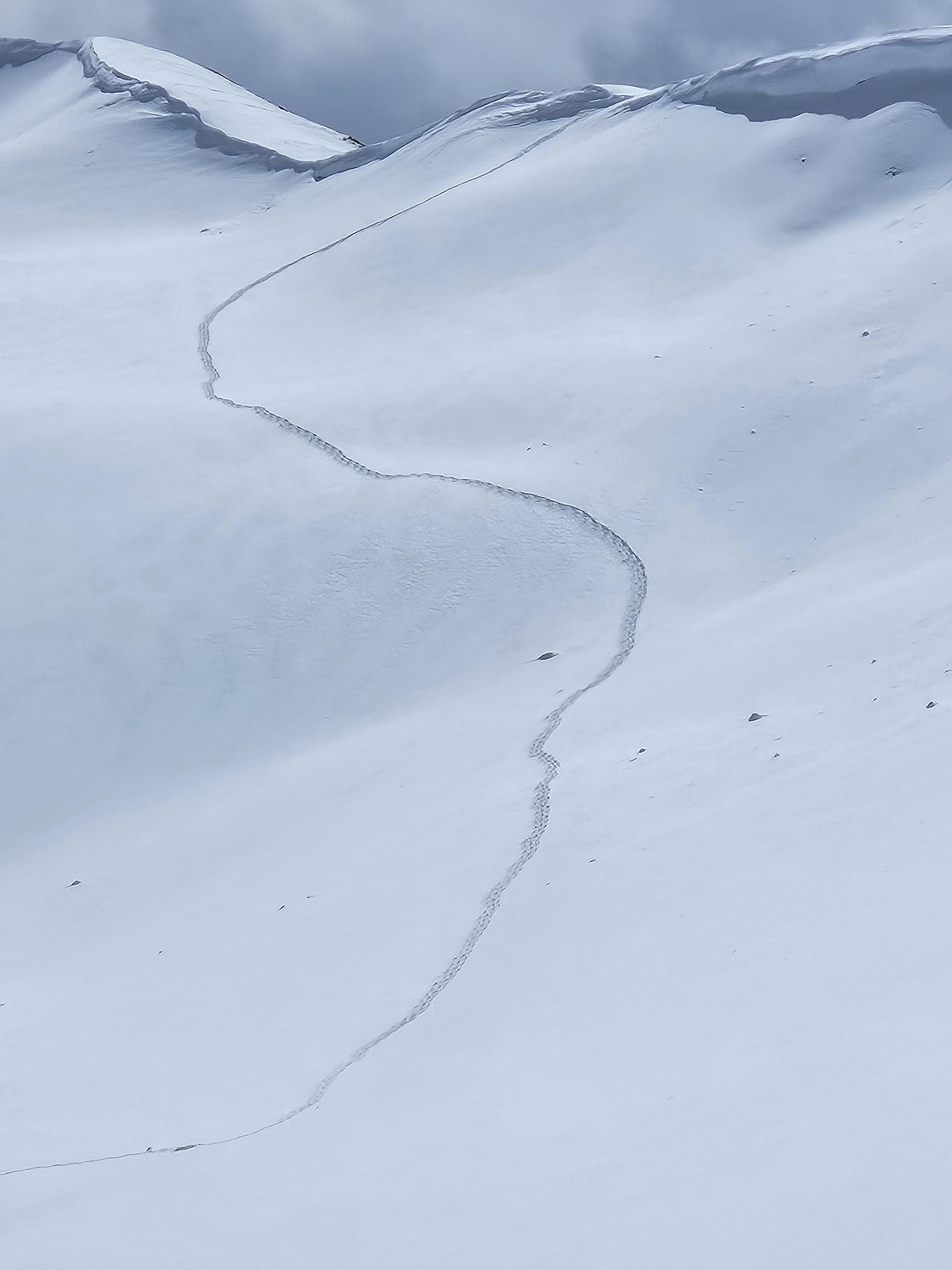
From IG message 4/17/24: "Remote trigger up little bear today. Went to the groundish."
Full Snow Observation Report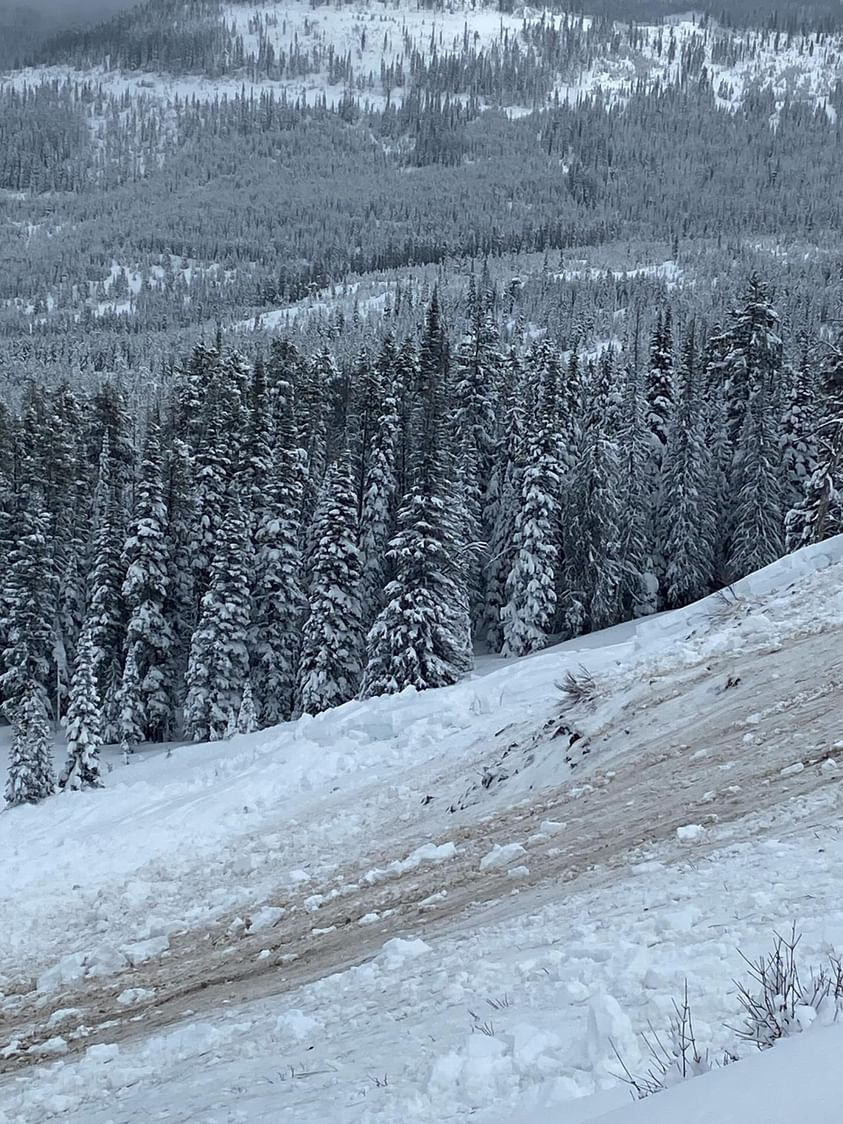
Wet slab 150-200 ft across, SE shoulder of Abundance towards Wolverine. Looks to have maybe happened before new snow. New snow 6-8 was extra funky, 2-3 powder on a rain? crust on heavy wet. Bonded to unsupportive melt freeze on completely saturated glop. Lots of short running sluffs
Full Snow Observation Report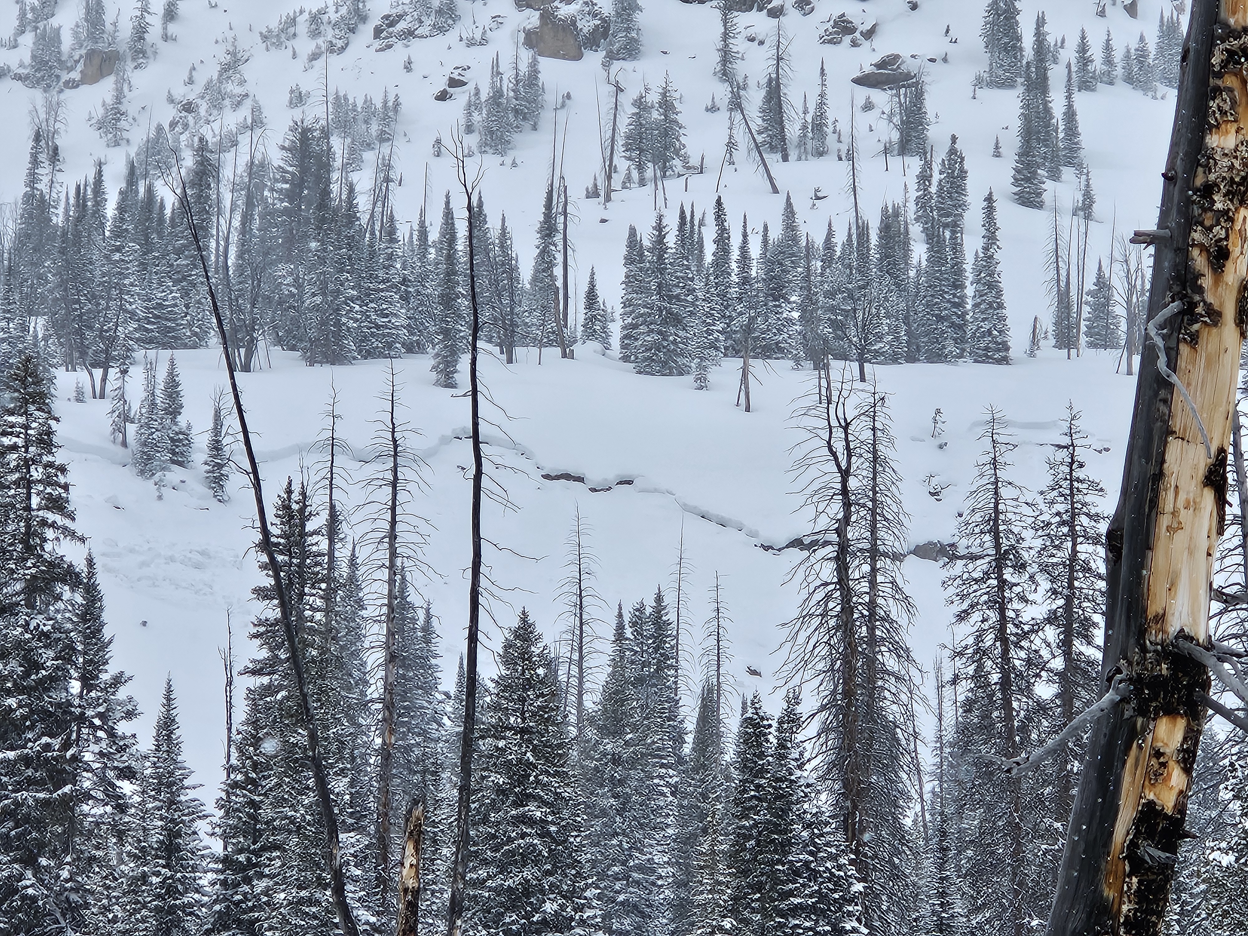
From IG: Wet slide to the ground above Quake Lake.
Full Snow Observation Report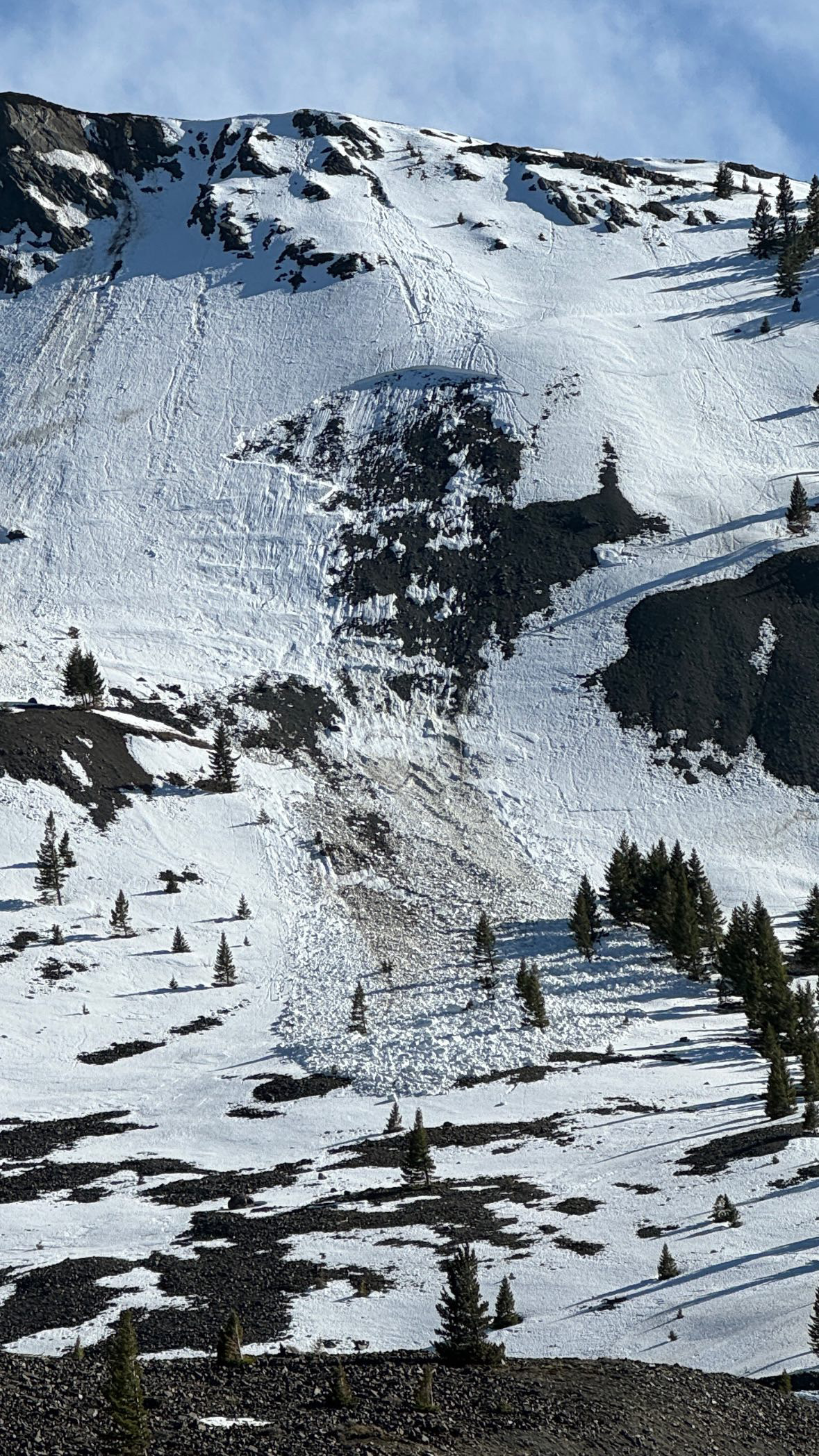
Natural cornice failure and small slab on Iceberg Peak’s NE face. We skied by the day prior and judging by what the wind did to our tracks overnight, this looked like it happened in the morning.
Full Snow Observation Report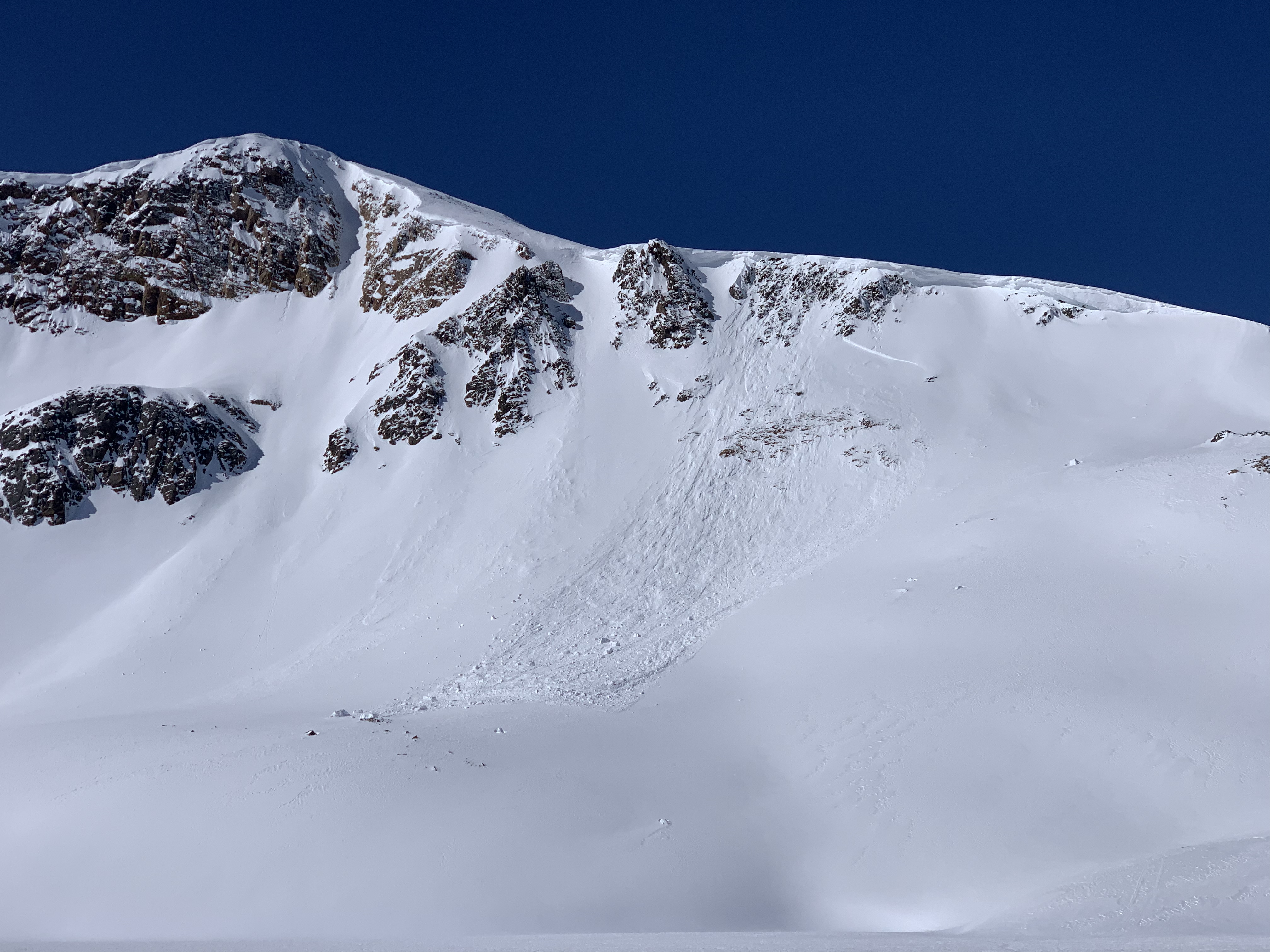
From email: "Had propagation on 1.5mm rounding facets below the mid-March, 1/2cm thick and knife hard MF crust. This location is always shallow and has a poor structure, but I was surprised to get propagation.
Further up valley on a west aspect, HS 130, 1 of 2 pits had ECTP28 on the basal facets. Pretty wild to still be getting propagation in mid April.
Winds were light out of the south, gusting to strong at ridgetops out of the west with active snow transport. No wet loose activity seen today, but several old wet loose avalanches on Climax from the last warm up. "
Full Snow Observation ReportDug a pit on our way up the west side of Henderson Mountain. Incline 26 degrees, elevation 9545. Surface depth at 165cm, dug down to about 65cm. Performed extended column test and yielded ECTN17 along melt freeze crust at 135cm above ground.
Full Snow Observation Report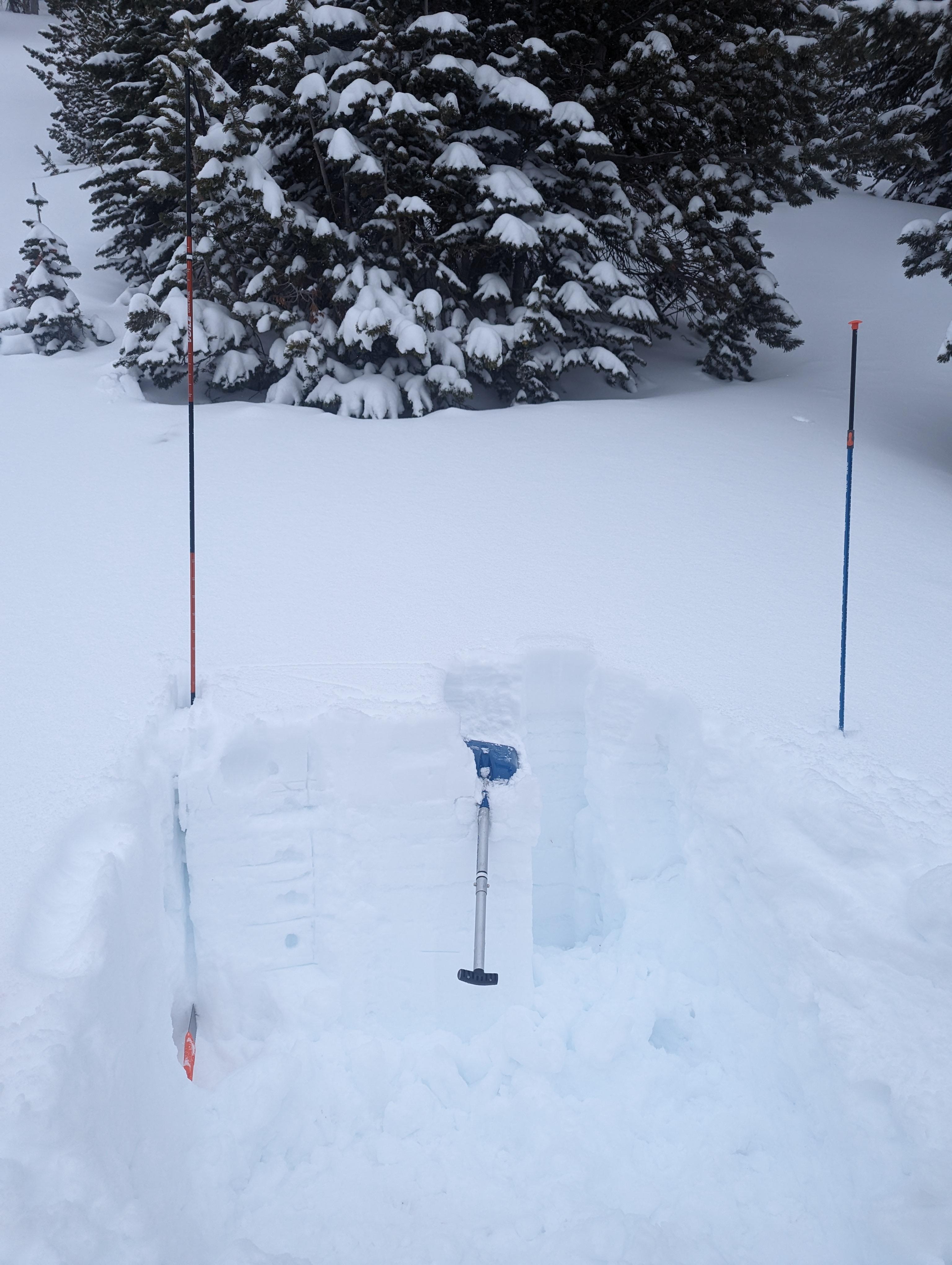
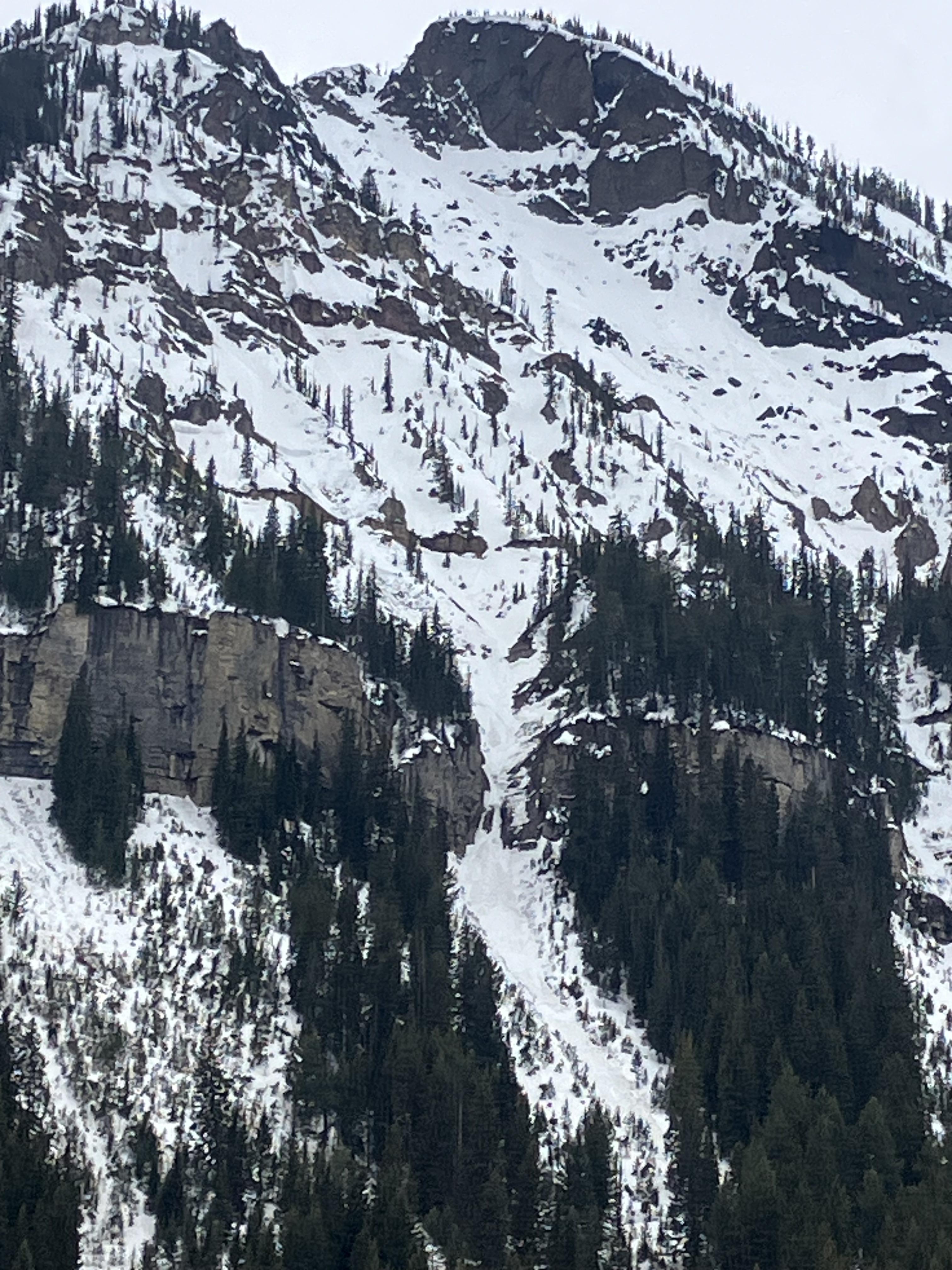
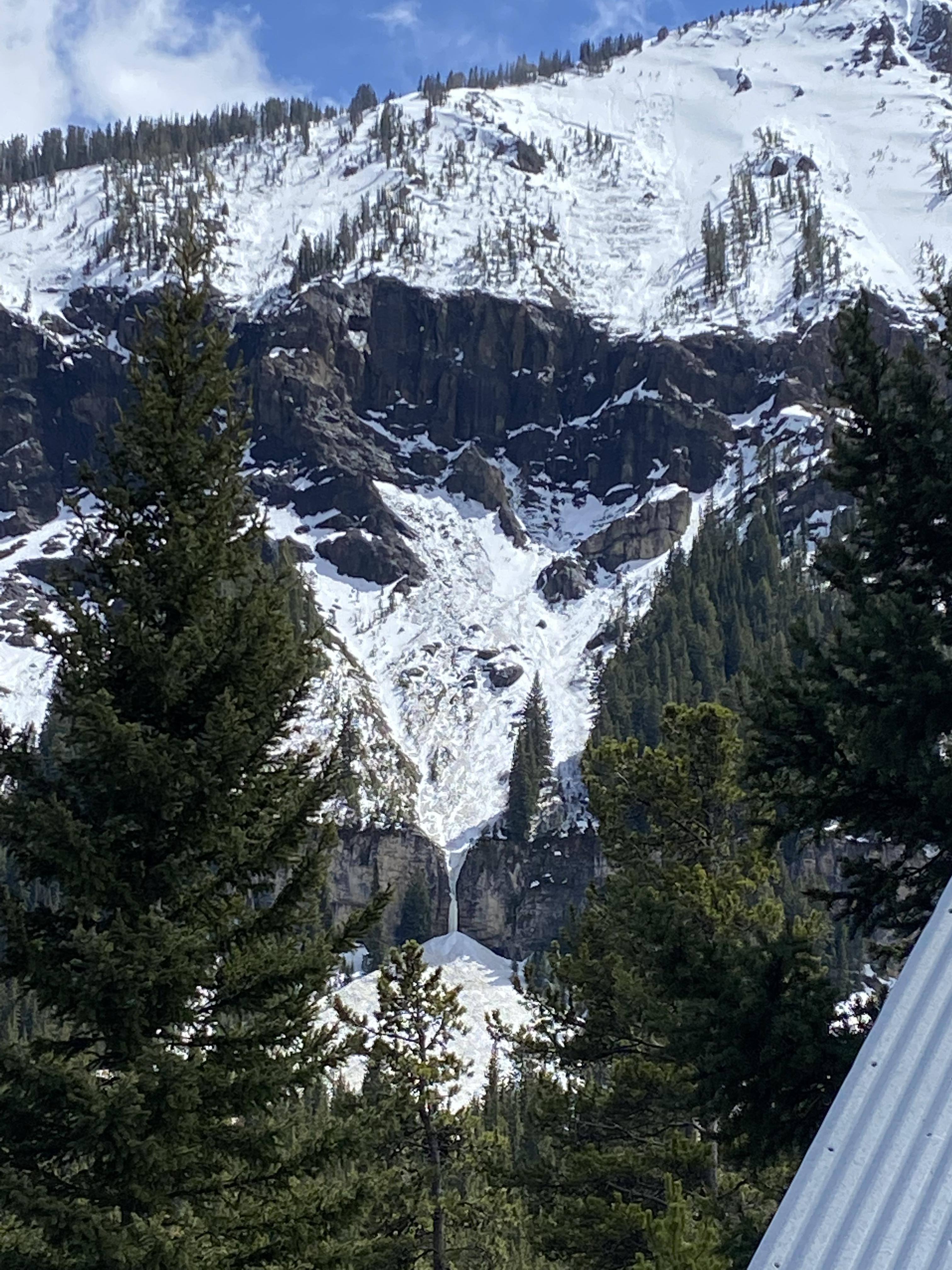
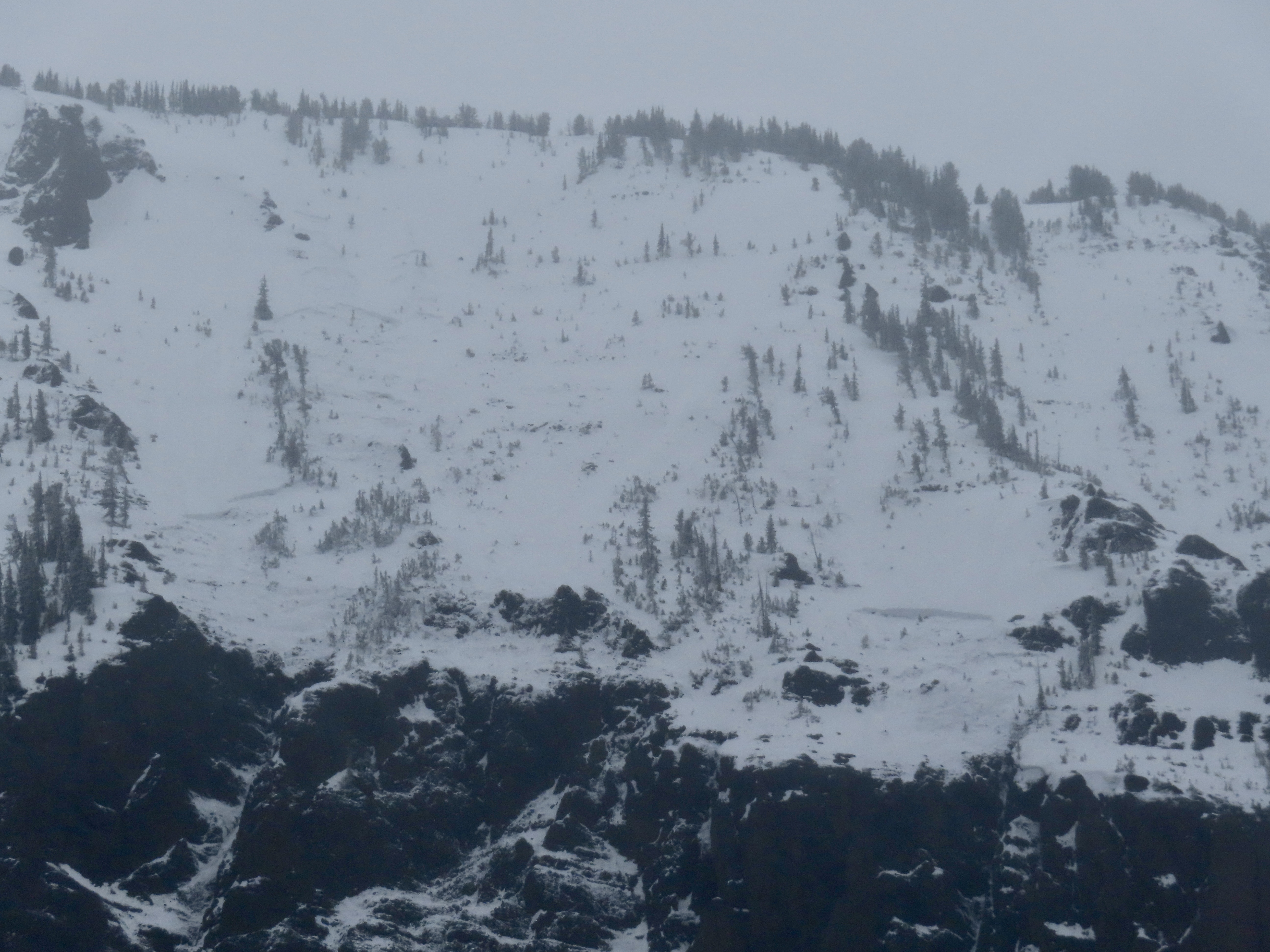
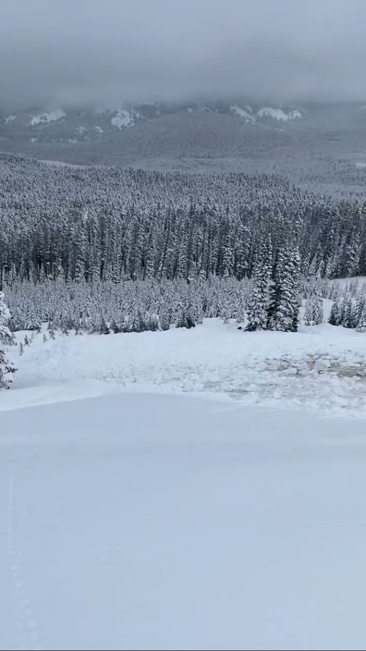
Toured out into Lower Hayden today to look around. Lots of wet loose avalanches on all aspects by noon. And by the time I came back down the hill, the Fin had slid. It likely happened sometime between 10:30 and 1:30 today. It doesn’t look super deep, but it’s hard to say for sure. I’d guess around 2 feet deep.
Full Snow Observation Report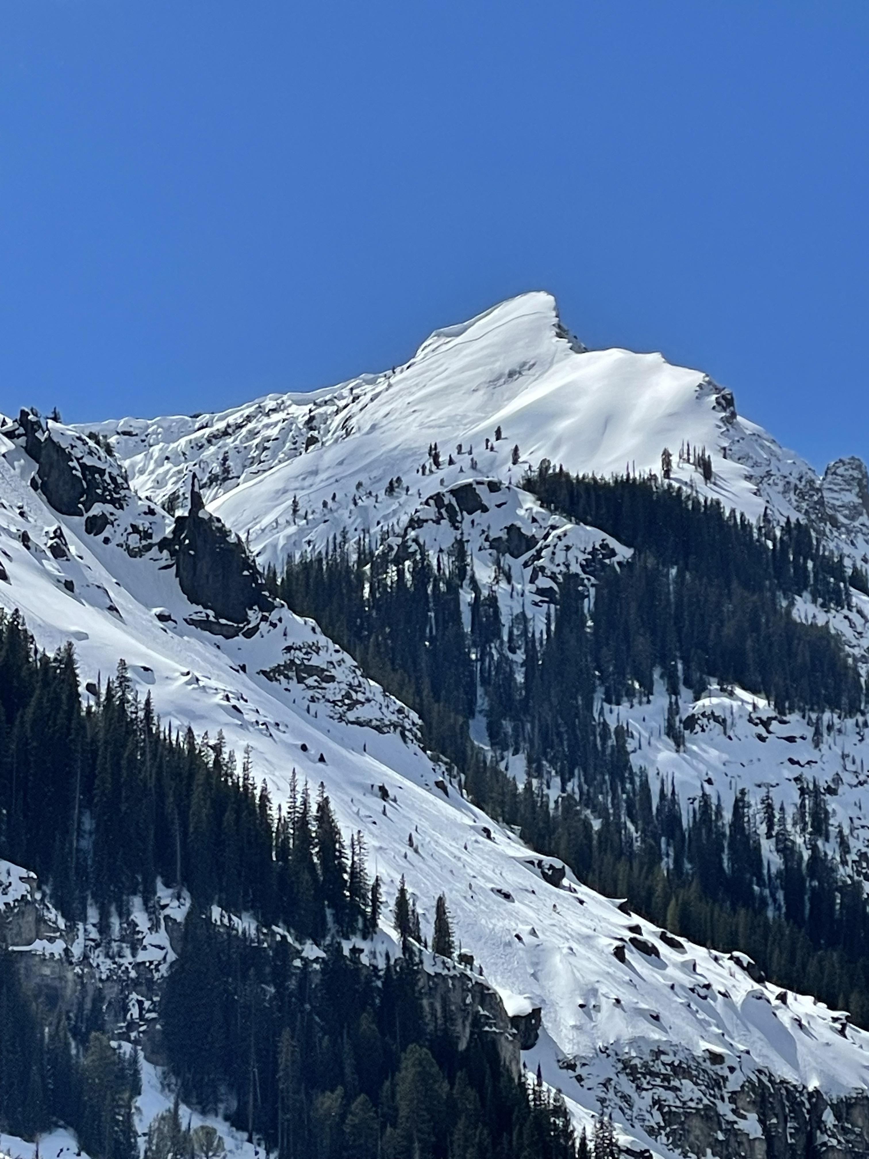
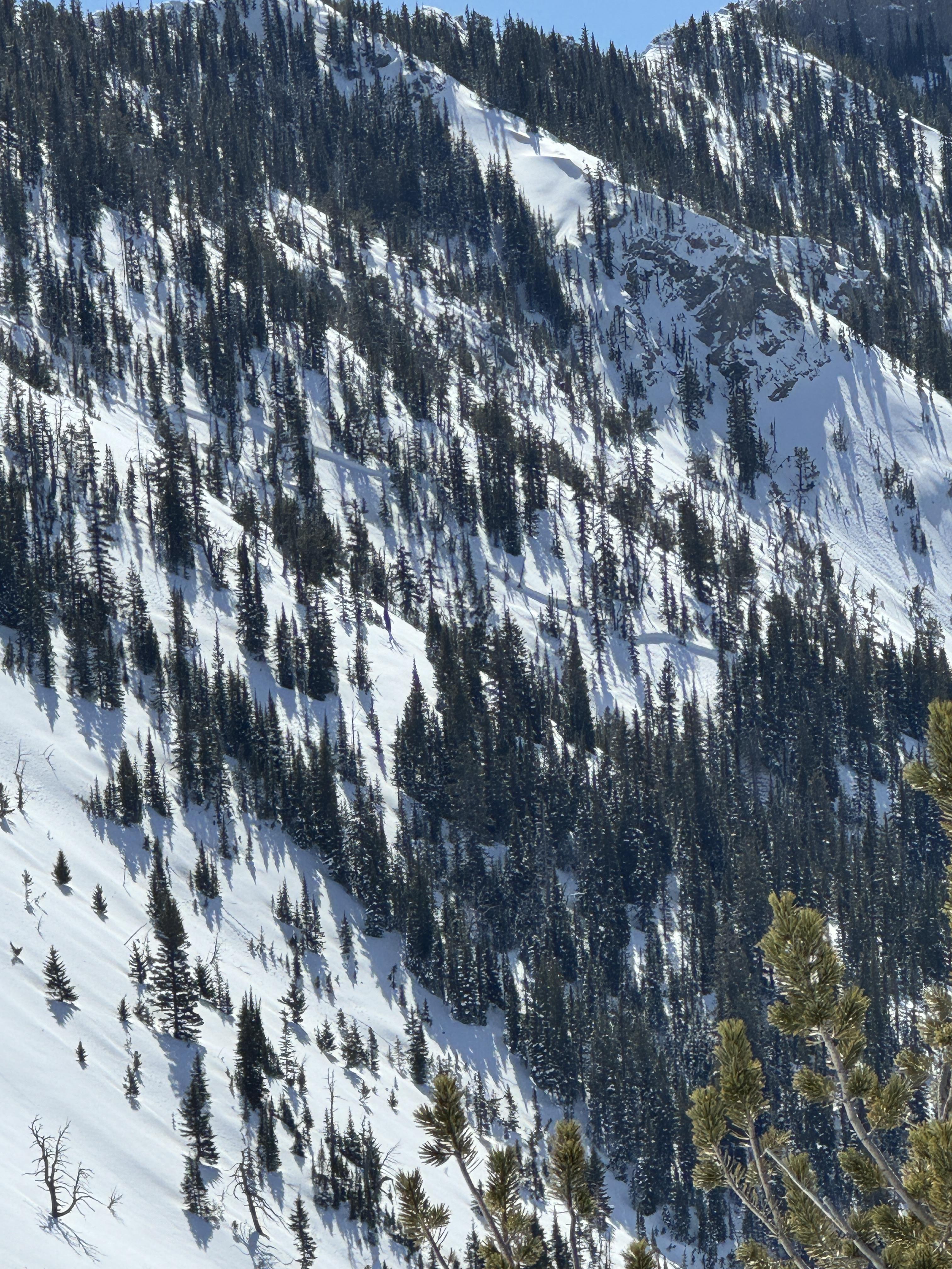
We toured down the west side of the Bridger Range on the edge of Truman Gulch and found predictably weak snow on an upper-elevation NW-facing slope. Conditions were variable and transitioned to a thick crust as we moved on to a lower elevation, west-facing slope. By the time we came down the Ramp, the snow was getting wet, we saw roller balls, and we avoided steep, sun-exposed terrain.
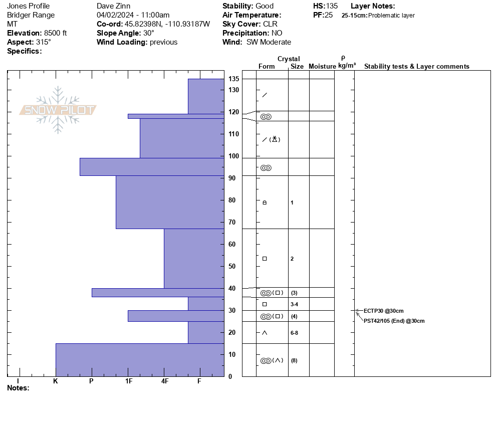
We dug below NW Passage. It was a 135 cm deep snowpack, dry throughout, with Fist plus hard facets and depth hoar making up the foundation (ECTP30, PST 42/100 end at 30 cm from the ground.
Full Snow Observation ReportMODERATE rising to CONSIDERABLE seemed correct.

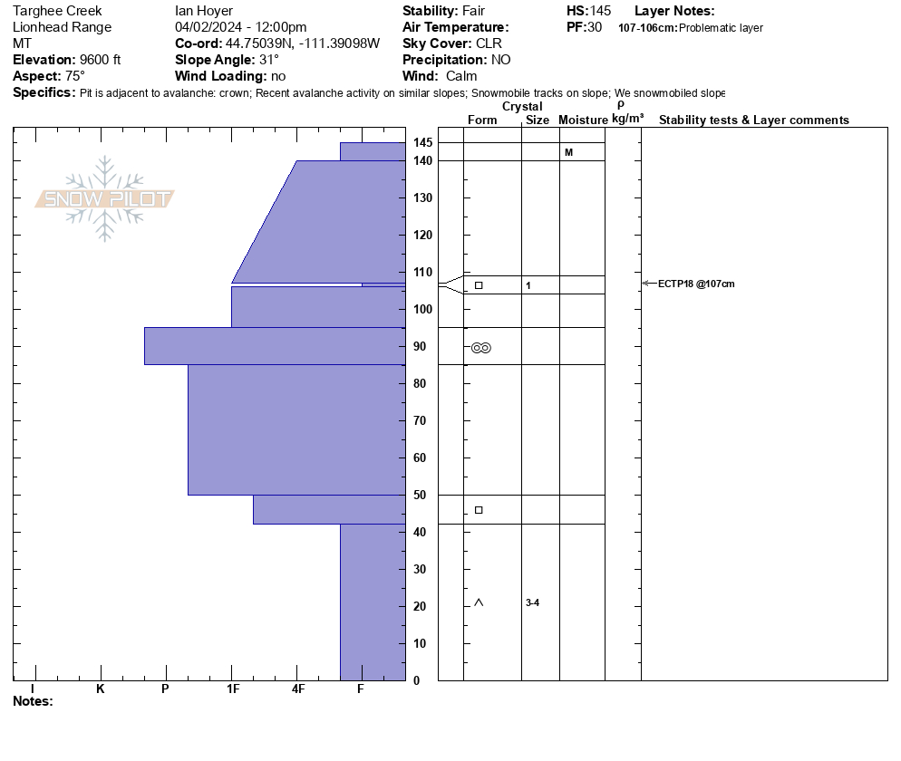
We rode from the Buttermilk trailhead up Denny Creek to Lionhead Ridge, along Lionhead Ridge through Watkins Creek and to the motorized boundary at the head of Targhee Creek.
There was a ~1" crust at the surface when we left the trailhead, with dry snow beneath. We saw our first wet loose avalanche of the day running around 11 am. By 12:30 there were dozens and many rollerballs. None of them ran particularly far or picked up too much volume. The snow surface was moist on sunny slopes by late morning, but not more than a few inches down.
We saw one small slab avalanche that occurred since this weekend's snow. It appears to have been triggered by a snowmobile yesterday (4/1/24). It broke 10" to 2 ft deep, 50 ft wide, and ran ~50 vertical feet. It broke on a thin layer of facets beneath the new snow. Digging in the crown, dry facets at the ground were along still present and weak (fist hardness).
Signs of older avalanches were visible beneath the new snow, including one slide that broke in early March. No cracking or collapsing were observed today.
Full Snow Observation ReportMOD rising to CON seemed totally reasonable.

From email: "Snowpit from this morning: SE aspect, 9250'.
It snowed all day in Cooke (S2), mild temps, light westerly winds."
Full Snow Observation Report