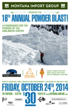
Advisory Archive
Last night another 2-3 inches of snow fell in the mountains. Since Friday evening over a foot has fallen in the Bridger Range, outside Cooke City and West Yellowstone, with 6-8 inches falling up Hyalite and around Big Sky. Winds were blustery over the weekend hitting speeds of 70 mph from the west on Saturday. This morning westerly winds are blowing 25-35 mph and gusting to 50 mph with temperatures in the teens under partly cloudy skies. Another system crawls in tonight to deliver snow tomorrow and Wednesday. It’s a northwest flow and new snow will blanket the mountains. My fingers are crossed that it will be a bountiful Thanksgiving.

Temperatures in the mountains warmed today into the upper 20s F to lower 30s F. The most recent snow fell last weekend with 3-5 inches near Bozeman and Big Sky and 7-12 inches near West Yellowstone and Cooke City. No more snow has fallen this week. A Pacific weather system will bring precipitation starting Friday night followed by colder temperatures Saturday night. Next week looks promising for more snow as well.
The cold snap ended and 25F never felt so warm. Who needs a hat? Five days of frigid temperatures (minus teens in the mountains) with a few snow storms cured me of wondering when winter would arrive. It’s here, like it or not. The first half of this week looks to be sunny with mountain temperatures in the teens to upper 20s and a sweltering mid-thirties in the valleys. Ridgetop winds are out of the northwest and will blow 20-30 mph for the next few days. Later in the week clouds will return with a chance of light snowfall.
Over the past 24 hours accumulating snowfall and plummeting temperatures have impacted the entire forecast area. In most mountain locations temperatures are in the single digits and have dropped roughly thirty degrees F since yesterday afternoon. Snowfall amounts between 6-8 inches have been recorded in the Bridger Range, Carrot Basin (southern Madison Range) and mountains around Cooke City. The rest of the advisory area picked up around 1-3 inches. Fortunately, winds are relatively light, blowing 5-10 mph out of the WNW. Today, light snow will continue with an additional 1-2 inches possible and temperatures will warm into the double digits. Snow will taper off this evening and temperatures will again drop to the single digits above or below zero.

While snow has been falling periodically since late August, little of it survived the beautiful, warm fall we’ve had so far. More snow fell in the mountains this weekend. Near Cooke City and West Yellowstone 10 inches of snow fell while the mountains near Bozeman and Big Sky got only a few inches.
A trace to two inches of new snow fell in the last 24 hours. Under cloudy skies temperatures are in the low twenties as winds blow 20-30 mph from the southwest. A moist northwest flow will keep skies cloudy today and bring snow showers. I expect 1-3 inches by tonight with a bit more in the Bridger Range. Today winds will increase slightly and temperatures will reach the high 20s. Behind this storm a high pressure ridge will bring a week of sunny skies and warm temperatures (60F!).
Last night 1-3 inches of snow fell throughout the advisory area. This morning temperatures were in the low-mid 20s F. Westerly winds blew a bit stronger overnight but eased some this morning and were blowing 10 mph gusting 15-20 mph. More clouds and some moisture will come today. High temperatures will be near freezing. Light winds will blow 5 mph gusting 15 mph from the W and may increase again this afternoon. Another 1-3 inches of snow should fall with more snow coming from the NW on Sunday.