Good Morning. This is Eric Knoff with the Gallatin National Forest Avalanche Advisory issued on Friday, January 19th at 7:30 a.m. Today’s advisory is sponsored by Grizzly Outfitters in partnership with the Friends of the Avalanche Center. This advisory does not apply to operating ski areas.
Since midnight, the mountains around Bozeman and Big Sky picked up 6-10” of new snow while the southern ranges picked up 4-6”. Snow will continue through the day with an additional 3-5” falling across the advisory area. At 5 a.m. temps range from the teens to mid-20’s F and winds are blowing 15-30 mph out of the west. Ridgetop gusts near West Yellowstone and Cooke City are pushing 40 mph. Temps will not warm much today as cooler air moves over the region. Winds will decrease through the day as the storm pushes to the east.

The combination of new snow, wind and buried weak layers will keep the avalanche danger elevated in the Lionhead area near West Yellowstone. Today, there will be multiple avalanche problems to look out for. The main problem will large persistent slab avalanches failing on a layer of facts buried 2-4’ feet deep. This layer has been slow to gain strength and has produced numerous human triggered slides over the past week (video, photo). Today, all steep slopes should be considered suspect and avalanche terrain should be approached with caution.
Additional problems include cornices and wind slabs. Strong winds over the past 24 hours contributed to cornice and wind slab growth near the ridgelines. These will both be touchy to human triggers today. Give cornices a wide berth along the ridgelines and avoid wind loaded slopes in steep, upper elevation terrain.
Today, wind slabs and weak layers make human triggered avalanches likely and the avalanche danger is rated CONSIDERABLE.
New snow instabilities will be the main issue in the mountains around Bozeman, Big Sky and Cooke City. Over the past six hours, the Bridger Range has picked up 10” of new snow totaling nearly 1” of SWE. The mountains south of Bozeman have picked up 5-7” totaling .5 to .7” of SWE.
Snow and wind throughout the day will allow wind slabs and storm slabs to grow in size and distribution. Wind loaded slopes will be the most prone to producing human triggered slides (photo). Watch for fresh wind slabs on the leeward side of ridgelines and cross loaded terrain features. Cracking and collapsing of the new snow are obvious clues of instability. Today, wind loaded slopes will fail easily under the weight of a skier or rider and should be approached with caution.
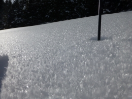
On some slopes, the new snow has been deposited on a layer of surface hoar or near surface facets (photo, video). These layers are not widespread, but have survived on some shady and sheltered slopes. This will be something to look out for when traveling in steep, sheltered terrain.
Last but not least, slides still have to the potential to fail on weak facets buried 2-4’ deep. Earlier in the week, skiers west of Cooke City experienced cracking/collapsing and observed a fresh avalanche (photo). This layer also produced unstable results in stability tests north of Big Sky on Wednesday (video, snowpit). Although this deep instability is gaining strength, slides failing this layer can’t be entirely ruled out.
Today, human triggered avalanches are likely on wind loaded slopes which have a CONSIDERABLE avalanche danger. Non-wind loaded slopes have a MODERATE avalanche danger. The danger could rise on all slopes if the storm continues through the day.
If you get out and have any avalanche or snowpack observations to share, drop a line via our website, email (mtavalanche@gmail.com), phone (406-587-6984), or Instagram (#gnfacobs).
King and Queen of the Ridge
King and Queen of the Ridge, Saturday, February 3rd. A Hike and Ski/Ride-a-Thon fundraising event to support the Friends of the Gallatin National Forest Avalanche Center. Sign up and start collecting pledges HERE.
Upcoming Avalanche Education and Events
BOZEMAN
Jan. 22, MAP Brewing Pint Night, 4-8 p.m. MAP donates 50 cents of every pint sold to the Friends of the Avalanche Center.
Jan. 24, 25 and 27, Advanced Avalanche Workshop w. Field Day, Info and Register Here
Feb. 6th, Sidecountry specific avalanche awareness for family and friends. 6-8 p.m. @ Beal Park
Feb. 7th, Woman’s specific avalanche awareness, 6-7:30 p.m. @ REI in Bozeman
Feb. 7th, Avalanche awareness, 6-7:00 p.m. @ Roski Hall MSU
Feb. 9 and 10, Companion Rescue Clinic, Info and Register
March 2nd, Avalanche Awareness, 6-7:00 p.m. Bozeman Split Fest
March 7th, Avalanche Awareness, 6-7:30 p.m. @ REI
Dillion
Feb. 24th and 25th, Snowmobile intro to avalanches w/ field course. Visit mtavalanche.com/workshops/calendar for more info.
WEST YELLOWSTONE
Jan. 20, Avalanche Awareness, 7-8 p.m. at West Yellowstone Holiday Inn Conference Center
Feb. 3rd, Avalanche Awareness, 7-8 p.m. at West Yellowstone Holiday Inn Conference Center
COOKE CITY
Every Friday and Saturday, Current Conditions Update and Avalanche Rescue, Friday 6:30-7:30 p.m. at The Antler's Lodge in January. Saturday anytime between 10-2 @ Round Lake.
Our report from the snowmobiler avalanche fatality on January 10 is HERE. A snowmobiler was caught, fully buried and killed in Idaho near Reas Peak in the Centennial Range.