Good Morning. This is Alex Marienthal with the Gallatin National Forest Avalanche Advisory issued on Sunday, January 21st at 6:45 a.m. Today’s advisory is sponsored by World Boards and the Community Food Co-op. This advisory does not apply to operating ski areas. The Avalanche Center has been granted an “exception” and will remain open at full capacity during the government shutdown.
AVALANCHE FATALITY
Yesterday afternoon a snowmobiler was caught, buried and killed in an avalanche south of Reas Peak on the Caribou-Targhee National Forest near Island Park, Idaho. The rider was located with a beacon and buried deeply. His group and others tried unsuccessfully to resuscitate him. We will post more information as it becomes available.
The mountains did not get any snow since yesterday morning. Temperatures this morning are in the single digits to teens F. Wind overnight was north-northwest at 5-15 mph near Big Sky, Hyalite and Cooke City. In the Bridger Range and near West Yellowstone wind was 15-20 mph with gusts to 30 mph. Today will be partly cloudy with temperatures in the teens to low 20s F, and northerly wind at 10-20 mph will shift westerly this afternoon. Snow is expected early tomorrow with 3-5” possible by tomorrow evening.

The Lionhead area near West Yellowstone has all the red flags of an unstable, dangerous snowpack. The list starts with 2 feet of snow equal to 2” of snow water equivalent (SWE) on Friday, strong wind last night, and weak facets buried 3-4’ deep. Additionally, there have been snowmobile triggered avalanches or large collapses almost daily for two weeks (photo, photo), and three people killed in avalanches nearby in the last three weeks. I was on Lionhead Ridge yesterday and my group collapsed a large, low angle slope after finding stable results in our stability tests (video). Signs of instability are slowly becoming less obvious. It may not be the first person on a slope to trigger it, but large, deadly avalanches are likely today. Avoid steep slopes and terrain below. Avalanche danger is HIGH on wind loaded slopes and CONSIDERABLE on all other slopes.

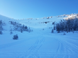
In the Bridgers, Gallatin and Madison Ranges, and mountains near Cooke City 1-1.5 feet of snow (1-1.5” SWE) that fell Friday makes avalanches possible today. Strong wind in some locations drifted this snow into fresh slabs that were easily triggered by skiers in the Bridger Range (photo) and riders in Taylor Fork (photo) yesterday. Today, wind slabs 1-3 feet thick near ridgelines or the edges of cliffs and gullies are easy to trigger.
Recent snow also buried a weak layer of surface hoar (photo). The distribution of this weak layer is uncertain, but is more likely on slopes sheltered from sun and wind. Avalanches are possible where this weak layer was buried, and careful snowpack assessment is essential before travel in avalanche terrain. Quickly dig 1-2’ to rule out this weak layer before riding any steep slope.
Avalanches breaking on facets 2-4’ deep are becoming less likely, but are possible and could be large (video). This weak layer is most unstable and likely to trigger where the snowpack is 3-5’ deep or shallower. Skiers near Cooke City earlier this week saw avalanches and had large collapses on this layer (photo). Be cautious of steep slopes where the snowpack is relatively shallow or highly variable.
Today, avalanche danger is CONSIDERABLE on wind loaded slopes and MODERATE on all other slopes.
If you get out and have any avalanche or snowpack observations to share, drop a line via our website, email (mtavalanche@gmail.com), phone (406-587-6984), or Instagram (#gnfacobs).
King and Queen of the Ridge
King and Queen of the Ridge, Saturday, February 3rd. A Hike and Ski/Ride-a-Thon fundraising event to support the Friends of the Gallatin National Forest Avalanche Center. Sign up and start collecting pledges HERE.
Upcoming Avalanche Education and Events
BOZEMAN
Tonight, Darren Johnson Avalanche Education Memorial Fundraiser, Beehive Basin Brewery in Big Sky @ 7 pm
Jan. 22, MAP Brewing Pint Night, 4-8 p.m. MAP donates 50 cents of every pint sold to the Friends of the Avalanche Center.
Jan. 24, 25 and 27, Advanced Avalanche Workshop w. Field Day, Info and Register Here
Feb. 6th, Sidecountry specific avalanche awareness for family and friends. 6-8 p.m. @ Beal Park
Feb. 7th, Woman’s specific avalanche awareness, 6-7:30 p.m. @ REI in Bozeman
Feb. 7th, Avalanche awareness, 6-7:00 p.m. @ Roski Hall MSU
Feb. 9 and 10, Companion Rescue Clinic, Info and Register
March 2nd, Avalanche Awareness, 6-7:00 p.m. Bozeman Split Fest
March 7th, Avalanche Awareness, 6-7:30 p.m. @ REI
Dillion
Feb. 24th and 25th, Snowmobile intro to avalanches w/ field course. Visit mtavalanche.com/workshops/calendar for more info.
WEST YELLOWSTONE
Feb. 3, Avalanche Awareness, 7-8 p.m. at West Yellowstone Holiday Inn Conference Center
COOKE CITY
Every Friday and Saturday, Current Conditions Update and Avalanche Rescue, Friday 6:30-7:30 p.m. at The Antler's Lodge in January. Saturday anytime between 10-2 @ Round Lake.
Three snowmobilers have been killed in the last three weeks near West Yellowstone and Island Park. Our report from the snowmobiler avalanche fatality on January 10 is HERE.