Good Morning. This is Doug Chabot with the Gallatin National Forest Avalanche Advisory issued on Wednesday, February 21st at 7:00 a.m. Today’s advisory is sponsored by Yellowstone Arctic Yamaha and Yamaha Motor Corp in partnership with the Friends of the Avalanche Center. This advisory does not apply to operating ski areas.
Under partly cloudy skies, mountain temperatures are -5F to -10F with winds averaging 10-20 mph and gusting to 25 mph out of the W-SW and SE around Cooke City. Overnight a trace to 1” of snow fell in the southern mountains and Cooke City. Today will remain partly cloudy, temperatures will rise into the high single digits and drop to zero tonight as winds decrease to 10-20 mph from the W-SW. The southern ranges and Cooke City may get an inch of snow later today.

Eric is in Cooke City and found blowing snow, wind-loading and also a wafer-thin weak layer of small-grained facets 18” under the surface, which he describes in his (video). This is the same layer I saw a week ago, but it now has a thicker slab of snow sitting on it. This layer was unstable in his tests and found on many slopes, wind-loaded and not. The good news is that it may not be a problem for long, but in the meantime assume it’s on most slopes until proven otherwise. Thick drifts and a few avalanche crowns are reminders that wind-loaded slopes could still avalanche (photo). For today, wind-loading and a buried weak layer point to the possibility of avalanches and a MODERATE danger.
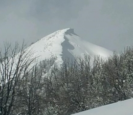
From the Bridger Range, to Big Sky and West Yellowstone, winds formed large cornices and also blew snow into thick slabs that could avalanche. On Monday, skiers up Hyalite near Maid of the Mist came close to falling off a cliff when a cornice broke inches away from their feet. It triggered the slope below which wiped out part of their track (photo). Yesterday, my partner and I skied north of Bridger Bowl along the ridge, ever mindful of the Hyalite incident. I kept my path on solid ground near the trees as we passed huge cornices (photo, photo) giving them a wide berth (illustration).
Our snowpit revealed wind slabs no more than a foot thick overlying softer snow, an unstable structure that could produce avalanches, which I talk about in our video. Other relevant observations include a small avalanche in Middle Basin north of Big Sky (photo), large cornices along Buck Ridge (photo), and an avalanche under a corniced ridge in Teepee Basin (photo). Today’s concerns are limited to wind-loaded slopes which have a MODERATE avalanche danger. All other slopes have a LOW danger since the snowpack lacks widespread weak layers and has good stability.
If you get out and have any avalanche or snowpack observations to share, drop a line via our website, email (mtavalanche@gmail.com), phone (406-587-6984), or Instagram (#gnfacobs).
Upcoming Avalanche Education and Events
BOZEMAN
Feb. 28th, Know Before You Go avalanche awareness, 7:00 p.m. @ Procrastinator Theater, MSU
March 2nd and 3rd, SheJumps Companion Rescue Clinic, Info and Register HERE
March 2nd, Avalanche Awareness, 7-8:00 p.m., MAP Brewing Bozeman Split Fest
March 7th, Avalanche Awareness, 6-7:30 p.m. @ REI
DILLON
Feb. 24th and 25th, Snowmobile intro to avalanches w/ field course. More info: https://msuextension.org/conference/
COOKE CITY
Every Friday and Saturday, Current Conditions Update and Avalanche Rescue, Friday 6:30-7:30 p.m. at The Soda Butte Lodge in February. Saturday anytime between 10-2 @ Round Lake.
A snowmobiler was caught and killed in an avalanche in Idaho, near the Wyoming border north of Alpine on Tuesday, February 20. This is the 3rd avalanche in SE Idaho since the beginning of the year. The East Idaho News has a preliminary report.