Good Morning. This is Eric Knoff with the Gallatin National Forest Avalanche Advisory issued on Friday, March 2nd at 7:00 a.m. Today’s advisory is sponsored by Pinhead Classic and Alpine Orthopedics. This advisory does not apply to operating ski areas.
Overnight the mountains near West Yellowstone picked up 2-3” of new snow while the Cooke City area picked up 1-2”. The rest of the advisory area remained dry. At 5 a.m. temps are in the teens to low 20’s F and winds are blowing 15-30 mph out of the S-SE with gusts in Hyalite breaking 50 mph. Today, 4-6” of new snow will fall in the mountains near West Yellowstone and 2-3” will accumulate around Cooke City. The mountains around Bozeman and Big Sky will see 1-3”. Snow diminishes this evening, but the southern mountains could see an additional 1-2” overnight. Highs today will warm into the 20’s F and winds will continue to blow 15-30 mph out of the S-SE with stronger gusts possible along the ridgelines.

The mountains near West Yellowstone will see the strongest impacts of this current storm system. New snow and wind will form a fresh batch of wind slabs, which will grow in size and distribution throughout the day. Instability will be on the rise, so evaluate terrain and the snowpack carefully before exposing yourself to steeper slopes. The safest riding today will be on sheltered, low angle slopes not attached to steeper slopes.
Dry loose avalanches (sluffs) will also be possible in steeper terrain. This will be a growing problem as snow accumulates through the day. These slides won’t be huge, but could potentially carry a skier or rider into trees, rocks or gullies. Give cornices a wide berth along the ridgelines as they can break further back than you might expect.
Outside of new snow instabilities, the snowpack is mostly stable.
Today, the combination of new snow and wind will make human triggered avalanches likely on wind loaded slopes which have a CONSIDERABLE avalanche danger. Non-wind loaded slopes have a MODERATE avalanche danger.

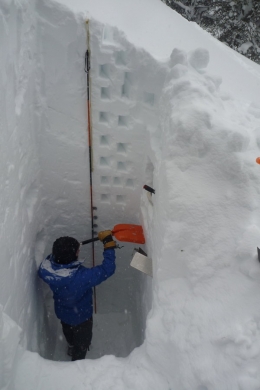
The mountains saw fresh snow and wind earlier this week. This created dense slabs sitting on top of lower density snow. On Wednesday, these fresh slabs were reactive to stability tests in the Bridger range (video). These slabs will be largest and most widespread at upper elevations and in cross loaded terrain, and may be covered by fresh snow throughout the course of the day. These slabs have had a few days to and stabilize, but they could still be triggered (video).
Growing cornices continue to pose a threat and should be given a wide berth. They can break farther back than expected if you hit the right spot. A large natural slide occurred on Monday in the Bridger range (photo), likely due to cornice failure.
Today, natural avalanches are unlikely, but human triggered avalanches remain possible on wind loaded slopes which have a MODERATE avalanche danger. Non-wind loaded slopes have a LOW avalanche danger.
If you get out and have any avalanche or snowpack observations to share, drop a line via our website, email (mtavalanche@gmail.com), phone (406-587-6984), or Instagram (#gnfacobs).
Upcoming Avalanche Education and Events
BOZEMAN
Tonight, Avalanche Awareness, 7-8:00 p.m., MAP Brewing Bozeman Split Fest
Tonight and March 3rd, SheJumps Companion Rescue Clinic, Info and Register HERE
March 3rd, Pinhead Classic at Bridger Bowl. Ski race, awards and legendary after party. Info HERE.
March 7th, Avalanche Awareness, 6-7:30 p.m. @ REI
LIVINGSTON
March 20, Beer for a Cause Night at Katabatic Brewing, 4-8p.m. A dollar from every pint will be donated to The Friends of the Avalanche Center.
COOKE CITY
Every Friday and Saturday, Current Conditions Update and Avalanche Rescue, Friday 6:30-7:30 p.m. at The Soda Butte Lodge in February. Saturday anytime between 10-2 @ Round Lake.
In Dashboard Talks, Episode 7, Alex Marienthal and Doug Chabot provide a few thoughts about why you should read the daily advisory. As the season wears on, don't get "Advisory Fatigue." There is a lot of winter still to come!