Good Morning. This is Doug Chabot with the Gallatin National Forest Avalanche Advisory issued on Tuesday, March 13th at 6:45 a.m. Today’s advisory is sponsored by Mystery Ranch and the Community Food Co-op. This advisory does not apply to operating ski areas.
At 5 a.m. under clear skies, mountain temperatures are in the low 20s F and wind is southwest to southeast at 5-10 mph. Today will be sunny and mountain temperatures will reach the upper 40s F, our warmest of the season. Tonight will remain clear and temperatures will drop into the 20s F and tomorrow looks to be even warmer, but cloudy.
Wet Avalanche Danger
The threat of wet avalanches will increase this afternoon on steep and sunny slopes, especially those with rock outcroppings or cliffs. Yesterday, I rode into Carrot Basin and found an icy crust on slopes exposed to the sun (video). Once this crust melts wet snow avalanches will release naturally. Rollerballs (photo), pinwheels or wet loose avalanches are signs to avoid avalanche terrain. Today, the wet snow avalanche danger will rise to MODERATE once the surface crust melts (photo, photo).

Today’s avalanche concerns center on sunny, calm and warm weather. The surface snow will get no cooling effect from a breeze nor will the snow be shielded from the sun by clouds. It’s a warm day and no mountain range is immune to loose, wet snow avalanches on sunny, mostly south-facing, slopes (photo). The danger from today’s wet avalanches do not lie in triggering them below your feet, but in having one hit you from above and carry you down a slope. Above freezing temperatures also make cornices weak. These overhangs of snow already teeter and melting will only make them more likely to break. A passing skier triggered a large cornice in the Hourglass Chute north of Bridger Bowl on Saturday (photo), and with today’s temperatures cornices will break even easier.
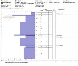
Underneath the surface the snowpack is dry, strong, and lacks widespread weak layers. Cooke City experienced wind slab avalanches over the weekend (photo, photo) that possibly failed on a layer of ball-bearing graupel (photo), but this instability will heal quickly. Our snowpits and other field observations reveal stable conditions in our advisory area (video). Today, the dry snow avalanche danger is rated LOW on all slopes. A low danger means avalanches are unlikely, but not impossible.
If you get out and have any avalanche or snowpack observations to share, drop a line via our website, email (mtavalanche@gmail.com), phone (406-587-6984), or Instagram (#gnfacobs).
Upcoming Avalanche Education and Events
LIVINGSTON
March 20, Beer for a Cause Night at Katabatic Brewing, 4-8p.m. A dollar from every pint will be donated to The Friends of the Avalanche Center.
Alex and Eric wrote up a one-page accident report on the avalanche that caught a snowmobiler on Kirkwood Ridge in the southern Madison Range on March 7th that is worth looking at: accident report, video.