Good Morning. This is Alex Marienthal with the Gallatin National Forest Avalanche Advisory issued on Monday, April 2nd at 7:00 a.m. Today’s advisory is sponsored by Mystery Ranch and World Boards. This advisory does not apply to operating ski areas.
At 5 a.m. heavy snowfall has dropped 10” near Cooke City, 8” in the Bridger Range, 6” near Big Sky and 1” near West Yellowstone. Temperatures are mid-20s F with west to southwest wind at 15-20 mph and gusts over 30 mph. Temperatures will warm to high 20s and low 30s F this morning, then drop to teens F this afternoon and single digits F tonight. Wind will shift to the northwest at 20-35 mph. Heavy snow continues through this afternoon and will taper off overnight. By this evening the mountains will get another 6-8” near Bozeman and Big Sky, 3-5” near West Yellowstone and Cooke City, and 1-3” more overnight.

Heavy snowfall will continue today and create an unstable snowpack and dangerous avalanche conditions, and stability will decrease through the day. New snow instabilities will be widespread. Below today’s new snow, the snowpack is 8-12 feet deep and generally stable.
The mountains near Bozeman, Big Sky and Cooke City have 6-10” of new snow equal to 0.6-1” of snow water equivalent (SWE), and could have a total of 12-18” of new snow by the end of today. Strong wind this afternoon will drift this snow into slabs 2-4’ thick that are easy to trigger and could break naturally. The heavy new snow fell on a variety of old snow surfaces, from crusts on southerly aspects to dry new snow on higher, shadier aspects. Avalanches may break within or below the new snow, and will bond variably across aspects and elevations.
Danger will increase through the day and stability assessment will be tricky. Conservative terrain selection is the key to avoid dangerous avalanches today. Avoid travel on and below steep wind loaded slopes, and avoid slopes steeper than 35 degrees. Avalanche danger is CONSIDERABLE on all slopes this morning and will rise to HIGH on wind loaded slopes this afternoon.

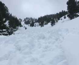
The mountains near West Yellowstone and the southern Madison and Gallatin ranges received just 1” of snow overnight and are expected to get 3-5” today. Avalanche concerns will be fresh wind slabs from new snow and moderate west-northwest wind today, and large cornices (photo). Avoid wind loaded slopes if you see blowing snow and/or cracking of fresh drifts and be extra cautious of steep slopes if snowfall is heavier than expected today. Keep a far distance back from the edge of cornices and avoid slopes directly below them. The snowpack below today’s snow is generally stable and deeper avalanches are not likely. New snow and wind today will make avalanches possible and avalanche danger is MODERATE on wind loaded slopes and LOW on non-wind loaded slopes.
If you get out and have any avalanche or snowpack observations to share, drop a line via our website, email (mtavalanche@gmail.com), phone (406-587-6984), or Instagram (#gnfacobs).
Info and Announcements
Our last daily advisory will be Sunday, April 8th.
Hyalite Canyon road is closed to vehicles until May 15th.
Send us your observations on Instagram! #gnfacobs
Posting your snowpack and avalanche observations on Instagram (#gnfacobs) is a great way to share information with us and everyone else this spring.