Good Morning. This is Alex Marienthal with pre-season avalanche and weather information for the Gallatin National Forest Avalanche Center on Wednesday, November 7th. This information is sponsored by The Friends of the Avalanche Center and Yellowstone Club Community Foundation. We will update this information on Saturday.
Since Monday morning the Bridger Range got 16” of new snow, Cooke City, Hyalite and Big Sky got 10-12”, and 5” fell in the southern Madison Range and near West Yellowstone. Wind has been westerly at 5-15 mph and temperatures this morning are teens to low 20s F. The mountains will get 1-3” of snow this evening with clear skies expected Thursday and Friday. Temperatures will be mid-20s F with overnight lows reaching single digits F and wind at 5-15 mph out of the west.

Over the past week the mountains near Bozeman, Big Sky and Cooke City got 3-5 feet of snow equal to 3-6” of snow water equivalent (SWE), and near West Yellowstone got 2 feet of snow equal to 2” of SWE. Yesterday, skiers at Bridger Bowl and in Hyalite saw small natural avalanches that broke 6-8” deep in the storm snow (details, details). Big Sky ski patrol triggered a large hard slab avalanche with a large explosive. It broke 3 feet deep and ran on the crust that formed prior to the recent week’s storm (details).
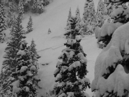
Doug and I toured near Bridger Bowl the last couple days and found mostly good stability within the new snow, and between the new snow and old snow (video, photo). However, as shown by the avalanche activity yesterday, it is important to be cautious of wind loaded slopes and avalanches breaking in the new snow for a couple days. Wind has been light for the past 24 hours, so there is plenty of fresh snow still lying around to form fresh drifts when wind speeds increase.
Watch for blowing and drifting snow and avoid steep, wind loaded slopes if you see cracking of fresh drifts. If you plan to ride in avalanche terrain, it is a good idea to dig to the ground and do a quick stability test. It will yield valuable information and give you an extra couple minutes to check your travel plan.
We are preparing for winter, scheduling avalanche classes, and setting up weather stations. If you get outside send us an observation via our website, email (mtavalanche@gmail.com), phone (406-587-6984), or Instagram (#gnfacobs).
Upcoming Avalanche Education and Events
Our education calendar is full of awareness lectures and field courses. Check it out: Events and Education Calendar.
TONIGHT!!!, 1-hr Avalanche Awareness, 6-7pm at REI Bozeman
November 8, 1-hr Avalanche Awareness, 6-7pm at Langford Hall at MSU
November 8, 1-hr Side-country Avalanche Awareness, 6-7pm at PHD Skis
November 14, 1-hr Avalanche Awareness, 6-7pm at Spire Climbing Center
November 26, MSU Snow and Avalanche Workshop, 5-9pm at MSU SUB Ballroom A
Novembeer 29, 30 and Dec 1, 2or 8, Intro to Avalanche w/ Field Day, more info here
Every Friday and Saturday in Cooke City starting November 23 and 24, Free Rescue training and Snowpack update, exact locations TBD
To prepare yourself for a safe winter in the backcountry you can read this accident report from October 2012 in the northern Bridger Range, and plan to attend one of our avalanche education courses listed HERE.