Good morning. This is Alex Marienthal with the Gallatin National Forest Avalanche Forecast issued on New Year’s Eve, Monday, December 31st at 7:00 a.m. Today’s forecast is sponsored by Mystery Ranch and Gallatin County Search and Rescue. This forecast does not apply to operating ski areas.
Since yesterday morning the mountains got 12” of snow near Big Sky, 9” in the Bridger Range and Hyalite, 7” south of Big Sky to West Yellowstone, and 4” near Cooke City. Yesterday wind was southwest at 15-25 mph with gusts to 45 mph, and overnight wind shifted to the north-northwest at 5-15 mph. This morning, temperatures are single digits to teens below zero F and will remain below zero F today with wind out of the north to northeast at 5-15 mph. No snow is expected until next year.

The Avalanche Warning expires this morning for the mountains near West Yellowstone and the southern Madison and Gallatin Ranges, but dangerous avalanche conditions exist. Since Saturday, these mountains got 11-18” of snow equal to .7-1” of snow water equivalent (SWE). Strong wind drifted this snow into thick slabs on top of a fragile snowpack. Light to moderate wind will continue to load slopes today. On Friday, we toured near Hebgen Lake and found two feet of unsupportive, sugary snow on the ground (video, photo). Riders near Lionhead found similar conditions (details). Today, natural and human triggered avalanches are likely on wind loaded slopes and human triggered avalanches are likely on all steep slopes. Avoid riding on and below steep slopes. Avalanches can be triggered from flat terrain below and small slopes can be as deadly as large slopes. Avalanche danger is HIGH on wind loaded slopes and CONSIDERABLE on non-wind loaded slopes.

Yesterday, the mountains near Big Sky and Hyalite got 9-12” of new snow equal to .8” of snow water equivalent (SWE), and the Bridger Range got 9” of snow equal to 1” of SWE. The prior two days, these mountains got 8-12” of low density snow. Yesterday, skiers found unstable slabs of new snow in the Bridger Range (details) and Hyalite (details, details). Strong wind out of the southwest yesterday and north-northwest overnight formed fresh drifts that are easy to trigger on most aspects. On non-wind loaded slopes, dry loose avalanches and storm slabs can be triggered. Avalanches breaking deeper than the new snow are less likely, but a layer of facets buried 1.5 to 2’ deep is still propagating in stability tests. Yesterday, Doug and I got unstable test results on this layer on Buck Ridge (video, photo) and snow bikers had similar observations in the northern Gallatin Range (photo). Avalanche danger is CONSIDERABLE on wind loaded slopes and MODERATE on non-wind loaded slopes. Be cautious of fresh drifts and avoid steep slopes if you see collapsing or cracking of the snow surface.

The mountains near Cooke City got 8-10” of snow since Friday. Yesterday, skiers triggered a small drift of new snow (photo). Today, these fresh drifts are possible to trigger. Drifts are smaller and more isolated than in the rest of the advisory area, and a lack of wind today allows them to stabilize. A layer of facets 1-1.5’ below the surface is capable of producing avalanches. Doug found this layer last week (video, photo), and on Friday a snowmobiler triggered an avalanche that broke on this layer (photo). On slopes with less than three feet of snow, the snowpack is weak and sugary to the ground (video). Today, new snow and buried weak layers make avalanches possible to trigger and avalanche danger is MODERATE.
If you get out and have any avalanche or snowpack observations to share, contact us via our website, email (mtavalanche@gmail.com), phone (406-587-6984), or Instagram (#gnfacobs).
New webpage dedicated to the Centennial Range in Idaho and Montana
After last season's two snowmobiler avalanche fatalities on Reas Peak in the Centennial Range we created a webpage so riders could get good, relevant information regarding snowpack and avalanches. Although the Centennial Range is not part of the Gallatin National Forest Avalanche Center's forecast area, we are the closest avalanche center and have valuable information to share. More…
Upcoming Avalanche Education and Events
Our education calendar is full of awareness lectures and field courses. Check it out: Events and Education Calendar.
BOZEMAN
January 2, Avalanche Awareness, 6-7:30 p.m. at REI, Bozeman. Pre-register at https://www.rei.com/events.
January 8, Women’s Specific Avalanche Awareness, 6:30-8 p.m. Story Mill Park, Bozeman.
January 9, 1-hr Avalanche Awareness, 7-8 p.m. Spire Climbing Center, Bozeman.
January 16, 17 and 19 or 20, Intro to Avalanches w/ Field Day, Info and Register Here.
January 23, 24 and 26, Advanced Avalanche Workshop w/ Field Day, Info and Register Here.
WEST YELLOWSTONE
January 12 and 26, 1-hr Avalanche Awareness for Snowmobilers, 7-8 p.m. Holiday Inn West Yellowstone.
DILLON
January 22, 1-hr Avalanche Awareness, 6:30-7:30 p.m. U.M. Western Library.
BILLINGS
January 22, 1-hr Avalanche Awareness, 6-7 p.m. The Base Camp, Billings
COOKE CITY
Every Friday and Saturday, Rescue Training and Snowpack Update. Friday 6:30-7:30 p.m. at the Soda Butte Lodge. Saturday anytime between 10-2 @ Round Lake.
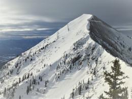
See Alex’s recent article about the Lift-accessed Backcountry of Saddle Peak. Be prepared with the necessary knowledge and skills before leaving the ski area into this complex and deadly terrain.