Good morning. This is Alex Marienthal with the Gallatin National Forest Avalanche Forecast issued on Monday, January 21st at 7:00 a.m. Today’s forecast is sponsored by Yellowstone Club Community Foundation and Bridger Bowl. This forecast does not apply to operating ski areas.
Since yesterday morning the mountains received 9” of snow near Cooke City, 6-9” from Big Sky to West Yellowstone, 4” in the Bridger Range and 2” in hyalite. Yesterday evening wind gusted 40-50 mph out of the southwest, and this morning wind shifted west to northwest at 5-15 mph. Today, temperature will decrease from mid 20s F this morning to teens F this afternoon. Wind will be northwest to northeast at 15-25 mph. Snow showers through tonight will deliver 6-8” to the mountains near Bozeman, Big Sky and Cooke City with 1-2” near West Yellowstone.

Since Friday morning the Bridger Range received 18-20” of snow equal to 2.1” of snow water equivalent (SWE). On Friday a skier was buried to his waist in an avalanche near Fairy Lake (details, video). Saturday on Saddle Peak there were three skier triggered avalanches and one natural avalanche (details, details). Yesterday, there were two large natural slides and at least one skier triggered avalanche on Saddle Peak (details, details), and a skier remotely triggered an avalanche in Frazier Basin (details). All these avalanches consisted of new snow. Ian and I skied near the Throne yesterday. The dense 18” slab of new snow was enough of a red flag for us to ride low angle slopes (less than 30-33 degrees) (video, photo). An additional four to six inches of snow this morning makes avalanches of new snow, greater than two feet deep, easy to trigger and possibly break naturally today. Avalanche danger is CONSIDERABLE.
In the mountains near West Yellowstone and south of Big Sky the snowpack is poorly supported by 1.5’ of weak, sugary facets on the ground (video). Since Saturday these mountains got 10-14” of snow equal to 1-1.5” of SWE. Strong wind last night drifted this snow into thick slabs, followed by loading from more snow this morning. This recent load on an unstable snowpack makes it easy to trigger avalanches 2-3’ deep that can propagate hundreds of feet wide. Avalanches can be triggered from lower angle terrain below steep slopes. Slopes with thick drifts are the most likely place to trigger an avalanche, but all steep slopes are dangerous (photo, details). Avoid travel on and underneath steep slopes. Today, human triggered avalanches are likely and avalanche danger is CONSIDERABLE.
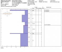
Yesterday Doug and his partner rode north of Cooke City. They found stability is getting worse than when I was there on Saturday (my video). The new snow cracked under their skis and they got unstable test results. Both indicate avalanches of new snow are easy to trigger (Doug’s video). They also found weak, sugary snow on some slopes that makes deeper, larger avalanches possible. Since yesterday morning 10-12” of new snow added the weight of 1” of SWE. Thick slabs of new and wind-drifted snow are easy to trigger today and could break deeper and wider on buried weak layers. Avalanche danger is CONSIDERABLE.
The mountains around Hyalite and near Big Sky got the short end of storms over the weekend. They were not entirely left out however, and 10-14” of snow since Thursday will be drifted into slabs that are easy to trigger. On non-wind loaded slopes, slabs and loose avalanches of new snow are possible. Avalanches can break larger on weak layers buried 1.5-2’ deep (video, video). Carefully assess the snowpack and consequences of being caught in a slide before riding steep slopes. Avalanche danger is CONSIDERABLE on wind loaded slopes and MODERATE on other slopes.
Skier killed in avalanche in Utah
On Friday a skier was buried and killed in an avalanche in Utah. He and his partner were not wearing avalanche transceivers. Details from the Utah Avalanche Center are HERE.
Upcoming Avalanche Education and Events
Our education calendar is full of awareness lectures and field courses. Check it out: Events and Education Calendar.
BOZEMAN
January 23, 24 and 26, Advanced Avalanche Workshop w/ Field Day, Info and Register Here.
February 2, King and Queen of the Ridge at Bridger Bowl (fundraiser). Register with Bridger to hike in the event, and create a pledge page to raise funds with your Ridge laps.
BIG SKY
January 22, Pint Night at Beehive Brewery, 4-8 p.m. A fundraiser for the Darren Johnson Avalanche Education Memorial Fund.
WEST YELLOWSTONE
January 26, 1-hr Avalanche Awareness for Snowmobilers, 7-8 p.m. Holiday Inn West Yellowstone.
DILLON
January 22, 1-hr Avalanche Awareness, 6:30-7:30 p.m. U.M. Western Library.
BILLINGS
January 22, 1-hr Avalanche Awareness, 6-7 p.m. The Base Camp, Billings.
COOKE CITY
Every Friday and Saturday, Rescue Training and Snowpack Update. Friday 6:30-7:30 p.m. at the Soda Butte Lodge. Saturday anytime between 10-2 @ Round Lake.
The government shutdown and its effects on USFS avalanche centers is highlighted in this article in Powder Magazine.