Good morning. This is Ian Hoyer with the Gallatin National Forest Avalanche Forecast issued on Tuesday, January 22nd at 7:10 a.m. Today’s forecast is sponsored by Highline Partners and Mystery Ranch. This forecast does not apply to operating ski areas.
Since yesterday morning, 3-5” of new snow fell near Big Sky, with 1-3” in the rest of the advisory area. This morning, northwest winds are light and temperatures are in the single digits (F) to low teens (F). Winds will increase and shift to the southwest today. Snow will return tonight and continue through tomorrow. By tomorrow morning, expect 2-4” near West Yellowstone and Cooke City, with 3-6” near Bozeman and Big Sky.

The southern ranges received a large load of snow over past week (1.5”-1.7” of snow water equivalent), falling on a very weak foundation . You can trigger slides breaking deep in the snowpack (2-3’ deep), on weak snow near the ground. The 1.5’ of loose, sugary snow at the ground developed during the cold temperatures in early December, and is now capped by a cohesive slab (video). This dangerous combination is a widespread. Avalanches on these weak layers may propagate hundreds of feet wide and can be triggered from flatter terrain beneath steep slopes. Skiers on Sunday reported large collapses on low angle terrain (details, details). Cautious route-finding is essential, as you can’t count on getting these warning signs before triggering a slide. The best way to avoid triggering an avalanche is to stay off of and out from underneath steep slopes, including small terrain traps such as creek beds, gullies and road cuts. Winds will pick up today, thickening slabs and making conditions touchier on wind loaded slopes. Human triggered avalanche are likely and the avalanche danger is CONSIDERABLE.
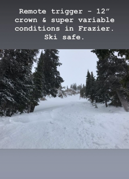
Avalanches breaking within the new snow are the primary concern in the northern ranges. Since Friday, snow totals range from 14” - 25” (1.1”-2.6” of SWE). The most dangerous slopes are those with cohesive slabs of new snow that have not bonded well to the old snow surface. You will find the thickest and most dangerous slabs in the areas with the highest snowfall totals and on slopes loaded by north and west winds. Yesterday, skiers in the northern Gallatin Range remotely triggered a slide from 200’ away (details), ice climbers triggered a slide in Hyalite (photo), and natural wind slab avalanches broke on Mt. Republic, near Cooke City (photo, photo). Numerous other avalanches have been triggered since snowfall began on Friday, including natural and skier triggered slides on Saddle Peak (details, details) and a skier buried to his waist in an avalanche near Fairy Lake (details, video).
Yesterday, near Cooke City, Doug found that while the new snow has generally bonded well on non-wind loaded slopes, there are some slopes where it has not (video). Quickly check how the new snow has bonded to the old snow surface before getting into any steep terrain. While not widespread, on slopes with a shallower snowpack there is also the potential to trigger slides on deeper weak layers.
Steer clear of steep, wind loaded slopes where you are most likely to trigger an avalanche. The avalanche danger is CONSIDERABLE on wind loaded slopes and MODERATE on other slopes.
Skier killed in avalanche in Colorado
Yesterday, a backcountry skier was buried and killed in an avalanche near Aspen, Colorado. Preliminary information from the Colorado Avalanche Information Center is HERE.
Skier killed in avalanche in Utah
On Friday, a skier was buried and killed in an avalanche in Utah. He and his partner were not wearing avalanche transceivers. Details from the Utah Avalanche Center are HERE.
Upcoming Avalanche Education and Events
Our education calendar is full of awareness lectures and field courses. Check it out: Events and Education Calendar.
BIG SKY
TONIGHT! Pint Night at Beehive Brewery, 4-8 p.m. A fundraiser for the Darren Johnson Avalanche Education Memorial Fund.
DILLON
TONIGHT! 1-hr Avalanche Awareness, 6:30-7:30 p.m. U.M. Western Library.
BILLINGS
TONIGHT! 1-hr Avalanche Awareness, 6-7 p.m. The Base Camp, Billings.
BOZEMAN
January 23, 24 and 26, Advanced Avalanche Workshop w/ Field Day, Info and Register Here.
February 2, King and Queen of the Ridge at Bridger Bowl (fundraiser). Register with Bridger to hike in the event, and create a pledge page to raise funds with your Ridge laps.
WEST YELLOWSTONE
January 26, 1-hr Avalanche Awareness for Snowmobilers, 7-8 p.m. Holiday Inn West Yellowstone.
COOKE CITY
Every Friday and Saturday, Rescue Training and Snowpack Update. Friday 6:30-7:30 p.m. at the Soda Butte Lodge. Saturday anytime between 10-2 @ Round Lake.
The government shutdown and its effects on USFS avalanche centers is highlighted in this article in Powder Magazine.