Good Morning. This is Alex Marienthal with the Gallatin National Forest Avalanche Forecast on Monday, March 2nd at 7:00 a.m. Today’s forecast is sponsored by Spark R&D and Yellowstone Ski Tours. This forecast does not apply to operating ski areas.
Last night westerly wind increased to 15-25 mph with gusts of 30-45 mph. This morning there is no new snow and temperatures are single digits to teens F. Today, temperatures will reach high 20s F with westerly wind at 25-40 mph. Cloud cover will increase through the day, and the mountains will get 1-2” of snow overnight.

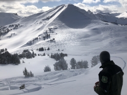
Strong westerly wind is drifting 2-5” of recent snow into fresh slabs. These slabs are possible to trigger and can break large enough to bury or injure a person. Additional wind-loading today will push massive cornices closer to breaking. These overhanging waves of snow along ridgelines can be triggered by a person and break farther back from the edge than expected. A cornice fall or wind slab avalanche will thoroughly impact a slope and can trigger a deeper avalanche (photo). Be extra cautious of steep slopes with fresh drifts. Stay far back from the edge of ridgelines and avoid slopes below large cornices.
Although less likely than triggering a fresh wind slab, a scary possibility is an avalanche that breaks over 3-5’ deep on weak sugary snow at the base of the snowpack. On Thursday night in the northern Gallatin Range a trail groomer triggered and was damaged by an avalanche that broke 2-3’ deep on sugary snow near the ground (video, photo and details). This and two natural avalanches last Wednesday (photos and details, photos and details) show the scary possibility and destructive consequences of triggering an avalanche on weak snow near the ground. Avoid steep slopes where the snowpack has potential shallow trigger points. Examples are lower elevation slopes with a relatively shallow snowpack, and where snow depth is more variable like rocky or heavily wind loaded slopes.
Today, fresh wind slabs and weak snow near the bottom of the snowpack create heightened avalanche conditions, and avalanches are possible to trigger. Avalanche danger is MODERATE.

Near West Yellowstone and Cooke City it has been several weeks since an avalanche broke on weak snow near the base of the snowpack. Evidence of this weak layer is not absent (details, video), but without new snow and wind to stress the snowpack large avalanches are unlikely. Today watch for small fresh wind slabs that could be hazardous if they push you into trees, confined gullies or over cliffs. Today avalanches are unlikely and avalanche danger is LOW. Low danger is not no danger. Remain diligent with thoughtful decision making, careful snowpack assessment and safe travel protocols (video).
If you get out, please send us your observations no matter how brief. You can fill out an observation form, email us (mtavalanche@gmail.com), leave a VM at 406-587-6984, or Instagram (#gnfacobs).
Upcoming Avalanche Education and Events
Our education calendar is full of awareness lectures and field courses. Check it out and plan to attend one or two: Events and Education Calendar.
COOKE CITY
Every Friday and Saturday, Snowpack Update and Rescue Training. Friday, 6:30-7:30 p.m. at the Soda Butte Lodge. Saturday anytime between 10-2 @ Round Lake.
BOZEMAN
February 27 - March 1, Bozeman Splitfest, More info and schedule here.
March 4, 1-hr Avalanche Awareness. 6-7 p.m. at REI.
March 6 and 7, She Jumps Companion Rescue Clinic, Fri 6-8 p.m. and Sat 10a-2p. More info and Register HERE.
BILLINGS
March 12, 1-hr Avalanche Awareness, 6-7 p.m. at The Basecamp.
MSU film student, Nate Kenney made Propagation, a video that profiles GNFAC forecaster Alex Marienthal and highlights what we do at the Avalanche Center. Thanks, Nate! Nice job.