Good Morning. This is Dave Zinn with the Gallatin National Forest Avalanche Forecast on Tuesday, December 29th at 7:00 a.m. This forecast is sponsored by Uphill Pursuits and Cowgirl Creativity. This forecast does not apply to operating ski areas.
Mountain temperatures are in the teens this morning with 10-15 MPH winds from the west to northwest and there was no new snow in the last 24-hours. Today, skies will be mostly sunny with 5-15 MPH winds from the west to northwest and temperatures around 20 F. Our next chance for snow arrives tomorrow.

Recent avalanche activity, cracking, “whumphing” and extended column tests that propagate failure are all indicators to avoid steep terrain. Heed the signals mother nature provides. Today, human triggered avalanches are possible and the danger is rated MODERATE.
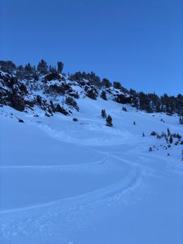
The foundation of the snowpack in Cooke City is generally strong. Human triggered avalanches are possible in steep terrain within recent and wind-drifted snow. Numerous human and natural avalanches occurred during and immediately following last week’s snow and wind, but without widespread weak layers in the snowpack, these storm layers are stabilizing (video, photo, avalanche activity log). We are not out of the woods yet as climbers outside Cooke City triggered a collapse yesterday, but we are on a good trend until the next storm arrives.
Search for instabilities within the upper few feet of the snowpack before entering steep terrain (video). If you find them, move to a different slope. Human triggered avalanches are possible and the avalanche danger in Cooke City is MODERATE.
If you get out, please send us your observations no matter how brief. You can submit them via our website, email (mtavalanche@gmail.com), phone (406-587-6984), or Instagram (#gnfacobs).
Upcoming Avalanche Education and Events
See our education calendar for an up to date list of all local classes. Here are a few select upcoming events and opportunities to check out:
Every Saturday in Cooke City, FREE snowpack update and rescue practice at the Round Lake Warming Hut between 10 a.m. and 3 p.m. Poster with More Info.
January 20 & 21 (plus field sessions the following weekends), Avalanche Fundamentals with Field Course. There are separate field sessions tailored for both skiers and splitboarders (Bridger Bowl) and snowmobilers (Buck Ridge). Register here.
A skier at Berthoud Pass in Colorado was buried and killed in an avalanche on Saturday. This the fifth fatality nationally and the fourth in Colorado this season. You can read more about all these tragic incidents here. Be safe out there and continue to take care of each other.