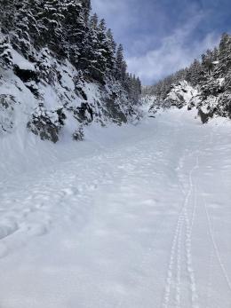
Good Morning. This is Dave Zinn with a spring weather and snowpack update on Friday, April 23rd. The Gallatin National Forest Avalanche Center has stopped issuing daily avalanche forecasts for the season. We will issue weather and snowpack updates on Monday and Friday mornings through April.
Last night the Bridger and Northern Gallatin Ranges received 2” of new snow with 1” near Big Sky and Cooke City, and nothing closer to West Yellowstone. Temperatures are in the teens to low-20s F and the wind is 5-15 mph from all over the map (east in the Bridger Range, west around Big Sky, and south in Cooke City). Several pulses of precipitation will move through the area this weekend with the highest amounts Saturday night and Sunday night. By Monday morning we will see 7-8” total in Cooke City, 3-5” around West Yellowstone, and 3-4” near Big Sky and Bozeman. The precipitation type will vary by elevation and time of day, both rain and snow are likely this weekend. High temperatures will be in the 30s and 40s F and the wind will be light and shift to the west and the south before increasing on Sunday to 10-25 mph from the southwest.

All Regions
The amount and type of precipitation will drive our avalanche concerns this weekend. Rain and above freezing temperatures are likely at lower elevations and will increase in the wet snow avalanche danger. Alarm bells should go off if you observe an unsupportable wet snowpack or if you sink into wet snow deeper than mid-boot (wet loose vs wet slab video). Colder temperatures will freeze the surface of the snowpack at higher elevations limiting avalanches to the new snow (loose snow avalanches outside the advisory area). Look for a supportable crust below the fresh snow and assess how the new snow is bonding before committing to any steep terrain. Expect variations in snowpack stability as temperatures fluctuate throughout the day and at different elevations and aspects. Increasing winds on Sunday will drift recent snow into unstable slabs that will avalanche under the weight of a skier or rider.
Ask yourself these questions before entering avalanche terrain this weekend:
- Is it raining on the snowpack? Avoid steep terrain and go watch a movie, it’s raining.
- Is the snowpack frozen with a crust? A solid crust will minimize the potential for deeper avalanches.
- If there is a crust, how is the new snow bonding to it and how much new snow is there? Manage this hazard by avoiding areas with terrain traps.
- Is wind drifting the snow and increasing the danger? Avoid these drifts in steep terrain.
Deep-slab avalanches are unlikely, but skiers near Big Sky recently observed the weak, sugary snow at the base of the snowpack on colder, shady slopes (photo). A large spring storm or the rapid addition of liquid water to the snowpack would increase the deep-slab danger. Our season snowpack summary video highlights the poor snowpack structure that could still large avalanches. See our website for additional general spring snowpack and travel advice.
We will issue spring snowpack and weather updates each Monday and Friday through April, or as needed, and we will share relevant avalanche and snowpack information on our website and social media. If you get out, please send us your observations no matter how brief. You can submit them via our website, email (mtavalanche@gmail.com), phone (406-587-6984), or Instagram (#gnfacobs).
Announcements, Avalanche Education and Events
Bridger Bowl is closed, and backcountry conditions exist (video). There is no avalanche mitigation or ski patrol rescue. Please stay clear of work areas, snowmobiles, chair lifts and other equipment.
See our education calendar for an up-to-date list of all local classes.
GENERAL SPRING SNOWPACK AND TRAVEL ADVICE
Spring weather can be highly variable and create a mix of avalanche problems. Snow conditions and stability can change drastically from day to day or hour to hour. Anticipate rapid change and plan accordingly. Abundant snowfall over the winter with more spring snow to come makes avalanches possible into summer.
NEW SNOW AND WIND LOADED SLOPES
Spring storms are notorious for depositing heavy amounts of snow in the mountains. Even with a deep and generally stable snowpack throughout the advisory area, heavy and rapid loads of new snow will decrease stability. The main problems to look out for are avalanches breaking within the new snow, wind slabs, and loose snow avalanches. The likelihood of triggering an avalanche spikes during and immediately after snowstorms. New snow instabilities tend to stabilize quickly, but it’s a good idea to give fresh snow a day to adjust before hitting big terrain. New snow instabilities can be challenging to assess, and spring storms bond to old snow differently across aspects and elevations. Conservative terrain selection is essential during and immediately following storms. Avoid wind-loaded slopes and slopes steeper than 35 degrees for 24-48 hours after new snow and wind.
New snow can quickly change from dry to wet on a spring day, and stability can decrease rapidly with above freezing temperatures or brief sunshine. New snow may bond well early in the morning and then easily slide later. Wet loose slides are likely during the first above freezing temperatures or sunshine immediately after a storm. Anticipate changes in snow stability as you change aspect or elevation and over the course of the day. An early start is always an advantage. Be ready to change plans or move to safer terrain at the first signs of decreasing stability.
WET SNOW AVALANCHES
Spring and wet snow avalanches go hand-in-hand. Above freezing temperatures, rain, and/or intense sunshine cause the snow to become wet and weak and make wet avalanches easy to trigger or release naturally. Conditions tend to become most unstable when temperatures stay above freezing for multiple days and nights in a row. Avoid steep terrain, and be aware of the potential for natural wet avalanches in steep terrain above you, if you see:
- Heavy rain,
- Above freezing temperatures for more than 24 hours,
- Natural wet avalanches,
- Rollerballs or pinwheels indicating a moist or wet snow surface,
- Or if you sink to your boot top in wet snow.
In general, if the snow surface freezes solid overnight, the snowpack will be stable in the morning and stability will decrease through the day as snow warms up. The snow surface hardness, rate of warming, duration of sunshine, aspect and elevation determine how fast stability will decrease through the day. Be aware that sunny aspects may have a wet snow avalanche danger while shadier slopes still have a dry snow avalanche danger. Getting off of steep slopes should be considered when, or before, the above signs of instability are present. Wet snow avalanches, whether loose snow or slabs, can be powerful, destructive and very dangerous. Conservative terrain choices, starting early in the day, and careful observations can keep you safe. See Alex’s recent video, and this article for more spring travel advice.
CORNICES
Cornices along ridgelines are massive and can break under the weight of a person (photo). Prolonged above freezing temperatures and rain make them weaker and possible to break naturally. They can break off suddenly and farther back than one might expect. Cornice falls can also entrain large amounts of loose snow or trigger slab avalanches. Stay far back from the edge of ridgelines and minimize exposure to slopes directly below cornices. Regardless of whether a cornice triggers a slide or not, a falling cornice is dangerous to anyone in its path.
DISCLAIMER
It does not matter if new snow falls or not, avalanches will continue to occur until the existing snowpack is mostly gone. Always assess the slope you plan to ride with diligence and safety in mind. Do not let your guard down. Travel with a partner, carry rescue gear and only expose one person at a time in avalanche terrain.
Have a safe and enjoyable spring and summer!
Doug, Alex, Ian and Dave
For more spring travel advice see this article from our GNFAC forecaster blog.
Snow will be around the mountains for a month or two and avalanches will continue. When warm temperatures return, wet snow hazards will increase. If there are big spring snowstorms, dangerous conditions may develop for new snow avalanches and wind slabs. With either extended warming or a big storm, there is still a lingering possibility of deep avalanches breaking on weak, sugary snow near the ground. See this article for some general spring travel advice.