Good morning. This is Doug Chabot with the Gallatin National Forest Avalanche Forecast on Thursday, December 23rd at 7:00 a.m. This information is sponsored by Knoff Group Real Estate, Stronghold Fabrication and Alpine Orthopedics & Sports Medicine This forecast does not apply to operating ski areas.
Today is the Eve of Christmas Eve which is when Santa makes his list and checks it twice. I’m wishing for lots of snow, but it’s unclear if I’ve been naughty or nice.
In the last 24 hours Cooke City got 7” of new snow with 1-2” around West Yellowstone. It remained dry everywhere else. Winds are strong out of the west to southwest at 20-40 mph with gusts touching 59 mph. Snowfall will continue in the south with Cooke City and West Yellowstone getting 8-12” by tomorrow morning. Everywhere else will get 2-3” with snowfall starting later this afternoon. Winds will continue to be westerly and strong and temperatures won’t budge out of the low 20s.

The spigot is turned on for Cooke City. Seven inches of snow (.7” snow water equivalent) and more forecasted with strong west wind will raise the avalanche danger. Today will be stormy and avalanches are likely to be triggered on slopes that are wind-loaded. A natural avalanche on Sheep Mountain on Tuesday illustrates this instability (photo). Dave’s video from Monday outlines his concern with wind-drifted snow. On some slopes the snowpack has a weak layer of faceted, sugary snow in it’s lower third which will become more sensitive to avalanching as the snow piles up. For today, be mindful of the increased likelihood of triggering slides which must be balanced with our stoke of new snow. The avalanche danger is rising and rated CONSIDERABLE on wind-loaded slopes and MODERATE elsewhere.

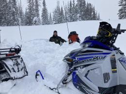
Ian and I rode into Tepee Basin in the southern Madison Range yesterday and saw many small avalanches that slid last week during the High danger. These failed on sugary, faceted snow near the ground (photo1, photo2). We dug in the flanks of an avalanche and confirmed the poor structure (video, snowpit profile) which resembled the snowpack at Lionhead (video). This area got 1-2” of new snow yesterday which will not adversely affect the stability. However, it remains possible to trigger avalanches on steep slopes that either have a wind-drift or weak facets underlying the snowpack. For today the avalanche danger is rated MODERATE on all slopes.
From the Bridger Range to Big Sky the snowpack is 2-3 feet deep and harbors a layer of faceted snow near the ground that is not very reactive. In the last 48 hours we have been to Buck Ridge (video), Beehive Basin (video) and Mt. Blackmore (photo1, photo2). The story is the same in each: in areas where previous wind-loading created stiff, dense drifts, we can occasionally get them to break on this faceted (sugary) layer in our stability tests. For today, it is possible to trigger a small slide on these isolated drifts which are found on many aspects and elevations. The avalanche danger is rated MODERATE on slopes with older wind drifts and LOW on all others.
If you get out, please send us your observations no matter how brief. You can submit them via our website, email (mtavalanche@gmail.com), phone (406-587-6984), or Instagram (#gnfacobs).
Upcoming Education Opportunities:
Get your avalanche brain ready for the season at one of the many classes listed on our education calendar, and list of upcoming events below.
Every Saturday near Cooke City, 10 a.m.-3 p.m. FREE snowpack update and transceiver/rescue training. Stop by for 20 minutes or more at the Round Lake Warming Hut.
Friends of GNFAC Powder Blast Fundraiser
The Friends of the Avalanche Center are hosting the Virtual Powder Blast fundraiser. With only $1,000 left to go, help us reach the $65,000 goal. Your donations support free and low-cost avalanche education, beacon checkers at trailheads, beacon parks, weather stations, and GNFAC programs!
Memorize the 5 steps to staying safe in avalanche terrain from Know Before You Go. Step #1 is Get The Gear. If you play in the mountains you need to carry rescue gear: an avalanche transceiver, a metal shovel and a probe pole. All three are life-saving items for yourself and your partners.