Good morning. This is Dave Zinn with the Gallatin National Forest Avalanche Forecast on Tuesday, February 15th, at 7:15 a.m. This information is sponsored by Gallatin Valley Snowmobile Association, Beartooth Powder Guides and Bridger Bowl. This forecast does not apply to operating ski areas.
Temperatures this morning are in the low 20s F with 5-20 mph winds from the west to southwest, and it is snowing. The mountains have received 1-3” of new snow so far. Today, temperatures will be in the high 20s F with northwest winds blowing 10-15 mph. Through the day, the mountains around Bozeman and Big Sky will get 3-5” of snow with 1-3” elsewhere. Another round of snowfall will begin early in the morning tomorrow hopefully bumping these totals up.

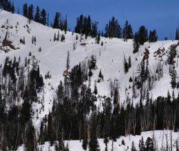
The likelihood of triggering avalanches in Cooke City will largely depend on the amount and rate of snowfall today. As of 6 a.m., there is 3” of new snow equal to 0.3” of snow water equivalent (SWE) on the ground with 1-3” expected through the day. Currently, dangerous avalanches are possible under the weight of a skier or rider. A natural avalanche on Friday near Wyoming Creek and two slides triggered by a rider and a skier north of Cooke City and Silver Gate, respectively, on Saturday were all dangerous events (Wyoming Creek photo and details, Silver Gate photo and details). Thankfully, no one was caught or injured. Avalanches today will likely be similar in size to this weekend’s activity.
If today’s snow pushes toward or past the expected totals, avalanches will become more likely. A thick layer of weak facets and surface hoar is buried 12-24” deep with a slab on top. This is a recipe for avalanches. Get your shovel in the snow to test the upper layers in the snowpack and weigh signs of instability such as avalanche activity, cracking or collapsing heavily in your assessment. The danger is MODERATE but be ready to dial back your plans with changing conditions.

Today’s snowfall will drive the avalanche danger in the mountains around Bozeman, Big Sky and West Yellowstone. So far, 1-2” of snow has fallen and this will do little to change generally safe avalanche conditions. However, with 3-5” expected in the northern portion of the advisory area and 1-3” in the south, conditions will change through the day. Snow is falling on a weak, but not yet unstable snowpack. As Alex explained in his video from the Bridger Range yesterday, if we push toward 6” of new snow or more (come on northwest flow!) avalanches will become likely.
As it stands this morning, large avalanches are not likely. As you travel, do like Doug did on Sunday and search for isolated instabilities related to buried weak layers and small wind drifts that tell you to back off steep slopes (video). When the snowpack is generally stable, travel protocols such as carrying rescue gear, watching our partners from a safe location and mitigating the added threat of terrain traps provide a buffer for safer backcountry travel.
Currently, the avalanche danger is LOW. However, the danger will increase through the day as snow builds up. Watch for signs of decreasing stability and adjust your plans as necessary.
If you get out, please send us your observations no matter how brief. You can submit them via our website, email (mtavalanche@gmail.com), phone (406-587-6984), or Instagram (#gnfacobs).
Upcoming Education Opportunities
See our education calendar for an up-to-date list of all local classes. Here are a few select upcoming
February 19, Women’s only Companion Rescue Clinic sponsored in partnership with SheJumps! Register Here.
March 4, Companion Rescue Clinic with the Bozeman Splitfest. Information and registration HERE.
Every Saturday near Cooke City, 10 a.m.-3 p.m. FREE snowpack update and transceiver/rescue training. Stop by for 20 minutes or more at the Round Lake Warming Hut.
A detailed report on the avalanche fatality at Ski Hill in Lionhead is HERE, a video summary is on our YouTube channel and the incident is recorded on our Accident Reports page.