Good morning. This is Doug Chabot with the Gallatin National Forest Avalanche Forecast on Wednesday, February 16th, at 7:15 a.m. This information is sponsored by Yellowstone Club Community Foundation and onX. This forecast does not apply to operating ski areas.
The Bridger Range received 5” yesterday and another 7” this morning and it is still snowing hard. Since 6 a.m. yesterday the Big Sky area got 8” of new snow, half of that falling this morning. 2” fell everywhere else. Snowfall will continue this morning with temperatures reaching the high teens. Wind is W-NW at 10-15 mph with gusts of 20-30 mph which will continue today. Snowfall will add another 3-6” in the mountains around Big Sky and Bozeman and 1-2” elsewhere before tapering off this afternoon.

The Bridger Range has the most snow and the most dangerous avalanche conditions. Since the storm started yesterday 14+ inches of snow has fallen measuring over an inch of snow water equivalent (SWE). This is a lot of weight to add onto a weak snowpack. West wind is drifting snow, adding even more weight. Alex talked about this danger in his video on Monday (video). You can trigger avalanches on steep slopes today. Stay out of avalanche terrain (slopes steeper than 30 degrees) and be extra careful around anything wind-loaded. Avalanche terrain is not to be trifled with. It is still snowing, winds are blowing and the danger is getting worse. For today the avalanche danger is rated CONSIDERABLE on all slopes.
The avalanche danger is rising with snowfall and increasing wind. Around Big Sky about 9” of snow equal to .4” of snow water equivalent (SWE) fell onto a snowpack that has weak layers in the upper 2 feet. Ian and I were in Beehive Basin yesterday and noted that conditions would deteriorate with more snow, which we now have (video). Increasing wind will drift the new snow into denser slabs which will avalanche. During and immediately after storms are the most dangerous for triggering slides. For today the avalanche danger is rated CONSIDERABLE on all wind-loaded slopes and MODERATE on all others.

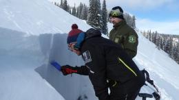
The mountains around Cooke City have gotten 6” of snow since yesterday (.4” SWE) and a couple more inches are expected today. Wind has been relatively calm and our main concern in these mountains is that the new snow is falling onto a snowpack that has weak snow in the upper couple of feet. Evidence of instability include a skier and snowmobiler triggering separate avalanches this weekend (Wyoming Creek photo and details, Silver Gate photo and details). Triggering avalanches remains possible today and the avalanche danger is rated MODERATE on all slopes.
The mountains to the south of Big Sky to West Yellowstone have gotten 3-4” of new snow equal to .3-.4” of SWE. It hasn’t snowed in Carrot Basin or Lionhead since noon yesterday. Wind is picking up and will move snow and create drifts at the ridgelines which could be triggered. I was in Taylor Fork and Lightning Creek on Sunday and found mostly stable snow, but one slope was not and I decided to back off (video). On slopes with wind-drifted snow avalanches are possible and the danger is rated MODERATE. On slopes without a wind-load avalanches are unlikely and the danger is rated LOW.
If you get out, please send us your observations no matter how brief. You can submit them via our website, email (mtavalanche@gmail.com), phone (406-587-6984), or Instagram (#gnfacobs).
Upcoming Education Opportunities
See our education calendar for an up-to-date list of all local classes. Here are a few select upcoming events.
February 19, Women’s only Companion Rescue Clinic sponsored in partnership with SheJumps! Register Here.
March 4, Companion Rescue Clinic with the Bozeman Splitfest. Information and registration HERE.
Every Saturday near Cooke City, 10 a.m.-3 p.m. FREE snowpack update and transceiver/rescue training. Stop by for 20 minutes or more at the Round Lake Warming Hut.
A detailed report on the avalanche fatality at Ski Hill in Lionhead is HERE, a video summary is on our YouTube channel and the incident is recorded on our Accident Reports page.