Good morning. This is Dave Zinn with the Gallatin National Forest Avalanche Forecast on Tuesday, February 27th at 7:00 a.m. Today’s forecast is sponsored by Gallatin County Sheriff Search and Rescue and Basecamp Gallatin and Yamaha. This forecast does not apply to operating ski areas.
AVALANCHE WARNING
The Gallatin National Forest Avalanche Center is issuing a Backcountry Avalanche Warning for the Southern Madison and Southern Gallatin Ranges, where 10” of heavy snow fell onto a weak snowpack in the last 24 hours. We are renewing the Avalanche Warning for the mountains around Cooke City, where an additional 7” of snow added to storm totals nearing 20.” The snowpack is unstable, and triggering dangerous avalanches is very likely. Avoid avalanche terrain and avalanche runout zones. The avalanche danger is HIGH on all slopes. Contact the Gallatin National Forest Avalanche Center for more detailed information.
This warning will expire or be updated by 6:00 a.m. on Wednesday, February 28th.
Mountain temperatures are in the single digits above and below 0 F this morning, and after the extreme winds died down yesterday afternoon, winds are 10-20 mph from the west. The mountains around Bozeman, south of Big Sky, and around Cooke City received 7-10” of new snow, with 5-6” in Big Sky, West Yellowstone, and Island Park. Today, temperatures will be in the single digits to teens F, with 10-20 mph winds from the west. The mountains will get a trace to 1” of new snow in the next 24 hours.

Avalanche Warning
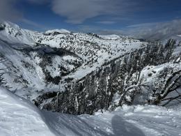
Very dangerous avalanche conditions exist in the mountains around Cooke City, where storm totals add up to 19” of snow, equal to 1.9” of snow water equivalent (SWE) since Saturday, and in the Southern Madison and Southern Gallatin Ranges, where 10” of heavy snow equal to 1.1” SWE fell in the last 24 hours. New and wind-drifted snow are overloading a snowpack that Alex described as one of the weakest he has ever seen in his recent video from Cooke City.
Natural and human-triggered avalanches breaking 2-4 feet deep and failing widely on persistent weak layers are likely. Recent avalanche activity on Miller Ridge (photo and details), a rider-triggered close call on Fisher Mountain (photos and details), and a skier-triggered avalanche on Woody Ridge (photos and details) provide insight into the spectrum of avalanches one might encounter.
Seek out low-angle terrain (less than 30 degrees) that is away from the bottom of steeper slopes. Avoid all avalanche terrain and avalanche runout zones, and enjoy the new snow.
The danger is HIGH on all slopes.

Dangerous avalanche conditions exist in the mountains around Bozeman, Big Sky, West Yellowstone and Island Park, where 5-8” of new snow, equal to 0.5-0.8” of SWE, and recently wind-drifted snow are adding stress to persistent weak layers buried 2-4’ deep. Large, human-triggered avalanches are likely.
Cautious route-finding that avoids most avalanche terrain and areas immediately below steep slopes is essential to enjoying a safe day in the new snow. Use an inclinometer, or slope meter, to help minimize your exposure to slopes steeper than 30 degrees (Buck Ridge video, 20-30 Rule).
Recent avalanche activity is the most telling indicator of potential slides. Before yesterday’s snow, reports of avalanches in Targhee Creek near Lionhead Ridge (photo and details), on Fan Mountain (details), in Bear Basin (photo and details) and McAtee Basin near Big Sky, on Bridger Peak and south of Saddle Peak in the Bridger Range and in the Mount Bole Basin in the Northern Gallatin Range paint a clear picture of the danger.
The danger is CONSIDERABLE.
If you venture out, please fill an observation form. It does not need to be technical. Did you see any avalanches? How much snow is on the ground? Was the wind moving snow? Simple observations are incredibly valuable. You can also contact us via email (mtavalanche@gmail.com), phone (406-587-6984), or Instagram (#gnfacobs).
Upcoming Avalanche Education and Events
Our education calendar is full of awareness lectures and field courses. Check it out: Events and Education Calendar.
Friday evening and Saturday, March 1 and 2. Companion Rescue Course. More information and registration HERE.
March 8-10. Bozeman Splitfest. Check the Bozeman Splitfest website for event details and avalanche education opportunities offered by the Friends of the Avalanche Center.
Every weekend in Cooke City: Friday at The Antlers at 7 p.m., Free Avalanche Awareness and Current Conditions talk, and Saturday from 10 a.m.-2 p.m. at Round Lake Warming Hut, Free Rescue Practice.
Loss in the Outdoors is a support group for those affected by loss and grief related to outdoor pursuits. Check out the link for more information.
Last Thursday, Ian rode in the Independence Mine area (up the Main Boulder, outside our advisory area) to check out the snowpack conditions before the Sweet Grass County Recreation Association Poker Ride. Watch his video for a snowpack update. Avoiding riding on and staying out from under slopes steeper than 30 degrees would be a wise choice if you’re headed up to that area.