Advisory Archive
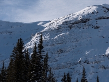
Southwest Montana is under an unusual weather pattern. Currently, strong temperature inversions are in place with most valley locations recording temps in the single digits to low teens, while the mountains have temperatures in the mid to upper 20s F. Typically, when an inversion is in place conditions are relatively calm, but this morning winds are blowing 10-20 mph out of the W-SW with ridgetop gusts reaching upwards of 30 mph. Today, temperatures will remain above average with most mountain locations seeing highs in the mid-20s to low 30s F. Winds will continue to blow 10-20 mph out of the W-SW with ridgetop gusts pushing 30 mph. Skies will become increasingly cloudy as a weak storm system approaches from the southwest. The southern mountains could see a trace of snow tonight while the northern mountains will remain dry.


This morning, mountain temperatures range from the mid-teens to mid-20s F under clear skies. Winds are increasing out of the S-SW with gusts around Big Sky and Hyalite blowing over 30 mph. Today, a southwest flow will user in a few high clouds, but conditions will remain dry. Winds will continue to blow 15-30 mph out of the S-SW. High pressure remains over the area for the next few days, but the pattern begins to change by mid-week. With a little luck we’ll see some snow falling by Wednesday or Thursday.


At 4 a.m. the bank’s thermometer across the street is showing 4 degrees F and temperatures in the mountains are in the 20s F. Wind is blowing 5-15 mph out of the E-SE. Today will be sunny and the inversion will continue with mountain temperatures in the 20s to low 30s F. Wind will be 10-15 mph out of the southeast and shift to the south throughout the day. Clear skies and dry conditions will continue through the first half of the week.


The mountains have not received any new snow in the last 24 hours. Wind speed has been 5-15 mph out of the N-NW with gusts around 20 mph. Since yesterday morning, wind gusts have been around 30 mph at mid-elevations at Bridger Bowl and on the summit of Lone Mountain. Temperatures in the mountains are in the high teens F, while lower elevation temperatures are in the single digits F. This inversion will persist through today with temperatures reaching the 20s F. Wind direction will shift to the E-SE and wind speed will increase to 15-20 mph with gusts around 30 mph.
The mountains received a trace of new snow over the last 24 hours. Except in the Bridger Range where 5” of very low density snow fell. Temperatures this morning are in the single digits above and below zero F. Winds have been northerly at 5-10 mph with gusts around 20 mph. Light snow will continue this morning and skies will clear this afternoon. Calm wind will continue out of the N-NW and temperatures today will reach the low teens F. Next year will start with clear skies and daytime temperatures in the 20s F.


A trace to one inch of snow fell in the last 24 hours. At 5 a.m. west to southwest winds are blowing at 5-10 mph and 20 mph in the Bridger Range. Mountain temperatures are a few degrees either side of 0F, but will warm into the high teens with winds remaining light. Mostly cloudy skies will produce a few flurries, but no accumulation is expected. High pressure builds through the week and by Friday a Rex Block forms, a fortress of dry air.
Last night the mountains around Cooke City picked up 1-2 inches of new snow with the rest of our area getting a trace. Temperatures are near 10F this morning with light east to north winds blowing at 5-10 mph. Today will be partly to mostly cloudy, winds will be calm and temperatures will rise into the mid-20s. Light flurries will continue today and tonight, but only add up to an inch or two at most. Looking towards the weekend there are no major storms on the horizon.


A mostly stable air mass remains over the area producing light winds and partly to mostly cloudy skies. This morning, temperatures range from the mid-teens to low 20s F and winds are swirling 5-10 mph from all directions. Today, increasing clouds and moisture begin to push into the area as a weak storm system approaches from the west. Temperatures will only a warm a few degrees during the day and winds will pick up slightly blowing 10-15 mph out of W-NW. Light snow develops tonight and the mountains should see 1-2 inches by tomorrow morning.
High pressure has produced clear skies and light to moderate winds over the past 24 hours. This pattern has also created a significant temperature inversion. At 4 a.m. valley temperatures are in the single digits above or below zero while mountain temps range between 10-20 degrees above zero. Today, high pressure will remain over the area producing sunny skies and relatively calm conditions. Daytime highs will warm into the upper teens to mid-20s F and winds will blow 5-20 mph out of the W-SW.
Over the past 24 hours the mountains south of Bozeman picked up 1-2 inches of new snow. This morning mountain temperatures are in the single digits above or below zero and winds are blowing 10-20 mph out of the W-NW. Today, a northwest flow will keep temperatures cold and highs will struggle to climb into the double digits above zero F. Skies will remain partly cloudy and winds will continue to blow 10-20 mph out of the W-NW. No new snow is expected over the next 24 hours.