Good morning. This is Doug Chabot with the Gallatin National Forest Avalanche Forecast issued on Wednesday, March 27th at 6:00 a.m. Today's forecast is sponsored by Highline Partners and Spark R&D. This forecast does not apply to operating ski areas.
At 5 a.m. the Bridger Range picked up 2” of snow with a trace to 1” falling everywhere else. Mountain temperatures are in the mid to high 20s with ridgetop winds blowing west to southwest at 10-20 mph and gusting to 30 mph. Today will be a mixed bag of cloudy skies interspersed with drizzle and scattered snow. The storm intensifies tonight and by morning I expect 2-4” of snow in the mountains with more falling tomorrow.

All Regions
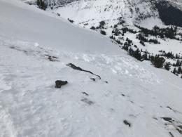
Both wet and dry avalanches are unlikely today. Conditions are a hodge-podge of wet snow at lower elevations and frozen, rattle-your-teeth-out chunks, fondly referred to as chunder, on upper elevation slopes that were previously wet from the sun. Yesterday, Eric and our intern Andrew skied down the west and east sides of the Bridger Range and encountered it all: dry snow, wet snow and chunder. Small changes in aspect and elevation had dramatic effects on the snowpack with dry conditions on more high and northerly and wet on anything southerly (photo, video). This is similar to what Ian and I found in Lionhead on Monday (video).
Most of our avalanche concerns have been with wet avalanches, but yesterday at upper elevations in Hyalite skiers triggered small, dry wind slabs on slopes that were cross-loaded (details). Today, our avalanche concern is confined to new snow and wind-drifted snow, which is not much of problem since snow showers are predicted to be light. This may change tomorrow, but right now the avalanche danger throughout our forecast area is rated LOW.
If you get out and have any avalanche or snowpack observations to share, contact us via our website, email (mtavalanche@gmail.com), phone (406-587-6984), or Instagram (#gnfacobs).
Spring is here and wet snow avalanches are becoming a daily concern. Anticipate decreasing stability while forming a travel plan. This article from Backcountry Magazine highlights some things look for that indicate when it is time to turn around.