Photos

|
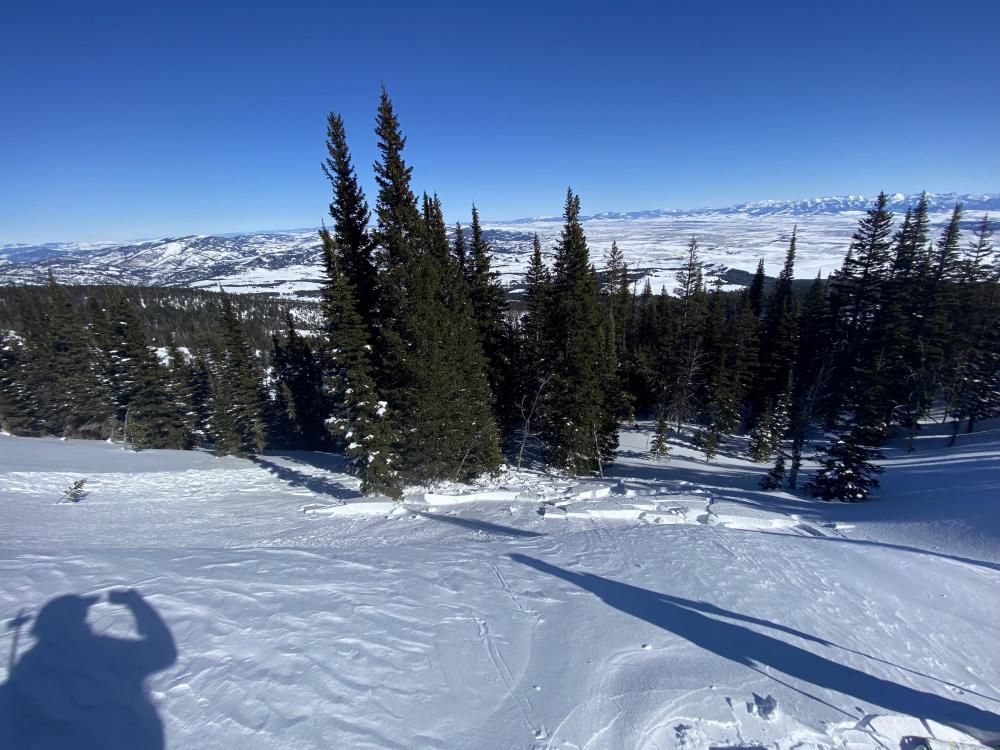
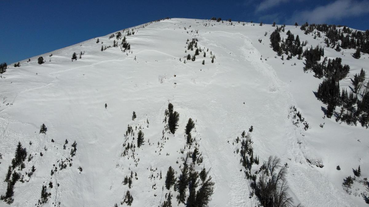
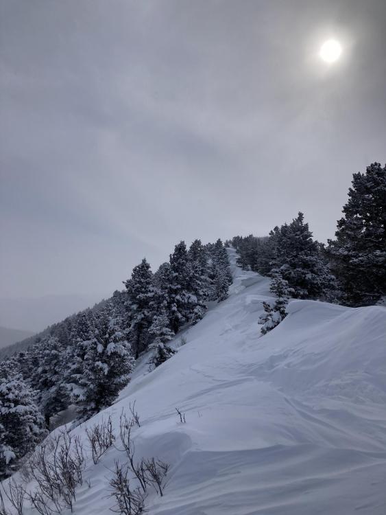
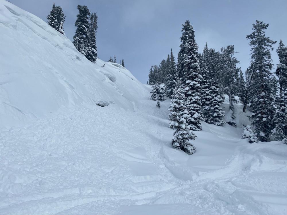
Bridger Range, 2022-02-26 From email 2/26/22: "Skiing in the Northern Bridgers today, one skier in our party of three triggered an avalanche in October bowl. The slide was approximately 40 yds wide and ran around 150 yds. The skier was carried approximately 100 yds, but was not buried and sustained no injuries. Neither of the other members of our party were in the slide path when it occurred... This photo shows the distance the skier slid; the photo being taken from approximately where the skier fell." Link to Avalanche Details |
|
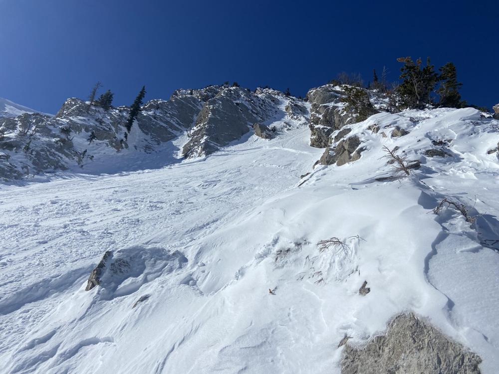
Bridger Range, 2022-02-26 From email 2/26/22: "Skiing in the Northern Bridgers today, one skier in our party of three triggered an avalanche in October bowl. The slide was approximately 40 yds wide and ran around 150 yds. The skier was carried approximately 100 yds, but was not buried and sustained no injuries. Neither of the other members of our party were in the slide path when it occurred." This photo shows the crown from the location of one of the other skiers. Link to Avalanche Details |
|
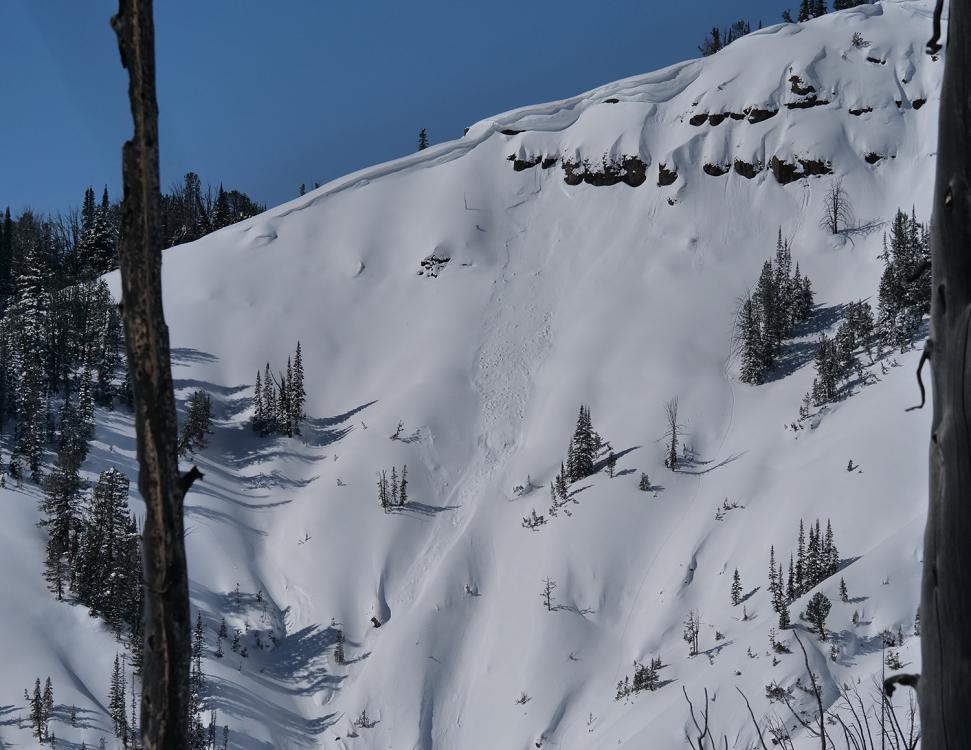
Bridger Range, 2022-02-26 Crown of avalanche that was remote triggered by a skier on 2/26/22. Photo: M. Cohen Link to Avalanche Details |
|
Bridger Range, 2022-02-26 Toe of debris from an avalanche triggered by skiers in the N. Bridger Range on 2/26/22. Photo: M. Cohen Link to Avalanche Details |
|
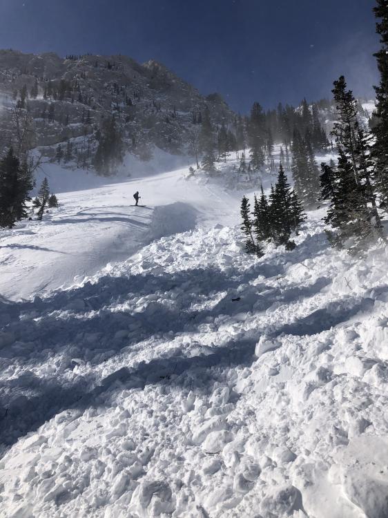
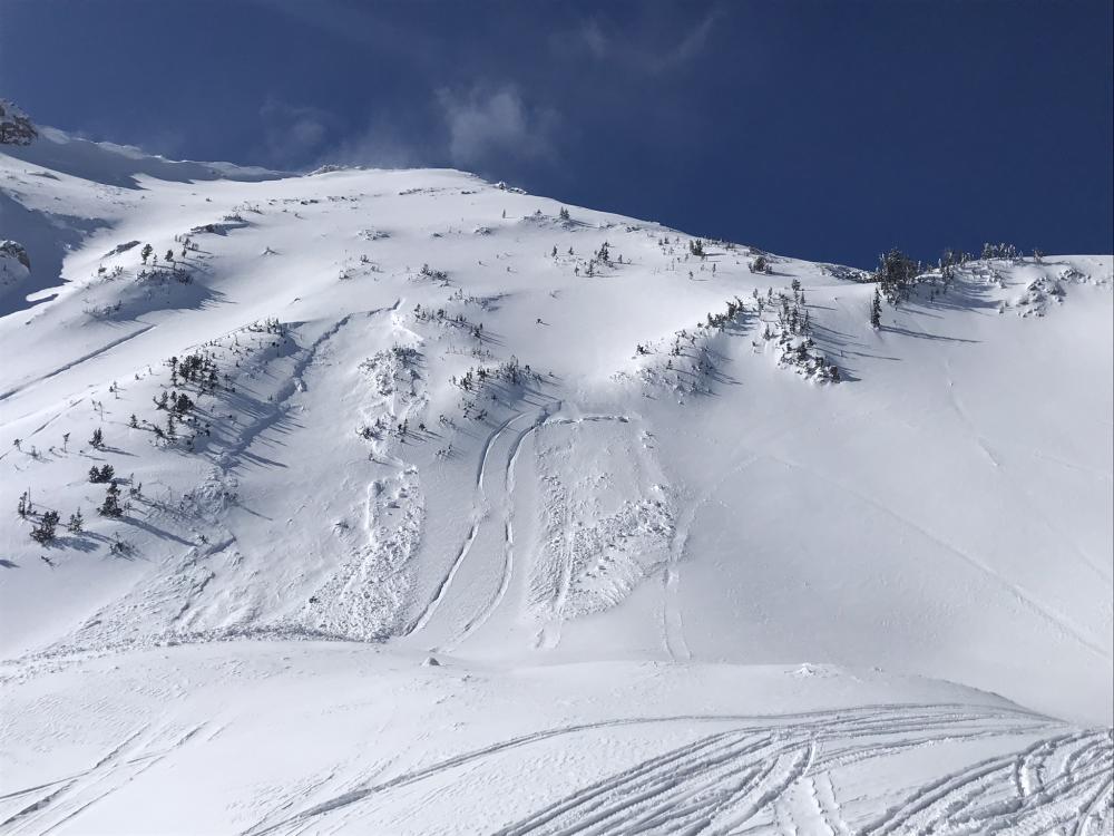
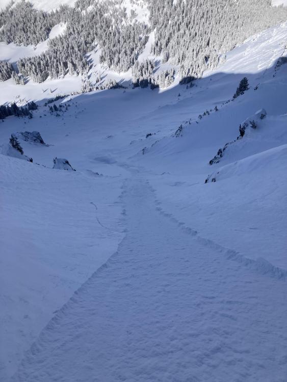
Bridger Range, 2022-02-26 From obs 2/26/22: "We were stopped on a flat bench on top of a steep rollover... when we heard a whumpf, and then a hard wind slab released on the slope below us and ran into the trees below. We then decided to enter the avalanche at the bottom of the debris to look at the crown, where we observed that the slab was about 60cm deep at its deepest, and ran around 50 feet wide, wrapping across a small aspect change. We did two ECT tests and observed propagation on the layer during isolation in both tests... We identified a P hard wind slab overlaying a 3 cm deep layer of 1F hard facets. The layer below the avalanche interface was F hard facets. After this result, we dialed back our ski plans for the day." Photo: M. Beck Link to Avalanche Details |
|
Southern Madison, 2022-02-26 From obs on 2/25/22: "18 inches of new snow from last week slid on top of crust layer. The slide on the left was triggered by an uphill snowmobile hill climber, the slide on the right occurred when snowmobile turned out of a hill climb and his track broke through the crust layer causing everything with in his up and downhill track to slide." Link to Avalanche Details |
|
Northern Madison, 2022-02-26 From obs on 2/25/22: "I did get a couple new wind pillows to break and move somewhat forcefully while walking near the summit of Blaze, in an area with a very shallow snowpack. These were sitting on top of some large, old facets, and while they were relatively small, they definitely could have knocked me down in more consequential terrain." Photo: S. Reinsel Link to Avalanche Details |
|
Cooke City, 2022-02-25 This avalanche was triggered Monday 2/21/22 by a snowmobiler (they were not caught or harmed). It is on the south face of Mt. Abundance near Cooke City. Photo: GNFAC, 2/25/22 Link to Avalanche Details |
|
Cooke City, 2022-02-25 Crown of an avalanche that was triggered Monday 2/21/22 by a snowmobiler. It is on the south face of Mt. Abundance near Cooke City. Photo: GNFAC, 2/25/22 Link to Avalanche Details |
|
Cooke City, 2022-02-25 Small avalanche in Yellowstone National Park, near Cooke City. Photo: B. Fredlund (2/23/22) Link to Avalanche Details |
|
Island Park, 2022-02-24 We dug a pit at 9,000' on an east facing slope on Sawtelle Peak on 2/24/22. Our old pit from 1/12/22, almost 6 weeks ago, is still plainly visible in the foreground. It has been a dry 6 weeks! Photo: GNFAC |
|
Northern Gallatin, 2022-02-23 From email 2/22/22: "I did a loop around Alex Lowe and Blackmore today...There was a 5-10mph breeze near ridgelines, and other places were dead calm...I noticed a number of small to medium natural sloughs, some of which could have had the power to knock someone over." Photo: S. Reinsel Link to Avalanche Details |

|
Cooke City, 2022-02-22 This Google Earth image shows the avalanche and the approximate location of the 5 riders before the avalanche. 1. Victim on a snow bike. 2. Snow biker. 3. Snowmobiler. 4 and 5. Father and son snowmobiling. Link to Avalanche Details |

|
Cooke City, 2022-02-22 This Google Earth image shows the location of the avalanche that killed a snow biker. He was in Sheep Creek on the south face of Miller Mountain north of Cooke City. Link to Avalanche Details |
|
Northern Gallatin, 2022-02-22 East winds are stripping snow from an area typically loaded by prevailing winds. Photo: E. Schreier |
|
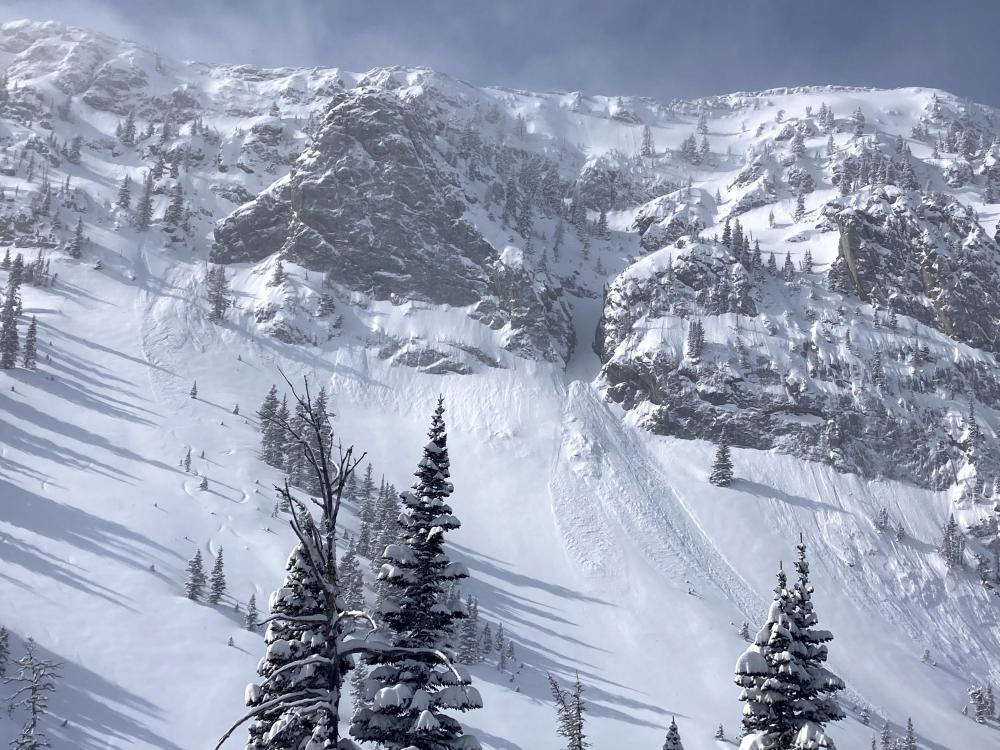
Cooke City, 2022-02-22 This large avalanche on the south face of Mount Abundance occurred on President's Day. Unknown if human-triggered or natural. Photo: A Bertolino Link to Avalanche Details |
|
Cooke City, 2022-02-22 Riders saw a large avalanche on the south face of Mount Abundance on Monday. Photo: A Bertolino Link to Avalanche Details |
|
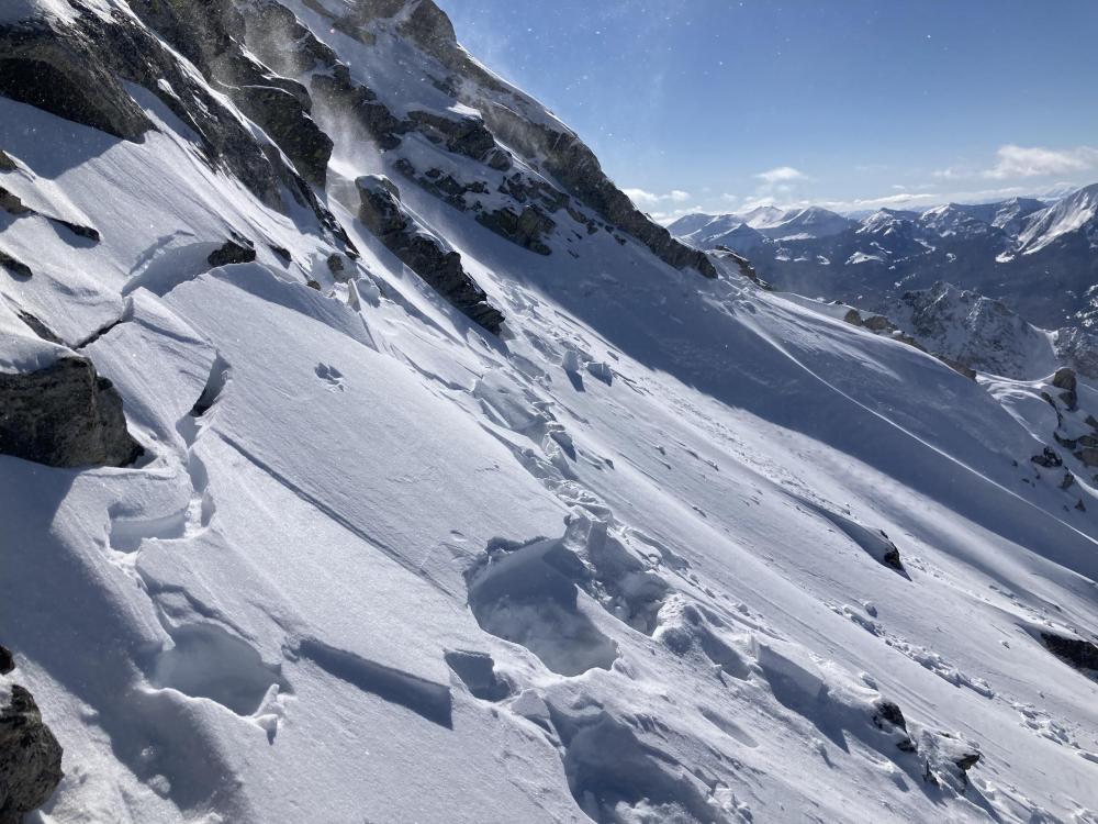
Bridger Range, 2022-02-21 Natural dry loose avalanches that we saw on 2/21/22. Probably ran this morning. Photo: GNFAC Link to Avalanche Details |
|
Cooke City, 2022-02-21 From email: "We were sledding and I was riding up below the steeper part of the hill and set this off above me. I was able to ride out untouched. We estimated it was 200 feet wide and 50 feet tall and a foot deep at the crown. Because of the small gully that was there before it slid it would’ve easily buried someone. We guessed there was at least 5 feet of snow burying the gully or low spot next to the hill." Link to Avalanche Details |