Advisory Archive
This morning mountain temperatures are in the mid-teens to low twenties F and westerly winds are blowing 5-20 mph with ridgetop gusts reaching close to 50 mph in Hyalite. Today, temperatures will warm into the mid-twenties to low thirties F and winds will continue to blow 10-20 mph out of the west. Ridgetop gusts will remain strong in the mountains around Bozeman and Big Sky blowing 30-40 mph. An unsettled northwest flow aloft will produce light flurries in the mountains of southwest Montana; however, accumulations will stay less than an inch.


For the first time in nearly a week there is no new snow to report. Today will be a near ground hog day to yesterday with plenty of sunshine and warm temperatures. This morning, temps are in the high teens to mid-twenties F and winds are averaging 5-15 mph out of the WSW with gusts reaching close to 30 mph. Today, highs will climb into the 30s F under clear skies and winds will remain out of the WSW blowing 5-20 mph. No new snow is expected over the next 24 hours.
Snow showers yesterday morning produced 2-4 inches in most areas. This morning temperatures were in the teens F and westerly winds were blowing 10-15 mph with gusts 20-30 mph. Today will be mostly sunny with temperatures in the low 30s F. Westerly winds will blow 10-25 mph.
Yesterday an additional 8 inches of dense snow fell in the Bridger Range; 4-6 inches fell near Hyalite, Big Sky and Cooke City; and 2-3 inches fell near West Yellowstone. This morning temperatures were in the high teens and low 20s F with winds blowing 10-15 mph from the west and gusting 20-30 mph. Today temperatures may drop a few degrees and winds will ease just a little shifting to the WNW. Snowfall will end around midday with 1-3 inches accumulating in most areas. By late afternoon a few rays of sunshine may break through the clouds making way for more sunshine this weekend.


Since yesterday morning 15 inches of snow fell in Hyalite Canyon, 10-12 inches near Bridger Bowl, 8-9 inches near Big Sky and Cooke City, and 2-6 inches near West Yellowstone. Westerly winds have been averaging 20 mph and gusting to 40-50 mph. This morning temperatures were in the high teens F and should rise to the low 20s F today. Winds will remain westerly and ease slightly, blowing 15 mph with gusts of 30-35 mph. Snowfall will continue today. By tomorrow morning most areas will get an additional 3-6 inches. The mountains near West Yellowstone will receive 2-3 inches.
Yesterday’s storm dropped 22 inches in the Bridger Range. They just picked up another five inches this morning while the rest of our advisory area received 2-4 inches. Unsettled weather will continue to bring snow, but the real change is the wind. Relatively calm winds yesterday are no longer. Westerly winds are currently averaging 20-30 mph with gusts hitting 45 mph. These will continue today before tapering tonight. Mountain temperatures are near 10F this morning and will warm into the low 20s. By early tomorrow I expect an additional 3-6 inches.
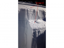
Cough, cough. Call in sick today and head up to Bridger Bowl, and don’t forget your snorkel. The range is under a strong, moist, northwest flow and the Bridger Bowl Cloud is in full effect. At 6 a.m. it has snowed 18 inches in five hours! It’s anyone’s guess how long it will last, but the models show good energy and moisture into this afternoon. Click here for the latest snowfall amounts. The rest of our forecast area has 1-3 inches of new snow. Winds are averaging 15-20 mph out of the west with gusts of 25 mph. Mountain temperatures dropped last night into the single digits. This week looks to be snowy, a welcome relief to our powder drought. By tomorrow morning I expect 4-6 inches in most areas with the Bridger Range getting another foot or two.

Since yesterday morning 6-8 inches of snow fell in the mountains around West Yellowstone and Big Sky including the northern Gallatin Range. The mountains around Cooke City picked up 4-5 inches while the Bridger Range squeezed out 3 inches. Today, snow showers will linger but accumulations will be less than an inch. Currently, temperatures are ranging from the single digits to low teens F and winds are light out WNW blowing 5-15 mph. Today, temperatures will warm into the upper teens to low twenties F and winds will stay light to moderate out of the WNW. A stronger storm system will move into southwest Montana late tonight and last through tomorrow. Accumulations upward of a foot are possible by Wednesday morning.
Over the past 24 hours 2-3 inches of snow fell in the mountains around West Yellowstone and Cooke City. A trace to one inch fell in the mountains around Bozeman and Big Sky. These numbers will increase today as moisture arrives on a southwest flow. By this evening, an additional 3-5 inches will accumulate in the southern mountains and 2-4 inches will fall in the north.
This morning temperatures are in the 20s F and winds are blowing 5-15 mph from the WSW. Today, temperatures will climb into the upper 20s to low 30s under snowy skies and winds will continue to blow 10-20 from the WSW. Snow will taper off this evening and temperatures will drop to around 10 degrees F. Another potent storm is scheduled to arrive Monday night into Tuesday.
Overnight 1-2 inches of snow fell in the mountains around Bozeman, Big Sky and Cooke City. The southern Madison Range and mountains around West Yellowstone picked up 2-3 inches. Morning temperatures are in the mid to upper 20s F and winds are blowing 15-25 from the WSW with gusts reaching upward of 30 mph. Today, light snow is likely in the mountains with an additional 1-2 inches possible by this afternoon. Mountain temperatures will warm into the upper 20s to low 30s F and winds will continue to blow 15-25 from the WSW. A stronger storm system will impact our area starting tonight and should deliver 3-5 inches by tomorrow afternoon.