Good Morning. This is Alex Marienthal with the Gallatin National Forest Avalanche Advisory issued on Saturday, December 30th at 7:00 a.m. Today’s advisory is sponsored by Yellowstone Arctic Yamaha and Yamaha Motor Corp in partnership with the Friends of the Avalanche Center. This advisory does not apply to operating ski areas.
AVALANCHE WARNING
ISSUED ON DECEMBER 30 2017 at 5:00 a.m.
The Gallatin National Forest Avalanche Center is issuing a Backcountry Avalanche Warning for the Southern Madison and Southern Gallatin Ranges, the Lionhead area near West Yellowstone and the mountains around Cooke City. Near Cooke City, over 4 feet of snow in the last four days and strong wind create dangerous avalanche conditions. In the Lionhead area near West Yellowstone, the southern Madison range and southern Gallatin Range, an unstable snowpack is being loaded further by new snow and wind. Avalanche danger is HIGH on all slopes. Natural and human triggered avalanches are likely. Avalanche terrain and avalanche runout zones should be avoided.
This warning will either expire or be updated by 6:00 a.m. on December 31, 2017.
The mountains near Cooke City received another foot of snow since yesterday morning. The mountains near Bozeman and Big Sky got 7-10”, and near West Yellowstone got 2-4”. Temperatures this morning are teens to low 20s F and wind is southwest at 20-30 mph with gusts to 40 mph. Today, temperatures will drop to the low teens F with west-southwest wind at 30-40 mph, and the mountains could get 2-4” of snow by evening.

Avalanche Warning
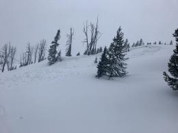
Since Wednesday, the mountains near Cooke City received over 4 feet of snow equal to 4” of snow water equivalent (SWE). This rapid, heavy load combined with strong wind makes natural and human triggered avalanches likely today. Yesterday, large wind slabs were triggered by snowmobilers from adjacent flat terrain (photo, photo) and multiple natural avalanches were observed (photo, photo, photo). On Thursday, a skier triggered and was partially buried by a 2’ deep, 200’ wide slide in Sheep Creek.
Today, the avalanche danger is HIGH on all slopes. Avoid all steep slopes as well as connected, less steep terrain below.
Avalanche Warning
In the Lionhead area near West Yellowstone, the southern Madison and southern Gallatin ranges, a weak and unstable snowpack has been pushed to its breaking point by recent snow and wind loading. Two days ago, Doug observed multiple natural avalanches in the Lionhead area (video, photo). Yesterday, riders in Tepee creek observed natural and snowmobile triggered avalanches (photo, photo), and Eric experienced large collapses and saw avalanches near Bacon Rind (video, photo).
Under these conditions, avalanches can be triggered remotely from flat terrain. This means you can trigger an entire slope from flat or low angle terrain below. The message in this recent video from the UAC is clear and concise, “that’s enough to kill somebody”.
Today, the avalanche danger is HIGH on all slopes. Avoid all steep slopes as well as connected, less steep terrain below.
The mountains near Bozeman and Big Sky received 1-2 feet of heavy snow over the last two days. Since yesterday morning, the Brackett creek SNOTEL in the Bridger Range and Timber station at the Yellowstone Club recorded 1.5” of snow water equivalent (SWE). Strong wind last night and today will drift this heavy snow into slabs 2-4’ thick that are easy to trigger and could avalanche naturally. Yesterday, a skier was caught and injured in an avalanche on the west side of the Bridger Range. Today, avalanches are easy to trigger and natural avalanches are likely on wind loaded slopes. Avalanche terrain should be avoided. Avalanche danger is HIGH on wind loaded slopes and CONSIDERABLE on non-wind loaded slopes.
If you get out and have any avalanche or snowpack observations to share, drop a line via our website, email (mtavalanche@gmail.com), phone (406-587-6984), or Instagram (#gnfacobs).
Upcoming Avalanche Education and Events
BOZEMAN
Jan. 3, Avalanche Awareness, 6-7 p.m. at REI Bozeman
Jan. 12 and 13, Companion Rescue Clinic, Info and Register
Jan. 17, 18 and 20 or 21, Introduction to Avalanches w/ Field Day, Info and Register Here
Jan. 24, 25 and 27, Advanced Avalanche Workshop w. Field Day, Info and Register Here
Feb. 9 and 10, Companion Rescue Clinic, Info and Register
WEST YELLOWSTONE
Jan. 6, Avalanche Awareness, 7-8 p.m. at West Yellowstone Holiday Inn Conference Center
BIG TIMBER
Jan. 11, Avalanche Awareness, 6-7 p.m. at Sweet Grass County High School
BUTTE
Jan. 13, Rescue Clinic, 10 a.m. at Homestake Lodge
Dillon
Jan. 16, Avalanche Awareness, 6:30-8 p.m. at U.M. Western Library
COOKE CITY
Every Friday and Saturday, Current Conditions Update and Avalanche Rescue, Friday 6:30-7:30 p.m. at The Antler's Lodge in January. Saturday anytime between 10-2 @ Lulu Pass road.
Avalanches can be triggered from low angle terrain during the current High danger. Mark Staples from the UAC explains remote triggering in this video in regards to a slide that caught 4 riders in Utah last week.