Good Morning. This is Alex Marienthal with the Gallatin National Forest Avalanche Advisory issued on New Year’s Eve, Sunday, December 31st at 7:00 a.m. Today’s advisory is sponsored by Grizzly Outfitters in partnership with the Friends of the Avalanche Center. This advisory does not apply to operating ski areas.
Yesterday morning the mountains near Bozeman, Big Sky, and Cooke City got 2-3” of snow. Wind yesterday was west-northwest at 20-30 mph with gusts of 40-50 mph. This morning, wind is west-northwest at 15-25 mph and temperatures are in the single digits F. Under clear skies today, temperatures will reach the mid-teens F with westerly wind at 10-20 mph. The New Year will begin with a ridge of high pressure over the region bringing clear skies and cold temperatures with little chance for snow until next weekend.

The mountains near Cooke City received over 4 feet of snow equal to 4” of snow water equivalent (SWE) between Wednesday and Saturday. This rapid, heavy load and strong wind resulted in widespread natural and human triggered avalanches 2-4’ deep. Many of these slides were observed yesterday as visibility cleared. See our photos page or regional page for a look at all the activity, or our weather and avalanche log for a list of recent avalanches.
These slabs will quickly gain strength on many slopes, but today large avalanches 2-4’ deep are easy to trigger, especially on wind-loaded slopes. On slopes where the snowpack is relatively shallower, a layer of facets 3-4 feet deep can produce large avalanches even without a wind load. Avalanche danger today is CONSIDERABLE. Avoid wind loaded slopes and be extra cautious on or below avalanche terrain.
In the Lionhead area near West Yellowstone a weak and unstable snowpack was pushed to its breaking point by a few inches of snow last week. On Thursday, Doug observed multiple natural avalanches in this area (video, photo). These slides broke on sugary, weak facets buried 2-3’ deep on all aspects and elevations (photo). This widespread layer of weak facets makes large avalanches easy to trigger today. Under these conditions, avalanches can be triggered remotely from flat terrain or low angle terrain below. The avalanche danger today is CONSIDERABLE. Avoid wind-loaded slopes and be extra cautious on and below all steep slopes.
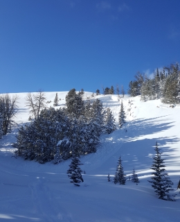
The mountains near Bozeman and Big Sky got 2-3 feet of snow equal to 2-3” of snow water equivalent (SWE) between Tuesday and Saturday. Strong wind yesterday drifted this snow into slabs 2-3’ deep that are easy to trigger today. Natural and snowmobile triggered avalanches were observed on Buck Ridge yesterday (photo, photo) and in Tepee Creek on Friday (photo, photo). On slopes with a relatively shallow snowpack, weak facets 2-3’ deep produced natural avalanches and widespread cracking and collapsing. Eric found this bullseye instability data near Bacon Rind on Friday (video, photo), and I found it near Big Sky (video).
Doug and I went to the west side of the Bridger Range yesterday to look at an avalanche that caught and injured a skier on Friday (video, photo). The slide broke 2 feet deep on old, weak faceted snow. This is bullseye data that some slopes are unstable and recent snow and wind pushed them to a breaking point. Travel in avalanche terrain today requires careful snowpack evaluation and cautious route finding. Recent snow and strong wind make avalanches easy to trigger today and avalanche danger is CONSIDERABLE.
If you get out and have any avalanche or snowpack observations to share, drop a line via our website, email (mtavalanche@gmail.com), phone (406-587-6984), or Instagram (#gnfacobs).
Upcoming Avalanche Education and Events
BOZEMAN
Jan. 3, Avalanche Awareness, 6-7 p.m. at REI Bozeman
Jan. 12 and 13, Companion Rescue Clinic, Info and Register
Jan. 17, 18 and 20 or 21, Introduction to Avalanches w/ Field Day, Info and Register Here
Jan. 24, 25 and 27, Advanced Avalanche Workshop w. Field Day, Info and Register Here
Feb. 9 and 10, Companion Rescue Clinic, Info and Register
WEST YELLOWSTONE
Jan. 6, Avalanche Awareness, 7-8 p.m. at West Yellowstone Holiday Inn Conference Center
BIG TIMBER
Jan. 11, Avalanche Awareness, 6-7 p.m. at Sweet Grass County High School
BUTTE
Jan. 13, Rescue Clinic, 10 a.m. at Homestake Lodge
Dillon
Jan. 16, Avalanche Awareness, 6:30-8 p.m. at U.M. Western Library
COOKE CITY
Every Friday and Saturday, Current Conditions Update and Avalanche Rescue, Friday 6:30-7:30 p.m. at The Antler's Lodge in January. Saturday anytime between 10-2 @ Lulu Pass road.
Yesterday's Avalanche Warning is no longer in effect. Clear skies and fresh snow will make for great riding conditions today, but avalanches are still easy to trigger. Give steep slopes time to adjust to the recent heavy load, and enjoy low angle powder.