Good Morning. This is Eric Knoff with the Gallatin National Forest Avalanche Advisory issued on Thursday, March 29th at 7:00 a.m. Today’s advisory is sponsored by Highline Partners and Yellowstone Ski Tours. This advisory does not apply to operating ski areas.
Since yesterday morning the northern Gallatin Range and mountains around Big Sky picked up 3-5” of new snow. The Bridger Range and Cooke City received 1-2” while the West Yellowstone area remained dry. This morning temps are in the teens F under partly cloudy skies and winds are blowing 10-25 out of the W-NW. Today, highs will warm into the mid to upper 20’s F and winds will blow 15-30 mph out of the W-NW. Skies will be mostly cloudy in the north and partly cloudy in the south. The mountains around Bozeman, Big Sky and Cooke City could see 1-2” of new snow by tomorrow morning.

The northern mountains and Cooke City got a healthy shot of snow out of the latest storm system. The mountains around Bozeman and Big Sky picked up 8-10” of snow totaling .7-1.1” of SWE (snow water equivalent) since Tuesday. A reliable observer around Cooke City said Fisher Creek Snotel site under reported and the upper elevations around that area picked up close to a foot.
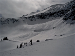
Today, fresh snow combined with moderate to strong winds out of the west-northwest will produce touchy wind slabs. Watch for wind loaded slopes below ridgelines, cross loaded gullies and steep convex terrain features (photo). Fresh wind slabs will be most prominent in upper elevation terrain, but could also be encountered on mid to low elevation slopes. On Tuesday, I observed blowing and drifting snow on all aspects and elevations in the Bridger Range (video, photo). Today, the story is similar to the past few days – avoid wind loaded slopes and you’ll likely avoid avalanches.
Cornices also pose a serious threat. These can break farther back than you might expect along the ridgelines and can trigger avalanches below (photo).
Today, fresh snow and wind is creating unstable conditions and a CONSIDERABLE avalanche danger on all wind loaded slopes. Slopes without a wind-load have a MODERATE danger.

A northwest flow has not favored the mountains near West Yellowstone including the southern Madison Range. These areas only picked up a few inches of snow over the past few days, which will limit the size and distribution of fresh wind slabs. With that said, wind loaded slopes are the main concern and still hold the potential to produce avalanches.
Watch for and avoid thick wind drifts near upper elevations ridgelines and cross loaded terrain features. Wind slabs won’t be hair trigger today, but do hold the potential to fail under the weight of a skier or rider. In addition to wind loaded slopes, cornices are a significant problem. Last Saturday, a cornice failed naturally and triggered a large slide in the Lionhead area (photo). This is great example of the threat that cornices pose, both on and below the ridgelines.
Today, human triggered slides are possible on wind loaded slopes which have a MODERATE avalanche danger. Non-wind loaded slopes have a LOW avalanche danger.
If you get out and have any avalanche or snowpack observations to share, drop a line via our website, email (mtavalanche@gmail.com), phone (406-587-6984), or Instagram (#gnfacobs).
Send us your observations on Instagram! #gnfacobs
Posting your snowpack and avalanche observations on Instagram (#gnfacobs) is a great way to share information with us and everyone else this spring.