Good Morning. This is Eric Knoff with the Gallatin National Forest Avalanche Advisory issued on Saturday, March 31st at 7:00 a.m. Today’s advisory is sponsored by Knoff Group Real Estate at Pure West and Montana Alpine Guides. This advisory does not apply to operating ski areas. Remember, Hyalite Canyon closes tomorrow and will be closed for the next six weeks.
Over the past 24 hours the mountains around Cooke City picked up 2-3” of new snow while the rest of the advisory area squeezed out 1-2”. Currently, temps are in the teens to low 20’s F under mostly cloudy skies and winds are blowing 15-30 mph out of the W-SW. Today, snow showers will linger in the northern mountains which could see and additional 1-2" by late morning. Snow exits the area by early afternoon and there's a chance for sunshine later in the day. Highs will warm into the 20’s to low 30’s and winds will be light to moderate out of the W-NW. Little to no snow is expected overnight.

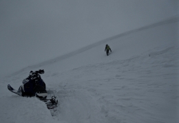
Yesterday, strong-gusty winds built slabs 1-2’ thick that failed naturally and with human triggers. Winds blew predominately out of the west-southwest, but seemed to affect all aspects and elevations. Yesterday, Alex found unstable conditions on wind loaded slopes around Cooke City (video, photo). Skiers up Hyalite also observed recent avalanches in wind loaded terrain.
Today, decreasing winds will reduce transport and give recently loaded slopes a bit of a breather. I don’t expect wind slabs to be as sensitive today, but I would still approach all wind loaded slopes with caution. Watch for signs of instability such as shooting cracks or recent avalanches and avoid steep, wind loaded slopes where these signs are present (photo).
Strong winds also added significant weight and stress to cornices (photo). These could fail naturally or under the weight of a single person. Give cornices a wide distance along the ridgelines and don’t have a picnic on slopes below.
There is a possibility the sun could come out this afternoon. This could create wet loose avalanches on steep, sun exposed slopes. It’s unlikely these will pose a significant threat, but it’s something to keep an eye out for later in the day.
Human triggered avalanches are possible today on wind loaded slopes which have MODERATE avalanche danger. Non-wind loaded slopes have a LOW avalanche danger.
If you get out and have any avalanche or snowpack observations to share, drop a line via our website, email (mtavalanche@gmail.com), phone (406-587-6984), or Instagram (#gnfacobs).
Send us your observations on Instagram! #gnfacobs
Posting your snowpack and avalanche observations on Instagram (#gnfacobs) is a great way to share information with us and everyone else this spring.