Good Morning. This is Alex Marienthal with the Gallatin National Forest Avalanche Forecast issued on Monday, December 17th at 6:50 a.m. Today’s forecast is sponsored by Highline Partners and Bridger Bowl. This forecast does not apply to operating ski areas.
This morning, temperatures are high 20s to low 30s F and wind is southwest at 20-35 mph with gusts of 40-50 mph. There is no new snow to report, but that pattern will change in the next couple days. Today, temperatures will be low 30s F and cool to mid-20s F this afternoon with southwest wind at 20-35 mph. The mountains near West Yellowstone could get 1-2” of snow tonight with a trace elsewhere, and more snow throughout the area tomorrow and Wednesday.
A weak layer of sugary facets formed on the surface of the snowpack during cold, dry weather at the beginning of December, and is now buried by new and drifted snow from the last week. Ten days ago I found this persistent weak layer on the surface of the snowpack on Buck Ridge (video, snowpit), and yesterday Doug and I went to the same area and found it buried by 6-8” of snow (video, snowpit). We got unstable results in stability tests and saw a large snowmobile triggered avalanche on a wind loaded slope (pit photo, avalanche details).
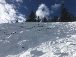
Over the past week, we found this weak layer buried in the Bridger Range (video), Hyalite (video), Taylor Fork (video), and Cooke City. On non-wind loaded slopes, this weak layer is buried by 6-8” of light snow and avalanches are unlikely. On wind loaded slopes, strong wind on Saturday formed 12-18” thick hard slabs that rest unsteadily over this weak layer. The following reports of activity highlight the need to carefully assess or avoid wind loaded slopes today:
- On Saturday, Eric and I collapsed a 30’ wide, 12-18” hard slab that was accompanied by an audible “whumph” on the west side of the Bridger Range (video, photo, details).
- Two (2) snowmobilers triggered avalanches on Buck Ridge this weekend (details, details).
- A snowbiker triggered a thick wind slab on a small slope near Cooke City (details).
- Multiple natural avalanches in Hyalite (details), Big Sky (details), and southern Madison Range (details).
- Yesterday, the Yellowstone Club ski patrol triggered an avalanche with an explosive that propagated 120’ wide on weak faceted snow (details).
Today, avalanches are possible on wind loaded slopes which have a MODERATE avalanche danger. On non-wind loaded slopes avalanche danger is LOW.
The Lionhead area near West Yellowstone has the weakest, shallowest snowpack in the advisory area. Strong wind on Saturday drifted snow into thick hard slabs over weak, sugary snow. Eric was on Lionhead Ridge last week and found the bottom half of the snowpack is a persistent weak layer of sugary facets (video, photo). This weak layer could produce large avalanches on wind loaded slopes. Today, wind loaded slopes have a MODERATE avalanche danger, and they should be avoided or carefully assessed. On non-wind loaded slopes avalanche danger is LOW.
If you get out and have any avalanche or snowpack observations to share, contact us via our website, email (mtavalanche@gmail.com), phone (406-587-6984), or Instagram (#gnfacobs).
Upcoming Avalanche Education and Events
Our education calendar is full of awareness lectures and field courses. Check it out: Events and Education Calendar.
COOKE CITY
Every Friday and Saturday, Rescue Training and Snowpack Update. Friday 6:30-7:30 p.m. at the Soda Butte Lodge. Saturday anytime between 10-2 @ Round Lake.
Check out our new “Avalanches and Snowpits” menu item where we list all the reported avalanche activity.


