Good Morning. This is Eric Knoff with the Gallatin National Forest Avalanche Forecast issued on Thursday, December 20th at 7:00 a.m. Today’s forecast is sponsored by Yellowstone Club Community Foundation and Lawson Dental. This forecast does not apply to operating ski areas.
There’s no new snow to report this morning and temps are in the teens under mostly clear skies. Winds are blowing 10-30 mph out of the west-southwest. Today, temps will warm into the mid to upper 20’s and winds remain light to moderate out of the west-southwest. Skies will start out mostly clear, but become increasingly cloudy by this afternoon. A weak storm moves into the area later tonight. By tomorrow morning the mountains will see 1-3” of new snow.

The snowpack in the mountains around West Yellowstone is plagued by a foundation of rotten, sugary facets. This persistent weak layer has produced unstable results in stability tests and has caused recent avalanches on wind loaded slopes (video, photo). The 6” of snow that fell Tuesday night did not create widespread avalanche activity - but it did put the snowpack on edge.
Yesterday, my partner and I toured around Bacon Rind in the southern Madison Range and found a snowpack structure on the cusp of producing avalanches (video). On non-wind loaded slopes, the snowpack was not quite cohesive enough to support widespread propagation. However, on any slope that had wind drifted snow we experienced cracking and collapsing. It is likely wind loaded slopes would have produced avalanches in steeper terrain.
Although the snowpack has had time to adjust, I would still be cautious on any slope steeper than 30 degrees, especially those with wind drifted snow. Given the poor structure, human triggered avalanches are possible today and the avalanche danger is rated MODERATE.
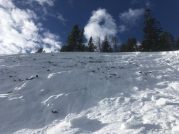
The mountains near Bozeman, Big Sky and Cooke City have a few weak layers to look out for. The main one being a layer of small grained facets buried 1-1.5’ deep (video). This layer has been the culprit of recent avalanche activity, mainly on wind loaded slopes (photo, photo). A skier triggered slide on Bridger Peak a few days ago is a great example of what’s possible under these conditions (photo, video, details). Look for and assess this layer before committing to steeper slopes, especially those with drifted snow.
Avalanches failing on weak snow near the ground are less likely, but something to consider. Yesterday, the Yellowstone Club Ski Patrol triggered a slide that broke 2-3’ deep on facets near the ground. This slide occurred in steep, wind loaded terrain. Another slide at the Yellowstone Club earlier in the week also failed on facets near the ground (photo). This problem is not widespread, but something to think about as incremental loading adds weight and stress to the snowpack.
Today, buried weak layers make human triggered avalanches possible, mainly on wind loaded slopes. For this reason the avalanche danger is rated MODERATE.
Upcoming Avalanche Education and Events
Our education calendar is full of awareness lectures and field courses. Check it out: Events and Education Calendar.
BOZEMAN
January 2, Avalanche Awareness, 6-7:30 p.m. at REI, Bozeman. Pre-register at https://www.rei.com/events.
January 8, Women’s Specific Avalanche Awareness, 6:30-8 p.m. Story Mill Park, Bozeman.
January 9, 1-hr Avalanche Awareness, 7-8 p.m. Spire Climbing Center, Bozeman.
COOKE CITY
Every Friday and Saturday, Rescue Training and Snowpack Update. Friday 6:30-7:30 p.m. at the Soda Butte Lodge. Saturday anytime between 10-2 @ Round Lake.
Check out our new “Avalanches and Snowpits” menu item where we list all the reported avalanche activity.