Good Morning. This is Alex Marienthal with the Gallatin National Forest Avalanche Forecast issued on Saturday, December 22nd at 7:00 a.m. Today’s forecast is sponsored by Stronghold Fabrication and Cooke City Motorsports. This forecast does not apply to operating ski areas.
Yesterday morning a fast moving cold front was accompanied by southwest wind at 30-60 mph. The mountains from Bozeman to West Yellowstone got 2-3” of snow with 4” near Cooke City. This morning, wind decreased to 10-20 mph out of the west-northwest and temperatures are in the single digits to low teens F. Cloud cover will decrease through today with westerly wind at 15-25 mph and temperatures in the teens F. Light snow showers are expected tomorrow through Christmas.

In the Lionhead area near West Yellowstone and the southern Madison and Gallatin Ranges, the lower half of the snowpack is weak, sugary facets. This weak snowpack will struggle to support fresh drifts of snow that formed from strong southwest wind yesterday. Over the past week, Eric found this weak snowpack near Bacon Rind (video) and Doug saw it near West Yellowstone (video). Recently wind loaded, steep slopes are a likely place to trigger avalanches and should be avoided today. Non-wind loaded slopes are less unstable, but should be carefully assessed before riding. Avalanche danger is CONSIDERABLE on wind loaded slopes and MODERATE on non-wind loaded slopes.
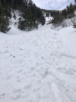
In the mountains near Cooke City the snowpack is deeper and stronger than the other southern ranges, but it has buried weak layers and received more snow than elsewhere in the advisory area over the last week. I was riding near Cooke City the past two days and found two buried weak layers that were reactive in stability tests (video, photo), and I observed widespread drifting snow yesterday (video). Today, human triggered avalanches are likely on steep, wind loaded slopes where fresh drifts of snow added weight to buried weak layers. Avalanche danger is CONSIDERABLE on wind loaded slopes and MODERATE on non-wind loaded slopes.

The mountains near Bozeman and Big Sky got 2-3” of snow yesterday morning. Strong wind drifted this snow into fresh wind slabs that are possible to trigger today. A layer of weak, sugary facets is buried 10-12” deep and avalanches were triggered on this layer on wind loaded slopes over the past week (Avalanche Activity, video). Below this weak layer the snowpack is generally strong and avalanches breaking deeper are unlikely. Today, avalanches are possible and avalanche danger is rated MODERATE.
If you get out and have any avalanche or snowpack observations to share, contact us via our website, email (mtavalanche@gmail.com), phone (406-587-6984), or Instagram (#gnfacobs).
Upcoming Avalanche Education and Events
Our education calendar is full of awareness lectures and field courses. Check it out: Events and Education Calendar.
BOZEMAN
January 2, Avalanche Awareness, 6-7:30 p.m. at REI, Bozeman. Pre-register at https://www.rei.com/events.
January 8, Women’s Specific Avalanche Awareness, 6:30-8 p.m. Story Mill Park, Bozeman.
January 9, 1-hr Avalanche Awareness, 7-8 p.m. Spire Climbing Center, Bozeman.
COOKE CITY
Every Friday and Saturday, Rescue Training and Snowpack Update. Friday 6:30-7:30 p.m. at the Soda Butte Lodge. Saturday anytime between 10-2 @ Round Lake.
Check out our new “Avalanches and Snowpits” menu item where we list all the reported avalanche activity.