Good Morning. This is Alex Marienthal with the Gallatin National Forest Avalanche Forecast on Monday, January 20th at 7:00 a.m. Today’s forecast is dedicated to Tyler Stetson. Tyler was killed in an avalanche in Beehive Basin on this day twelve years ago. This forecast does not apply to operating ski areas.
This morning there is no new snow and wind is 5-15 mph out of the southwest-west. In the northern mountains temperatures are inverted with teens F in the valleys and mid-20s to low 30s F at higher elevations. In the southern mountains temperatures are single digits to teens F. Today temperatures will be high 20s to mid-30s F with southwest wind at 15-25 mph. Tomorrow snow is expected to favor the southern mountains with 1-2” near West Yellowstone by morning and more through the day.

Yesterday two deep avalanches were triggered by snowmobilers, one near Big Sky (details) and one in the Centennials (photo). A skier north of Bridger was surprised by a smaller, but big enough avalanche (details). This was similar to a snowmobile triggered slide in Taylor Fork on Saturday (photo). Many recent human triggered avalanches were very big, measuring up to 7 to 15 feet deep. They would kill you if you ended up on the wrong side, luckily nobody has.
Over the weekend there were seven avalanches triggered by skiers and snowmobilers, six were unexpected or “close calls” (avalanche log). In addition, we saw natural avalanches in the Bridger Range (photo) and got reports of collapsing from Taylor Fork and the west side of the Bridgers (details). Yesterday at Lionhead, Dave and I saw a large natural cornice triggered avalanche that broke after a few inches of new snow fell yesterday morning (video, photo).
Avoid heavily wind loaded slopes. These are where you can trigger a large avalanche. In Doug’s video from the crown of a recent snowmobiler triggered slide near Cooke City he explains how triggering a huge avalanche is possible on these slopes, where snow depth varies from inches to several feet.
Buried persistent weak layers have been steadily loaded by snow and wind since the start of 2020. Large avalanches are getting more difficult to trigger with less snow the last few days, but recent activity is a warning that weak layers are not stable. Dave and I discussed this “scary moderate danger” in this video made during our drive yesterday. If you plan to cross or ride on steep slopes carefully assess the snowpack for buried weak layers or fresh wind slabs. Large avalanches are possible to trigger with severe consequences and avalanche danger is MODERATE.
In Hyalite the snowpack was relatively stable while little snow fell through December. A few storms the last couple weeks activated buried weak layers on wind loaded slopes. On Saturday there were three skier triggered avalanches reported from the northern Gallatin Range (details, details). All broke on wind loaded slopes and appear to have propagated on weak, sugary snow a few feet deep. One was up to 7 feet deep (details). Avalanches are possible to trigger on wind loaded slopes where danger is MODERATE. On non-wind loaded slopes avalanches are less likely and danger is LOW.
If you get out, please send us your observations no matter how brief. You can fill out an observation form, email us (mtavalanche@gmail.com), leave a VM at 406-587-6984, or Instagram (#gnfacobs). Ride safe and have fun.
Recent Avalanche Fatalities Across the Western U.S.
In the last week there were five avalanche fatalities in the U.S., in Oregon, Idaho, Utah, California and Colorado. Their have been 12 avalanche fatalities this season (More info). We are deeply saddened by each of these events. Their frequency is typical this time of year and we lose sleep over preventing more. Throughout the western U.S. the snowpack has buried weak layers that have been overloaded by storms since the start of 2020. Ride safe.
Upcoming Avalanche Education and Events
Our education calendar is full of awareness lectures and field courses. Check it out and plan to attend one or two: Events and Education Calendar.
COOKE CITY
Every Friday and Saturday, Snowpack Update and Rescue Training. Friday, 6:30-7:30 p.m. at the Soda Butte Lodge. Saturday anytime between 10-2 @ Round Lake.
BOZEMAN
January 27, Avalanche Information and Demonstration Table, 10 a.m. to 12 p.m. at Montana Science Center.
January 29, GNFAC Forecaster Chat: Avalanche Myth Busters, 6-8 p.m. at Uphill Pursuits.
January 31, Women’s Only Companion Rescue Clinic, 6 - 8 pm at REI followed by a field day February 1. More info and Register Here.
February 1, King and Queen of the Ridge at Bridger Bowl (fundraiser). This is the Friends of the Avalanche Center’s second biggest fundraiser of the year. Come on out and help us raise money by hiking and skiing laps on the ridge. Prizes, camaraderie and a good time is guaranteed. Register with Bridger to hike in the event, and create a pledge page to raise funds with your Ridge laps.
DILLON
January 29 and 30, Introduction to Avalanche w/ Field Course, evenings of January 29 & 30 plus a field day February 1. Snowmobile specific field day offered February 2. More Info and Register Here.
WEST YELLOWSTONE
January 25, 1-hr Avalanche Awareness, 7-8 p.m. at West Yellowstone Holiday Inn.
February 1, 1-hr Avalanche Awareness, 7-8 p.m. at West Yellowstone Holiday Inn.
HELENA
January 28, 1-hr Avalanche Awareness, 6-7 p.m. Carroll College.
LIVINGSTON
January 30, Introduction to Avalanche w/ Field Course, evening of January 30 plus a field day February 2. More info and Register Here.
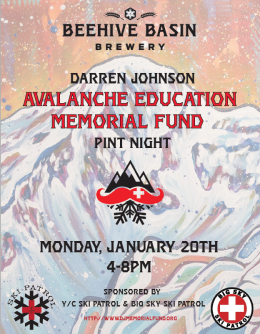
Tonight from 4-8pm at Beehive Basin Brewery, join the YC and Big Sky Ski Patrols to support the Darren Johnson memorial fund. Darren was a ski patroller at the Yellowstone Club who was killed in an avalanche on January 19th, 2016. The memorial fund gives scholarships for patrollers to attend the National Avalanche School.