Photos
|
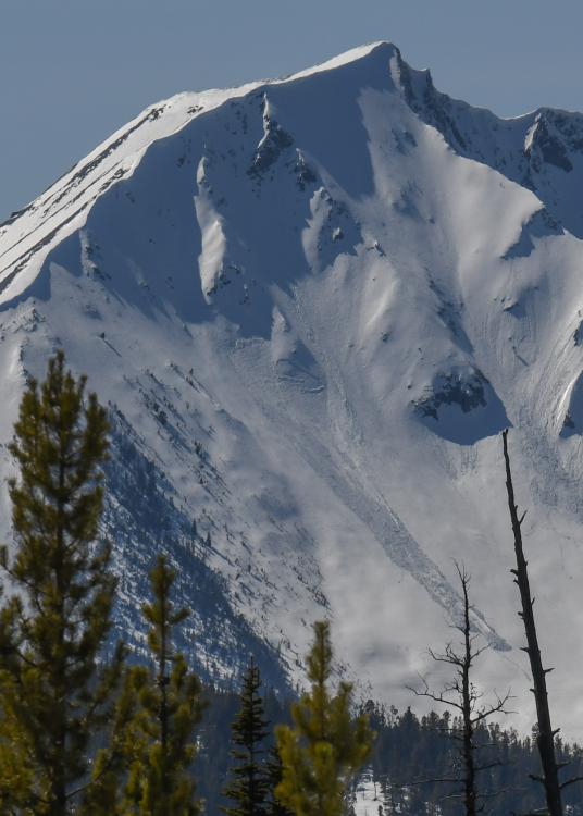
Northern Madison, 2020-04-11 From IG message (4/10/20): "My party and I observed a wet slide off of the s-se facing aspect of the Sphinx today around 1pm." Photo: @laura_delray Link to Avalanche Details |
|
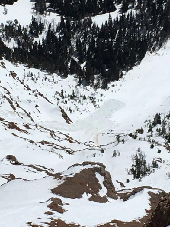
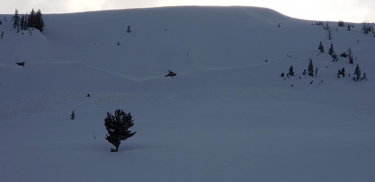
Lionhead Range, 2020-04-10 |
|
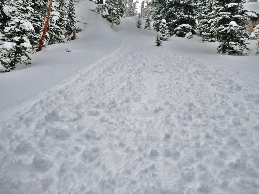
Lionhead Range, 2020-04-10 Wet slab near Lionhead. May have been snowmobile triggered. Observed 4/9/2020. Photo: G. Antonioli Link to Avalanche Details |
|
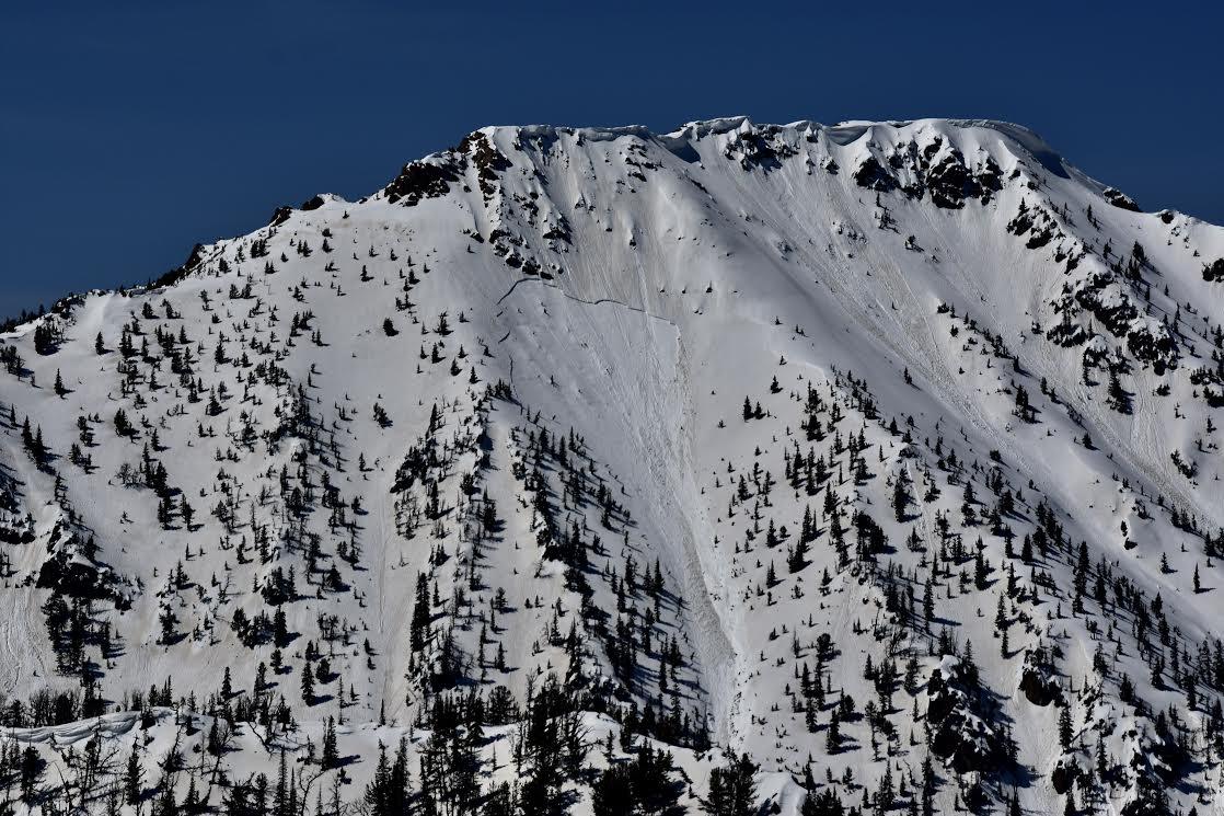
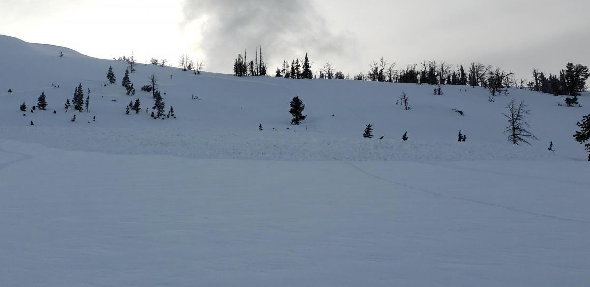
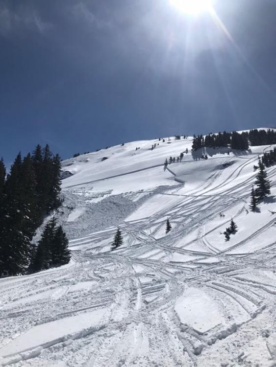
Lionhead Range, 2020-04-10 Cornice triggered wet slab near Lionhead. Observed 4/9/2020. Photo: G. Antonioli Link to Avalanche Details |
|
Northern Madison, 2020-04-09 Observed 4/9/20 at 3pm. Photo: T. Gittins Link to Avalanche Details |
|
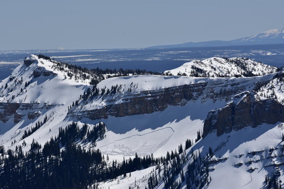
Lionhead Range, 2020-04-09 From email: "On Tuesday, April 7th my group noticed a slab avalanche above our route back to the parking lot. The coordinates of the slide are 44.7184217, -111.3190452. There were snowmobile tracks directly to the right (NW) of the slide. The slide was considerably wide , more than100 yards." Photo: H. Marcussirounian Link to Avalanche Details |
|
Northern Madison, 2020-04-09 Photo: L. Ippolito Link to Avalanche Details |

|
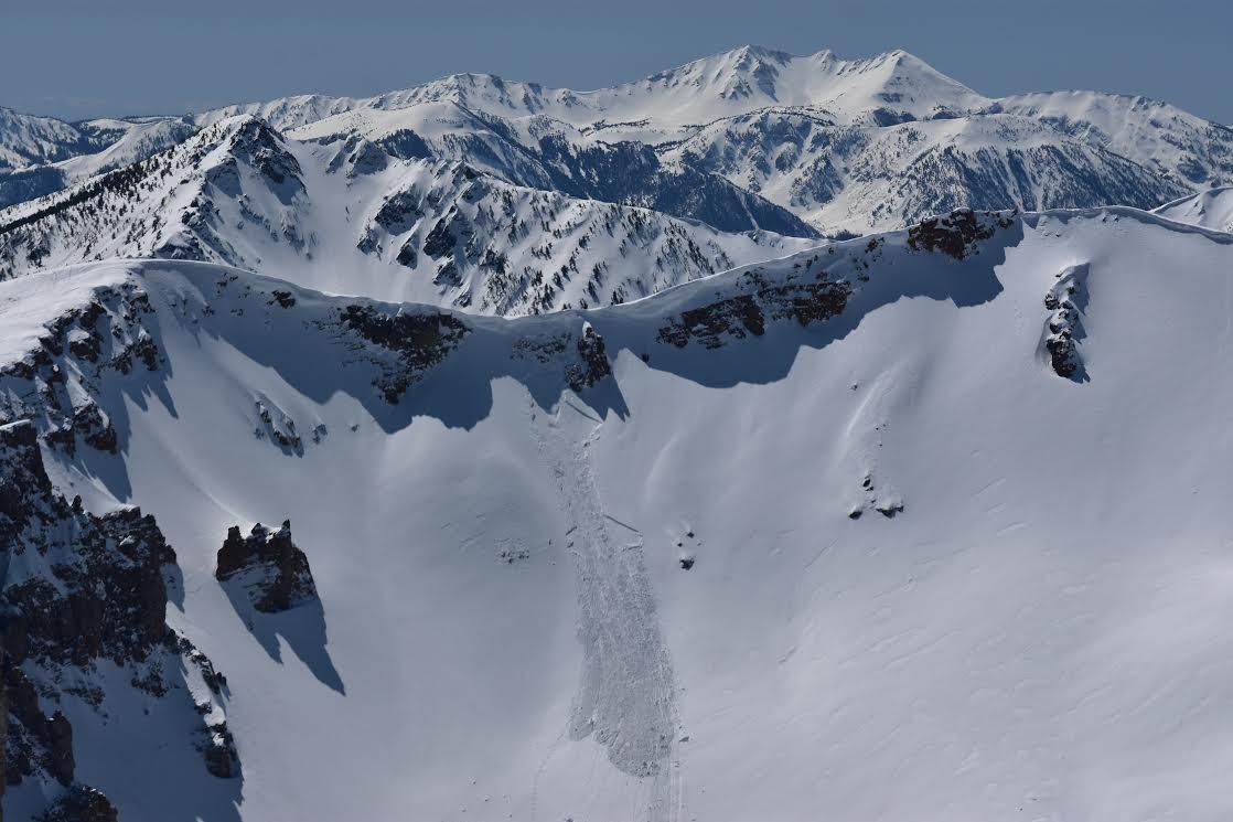
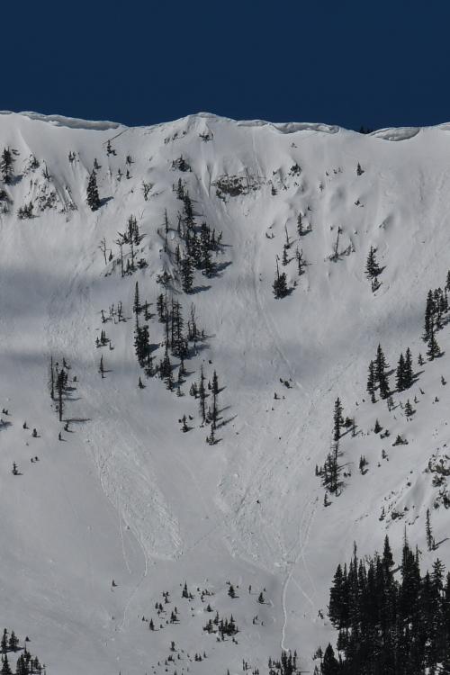
Northern Madison, 2020-04-09 From obs (4/8/20): "My partner and I noticed this slide as we summited 10602 at approximately 10:30am, which is when I took the first photo and was able to capture the full runout. After our descent of the peak, we skinned back up to the slide to get a better look (the second photo). The slide appeared approximately a day old, with a crown 1-2 feet deep, on an almost directly north-facing aspect at 10200" elevation. It broke right along the rocks that had heated up in the sun, and was around 200-300 feet at its widest. We did not get close enough to determine which layer failed (suspected wind from the heavy wind-crust in the neighboring area), but the debris at the bottom indicated it was a wet slide." Photo: L. Ippolito Link to Avalanche Details |
|
Cooke City, 2020-04-07 From obs on 4/6/20: "I got tagged by a small point release today. Skinning up the Republic Mountain ridgeline I had stopped to pull skins because it was apparent from hand-pit that the new snow was not bonding well with the old snow interface. I was looking down slope so didn’t actually see the release, but think it was a natural point release that I just happened to be standing in the way of, at least I didn’t feel any collapse so it didn’t seem like I had remotely triggered it. Restricted to new snow ~ 6” deep and ran for about 80 vertical feet. Point release in rock band at ~8,980 to toe at where I was standing at 8,900’ on ESE aspect on ~35° slope ( 45.004, -109.942). IWx: Overcast, warm (35°+), calm, snowing heavy at time (0.6 SWE at Fisher Creek SNOTEL in 10 hr.)." Link to Avalanche Details |
|
Northern Gallatin, 2020-04-07 Triggered by sledders on Saturday (4/4/20). Photo: @scottmooney Link to Avalanche Details |
|
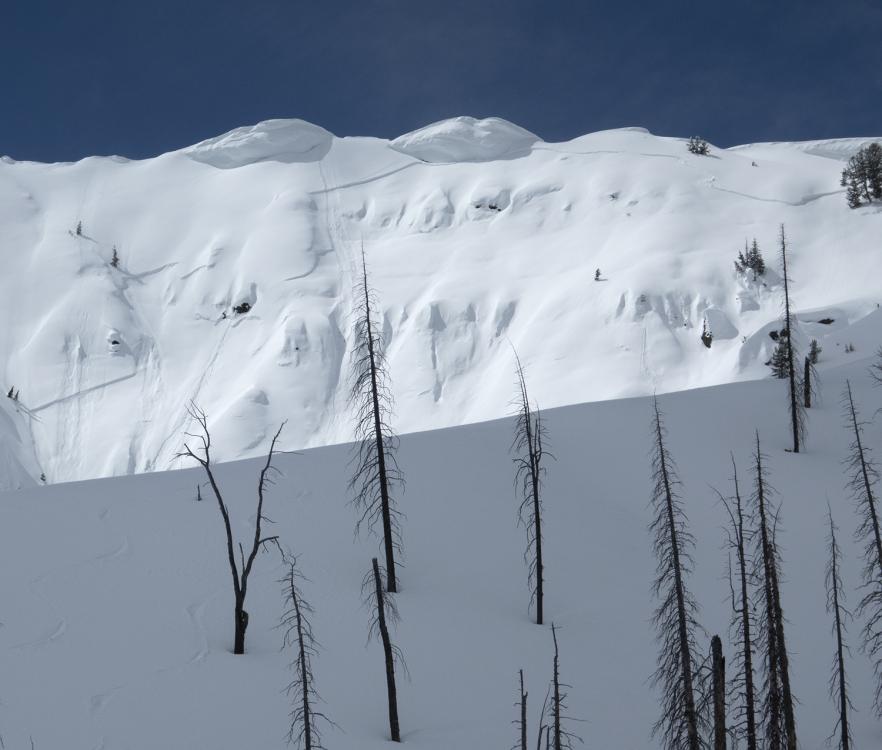
Bridger Range, 2020-04-06 Cornice triggered avalanches in Mundy's Bowl at Bridger Bowl. Unsure if natural or skier triggered from the ridgeline. Observed the morning of 4/5/20. Appear to be dry slab/loose. Photo: T. Gittins Link to Avalanche Details |
|
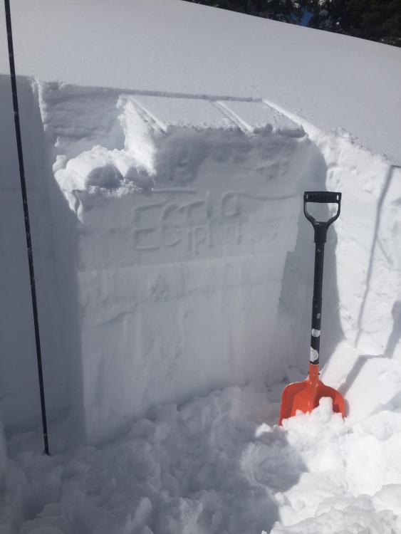
Southern Madison, 2020-04-05 From obs. (4/4/20): "Rode Tepee today... Got ECTP 24 & 25 on a thin layer of SH... We also saw a few cornice drops that pulled out small slabs, new snow only..." Photo: E. Knoff |
|
Northern Gallatin, 2020-04-05 From email (4/4/2020): "...HS 215cm - ECTP19@165cm on preserved 4-7mm surface hoar... Also found a whole variety of crusts in the slab above the propagation from the frequent recent warm ups it seems... Kept it low angle with the surface hoar lingering..." Photo: Z. Miller |
|
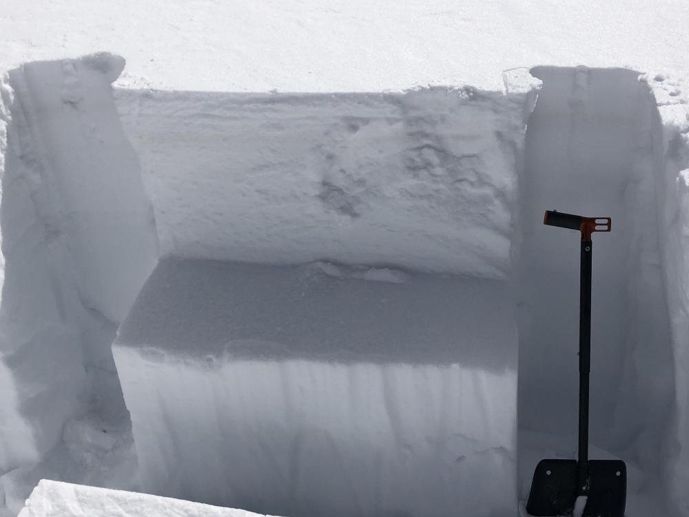
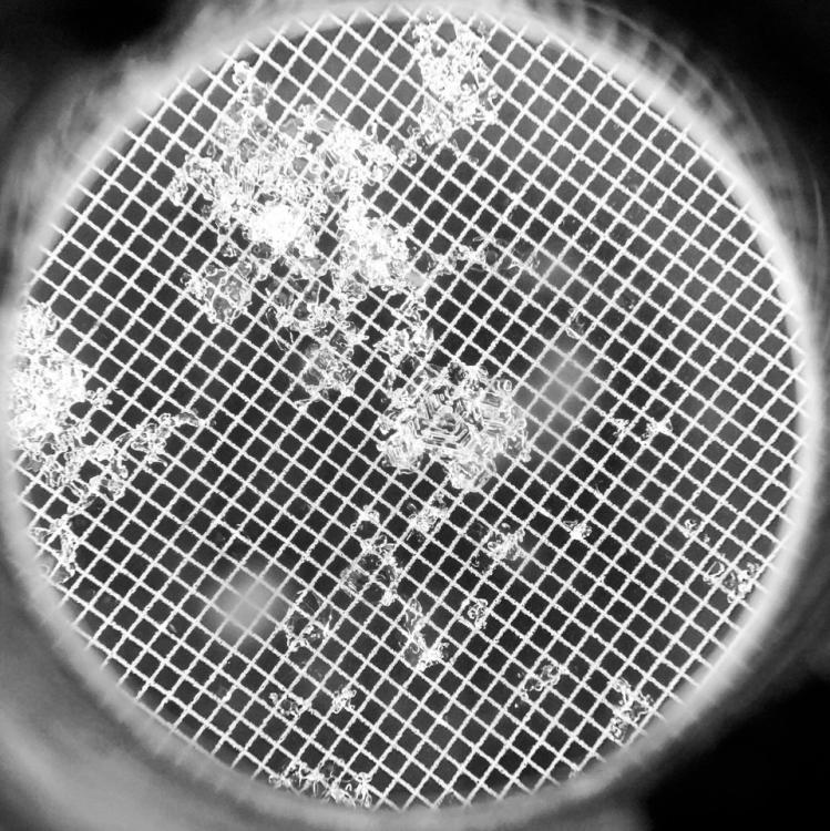
Bridger Range, 2020-04-05 Close up of a crystal from the surface hoar layer buried 2-3 feet deep north of Bridger Bowl and throughout most of the advisory area. From 4/3/20: "I dug a quick pit at ~7450’ on a protected east 36 degree slope - HS 240cm...ECTP18@175 on 3-6mm preserved surface hoar (photos -1mm grid)... All results repeated identically in a second ECT... Seeing the reactive SH layer I opted out of skiing anything that had a distinct rollover or was steeper..." Photo: Z. Miller |
|
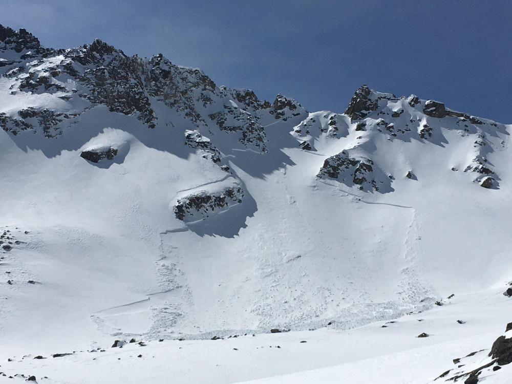
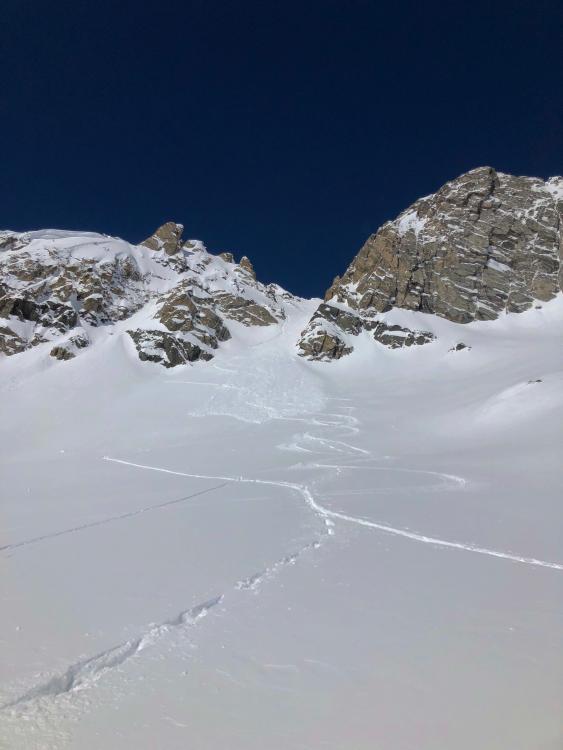
Cooke City, 2020-04-04 From email (4/4/20): "...east aspect, around 9700'. The crown looked to average about 2' deep, and it was about 400' wide. I'd estimate that this avalanche happened on April 1 or 2. (2-3 days ago)". Photo: B. Fredlund Link to Avalanche Details |
|
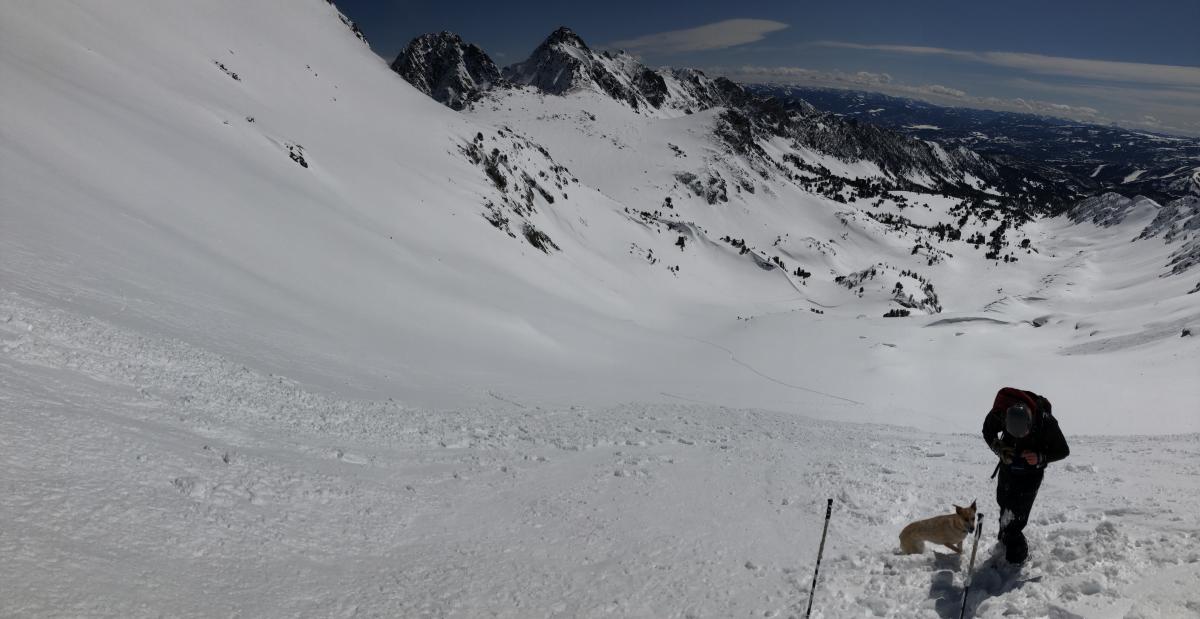
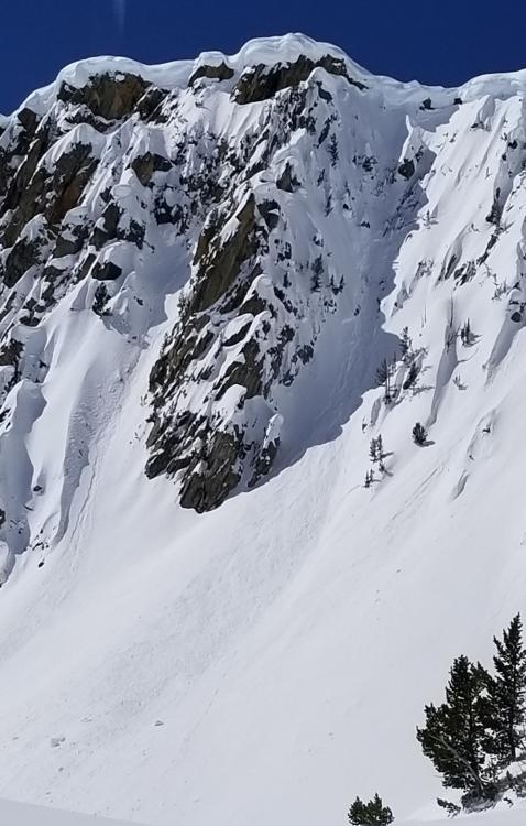
Northern Madison, 2020-04-04 From obs 4/4/20: "Avalanche, 4th of July Couloir, Beehive. No person was caught. A dog was caught but not buried. Crown between 2 and 5 inches, based on cracking depth during ascent and pictures. Runout aproximately 120x40 yards. Estimated using gaia gps." Link to Avalanche Details |
|
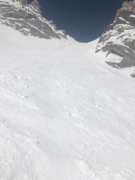
Northern Madison, 2020-04-04 From email 4/4/20: "...huge merengue like cornices on the east facing stuff lookers left of behive peak. There was evidence of recent cornice collapses." Photo: T. Gittins |