Merry Christmas, Merry Kwanzaa, Feliz Navidad, Chag Sameach, and Christmas Mubarak! This is Doug Chabot with the Gallatin National Forest Avalanche Forecast issued on Christmas, December 25th at 7:10 a.m. Today’s forecast is sponsored by the US Forest Service who granted avalanche centers across the country an “exception” to the government shutdown. This forecast does not apply to operating ski areas.
In the last 24 hours 6” of new snow fell in the Bridger Range, 2” in Hyalite, a trace around Big Sky, 1” at Lionhead, and 3” outside Cooke City. Under clearing skies, mountain temperatures are 10-15F. Early this morning ridgetop winds shifted from westerly to easterly and are blowing light at 5-10 mph. Today, temperatures will reach 20F and skies will become mostly cloudy by late afternoon. Winds will remain light and shift westerly with 1-2” of snow falling tonight.

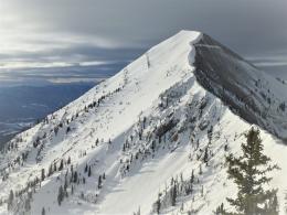
Since yesterday morning the Bridger Range got two rounds of snowfall totaling 6”. Remarkably, winds were light. About 12” under the snow surface is a persistent weak layer of facets or surface hoar. Alex and I dug on Saddle Peak on Sunday and found this to be the main instability in a snowpack that is generally strong (video). The new snow (.4 inches of snow water equivalent) creates the possibility of triggering avalanches on this faceted layer, especially in areas where it is buried under hard wind drifts. For today, the avalanche danger is rated MODERATE on all slopes.
In the mountains from Big Sky to West Yellowstone the snowpack structure is weak. The lower half consists of sugary facets that are breaking in stability tests, and more concerning, collapsing with “whumphs” from the weight of a skier. This occurred at Bacon Rind (details) where Eric’s snowpit revealed a terrible snow structure (video) that mirrored my findings in Lionhead near West Yellowstone (video). Given the overall snowpack weakness and instability identified by collapses, triggering avalanches is possible today and the danger is rated MODERATE. Avoid steep slopes that have a thick slab of snow overlying sugary facets.
Yesterday, 2-3” fell outside Cooke City and south of Bozeman in Hyalite, while the Big Sky area only got a dusting. The snowpack in the northern Gallatin and northern Madison Ranges, and also around Cooke City, is close to 3 feet deep and generally strong and stable. A weak layer of facets and surface hoar is buried 8-12” deep and can be found on many slopes. In some areas this layer is buried under a hard wind slab where it would be possible to trigger a slide. This instability is not widespread, but requires careful assessment by digging and testing. Eric’s video from Beehive Basin and Alex’s video from Cooke City show the weak layer breaking under the wind-drifted snow. For today, it is possible to trigger small wind slabs on these facets and the avalanche danger is MODERATE on wind-loaded slopes and LOW elsewhere.
If you get out and have any avalanche or snowpack observations to share, contact us via our website, email (mtavalanche@gmail.com), phone (406-587-6984), or Instagram (#gnfacobs).
New webpage dedicated to the Centennial Range in Idaho and Montana
After last season's two snowmobiler avalanche fatalities on Reas Peak in the Centennial Range we created a webpage so riders could get good, relevant information regarding snowpack and avalanches. Although the Centennial Range is not part of the Gallatin National Forest Avalanche Center's forecast area, we are the closest avalanche center and have valuable information to share. More…
Upcoming Avalanche Education and Events
Our education calendar is full of awareness lectures and field courses. Check it out: Events and Education Calendar.
BOZEMAN
January 2, Avalanche Awareness, 6-7:30 p.m. at REI, Bozeman. Pre-register at https://www.rei.com/events.
January 8, Women’s Specific Avalanche Awareness, 6:30-8 p.m. Story Mill Park, Bozeman.
January 9, 1-hr Avalanche Awareness, 7-8 p.m. Spire Climbing Center, Bozeman.
WEST YELLOWSTONE
January 12 and 26, 1-hr Avalanche Awareness for Snowmobilers, 7-8 p.m. Holiday Inn West Yellowstone.
COOKE CITY
Every Friday and Saturday, Rescue Training and Snowpack Update. Friday 6:30-7:30 p.m. at the Soda Butte Lodge. Saturday anytime between 10-2 @ Round Lake.
See Alex’s recent article about the Lift-accessed Backcountry of Saddle Peak. Be prepared with the necessary knowledge and skills before leaving the ski area into this complex and deadly terrain.